From Safety4Sea by Peter Sparkes
UKHO’s Chief Executive, Peter Sparkes, refers to the radical changes that S-100 suite of standards will bring to navigational safety, highlighting that the future is digital.
In that regard, UKHO is currently in a transition phase up to 2026 as it is withdrawing from paper chart production, supporting users to unlock the benefits that digital navigation brings.
The shipping industry is navigating an era of unparalleled change and a digital transformation, Mr .Sparkes says, adding that, in that regard, it is vital to understand the marine context in which we operate to successfully enhance not only safety but also decarbonizing efforts.
SAFETY4SEA: What are the top priorities on your agenda for the next five years?
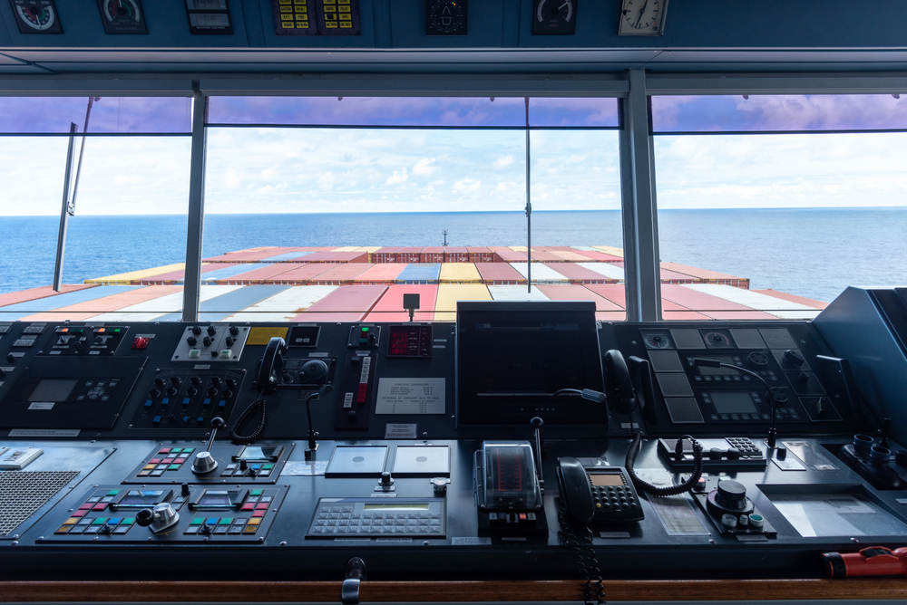
Peter Sparkes: The future of shipping will be underpinned by digital innovation, enhanced satellite connectivity at sea, and data-driven decision-support solutions that better optimise operations.
Meanwhile, the next generation of electronic navigational charting data standards (S-100) will greatly enhance the safety and efficiency of maritime navigation.
Our aim is to be at the forefront of the industry’s digital transition, continuing to provide the assured and globally trusted ADMIRALTY Maritime Data Solutions that the world’s seafarers depend on.
An increasingly digital maritime industry will be shaped by the International Hydrographic Organization’s new universal S-100 data standards – which we will support as one of our top priorities – fusing and enriching navigational products and services.
S-100 will also enable fleet operations and supply chains to work in closer harmony, to unlock a new level of port access, transparency and support in near real-time.
The new standards will dramatically reduce the time that vessels need to wait for important navigational and safety updates, improving the safety of life at sea and supporting enhanced voyage optimisation and weather avoidance.
We seek to play a leading role in advancing the development of these new digital standards by working with users, providers and partners to test product specifications, build safety cases, improve the user experience and fully realise the undoubted potential of the S-100 suite of standards.
S4S: Following your recent announcement, what are the key barriers and drivers with regards to the digital transformation within the industry that you are currently facing?
P.Sp: We understand and acknowledge the significance of our announcement to withdraw from global paper chart production by 2026, given our history of creating standard nautical charts (SNCs) and the trust that mariners have long placed in ADMIRALTY charts.
Generating timely and effective digital alternatives and managing a smooth transition is a responsibility we feel keenly.
The last 10 years have seen a rapid decline in user demand for paper charts, driven by the SOLAS-mandated transition to ECDIS and growing recognition of the wider operational benefits of digital solutions, including the next generation of navigation services.
In 2011, 80% of ADMIRALTY products sold were paper based, with 20% digital.
In 2021, 84% of ADMIRALTY products sold were digital, while only 16% were paper based so demand is declining at about 17% per annum.
Our users are telling us they want and need digital solutions.
They need to know where they are, not where they were.
Withdrawing from paper chart production enables us to greatly increase our focus on digital navigation products and services that we will be able to update in near real-time, greatly enhancing safety of life at sea.
During the transition period, we will support users of SNCs and work with our distributor channel to help users switch to digital alternatives, between now and 2026.
The key message is, we want to take all our ADMIRALTY users with us, greatly improving our support for them and helping them to unlock the benefits that digital navigation brings.
S4S: What changes should we expect to see following the transition to a digital chart portfolio by 2026?
P.Sp: The UKHO has produced first-generation electronic navigational charts (S57 ENCs) for nearly 20 years, with 18,000+ cells now available through the global ADMIRALTY Vector Chart Service (AVCS).
Our extensive international portfolio of ENCs, which meet flag and port State requirements, help bridge crews, navies and shipping companies to navigate safely and efficiently, whilst helping inform the operational and investment decisions of charterers and other key stakeholders.
Our strategy to withdraw from paper chart production is centred around reducing and eventually removing our paper chart portfolio, in line with user needs, market trends and commercial viability.
It will happen in a phased and carefully managed transitionary approach, in close consultation with our customers, partner hydrographic offices and regulatory bodies, including the UK Maritime and Coastguard Agency (MCA).
As we withdraw paper charts, we will focus on providing users with authoritative digital alternatives to meet their demands and those of regulatory bodies, phasing out SNC coverage in a way that is safe for mariners and sustainable for the UKHO.
The withdrawal of paper charts does not include paper publications, which we will continue to support.
However, we are also developing a much improved, far more user-friendly ADMIRALTY Digital Publication solution, too.
S4S: What advice would you give to industry stakeholders for safer navigation in the digital age?
P.Sp: The shipping industry is navigating an era of unparalleled change and a digital transformation.
But despite the pace and scale of these challenges, the next generation of navigation technology will deliver a huge leap forward in positional and situation awareness capability, providing tools that will enable us to make smarter, faster decisions about the operations of our vessels, and deliver the safe, secure, and thriving oceans that we all seek.
Better understanding the marine context in which we operate is fundamental to successfully protecting our oceans, coastlines, and environment, as well as to decarbonising maritime operations.
Cleaner fuels and novel propulsion technologies will play a significant role in reducing shipping’s carbon impact.
High-fidelity navigational data can, in the near-term, also help to unlock significant latent operational efficiencies in our ports and in how we operate ships.
Together, we can help to enhance voyage and route optimisation, expedite port operations, and enable ‘smarter steaming’ and ‘Just in Time’ arrivals.
S4S: What does the industry need to start doing differently to prepare for a smarter and digitalised future?
P.Sp: For me as a former mariner, what’s really exciting is the scale of the latent potential that we can help realise.
Data-based vessel, voyage and fleet optimisation is particularly interesting, as are the impacts of heavy weather avoidance, slower steaming and ‘Just in Time’ arrivals as they become operational norms.
A recent ‘Seas at Risk and Transport & Environment’ report identified that by reducing speeds across the global fleet by 20% – which is an achievable by-product of ‘Just in Time’ – we may be able to reduce shipping’s carbon footprint by a remarkable 34%.
This means that the potential impact of smarter navigation, enabled by data-driven efficiencies, is huge.
The UKHO is actively looking at the role it can play to harness this opportunity, working with other like-minded stakeholders in common purpose.
To help support the development of ‘Just-in-Time’ arrivals, UKHO is working with partners on the Port Call Optimisation Task Force to create a new universal data standard for all parties involved in a port call.
This is a great example of how we can harness the latest innovations in navigational standards to meet shipping and society’s environmental goals.
I’m excited by the contribution we can make to reducing shipping’s carbon emissions, and that’s just one area among many that we are focusing on.
S4S: How can we promote/encourage more innovation in the marine navigation?
What would be the key trends that will cast our attention in the coming years?
P.Sp: One example close to home for the UKHO is the Centre for Seabed Mapping (UK CSM).
The Centre was launched in July to increase the coverage, ‘map the gaps’, improve the quality and access of seabed mapping data collected using public funds, and better promote the role that marine data plays as a critical component of national infrastructure.
We are inviting UK Government organisations involved in seabed mapping, who share common interests in optimising the UK’s national maritime assets, to become a member of the newly unveiled UK CSM.
The idea behind the Centre is to spearhead a coordinated approach to the collection, management, and access of seabed mapping data – and to champion a more integrated marine geospatial sector in the UK.
The UK CSM has established three initial working groups that members can join and contribute to: National Data Collaboration, International Data Collaboration, and Data Collection Standards.
This initiative and other international collaborations that UKHO participates in will help to encourage innovation in the marine data and navigation space.
The role of collaboration in the near-term cannot be understated.
The sector’s challenges are so large that no one player can hope to solve them on their own, so it’s critical we find the right mechanisms – such as the UK CSM – for working together.
S4S: Do you have any other projects/plans you would like to share with industry stakeholders?
P.Sp: To give one example of where things might be heading, the digitalisation of onboard systems, the rapid growth of the Internet of Things, and the improvement in broadband communications have brought the possibility of uncrewed and autonomous vessels within reach.
This will require UKHO to consider how we move from navigational systems that have been simplified to meet the needs of the human user, to navigation solutions that are data-rich and machine-readable.In June, the crewless Mayflower Autonomous Ship arrived in North America after setting sail from Plymouth, UK, three months earlier.
The vessel’s successful voyage – which the UKHO supported with electronic navigational data – demonstrates the power of AI and autonomous technology, and sets the coordinates for where maritime is heading in the near future.
S4S: What is your key message to industry stakeholders with respect to e-navigation?
P.Sp: As the UKHO transitions from paper charts to focusing fully on our ADMIRALTY digital products and services, our core purpose remains the same: supporting the safety of shipping operations and delivering the best possible navigation solutions to achieve that.
Whether for the Royal Navy, commercial vessels or other ocean users, the organisation’s focus is on developing and delivering ADMIRALTY digital services our users need, to promote safe, secure and thriving oceans.
Links :
- Maritime Executive : Interview: RADM Peter Sparkes, CEO of the UK Hydrographic Office
- GeoGarage blog : UKHO announces intention to withdraw from paper chart production
No comments:
Post a Comment