

Seen from the air, the disappearance of the southern conch of the Banc d'Arguin is spectacular.
from images published on Parc Naturel Marin du Bassin d'Arcachon Facebook account
The Parc naturel marin du bassin d'Arcachon has just published aerial photos of the erosion that led to the disappearance of the southern conch of the Banc d'Arguin.
Spectacular...
Seen from the water, it's already impressive, but seen from the sky, it's even more so.
Seen from the water, it's already impressive, but seen from the sky, it's even more so.
The Parc naturel marin du bassin d'Arcachon (PNM) has just posted images of the Banc d'Arguin from the air, following the disappearance of the site's southern conch this autumn.

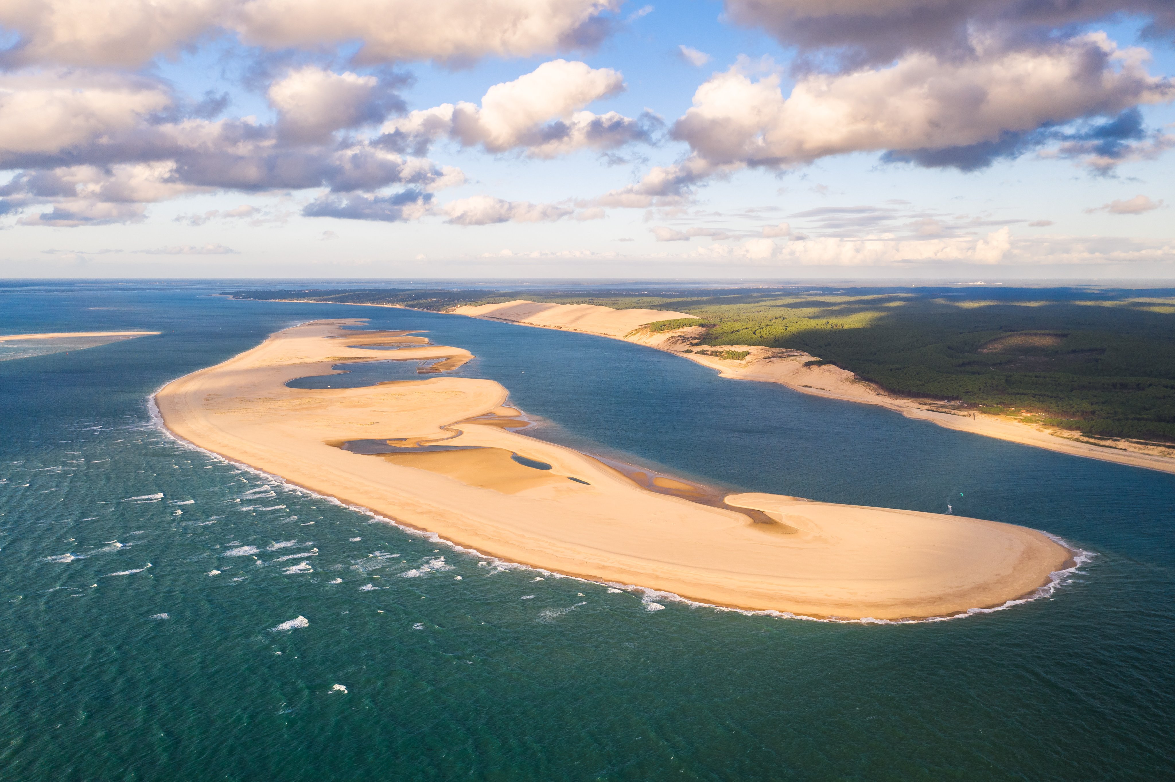
In this Sentinel2 photo from 02/08/19 we can see the Arcachon basin, the dune du Pilat, and the Banc d'Arguin.
Since June 2014, this area has been home to the Parc naturel marin du Bassin d'Arcachon.

This movement has already been underway for many months, since before the passage of storm Aline in October, the southern tip of the bank had already lost more than a kilometer, and the bank had already been cut in two during high tides in September 2022.

In its post, PNB juxtaposes images of the bank from September 2021 up to the last photograph taken by Air Infrarouge on November 18, i.e. after the passage of the autumn storms.
This shows the extent to which the surface of Arguin has been eroded and reduced to the south, burying dozens and dozens of oyster-farming concessions under the sand.
"Compared to those acquired in September 2021 and August 2022, the evolution of the Banc d'Arguin and its southern part is impressive!" exclaims PNB.
"Compared to those acquired in September 2021 and August 2022, the evolution of the Banc d'Arguin and its southern part is impressive!" exclaims PNB.
"And echoes the results of the Arcade study (a study of the Bassin's passes, Editor's note), recently presented to the public, which shows the lagoon's inherent strong hydrodynamics and its openness."
Links :
No comments:
Post a Comment