Wednesday, October 19, 2022

NOAA system makes the fastest-growing port In Texas safer


Ritu S

From Geospatial world

Located in the industrial hub of Brazoria County, Texas, Port Freeport is one of the most accessible ports in Texas by land and sea.
It is a deep sea port with the shortest deep-water channel on the Texas Coast and an abundance of land available for future development.

On October 4 it was announced that now this port has an added advantage offering enhanced safety feature for the mariners sailing in and around it.
The port has been fitted with an efficient NOAA marine navigation system which has increased its safety, commercial opportunities and real-time observations.

Freeport is now fitted with NOAA marine navigation system

This Texan seaport is equipped with NOAA’s Physical Oceanographic Real-Time System or PORTS which ensures safe and efficient marine navigation for vessels entering and exiting its port waters.
Port Freeport is the 38th system in this network of marine sensors.
The integrated series of precision marine navigation sensors track oceanographic and meteorological conditions as they unfold around the port.

“Precision navigation is critical to our nation’s data-driven blue economy and helps our environment,” said NOAA Administrator Rick Spinrad at the announcement of the NOAA system in Freeport.
“The real-time information tracked by NOAA allows ships to move safely within U.S.
waterways to make operations more efficient and lower fuel consumption, which also lowers carbon emissions” said Spinrad.

Physical Oceanographic Real-Time System (PORTS)
 
Source: NOAA

NOAA’s PORTS program provides accurate and critical information to all vessel operators and helps them to take efficient decisions regarding their movement within the port area and thereby greatly enhancing their productivity and reducing accident risks.
This system is an effective decision-support tool that improves coastal resource management.

Some relevant marine data collected and disseminated by PORTS are observations of water levels, currents, salinity, bridge air gap and meteorological parameters like winds, atmospheric pressure, and air and water temperatures, all of which are essential for safe navigation by mariners.
 
Freeport TX with the GeoGarage platform (NOAA nautical raster chart)

Port safety enhances the economy

The US marine transportation system is the backbone for the movement of goods, services, and people throughout the country and today the network of waterways and seaports is challenged by ever-increasing demand.

Estimates for Port Freeport have shown that more than 30 million tons of cargo moved through the port in 2019, which supported more than 279,000 jobs nationwide, for a total economic impact of USD 149 billion.
The economic impact of port activities is indeed far-reaching.

However, increased marine traffic and the movement of bigger vessels bring in the challenge of the increased potential for accidents.
Estimates have shown well over 600 commercial vessels annually are involved in accidents on the nation’s waterways and major seaports.

Maritime accidents can result in catastrophic impacts resulting in the loss of hundreds of millions of dollars in property damage, oil spill contaminations, harmful effects on the coastal environment, port facility closures, and the potential for loss of life.
The trend towards bigger vessels and greater port traffic will result in increased potential for accidents.

In this context, the presence of NOAA’s PORTS system is a much-needed feature to ensure such marine vessel accidents may be avoided and further protect the economy linked to marine services from incurring any huge loss.

Real-time observations from PORTS®, when combined with up-to-date nautical charts and precise positioning, can greatly increase the safety and efficiency of maritime commerce.
In fact, reports have confirmed that there has been a nearly 60 per cent reduction in groundings at some seaports currently served by PORTS.
All PORTS observations and predictions are quality controlled by NOAA 24 hours a day, 365 days a year.

“This new system, and the others like them around the country, reduce ship accidents by more than 50%, and allow for larger ships to get in and out of seaports and reduce traffic delays,” said Nicole LeBoeuf, director of NOAA’s National Ocean Service at the announcement of the Freeport connection with the PORTS.
“PORTS can also provide real-time data as conditions rapidly change, giving our coastal communities time to prepare and respond.”

Geospatial system provides essential marine information

This geospatial system provides much needed real-time location data collected through the newly installed current meters in the surrounding waterways where those conditions can rapidly change over small distances.
These sensors are now helping the Texas seaport gain much valuable information.

Freeport’s new system also integrates real-time water level and meteorological information from the NOAA Freeport Harbor National Water Level Observation Network station.
This station provides access to details about wind speed and wind directional data which will support the mariners to plan safer ship movements during adverse weather conditions.

Safety is paramount to the maritime community and the recent announcement of the location data enrichment for the Texas port ushers in safer and more efficient port services for Freeport and in turn invites better economic opportunities for the surrounding areas.

Climate change: Can an enormous seaweed farm help curb it?


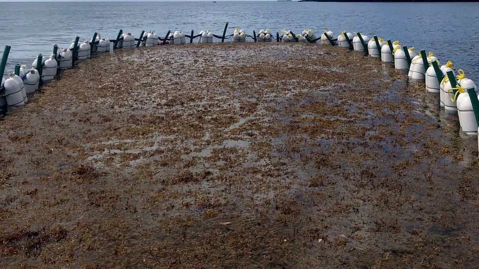
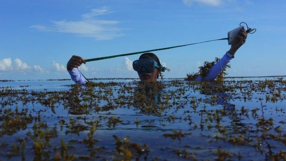
A scientist from Seafields measures the depth on beds of floating Sargassum

From BBC by David Reid and Justin Rowlatt

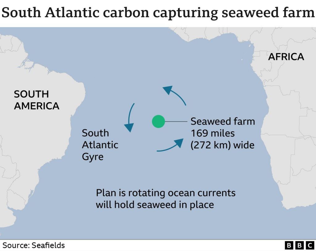
Imagine a huge seaweed farm the size of Croatia floating in the South Atlantic between Africa and South America.

Spinning in a natural ocean eddy, it sucks a billion tonnes of carbon out of the atmosphere every year and sinks it to the ocean floor out of harm's way.

Far-fetched? Maybe.
But a British businessman plans to have this up and running by 2026.

Scientists say reducing the world's emissions probably won't be enough and that carbon capture will be crucial to limiting global warming.
But carbon capture schemes have so far been relatively low-scale and seen limited success.

If they are going to work, they need to be bold, big, and attractive to investors.

Businessman John Auckland believes he has just such an idea.
He wants to exploit what he calls "the wondrous properties" of the floating seaweed sargassum.
He's confident his Seafields floating farm will draw sufficient CO2 from the air to moderate the effects of climate change, while also earning its backers carbon credits.

At 55,000 sq km (21,200 sq miles) Auckland is thinking big.
It needs to be vast to put a dent in the fifty gigatonnes of carbon dioxide we pump into the atmosphere every year.
A gigatonne is a billion tonnes: the amount of carbon Auckland's mega-farm aims to capture annually.


Testing whether sargassum seaweed can be contained in the open ocean

The project is currently road-testing its technology in the Caribbean and Mexico, and is inspired by the ideas of Prof Victor Smetacek, a marine biologist.
Described by Seafields as their Scientific Founder, he has long been fascinated by the potential to grow seaweed in enormous rotating ocean currents known as gyres.
"They collect all kinds of stuff in the middle," he says. 
"The best known examples, of course, are the plastic garbage that is accumulating in the middle of the subtropical gyres."

In the same way these giant eddies trap islands of floating plastics, Seafields plans to hem in its crop of sargassum.
"The gyre just stops the sargassum from escaping," explains John Auckland.
"As long as we create the right conditions for it, it will only grow there.
If any escapes from our farm, it will just die off or just fail to continue growing."


He had better be right.
Sargassum has plagued the Caribbean's tourism industry for decades.
When it washes up on the coast, its rot gives off a foul stench.
Not the best setting for relaxing on a beach towel.

But Seafields is confident this will not happen with their seaweed.
It says any that escapes from the farm should be starved the nutrients the team plans to syphon up from the ocean depths to feed their crop.

Because of evaporation from the subtropical sun beating down on it all day, the surface water trapped in gyres is very salty and low in nutrients.
It is why Prof Smetacek calls gyres "the oceans' deserts".

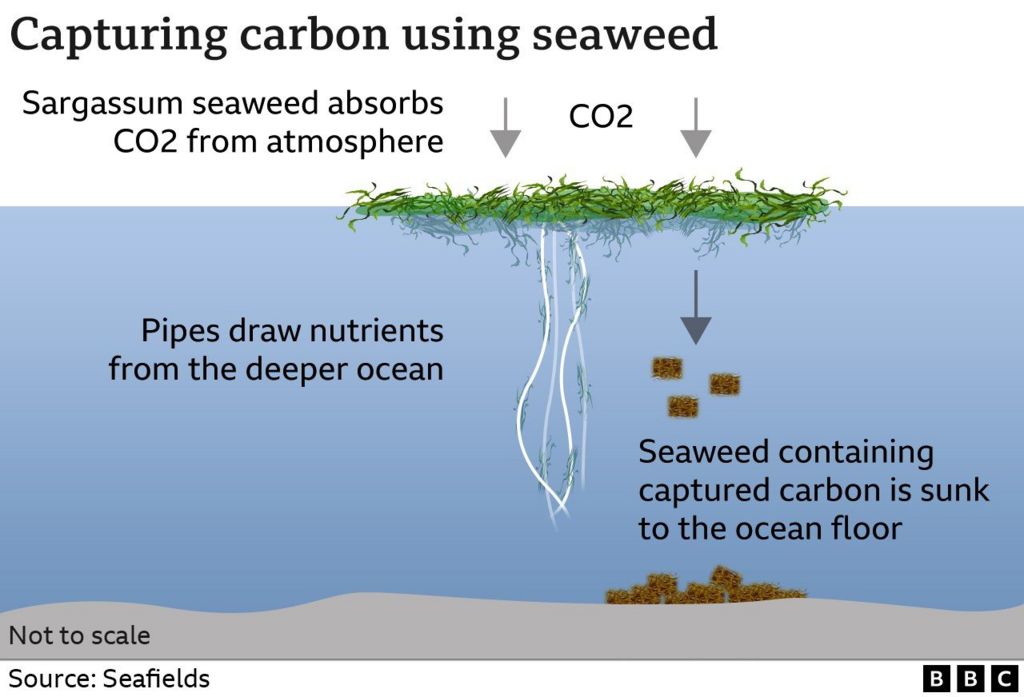
Yet, as these deserts slowly turn, they glide over a colder, nutrient rich ocean layer that the professor wants to draw to the surface to sustain the sargassum.

"If you were to connect the nutrient rich, deep water with pipes," explains Prof Smetacek, "bring that water up from the bottom and let it warm up, then it will flow up by itself and continue flowing forever."


The team is testing their technology in early 2023.
It will be a nail-biter.
While first theorised back in 1956, the salt fountain has successfully been recreated, but nowhere near the enormous scale Seafields plans.

If the salt fountain does work to scale, Prof Smetacek predicts a bumper crop of sargassum.
"They have enormous growth rates.
They double their biomass every 10 days," he says.
"The good thing about seaweed is that you can harvest it with a combine harvester."

Prof Smetacek envisages floating harvesters will bale the crop up and then send it down to the inert depths of the sea floor, where there is so little oxygen the bales will not rot.
The carbon they contain will remain fixed in the seaweed's structure.
Tests are ongoing, but the team envisages they can sequester captured carbon for hundreds, perhaps thousands of years.


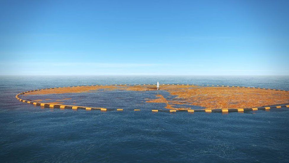
A computer-generated image of a floating Sargasum farm

Seafields' financial backers hope sargassum will float money their way too.
They plan to sell credits for captured carbon on the world's carbon markets.
These credits allow businesses like airlines that cannot easily cut their emissions, to buy up carbon reductions made elsewhere.

Carbon market critics complain the onward rush to monetise CO2 capture has led to backers overselling technologies that eventually fall short of their stated aims.
Which begs the question: will Seafields' promising plan in the laboratory actually work when released into the wild?

Dr Nem Vaughan, associate professor in climate change at the University of East Anglia says: "I'm a boring scientist, [I'd want] more data, more research, before I'd wholeheartedly say that you're going to get that kind of gigatonne-scale removal happening."

Dr Vaughan is also worried about a scheme that itself could have profound impacts on biological systems.
Can Seafields contain so much potentially damaging seaweed out in the South Atlantic? Is the salt fountain robust enough to weather all conditions?
"People wouldn't be very happy," she says, "if tonnes of plastic tubes got set adrift by a big Atlantic storm like we've just had".

She says there are less technologically challenging ways of giving nature a nudge, such as growing more trees and hedgerows and protecting habitats such as peatlands that naturally hold carbon.
But, first and foremost, she says: "We need to not stick it [CO2] up there.
Just leave the fossil fuels in the ground, team.
It's an awful lot easier to just leave it in the ground than it is to try and capture it once it's out."

John Auckland concedes some elements of the process aren't yet proven, but believes it's worth the gamble.
"I see far more risky things on a daily basis that investors are willing to put their money into," he says.
"We can actually make significant gains in solving the climate crisis.
You can't not take this risk, because if everyone thought that way, no-one would be working on solutions of this scale."

Links :

Tuesday, October 18, 2022

Arctic sea ice thinning twice as fast as thought, study finds


The Arctic has warmed nearly 4 x faster than the global average since 1979, more than previously thought, per study by Finnish Meteorological Institute scientists

From The Guardian by Damian Carrington


Less ice means more global heating, a vicious cycle that also leaves the region open to new oil extraction

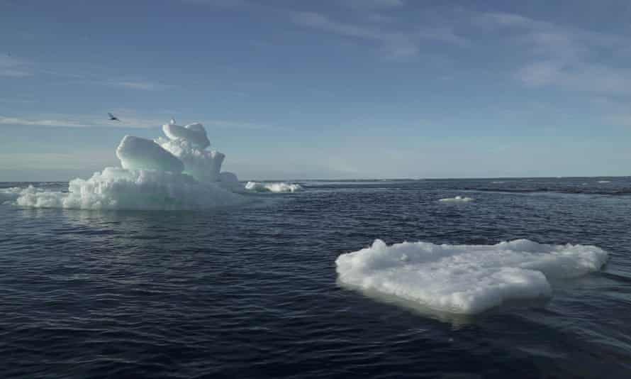
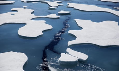
Snow weighs the ice down, so it is critical to know how deep it is in order to calculate the thickness of the ice.
Photograph: Natalie Thomas/Reuters

Sea ice across much of the Arctic is thinning twice as fast as previously thought, researchers have found.

Arctic ice is melting as the climate crisis drives up temperatures, resulting in a vicious circle in which more dark water is exposed to the sun’s heat, leading to even more heating of the planet.

The faster ice loss means the shorter north-eastern shipping passage from China to Europe will become easier to navigate, but it also means new oil and gas extraction is more feasible.

Calculating the thickness of sea ice from satellite radar data is difficult because the amount of snow cover on top varies significantly.
Until now, the snow data used came from measurements by Soviet expeditions on ice floes between 1954 and 1991.
But the climate crisis has drastically changed the Arctic, meaning this information is out of date.

The new research used novel computer models to produce detailed snow cover estimates from 2002 to 2018.
The models tracked temperature, snowfall and ice floe movement to assess the accumulation of snow.
Using this data to calculate sea ice thickness showed it is thinning twice as fast as previously estimated in the seas around the central Arctic, which make up the bulk of the polar region.

Robbie Mallett of University College London, who led the study, said: “Sea ice thickness is a sensitive indicator of the health of the Arctic – and, when the Arctic warms, the world warms.

“Thicker ice acts as an insulating blanket, stopping the ocean from warming up the atmosphere in winter and protecting the ocean from the sunshine in summer.
Thinner ice is also less likely to survive during the Arctic summer melt.”


Changes in the Arctic are also increasingly believed to influence extreme weather such as heatwaves and floods around the northern hemisphere.
The rapid thinning of sea ice has consequences for human activities in the Arctic as well.
Advertisement

The newly exposed waters enabled storms to hit coastal communities and erode coasts, Mallett said.
The opening of the shorter north-eastern shipping route around Siberia means less fuel is needed to transport goods between China and Europe, leading to lower carbon emissions.

In February, a cargo ship made a round trip for the first time in winter.
“However, this also raises the risk of fuel spillages in the Arctic, the consequences of which could be dire,” said Mallett.

“There’s also a lot of interest in oil and gas extraction from the Russian shelf seas,” Mallett said.
But the research revealed much greater annual variability in ice thickness than estimated before.
“Knowing the thickness of the ice is pretty critical to planning those activities, so the enhanced variability is generally bad news for those planning to work in the Arctic,” he said.

The Soviet-era data was hard won, Mallett said. 
“They sent these brave guys out and they sat on these drifting stations and floated around the Arctic, sometimes for years at a time, measuring the snow depth.” But the Intergovernmental Panel on Climate Change identified the lack of more recent data as a key knowledge gap in 2019.

Sea ice thickness is calculated from satellite radar data that measures how high the ice sits above the sea surface.
Snow on top of the ice is invisible to the radar signals but it weighs the ice down, so it is critical to know the depth of snow.

“Sea ice has begun forming later and later in the year, so the snow on top has less time to accumulate,” said Mallett.
“Our calculations account for this declining snow depth for the first time.”
The research is published in the journal The Cryosphere.

“We are still learning about the changes to the Arctic environment, and one of the big unknowns – or less well-knowns – is snow cover,” said Walt Meier, at the US National Snow and Ice Data Center, and not involved in the new research.
“The approach in the study is a significant improvement over older methods, and the results fit with other changes we’re seeing with Arctic sea ice, including earlier melt onset, lower summer ice cover, and later freeze-up.”

Prof Julienne Stroeve, at UCL, said: “There are [still] a number of uncertainties but we believe our new calculations are a major step forward.
We hope this work can be used to improve climate models that forecast the effects of long-term climate change in the Arctic – a region that is warming at three times the global rate and whose ice is essential for keeping the planet cool.”

Links :

Monday, October 17, 2022

Humans can dive deeper into the world’s oceans than ever before with Alvin

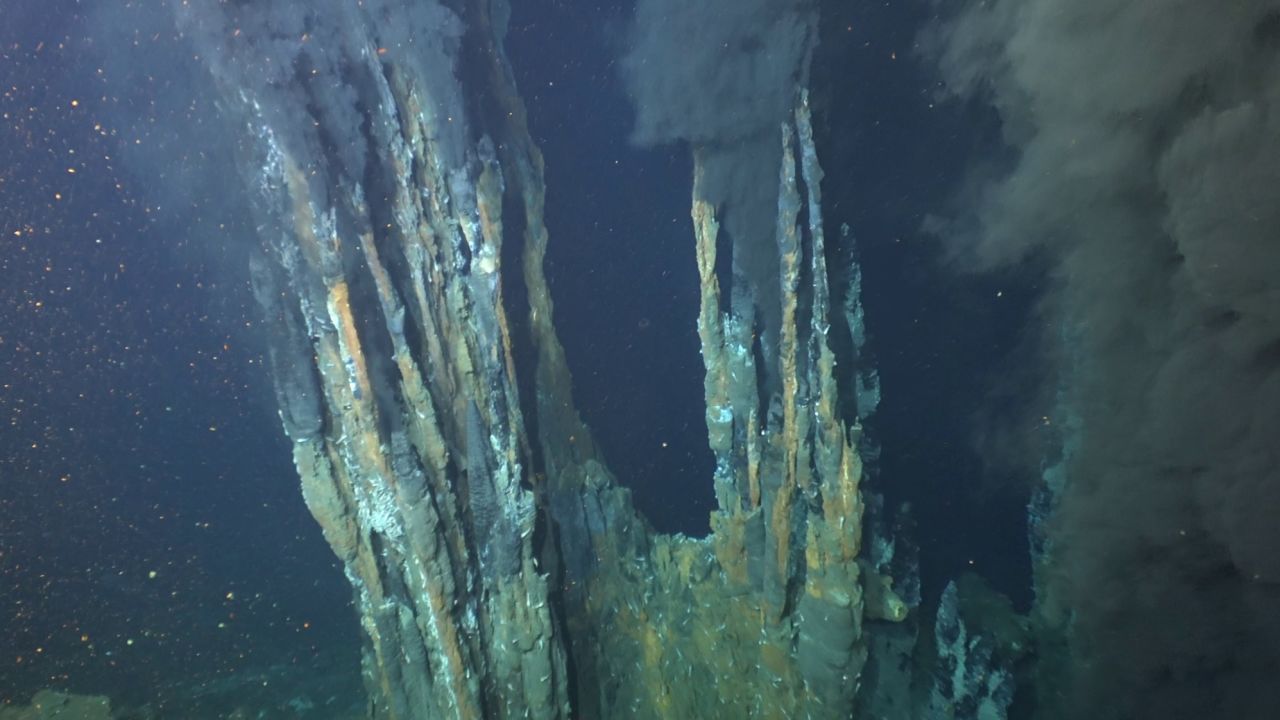
The Beebe Hydrothermal Vent Field, the deepest and hottest known hydrothermal vent in the world, is visible from a dive of the submersible Alvin near the Cayman Islands in the Caribbean.
Woods Hole Oceanographic Institution

From CNN by Ashley Strickland

Black smoke appears to rise from chimney-like formations of the hottest and deepest known hydrothermal vents on Earth.

Over the summer, Anna Michel was able to see them for herself — a few miles beneath the ocean’s surface.

Michel, an associate scientist at the Woods Hole Oceanographic Institution in Massachusetts, was part of a three-person crew aboard the submersible Alvin as it dove down to the Mid-Cayman Rise.
Known as the Beebe Hydrothermal Vent Field, these vents exist on the ocean floor where two tectonic plates are separating about a half an inch (15 millimeters) per year south of the Cayman Islands. 

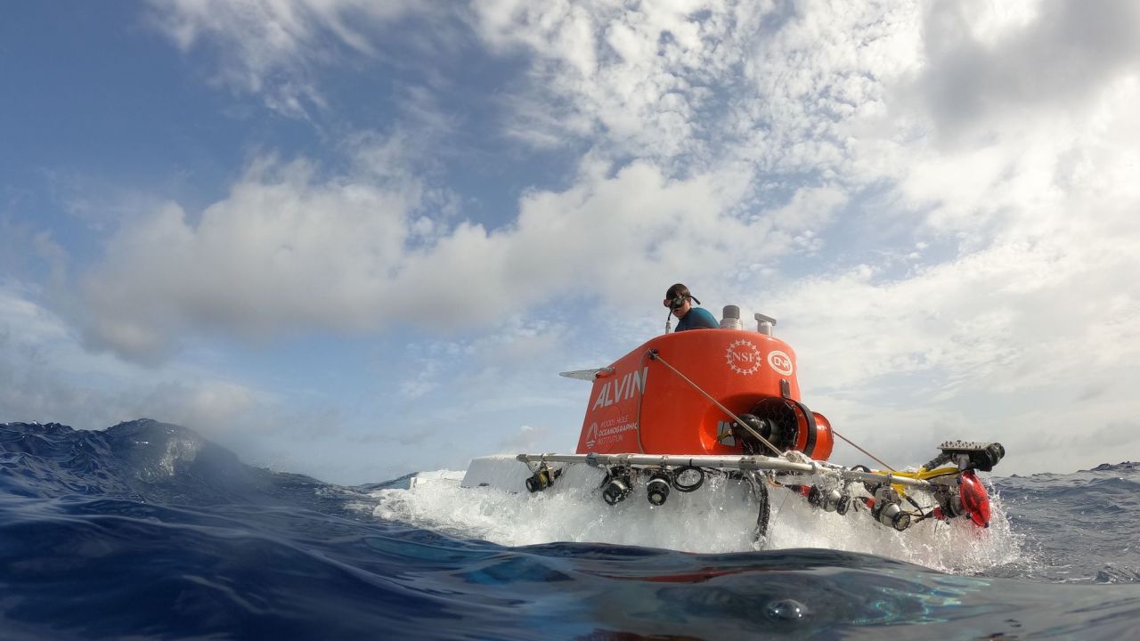
With its upgrades, Alvin is capable of diving 4 miles beneath the ocean's surface after rigorous testing.
Marley Parker/Woods Hole Oceanographic Institution

Hydrothermal vents form where rising magma beneath the seafloor creates underwater mountain ranges called ocean ridges.

The chilly seawater seeps through seafloor cracks and becomes heated to 750 degrees Fahrenheit (400 degrees Celsius) as it interacts with the magma-heated rocks.
This interaction releases minerals from the rocks, venting out nutrients and providing the perfect ecosystem for unusual marine life that clusters around them.

Alvin, which has been operating for 58 years, reached a record depth of 6,453 meters (4 miles) in July in the Puerto Rico Trench, north of San Juan, Puerto Rico.
On multiple excursions, Alvin traveled 6,200 to 6,500 meters (3.8 to 4 miles) below the ocean’s surface after meeting requirements set by the US Navy and Naval Sea Systems Command.

The new range means that about 99% of the seafloor is now within Alvin’s reach as well as that of its pilot and two passengers.
It’s the third increase in depth for Alvin since the submersible was commissioned, according to Andrew Bowen, principal engineer at Woods Hole Oceanographic Institution’s Applied Ocean Physics & Engineering.

“That was the first time I went to a hydrothermal vent site in person and to me, that was just absolutely incredible,” said Michel, also the chief scientist of the National Deep Submergence Facility that operates Alvin. “We were able to bring humans to see places that we’ve not gone to before with Alvin.”

Alvin can carry three people deep underwater, including a pilot and two passengers.
Marley Parker/Woods Hole Oceanographic Institution

Michel has worked with remotely operated underwater vehicles for 20 years, but this summer was her first time as an Alvin passenger.
Despite the enclosed space of the titanium-encased sub, Michel never felt claustrophobic.
Instead, she said it felt like riding in an elevator, and the eight-hour expedition flew by.

“You see a lot more three-dimensionality in real life and your spatial awareness is very different of these huge spires,” she said, referring to the vents.

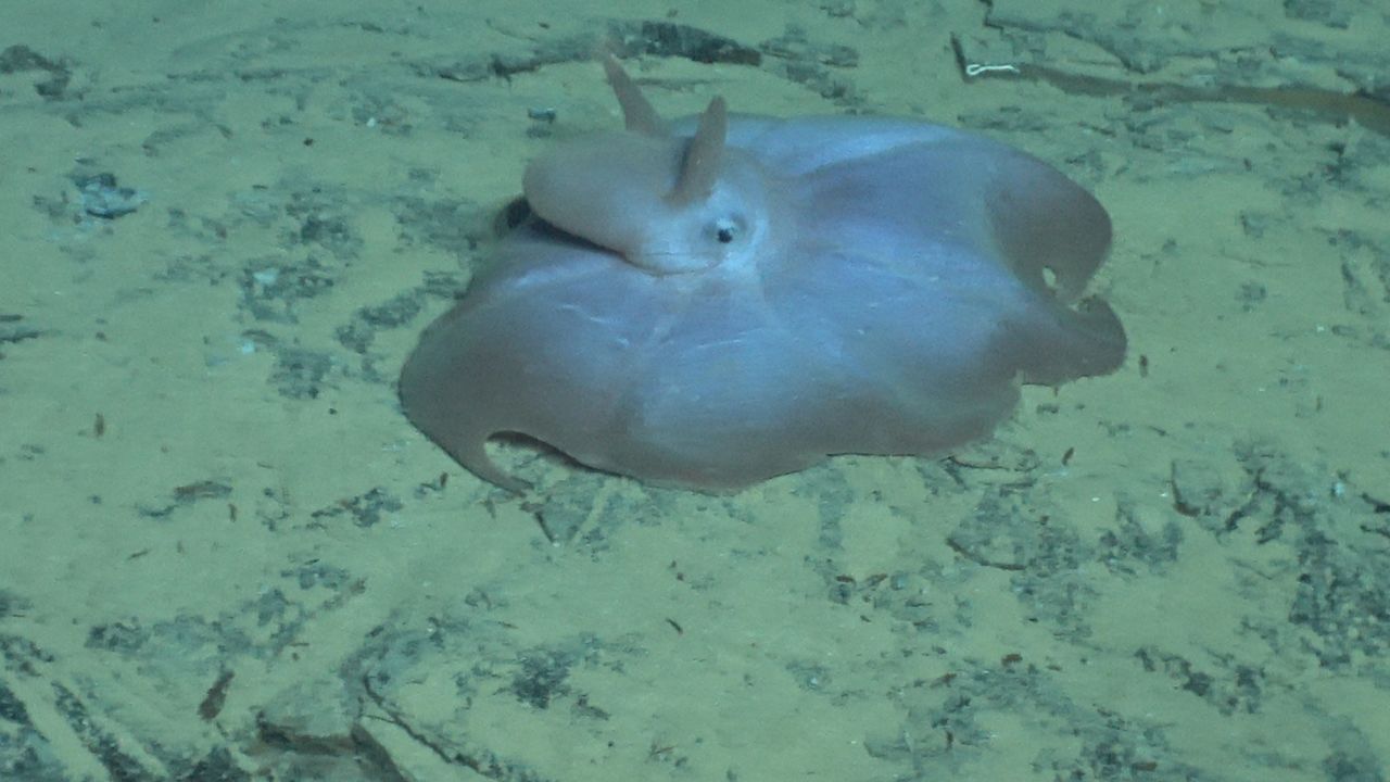
A Dumbo octopus can be seen on the ocean floor during one of Alvin's dives.
Woods Hole Oceanographic Institution

Scientists will now have direct access to the ocean’s deepest zones, exploring places humans have never been to before.
Researchers expect to find new species and study the fundamentals of life.

Michel and University of Rhode Island geophysicist Adam Soule, a professor of oceanography, led five scientific dives for Alvin’s Science Verification Expedition over the summer, traveling to Puerto Rico and the Caymans.

At the Puerto Rico Trench, where underwater cliffs form as the North American and Caribbean tectonic plates collide, the team collected samples of exposed ocean crust and some of the deepest known examples of seafloor organisms.
During the Mid-Cayman Rise expedition, researchers took biological and chemical samples from the hydrothermal vents. 

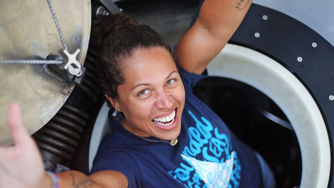
Sabrina Douglas emerges from Alvin after a dive.
She became the first Cayman native to dive down to the Mid-Cayman Rise, part of the boundary between the North American and Caribbean tectonic plates.Marley Parker/Woods Hole Oceanographic Institution

Previously, Alvin was only able to travel down 4,500 meters (2.7 miles).
The new feat was possible after 18 months of overhauling the 43,000-pound (19,500-kilogram) submersible.
Alvin’s new upgrades include a 4K imaging system, a new hydraulic manipulator arm, more powerful thrusters, new motor controllers and an integrated command and control system.

Alvin has contributed to numerous discoveries, including shipwrecks and ocean science.
The human-operated vehicle, or HOV, has carried more than 3,000 people on over 5,000 dives to the deep.
It’s the only deep-submergence vehicle in the US capable of carrying humans to the deep ocean.

Researchers have used Alvin to study plate tectonics and hydrothermal vents, discover strange sea life — and even explore the RMS Titanic in 1986 after Woods Hole Oceanographic Institution scientist Robert Ballard located the famed shipwreck.
The submersible also helped the Navy locate a missing hydrogen bomb from World War II and took scientists to the seafloor beneath the Deepwater Horizon oil spill of 2010.

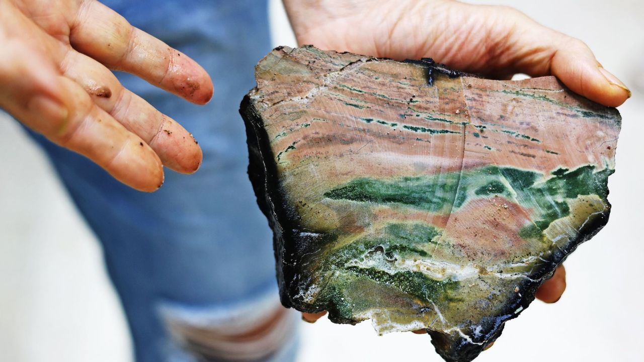
University of Hawaii geologist Ken Rubin, professor of geochemistry and volcanology, holds a fragment of the North American tectonic plate collected by Alvin.Marley Parker/Woods Hole Oceanographic Institution

“For almost 60 years, the deep-submergence vehicle Alvin has unveiled the ocean’s mysteries — not just for military and national security purposes but also for the scientific benefit of society as a whole,” said Rear Adm. Lorin C. Selby, chief of naval research, in a statement.

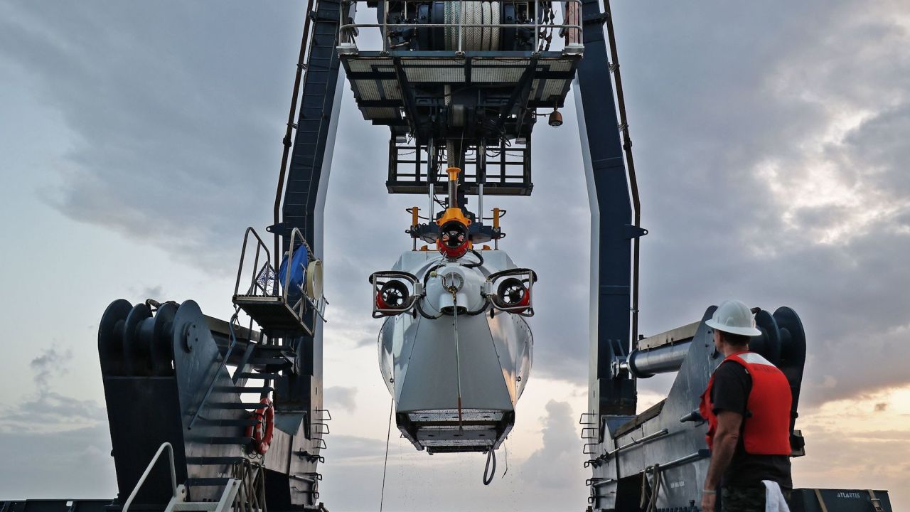
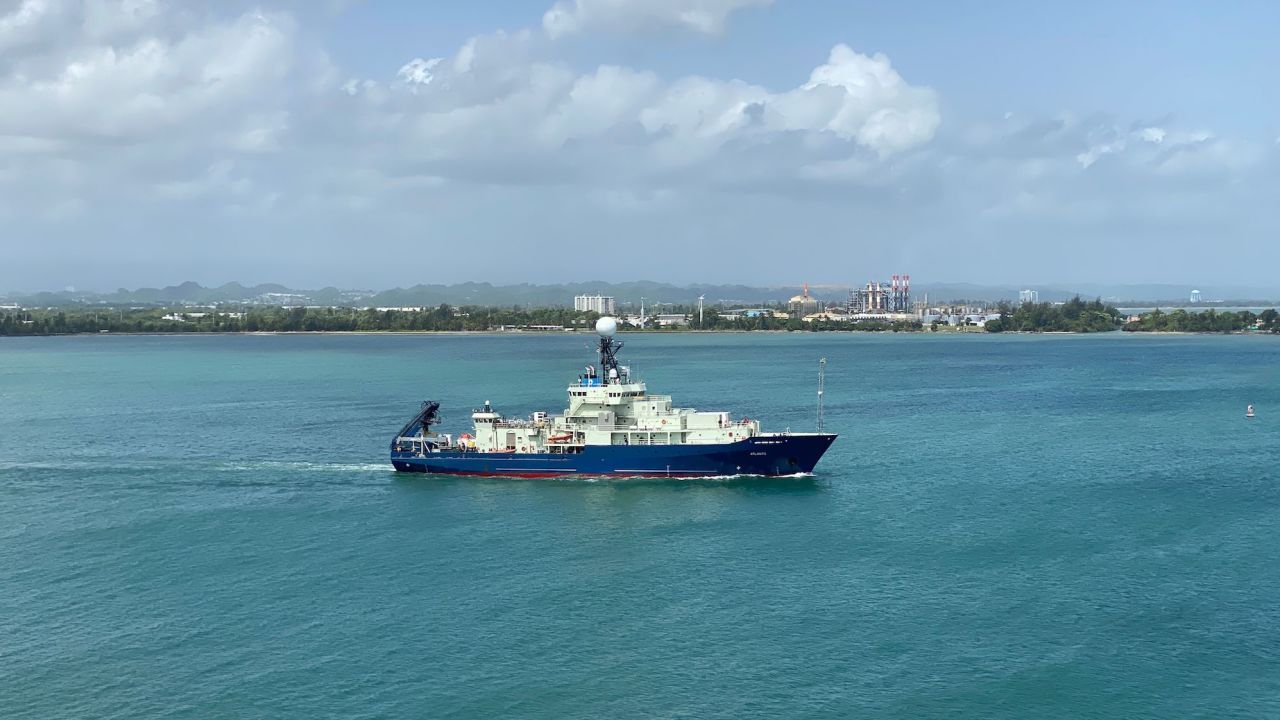
The sub uses its two arms to collect samples that can be brought to the surface when Alvin “parks” aboard its ship, the R/V Atlantis.
Alvin’s capabilities mean that scientists participating in a dive can capture photos and videos of the seafloor’s alien landscape and rare creatures, conduct experiments and deploy scientific instruments.

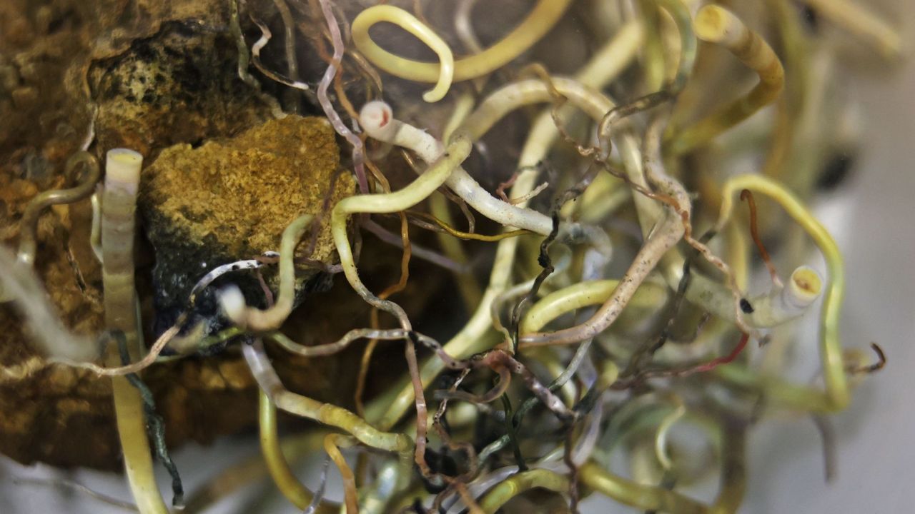
Tube worms are attached to a rock collected from the Beebe Hydrothermal Vent Site.
Marley Parker/Woods Hole Oceanographic Institution

Alvin takes its name from Allyn Vine, the Woods Hole Oceanographic Institution physicist and oceanographer who championed the idea of submersibles that could carry researchers safely through the deep sea to conduct science in an otherwise inaccessible place.
“Alvin is built and maintained to enable new discoveries and provide new insight into the way our planet works,” Michel said.
“Every generation of scientists presents new questions, and Alvin has responded in ways that have rewritten textbooks. There’s a new generation waiting to use the sub, and to them we say, ‘Alvin is ready, where do you want to go?’”

Scientists submit proposals to reserve time on Alvin to conduct their research, and the submersible undertakes about 100 dives per year to explore ocean biodiversity, Earth’s crust and the way life thrives at extreme depths.

The R/V Atlantis will take Alvin across the Pacific Ocean on multiple dives in 2023.
Ken Kostel/Woods Hole Oceanographic Institution

A variety of other underwater vehicles, including autonomous ones, are increasing exploration possibilities beneath the waves.

“Imagine exploring the Grand Canyon at night with a flashlight,” Bowen said.
“Historically, that’s sort of what we’ve been able to do, and Alvin has been a key part of that. Increasingly, we’ve added more technology in the form of drones, tethered vehicles and autonomous systems that really broadens the footprint for the Alvin submersible.
“Visiting the deep ocean is a laborious process. Getting the maximum benefit out of going there is where technology has a huge potential benefit.”
 
Links :