Yemen's Iran-backed Houthis claimed responsibility on Monday for an attack that damaged a commercial vessel in the Red Sea and forced its crew to abandon ship.
The Houthis "targeted the Magic Seas ship... using two unmanned boats, five ballistic and cruise missiles, and three drones" on Sunday, military spokesman Yahya Saree said in a video statement.
He added that the ship was targeted for violating their ban on navigation to "occupied Palestine's ports."
5 meters depth in the middle of the North Atlantic Ocean ?
That extremely shallow depth is surprising for a seamount setting—which are often much deeper—and suggests either a submerged pinnacle or perhaps a shoal very close to surfacing.
If you're planning navigation, diving, or research in that vicinity, you’ll definitely want to account for that potential hazard or point of interest.
Would you like to explore navigational charts around that coordinate, or dive into how that shallow patch might have formed?
approximate position : 35.352336,-51.479050
This is confirmed by NtM (112469) from SHOM published in 2011
(data issued from UKHO Taunton NtM 11-2149)
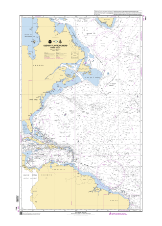
250 m depth in raster chart 7043
date : 12-04-2011
SHOM NtM issued from
UKHO Notice to Mariner NtM 2149/11 (21wknm11) also published in 2011 :
so 5 meters (2003) seems to be the corrected selected depth
from original 250 m (even though this last one seems to have been established 4 years later in 2007)
UKHO chart 4407 / date 11-01-2011
actually original information from UKHO
(current raster chart GB4411/GB4012/GB4013)
also visible in GB4407 Trinidad to the Mid-Atlantic Ridge in the GeoGarage platform UKHO set
Associated data for the 5.5 m sounding for GB1CK00 ENC (QTVLM software)
The UKHO was informed in 2007 of a reported depth of 250m. This depth info was published as a NtM (5302/07) affecting 4 GB Charts in the 4000 series.
In 2011 the UKHO learnt of a reported depth of 5.5m that was originally reported in 2003.
The UKHO researched this observation from 2003 (in 2011) to understand further, in order to update navigational products if necessary. The UKHO learnt that the 5.5m observation was reported to a National Hydrographic Office and to a National Coast Guard in 2003 but was not reported to the UKHO. Upon further investigation by the UKHO, UKHO learnt that the crew of the vessel who reported this depth, noted that as they approached an ‘object’ on the surface, the depth sounder went from over 600ft (no bottom showing) to a depth of 18ft then the object which was assessed as at a depth of 5.5m.
Given the position of the 250m (reported 2007) and the position of the 5.5m (reported 2003 but only made aware to UKHO in 2011) and the scale of navigational products, under SOLAS we issued the NtM 2149/11 replacing the 250m (reported in 2007) with the 5.5m PA (reported in 2003).
As is the case with Reported Depths, the UKHO will chart them with the legend Rep (Year of report) and depending on criteria UKHO may also include a legend – PA which stands for Position Approx. Which is what we have done in this case. UKHO always would like a survey to be carried out to either prove or disprove a reported depth (or obstruction). For this geographical area there has not been an appetite to undertake such a survey to our knowledge...
The vessel SV Journey who observed the depth in 2003 was a leisure vessel. Depth information (and other observations) are used from leisure vessels for SOLAS where data is sparse. UKHO does use bathymetric surveys but where there are areas that are lacking data, and the Hydrographic Office receives a report of a danger to navigation, it will be reviewed and included on the UKHO products. If it is from a non-survey vessel, as in this case, UKHO will use the legend PA (mentioned above) to inform the mariner that the depth is position approx.
5 m depth also visible on Transas nautical charts
but no 5 m depth in NGA raster chart
but no 5 m depth in Navionics Garmin raster chart
but no 5 m depth in C-Map raster chart
same : no 5 m depth in C-Map/Navico raster chart
no specific visualization of 5 m depth in Google Earth SOEST Hawaï seamounts database
no specific visualization of 5 m depth on STRM bathymetry
In 2005, NOAA conducted a mission called 05stepstones in the area :
Climate change is rapidly reshaping a region of the world that’s home to millions of people.
In the next 30 years, Pacific Island nations such as Tuvalu, Kiribati, and Fiji will experience at least 6 inches (15 centimeters) of sea level rise, according to an analysis by NASA’s sea level change science team.
This amount of rise will occur regardless of whether greenhouse gas emissions change in the coming years.
The sea level change team undertook the analysis of this region at the request of several Pacific Island nations, including Tuvalu and Kiribati, and in close coordination with the U.S. Department of State.
In addition to the overall analysis, the agency’s sea level team produced high-resolution maps showing which areas of different Pacific Island nations will be vulnerable to high-tide flooding — otherwise known as nuisance flooding or sunny day flooding — by the 2050s.
Released on Sept. 23, the maps outline flooding potential in a range of emissions scenarios, from best-case to business-as-usual to worst-case.
“Sea level will continue to rise for centuries, causing more frequent flooding,” said Nadya Vinogradova Shiffer, who directs ocean physics programs for NASA’s Earth Science Division.
“NASA’s new flood tool tells you what the potential increase in flooding frequency and severity look like in the next decades for the coastal communities of the Pacific Island nations.”
Team members, led by researchers at the University of Hawaii and in collaboration with scientists at the University of Colorado and Virginia Tech, started with flood maps of Kiribati, Tuvalu, Fiji, Nauru, and Niue.
They plan to build high-resolution maps for other Pacific Island nations in the near future.
The maps can assist Pacific Island nations in deciding where to focus mitigation efforts.
“Science and data can help the community of Tuvalu in relaying accurate sea level rise projections,” said Grace Malie, a youth leader from Tuvalu who is involved with the Rising Nations Initiative, a United Nations-supported program led by Pacific Island nations to help preserve their statehood and protect the rights and heritage of populations affected by climate change.
“This will also help with early warning systems, which is something that our country is focusing on at the moment.”
Future Flooding
The analysis by the sea level change team also found that the number of high-tide flooding days in an average year will increase by an order of magnitude for nearly all Pacific Island nations by the 2050s. Portions of the NASA team’s analysis were included in a sea level rise report published by the United Nations in August 2024.
Areas of Tuvalu that currently see less than five high-tide flood days a year could average 25 flood days annually by the 2050s.
Regions of Kiribati that see fewer than five flood days a year today will experience an average of 65 flood days annually by the 2050s.
“I am living the reality of climate change,” said Malie. “Everyone (in Tuvalu) lives by the coast or along the coastline, so everyone gets heavily affected by this.”
Flooding on island nations can come from the ocean inundating land during storms or during exceptionally high tides, called king tides.
But it can also result when saltwater intrudes into underground areas and pushes the water table to the surface.
“There are points on the island where we will see seawater bubbling from beneath the surface and heavily flooding the area,” Malie added.
Matter of Location
Sea level rise doesn’t occur uniformly around the world.
A combination of global and local conditions, such as the topography of a coastline and how glacial meltwater is distributed in the ocean, affects the amount of rise a particular region will experience.
“We’re always focused on the differences in sea level rise from one region to another, but in the Pacific, the numbers are surprisingly consistent,” said Ben Hamlington, a sea level researcher at NASA’s Jet Propulsion Laboratory in Southern California and the agency’s sea level change science team lead.
The impacts of 6 inches (15 centimeters) of sea level rise will vary from country to country.
For instance, some nations could experience nuisance flooding several times a year at their airport, while others might face frequent neighborhood flooding equivalent to being inundated for nearly half the year.
Researchers would like to combine satellite data on ocean levels with ground-based measurements of sea levels at specific points, as well as with better land elevation information.
“But there’s a real lack of on-the-ground data in these countries,” said Hamlington.
The combination of space-based and ground-based measurements can yield more precise sea level rise projections and improved understanding of the impacts to countries in the Pacific.
“The future of the young people of Tuvalu is already at stake,” said Malie.
“Climate change is more than an environmental crisis. It is about justice, survival for nations like Tuvalu, and global responsibility.”
Scientists at the University of Minnesota Duluth's Large Lakes Observatory have discovered a new microorganism in an unexpected place—hiding in the oily recesses of a Great Lakes research vessel.
The researchers made the discovery last fall, after crew members aboard the R/V Blue Heron noticed a strange knocking sound coming from the ship’s propeller system while on a research expedition on Lake Erie.
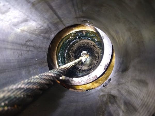
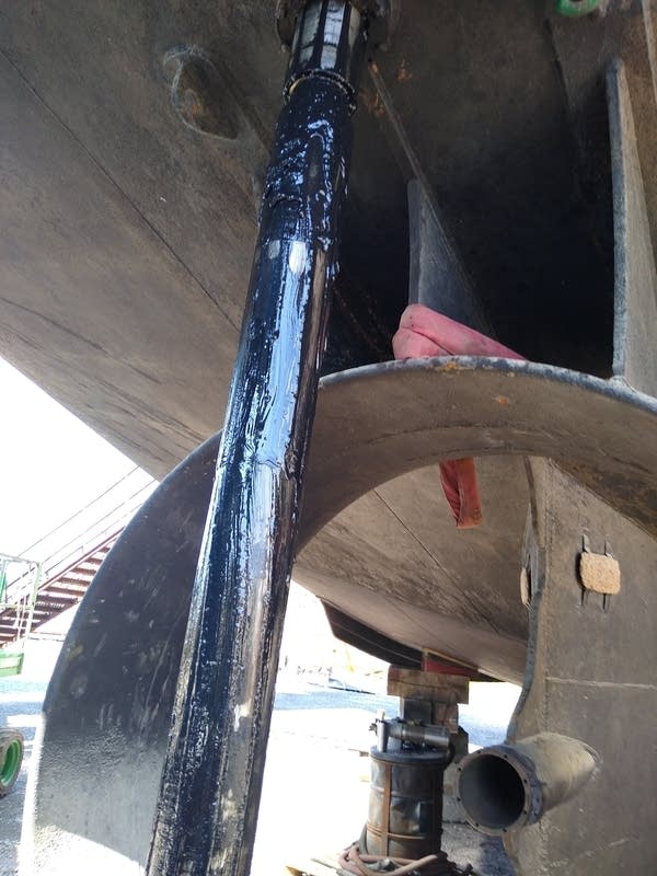
They hauled the ship out of the water at the Great Lakes Shipyard in Cleveland. That’s when the Large Lakes Observatory’s Marine Superintendent Doug Ricketts saw a black, tar-like goop oozing out of the ship’s rudder shaft.
Scientists at the University of Minnesota Duluth's Large Lakes Observatory discovered novel new microbes hiding in the warm, oxygen-free environment of the rudder shaft housing of the research vessel the Blue Heron. Courtesy of UMD's Large Lakes Observatory
He had never seen the stuff before, and thought it was odd. So he filled a red plastic cup full of the substance, and gave it to UMD professor Cody Shiek, a biologist who focuses on microbial ecology. Shiek decided to sample it. "I was completely like, we're not going to get anything off of this,” he remembers thinking. “But surprisingly, we found DNA and it wasn’t too destroyed, nor was the biomass too low."
After sequencing the DNA and comparing it with global databases, the team confirmed they had discovered an entirely new organism, a microbial species that appeared to thrive in the warm, oily, oxygen-free environment within the ship’s rudder shaft.
Shiek and his team temporarily dubbed the substance “ShipGoo001.” "And we don't know exactly what ShipGoo001 is good for right now,” said Catherine O'Reilly, director of the Large Lakes Observatory. “But there's a good chance that we'll learn more about it, and it might turn out to have applications to things that we care about as a society."
For example, some organisms in the goo appear to be methane producers, O’Reilly said, potentially useful for biofuel production.
This isn’t the first time Shiek has discovered a new organism. Far from it. On research trips on Lake Superior aboard the Blue Heron, he said it’s common to find new species, especially in the sediment of the lake “When we go out into the environment, we're constantly finding new organisms, and that's just because things are very under sampled,” Shiek said.
What’s different and exciting about the ship goo is that they were not looking for these organisms. It was an accidental discovery. “We weren’t supposed to probably see this,” he said.
Shiek has studied microbes living in extreme environments from Lake Superior, to deep ocean hydrothermal vents and hot springs.
This discovery highlights how much remains unknown, even in familiar, built-up environments like ships.
“I think it tells us we can discover new things everywhere. We don't have to go to Mars necessarily to find brand new things right under our noses,” O’Reilly said. She added that it’s important to allow scientists to pursue new things without necessarily having a goal in mind.
“This shows us how how important it is to be creative as a scientist, to be open minded, to take advantage of opportunities that come to you and just explore what's right in front of you, because you really don't know what you're going to find.”
Researchers at the University of Minnesota Duluth's Large Lakes Observatory discovered new microorganisms dubbed "ShipGoo001" in a black tar-like substance on the rudder shaft of the research vessel the Blue Heron. Courtesy of UMD's Large Lakes Observatory
A mystery that Shiek is still trying to answer is determining where the organisms originate. He speculates they may have been dormant in the oil used to grease the rudder, waiting until conditions were right for growth.
While ShipGoo001 is new to science, similar species have been found in tar pits and petroleum wells around the world.
Shiek said the next step in the research is to try to decipher the metabolic processes of the microbes.
“Does it eat oil? Does it breathe in metal, like iron? And so that's where we're at right now. Thinking about how these organisms are surviving, or maybe even just thriving, in this built environment that we very rarely think about.”
And soon, the substance will receive a new scientific name. Participants in the Large Lakes Observatory’s Freshwater Discovery Day aboard the Blue Heron on July 30 will have a chance to join Shiek in coming up with an official name for what remains, for now, ShipGoo001.
Archaeologist Greer Jarrett at Lund University in Sweden has been sailing in the footsteps of Vikings for three years.
He can now show that the Vikings sailed farther away from Scandinavia, and took routes farther from land, than was previously believed to have been possible.
In his latest study, he has found evidence of a decentralised network of ports, located on islands and peninsulas, which probably played a central role in trade and travel in the Viking era.
Greer Jarrett has identified four possible small ports, or "havens," used by Vikings along the Norwegian coast.
If you want to learn more about how and where the Vikings sailed, making the journey through the fjords yourself in replica boats is a practical, hands-on approach to achieving that end. Greer Jarrett, an archaeologist at Lund University in Sweden, has spent the last three years doing just that, sailing more than 5,000 kilometers along known Viking trade routes in open, spare-rigged clinker boats similar to those used by the Vikings.
Not only has Jarrett learned a great deal about the boats themselves, he also identified four possible havens along the Norwegian coast, part of what may have been a decentralized network that played a crucial role in trade and travel during that period. And those ports are located farther out to sea than other major ports and hubs known to date, according to a paper he published in the Journal of Archaeological Method and Theory.
It's just the latest intriguing discovery enabled by the growing field of experimental archaeology, whereby researchers seek to reverse-engineer all manner of ancient technologies. Experimental archaeologists have, for instance, built their own versions of Early Upper Paleolithic adzes, axes, and chisels. The resulting fractures and wear enabled them to develop new criteria for identifying the likely functions of ancient tools. Others have tried to cook like the Neanderthals, concluding that flint flakes were surprisingly effective for butchering birds, and that roasting the birds damages the bones to such an extent that it's unlikely they would be preserved in the archaeological record.
Kent State University's Metin Eren has conducted practical experiments to study, for instance, the trajectories of atlatls attached to spears tipped with replica Clovis points, and how their performance compares to javelins used by Neanderthals. He even fashioned rudimentary blades out of his own frozen feces to test whether they could cut through pig hide, muscle, and tendon—solely to test a famous anthropological legend about an elderly Inuit man in the 1950s who purportedly did the same to kill and skin a dog, using its rib cage as a makeshift sled to venture off into the Arctic. (It did not work, so myth: busted. But it did snag Eren an Ig Nobel prize.)
Taking a hands-on, experimental archaeological approach to studying the Vikings makes sense in light of the dearth of contemporary written sources. "We have a few things written by outsiders, but there's very, very few accounts written or delivered by people from Scandinavia during that period," Jarrett told Ars. "We normally rely on indirect forms of evidence, be that genetics or archaeology or linguistics, which show strong, very frequent connections across maritime areas in the North Atlantic. But because traveling by boat is kind of an archaeologically invisible act, you don't leave any footprints. So we have very little information about the voyages between these points."
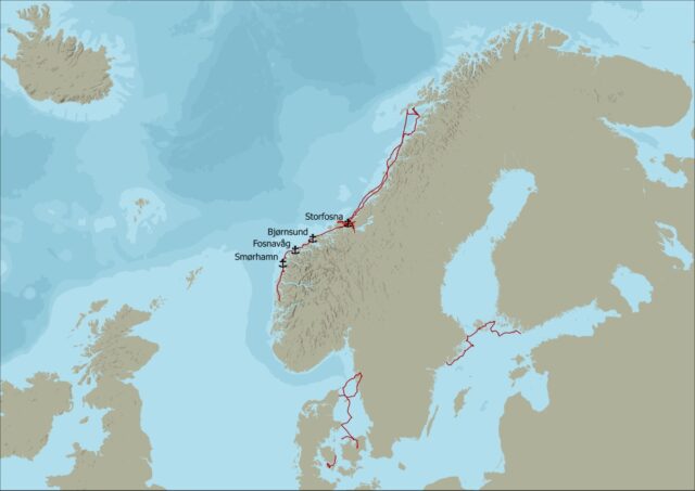
The sailing voyages made by Greer Jarrett during the research project, as well as the four possible Viking harbors he identified.
Credit: Greer Jarrett
Garrett and his crew used four or five different replica boats for their test voyages. Most were built by volunteers, enthusiasts, or students Jarrett had met during his considerable time in the field. They then sailed along the west coast of the Scandinavian Peninsula, a core area of Viking seafaring.
"These are reconstructions of traditional Norwegian boats from the 1800s and early 1900s," said Jarrett. "My idea was, because of this really long-term continuity in traditional boat building practices, especially in Norway, it might be possible to use these later boats which have lots of similarities to try and work out the potentials of where people might have gotten out. It's the idea of suggesting potentials based on practical experience to try and join those dots between the different evidence we have across the Viking world."
That decision has led to some criticism from colleagues because of the enormous gap in time, but Jarrett defends his choice. "The Viking Age ends in the 11th century, and we're talking about boats from 800 years later," he said. "But the construction techniques and the way they are rigged and their general performance characteristics are similar enough. Because this is a project about voyages and not a project about boat building, it seemed like a defensible analogy."
Seeking safe harbor
"On the long-range voyages, we worked in watches of four hours on and four hours off, and that is just about long enough to get some sleep on your off watch, but also just about short enough that you don't get really, really, really cold, which is obviously a risk," said Jarrett. "It was manageable, but we looked like penguins. I mean, we're wearing six layers of wool at any time and sleeping all stacked together for warmth. But other times it's really nice. The spring and the autumn in Scandinavia, there's much more likelihood of high-pressure cycles, which means that it's clearer and sunnier than in the summer itself."
Nonetheless, there were some rough moments, such as when the mast spar holding up the mainsail snapped, forcing the crew to improvise and lash two oars together to hold the sail so they could continue their journey. It took several days to repair the boat so it could sail again. There was no safety boat following along in case the crew got into trouble, and no engine, although they did have a life raft, which the crew has yet to use.
Based on his sailing trials, Jarrett believes that the Vikings had no need for navigational tools like maps, a compass, or a sextant, relying instead on what he calls "mental maps"—or a "maritime cultural mindscape"—based on sailors' memories and experiences passed down orally through generations. Those maps might also be informed by the myths linked to well-known coastal landmarks, such as skerries, small islets, or reefs.
"People had been moving by boat along the west coast of Scandinavia for a really, really, really long time, probably since the late Neolithic, if not earlier—thousands of years before the Viking age," said Jarrett. "There are big trading networks in place beforehand, and that is reflected in the names, place names along the west coast. My primary argument is if you spend 3,000 years traveling up and down a coastline in which you can use the coast at all times for navigation, then it's unnecessary to develop instrumentation.
"Instruments are used when you are in a place out in the open sea that you don't know," Jarrett continued. "We definitely know they didn't have compasses because those don't arrive from China until the 1200s. There are these ideas about sunstones and sundials, or little sun compasses, which are entirely possible. But there's no legitimate proof of either of them archaeologically yet. I may well be proved wrong if we find them at some point, but I don't think they're necessary for this at all."
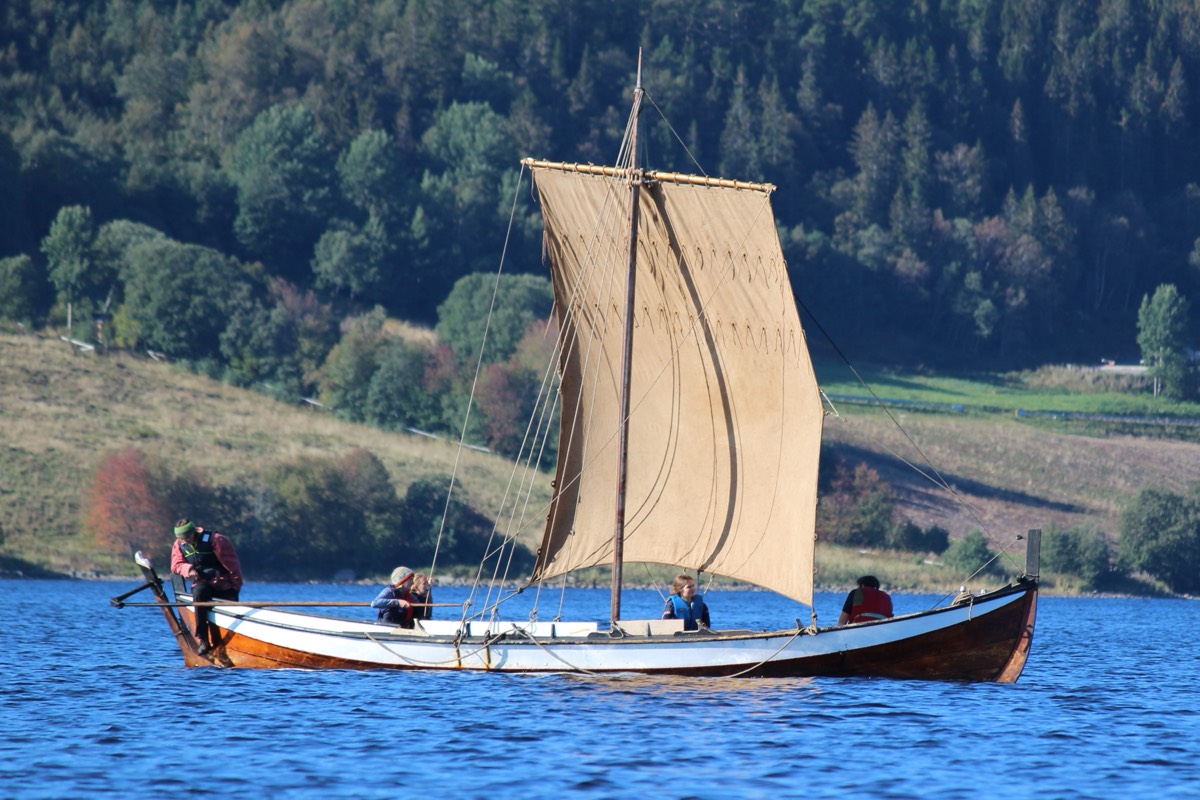
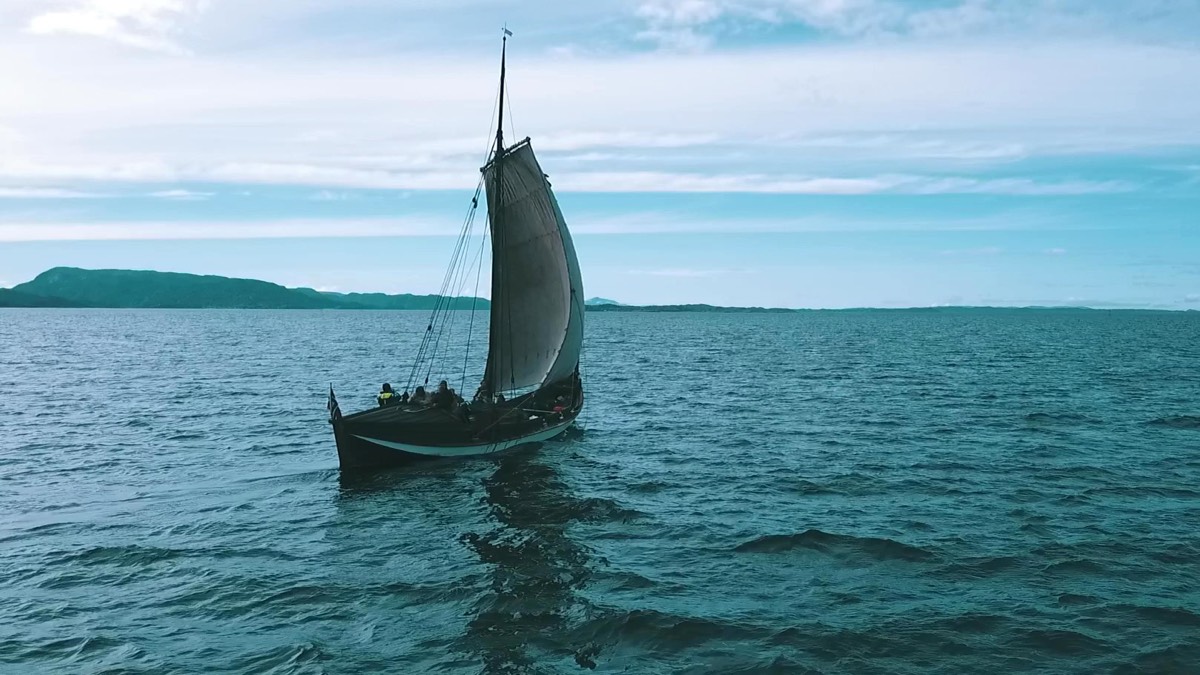
This type of sailing boat is known as a faering.
It was built at a folk high school in Norway as part of Greer Jarrett's research project.
The boat at sea.
Greer Jarrett
Based on the sailing trials, archaeological and documentary evidence of Viking Age maritime centers, and digital reconstructions of past sea levels. Jarrett was able to develop a useful set of criteria for evaluating potential havens. For instance, the site should be reachable in low visibility, with land or sea marks that sailors could use as bearings; large enough to accommodate multiple vessels of at least the size of a fyring(which can house a crew of four to 10 people); provide good protection from sea swell and storm surges; and have access to fresh water, among other criteria. Four sites scored sufficiently high by those criteria to qualify as possible Viking havens.
The four sites are Smørhamn, located at the confluence of Oldersund and the Frøysjø, where an inn and trading post are known to have existed since at least the late 17th century; the archipelago of Sørøyane between Stad and Ålesund, near where the sea battle of Hjörungavágr was fought circa 986 CE; Bjørnsund, a number of small islands off the southwestern tip of Hustadvika; and the island of Storfosna, which appears on 16th and 17th century charts.
"I'm not saying, 'This is where they went,'" said Jarrett. "I'm saying that, with these kinds of boats under these conditions, it would be possible to go to these places. And it's much more difficult—not impossible, but much more difficult—to go to these other places or to sail in these other conditions."
Pining for the fjords
The next step is for Jarrett and other archaeologists to hunt for evidence in support of his hypothesis. "Most of these sites have never been excavated," said Jarrett. "There's been a long assumption that these are landing places with the idea that you are dragging your boat ashore. I'm very opposed to that idea because these are two-and-a-half-ton boats, let alone the cargo. Unless you have a team of oxen and 20 people at your command, there is no way you're getting them on the beach. I'm very convinced that these places have jetties and mooring posts likely preserved underwater. All of that organic material survives much better underwater than it does on land. So I think that's very possible."
They might also find smaller items suggestive of a thriving harbor community. "Whenever you go into land, you've got something that's broken, so you need to do repairs," said Jarrett. "So things like clink nails or piles of balustones or signs of smithing—the typical kind of things you'd use for repairing your ship, I think are possible to find." Jarrett's methodology might also prove useful for studying other seafaring communities.
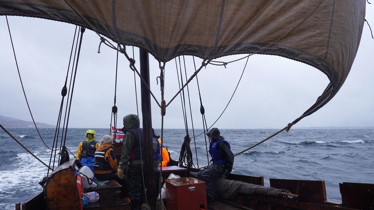
Cold winds off the coast of northern Norway.
Greer Jarrett
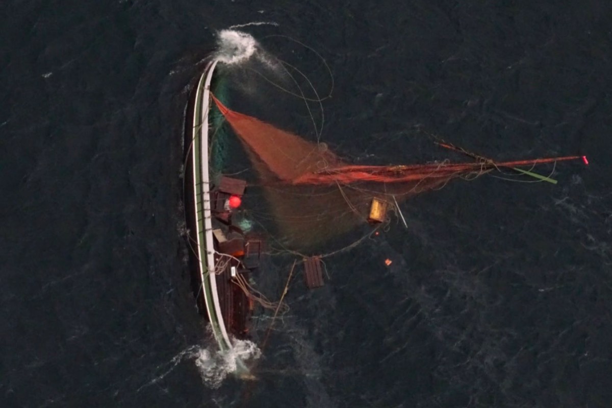
A katabatic wind caused this fembøring to capsize off the coast of Kunna in 2023.
HRS Nord-Norge
The practical experience of sailing the same seas as the Vikings naturally led to some surprising insights. "You are able to ask very different questions the minute you walk away from your desk and get on a boat," said Jarrett. "I think it's essential to do that because you think in new ways. In terms of the results themselves, the boats are extremely seaworthy crafts. When you get in them for the first time, you don't think that, because they're very, very light. They feel very flimsy, and they're very low in the water compared to a modern sailing boat. So you feel really in touch with the wave, which is kind of scary. But because they're so flexible and because of the way they're rigged, they're actually really stable, even in big waves.
"We kept going out thinking, 'Oh, this is maybe the limit of what this boat can tolerate,' and then it would be fine, and we'd be, 'Okay, let's go a little bit in slightly bigger waves with slightly stronger wind,'" Jarrett continued. "So I think our comfort zones definitely visibly expanded during that period. And I had the chance to work with the same crews over three years. By the end of those three years, we were doing stuff that we would never have been able to do at the beginning."
Another big difference from modern boats, Jarrett discovered, is that one cannot sail a traditional Viking craft alone. "It has to be a collaborative effort because of how you need a person at the front and the back of the boat basically at all times," he said. "So developing the crew together and gaining not only skills, but also trust between us meant that we could do things in 2024 that seemed completely insane just a couple of years earlier. I cannot imagine what that is like if you have an entire lifetime of Viking sailors working together for 30 years. It must be an incredible way of creating social bonds."