
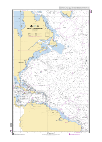
Raster chart 7043 (SHOM) visualization in Weather 4D R&N mobile app
5 meters depth in the middle of the North Atlantic Ocean ?
That extremely shallow depth is surprising for a seamount setting—which are often much deeper—and suggests either a submerged pinnacle or perhaps a shoal very close to surfacing.
If you're planning navigation, diving, or research in that vicinity, you’ll definitely want to account for that potential hazard or point of interest.
Would you like to explore navigational charts around that coordinate, or dive into how that shallow patch might have formed?

approximate position : 35.352336,-51.479050

This is confirmed by NtM (112469) from SHOM published in 2011
(data issued from UKHO Taunton NtM 11-2149)


date : 12-04-2011
SHOM NtM issued from
UKHO Notice to Mariner NtM 2149/11 (21wknm11) also published in 2011 :

from original 250 m (even though this last one seems to have been established 4 years later in 2007)


(current raster chart GB4411/GB4012/GB4013)
also visible in GB4407 Trinidad to the Mid-Atlantic Ridge in the GeoGarage platform UKHO set

Scale : 3000000 / Cat : 1 / Type : Overview
Edition_date : 20240522 / Edition : 2
Update_date : 20250328 / Update : -
Edition_date : 20240522 / Edition : 2
Update_date : 20250328 / Update : -

The UKHO was informed in 2007 of a reported depth of 250m.
This depth info was published as a NtM (5302/07) affecting 4 GB Charts in the 4000 series.
In 2011 the UKHO learnt of a reported depth of 5.5m that was originally reported in 2003.
The UKHO researched this observation from 2003 (in 2011) to understand further, in order to update navigational products if necessary.
The UKHO learnt that the 5.5m observation was reported to a National Hydrographic Office and to a National Coast Guard in 2003 but was not reported to the UKHO.
Upon further investigation by the UKHO, UKHO learnt that the crew of the vessel who reported this depth, noted that as they approached an ‘object’ on the surface, the depth sounder went from over 600ft (no bottom showing) to a depth of 18ft then the object which was assessed as at a depth of 5.5m.
Given the position of the 250m (reported 2007) and the position of the 5.5m (reported 2003 but only made aware to UKHO in 2011) and the scale of navigational products, under SOLAS we issued the NtM 2149/11 replacing the 250m (reported in 2007) with the 5.5m PA (reported in 2003).
As is the case with Reported Depths, the UKHO will chart them with the legend Rep (Year of report) and depending on criteria UKHO may also include a legend – PA which stands for Position Approx.
Which is what we have done in this case.
UKHO always would like a survey to be carried out to either prove or disprove a reported depth (or obstruction).
For this geographical area there has not been an appetite to undertake such a survey to our knowledge...
The vessel SV Journey who observed the depth in 2003 was a leisure vessel.
Depth information (and other observations) are used from leisure vessels for SOLAS where data is sparse.
UKHO does use bathymetric surveys but where there are areas that are lacking data, and the Hydrographic Office receives a report of a danger to navigation, it will be reviewed and included on the UKHO products.
If it is from a non-survey vessel, as in this case, UKHO will use the legend PA (mentioned above) to inform the mariner that the depth is position approx.
5 m depth also visible on Transas nautical charts


but no 5 m depth in C-Map raster chart


same : no 5 m depth in C-Map/Navico raster chart


no specific visualization of 5 m depth in Google Earth SOEST Hawaï seamounts database

no specific visualization of 5 m depth on STRM bathymetry
In 2005, NOAA conducted a mission called 05stepstones in the area :

This map shows the various peaks of the Corner Rise seamount cluster.
The peaks are labeled with arbitrary numbers and are accompanied by estimated summit height, in meters, in parentheses.
Image courtesy of Les Watling, University of Maine.
In 2021, NOAA's Okeanos Explorer conducted a 30-day expedition to explore New England and Corner seamounts.


No comments:
Post a Comment