Sometimes referred to as the fourth dimension, time has a highly geographical relevance
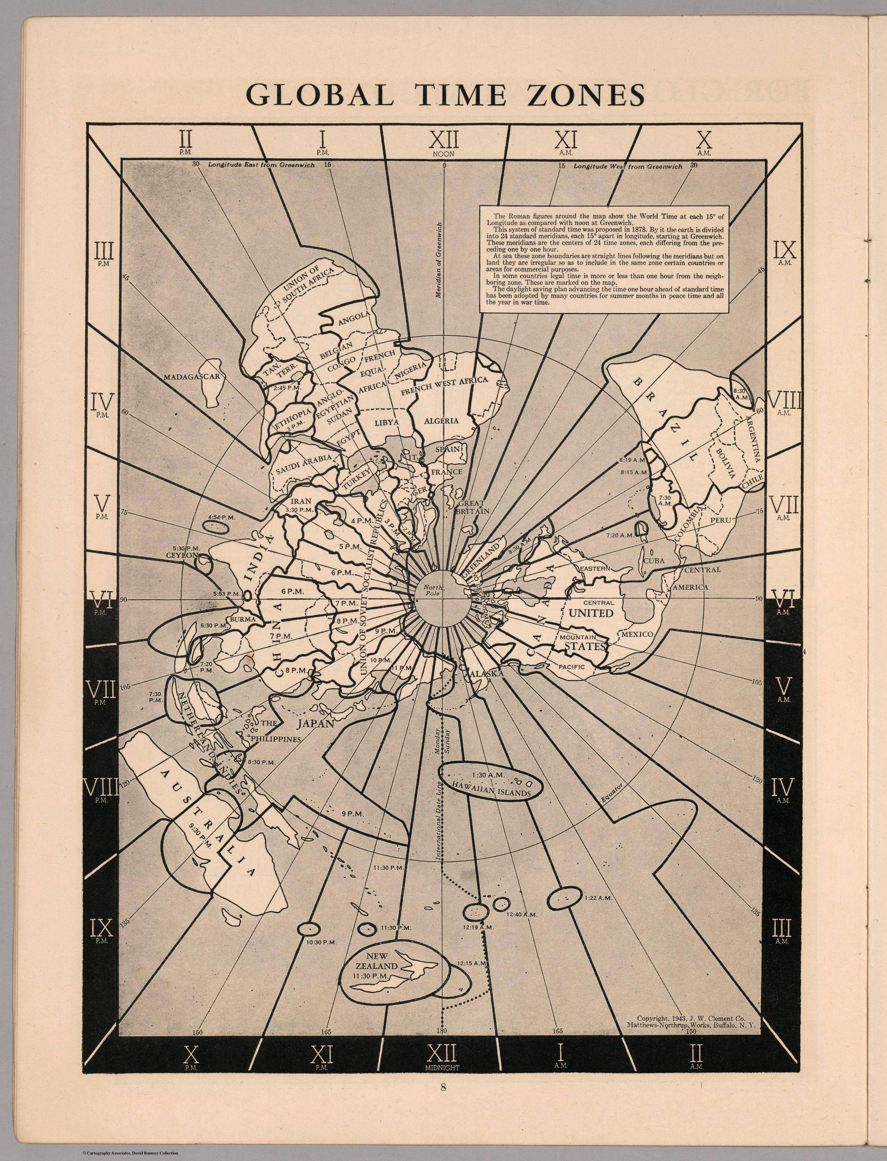
1943
For human geography, population sizes can have as much impact on the ‘tempo of places’ as culture or even climate.
In physical geography, the concept of time is indispensable for an understanding of how the natural environment has changed and keeps changing.
In the 21st century, time has been described as being a commodity itself, affecting everything from manufacturing and trade, to financial flows and global transport links.
The general geographic distribution of time zones is based on the general concept of dividing the world into zones of equal time following a 24-hour day around the world.
In theory, this means that there are 12 time zones of 15° width in which each differs by one hour’s time difference.
The 12 TZ for France
The necessity of time zones was closely linked to growing needs of transport and communication links during industrialisation.
British railway companies began adopting Greenwich Mean Time (GMT) which helped to coordinate timetables.
In 1880, GMT became standard across Britain and time differences of tens of minutes between cities in the country started vanishing.
At a global level, time zones became established in the first decades of the 20th century.
But as much as time zones are legal, commercial and social constructs, they are also highly political issues which find their expression in the spatial patterns of today’s time zones.
The adoption of the Greenwich meridian itself can be seen as a highly political act that helped in manifesting a Euro-centric world view.
Furthermore, many of the time zone boundaries do not follow the geographical pattern of each zone.
Most boundaries follow political boundary lines such as country or state borders.
While in some cases this can be practical minor deviations, more often the political decisions for time zones have a considerable impact on people’s everyday lives.
The most extreme example for geographical distortion through time can be seen in the case of China which covers the extent of five time zones, but only uses one, orientated on the location of Beijing (at UTC +8 hours).
Situation in Antarctica
At the most extreme ends of the country, people use the same time even if sunrise is approximately four hours apart.
India made a similar decision to continue using only one time zone by adjusting Indian time half way between the two time zones that used to divide the country (now at UTC +5:30 hours), with only approximately two hours solar difference appearing between the outermost parts of the country.
Another political decision was North Korea’s creation of Pyongyang Time in 2015, creating a 30-minute distance to its southern neighbour.
Another political decision was Iceland’s move to abolish changing the clocks between summer and winter time in 1968.
Iceland’s decision meant a move towards adopting Greenwich Mean Time and becoming the westernmost country in that zone.
On GMT’s eastern edge, almost all of the western European countries that would geographically fall into this zone instead adopted Central European Time (GMT +1), which has become equally large, touching the geographic extent of almost four time zones.
Larger populations are not always affected by such deviations from the theoretical time zone: The most extreme deviation was created by Kiribati’s decision to realign the zone for the Line Islands with the same date as its territory, meaning that the sparsely populated islands follow the same time as Hawai’i but are one day ahead as the ‘easternmost land’ with the earliest time zone (GMT +14 hours).
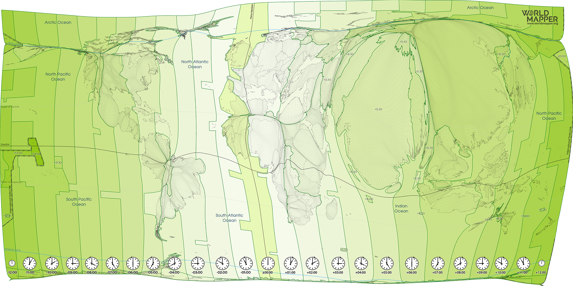
The above cartogram shows time zones from the perspective of an equal-population projection – a gridded population visualisation where each small area is proportional to the population living there.
The map highlights how these geopolitical considerations have an effect on the impact that time has on people and the functioning of the world.
Globalisation is far from having resulted in a compression of space and time.
On the contrary, time defines our contemporary world because it has put a new meaning to the spaces of humanity, or, as Tennessee Williams describes it in The Glass Menagerie: ‘Time is the longest distance between two places.’
In an interconnected world, time is equally the longest distance between two people.
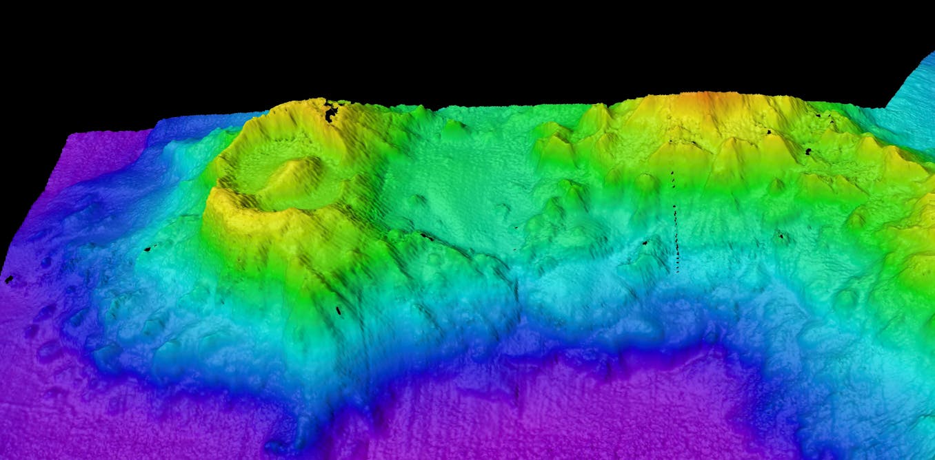
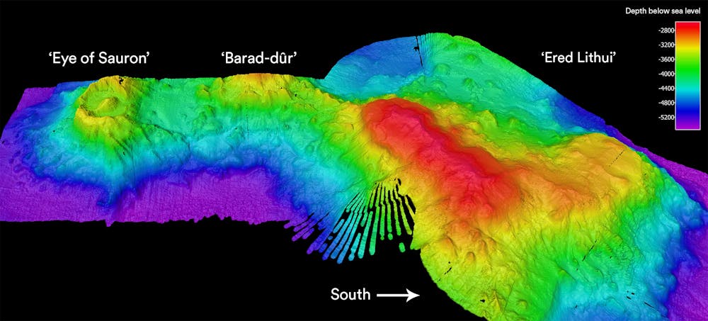
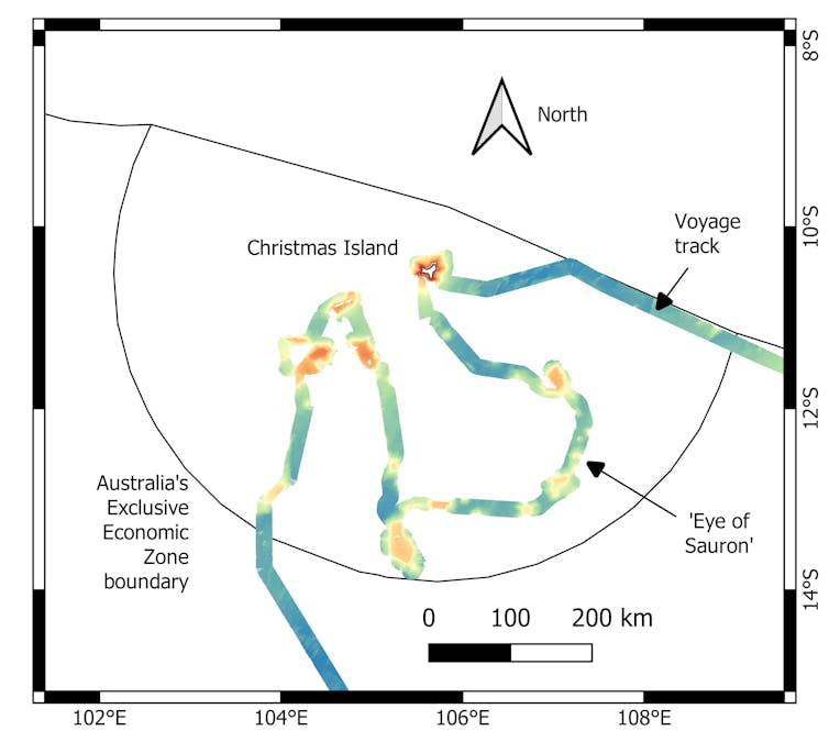
Looking like the Eye of Sauron from the Lord of the Rings Trilogy, an ancient undersea volcano was slowly revealed by multibeam sonar 3,100 metres below our vessel, 280 kilometres southeast of Christmas Island.
This was on day 12 of our voyage of exploration to Australia’s Indian Ocean Territories, aboard CSIRO’s dedicated ocean research vessel, the RV Investigator.
Previously unknown and unimagined, this volcano emerged from our screens as a giant oval-shaped depression called a caldera, 6.2km by 4.8km across.
It is surrounded by a 300m-high rim (resembling Sauron’s eyelids), and has a 300 m high cone-shaped peak at its the centre (the “pupil”).
Sonar image of the ‘Eye of Sauron’ volcano and nearby seamounts on the sea bed south-west of Christmas Island.
Phil Vandenbossche & Nelson Kuna/CSIRO, Author provided
A caldera is formed when a volcano collapses
The molten magma at the base of the volcano shifts upwards, leaving empty chambers.
The thin solid crust on the surface of the dome then collapses, creating a large crater-like structure
Often, a small new peak then begins to form in the centre as the volcano continues spewing magma.
One well-known caldera is the one at Krakatoa in Indonesia, which exploded in 1883, killing tens of thousands of people and leaving only bits of the mountain rim visible above the waves.
By 1927, a small volcano, Anak Krakatoa (“child of Krakatoa”), had grown in its centre.
A great eye, wreathed in flame emerging from the seabed
In contrast, we may not even be aware of volcanic eruptions when they happen deep under the ocean.
One of the few tell-tale signs is the presence of rafts of light pumice stone floating on the sea surface after being blown out of a submarine volcano.
Eventually, this pumice stone becomes waterlogged and sinks to the ocean floor.
Our volcanic “eye” was not alone.
Further mapping to the south revealed a smaller sea mountain covered in numerous volcanic cones, and further still to the south was a larger, flat-topped seamount.
Following our Lord of the Rings theme, we have nicknamed them Barad-dûr (“Dark Fortress”) and Ered Lithui (“Ash Mountains”), respectively.
The voyage of the RV Investigator around Christmas Island.
Tim O'Hara/Museums Victoria
Localization with the GeoGarage platform (AHS nautical raster chart)
Although author J.R.R. Tolkein’s knowledge of mountain geology wasn’t perfect, our names are wonderfully appropriate given the jagged nature of the first and the pumice-covered surface of the second.
The Eye of Sauron, Barad-dûr, and Ered Lithui are part of the Karma cluster of seamounts that have been previously estimated by geologists to be more than 100 million years old, and which formed next to an ancient sea ridge from a time when Australia was situated much further south, near Antarctica. The flat summit of Ered Lithui was formed by wave erosion when the seamount protruded above the sea surface, before the heavy seamount slowly sank back down into the soft ocean seafloor.
The summit of Ered Lithui is now 2.6km below sea level.
A flyby of the seamounts, south of Christmas Island.
3D imagery courtesy of CSIRO/MNF, GSM
But here is the geological conundrum.
Our caldera looks surprisingly fresh for a structure that should be more than 100 million years old.
Ered Lithui has almost 100m of sand and mud layers draped over its summit, formed by sinking dead organisms over millions of years.
This sedimentation rate would have partially smothered the caldera. Instead it is possible that volcanoes have continued to sprout or new ones formed long after the original foundation.
Our restless Earth is never still.
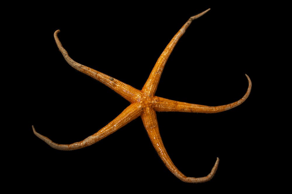
The large deep-sea predatory seastar Zoroaster.
Rob French/Museums Victoria, Author provided
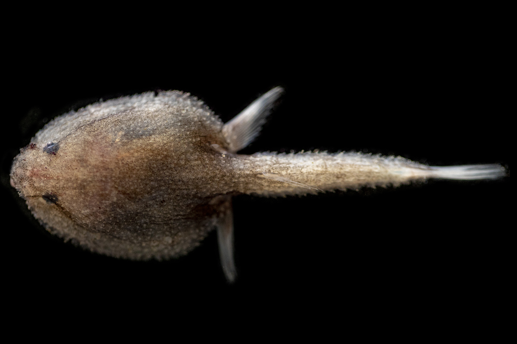
Small batfish patrol the seamount summits.
Rob French/Museums Victoria, Author provided
Elasipod sea cucumbers feed on organic detritus on deep sandy seafloors.
Rob French/Museums Victoria, Author provided
But life adapts to these geological changes, and Ered Lithui is now covered in seafloor animals.
Brittle-stars, sea-stars, crabs and worms burrow into or skate over the sandy surface.
Erect black corals, fan-corals, sea-whips, sponges and barnacles grow on exposed rocks.
Gelatinous cusk-eels prowl around rock gullies and boulders.
Batfish lie in wait for unsuspecting prey.
Our mission is to map the seafloor and survey sea life from these ancient and secluded seascapes.
The Australian government recently announced plans to create two massive marine parks across the regions.
Our expedition will supply scientific data that will help Parks Australia to manage these areas into the future.
Scientists from museums, universities, CSIRO and Bush Blitz around Australia are participating in the voyage. We are close to completing part one of our journey to the Christmas Island region.
Part two of our journey to the Cocos (Keeling) Island region will be scheduled in the next year or so.
No doubt many animals that we find here will be new to science and our first records of their existence will be from this region. We expect many more surprising discoveries.
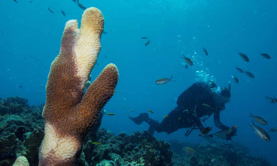
A researcher off the Virgin Islands swims past a pillar coral showing signs of stony coral tissue loss disease (SCTLD). Photographs: Lucas Jackson/Reuters
Researchers find ‘significant relationship’ between stony coral tissue loss disease and nearby shipping
A virulent and fast-moving coral disease that has swept through the Caribbean could be linked to waste or ballast water from ships, according to research.
The deadly infection, known as stony coral tissue loss disease (SCTLD), was first identified in Florida in 2014, and has since moved through the region, causing great concern among scientists.
It spreads faster than most coral diseases and has an unusually high mortality rate among the species most susceptible to it, making it potentially the most deadly disease ever to affect corals. More than 30 species of coral are susceptible. It was found in Jamaica in 2018, then in the Mexican Caribbean, Sint Maarten and the Bahamas, and has since been detected in 18 other countries.
In Mexico, more than 40% of reefs in one study had at least 10% of coral infected by SCTLD, and nearly a quarter had more than 30%. In Florida, regional declines in coral density approached 30% and live tissue loss was upward of 60%.
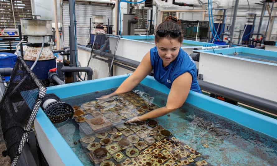
Biologist Emily Williams moves corals between tanks as researchers try to find out more about an outbreak of SCTLD in Florida in 2019
Scientists have not yet been able to determine whether the disease is caused by a virus, a bacterium, a chemical or some other infectious agent, but the peer-reviewed study in the journal Frontiers in Marine Science supports the theory that ballast water from ships may be involved. Conducted in the Bahamas by scientists at the Perry Institute for Marine Science, it found that SCTLD was more prevalent in reefs that were closer to the Bahamas’ main commercial ports, in Nassau and Grand Bahama, suggesting a likely link between the disease and ships.
Judith Lang, scientific director at the Atlantic and Gulf Rapid Reef Assessment project, which has been tracking the disease, said: “The prevailing currents in the Caribbean push seawater to Florida and not in the reverse direction, and the predominant wind direction is westward. So human dispersal [to those three territories] in 2018 seems necessary.”
In 2017, the spread of deadly pathogens by ships when they discharge ballast water prompted the International Maritime Organization to implement the Ballast Water Management Convention, which requires that ships discharge their ballast water – used to maintain the ship’s stability – 200 nautical miles from shore in water at least 200 metres deep before entering port, to ensure they do not bring in harmful foreign pathogens.
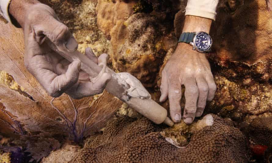
A research technician cuts a coral with a steel chisel to remove the section being killed by SCTLD, US Virgin Islands
In the Bahamas, SCTLD has spread rapidly since first being identified in December 2019.
Krista Sherman, senior scientist at the Perry Institute and a co-author of the recently published paper, said: “The disease is spread along about 75km of reef tract, about 46 miles – so for Grand Bahama that is a large structure of reef. We’re talking about mostly covering the entire southern coastline of the island.”
The disease is also widespread in the coral reefs of New Providence, where the Bahamas’ capital, Nassau, and main port are located. The study notes the presence of international container ships, cruise ships and pleasure boats at that location, as well as a fuel shipping station.
Infection rates among the most susceptible species were 23% and 45% across New Providence and Grand Bahama respectively, and recent mortality rates have reached almost 43%.
With the exception of two species, the researchers found “there was a significant relationship” between the disease and proximity of reefs to the major shipping ports. They noted “an increasing proportion of healthy colonies as distance from the port increased on both islands, and a greater proportion of recently dead colonies closer to the port than farther away”.
The locations where SCTLD is prevalent in the Bahamas are all popular with tourists, recreational fishers and divers, Sherman said.
A research assistant applies an antibiotic ointment to a mountainous star coral affected by SCTLD near Key West, Florida
There are concerns that the coral disease could affect the country’s main fishery export, spiny lobster, said Adrian LaRoda, president of the Bahamas Commercial Fishers Alliance. Although the lobster fishers work further out to sea, the industry would be affected if the reefs die. The spiny lobster fishery brings in $90m (£66m) a year and employs 9,000 people.
“Any negative impact on our reefs would definitely drastically affect our spiny lobsters because the mature animals migrate [from the reefs] to the fish aggregating devices [a technique for catching fish],” LaRoda said. He added that the lobsters’ reproduction rate and the food supply for juvenile lobsters in the reef would also be affected.
The Bahamian government has set up a national taskforce to tackle the problem. Currently, the most effective treatment for the disease is the application of the antibiotic amoxicillin directly to the corals, which has seen some success in reducing mortality, but no realistic permanent solution is available.
According to Lang, rather than treating the symptoms, there is a need to tackle the possible human-made causes. “Given a chance, nature can heal naturally,” she said.
Relic munitions and unexploded ordnance are a global problem, ubiquitously affecting European coastal waters.
The risk of possible detonations and environmental contamination hinders the development of many sectors of the blue economy — including offshore energy, shipping, aquaculture and tourism.
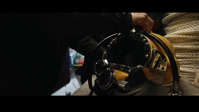
For the police divers who work for the Schleswig-Holstein Bomb disposal unit in Kiel, their daily job is to go down into the murky cold sea to find lost weapons of war, a deadly legacy of the 20th century.
The coastal waters of Germany and other European countries are scattered with old munitions.
They rarely explode, but some can detonate if hit by an anchor.
Measures to protect the seafloor
On the day we visit Schleswig-Holstein's special unit, the bomb hunters are heading to the military port of Kiel.
Navy specialists have found a submerged explosive device close to the pier there.
As a rule, the divers try to extract the weapons for proper on-land disposal.
Only when that is not possible, are the bombs detonated on the seafloor.
Frank Ketelsen, Head of the diving operations at the Schleswig-Holstein Bomb disposal unit, tells us that if they must detonate a bomb in the water, they set up "air bubble curtains to protect marine mammals".
The tip of the iceberg
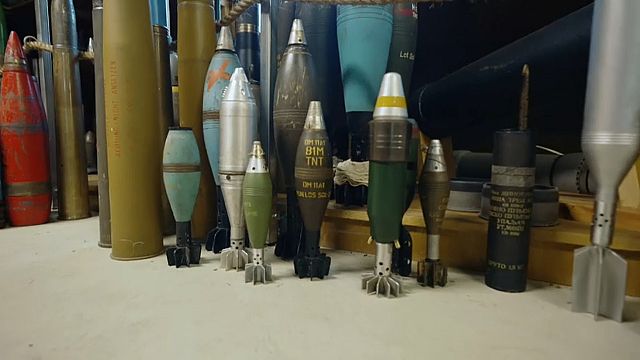
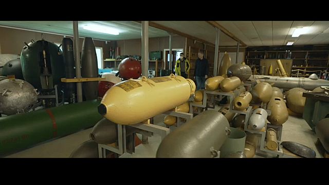
At the bomb unit headquarters, there are many samples of munitions from various periods and of different origins.
The collection is used to train new police officers.
Unexploded bombs found on land often make the news, but munitions on the seabed are rarely heard of, yet their quantity is unbelievable.
Oliver Kinast, Head of the Schleswig-Holstein bomb disposal unit, says that there's an estimated "1.6 million tonnes of munition from the World Wars in the North and Baltic Sea, 300 000 tonnes of which are in the Baltic Sea alone".
According to him though, those figures don't fully take into account munitions lost during battle operations.
The hunt for underwater munitions
Littorina, a scientific vessel from the GEOMAR institute, takes us along with a team of scientists to a large munitions dumpsite a few kilometres off the Baltic coast of Germany.
Two EU-funded projects, BASTA and ExPloTect, are testing new methods of finding bombs there: relic munitions are becoming a growing problem for marine industries and underwater ecosystems.
Aaron Beck is a researcher in aquatic biogeochemistry for the GEOMAR Helmholtz Centre for Ocean Research Kiel.
He has realised that the more they develop offshore resources, the more munitions they encounter and "the more they have to be cleaned up".
He thinks that "the biggest impetus for cleaning them up is wind farm installation, cable laying and so forth".
Polluting the sea
However, that is not the only problem these munitions pose.
They are becoming big pollutants.
"All of these munitions are in metal casings, and they all have been corroding for 70-80 years. We're coming up to a point where all the chemicals that have been inside will all start to come out", Aaron adds.
Much of the munitions on the seabed, both conventional and chemical, were deliberately disposed of in large numbers by the armed forces of many different countries.
Our knowledge of where exactly all these dumpsites are is patchy.
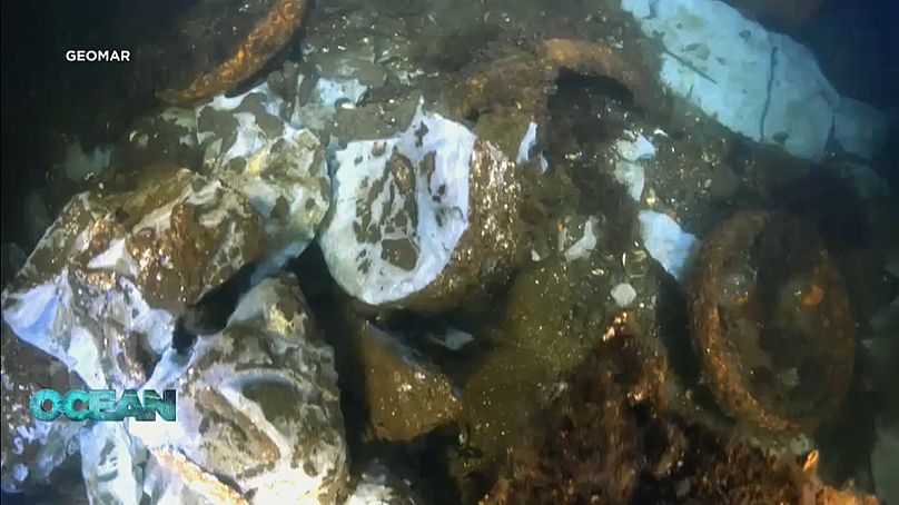
An AUV image of underwater munitions, chunks of TNT and other explosives
GEOMAR
Vehicles adapted for seafloor exploration
Autonomous underwater vehicles explore the seafloor quickly and efficiently.
They take pictures and measurements using a magnetometer.
Several of these devices can work simultaneously, which greatly reduces the costs.
The BASTA project vehicle, LUISE, explores the seafloor along a programmed trajectory, transmitting collected data to a ship.
The detailed photos and magnetic measurements, together with results of previously conducted acoustic scanning, reveal the exact shape of the suspicious objects and the presence of metal in their composition.
Marc Seidel, a Geophysicist for GEOMAR tells us that by combining the camera footage and the magnetic signatures that they measure, they get a good idea of what the object might be. Chemical analysis gives even more clarity.
'Silver bullet' technology
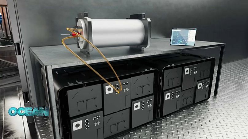
Scientists from the ExPloTect project are developing a sampling system with special filters for catching dissolved particles of explosive materials from the seawater.
Back on the ship, the samples are further concentrated and analysed with a compact mass spectrometer that indicates the presence of various explosives.
This method can drastically speed up detection of underwater munitions.
According to Aaron Beck, a researcher in aquatic biogeochemistry for the GEOMAR Helmholtz Centre for Ocean Research Kiel, with the new chemical analysis, they've gone from two to three months from collecting a sample to getting the data to the whole process potentially only taking 15 minutes.
"We need that kind of rapid response", he says.
The ExPloTect system visualisationK.U.M. Umwelt- und Meerestechnik Kiel
Developers call this new weapon in the fight against underwater munitions a "silver bullet".
It hits the target for many industrial sectors that now spend a lot of time and resources clearing unexploded ordnances (UXOs), off the seabed.
The technology is also helping out the environment.
Onno Bliss, Business Development Manager for K.U.M. Umwelt und Meerestechnik, says that they will adapt the technology to different kinds of structures.
It will enable them to do long-term "permanent environmental monitoring at known UXO fields".
Doing so is also another way to decide where to start clearing the munitions first.
But how can the huge amount of data collected by underwater vehicles be processed?
Artificial intelligence
Egeos, a company based in Kiel, is developing a software platform that brings together new scientific data and relevant historic records like old archives documenting coastal military operations.
The algorithms look for relevant data patterns, suggesting areas that are likely to be contaminated with munitions.
To the CEO and founder of Egeos, Jann Wendt, "automation is definitely helping".
The process is still quite manual, but they're improving every day.
"We are getting smarter from the side of data analytics. We are getting smarter from the perspective of autonomous underwater vehicles, autonomous sensors that are capturing this data and that makes the whole process cheaper", he explains.
Clearing the seabed is a task with huge economic potential.
Private companies are already developing large-scale projects for the recovery and proper disposal of underwater munitions.
According to Aaron Beck, there's a whole industry of people able to find and clean up munitions on the seabed.
All they really need is the funding to be able to do so.







 Biologist Emily Williams moves corals between tanks as researchers try to find out more about an outbreak of SCTLD in Florida in 2019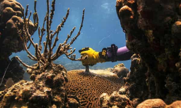
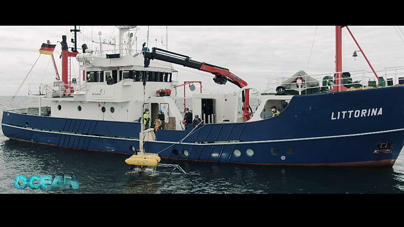 AUV LUISE being lowered into the seaeuronews