
source : https://www.un.org/Depts/los/
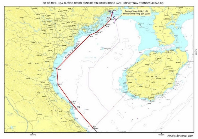
Chart_Vietnam_Baseline_Gulf_Bac_Bo
The UN confirms Vietnam has submitted its nautical chart and baseline coordinates for the Tonkin Gulf, reinforcing its maritime boundaries under the 1982 UNCLOS.
The United Nations Secretary-General has officially announced that Vietnam has completed the registration of its nautical chart and geographic coordinates related to the baseline used to determine the breadth of its territorial sea in the Tonkin Gulf.
The United Nations Secretary-General has officially announced that Vietnam has completed the registration of its nautical chart and geographic coordinates related to the baseline used to determine the breadth of its territorial sea in the Tonkin Gulf.
Vietnam's baseline registration at the UN
In a March 12 notification to UN member states, the Secretary-General confirmed that on March 7, the Government of Vietnam, in accordance with Article 16(2) of the 1982 United Nations Convention on the Law of the Sea (UNCLOS), submitted a nautical chart along with a list of geographic coordinates defining straight baselines for its mainland territory in the Tonkin Gulf and the outer limits of its territorial sea in this region.
On March 14, the United Nations website officially published detailed information on Vietnam’s baseline submission.
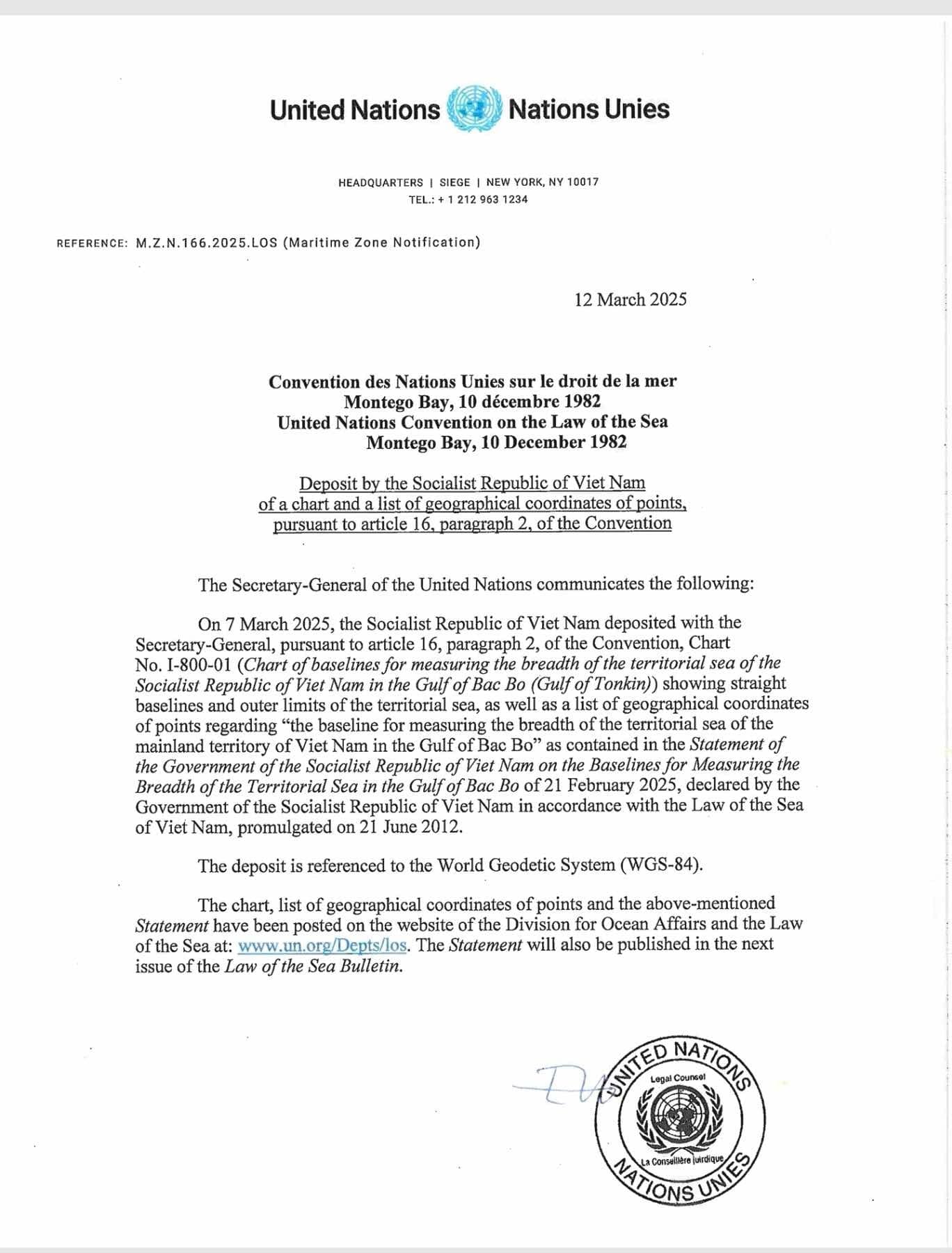
Additionally, the notification stated that Vietnam’s official declaration on February 21, 2025, regarding the baseline used to determine the breadth of its territorial sea in the Tonkin Gulf, will be included in an upcoming edition of the UN’s official publication, "Law of the Sea Bulletin".

Vietnam Coast Guard patrols the northern waters of the gulf of Tonkin
Links :
- HaiDuong : Declaration on baselines for calculating the breadth of Vietnam's territorial waters in the Gulf of Tonkin / Vietnam deposits at the United Nations nautical charts and baseline coordinates in the Gulf of Tonkin
- Vovworld : Vietnam deposits with UN baseline chart and coordinates in Gulf of Tonkin
Vietnam.vn : Another step forward in affirming Vietnam's sovereign sea areas
ReplyDeleteVietnamnet : Vietnam’s Gulf of Tonkin baseline declaration cements maritime jurisdiction
ReplyDelete