The Saildrone Surveyor, the world’s largest uncrewed ocean mapping vehicle, has mapped more than 45,000 square kilometers (17,375 square miles) of previously unexplored ocean floor during a months-long survey around Alaska’s Aleutian Islands and off the coast of California.
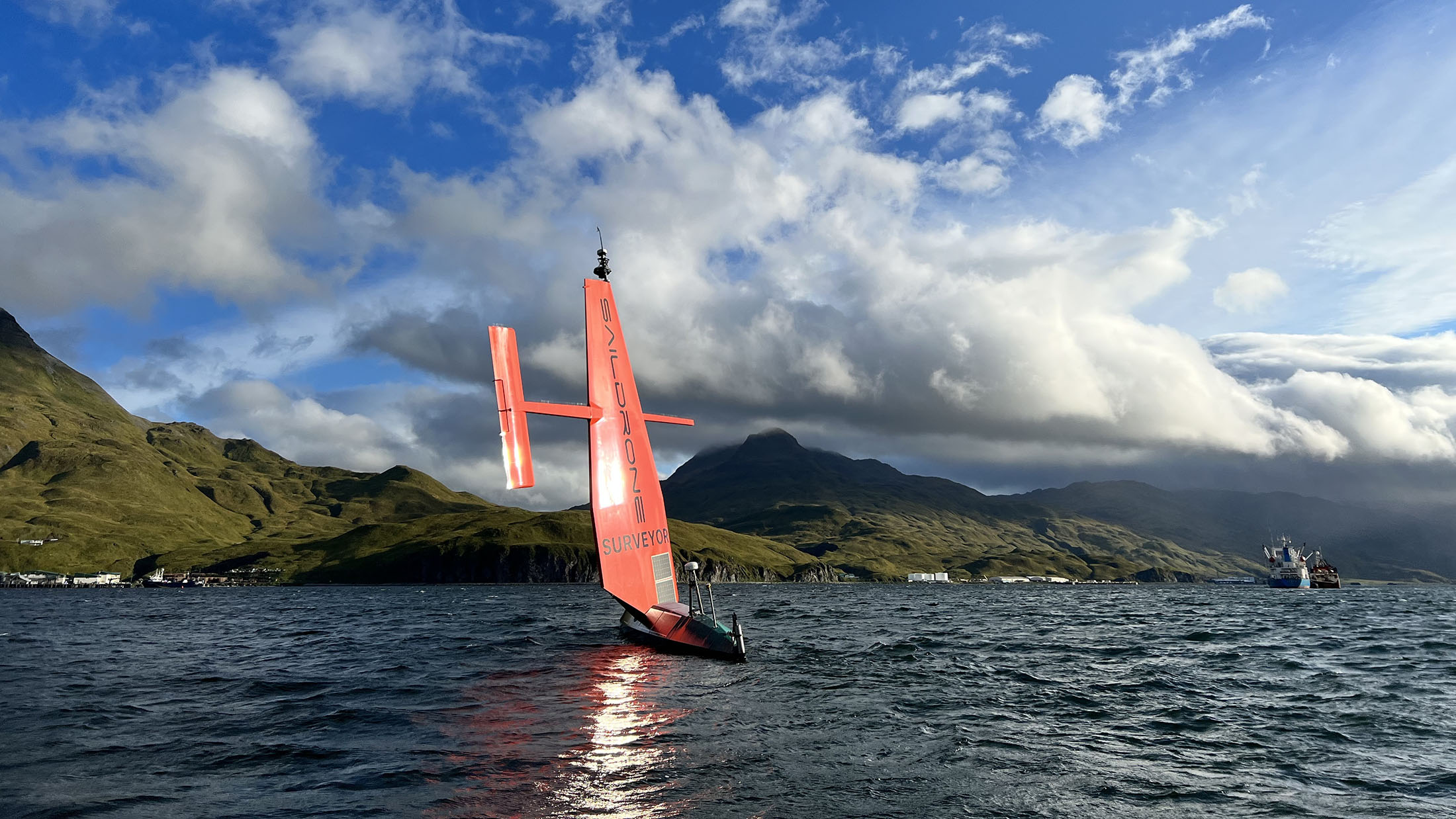
Saildrone Surveyor SD 1200 sails out of Dutch Harbor on Amaknak Island in Unalaska, AK.
Saildrone Surveyor SD 1200 sails out of Dutch Harbor on Amaknak Island in Unalaska, AK.
From Saildrone
The Saildrone Surveyor, the world’s largest uncrewed ocean mapping vehicle, has completed a months-long survey around Alaska’s Aleutian Islands and off the coast of California as part of a multi-agency public-private partnership funded by the National Oceanic and Atmospheric Administration (NOAA) and the Bureau of Ocean Energy Management (BOEM) to address ocean exploration gaps in remote areas with uncrewed surface vehicles (USVs).
The United States Exclusive Economic Zone (EEZ), stretching from the coast to 200 nautical miles from shore, is one of the largest in the world, but it is largely still unmapped, unobserved, and unexplored.
Alaska’s coastline is approximately one-third of the entire US coastline, far longer than that of any other US state or territory.
And yet, Alaska is by far the least mapped region of the US EEZ.
In 2022, the White House released the Strategic Priorities Report for Ocean Exploration and Characterization report, which specifically calls out the Aleutian chain as one of the highest priority regions in the US EEZ for collecting additional data and information in multidisciplinary interests across the Federal space.
Exploration and seafloor mapping of this region has the potential to unlock new opportunities for conservation, climate science, and the Blue Economy.
“Every American, in one way or another, depends on the ocean—from protein from fish to feed animals or humans, to deep-sea cables that make the internet possible.
The only way the US can maximize our ocean resources is to understand what’s there.
This mission is the first step to mapping the seafloor of key regions in Aleutian waters in high resolution.
The beauty of the Surveyor is getting that initial exploration step done faster, cheaper, and without as much staff,” said Dr. Aurora Elmore, Cooperative Institute Manager at NOAA Ocean Exploration.
Saildrone Surveyor SD 1200 sails in rough, windy conditions across the North Pacific on its way back to California in October 2023, as captured by the vehicle’s onboard cameras.
To the unknown and back
Saildrone Surveyor SD 1200 departed Saildrone HQ in Alameda, CA, to sail across the North Pacific to the survey area around the Aleutian Islands in July 2022.
For 52 days between August and October, the Surveyor mapped 16,254 square kilometers (6,276 square mile) of unknown seafloor around the Aleutian Islands.
Mission collaborators were able to follow the data collection in real time.
Preliminary data revealed unprecedented detail of the Aleutian arc seafloor, including previously unknown structures, some of which indicate potential hydrothermal vents.
 Amukta Canyon in the Bering Sea, as mapped by the Saildrone Surveyor during the Aleutians Uncrewed Ocean Exploration expedition.
Severe weather is the norm in the Aleutian region, with violent storms and persistent fog.
During the mission, the Surveyor was diverted south to a secondary priority area to avoid the remnants of Typhoon Merbok that pounded Alaska with gale-force winds.
“Part of the premise of the mission was to test the Surveyor to its limits,” said Rachel Medley, chief of the Expeditions and Exploration Division at NOAA Ocean Exploration and NOAA co-chair for the Interagency Working Group on Ocean Exploration and Characterization (IWG-OEC).
Despite 35-knot winds and wave swells over 5 meters (16 feet)—conditions that would have proved too challenging for most crewed survey vessels—the Surveyor continued to collect high-quality data without risk to human life and with a reduced carbon footprint.
In addition to high-resolution mapping sonars, the Surveyor carried technology from the Monterey Bay Aquarium Research Institute (MBARI) to sample environmental DNA (eDNA).
Outfitted with the Environmental Sample Processor (ESP)—a groundbreaking “lab in a can”—the Surveyor was able to collect important clues about marine biodiversity and ocean health from the genetic “fingerprints” left behind by marine life that can inform our knowledge about marine biodiversity and ocean health.

Top and side views of the 1,000 m seamount mapped by Surveyor SD 1200 using its Kongberg 304 echo sounder during the second part of the Aleutians Uncrewed Ocean Exploration expedition.
New discoveries—right off the coast of California
After transiting 2,000 nautical miles back to San Francisco and a brief pit stop at Saildrone HQ, the Surveyor was tasked to map additional priority areas a few hundred miles off the coast of California.
The Surveyor mapped an additional 29,720 square kilometers (8,665 square nautical miles) of the US EEZ and discovered a previously unknown seamount standing approximately 1,000 meters (3,200 feet) high from the seabed.
Discoveries like this improve our understanding of the physical processes of the ocean and help scientists identify unique habitats that need further exploration.
The future of ocean mapping
Accurate and up-to-date topography of the ocean floor is essential for understanding how ocean currents move heat and carbon around the planet, sustainably managing resources, tsunami and storm surge forecasting, safety of navigation, telecommunications, developing and maintaining coastal infrastructure, and establishing new offshore energy sites.
Oceans cover more than 70% of Earth’s surface, but as of June 2022, less than 24% of the global ocean has been mapped using modern technology, leaving most of the planet unmapped and unexplored.
This is because the traditional method of exploring and mapping the ocean with large survey ships is difficult, time-consuming, and expensive.
The global Seabed 2030 initiative and the National Strategy for Mapping, Exploration, and Characterization (NOMEC) of the US EEZ have set ambitious seafloor mapping goals, which cannot be achieved with the current global survey fleet alone.
Rigorous sea trials showed that the data quality the Surveyor collects rivals that of the most advanced ocean survey ships in use today—meeting or exceeding International Hydrographic Organization standards.
The Saildrone Surveyor represents a paradigm shift in how we explore our oceans, carrying the same cutting-edge sonar equipment as survey ships to deliver high-resolution data to the global community—at a fraction of the cost and carbon footprint.
“Surveyor brings a new and exciting capability for ocean exploration and mapping.
Mapping in the Aleutians is not trivial, and the conditions there can be austere any time of year.
The Surveyor weathered the storms, collected high-resolution bathymetry, and put no humans at risk.
This mission proves that long-endurance USVs provide a viable option to achieve the goals of NOMEC.
This is the future of ocean mapping,” said Brian Connon, Saildrone VP of Ocean Mapping.
The Aleutians Uncrewed Ocean Exploration expedition served as an excellent example of how public-private partnerships and uncrewed surface vessels (USVs) like the Surveyor can increase the pace and efficiency of seafloor mapping and help us reach national and international goals.
Whether used on their own or paired with traditional ship-based operations, USVs can act as force multipliers, expanding capabilities in a way that is cheaper, more environmentally friendly, and safer.

The total area mapped by Saildrone off around the Aleutian Islands and off the coast of California.
What happens to the data?
NOAA Ocean Exploration is already using some of the preliminary data collected by the Surveyor to inform its exploration of Alaskan waters with NOAA Ship Okeanos Explorer during its 2023 field season.
These expeditions, the first for the ship in the region, will fill gaps in the understanding of Alaskan deep waters through mapping and remotely operated vehicle operations.
The ROV operations will establish baselines to help sustainably manage and protect Alaska’s deep waters and the resources they provide and contribute to safer navigation and community access, hazard mitigation, and a deeper comprehension of and appreciation for the region’s marine environment.
“NOAA Ocean Exploration is excited to see the results of this remarkable multi-partner expedition come to fruition,” said Jeremy Weirich, director of NOAA Ocean Exploration.
“By joining forces with other federal agencies, academia, and industry, we were able to leverage a variety of expertise and multiple technologies to investigate areas off of Alaska and California that were otherwise unexplored.
In order to map and characterize vast and remote expanses of the ocean, we need new technologies like the Saildrone Surveyor to augment ship-based exploration.”
 Saildrone Surveyor SD 1200 is escorted out of Dutch Harbor in August 2022.
Once post-processing has been completed by the Center for Coastal and Ocean Mapping at the University of New Hampshire, the high-resolution data collected during the Aleutians Uncrewed Ocean Exploration expedition will be made publicly available through NOAA’s National Centers for Environmental Information to further exploration and characterization efforts and in support of US and international mapping initiatives, including the Seascape Alaska regional mapping campaign.
“This mission is an exciting partnership opportunity with industry, academia, and government to accelerate and advance new US-based technologies that will not only benefit the scientific community but also have the potential to answer some of our largest global challenges by providing a better understanding of ocean dynamics and climate science,” said Medley.
Scaling up the fleet
SD 1200 is the first of Saildrone’s Surveyor class vehicles.
An additional four Surveyor-class ocean mapping vehicles will be built by Austal USA in Mobile, AL, this year to meet increasing global demand for uncrewed survey vehicles.
Links :
- Ocean Robotics Planet : Saildrone Completes World-first Uncrewed Alaska Ocean Mapping Mission
- Kira Coley, “The Mighty Quest to Unveil our Blue Planet,” Maritime Technology Reporter, February 1, 2023
- Brian Connon, “Who Is Going to Map the High Seas?” Hydro International, August 17, 2021
- Bureau of Ocean Energy Management, “BOEM-Sponsored Saildrone Surveyor Expedition Returning Home After Exploring Aleutian Islands,” boem.gov, November 17, 2022
- NOAA Ocean Exploration, “Unexplored Waters of Alaska and California Mapped During Uncrewed Expedition,” oceanexplorer.noaa.gov, March 15, 2023
- NOAA Ocean Exploration, “Interagency Public-Private Partnership Sends Uncrewed Saildrone to Explore Remote Alaskan Waters,” oceanexplorer.noaa.gov, August 18, 2022
- Catalyst : Saildrone reaches unmanned maritime milestones
SF Chronicle : An underwater mountain was newly discovered off California coast
ReplyDeleteSailDrone : New Mid-size Voyager USV Expands Data Collection at Sea
ReplyDelete