Thursday, March 31, 2022

Open source intelligence observers gain growing role in how war is viewed


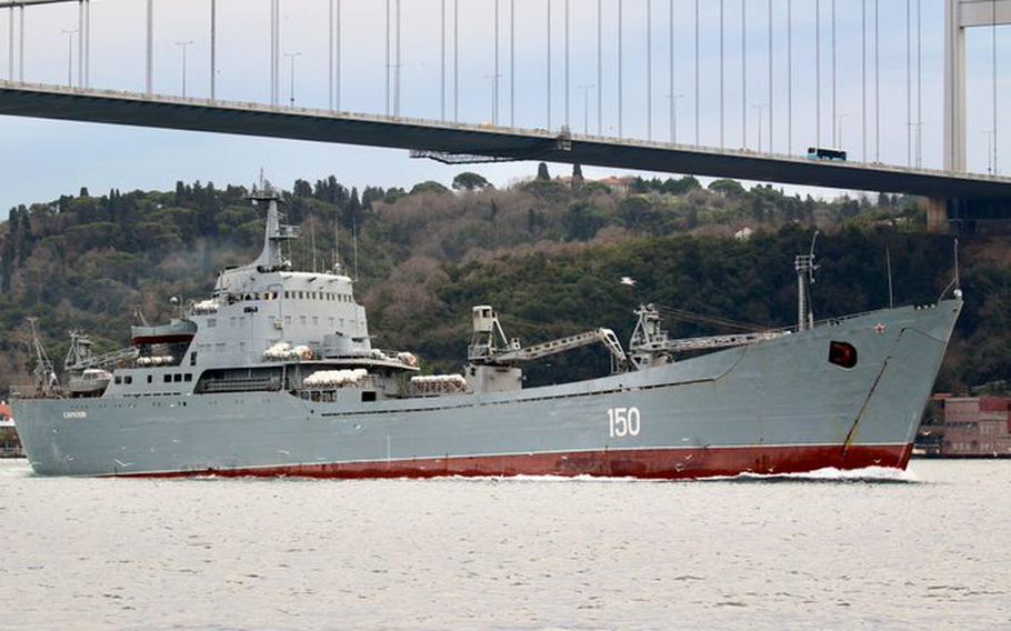
The Russian Alligator-class landing ship Saratov in the Bosporus in 2020.
The use of open source intelligence, which includes publicly available images and data, is resulting in real-time reporting on the war in Ukraine on an increasingly greater scale.
(Yoruk Isik)
 
From Stripes by Alison Bath

The Russian Alligator-class landing ship Saratov in the Bosporus in 2020.
The use of open source intelligence, which includes publicly available images and data, is resulting in real-time reporting on the war in Ukraine on an increasingly greater scale. (Yoruk Isik)

Citizen intelligence analysts are spotlighting the Russian navy’s role in its war on Ukraine, using publicly available information to report on missile launches, blockades and other actions in the Black and Mediterranean seas.

The information gathered using open-source intelligence, or OSINT, offers a glimpse into Russia’s maritime war activities and sometimes challenges information released by government sources.

Dozens of private citizens are parlaying their prior military experience, specialized knowledge of the Russian navy and online information-mining skills into robust, almost-real-time coverage of Russia’s full-scale invasion, which began Feb. 24.
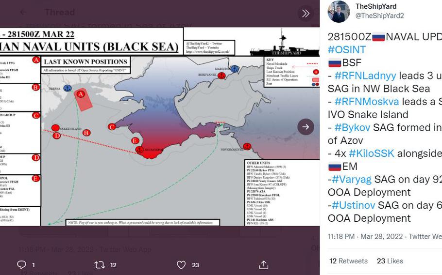

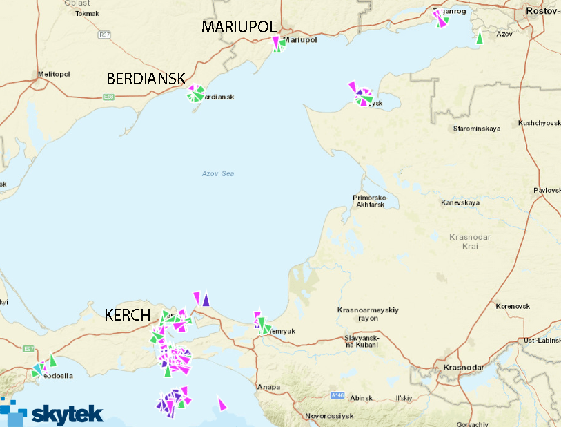
A map showing Russian naval units in the Black Sea on March 22, 2022.
The use of open source intelligence on Twitter and other social media platforms is resulting in real-time reporting on the war in Ukraine that sometimes challenges official narratives.

OSINT relies on public information such as satellite images, video and photographs, documents, databases, news stories and social media posts about a particular event or topic.

It’s painstaking work — usually unpaid — involving hourslong searches for information, verification of its authenticity and accuracy and then contextualization of events before analysis is posted on social media or a blog.

The work finds its roots in early government efforts by the U.S. and other countries to monitor news and other reports as part of intelligence gathering.

Not everyone has the skill set to parse the meaning of all this information, but those who do now have relatively easy access to satellite images and quality imagery recorded by increasingly sophisticated phones, experts say.
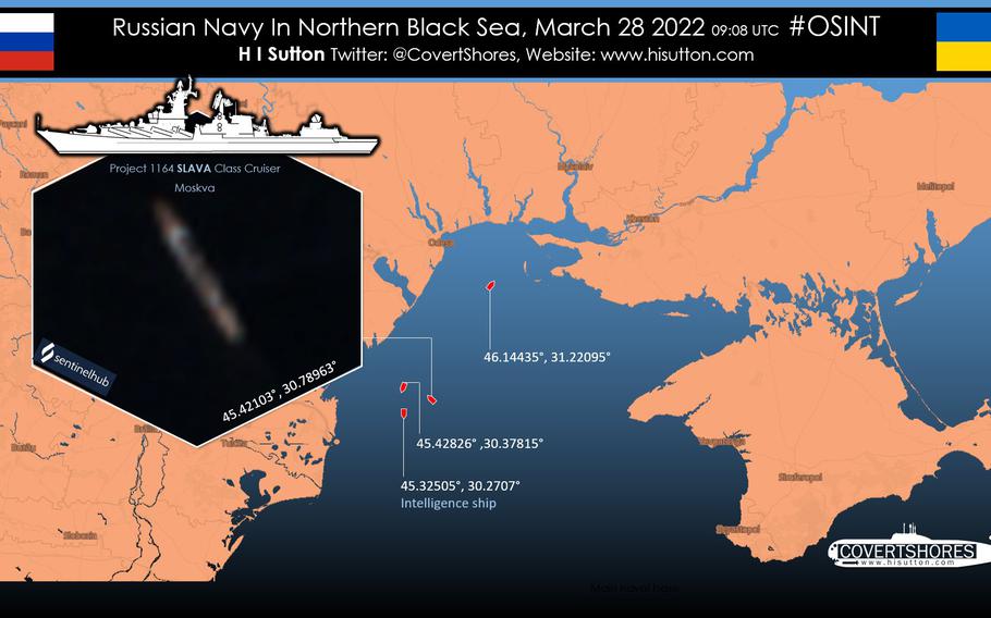

Open source intelligence provided by citizen analysts on Twitter and other social media forums is revealing Russia's full-scale war in Ukraine in minute detail.

“What I bring here is (professional) knowledge that I try to bring to open source using primary and secondary sources to actually give you an idea of what’s going on,” said James Phillips, a naval historian whose Twitter account, @TheShipYard2, presents detailed maps showing the location of Russian ships and other information.

On Monday, Phillips posted on Twitter a map showing an amphibious assault group in the Sea of Azov near the Ukrainian port city of Berdyansk.

In the early days of the invasion, images and public data gathered by private OSINT analysts painted a different picture of what an unnamed senior Pentagon official said was happening near the port city of Mariupol on the Sea of Azov.

The unidentified official indicated that a nighttime amphibious assault potentially involving thousands of Russian troops was underway there.
The assertion was tweeted out by several U.S. national security reporters and almost immediately challenged online.
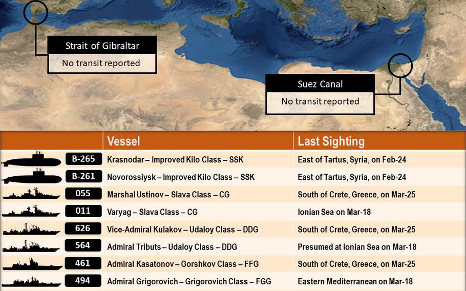

A list of Russia's naval deployment in the Mediterranean Sea compiled using open source intelligence by Frederik Van Lokeren, a former Belgian navy officer.
Van Lokeren is among several private citizens using their experience to provide detailed information online about the Russia-Ukraine war.

“I keep stressing: the Russian Navy never trained for night time amphibious assaults,” said Frederik Van Lokeren, a Belgian former navy officer, in a Feb. 26 tweet
“They can not do this as they lack expertise and equipment needed. Why U.S. officials keep claiming otherwise for the second night in a row is beyond understanding.”

Van Lokeren's OSINT analysis found that a Russian amphibious assault group was in the Sea of Azov but he strongly disputed the number of sailors involved, which he estimated at 300 to 400 based on the number and size of the landing ships involved and their capacity.
He also expressed doubt that any naval landing had happened, citing a lack of evidence.

There were ample images in the days that followed of war damage and fighting in Ukraine, but none of a large-scale amphibious assault.
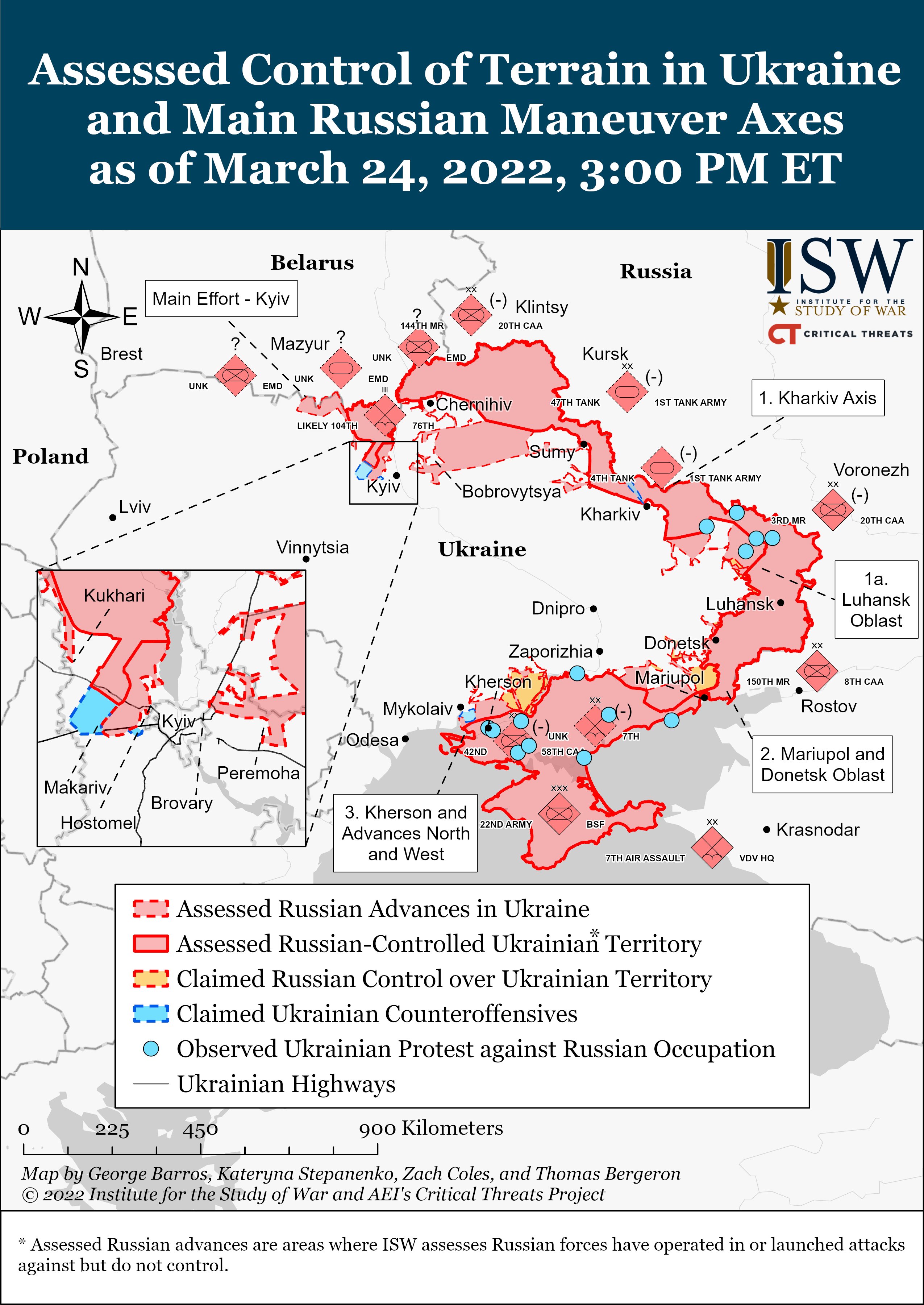
 

Read the latest from @TheStudyofWar and @criticalthreats

In other cases, OSINT analysts were among the first to break news later addressed through official channels.

On Thursday, several analysts were quick to provide details on how a Russian Alligator-class landing ship in port in Berdyansk had caught fire, potentially as the result of a strike by a Ukrainian missile.

And on March 22, several analysts, including H. I. Sutton, who tweets as @CovertShores, posted video on Twitter showing a Russian ship near Sevastopol on the Crimean Peninsula firing eight Kalibr cruise missiles into Ukraine.

Others have kept running tallies on the last known locations of Russian navy ships, submarines and other vessels, detailing their actions in the Black and Azov seas and providing supporting information about capabilities and potential strategies.
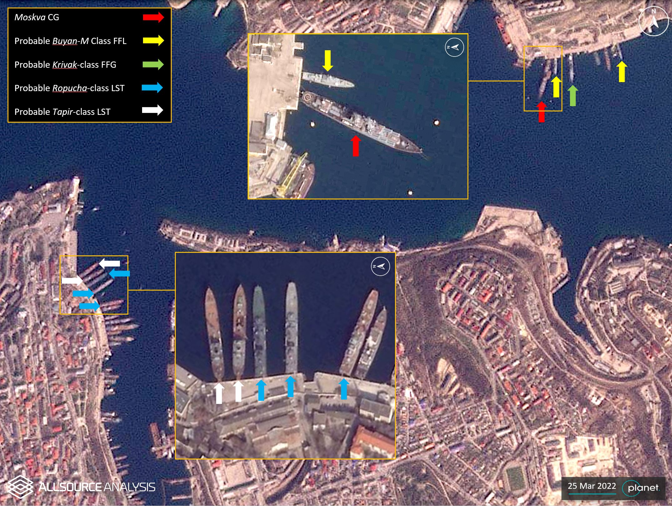
 
GEOINT analysis on 25 March 2022 shows several Russian naval vessels moored at the port of Sevastopol.

Russian navy vessels thought to be observing U.S. and NATO maritime activities in the eastern Mediterranean and protecting a Russian port in Tartus, Syria, also are analyzed.

“I haven’t seen a conflict this well-covered (through the OSINT community) in my career,” said Lukas Andriukaitis, associate director of the Digital Forensic Research Lab at the Atlantic Council think tank, in a phone interview. 
“You can watch the conflict almost evolve live.”
 
There are signs that Moscow increasingly is aware of the OSINT community’s ability to quickly challenge narratives and document war crimes and other activities.
For example, before the war started, Russia took away troops’ cellphones, Andriukaitis said.

The Russian navy also recently started painting over ship numbers and obscuring other identifying information, Phillips and other analysts have noted.

The greatest contribution OSINT analysts have made came in the months leading up to the war, said Ryan Fedasiuk, an adjunct fellow for the Center for a New American Security’s technology and national security program.
 
Interactive map of reports (with timestamps) about civilian casualties in Ukraine.

A private company publicized satellite images that correctly identified a buildup of nearly 200,000 Russian troops and advanced weaponry along the northern, eastern and southern borders of Ukraine.

Citizen journalists on Twitter also sounded the alarm bell in January that six Russian navy amphibious assault ships left the Baltic and North seas, passing through Gibraltar and into the eastern Mediterranean before entering the Black Sea.

The value of open-source intelligence is in sifting through the noise to identify signals that something is going to happen, he said.
“In the future, governments ought to take that sort of signal much more seriously, even if it isn’t a smoking gun, secretive indication of intent,” Fedasiuk said.

Links :

Wednesday, March 30, 2022

'Apathy is one of our biggest problems': Ocean photographer Shawn Heinrichs wants to save the seas

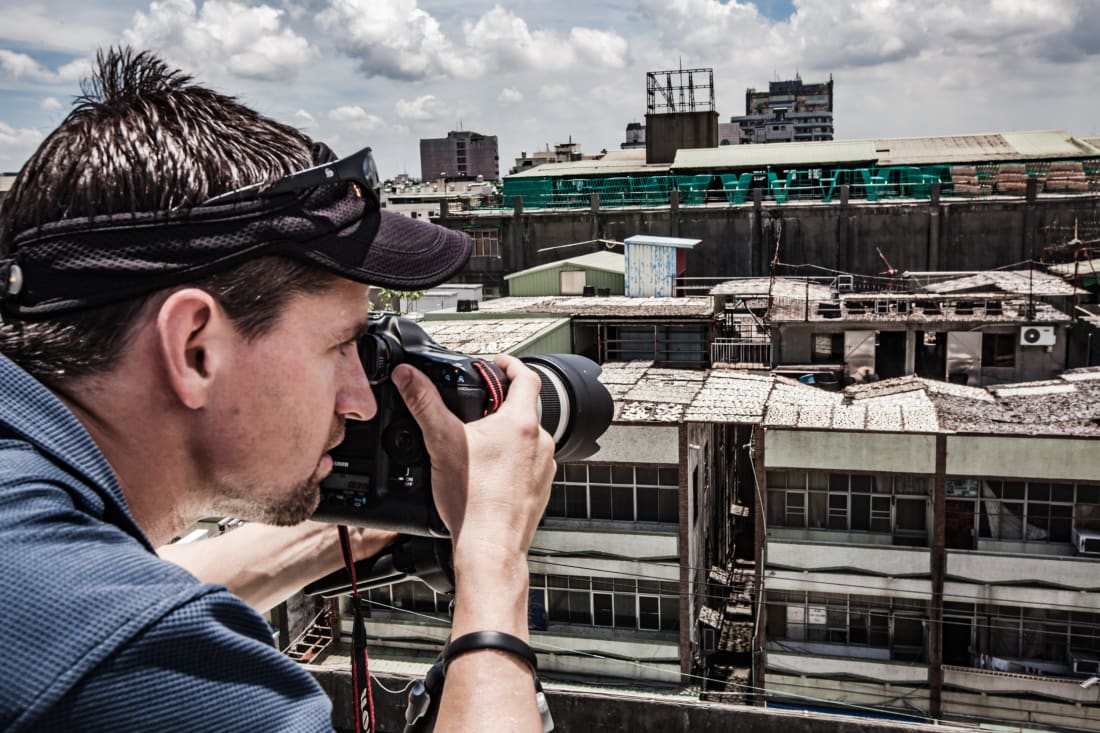
Photographer Shawn Heinrichs believes that storytelling is man's most powerful tool. His imagery seeks to inspire protection of nature, and that is what drives him to document life in the ocean. 
"Art is my passion, but conservation is my deep purpose," he said.
"And the two for me are inseparable."
 
From CNN by Stefanie BlendisTommy O'Callaghan 

The images of sea life captured by photographer and cinematographer Shawn Heinrichs have a dual message: we should revere these majestic, yet fragile creatures, but we should also fear the prospect of their extinction.
 
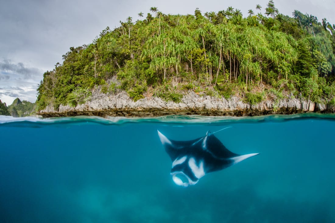
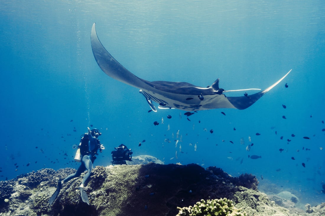
In 2013 Heinrichs helped to expose the illegal trade of manta rays in Asia.
He documented hunts and went undercover in markets.
His footage was presented at the Convention on International Trade in Endangered Species at the UN.
The team helped secure international protection for manta rays
 
Heinrichs, 50, grew up by the South African coast: "As a kid I spent every weekend around the oceans -- it has more abundance than you could ever imagine," he recalled.
His protective instinct for life beneath the waves inspired a career investigating its mistreatment by humans and campaigning for change.
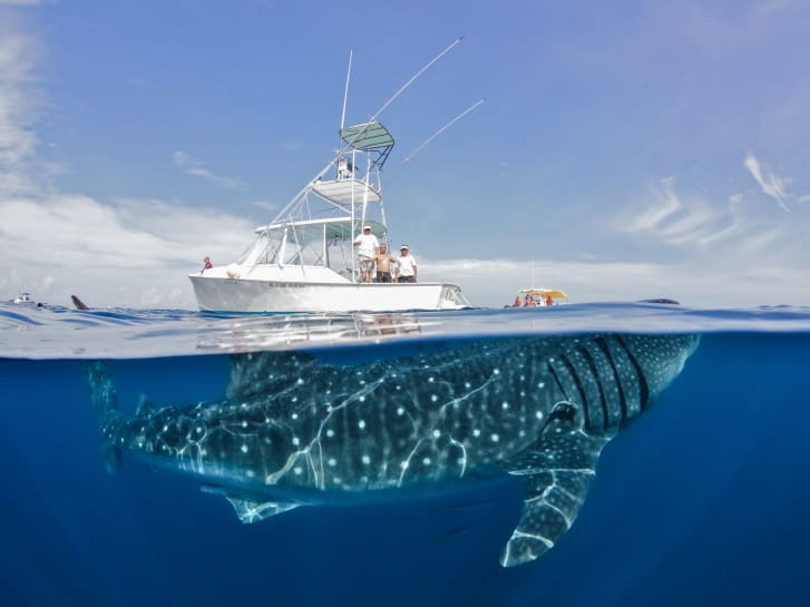
By locating elusive whale sharks in Mexico's Isla Mujeres, he heavily influenced local fishermen's career transition to ecotourism.
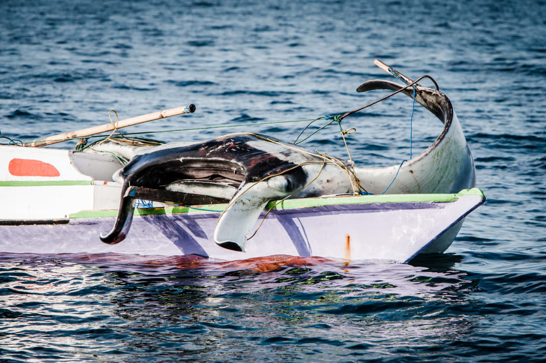
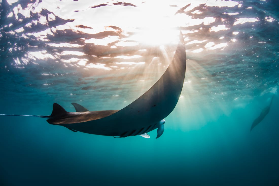
Heinrichs then documented the widespread hunting of manta rays for their gills, which are used in traditional Chinese medicine, and helped pave the way for mantas' official protection by the UN Convention on International Trade in Endangered Species.

Heinrichs grew up by the ocean in South Africa.
He says that a connection with the ocean makes him feel alive.
"That energy and excitement when I look down in the water or even see the wings of a giant manta ray pod beneath me -- that is always calling to my heart."
 
Some of his pictures showcase magnificence, while others are intentionally hard to look at.
But Heinrichs' imagery exists to inspire action.
Today he devotes much of his focus to SeaLegacy, an organization which seeks to channel a sense of public injustice at endless fishing and to direct it towards environmental activism.
 

Despite gaining international protection, thousands of manta rays are killed every year.
"I witnessed [slaughtered] manta lined up across an entire street," recalled Heinrichs.
"Documenting the hunting of these magnificent mammals was one of the most dangerous and trying things I've ever done."
 
CNN spoke to Heinrichs about his art and ocean conservation, and how the two have become inseparable.

This interview has been edited for length and clarity.
 
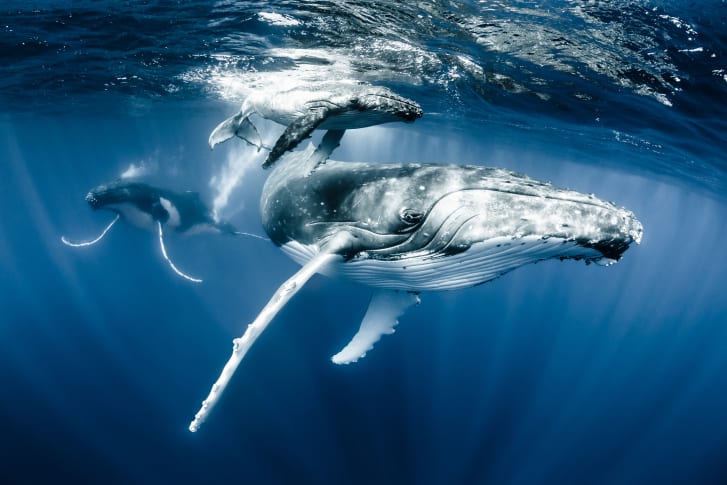
This image of a humpback whale and its calf off Tonga is Heinrich's favorite from his own work. 
"You can see into both of their eyes, and right behind them is a male escort in pursuit, hoping that he may get a chance at some point to mate with this female," he said. 
"You witness both the intimate connection between the mother and the calf, but also the system of life, how it all comes together for the next life cycle. 
And that to me is probably one of the most special images I've ever captured."

CNN: Why are photographers important in ocean conservation?

Heinrichs: Fundamental to us wanting to protect and preserve something, is our ability to connect with it. Given so few people ever get to directly go into the ocean and connect with the marine life in these habitats, it is so important that we bring the stories to them.
It's through the imagery, the video, and all the storytelling that we help people feel a connection, and through that, they develop a sense of empathy and a desire to act. It is a huge opportunity and an obligation on our part as storytellers to bring these stories to the people.
 
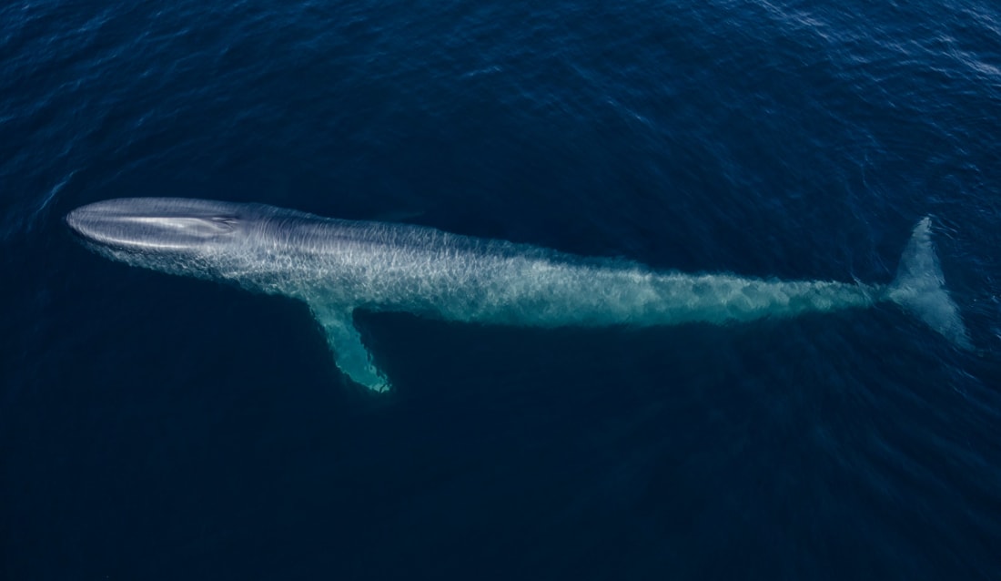
Heinrichs took this drone image of a blue whale in Baja California Sur in Mexico.
It's one of the planet's richest ecosystems and contains one of the greatest abundances of whale species in the Northern Hemisphere.
Jacques Cousteau once called this region "the aquarium of the sea."

CNN: What are the main threats to marine systems from your perspective?

Heinrichs: We look at the oceans as this inexhaustible resource -- a place where we can keep taking and taking.
We send out our factory ships and we scoop up tons and tons of species and bring it back to port labelled as seafood.
We have taken more than 90% of the large fish out of the oceans in just a few short decades through industrial fishing.
Nobody really understands that these are living sentient beings that maintain a habitat that is literally the life support system of our planet.
Half of the oxygen we as humans breathe comes from the phytoplankton that lives in our oceans.
And as we destroy our oceans, we're literally collapsing one of the lungs of this planet.
 

 Though almost two billion people live by the sea, few of them experience the same connection to marine life as Heinrichs.
He estimates that only 1% of people put on a scuba mask to go beneath the sea surface in their lifetimes.
"Fundamental to people wanting to protect and preserve the ocean is their ability to connect with it," he said
 
The most immediate threat to our oceans is our extraction, but in the long term perhaps one of the greatest threats will be climate change and global warming.
 As the seas warm, they become less productive, the currents slow down and the migrations of these fish should start to shift and their ability to reproduce changes.
As we bring more and more carbon into the seas, the ability for reefs to even form disappears.
So the literal support system on the ocean floor is starting to disappear from beneath us.

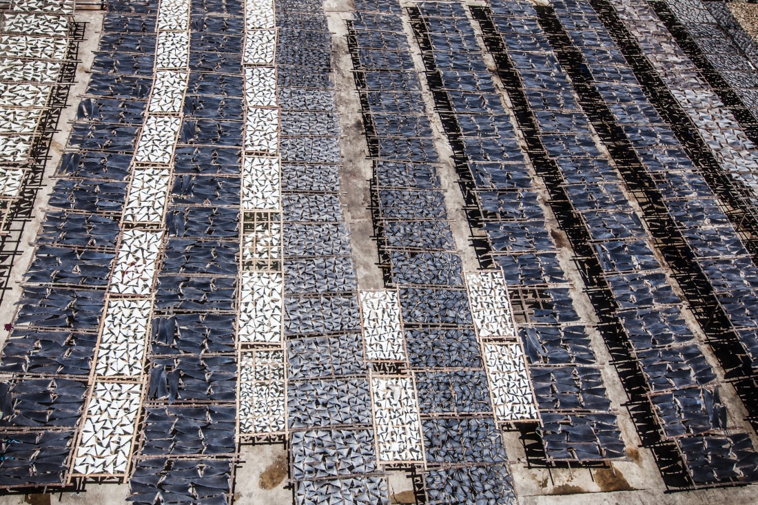
By using powerful imagery, such as this photograph of a shark fin market in Asia, Heinrichs motivates people to protect marine ecosystems.
 
 CNN: What have you seen first-hand?
 
Heinrichs: I spent the better part of an entire decade working on stories around the planet looking at destructive fisheries.
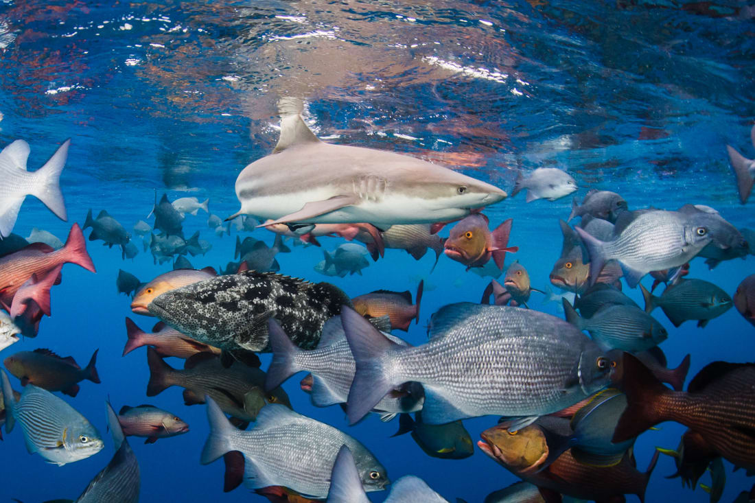
I was in ports in Asia where they brought in 7,000 sharks in a single day.
They hacked the fins off them, threw them into the tray and then the entire shark was turned into fertilizer.
Seven thousand sharks!
And when I spoke to the factory floor manager, he said, 'Today isn't a big day.
Some days, we get 10-12,000 sharks.
So in a single port, you're looking at three million sharks in a year. And what does that actually translate into?
The estimates are somewhere between 100 and 250 million sharks a year are slaughtered for their body parts.
I've seen ports where there's speared dolphins lying on the beach, and they use that for dog food.
I've witnessed mantas lined up across an entire street, in Asia, and they only take the gills out and they use them as a medicinal tonic, and the rest of the animal is wasted.
 
Heinrichs fears that we see the oceans as an inexhaustible resource. 
"We have taken more than 90% of the large fish out of the oceans in just a few short decades through industrial fishing," he said. 
"Nobody really understands that these are living sentient beings that maintain a habitat that is literally the life support system of our planet."
 
 CNN: What is SeaLegacy?

Heinrichs: SeaLegacy is an organization co-founded by my partners Paul Nicklen and Cristina Mittermeier, both world class photographers and conservationists, to activate people around the planet to help restore the health and abundance of our oceans.
One of the biggest problems we face today is that people feel helpless, or they feel apathetic.
It's either 'not my problem,' or 'there's nothing I can do about it.'
We created a place where you can come in, you can sign up and you can choose your own path: maybe you're interested in dolphins, whales, mangroves or reefs.
You then choose to take action.
Maybe it's simply sign a petition, make a donation.
Maybe it's a letter to Congress or to some other country, urging them to take action to protect critical mangroves.
But we also provide information on how you can make changes in your own private life.
What you consume, what you dispose of, your energy use.
Through our stories you help learn to be a better custodian of this planet.


Much of SeaLegacy's work is with fishing communities, supporting a transition from extractive fishing to ecotourism.
This image was taken from the largest shark fishing island in Eastern Mexico.
According to Heinrichs, some fishermen have made the switch from poaching whale sharks to taking tourists out to swim with them.
 
Heinrichs works with SeaLegacy, an organization that protects ocean life worldwide.
SeaLegacy encourages members to choose their own path of activism, Heinrichs says.
Some are more interested in sea mammals such as whales and dolphins, whereas others fight to preserve mangroves and reefs.
Recent SeaLegacy missions focused on promoting sustainable in fishing in Spain and protecting whale and turtle habitats in the Azores, for example.
 
CNN: What are your hopes for the future? Presumably, your work hasn't ended.

Heinrichs: We're long past the time for pretty pictures and fun stories.
We have to take action.
In my mind we have less than a decade left before we are in uncontrolled loss of the planet through climate and through destructive fisheries.
But I also believe that we are seeing fundamental change happening right this moment.
The next generation is waking up.
They're speaking to their parents and grandparents -- conversations that would never happen a decade ago are happening today.
 
Heinrichs has hope that younger generations are taking more responsibility for our planet.
"The next generation is waking up," he said.
"They're speaking to their parents and grandparents -- conversations that would never happen a decade ago are happening today.
I see little activists that are 13 years old, taking a stand in their schools to eliminate plastics.
I see fishermen transitioning their livelihoods from fishing sharks to taking a few people out to swim with sharks ...
We are seeing change."
 
I see little activists that are 13 years old, taking a stand in their schools to eliminate plastics
 I see fishermen transitioning their livelihoods, from fishing sharks to taking a few people out to swim with sharks. I see entire cities designating protected areas.
We are seeing change.
So I do have hope.
But more than anything, I'm inspired to be part of it.
Because I think we have a chance, but we must act now. 

Links :

Tuesday, March 29, 2022

The ocean twilight zone’s mysterious 'false bottom'


From Discover Mag by Jack Feerick

When sonar detected a massive object hundreds of meters below the water, operators suspected sunken islands.
It was actually the deep scattering layer.

The depths of Earth’s oceans remain, to a large extent, as mysterious as the reaches of outer space.
Cold, dark and hostile, less than 10 percent of their vast area has been explored by technology, and an even smaller fraction by human beings themselves.

Much of what we know about the sea, then, we know from deduction.
Before the 21st century, for example, we had no photographic evidence of giant squid, nor even an intact carcass.
But mariners from as far back as antiquity surmised their existence by the marks their tentacles left on the flanks of whales.

The story of the deep scattering layer is another one of deduction: an anomalous observation — in this case, a sonar glitch — changed the way we think about marine ecology forever.

Sounding the Depths


Sonar works similarly to a bat’s natural echolocation.
An underwater sound projector produces a regular sonic pulse, or “ping,” while a receiver detects the reflected sound waves.
The amplitude and return time of these echoes indicate the size and relative distance of objects nearby.

When sonar became standard equipment on U.S. Navy ships, around 1942, operators were confounded by an unexpected acoustic signature they called the “phantom bottom.”

It appeared to be a solid plane some 300 to 500 meters below their ships, in what we now call the mesopelagic, or “twilight,” zone.
That’s pretty deep — below the depth that most contemporary submarines can travel — but nowhere near the actual seabed, which sailors had long known from lead and line soundings to be at least 4,000 meters down in certain places.
 

Celebrated author and marine biologist Rachel Carson wrote about the phenomenon in her best-selling book The Sea Around Us.
In a lecture following the book’s release, she said, “people at first mistook [these readings] for shoals or sunken islands, and reported submerged land where none existed.”

The false bottom, however, was a global phenomenon.
Sonar operators across every ocean reported similar findings — indications of something substantial, miles wide in every direction, where no seafloor should be.
More curious still, it moved.
During daylight hours, the phantom bottom readings remained steady.
But as night fell the floor began to rise, the reflected signal dispersing overnight before descending as dawn approached.

Run Silent, Run Deep

During the Second World War, the U.S. Navy counted on sonar warnings to protect sailors and submariners from attack.
Therefore, unraveling the mystery of the phantom bottom became a matter of national security.
Multiple explanations were proposed, including equipment malfunction or some enemy sonar-jamming device, but none bore up to investigation.

In 1945, Martin Johnson of the Scripps Institution of Oceanography posited a solution.
He argued that this “deep scattering layer,” as he called it, was composed of living creatures — trillions of shrimp, jellyfish and bony fish that rose each night to feed in warmer surface waters before returning to their deeper homes. 
 Johnson’s field work, although limited to two days and nights of sampling in a single location, upended conventional wisdom.

Marine ecologists describe the ocean as a series of layers, or zones, each deeper than the last and each with its own unique ecosystem.
Waters circulate with the tides and currents, but the plant and animal life in each zone has adapted to a unique salinity, temperature and pressure.
The deep scattering layer lies in the mesopelagic zone and as Carson noted, “We had always assumed that these mid-depths were a barren, almost lifeless, Sahara of the sea. [W]here there is no sunlight, no plants can live. So we assumed that food would be too scarce to support a very abundant animal population there.”

In Johnson’s model, however, the mesopelagic zone teemed with life — enough to constitute a “living supercontinent” that blanketed the entire ocean and reflected sound waves.
As a result, our entire understanding of marine ecology shifted and revised estimates of global marine biomass increased tenfold.
 
Piercing the Twilight Zone

In the decades since Johnson’s initial hypothesis, new technologies have made the mesopelagic zone slightly more accessible to scientists.
Samples indicate that various species of lanternfish, ranging from two to ten inches in length, account for the majority of the deep scattering layer (and up to 65 percent of the planet’s total fish biomass).
With a global bulk estimated at between five and 10 million metric tons, lanternfish are now believed to be the most common and widely distributed variety of all marine animals — and probably of all vertebrates — on Earth.
 

Marine scientist Kelly Benoit-Bird explores the oceans' depths with acoustic technology to better understand animal behavior like schooling, cooperation, and predator-prey interactions.
At the Museum's Ocean Luminaries event held on March 2, 2018, she discussed the challenges of studying animals that live in the dark, and how a robot equipped with acoustic technology is providing new views of the deep.
Benoit-Bird is a senior scientist at the Monterey Bay Aquarium Research Institute.
 
But there are still mysteries to be solved.
In 2013, marine scientist Kelly Benoit-Bird sent robot cameras into the layer’s midst.
“We were limited in our perspective, looking down from the surface,” she says.
The new perspective revealed previously unsuspected schooling patterns: Mesopelagic animals are not randomly intermixed but seem to gather in tight formations by species.
Scientists previously assumed this type of clustering occurred only in the sunlit shallows, where it deterred visual predators like dolphins.
“This study shows that sound-scattering layers are not just accidental aggregations; they are the result of intentional effort by both individual animals and groups of animals,” says Benoit-Bird.
The reasoning behind these aggregations is yet another twilight zone mystery whose answer may eventually be brought out of the deep and into the light.


Monday, March 28, 2022

How companies are using AI to monitor sanctions risks on the Black Sea and beyond

Quantexa, Windward and Skytek use AI-based data analytics to monitor exposure to risks posed by sanctioned entities — whether it be to guard against financial fraud or maritime risks such as illegal cargo or flag-hopping.
Photo: Yasin Akgul/AFP via Getty Images
 
From Protocol by Kate Kaye
 
Amid the Ukraine conflict, AI-based data analytics are helping navigate the choppy waters created by sanctions against vessels, businesses and people associated with Russia.

Yasa Jupiter and Namura Queen were stranded.

When the bulk carrier ships were hit by missiles while anchored at ports off the coast of Ukraine in late February, their crew weren’t the only ones at risk.
So too were the ship owners, cargo underwriters, banks, energy companies and others involved in the complex web of businesses expecting the vessels to make their coal and wheat shipments.

But it isn’t just the threat of Russian missiles that has disrupted the supply chain flow in the Black Sea region.
It’s the choppy waters created by sanctions against vessels, businesses and people associated with Russia.
The conflict in Ukraine is putting a searchlight on technologies from companies including Quantexa, Windward and Skytek, which use AI-based data analytics to monitor exposure to risks posed by sanctioned entities — whether it be to guard against financial fraud such as money laundering or maritime risks such as illegal cargo or flag-hopping.
 
 
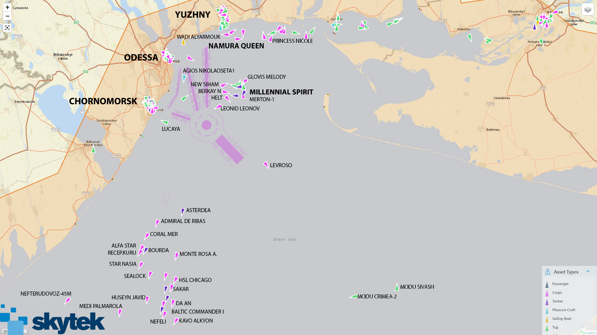
Damage to the two cargo ships — each of them valued at close to $30 million, according to sanctions compliance assessment software vendor Skytek — was minor, though one crew member on the Namura Queen sustained non-life-threatening injuries.
When they were struck, the ships were among 120 cargo vessels moored at Ukrainian ports, just before Ukraine's military suspended commercial shipping at its ports following the initial invasion by Russian forces into that country.
 
On 24 February, there were 120 ships moored under cargo operations in Ukrainian ports, with another 60 cargo ships waiting at anchor.
The Russian invasion into Ukraine saw vessels in anchorage being immediately instructed to leave the escalated risk area.
On the morning of February 24th, the first 24 ships departed anchorage displaying destinations as: “Open Sea” and “For Orders”.
Vessels moored in Ukrainian port have remained alongside due to the suspension of operations in all Ukrainian sea ports.
On 24 February 2022, Russia suspended ship movements in the Azov Sea until further notice, following its move to launch military operations in the Donbas region of the Ukraine. 
 
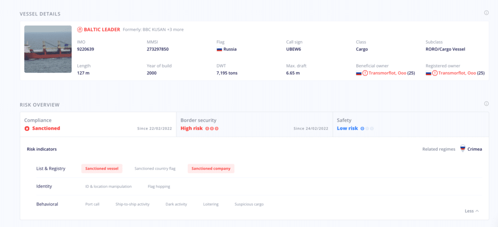
The data is just a sampling of the sort of information available through software from Skytek, which uses machine learning and data analytics to evaluate current and historical voyage patterns and alert customers when suspicious activities such as evasion tactics occur in sanctioned maritime zones.

When President Joe Biden announced a new round of sanctions targeting 400 people and entities affiliated with the Russian government during a Thursday press conference, a reporter asked if he believed the actions would have an impact on making Russia change course in Ukraine.
A frustrated Biden responded, “You’re playing a game with me.”
Just before, he remarked, “I did not say that, in fact, the sanctions would deter [Russian President Vladimir Putin]. Sanctions never deter.”

Whether or not they are directly deterring Putin from continuing Russia’s attacks on Ukraine, data from Windward — another company providing AI-based analytics software to assess maritime risk — showed that regulatory or “moral” sanctions appear to be having some effect.

“The Western market has been shutting off completely any work with anybody related to Russia,” said Ami Daniel, co-founder and CEO of Windward. That means that when it comes to companies or ships that are connected in some way to Russia, “A lot of the people won't even touch you with a stick right now.”

Right now, Windward’s customers are conducting queries in its software platform to help inform how they address sanctions against Russian entities.
“We have a German customer which is super risk averse and doesn't want to do any business with anybody who's ever been near one of these places in the last 24 months,” Daniel said.
 
Lloyd’s List Intelligence also offers data and AI-based analytics tools to monitor maritime risk.
But unlike startup competitors, the company launched in 1734 as a printed broadsheet posting ship arrivals and departures in a London coffee house.
It still maintains its media arm, which reported early this month that “Cargo underwriters are taking the decision not to cover consignments heading to Russia or Ukraine, and even nearby countries, citing reputational risks and the potential difficulties of paying out on insured claims.
 

Russian ships go home for fuel

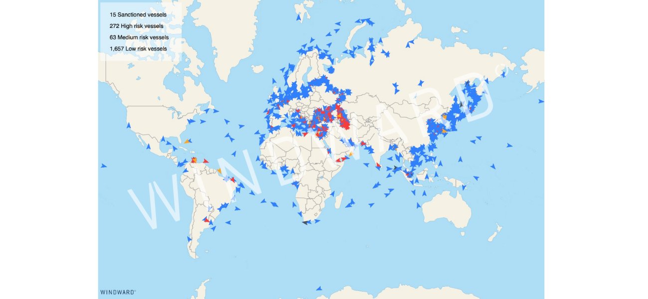
Windward’s software provides custom views of exposure to vessels connected to countries customers have particular concern about, such as Russia, Venezuela, Iran or Myanmar, over a selected time period.
The company feeds satellite image and radio frequency data, weather data, ship ownership and cargo data, port data and vessel schedule data into deep-learning models tailored to a customer’s risk tolerance, then scores their level of risk associated with sanctions or other laws and regulations.
As an example, the system pulls in imagery data from hundreds of satellites measuring a particular offshore area via an API every day.

Windward has published reports in recent weeks with updates related specifically to Ukraine and the Black Sea region, where intensifying attacks from Russia have led to a drastic decline in port activity around Ukraine.

But not all cargo ship activity is at a standstill. In fact, based on its analysis of its ship-tracking in the region, Windward reported on March 22 that general cargo and oil tankers calling port in Russia actually increased operations by 44% over the following week.
The company pointed out an important piece of information teased out in its analysis: 60% of that increase in Russian port calls was associated with Russian-flagged vessels.

That, Daniel said, likely meant that those ships were returning home before they got stranded. 
“This is Russian vessels coming home, and we think it's also because nobody would sell them marine fuel,” he said, adding, “About 50% of the marine fuel providers of bunker fuel will not provide them fuel. So they're in a tough spot.”
Flag-hopping and oligarch shell games

Tracking sanctions-related risk on the high seas is just one area companies need to monitor, of course. Financial institutions are also using sophisticated analytics and machine-learning-based software to keep one step ahead of Russian nationals and oligarchs recently added to the U.S. Treasury Department’s sanctions list.
 
Entity resolution is a key component in the processes used to identify suspicious actors by companies including Windward and Quantexa, which uses network analytics to detect possible financial fraud such as money laundering.
 
The Quantexa system automatically generates a contextual network, a graph indicating the links connecting target entities with other shell operations or shady individuals.

To isolate possible fraudsters, the financial fraud detection software ingests information from an array of sources, from SWIFT wire transfer messages and risk data from Bureau van Dijk’s Orbis and RDC Grid to less-obvious sources such as financial records data revealed through journalistic investigations of the leaked Pandora and Panama Papers.
“When you go in and look at the exposure, you see that person is not only a sanctioned individual, here's the company that our customers have been doing business with [and] he's 100% owner of that company,” said Clark Frogley, head of financial crime solutions at Quantexa.
He continued, “But guess what? He's also the primary shareholder of these other three companies that they've been doing business with or these other two customers that we weren't even looking at.”
 
There are +2000 Russian vessels out of 45K merchant vessels sailing the oceans.
As Western countries refuse to work with and provide bunkering services to them, they will soon go out of service.
Without these 5%, shipping prices will break new records in the upcoming weeks.

On the water, Windward must navigate the maritime version of oligarch shell games to resolve ship identity.
According to Windward, vessels are usually associated with multiple nationalities because they are linked to several owners, each performing different functions on a single ship.
Windward combines several sources of positional and vessel identifier data to detect flag-hopping, a manipulative tactic used to circumvent sanctions and fishing regulations by changing the nation where a ship is registered.

Shipping traders or legal teams at Windward’s customer companies are using its analysis to inform whether they should cancel booked shipments or other deals that might be subject to Russia-related sanctions.
Contracts associated with trading plans over the next six months or more could be canceled if deemed too risky, Daniel said, adding, “Listen, force majeure. Tough luck.”
 
Links :

Sunday, March 27, 2022

Image of the week : Cloud party in the Pacific

 From NASA
 
Some of the first features that scientists noticed in April 1960 after NASA launched TIROS-1, the first weather satellite, were peculiar hexagonal “cells” that appeared in clouds over the ocean.
With diameters ranging from 50 to 100 kilometers (30 to 60 miles), the features were large enough that they had never been recognized from the ground.
 
The phenomenon came to be called mesoscale cellular convection (MCC). Meteorologists soon grouped these cloud systems into two main classes.
The centers of “closed” cells were clouded over, while “open” cells had clear centers.
By the time TIROS-5 was launched in 1962, researchers had identified a third class of MCC—an intermediate type with a radial structure that looked similar to flowers or wagon wheels.
They named them actinoform clouds, derived from the Greek word aktinos, meaning “ray.”
 
Though actinoform clouds were initially thought to be rare, satellite observations collected in the past few decades have made it clear that they are fairly common.
The clouds are regularly spotted in imagery of the ocean.
They can last up to 72 hours and often bring drizzling rain.
 
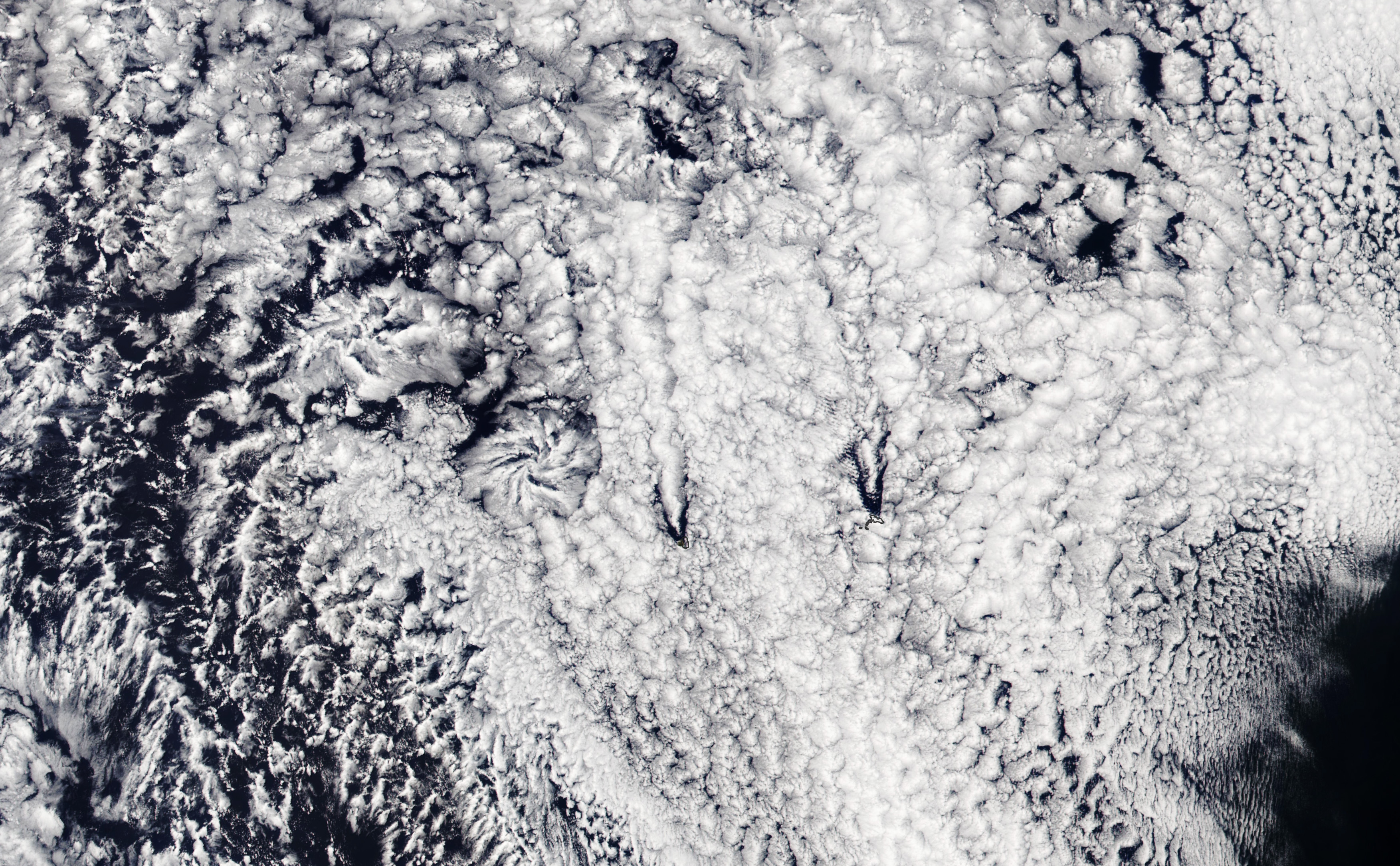
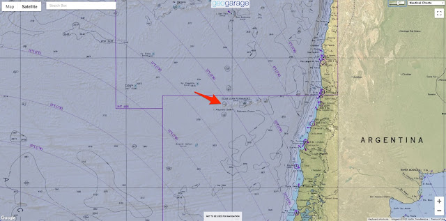
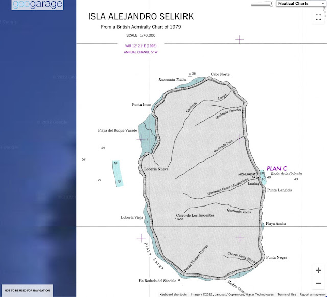
On March 11, 2022, the Visible Infrared Imaging Radiometer Suite (VIIRS) on the NOAA-20 satellite captured this image of two actinoform clouds to the west of Alejandro Selkirk and Robinson Crusoe islands.
The cloud farther to the east has a classic actinoform shape, while its partner to the northwest has a more linear, diffuse form.
 
It is not clear why actinoform clouds develop, but they show up where marine stratocumulus clouds occur—typically in stable air along the western coasts of major landmasses.
 
Researchers suspect that ocean currents and water temperatures play a role in their formation.
Other eye-catching clouds were also on display on March 11.
Faint rows of von Kármán vortices appear north of the two islands.
The spiraling cloud patterns form when winds get diverted around elevated areas, often islands, rising from the ocean.
 
 
The two islands beneath the clouds are volcanic mountains off the coast of Chile.
Alejandro Selkirk island was named after a Scottish sailor who spent four years as a castaway on the neighboring island after his captain abandoned him after an argument.
Alexander Selkirk’s (also spelled Selcraig) ordeal served as partial inspiration for the novel The Life and Adventures of Robinson Crusoe.
 

Once known as Más a Tierra, the smaller of the islands was renamed Robinson Crusoe in 1966 in honor of the book.
At the same time, Alejandro Selkirk island, formally known as Isla Más Afuera, was given its name.