A global standard limiting sulfur in ship fuel reduced artificial “ship track” clouds to record-low levels in 2020.
Pandemic-related disruptions played a secondary role.
Ship tracks, the polluted marine clouds that trail ocean-crossing vessels, are a signature of modern trade. Like ghostly fingerprints, they trace shipping lanes around the globe, from the North Pacific to the Mediterranean Sea.
But in 2020, satellite observations showed fewer of those pollution fingerprints.
Drawing on nearly two decades of satellite imagery, researchers found that the number of ship tracks fell significantly after a new fuel regulation went into effect.
A global standard implemented in 2020 by the International Maritime Organization (IMO) – requiring an 86% reduction in fuel sulfur content – likely reduced ship track formation. COVID-19-related trade disruptions also played a small role in the reduction.
Scientists used advanced computing techniques to create the first global climatology (a history of measurements) of ship tracks.
“Without this kind of complete and large-scale sampling of ship tracks, we cannot begin to completely understand this problem,” said lead author Tianle Yuan, an atmospheric scientist at NASA’s Goddard Space Flight Center in Greenbelt, Maryland, and the University of Maryland, Baltimore County.
Ship tracks fell significantly in 2020, due to new fuel regulations and the COVID-19 pandemic, according to a new NASA study. Credits: NASA Earth Observatory
Ship tracks were first observed as “anomalous cloud lines” in early weather satellite images acquired in the 1960s.
They are formed by water vapor coalescing around small particles of pollution (aerosols) in ship exhaust.
The highly concentrated droplets scatter more light and therefore appear brighter than non-polluted marine clouds, which are seeded by larger particles such as sea salt.
By capping fuel sulfur content at 0.5% (down from 3.5%), IMO's global regulation in 2020 changed the chemical and physical composition of ship exhaust.
Less sulfur emissions mean there are fewer of the aerosol particles released to form detectable ship tracks.
According to the Yuan and colleagues, similar but regionally defined sulfur regulations – such as an IMO Emission Control Area in effect since 2015 off the west coast of the U.S. and Canada – had not had the desired effect because operators altered their routes and charted longer courses to avoid designated zones.
While analyzing 2020 data, the researchers found that ship-track density fell that year in every major shipping lane. (See the map above.)
Ship-based tracking data indicated that the COVID-19 pandemic played a role by decreasing global shipping traffic by 1.4% for a few months.
But this change alone could not explain the large decrease in observed ship tracks, which remained at record-low levels through several months of 2021 (the most recent data analyzed).
The researchers concluded that the new global fuel regulation played the dominant role in reducing ship tracks in 2020.
With satellite data and artificial intelligence, scientists identified ship tracks across 17 years of daytime images (2003-2020). Credits: NASA Earth Observatory
Over the long span of their analysis, Yuan and colleagues also found that fluctuations in economic activity leave distinct traces in the satellite record.
In particular, Trans-Pacific ship track patterns between Asia and the Americas reflect dips and spikes in trade.
As outlined in the study, a general upward trend in shipping activity between 2003 and 2013 -- reflected in ship-track clouds -- dropped for about a year in the aftermath of the 2008 global financial crisis.
An even sharper decrease between 2014 and 2016 likely reflected a slowdown in Chinese imports and exports of raw materials and commodities.
Beyond their world trade significance, ship tracks can serve as case studies for an element of climate change.
“Ship tracks are great natural laboratories for studying the interaction between aerosols and low clouds, and how that impacts the amount of radiation Earth receives and reflects back to space,” Yuan said.
“That is a key uncertainty we face in terms of what drives climate right now.”
Among surfers, the term “heavy” can refer to any wave that is particularly dangerous.
That includes waves that are literally heavy, heaving a crushing amount of water toward the shore and onto unlucky surfers.
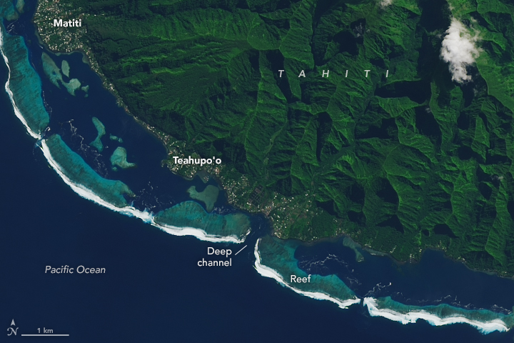
The waves off the coast of Teahupo’o in southern Tahiti have been called the heaviest in the world.
On May 2, 2022, the Operational Land Imager-2 (OLI) on Landsat 9 acquired this natural-color image of Tahiti, an island of French Polynesia.
The scene falls within the timeframe—from April to October—when the waves at Teahupo’o tend to be the strongest.
Visualisation with the GeoGarage platform (SHOM nautical raster chart)
Winter storms originating in the Southern Ocean and the South Indian Ocean frequently move into the southwest Pacific Ocean basin.
From there, large storm-generated swells can travel unimpeded toward the southern coast of Tahiti. Swells that approach Teahupo’o from the south or southwest are perfectly aligned to produce the area’s famously powerful barrel waves.
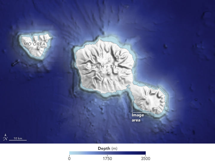
But the legendary waves would not exist without equally perfect bathymetry.
The seafloor around Tahiti rises quickly from about 5,000 feet deep at 3 miles from shore to just 1,000 feet deep at 0.3 miles from shore.
As a result, southwesterly swells carry ample energy from the open ocean until they are very close to shore and crashing into the reef off Teahupo’o.
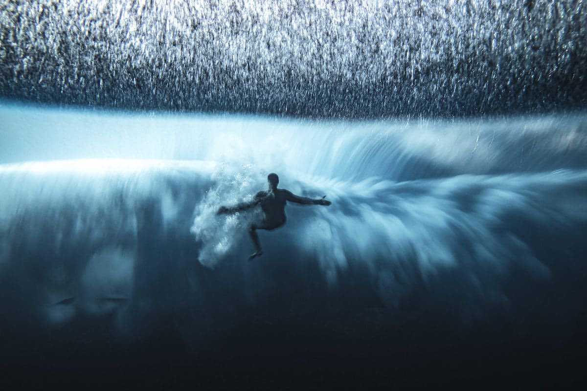
Surfer Matahi Drollet catches a wave at Teahupo'o
Photo : Ben Thouard
As the swells approach the reef, water piles up into a towering barrel wave; at the same time, water over the reef is pulled away from the shore.
Surfers are actually below sea level as they ride—and dangerously close to the reef—until entering the lagoon closer to shore.
A deep channel to the west, along with a deep slot in the reef, can focus even more energy into the barreling waves.
The epic waves at Teahupo’o have drawn participants to numerous surfing competitions, and the International Olympic Committee approved the site as the surfing venue for the 2024 Paris Olympic Games.
Teahupo’o is about 9,700 miles (15,000 kilometers) from France, one of the longest distances between an Olympic medal event and the host city.
Demand for resources in the seabed and a need to protect the deep-sea environment have spurred development of submersibles. Can they help us unlock the mysteries of the ocean?
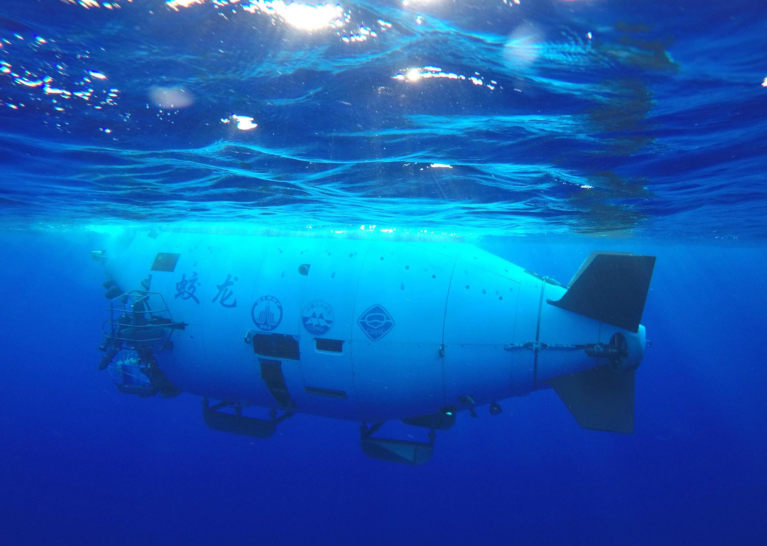
The Ministry of Science and Technology named a self-powered “soft robot” submersible that survived the pressure of the Mariana Trench as one of China’s 10 biggest technological achievements in 2021.
This wasn’t the first time that the deepest part of the world’s oceans have been explored, but the robot, built by a team from Zhejiang University and research institute Zhejiang Lab, was the lightest submersible ever to make the trip.
Weighing less than 250 grams, it is shaped somewhat like a snailfish, with the same two flapping dorsal fins. Its success has opened up new possibilities for exploring the deep sea.
The soft robot submersible developed by a team of Chinese scientists swims at 3,224 metres during a field test This video shows the deep-sea free swimming of soft robot in the South China Sea.
The soft robot was grasped by a robotic arm on ‘HAIMA’ ROV and reached the bottom of the South China Sea (depth of 3,224 m).
After the releasing, the soft robot was actuated with an on-board AC voltage of 8 kV at 1 Hz and demonstrated free swimming locomotion with its flapping fins.
The front view and side view of swimming process were recorded by the cameras and LED lights on the ROV.
This video shows the potential of soft robots in deep-sea exploration.
The “deep sea” refers to any ocean waters more than 200 metres deep – the depth at which there’s no longer enough light for photosynthesis. Four-fifths of the ocean is much deeper still, at over 2,000 meters. There, the darkness is joined by crushing pressure and exploration becomes hugely challenging; only a few dozen people have ever travelled into the Mariana Trench. The very deepest point of the trench, Challenger Deep, is the same distance from sea level as seven Eiffel towers stacked on top of Mount Everest. The pressure at the bottom is equivalent to a tonne of weight pressing on a fingernail.
To avoid being crushed, submersibles generally need tough outer shells. Manned submersibles have the highest requirements and can easily cost in the hundreds of millions of dollars and take years to build. But that has not stopped deep-sea explorers. Down in the depths, rich mineral resources and diverse ecosystems can be found. The ocean absorbs one-third of humanity’s carbon dioxide emissions, which is of huge significance for climate change. It is a source of both food and medicine. And it may hold the secrets to the origins of life on Earth and its subsequent evolution.
Despite a later start than the US, Japan and France, China too has developed submersibles to prospect for seabed resources, search for ocean life, and help to understand and tackle climate change. Its first manned submersible, launched in 1986, was intended for underwater rescues and had a maximum depth of only 300 metres. In 1997, the unmanned submersible CR-01 successfully reached a depth of 5,179 metres. Chinese manned submersibles capable of exploring deeper waters didn’t appear until 2009, with trials of a submersible named Jiaolong. It would be another decade before Chinese explorers reached the bottom of the Mariana Trench. Over these years, China has developed manned submersibles, unmanned underwater robots and underwater gliders, laying a foundation for future deep-sea exploration. So, how will these different vehicles help us explore the deep ocean?
Towards seabed mining
Name: CR-01 Launched: 1995 Max operational depth: 6,000m Operation: Autonomous The CR-01 is a self-propelled robotic vehicle that can follow a programmed trajectory and carry out survey tasks such as taking photos and measuring temperature and salinity (Graphic: Manuel Bortoletti / China Dialogue Ocean.)
The CR-01 is an autonomous underwater vehicle, or AUV, able to reach depths of 6,000 metres, and therefore 98% of the seabed. Launched in 1995 and with a torpedo-like appearance, it can follow a programmed trajectory to gather measurements and take photographs. But it is only a seabed observer – it cannot carry out more complex tasks such as collecting samples.
The CR-01 was one of the world’s earliest successes in prospecting for underwater minerals. In 1991, the China Ocean Mineral Resources R&D Association (COMRA) was registered as the fifth pioneer investor in deep-sea mining with bodies working to establish the International Seabed Authority (ISA). A few years later, the ISA approved COMRA’s plans to carry out initial surveys of 150,000 square kilometres of seabed in the northeast Pacific.
In the early summer of 1997, the CR-01 underwent 39 days of sea trials, supported by the vessel Da Yang 1. It surveyed marine mineral deposits known as polymetallic nodules on the seabed at depths of up to 5,179 metres, as well as taking photographs and temperature and salinity readings. The successful completion of its mission was key to China gaining the unique right to prospect for minerals across 75,000 square kilometres of seabed, as well as priority development rights, in 1999.
A deep-sea coral on a polymetallic nodule from the Clarion Clipperton Zone in the central Pacific, one of the areas in which pioneer deep-sea miners have shown greatest interest
The ISA was founded in 1994 to regulate seabed prospecting and exploitation, in accordance with the United Nations Convention on the Law of the Sea. It issued 31 exploration contractsto various nations, which also gained priority in development rights to the contracted areas. But there is not yet agreement on a “Mining Code”, and so actual mineral extraction has not started. One of the sticking points is how to avoid mining causing devastation to the deep-sea environment. After all, we have explored only 5% of the seabed and know little about deep-sea organisms and ecologies.
The Jiaolong submersible, a manned deep-sea submersible owned by COMRA with the capability to go to depths of more than 7,000 metres, is able to reach 99.8% of the seabed. Its development was linked to COMRA’s increasing involvement in surveying the international seabed, and the state’s increasingly urgent need for manned submersibles. Such submersibles can be more precise in selecting samples and carry out more comprehensive observations. While they can prospect for minerals and take samples of seabed silt, minerals, water and organisms, their most important function is helping China and the world understand seabed organisms.
Exploring new life
Name: Jiaolong Launched: 2009 Deepest dive: 7,062m Operation: Manned Capable of carrying three crew, the Jiaolong has robotic arms to collect samples of mineral deposits and deep-sea organisms. It can also record video and use sonar to create detailed maps, among other capabilities. (Graphic: Manuel Bortoletti / China Dialogue Ocean)
On Christmas Eve 2014, the Jiaolong – having completed a number of diving trials to depths of 7,000 metres – was launched from the Xiang Yang Hong 9 survey vessel to carry out its 35th ocean survey. This time, its destination was the mid-ocean ridge in the southwest Indian Ocean. Marine biologist Xiao Xiang summed up the aim of the mission: “In scientific terms, we all want to see if the biodiversity here is more like that of the Pacific or the Atlantic.”
He added: “The southwest Indian Ocean is one of the least studied ocean areas.”
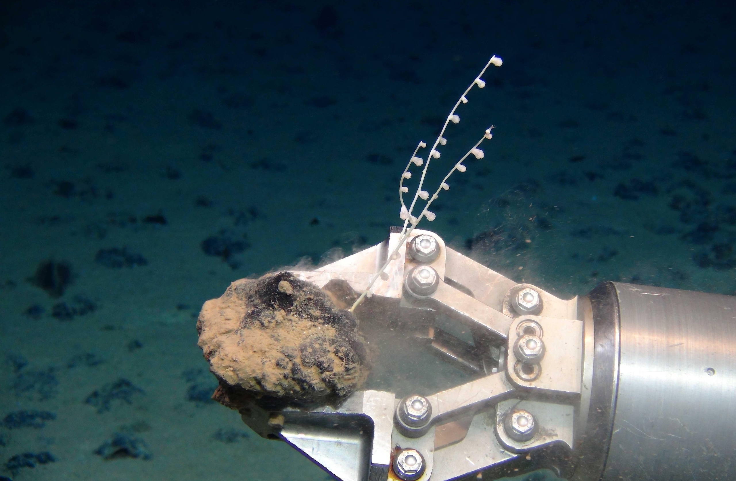
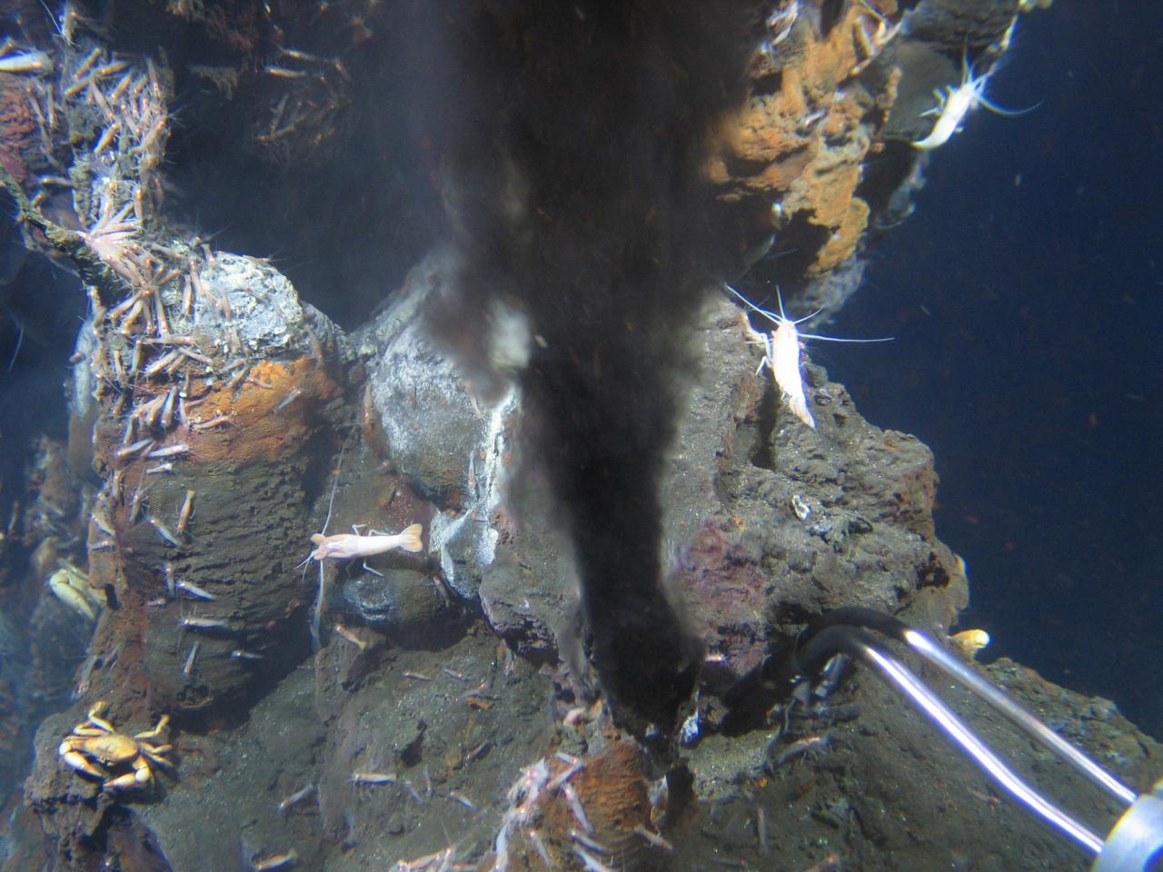
The Jiaolong discovered and took a sample from a black smoker – a type of hydrothermal vent – and also collected silt and water samples from a depth of 2,000 metres. Xiao Xiang hopes to use the single-celled organisms found within the black smoker to help explain how life on Earth began.
A black smoker on the Mid-Atlantic Ridge swarming with deep-sea shrimps (Image: ROV KIEL 6000 / GEOMAR, CC BY)
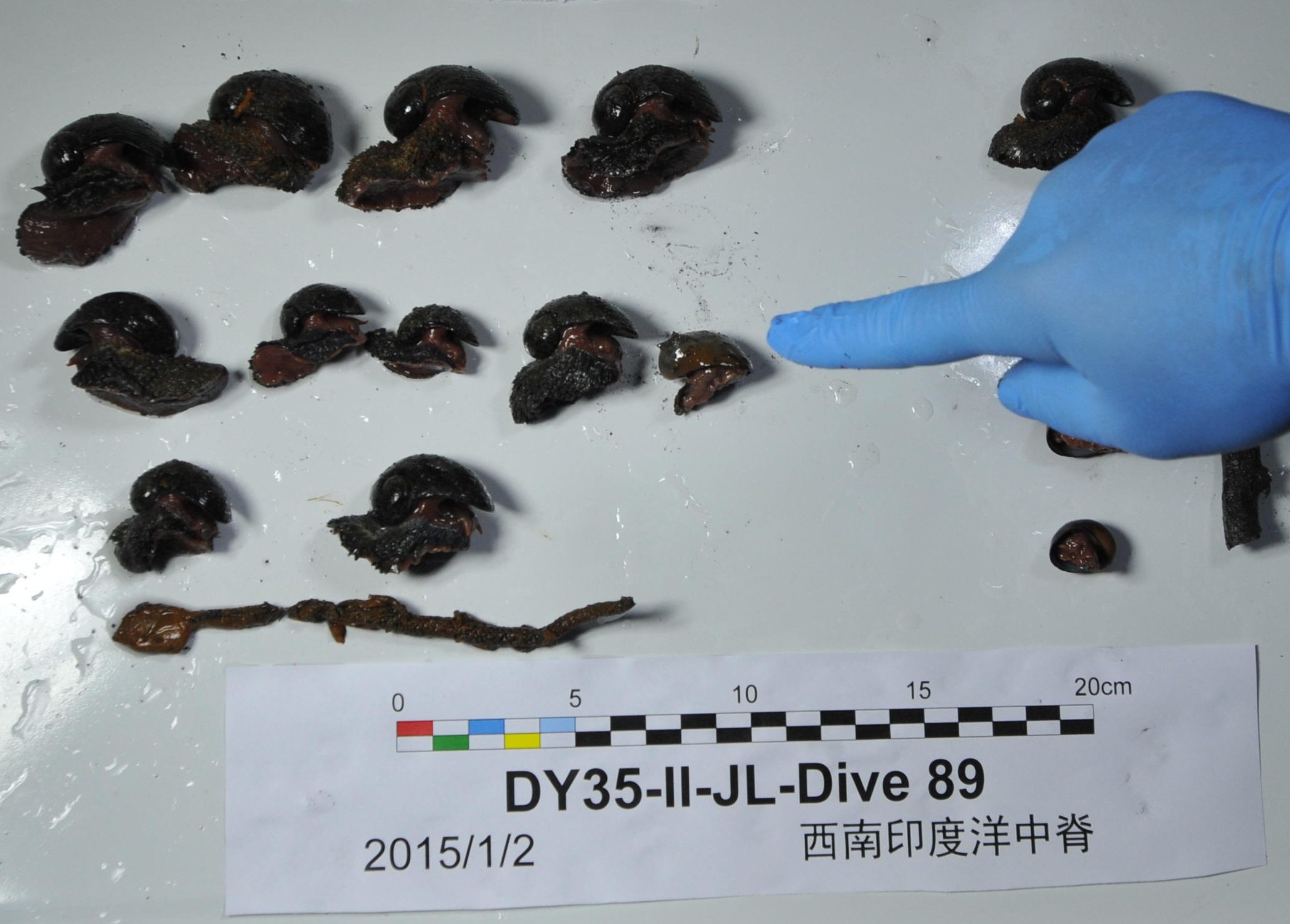
Deep-sea snails collected by the Jiaolong during its mission to study hydrothermal vents in the southwest Indian Ocean (Image: Zhang Xudong / Alamy)
The ocean depths teem with new species awaiting discovery. In 2019 alone, 66 were identifiedby scientists from around the world including China. With its maximum depth of 7,000 metres, the Jiaolong can carry out geophysical and biological studies on almost all of the seabed, but not all.
In November 2020, the “Fendouzhe” (or “Striver”), another three-person submersible, reached some of the deepest parts of the Mariana Trench, bringing back samples of rocks, seawater and organisms. In October 2021, it started surveying the trench.
The “Mariana Trench biology and environment research program” was formally started during this ocean survey. Its intention is to “invite researchers from China and overseas to participate in research into the Mariana Trench, to work together to study deep-sea geophysical change, how life developed and adapted to different environments, and biodiversity and climate change.”
Such grand plans will need help from cheaper and more flexible unmanned submersibles. The lightest unmanned submersibles are usually designed only to make observations and take measurements. The heaviest “work class” underwater robots have manipulator arms to allow for work such as construction and welding, while “light work class” submersibles sit between the two.
Scientists on the Chinese icebreaker Xue Long prepare to launch a Haiyi deep-sea glider in the Bering Sea (Image: Shen Cheng / Alamy)
Currently, China has five models of unmanned submersible, ranging from observation class to light work class, which have reached depths of 10,000 metres. The Haidou 1 was developed by the Chinese Academy of Sciences’ Shenyang Institute of Automation in 2016. It has three operating modes: tethered by a cable, for optimum signal transmission; untethered; and a hybrid mode where the submersible navigates independently but the cable remains connected. As a light work class submersible, the Haidou 1 has manipulator arms that can operate at great depths and grab or place items, to some extent replicating the functionality of manned submersibles. Gathering ocean data
Name: Haiyan-X Launched: 2020 Deepest dive: 10,619m Operation: Autonomous The Haiyan-X is one of a series of gliders designed to follow ocean eddies and survey conditions such as salinity and acoustics over long periods of time. Mimicking the function of fish bladders, it uses gas to control its buoyancy, rising to the surface to transmit data. (Graphic: Manuel Bortoletti / China Dialogue Ocean)
Many submersibles can measure temperature, salinity and oxygen levels at different depths. That data helps us keep up to date on how the oceans are changing and take appropriate climate change mitigation and adaptation measures.
In 2013, a team led by Wu Lixin, a Chinese scientist, came up with the “Transparent Ocean” plan. A key aim was to use modern ocean monitoring and exploration tech to gather real-time ocean data and create a high-resolution network of observations.
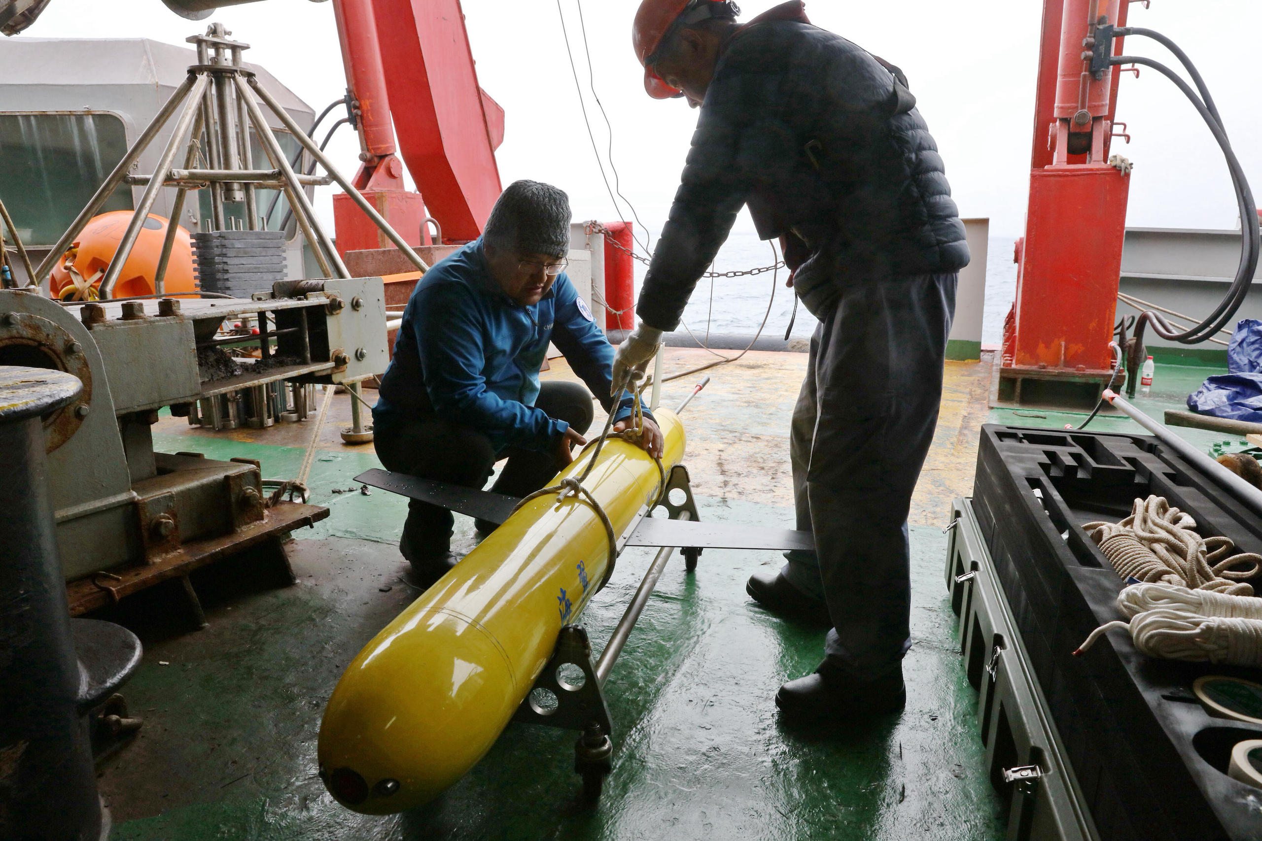
Alongside satellites and floats known as Argo floats, underwater gliders are also used to gather ocean data. Resembling small planes, with two wings and a tailplane, they control their buoyancy vertically to descend into deeper water and then rise up again to the surface, where they can send the data they have gathered back to a receiving station.
The lateral movement of Tianjin University’s Haiyan gliders is directed by ocean eddies. The Haiyan-X can reach depths of around 10,000 metres and in July 2020 spent six days carrying out deep-sea observations, gathering cross-sectional profile data including several at depths between 3,000 and 10,619 metres and sending back information on salinity and acoustics, as well as imagery.
In 2018, the Shenyang Institute of Automation’s Haiyi gliders were used by China’s 9thexpedition to the Arctic and launched in the Bering Sea. This was the first use of China’s underwater gliders in its Arctic research.
In 2017, an ocean dataset compiled by Chinese scientists was used for the first time by the Intergovernmental Panel on Climate Change in its special report on the ocean.
Underwater trends
Name: TBC First deep-sea trials: 2019 Deepest dive: 10,900m Operation: Autonomous Inspired by the Mariana hadal snailfish, this 22cm-long robot can withstand enormous pressure thanks to its soft silicon body and the decentralised positions of its electronics. Its functionality as a research tool is still being developed. (Graphic: Manuel Bortoletti / China Dialogue Ocean)
Unlike submersibles with solid hulls, the soft robot being developed by scientists in Zhejiang mimics the structure of snailfish that live thousands of metres deep. The necessary circuits and batteries are embedded in a soft silicon body designed to withstand huge pressures.
The robot is 22cm long and 28cm wide and can move in straight lines or curves by moving its “fins”, just like a snailfish. Smaller, lighter and cheaper than other deep-sea equipment, the invention means new possibilities for deep-sea exploration, and particularly the study of seabed microenvironments.
Globally, dozens of manned and hundreds of unmanned submersibles are in use. Both types have their advantages, and both are needed. Manned submersibles are complex and precise machines, requiring specialist personnel to operate. The Chinese ocean science community is currently training more of these pilots. Unmanned submersibles are cheaper and more flexible. China has developed a range of underwater robots according to its varying needs in its own and international waters. Alongside the roles described above, they can also be used for oil and gas prospecting, environmental studies, rescues, underwater archaeology and the inspection and repair of underwater pipelines and cables.
Costs are an unavoidable issue for all scientists carrying out ocean research. Lower-cost, unmanned submersibles will be able to carry out an increasing range of research tasks as they become smarter, more operable, and better able to communicate with the surface.
The soft robot which travelled to Challenger Deep does not currently gather information. But the development team plans to design new materials and structures, and make it smarter, more capable and more efficient. In the future, it may be able to take precise samples from coral reefs or caves, becoming a valuable tool for marine biologists.
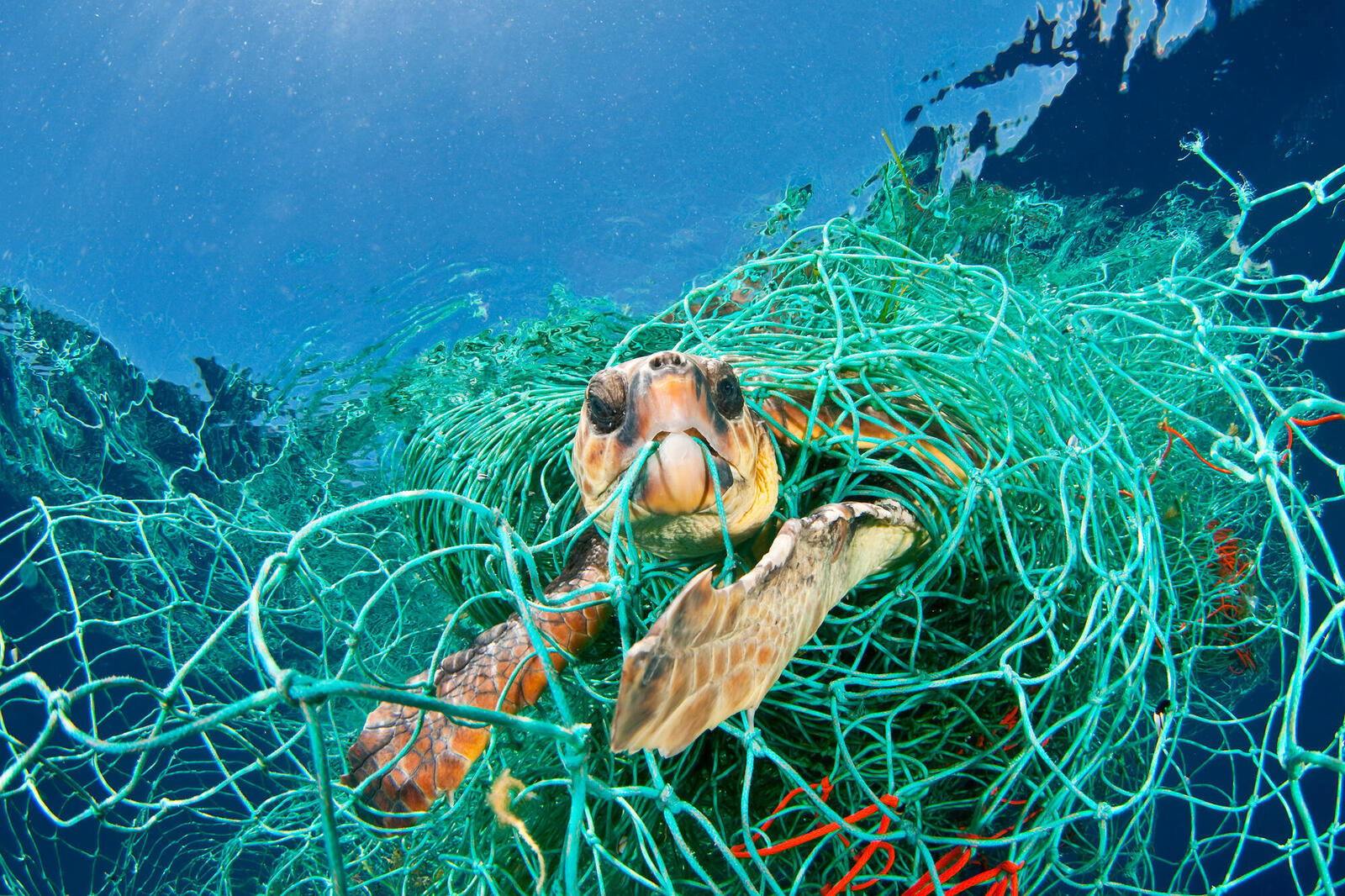
Lost nets, lines and hooks trap wildlife for years as they float in the ocean, sink to the bottom or are washed ashore
Enough commercial fishing line is left in the ocean each year to stretch to the moon and back, according to the most comprehensive study ever completed of lost fishing equipment.
The staggering amounts of lost gear, which includes 25 million pots and traps and 14 billion hooks, was likely having deadly consequences for marine life, one of the study’s authors said.
Enough nets were lost or discarded each year to cover Scotland. If all types of lost line was tied together, it would be able to stretch round the Earth 18 times. “This is super confronting,” said Dr Denise Hardesty, of the Australian government’s CSIRO science agency, and one of the study’s authors. “This is having an unimaginable toll of unknown deaths that could result in population level effects for marine wildlife.”
Published in the journal Science Advances, researchers from CSIRO and the University of Tasmania used standardised interviews with 451 commercial fishers in seven countries to ask what was being lost.
Researchers matched those interviews with data on the amount of commercial fishing globally to estimate what was lost.
Annual losses included:
78,000 sq km (30,000 sq miles) of purse seine nets and gillnets
215 sq km of bottom trawl nets
740,000 km (46,000 miles) of main long lines
15.5 million km (9.6m miles) of branch lines
13 billion longline hooks
25 million traps and pots
Fishers in the United States, Morocco, Indonesia, Belize, Peru, Iceland and New Zealand were interviewed. The countries were chosen because they had a fishing industry using most fishing methods. Smaller boats lost more gear than larger boats, and bottom-trawl fishers lost more nets than midwater trawlers.
A previous estimate put the percentage of gear lost at a higher level, but that research relied on a range of studies, rather than a standardised estimation based on interviews.
Hardesty said fishers often lost nets due to bad weather where equipment wasn’t properly secured or floated away, or gear became entangled with equipment from other vessels competing for the same fish.
But she said because nets were designed to catch and kill animals, lost gear would continue to entrap wildlife for years as it either floated in the ocean, sank to the bottom or washed ashore.
“That’s birds, turtles, whales, sharks, dolphins, dugongs,” she said. “You are then also catching a whole bunch of fish but then not eating them. That becomes a food security problem because that’s protein that’s not feeding people around the world.”
Kelsey Richardson, a lead author from the University of Tasmania, said the detailed estimates should help fisheries managers, the commercial fishing sector, and conservationists to better target solutions. The nets were adding to the global problem of marine plastic pollution, she said
Hardesty said there were solutions, such as local governments introducing buy-backs of older fishing gear which tended to get lost more often than new equipment. Tags or labels could be attached to gear, and free facilities could be introduced at harbours to allow fishers to discard unusable nets safely.
Richard Leck, head of oceans at WWF Australia, said: “These figures are breathtaking. This gives us a sense of the horrendous scale of the problem and the urgent need to tackle it. “Ghost nets – as they’re known – are a particularly lethal form of plastic pollution for all the marine life we care about. Once these nets are lost from a fishing vessel, they don’t stop fishing.”
Leck said a global plastic pollution treaty currently being negotiated through the United Nations needed to address the problem of ghost nets “at a global level to make sure countries are accountable” through transparent reporting and labelling of fishing gear. “This affects all countries – not just the places where nets are lost. This gear can migrate around oceans and continue to catch fish and entangle threatened species.”