Saturday, September 6, 2025

Hub Island: the curious story of the world's smallest inhabited island


I found one of the world's smallest islands.
It's called just room enough island because it has only enough room for a tree and a small house.

From SurferToday by Andrew Island 

It looks like a joke or a glitch on a nautical chart or Google Maps.
A speck of rock with a roof and a tree.
Locals call it Hub Island.
The rest of the world knows it as Just Room Enough Island.

It sits in the Thousand Islands, a spread of 1,864 isles in the St. Lawrence River between New York and Ontario, and gives a new meaning to the concept of island fever.


The setting is classic river country.
Tour boats glide past pine-lined shores.
Boldt Castle rises on nearby Heart Island like a postcard prop.

In the middle of it all, Hub Island stands there with a single cottage and a sliver of patio, looking both fragile and stubborn at once.

Sightseeing cruises out of Alexandria Bay point it out as they loop past the landmarks.
 

You can see the island from the water, but you cannot step on it.

It is private property.
So, how did this tiny islet become a hit and must-see attraction?

The Size of a Tennis Court

How small is "smallest"?
The footprint is roughly 3,300 square feet (306 square meters), about the size of a tennis court.

The house takes up most of that, with a tree and a few shrubs filling what's left.

At normal water levels, there's a narrow band of shore that reads as "beach" if you are feeling generous.

The Thousand Islands have their own rules for what counts as an island.
The land must stay above the river year-round.
It must be more than a square foot in area.

Luckily, the tidal range here is under a foot (30 centimeters), so it meets the criteria.

It also must support living trees or shrubs.
Many references say "at least two."
Either way, Hub Island clears the bar - barely - and that's the charm.

Bought In the 1950s

The backstory is straight out of summer-home lore.

In the 1950s, the Sizeland family bought the little rock and built a cottage for quiet weekends.
They planted a tree and gave the place its cheeky new name: Just Room Enough Island.

The plan for peace did not last.
Photos started to circulate.
Tour boats began pointing and slowing down.
The island became a river celebrity.

People who have passed by - and those who actually illegally stepped foot on the islet - have commented that it's an amazing natural wonder.

Title Record Taken from Bishop Rock

"The world's smallest inhabited island" is a real title with real history.
For years, people pointed to Bishop Rock, a lighthouse perch off England, as the record holder.

That changed in 1982 when the lighthouse was automated, and no one lived there anymore.
Hub Island's tiny cottage kept its lights on, and the crown drifted across the Atlantic.

Find it on a map and you'll see why boat captains mention Boldt Castle in the same breath.

Hub Island sits just off Heart Island, inside the village limits of Alexandria Bay in Jefferson County, New York.
Map services place its coordinates around 44.3426° N, 75.9249° W.

The setting makes it easy for sightseeing routes to include it without any detour.

One Misstep and You're Swimming

The cottage itself is simple.
Wood siding. Dormers peeking from the roofline.
A front door that opens almost straight onto water.

On calm days, patio chairs face the channel like theater seats.
On windy days, waves slap the stone edge, and the island seems to shrink.

One famous description of a visit summed it up like this: "one misstep and you're swimming."

Living here is not like living on a typical lake lot.
Space is a puzzle.
Storage is a puzzle.
Docking is a puzzle.
Even gardening is a puzzle.

The tree is not landscaping flair - it is part of the island's identity under local rules.
Remember: you have to have it for it to keep the prestigious title.
Everything you add takes away from the narrow ring of standing room, and storms can rearrange that ring overnight.

Yet that is the appeal. It's a place where every inch has a job.

Private and Not Open to Tourists

People always ask if they can rent it or tour it.
They cannot.
The island is private and not open to visitors.

The good news: the best view is from the water anyway.
Cruises that pass Boldt Castle and Millionaires Row usually glide by Hub Island and slow for photos.
Alexandria Bay's long-running operators make a point of showing off the river's extremes - from castles to cottages to this one-house dot.

Another common question: does it really belong in the Thousand Islands count?

Yes. The archipelago runs from the outflow of Lake Ontario downriver toward the city of Brockville and beyond.
It includes large parks, private camps, bare rocks, and single-home retreats like this one.

Enough Is Enough

Hub Island is tiny, but it meets the criteria and sits among the group.
That's why the boats keep coming.
If you go, think of Hub Island as a punctuation mark on the cruise.

You'll see long spans of green shore and wide channels.
You'll pass under bridges and around shoals.
Then, suddenly, a house pops up on a stone barely bigger than its own floor plan.

It's a one-scene story about the pull of river life: when you love the water enough, "just enough" really is enough.
Would you see yourself living there for the rest of your life?

What would happen if you pulled a 10m plug in the Mariana Trench

A few years ago I bought the book What If? by Randall Munroe of XKCD fame, which included a map showing what would be left of the world's oceans if you pulled a 10m plug in the Marianas Trench. 
I decided to build a model (likely similar to what he built, given the similarity of the final result) that would allow me to animate it.
courtesy of Vinnytsia - see BrilliantMaps  

Friday, September 5, 2025

Collapse of critical Atlantic current is no longer low-likelihood, study finds

The branching currents of the AMOC

From The Guardian by Damian Carrington

Scientists say ‘shocking’ discovery shows rapid cuts in carbon emissions are needed to avoid catastrophic fallout

The collapse of a critical Atlantic current can no longer be considered a low-likelihood event, a study has concluded, making deep cuts to fossil fuel emissions even more urgent to avoid the catastrophic impact.

The Atlantic meridional overturning circulation (Amoc) is a major part of the global climate system.
It brings sun-warmed tropical water to Europe and the Arctic, where it cools and sinks to form a deep return current.
The Amoc was already known to be at its weakest in 1,600 years as a result of the climate crisis.

Climate models recently indicated that a collapse before 2100 was unlikelybut the new analysis examined models that were run for longer, to 2300 and 2500.
These show the tipping point that makes an Amoc shutdown inevitable is likely to be passed within a few decades, but that the collapse itself may not happen until 50 to 100 years later.

The research found that if carbon emissions continued to rise, 70% of the model runs led to collapse, while an intermediate level of emissions resulted in collapse in 37% of the models.
Even in the case of low future emissions, an Amoc shutdown happened in 25% of the models.

Scientists have warned previously that Amoc collapse must be avoided “at all costs”.
It would shift the tropical rainfall belt on which many millions of people rely to grow their food, plunge western Europe into extreme cold winters and summer droughts, and add 50cm to already rising sea levels.

The new results are “quite shocking, because I used to say that the chance of Amoc collapsing as a result of global warming was less than 10%”, said Prof Stefan Rahmstorf, at the Potsdam Institute for Climate Impact Research in Germany, who was part of the study team.
“Now even in a low-emission scenario, sticking to the Paris agreement, it looks like it may be more like 25%.

“These numbers are not very certain, but we are talking about a matter of risk assessment where even a 10% chance of an Amoc collapse would be far too high.
We found that the tipping point where the shutdown becomes inevitable is probably in the next 10 to 20 years or so.
That is quite a shocking finding as well and why we have to act really fast in cutting down emissions.”

Scientists spotted warning signs of a tipping point in 2021 and know that the Amoc has collapsed in the Earth’s past.
“Observations in the deep [far North Atlantic] already show a downward trend over the past five to 10 years, consistent with the models’ projections,” said Prof Sybren Drijfhout, at the Royal Netherlands Meteorological Institute, who was also part of the team.

“Even in some intermediate and low-emission scenarios, the Amoc slows drastically by 2100 and completely shuts off thereafter.
That shows the shutdown risk is more serious than many people realise.”

The study, published in the journal Environmental Research Letters, analysed the standard models used by the Intergovernmental Panel on Climate Change (IPCC).
The scientists were particularly concerned to find that in many models the tipping point is reached in the next decade or two, after which the shutdown of the Amoc becomes inevitable owing to a self-amplifying feedback.

Air temperatures are rising rapidly in the Arctic because of the climate crisis, meaning the ocean cools more slowly there.
Warmer water is less dense and therefore sinks into the depths more slowly.
This slowing allows more rainfall to accumulate in the salty surface waters, also making it less dense, and further slowing the sinking, forming the feedback loop.
Another new study, using a different approach, also found the tipping point is probably going to be reached around the middle of this century.

Only some of the IPCC models have been run beyond 2100, so the researchers also looked to see which of those running to the end of this century showed Amoc was already in terminal decline.
This produced the 70%, 37% and 25% figures.
The scientists concluded: “Such numbers no longer comply with the low-likelihood-high-impact event that is used to discuss an abrupt Amoc collapse in [the IPCC’s last report].”

Rahmstorf said the true figures could be even worse, because the models did not include the torrent of meltwater from the Greenland ice cap that is also freshening the ocean waters.

Dr Aixue Hu at the NSF National Center for Atmospheric Research in Colorado, US, who was not part of the study team, said the results were important.
“But it is still very uncertain when Amoc collapse will happen or when the Amoc tipping point is going to crossed because of the lack of direct observations [of the ocean] and the varying results from the models.”

The study that found that a total collapse of the Amoc was unlikely this century was led by Dr Jonathan Baker at the Met Office Hadley Centre in the UK.
“This new study highlights that the risk rises after 2100,” he said.
“[But] these percentages should be treated with caution – the sample size is small, so more simulations [beyond 2100] are needed to better quantify the risk.”

Nonetheless, Baker said, “the ocean is already changing, and projected shifts in North Atlantic convection are a real concern.
Even if a collapse is unlikely, a major weakening is expected, and that alone could have serious impacts on Europe’s climate in the decades to come.
But the future of the Atlantic circulation is still in our hands.”

Links :

Thursday, September 4, 2025

How Ukraine’s naval drones hold Russia’s warships at bay

 
An undated photo of a Ukrainian Magura 5.
photograph: getty images
 
From The Economist by Mykolaiv region

The neverending struggle to keep out the Black Sea fleet

They look like friends messing about in boats.
They are anything but.
One jumps off a small vessel and stands in the water nudging it around, while others stand on shore watching.
A man holding a machine gun looks on, hidden from prying eyes by tall reeds.
Suddenly the boat, with no one on it, roars off into the distance, controlled remotely from a white van on the beach.
Today the meny are testing the boat, but its next mission will be to attack a Russian target.

Sea drones, or Unmanned Surface Vehicles (usvs), have transformed the war in the Black Sea and the rivers that flow into it.
Every month the technology that controls these vessels is becoming more sophisticated.
Ukraine’s forces have been credited with driving Russia’s Black Sea fleet out of the sea’s western sector, and with opening a safe corridor for vital grain exports in 2023.
But its navy has no ships of significant size.
It is now just one branch of the security services that are fighting the Russians at sea, on rivers and in reedy deltas.

This month’s summits between America, Russia and Europe haves produced no concrete agreements on ending Ukraine’s war.
On land, Ukrainian forces are limiting Russian advances on the eastern front to a slow, bloody crawl.
At sea too, it is up to Ukraine’s drones, missiles and small boats to keep the Russians out.

Back at base in the Mykolaiv region, the men from the Barracuda Battalion use a surveillance drone to hunt for movement in Oleshky, a town under Russian control on the far bank of the Dnieper river from Ukrainian-controlled Kherson.
The camera is so good that when it zooms in the screen is filled with a preening duck.
Elsewhere on the base men are making mines to place at the mouths of river inlets, which, unprotected, would allow Russian troops to sneak deep into Ukrainian territory.
In a warehouse engineers and welders are building usvs.
One has a compartment for evacuating wounded soldiers; another, a slim kamikaze vessel, is built to attack major naval or infrastructure targets.
Others can also be packed with explosives, or fitted with rocket launchers or trays that carry flying drones close to their target.

The battalion belongs not to the navy but to the army.
On the water, Ukraine is defended by a network of different organisations, co-operating loosely.
Ukraine’s military-intelligence service, the HUR, and its civilian equivalent, the sbu, run their own usv operations, sometimes without informing the navy.
The heads of the intelligence agencies, unlike the top navy brass, are important political players and are often better at getting publicity for their operations.

Until 2014 Ukraine’s navy was based in Crimea.
When Russia seized the peninsula most of Ukraine’s ships were lost; two-thirds of its personnel defected.
At the start of Russia’s full-scale invasion in 2022 the navy lost many of its remaining vessels, including its last frigate, scuttled to stop it falling into Russian hands.
Today 80% of Ukraine’s coastline is under Russian control.

Yet the navy succeeded in 2022 in preventing Russia from staging any major amphibious landings.
In April 2022 it sank the Russian heavy cruiser Moskva, the Black Sea fleet’s flagship, with home-made anti-ship missiles.
This was a huge morale boost.
After that Ukrainian forces drove the Russian navy out of its bases in Crimea.
According to Hanna Shelest, an analyst in Odessa, the main successes have come when the navy and other services co-operate.
The sbu uses usvs and launches raids, but it needs naval experts to advise on navigation.
(In addition, for major operations Ukraine’s usvs rely on American satellite intelligence; they would suffer greatly if America withdrew that support.) 
Dmytro Pletenchuk, the navy’s spokesman, notes that naval units are also fighting on land next to soldiers.

 
map: the economist

Tapping a map of the Black Sea, Andrii Ryzhenko, a former naval captain, cautions that driving the Russians out of its western part does not mean Ukraine controls it.
The grain corridor hugs the coast, and small Ukrainian vessels hunt for mines to keep it clear.
But neither Ukrainian nor Russian vessels can sail in the rest of this “grey zone”, he says.
The Russians can still attack Odessa with missiles and drones, and the river ports of Mykolaiv and Kherson remain inaccessible for navigation.
Russia is developing its own USVs, and has become far better at countering Ukrainian ones.

In 2018 Mr Ryzhenko took part in an expert working group that argued that Ukraine did not need big new ships.
Instead it needed a “mosquito fleet” of small, fast boats and USVs.
His vision has become reality.
Since 2022 some 100 speedy smaller craft have been delivered by allies, he says.
Naval men around the world are watching the war in the Black Sea for lessons on how to defend their ships, which have evidently become much more vulnerable to USV attack.
For Ukraine the effectiveness of naval drones against heavy warships has been reassuring.
For its allies it is worrying. 
 
Links :

Wednesday, September 3, 2025

'Radical rethink needed' over ship lookouts after North Sea crash


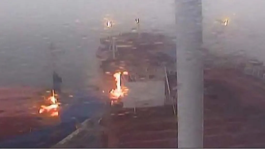
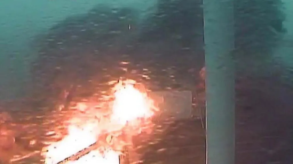
The moment of impact between the Solong cargo ship and the tanker Stena Immaculate was caught on CCTV
Crowley Government Services/MAIB 

From BBC by Kevin Shoesmith


Britain's marine safety body has called for a "radical rethink" over the use of ship lookouts "in the digital age" following a fatal collision in the North Sea and three other incidents.
But any changes to regulations would require international agreement and could take as long as a decade to implement, the BBC has learned.

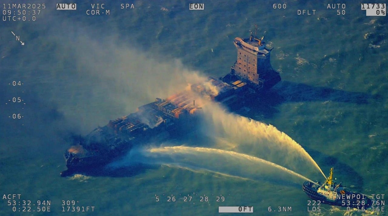
On 10 March, the Portuguese cargo ship Solong struck the US-flagged oil tanker Stena Immaculate, which was laden with jet fuel and anchored 13 miles (20km) off the East Yorkshire coast.
The ships did not have "dedicated lookouts" in what were "patchy conditions", an interim report by the Marine Accident Investigation Branch (MAIB) suggested.

Mark Angelo Pernia, 38, a Filipino crew member on the Solong, remains missing presumed dead, with the ship's captain, Vladimir Motin, accused of gross negligence manslaughter – a charge he denies. Mr Motin is due to stand trial in January.

Now, a new report, also published by the MAIB, suggests that in light of that incident, as well as three other collisions, there is a need to "radically rethink the role of human watchkeepers in the digital age".
It states: "Humans do not make good monitors and if under-stimulated they will find other things to occupy themselves."

 
The Stena Immaculate was carrying more than 220,000 barrels of jet fuel for the US military
Reuters 

The report adds that "humans can... be reluctant to utilise system functions that will alert them to impending problems".

David McFarlane, a marine safety consultant and accredited expert witness, said all vessels, regardless of whether or not they were moving, had "an obligation to keep a proper look-out".

This requirement is stipulated under the International Regulations for Preventing Collisions at Sea, which states that vessels must "maintain a proper lookout by sight, hearing, and all available means, to assess the situation and risk of collision".

Mr McFarlane said crews of cargo ships, including tankers, were assisted by safety mechanisms such as a Bridge Navigational Watch Alarm System (BNWAS).

This was "designed to alert others if the officer of the watch doesn't respond to something, such as another vessel approaching", or to a person "falling asleep or becoming incapacitated".
"These systems require some degree of human intervention. Someone is needed to turn them on when the vessel is moving," he said.
An alternative system, or tweaks to existing technology that would enable them to be "automatically activated" as soon as a vessel set off from port, "could be the way forward". 

 
One member of the Solong's crew is presumed dead, with 36 across both vessels surviving 
Crowley Government Services/MAIB 

According to Mr McFarlane, the Maritime and Coastguard Agency (MCA) could issue an urgent safety ruling requiring UK-flagged ships to be fitted with fully automated anti-collision systems.

However, given the volume of marine traffic from around the world that passes through UK waters, he said it was likely that any proposal would need to pass through the International Maritime Organisation (IMO). 
This "could take between four and 10 years for any measures to be brought in", due to member countries needing to agree.

Mr McFarlane said BNWAS, radar systems and other safety mechanisms, such as the Automatic Identification System, were fitted with "a number of alarms" designed to alert crew to an impending collision.

In respect of BNWAS, he said "an alarm should sound in a public area", in order to ensure others were alerted should the person steering the ship become "incapacitated" or "distracted".

In addition to using new technology to avoid collisions, he said there should be a review of "really tight schedules", which created "very, very hectic conditions" for seafarers.
"Ships will often spend less than 24 hours in port before setting off again," he added. "On top of that, captains will be having to deal with customs and excise and paperwork around the cargo and immigration."

A spokesperson for the IMO said: "We look forward to receiving any proposal from the UK arising from the investigation into the incident."

The MCA said it would be inappropriate to comment before the final conclusions of the MAIB investigation into the North Sea collision were published.

However, a spokesperson said that while there were "comprehensive regulations and international conventions in place" regarding safe watchkeeping practices on vessels, the agency would "consider any formal recommendations from the final report".
 
MCA

Links :