Tuesday, April 30, 2024

AI quickly and accurately predicts major storms’ path and intensity, University of Reading finds


Storm Ciaran batters Folkestone and the large waves form a Lions face in the waves.

From Meteo Tech Int by Elisabeth Baker

The University of Reading has released a study that highlights the rapid progress and transformative potential of artificial intelligence (AI) in weather prediction through an analysis of November 2023’s Storm Ciaran.
 
Machine learning in weather prediction

According to the researchers, AI can quickly and accurately predict the path and intensity of major storms.
The research suggests weather forecasts that use machine learning (ML) can produce predictions of similar accuracy to traditional forecasts faster, cheaper and using less computational power.

Surface land and ship station SYNOP observations of Storm Ciarán at 06 UTC 2 November 2023 extracted from the MetDB database, which holds data including surface and upper air observations and some satellite data. 
Credit: npj Climate and Atmospheric Science (2024). 
DOI: 10.1038/s41612-024-00638-w © Provided by Phys.org
 
The University of Reading  study has now been published in npj Climate and Atmospheric Science.

Professor Andrew Charlton-Perez, who led the study, said, “AI is transforming weather forecasting before our eyes.
Two years ago, modern machine learning techniques were rarely being applied to make weather forecasts.
Now we have multiple models that can produce 10-day global forecasts in minutes.
“There is a great deal we can learn about AI weather forecasts by stress-testing them on extreme events like Storm Ciarán. We can identify their strengths and weaknesses and guide the development of even better AI forecasting technology to help protect people and property. This is an exciting and important time for weather forecasting.” 
 
Promise and pitfalls


To understand the effectiveness of AI-based weather models, scientists from the University of Reading compared AI and physics-based forecasts of Storm Ciarán – a windstorm that hit northern and central Europe in November 2023 which claimed 16 lives in northern Europe and left more than a million homes without power in France.

The researchers used four AI models and compared their results with traditional physics-based models. The AI models, developed by companies like Google, Nvidia and Huawei, were able to predict the storm’s rapid intensification and track 48 hours in advance.
To a large extent, the forecasts were “indistinguishable” from the performance of conventional forecasting models, the researchers said.
The AI models also accurately captured the large-scale atmospheric conditions that fueled Ciarán’s explosive development, such as its position relative to the jet stream – a narrow corridor of strong high-level winds.

The ML technology underestimated the storm’s damaging winds, however.
All four AI systems underestimated Ciarán’s maximum wind speeds, which in reality gusted at speeds of up to 111 knots at Pointe du Raz, Brittany.
The authors were able to show that this underestimation was linked to some of the features of the storm, including the temperature contrasts near its center, that were not well predicted by the AI systems.

To better protect people from extreme weather like Storm Ciaran, the researchers say further investigation of the use of AI in weather prediction is urgently needed to save forecasters time and money.

Links :

Monday, April 29, 2024

Asia’s next war could be triggered by a rusting warship on a disputed reef

The Sierra Madre, a U.S.-built Philippine navy landing craft, was run aground on Second Thomas Shoal and is overseen by the Philippine navy. 
(source Video: Sky News/Film Image Partner via Getty Images)

From WashingtonPost by Rebecca Tan, Regine Cabato and Laris Karklis

Asia’s next war could be triggered by a rusting warship on a disputed reef


In the most hotly contested waterway in the world, the risk of Asia’s next war hinges increasingly on a ramshackle ship past her time, pockmarked with holes, streaked with rust and beached on a reef.

To buttress its claims in the South China Sea, the Philippines in 1999 deliberately ran aground a World War II-era landing ship on a half-submerged shoal, establishing the vessel as an outpost of the Philippine navy.
 
An aerial view shows the BRP Sierra Madre on the contested Second Thomas Shoal, locally known as Ayungin, in the South China Sea, March 9, 2023
 
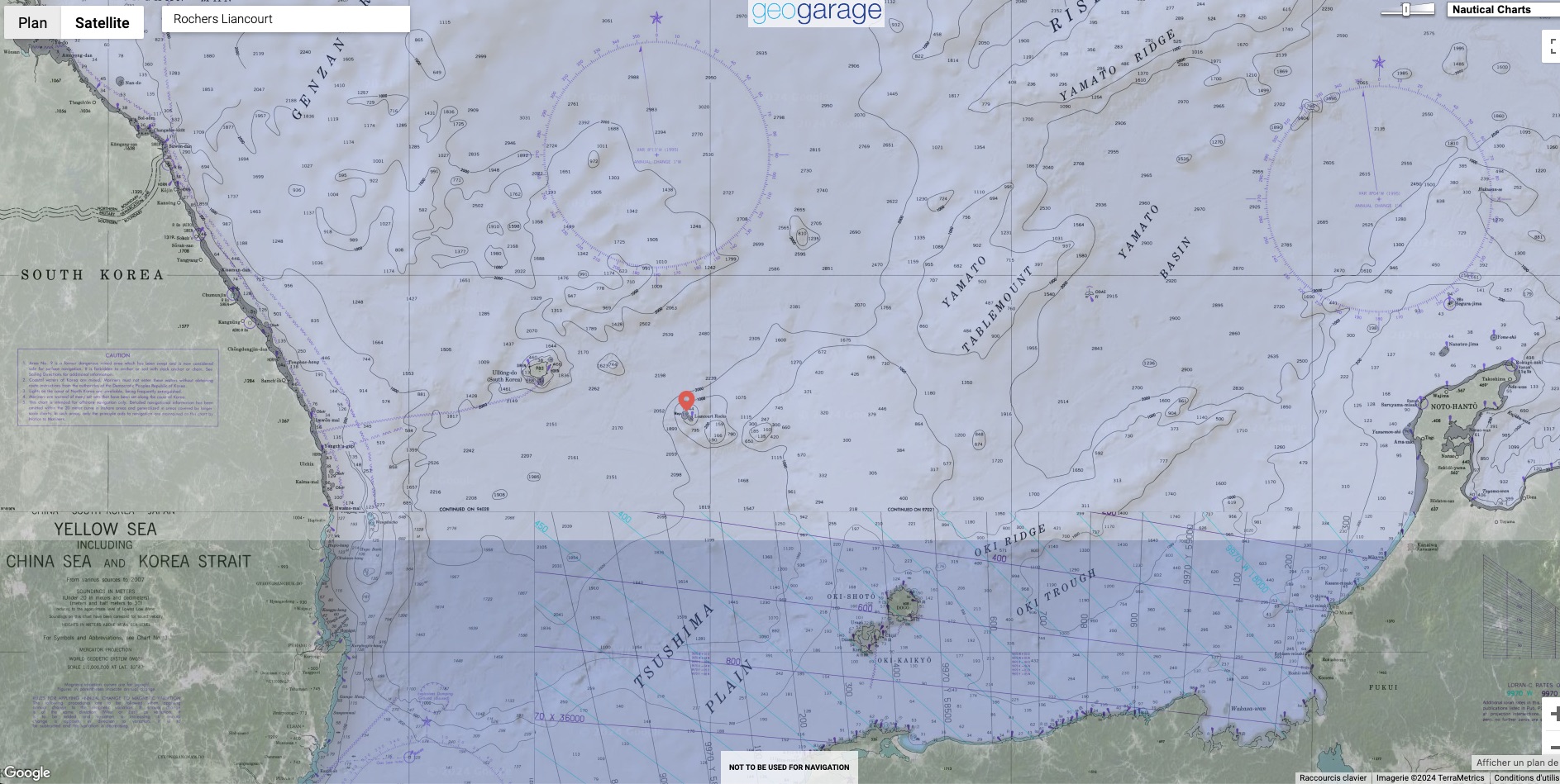
Localization with the GeoGarage platform (UKHO nautical raster chart)
 
The BRP Sierra Madre, which has remained on Second Thomas Shoal ever since, has now become the epicenter of escalating tensions between the Philippines and China — and a singular trip wire that could draw the United States into an armed conflict in the Pacific, say officials and security analysts


A Philippine supply vessel was hit with water cannons by the China Coast Guard on March 23 on its way to bring provisions to the Sierra Madre.
(Video: Armed Forces of the Philippines)


China claims the vast majority of the South China Sea and, in recent months, has ramped up efforts to prevent the Philippines from providing supplies to personnel aboard the Sierra Madre.
Analysis of ship-tracking data and videos over the past year shows that Chinese coast guard and militia ships have repeatedly swarmed and collided with Philippine resupply vessels.
The Chinese vessels have also increasingly deployed water cannons at close-range, at times disabling Philippine ships and injuring sailors.


China’s coastguard fired water cannons at Philippine ships on March 5 as the vessels attempted to resupply the Sierra Madre.
(Video: Armed Forces of the Philippines)


Any further escalation, warn Western and Philippine officials, could lead to open conflict.

Biden administration officials have stressed that an armed attack on a Philippine military vessel, such as the Sierra Madre, would trigger a U.S. military response under a 1951 mutual defense treaty.
Philippine President Ferdinand Marcos Jr. said after meeting with President Bidenin Washington earlier this month that the killing of Philippine service members by a foreign power would also be grounds to invoke the treaty.

China has spent the past three decades expanding its presence in the South China Sea, a strategic waterway through which a third of global shipping passes, according to the United Nations.
Beijing may not intend to start a war here, analysts say, but repeated confrontations at sea between vessels have raised the potential for fateful accidents, also potentially provoking a U.S. response.


Adding to the uncertainty is the question of what to do with the 328-foot Sierra Madre, which is no longer seaworthy and badly degraded after decades of exposure to the elements.
The Chinese say replacing the ship with a more permanent structure is unacceptable.
But in interviews, top Philippine officials said emphatically they will not give up control of Second Thomas Shoal.

At no time in recent decades have geopolitical tensions in the South China Sea reached such a prolonged and precarious state as they have recently at Second Thomas Shoal, said Harrison Prétat, deputy director of the Asia Maritime Transparency Initiative (AMTI) at the D.C.-based Center for Strategic and International Studies.

Members of the Philippine coast guard aboard the BRP Sindangan watch as a Chinese ship sails nearby during a mission last month to resupply Philippine troops on the Sierra Madre at Second Thomas Shoal.
(Ezra Acayan/Getty Images)

The dispute over that shoal — one of dozens of contested islands, reefs and other features — is part of an increasingly perilous competition among the countries that border the South China Sea for sovereignty over these strategic waters and control of the energy and other resources that lie below.

Trouble in the South China Sea

Tensions in the South China Sea have grown more intense than at any time in recent years.
Under President Xi Jinping, China has become more aggressive in asserting sovereignty over the sea’s contested islands, rocks, reefs and other features and the strategic waters that surround them.
A half dozen other countries that border the sea have also been pursuing their own claims and economic interests.
About one-third of the world’s trade passes through the South China sea, according to the U.N., including crucial energy supplies for U.S.
allies Japan and South Korea.
The sea also includes oil and natural gas reserves as well as valuable fishing grounds, coral and minerals.
The U.S.
has not formally endorsed any of these claims, urging that disputes be settled on the basis of international law.
The U.S.
insists on freedom of navigation through these contested waters and has repeatedly sailed warships through them to assert that right.


As China under leader Xi Jinping has grown ever more aggressive in pursuing its claims, Southeast Asian countries such as the Philippines, Vietnam and Malaysia have been taking steps — some in public, some largely below the radar — to assert their own claims and pursue their own economic interests, potentially bringing the region closer to war than at any time in years.

Before every mission to resupply the Sierra Madre, Marcos is briefed, said Philippine officials, as is the U.S. ambassador to the Philippines, according to U.S. officials.
The United States has significantly increased its deployment of Navy personnel in the Philippines in direct response to the situation at the Sierra Madre, said a U.S. State Department official.
Not since the siege of Marawi in 2017, when Islamic State-affiliated rebels seized a town in the Philippine south, has the United States provided such extensive support for a Philippine military operation, said the official, who spoke on the condition of anonymity because he had not been authorized to speak publicly on the issue.

To many in the Philippines, Chinese behavior at Second Thomas Shoal, which they call Ayungin Shoal, has become a symbol of Beijing’s increasingly brazen projection of power.
Orlando Mercado, a former Philippine secretary of defense, called it “the biggest, most graphic illustration of bullying.” 
Commodore Roy Trinidad, a spokesman for the Philippine navy, said it is a display of China’s “expansionist” ambitions.


Video footage shows another angle of the Philippine supply vessel hit by water cannons on March 23 on its way to bring provisions to the Sierra Madre.
(Video: Armed Forces of the Philippines)


“What’s happening in the West Philippine Sea is only a microcosm of what China wants to do to the world,” Trinidad added, using the Philippine name for the waters that it claims.

The Chinese Embassy in the Philippines declined requests for interviews and responded to questions by pointing to a previous statement saying that the Philippines has been violating China’s sovereignty.
“We demand that the Philippines tow away the warship,” the statement said.
Until it is removed, the statement added, China will “allow” resupply missions only if “the Philippines informs China in advance and after on-site verification is conducted.”


Research groups say China has hundreds of vessels deployed across the South China Sea at any time — a mix of coast guard and maritime militia, which are government-funded ships registered for commercial fishing but used to establish China’s presence in disputed waters.
These vessels have loitered around the Sierra Madre for years but began to surge in number in 2023, according to ship location data tracked by AMTI.
In 2021, China on average deployed only a single ship each time the Philippines conducted one of its resupply missions, which are carried out by civilian boats staffed with navy personnel.
By 2023, the average had jumped to 14.
During one mission last December, researchers found at least 46 Chinese ships patrolling Second Thomas Shoal.

*There have been two incidents in 2024 where China has used water cannons on Philippine vessels: March 5 and 23.
The analysis on ships involved for those incidents has not been completed at this time.

Source: CSIS/AMTI, Starboard Maritime Intelligence


During the Dec. 10 resupply mission, Chinese ships largely based at nearby Mischief Reef tried to form a “blockade” at a greater distance from Second Thomas Shoal than before, said Ray Powell, director of SeaLight at Stanford University’s Gordian Knot Center for National Security Innovation.
“They made the approach as tense and as difficult as possible.”


Videos from that day show that as one of the four Philippine ships, M/L Kalayaan, began to near Second Thomas, two significantly larger Chinese vessels pulled up on either side of it, and one blasted it with a water cannon.
The M/L Kalayaan’s engine was damaged and had to be towed back to shore, according to Philippine officials.
The vessel could not reach Second Thomas, though another Philippine ship, the Unaizah May 4, made it through.


Video shows a confrontation between Chinese and Philippine vessels and the use of water cannons in the South China Sea on Dec.
10, 2023. 
(Video: Armed Forces of the Philippines)

Once rare, the use of water cannons has become routine since December.
During a resupply mission on March 5, two Chinese vessels deployed water cannons within several feet of the Philippine ship, shattering its windscreen and injuring four sailors on board.

The Unaizah May 4 returned to shore without delivering its cargo.
When it tried again three weeks later, it was again targeted by water cannons.
This time, the Chinese ships “didn’t stop until the vessel was entirely disabled,” said a Philippine military official who spoke on the condition of anonymity to share undisclosed details of the incident.
The water cannons caused the ship to lose propulsion and wrecked its wooden hull, forcing the crew to transport the supplies to the Sierra Madre on inflatable dinghies.
When the Chinese boats came close, the official added, Chinese personnel on board also yelled at the Philippine crew.
“They were shouting at us, saying, ‘Construction? Construction?’” said the official.


Members of the Philippine coast guard sail a rubber boat past a Chinese coast guard vessel during a mission to resupply Philippine troops aboard the Sierra Madre on March 5.
(Ezra Acayan/Getty Images)
 
China has for months accused the Philippines of secretly transporting construction material to the Sierra Madre in an attempt to “permanently occupy” Second Thomas.
Philippine officials deny this.
Since last October, the Philippines has been conducting “superficial repairs” to the Sierra Madre to ensure habitability for soldiers, but it has not been constructing a new outpost, say officials.

With several Philippine resupply ships damaged and concerns growing over the escalating violence, Philippine officials said they have been rethinking how best to conduct the missions.
“We will not be deterred,” said Trinidad, the navy spokesman.
But neither, say security analysts, will the Chinese.

About this story:
To map the behavior of Chinese and Philippine vessels, The Washington Post drew upon data collected by the Asia Maritime Transparency Initiative at the Center for Strategic and International Studies, and the Gordian Knot Center for National Security Innovation at Stanford University
Both organizations track vessels based on location information transmitted by their Automated Identification System (AIS).
Researchers say the data paints a representative picture of ship behavior but is incomplete because not all ships turn on their AIS.
Chinese vessels, in particular, are known to turn off the AIS, or “go dark,” in the South China Sea.
 
Links :

Sunday, April 28, 2024

Remote sensing of plastic marine litter


The millions of tonnes of plastic ending up in the oceans every year are a global challenge.
ESA is responding by looking at the detection of marine plastic litter from space, potentially charting its highest concentrations and understanding the gigantic scale of the problem.
ESA funded 25 innovative projects to improve detection of plastic marine litter from space, through the Discovery Campaign 'Remote Sensing of Plastic Marine Litter', launched on the ESA’s Open Space Innovation Platform (OSIP).
"The projects address different problems, solutions and approaches, from using existing remote sensing technology in novel applications, to exploring new technologies to monitor marine litter, through developing new data processing, modelling and experimental techniques including approaches based on artificial intelligence," says Paolo Corradi, ESA systems engineer.

Saturday, April 27, 2024

Flying fish picked off from above and below


Flying fish can make powerful, self-propelled leaps out of water into air, where their long, wing-like fins enable gliding flight for considerable distances.
It appears these Flying Fish are in a no win situation, picked off above the surface by Frigatebirds and devoured underwater by the Dorado.

Friday, April 26, 2024

NASA’s CloudSat ends mission peering into the heart of clouds


An artist’s concept shows NASA’s CloudSat spacecraft in orbit above Earth.
Launched in 2006, it provided the first global survey of cloud properties before being decommissioned in March 2024 at the end of its lifespan.
NASA/JPL 

From NASA by Sally Younger
 
Over the course of nearly two decades, its powerful radar provided never-before-seen details of clouds and helped advance global weather and climate predictions.

CloudSat, a NASA mission that peered into hurricanes, tallied global snowfall rates, and achieved other weather and climate firsts, has ended its operations.
Originally proposed as a 22-month mission, the spacecraft was recently decommissioned after almost 18 years observing the vertical structure and ice/water content of clouds.

As planned, the spacecraft — having reached the end of its lifespan and no longer able to make regular observations — was lowered into an orbit last month that will result in its eventual disintegration in the atmosphere.

When launched in 2006, the mission’s Cloud Profiling Radar was the first-ever 94 GHz wavelength (W-band) radar to fly in space.
A thousand times more sensitive than typical ground-based weather radars, it yielded a new vision of clouds — not as flat images on a screen but as 3D slices of atmosphere bristling with ice and rain.

For the first time, scientists could observe clouds and precipitation together, said Graeme Stephens, the mission’s principal investigator at NASA’s Jet Propulsion Laboratory in Southern California.
“Without clouds, humans wouldn’t exist, because they provide the freshwater that life as we know it requires,” he said.
“We sometimes refer to them as clever little devils because of their confounding properties.
Clouds have been an enigma in terms of predicting climate change.”


NASA’s CloudSat passed over Hurricane Bill near the U.S.
East Coast in August 2009, capturing data from the Category 4 storm’s eye.
This pair of images shows a view from the agency’s Aqua satellite (top) along with the vertical structure of the clouds measured by CloudSat’s radar (bottom).
Jesse Allen, NASA Earth Observatory


Clouds have long held many secrets.
Before CloudSat, we didn’t know how often clouds produce rain and snow on a global basis.
Since its launch, we’ve also come a long way in understanding how clouds are able to cool and heat the atmosphere and surface, as well as how they can cause aircraft icing.

CloudSat data has informed thousands of research publications and continues to help scientists make key discoveries, including how much ice and water clouds contain globally and how, by trapping heat in the atmosphere, clouds accelerate the melting of ice in Greenland and at the poles.

Weathering the Storm

Over the years, CloudSat flew over powerful storm systems with names like Maria, Harvey, and Sandy, peeking beneath their swirling canopies of cirrus clouds.
Its Cloud Profiling Radar excelled at penetrating cloud layers to help scientists explore how and why tropical cyclones intensify.


In this animation, CloudSat’s radar slices into Hurricane Maria as it rapidly intensifies in the Atlantic Ocean in September 2017.
Areas of high reflectivity, shown in red and pink, extend above 9 miles (15 kilometers) in height, indicating large amounts of water being drawn upward high into the atmosphere.
Credit: NASA/JPL-Caltech/CIRA

Across the life of CloudSat, several potentially mission-ending issues occurred related to the spacecraft’s battery and to the reaction wheels used to control the satellite’s orientation.
The CloudSat team developed unique solutions, including “hibernating” the spacecraft during nondaylight portions of each orbit to conserve power, and orienting it with fewer reaction wheels.
Their solutions allowed operations to continue until the Cloud Profiling Radar was permanently turned off in December 2023.

“It’s part of who we are as a NASA family that we have dedicated and talented teams that can do things that have never before been done,” said Deborah Vane, CloudSat’s project manager at JPL.
“We recovered from these anomalies with techniques that no one has ever used before.” 
 
NASA's CloudSat Sees Tropical Storm Harvey in 3D in 2017

Sister Satellites

CloudSat was launched on April 28, 2006, in tandem with a lidar-carrying satellite called CALIPSO (short for the Cloud-Aerosol Lidar and Infrared Pathfinder Satellite Observation).
The two spacecraft joined an international constellation of weather- and climate-tracking satellites in Earth orbit.

Radar and lidar are considered “active” sensors because they direct beams of energy at Earth — radio waves in the case of CloudSat and laser light in the case of CALIPSO — and measure how the beams reflect off the clouds and fine particles (aerosols) in the atmosphere.
Other orbiting science instruments use “passive” sensors that measure reflected sunlight or radiation emitted from Earth or clouds.

Orbiting less than a minute apart, CloudSat and CALIPSO circled the globe in Sun-synchronous orbits from the North to the South Pole, crossing the equator in the early afternoon and after midnight every day.
Their overlapping radar-lidar footprint cut through the vertical structure of the atmosphere to study thin and thick clouds, as well as the layers of airborne particles such as dust, sea salt, ash, and soot that can influence cloud formation.

The influence of aerosols on clouds remains a key question for global warming projections.
To explore this and other questions, the recently launched PACE satellite and future missions in NASA’s Earth System Observatory will build upon CloudSat’s and CALIPSO’s legacies for a new generation.

“Earth in 2030 will be different than Earth in 2000,” Stephens said.
“The world has changed, and the climate has changed.
Continuing these measurements will give us new insights into changing weather patterns.” 

More About the Missions

The CloudSat Project is managed for NASA by JPL.
JPL developed the Cloud Profiling Radar instrument with important hardware contributions from the Canadian Space Agency. 
Colorado State University provides science data processing and distribution.
BAE Systems of Broomfield, Colorado, designed and built the spacecraft.
The U.S. Space Force and U.S. Department of Energy contributed resources.
U.S. and international universities and research centers support the mission science team.
Caltech in Pasadena, California, manages JPL for NASA.

CALIPSO, which was a joint mission between NASA and the French space agency, CNES (Centre National d’Études Spatiales), ended its mission in August 2023.

Links :

Thursday, April 25, 2024

China's high-tech ship helps military prepare for war


From Newsweek by Aadil Brar

China's surveillance vessels have mapped Taiwan's coast as Beijing has increased the use of research ships for war preparation, according to a new report.

"The Zhu Hai Yun, which bristles with advanced monitoring and surveillance equipment, charted a course that appears intended to challenge Taiwan and probe the environment around the island," the report by the Centre for International and Strategic Studies (CSIS) said on February 26.

Described as "drone carrier," the Zhu Hai Yun was built by China State Shipbuilding Corporation and owned by Southern Marine Science and Engineering Guangdong Laboratory (Zhuhai), also known as the "Southern Ocean Laboratory" of Sun Yat-sen University, according to a May 2022 report in Marine Executive, a specialist publication on maritime affairs.

The vessel, which can controlled remotely and navigate autonomously in open water, was commissioned into service on January 12, 2023, Chinese state media outlet Global Times reported.

Beijing has increased the use of research vessels for missions in the Indian Ocean, which China says are for research purposes alone.
In October 2023, controversy erupted after the Chinese research vessel Shi Yan 6 docked at the port in Sri Lanka's Colombo, which was protested by India.
Experts have argued that vessels like Shi Yan 6 have links to the People's Liberation Army, Newsweek has previously reported.

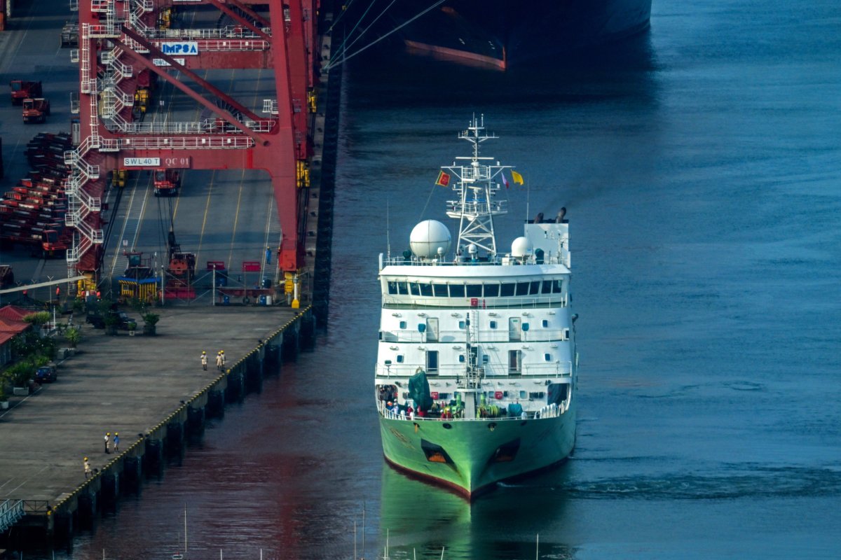
Chinese research ship Shi Yan 6 proceeds to deck at a port in Colombo on October 25, 2023.
China is increasingly using research vessels with links to the People's Liberation Army for gathering insights into Taiwan's military, a new report by the Center for International and Strategic Studies says.

Ishara S. Kodikara/Afp via Getty

"China's scientific research activities in relevant waters are for peaceful purposes and aimed at contributing to humanity's scientific understanding of the ocean.
The activities are in strict compliance with the terms of the United Nations Convention on the Law of the Sea," Wang Wenbin, a spokesperson for the Chinese Foreign Ministry, said on February 6 during the regular press briefing.

The CSIS report, however, underscores the ship's activities as part of what experts describe as an "all-domain pressure campaign" by the People's Republic of China against Taiwan.

"This represents one more tool the People's Republic of China is using in what I call the all-domain pressure campaign against Taiwan," Christopher Sharman, director of the China Maritime Studies Institute at the US Naval War College, told the Financial Times.

The Zhu Hai Yun research vessel has links to the PLA, the CSIS report said.

"Records indicate that the Zhu Hai Yun was built by the 704th Research Institute, a subsidiary of the massive state-owned defense contractor China State Shipbuilding Corporation.
In 2020, the U.S. Commerce Department placed the 704th Research Institute on its Entity List for illegally acquiring U.S.-origin equipment to support the PLA," it said.

The Zhu Hai Yun, equipped with advanced monitoring and surveillance equipment, undertook a path closely along Taiwan's coast, engaging in activities that suggest a deliberate attempt to challenge the island and probe its surrounding environment, the report said.

Notably, near Taiwan's northern coast, the vessel significantly reduced its speed, an action that CSIS interpreted as conducting a research operation.
Furthermore, the ship's course took it into the contiguous zone of Taiwan, coming within 24 nautical miles of the shore, and at points appeared to cross into this sensitive area, the report added.
 
Chinese vessel Xiang Yang Hong 3

"Data accessed from the Windward intelligence platform reveals that, besides the Zhu Hai Yun, only two other Chinese research vessels since 2015 have operated along Taiwan's east coast in a manner that was not suggestive of either direct transit or surveying the seabed for deposits of natural resources.
Just one of those vessels, operating in 2021, circled Taiwan in a route similar to the Zhu Hai Yun's but did not venture nearly as close to the island," it said.

"I can see the PRC using this to penetrate the contiguous zone with a drone swarm to test Taiwan's response and that would greatly increase the risk of an incident," Sharman told the Financial Times.

Despite Chinese sources claiming that the Zhu Hai Yun's purpose is solely for civilian research, evidence suggests a blurred line between the vessel and the People's Liberation Army (PLA).

"In Dalian, the ship docked at a pier operated by the Dalian Institute of Measurement and Control Technology. One of the institute's primary roles is studying ship vibration and acoustics for the Chinese navy," the CSIS report said.
 
Zhu Hai Yun – chinese-built drone mothership boasts autonomous sailing systems

The Zhu Hai Yun is not just a simple research vessel; it carries unmanned surface vehicles (USVs) and undersea gliders equipped with technology such as side-scan sonar, identified by Chinese naval researchers as beneficial for detecting undersea mines and submarines, the report said.
Aerial drones aboard the ship further extend its surveillance capabilities.

Furthermore, the Zhu Hai Yun's primary operator, the Southern Marine Science and Engineering Guangdong Laboratory (Zhuhai), underscores the vessel's links to China's military apparatus, being owned by the Zhuhai municipal government and managed by Sun Yat-sen University (SYSU), an institution with established connections to the PLA, the report said.

Links :

Wednesday, April 24, 2024

South Korea foreign ministry summons Japan diplomat over disputed islands

A navigational chart from the late Edo Period (1603-1867)
shows the disputed Takeshima islets as Japanese territory.
(Provided by the Japan Institute of International Affairs)
 
The disputed Takeshima islets are seen sandwiched between Japan’s Oki island group and South Korea’s Ullung-do island on a navigational chart from the late Edo Period (1603-1867). 
(Masashi Shimizu)
 
From Asahi by Reuters
 
South Korea’s foreign ministry summoned a Japanese diplomat on Tuesday to protest a claim in Japan’s annual diplomatic policy Bluebook over a group of islands between the countries at the center of a longstanding territorial row, Yonhap news reported.
 
Seoul’s official stance remains that Dokdo, which Japan claims as the Takeshima islands, is the “inherent territory” of South Korea.
Photo: AP

Earlier, South Korea’s foreign ministry said it “strongly protests” the claim made in the Diplomatic Bluebook issued by Japan on Tuesday and said the islands were historically and geographically its sovereign territory.
 
Localization with the GeoGarage platform (NGA nautical raster chart)
 
Rochers Liancourt with Google Earth satellite imagery
 
Official ENC from KHOA KR67BD58 at scale 1:5,000

While ties between the two countries have improved recently, the neighbors are at odds over the sovereignty of the islands called Dokdo in South Korea and Takeshima in Japan that lie about halfway between them.
 
The crew of a Korea Coast Guard ship unfurls banners carrying the phrase "Let's Overcome the Coronavirus" near the country's easternmost Dokdo Islets, in this file photo taken Sept. 2, 2021, eight days ahead of the 68th anniversary of Korea Coast Guard Day. 
(Pool photo) (Yonhap)
 
Links :

Tuesday, April 23, 2024

Geosciences sector proving its value across more than just the oil and gas industry

PIKSEL is Sercel's high-resolution 3D marine seismic technology.

From Geosciences by Ariana Hurtado
 
Geosciences sector proving its value across more than just the oil and gas industry
CGG geoscience expert identifies multiple uses for offshore seismic and surveying services


The offshore geosciences sector has been increasingly adapting to meet other seismic and surveying needs outside of the oil and gas industry, with services such as geological and geophysical (G&G) surveys for offshore wind, geothermal and other types of seafloor surveys.

For instance, Kredo Offshore commissioned Fugro in late 2023 to perform metocean and wind measurements offshore Yeonggwang County in South Korea.
Initial investigations are taking place at the project site to determine the suitability for an offshore wind development, with four Seawatch Lidar buoys deployed to take readings from wind, waves, current and meteorological conditions.
Data collection will take place over 12 months, with real-time data supplied to Kredo and its consultants ahead of final reporting.
 

The SEAWATCH® Wind Lidar Buoy represents the next generation of multi-purpose buoys tailored
for the renewable energy industry.
The buoy accurately measures the speed and direction of wind across the diameter of wind turbine rotors, whilst sensors record oceanographic parameters such as ocean waves and current profiles.
The SEAWATCH® Wind Lidar Buoy is a cost-efficient way to measure wind data at heights of conventional offshore wind turbines for wind resource assessments and engineering design criteria.
 
In February 2024, PGS secured an offshore wind site characterization contract from an unnamed company for a project in Europe.
PGS will mobilize a vessel early in July for the two-month acquisition program, deploying an ultrahigh-resolution 3D streamer.
The aim is to provide more detailed subsurface data for shallower targets compared to conventional 2D and geotechnical surveys. 
 
 
FWI technology

For the offshore oil and gas sector, CGG is working on the continued development of full waveform inversion (FWI) technology.
These include more complex wavefield modeling, such as offered by elastic FWI, to improve models and images in more complex subsurface geology; pushing FWI to higher frequencies to greater detail at the reservoir and also for near-surface hazards; using 4D FWI for time-lapse reservoir monitoring direct imaging with FWI as a replacement for migration algorithms.
However, according to the company, FWI technology can be applied to multiple offshore sectors.
 

“Reimaging of legacy seismic data is commonplace in the oil and gas industry, particularly when significant new technologies such as FWI become available.
This is equally applicable to the cost-conscious offshore renewables market, where high-resolution reimaging of seismic data can be an alternative to acquiring and processing new datasets,” Marianne Lefdal, vice president of Geoscience Global Excellence with CGG, told Offshore.

She continued, “For example, high-frequency FWI and FWI imaging are capable of providing shallow near-surface hazard delineation for wind farm site surveys.
In the case of CCUS, high-end reimaging can be combined with rapid interpretation of horizons and faults using machine learning to support screening studies in mature basins.
In both examples, the integration of new technology with geoscience expertise is key to successful application for these specific use cases.”
 
Offshore wind

Sercel, the sensing and monitoring division of CGG, provides earth science, data science, sensing and monitoring services.

“In terms of adapting geophysical surveys to support energy transition projects, Sercel has a range of equipment solutions, which are perfectly suited to the subsurface monitoring of geothermal, CCUS and energy storage projects where high-quality marine streamer, OBN and downhole data will be critical for 4D monitoring,” Lefdal said.

Sercel and Kappa Offshore Solutions released PIKSEL in 2021.
This compact marine seismic technology acquires data for high-resolution 3D imaging of targeted offshore areas.
Kappa noted that the system was designed to improve the efficiency of geohazard assessment surveys, while also providing G&G data integration, which is relevant for the offshore renewable energy sector.

“For offshore renewables, Sercel has a compact marine seismic solution (PIKSEL), which is specially designed for acquiring the best seismic data for high-resolution 3D surveying and geotechnical services for offshore wind,” she said.

Morphosense provides structural monitoring instrumentation and digital twin solutions for the renewables, nuclear and defense sectors.

In March 2023, Sercel acquired Morphosense, a company that provides structural health monitoring and structural integrity management.
At the time, Sercel said this addition allows it to access new market opportunities for the renewables, nuclear and defense sectors.

“Another aspect of offshore wind is the need to maximize the lifespan of assets like wind turbines exposed to challenging environmental conditions,” Lefdal continued.
“Sercel has a range of structural health monitoring solutions, which collect precise real-time measurements of movement and vibrations for analysis and modeling.
For offshore wind, its s-morpho sensors, AI-powered analysis and digital twin modeling solution can be used to identify signs of fatigue and wear and optimize preventive maintenance programs.”
 
Carbon storage

Utilizing its subsurface imaging technology, CGG supplies subsurface insights for carbon storage sites, which includes the initial site screening studies, 3D site characterization as well as planning the monitoring programs for injection and closure.

“We continue to look at how current technology in the oil and gas space can be re-focused to be applied to carbon storage such as 3D seismic imaging and 4D seismic monitoring, but also to continuously investigate what solutions are needed for the future,” Lefdal said..
“This R&D is designed to bring to production next-generation technology solutions that can answer the requirements of carbon storage whether they be driven by geology, regulations, cost structure or new data acquisition methods.”

In February of this year, CGG released its “Southeast Asia Carbon Storage Study” for the CCUS market.
The study ranks and prioritizes opportunities at large scale across 58 basins in Indonesia, Malaysia, Thailand and Vietnam, covering a total surface area of more than 6 million square kilometers, with the aim to provide guidance in identifying the best basins and plays for potential carbon storage.

“We are continuing to expand our portfolio of carbon storage studies, with the recent addition of a ‘Southeast Asia Carbon Storage Study’ to our existing North Sea and US Gulf of Mexico,” Lefdal continued.
“These involve the integration of geophysical, geological and data science expertise to create data-rich studies that provide a clear and reliable assessment of storage potential based on a proprietary quantitative and qualitative criteria-based screening methodology.”
 
The map provides an overview of the basins covered by the "Southeast Asia Carbon Storage Study" and a snapshot of storage play segmentation.

Geothermal

CGG has also been invested in geothermal resources research.
Earlier this year, the company released a white paper on the potential of offshore geothermal energy as a future global resource.
This occurred after completing global geothermal resource and associated lithium brine screening projects over the last three years.

“This is an area where oil and gas geoscience, drilling and engineering expertise could be repurposed to tap vast geothermal resources along the magmatically active ocean floor spreading centers and adjacent flooded rift systems,” Lefdal said.
“These offshore areas could be optimal locations to harvest geothermal resources for power in conjunction with the co-production of freshwater, green hydrogen, and ammonia, collectively creating an alternative set of rapidly scalable green energy solutions.”

She continued, “There are some clear needs for the efficient development of geothermal resources, which include delineating the geothermal ‘reservoir’ and identifying key features such as faults and fracture swarms which, depending on the geology, can either act as fluid conduits and provide permeability in igneous settings or can compartmentalize the reservoir in deep sedimentary basins.”

CGG has experience with more than 150 multiphysics projects for geothermal resource delineation.
According to Lefdal, seismic imaging and attribute analysis will be needed to provide details on faults and fractures, using technologies like fault-constrained tomography and least-squares imaging.

The schematic highlights offshore geothermal resource exploration and development adjacent to sea floor spreading centers generating baseload power, fresh H2O, green H2 and NH3 with the potential for CO2 storage and controlled ocean fertilization.
 
Links :
 

Monday, April 22, 2024

Anglerfish entered the midnight zone 55 million years ago and thrived by becoming sexual parasites

Deep sea anglerfish like Ceratias holboelli colonized the midnight zone and became sexual parasites after a global warming event millions of years ago.
(Image credit: Nature Picture Library/Alamy)

From LiveSciences by Richard Pallardy

Anglerfish first colonized the ocean's midnight zone 55 million years ago, during a period of extreme global warming, a new study finds.
The bizarre fish adapted to thrive in the deep sea by becoming sexual parasites, the researchers said.

 
Anglerfish first colonized the ocean's midnight zone 55 million years ago, during a period of extreme global warming, a new study finds.
The bizarre fish adapted to thrive in the deep sea by becoming sexual parasites, the researchers said.

These fish, in the order Lophiiformes, are among the most diverse vertebrate groups in the deep sea, having assumed a myriad of forms.
Among their most recognizable features are their bioluminescent lures.
The light from these dangling organs entices prey, drawing them within inches of a nightmarish array of needle-like teeth.
 

Angler fish and other monsters from the dark depths of the ocean attract unsuspecting fish with their weird and wonderful brightly lit lures.

Many anglerfish species patrol the benthic, or seafloor, zone, ranging from the near shore to depths of thousands of feet.
They walk along the bottom using modified fins that resemble legs.
But others live in deep open water of the bathypelagic, or midnight zone, 3,000 to 13,000 feet (900 to 4,000 meters) below the surface.

A new study, published Jan.
15 on the preprint server BioRxiv, suggests anglerfish of the group Ceratioidea colonized the midnight zone during the Paleocene-Eocene Thermal Maximum, which occurred 55 million years ago and lasted for around 200,000 years.

This period may have been initiated by volcanic events that released methaneinto the atmosphere.
The temperatures were so extreme, polar seas reached temperatures of up to 73 degrees Fahrenheit (23 degrees Celsius), while tropical sea surface temperatures may have gotten as warm as 97 F (36 C).

The event wiped out numerous deep-sea organisms and likely opened up new ecological niches.
And ceratioid anglerfish, it appears, were primed to take advantage of them thanks to a set of unique adaptations, the researchers revealed.
 
Most ceratioid anglerfish diverged from their more-coastal cousins 50 million to 30 million years ago, aligning with these climatic shifts. 

A female anglerfish with male sexual parasites attached to her body.
(Image credit: Neil Bromhall/Shutterstock)

"What we found is that they went into the deep ocean, much like whales going back into the ocean from walking ancestors," lead author Chase Brownstein, a first year graduate student at Yale, told Live Science.
"Anglerfish just did it in reverse.
They were walking on the ocean floor and they went back up into the water column."

Living in the midnight zone means having no real home — there are no reefs, caves, seaweed or other substrate to grasp onto.
This lifestyle is not conducive to finding a mate, but the researchers suggest anglerfish adopted new breeding strategies to thrive in this featureless landscape.

Firstly, they seem to locate each other by scent.

"The males have these giant nostrils. It's very sci-fi. We think they're picking up on pheromones," Brownstein said.

When an anglerfish does encounter a potential partner in the darkness, it doesn't want to let go.
Sometimes, males temporarily attach to females, which are significantly larger.
"The dimorphism is ridiculous," Brownstein said.
"Males are 1/100 the size of females in some cases."


The anglerfish uses a shiny lure to bring prey within range of its sharp teeth.
But it also has a weirdly clingy side — after finding a female, the male black devil angler latches on and never lets go! 
 
And sometimes the males fuse to their partners permanently — that is, the males are sexual parasites, merging with females' bodies.
In some species, only one male fuses with the female.
In others, multiple males may attach to the female.

This unique reproductive strategy is the result of immune system deficiencies.
Typically, the adaptive immune system would recognize and destroy foreign cells.
But the loss of these immune functions — the generation of certain antibodies for example —enables the female to accept the male as part of her own body, feeding him with her blood supply.
He in turn serves as a permanent sperm bank.

The researchers believe that the degeneration of the immune system and its facilitation of sexual parasitism were advantageous during this period of radical ecosystem upheaval, allowing anglerfish to head off into the featureless depths and diversify into the array of Lovecraftian creatures that stalk the midnight zone today.

"I think this might be an example of what's called exaptation, which is the idea that traits that don't have a clear positive adaptive role are later expressed in a new context and do provide an adaptive role," Brownstein said. 

Links :

Sunday, April 21, 2024

A chain of salps travelling together in the deep blue


salp or "sea grape"


Links : 

Saturday, April 20, 2024

These photos show AI used to reinterpret centuries-old graffiti


Reinterpretations of the etchings
Matthew Attard and Galleria Michela Rizzo


From NewScientist by Christian House

Artist Matthew Attard turned to eye-tracking technology to generate a fresh take on images of ships carved by seafarers on chapels in Malta hundreds of years ago

At the 60th Venice Biennale, Maltese artist Matthew Attard addresses his country’s maritime heritage, along with notions of faith and progress, through the prism of AI-driven technology.
His work focuses on images of ships that were graffitied by seafarers on the stone facades of chapels in Malta between the 16th and 19th centuries, one of which is pictured below.


Ship graffito at Our Lady of the Visitation Chapel, Wied Qirda – Żebbuġ, Malta
Elyse Tonna


Attard, pictured below, retraced the incised lines of the hulls, rigging and billowing sails using his gaze, in a process facilitated by an eye-tracking device and generative algorithms. 
“This gaze was translated into data points by the technology, which were then further interpreted to generate lines or drawings,” he says.

A database of digital images generated from the data points captured the engravings from various perspectives, from which artworks such as 3D scans and video pieces were created.


Matthew Attard with an eye-tracking device.
Elyse Tonna


The maritime graffiti resonates with cultures whose relationship with the sea has been – and still is – crucial, where the ship remains a metaphor for hope and survival.
Similarly, Maltese chapels have long been places of sanctuary.
Attard says he wanted to explore “parallels with our current ‘blind faith’ in digital technology”.

His reinterpretations of the etchings are ghostlike, skeletal impressions, as shown in the main image. “One could argue that even the most traditional mediums, such as a pencil or a piece of charcoal, can be considered a form of drawing technology,” he notes.
His show is at the Malta Pavilion at the Venice Biennale, Italy, commissioned by Arts Council Malta, until 24 November.

Friday, April 19, 2024

What are China’s long- term Antarctic ambitions?

Russia and China repeatedly rejected new marine protection areas in Antarctica
Main image courtesy of Unsplash user Derek Oyen.

From The Interpreter by Benjamin J. Sacks & Peter Dortmans

The recent opening of China’s Qinling base, its third permanent Antarctic station, has worried some Australian and American observers.
Their concerns suggest it may be time for Australia to delineate China’s Antarctic ambitions more clearly and better organise its response.

Qinling station
Image Credit : China News Service - CC BY 3.0
 
Qinling is China’s first base located adjacent to the Ross Sea, south of Australia and New Zealand and near the US McMurdo base.
Its satellite monitoring facility has raised Western apprehensions.
Qinling could become another node in China’s People’s Liberation Army-affiliated BeiDou navigation network and be used to monitor Australian and New Zealand communications.
Antarctica’s sheer remoteness and extreme climate limit its potential for Chinese military activities, at least with existing technology.

Some of Beijing’s own statements have supported these concerns, with China’s National Defense University’s Science of Military Strategy (2020) stating that “the polar regions have become an important direction for our country’s interests to expand overseas and far frontiers, and it has also proposed new issues and tasks for the use of our country’s military power”.
Elizabeth Buchanan notes that the Chinese government’s civil-military fusion law requires “all civilian research activities…to have military application or utility for China.
This extends to China’s Antarctic footprint”.

Qinling is China’s newest station to begin operations in Antarctica.
Concerns raised about China’s new research station in Antarctica : 
Qinling research station in Antarctica could intercept signals from Australia 
(ABC News: Erwin Renaldi)

While experts should be concerned, they might be worried for the wrong reasons.
Claire Young has stressed that Antarctica’s sheer remoteness and extreme climate limit its potential for Chinese military activities, at least with existing technology.
She argues that Qinling is simply too distant from Australia and New Zealand to effectively monitor their communications.
China could more easily monitor from neighbouring states or its disputed South China Sea artificial islands.

A 2023 RAND study, while acknowledging the potential military risks posed by China’s Antarctic activities, added that Chinese officials have affirmed their respect for the 1959 Antarctic Treaty and subsequent protocols, collectively known as the Antarctic Treaty System.
The Madrid Protocol, for instance, banned Antarctic mining.
China is a signatory.
 
 
The Ross Sea Marine Protected Area includes a (1) General Protection Zone; (2) Special Research Zone; and (3) Krill Research Zone (Wikimedia Commons)

What, then, are China’s long-term ambitions? Buchanan has argued that, in the Antarctic semi-regulated global commons, “presence equals power”.
RAND, through an examination of both English- and Chinese-language sources, concluded that Beijing seeks a “right to speak” in Antarctic regional affairs and that this could be part of China’s efforts to shift the balance of Antarctic influence in its favour ahead of any future Antarctic Territory renegotiation.

These efforts appear to be driven primarily by economics, especially in regard to krill fishing and mining, both of which fall under China’s vague goal of Antarctic “utilisation”.
Along with Russia, China’s long-distance fishing fleet – the world’s largest – is rapidly expanding its krill industry, deploying super trawlers in the name of scientific research (in krill research zones) that will eventually collect more krill than is allowed under the Antarctic Territory System.

Both Russia and China have repeatedly rejected new marine protection areas and are likely to continue growing their lucrative fishing industries.
China has so far resisted other signatories’ efforts to rein in its fishing ambitions.
While other signatories are willing to abide by the limits imposed by the Antarctic Territory System, China and Russia appear to want to ignore them.
Australia and its allies and partners should publicly “name-and-shame” China’s activities when and if they violate the Antarctic Territory System.
 
People attend the launch ceremony of China's first domestically built polar icebreaker, Xuelong 2, or Snow Dragon 2, at a shipyard in Shanghai, Sept. 10, 2018.

Similarly, China is eager to undertake onshore and offshore mineral extraction in Antarctica, despite being a signatory to the 1991 Madrid Protocol, which bans such activities.
Some experts posit that in the future, China may be able to develop advanced mining technologies in anticipation of the Protocol’s potential 2048 renegotiation where it may seek to legalise some forms of mining.
As the Antarctic Territory System currently has no enforcement mechanism, RAND added that Chinese Antarctic mining activities could consequently open “the floodgates for similar activities”.

Given that any signatory can call for the Antarctic Treaty’s renegotiation at any time – a privilege China has yet to invoke – it appears Beijing is biding its time while diversifying its Antarctic presence.
Under this reasoning, China’s recent actions, including the opening of Qinling base, constitute long-term shaping activities to place itself in the strongest position possible ahead of any changes to the Treaty.

How should Australia and its allies and partners respond? Some observers have highlighted the Antarctic Territory System’s provision for unannounced inspections as key to mitigating Chinese ambitions.
However, Russia has demonstrated that it can block inspections by making “station runways inaccessible” and switching off station radios “to block parties landing”.

Nengye Liu has suggested that Australia update its 2009 Australia–China Joint Statement to explicitly ensure the peaceful stability of bilateral Antarctic relations, given China’s significant Australian Antarctic Territory presence.
Australia and its allies and partners should publicly “name-and-shame” China’s activities when and if they violate the Antarctic Territory System.
Australia should consider sanctions against relevant Chinese individuals, state-owned enterprises, and the Polar Research Institute of China.

Given the uncertainties of Antarctica’s geopolitical future, as evidenced by growing concerns over China’s regional activities and ambitions, it may be time for the Australian Department of Foreign Affairs and Trade to establish its own Antarctic Affairs office.
Such an office could be charged with establishing Australia’s future strategy and contingencies, working across government to implement its official position, and negotiating and building an international consensus with allies and partners.

Links :