 PIKSEL is Sercel's high-resolution 3D marine seismic technology.
From Geosciences by Ariana Hurtado
Geosciences sector proving its value across more than just the oil and gas industry
CGG geoscience expert identifies multiple uses for offshore seismic and surveying services
The offshore geosciences sector has been increasingly adapting to meet other seismic and surveying needs outside of the oil and gas industry, with services such as geological and geophysical (G&G) surveys for offshore wind, geothermal and other types of seafloor surveys.
For instance, Kredo Offshore commissioned Fugro in late 2023 to perform metocean and wind measurements offshore Yeonggwang County in South Korea.
Initial investigations are taking place at the project site to determine the suitability for an offshore wind development, with four Seawatch Lidar buoys deployed to take readings from wind, waves, current and meteorological conditions.
Data collection will take place over 12 months, with real-time data supplied to Kredo and its consultants ahead of final reporting.
The SEAWATCH® Wind Lidar Buoy represents the next generation of multi-purpose buoys tailored
for the renewable energy industry.
The buoy accurately measures the speed and direction of wind across the diameter of wind turbine rotors, whilst sensors record oceanographic parameters such as ocean waves and current profiles.
The SEAWATCH® Wind Lidar Buoy is a cost-efficient way to measure wind data at heights of conventional offshore wind turbines for wind resource assessments and engineering design criteria.
In February 2024, PGS secured an offshore wind site characterization contract from an unnamed company for a project in Europe.
PGS will mobilize a vessel early in July for the two-month acquisition program, deploying an ultrahigh-resolution 3D streamer.
The aim is to provide more detailed subsurface data for shallower targets compared to conventional 2D and geotechnical surveys.
PGS will mobilize a vessel early in July for the two-month acquisition program, deploying an ultrahigh-resolution 3D streamer.
The aim is to provide more detailed subsurface data for shallower targets compared to conventional 2D and geotechnical surveys.
FWI technology
For the offshore oil and gas sector, CGG is working on the continued development of full waveform inversion (FWI) technology.
These include more complex wavefield modeling, such as offered by elastic FWI, to improve models and images in more complex subsurface geology; pushing FWI to higher frequencies to greater detail at the reservoir and also for near-surface hazards; using 4D FWI for time-lapse reservoir monitoring direct imaging with FWI as a replacement for migration algorithms.
However, according to the company, FWI technology can be applied to multiple offshore sectors.

“Reimaging of legacy seismic data is commonplace in the oil and gas industry, particularly when significant new technologies such as FWI become available.
This is equally applicable to the cost-conscious offshore renewables market, where high-resolution reimaging of seismic data can be an alternative to acquiring and processing new datasets,” Marianne Lefdal, vice president of Geoscience Global Excellence with CGG, told Offshore.
She continued, “For example, high-frequency FWI and FWI imaging are capable of providing shallow near-surface hazard delineation for wind farm site surveys.
In the case of CCUS, high-end reimaging can be combined with rapid interpretation of horizons and faults using machine learning to support screening studies in mature basins.
In both examples, the integration of new technology with geoscience expertise is key to successful application for these specific use cases.”
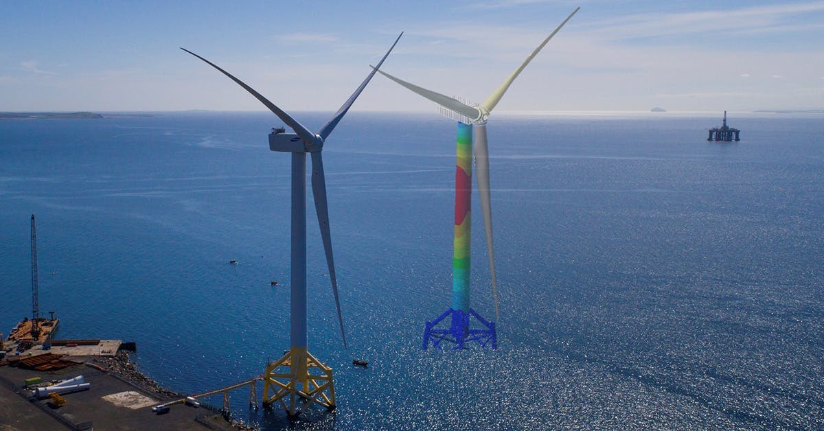
Offshore wind
Sercel, the sensing and monitoring division of CGG, provides earth science, data science, sensing and monitoring services.
“In terms of adapting geophysical surveys to support energy transition projects, Sercel has a range of equipment solutions, which are perfectly suited to the subsurface monitoring of geothermal, CCUS and energy storage projects where high-quality marine streamer, OBN and downhole data will be critical for 4D monitoring,” Lefdal said.
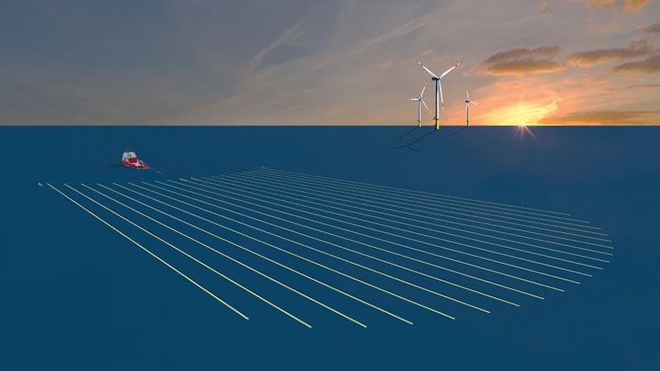
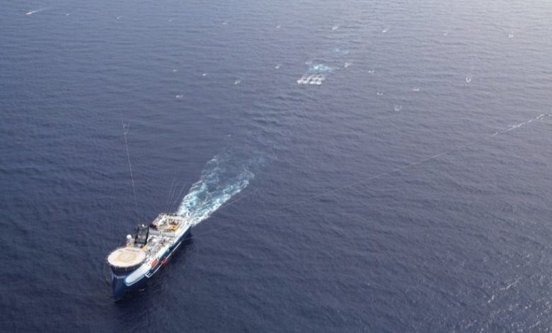
Sercel and Kappa Offshore Solutions released PIKSEL in 2021.
This compact marine seismic technology acquires data for high-resolution 3D imaging of targeted offshore areas.
Kappa noted that the system was designed to improve the efficiency of geohazard assessment surveys, while also providing G&G data integration, which is relevant for the offshore renewable energy sector.
“For offshore renewables, Sercel has a compact marine seismic solution (PIKSEL), which is specially designed for acquiring the best seismic data for high-resolution 3D surveying and geotechnical services for offshore wind,” she said.
Sercel, the sensing and monitoring division of CGG, provides earth science, data science, sensing and monitoring services.
“In terms of adapting geophysical surveys to support energy transition projects, Sercel has a range of equipment solutions, which are perfectly suited to the subsurface monitoring of geothermal, CCUS and energy storage projects where high-quality marine streamer, OBN and downhole data will be critical for 4D monitoring,” Lefdal said.
Sercel and Kappa Offshore Solutions released PIKSEL in 2021.
This compact marine seismic technology acquires data for high-resolution 3D imaging of targeted offshore areas.
Kappa noted that the system was designed to improve the efficiency of geohazard assessment surveys, while also providing G&G data integration, which is relevant for the offshore renewable energy sector.
“For offshore renewables, Sercel has a compact marine seismic solution (PIKSEL), which is specially designed for acquiring the best seismic data for high-resolution 3D surveying and geotechnical services for offshore wind,” she said.
 Morphosense provides structural monitoring instrumentation and digital twin solutions for the renewables, nuclear and defense sectors.
In March 2023, Sercel acquired Morphosense, a company that provides structural health monitoring and structural integrity management.
At the time, Sercel said this addition allows it to access new market opportunities for the renewables, nuclear and defense sectors.
“Another aspect of offshore wind is the need to maximize the lifespan of assets like wind turbines exposed to challenging environmental conditions,” Lefdal continued.
“Sercel has a range of structural health monitoring solutions, which collect precise real-time measurements of movement and vibrations for analysis and modeling.
For offshore wind, its s-morpho sensors, AI-powered analysis and digital twin modeling solution can be used to identify signs of fatigue and wear and optimize preventive maintenance programs.”
Carbon storage
Utilizing its subsurface imaging technology, CGG supplies subsurface insights for carbon storage sites, which includes the initial site screening studies, 3D site characterization as well as planning the monitoring programs for injection and closure.
“We continue to look at how current technology in the oil and gas space can be re-focused to be applied to carbon storage such as 3D seismic imaging and 4D seismic monitoring, but also to continuously investigate what solutions are needed for the future,” Lefdal said..
“This R&D is designed to bring to production next-generation technology solutions that can answer the requirements of carbon storage whether they be driven by geology, regulations, cost structure or new data acquisition methods.”
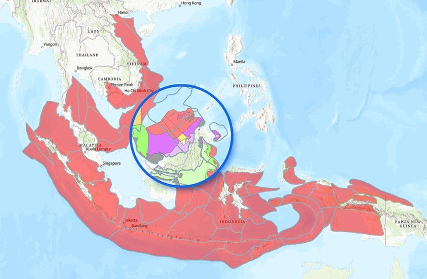
In February of this year, CGG released its “Southeast Asia Carbon Storage Study” for the CCUS market.
The study ranks and prioritizes opportunities at large scale across 58 basins in Indonesia, Malaysia, Thailand and Vietnam, covering a total surface area of more than 6 million square kilometers, with the aim to provide guidance in identifying the best basins and plays for potential carbon storage.
“We are continuing to expand our portfolio of carbon storage studies, with the recent addition of a ‘Southeast Asia Carbon Storage Study’ to our existing North Sea and US Gulf of Mexico,” Lefdal continued.
“These involve the integration of geophysical, geological and data science expertise to create data-rich studies that provide a clear and reliable assessment of storage potential based on a proprietary quantitative and qualitative criteria-based screening methodology.”
Utilizing its subsurface imaging technology, CGG supplies subsurface insights for carbon storage sites, which includes the initial site screening studies, 3D site characterization as well as planning the monitoring programs for injection and closure.
“We continue to look at how current technology in the oil and gas space can be re-focused to be applied to carbon storage such as 3D seismic imaging and 4D seismic monitoring, but also to continuously investigate what solutions are needed for the future,” Lefdal said..
“This R&D is designed to bring to production next-generation technology solutions that can answer the requirements of carbon storage whether they be driven by geology, regulations, cost structure or new data acquisition methods.”
In February of this year, CGG released its “Southeast Asia Carbon Storage Study” for the CCUS market.
The study ranks and prioritizes opportunities at large scale across 58 basins in Indonesia, Malaysia, Thailand and Vietnam, covering a total surface area of more than 6 million square kilometers, with the aim to provide guidance in identifying the best basins and plays for potential carbon storage.
“We are continuing to expand our portfolio of carbon storage studies, with the recent addition of a ‘Southeast Asia Carbon Storage Study’ to our existing North Sea and US Gulf of Mexico,” Lefdal continued.
“These involve the integration of geophysical, geological and data science expertise to create data-rich studies that provide a clear and reliable assessment of storage potential based on a proprietary quantitative and qualitative criteria-based screening methodology.”
The map provides an overview of the basins covered by the "Southeast Asia Carbon Storage Study" and a snapshot of storage play segmentation.
Geothermal
CGG has also been invested in geothermal resources research.
Earlier this year, the company released a white paper on the potential of offshore geothermal energy as a future global resource.
This occurred after completing global geothermal resource and associated lithium brine screening projects over the last three years.
“This is an area where oil and gas geoscience, drilling and engineering expertise could be repurposed to tap vast geothermal resources along the magmatically active ocean floor spreading centers and adjacent flooded rift systems,” Lefdal said.
“These offshore areas could be optimal locations to harvest geothermal resources for power in conjunction with the co-production of freshwater, green hydrogen, and ammonia, collectively creating an alternative set of rapidly scalable green energy solutions.”
She continued, “There are some clear needs for the efficient development of geothermal resources, which include delineating the geothermal ‘reservoir’ and identifying key features such as faults and fracture swarms which, depending on the geology, can either act as fluid conduits and provide permeability in igneous settings or can compartmentalize the reservoir in deep sedimentary basins.”
CGG has experience with more than 150 multiphysics projects for geothermal resource delineation.
According to Lefdal, seismic imaging and attribute analysis will be needed to provide details on faults and fractures, using technologies like fault-constrained tomography and least-squares imaging.
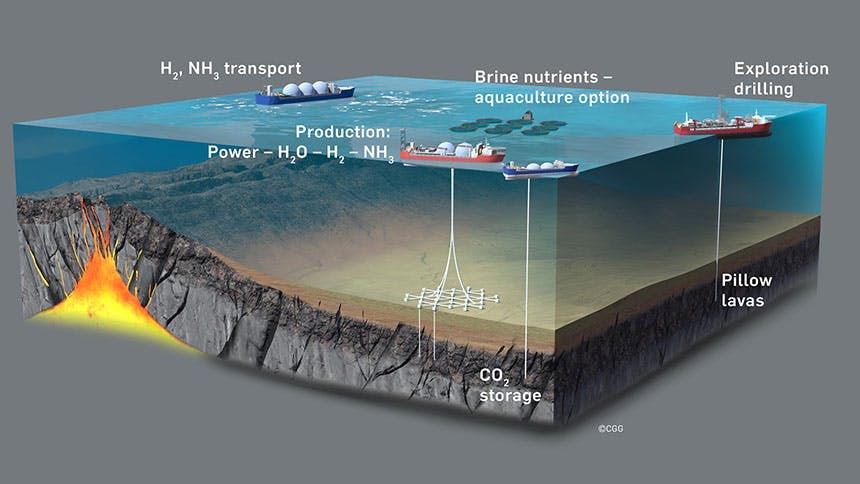
The schematic highlights offshore geothermal resource exploration and development adjacent to sea floor spreading centers generating baseload power, fresh H2O, green H2 and NH3 with the potential for CO2 storage and controlled ocean fertilization.
Links :
- Offshore : CGG identifies global potential for offshore geothermal energy / CGG reveals findings on Far East carbon storage potential / CGG, C-Questra enter carbon capture agreement / CGG tracks west with GoM carbon storage study
- Oil Review : New FWI technology from DUG replaces traditional processing and imaging workflows
- GeoExPro : FWI Imaging under complex geological anomalies
No comments:
Post a Comment