Monday, January 29, 2024

Under sea, under stone

Gerard Mercator's Septentrionalium Terrarum Descriptio is map of the Arctic, which was first published in 1595. 
Mercator's 1595 View of the Arctic is an annotated interactive presentation of the original map. Mercator's map of the Arctic is not entirely accurate.
It was plotted using contemporary discoveries but also uses myths and hearsay to fill in the gaps in real knowledge.
For example the map shows the location of a race of "Pygmies, at most 4 feet tall", living in the Arctic.
The map also seems to rely heavily on Inventio Fortunata, the travelogue of a Franciscan friar, which described the North Pole as a magnetic island surrounded by a giant whirlpool.
The map also includes the location of a very northerly California and, in one of the map's roundels, a depiction of the phantom island of Frisland. 
(from GoogleMapsMania

 Arctic Ocean in 2024
 
From RFEL by Mike Eckel, Wojtek Grojec, and Ivan Gutterman

How The U.S. Claimed Vast New Arctic Territory -- In An Unusual Way
 
As competition for resources in the Arctic Ocean intensifies, nations are staking claims to swaths of undersea territory where oil, gas, and other minerals could someday be found and mined.
The United States has just staked its own claim -- and it did so in a way that’s raising lots of questions.

Seventeen years ago, a pair of Russian minisubs whose crew included a prominent polar explorer descended to about 4,300 meters below the surface of the Arctic Ocean.
Using a mechanical arm, the crew planted a Russian tricolor flag made of titanium into the seabed and staked claim to hundreds of thousands of kilometers of mineral-rich undersea territory.
“Our dive, our action, was a geographical event, not a political one; it was like planting a flag on Everest or on the moon,” the explorer, Artur Chilingarov, asserted years later.

Others didn’t see it that way.
Though it had little scientific significance, the stunt infuriated other Arctic nations and kicked the international rush to map out claims to the seabed into high gear.
Last month, the United States planted its own figurative flag on a huge chunk of Arctic undersea territory, staking out an expanse of seabed twice the size of California.

The new U.S. claim covers about 1 million square kilometers in the Beaufort Sea, a windswept expanse stretching hundreds of kilometers north from Alaska’s coastline.
The area the United States is eyeing is what’s called the “extended continental shelf” -- what would essentially be the farthest reaches of U.S. territory under the sea.
It could contain huge oil and mineral resources: 90 billion barrels of oil potentially, according to a 2008 report by the U.S. Geological Survey.
 
Definition of the outer limits of the continental shelf as found in Article 76 of UNCLOS.
Resource rights in ECS regions are limited to the seabed.
The extended continental shelf ends 350 nautical miles (NM) fr m the baseline, or 100 nm from the 2,500 meter isobath line, whichever is greater.
 
Other countries have done the same thing for their “extended continental shelf.” 
Russia, for example, has submitted several claims under a process sketched out by a 1994 UN treaty called the Convention on the Law of the Sea.
Among other things, the treaty, known widely by its acronym UNCLOS, set up a way for countries to collect evidence, make a territorial claim, and have the claim reviewed by scientific experts.

But while Russia is a member of UNCLOS, the United States isn’t.
The announcement made by the U.S. State Department last month essentially boils down to this: If we were ever part of the treaty, which may or may not happen someday in the future, then this is what our claim would look like.
“It was a very unconventional and surprising move,” said Rebecca Pincus, director of the Polar Institute at the Wilson Center in Washington, D.C.
“As the kids would say, it’s a choice, because yes, the U.S. has claimed a million square kilometers of territory, which is great, but we have done so in a way that raises some questions about international law,” she said in an interview.

The U.S. perspective is, “‘We’re not staking a claim, we’re merely registering, we’re declaring the limits of what is ours by nature of geology, rather than through some sort of political flag-planting, as it were,’” said Philip Steinberg, a political geographer and head of the Center for Borders Research at Durham University in Britain.


For its part, the United States spent nearly two decades mapping and exploring before finalizing its claim, publicly released on December 19: “The largest offshore mapping effort ever conducted by the United States.” 
The claim extends north, toward the North Pole, away from the “exclusive economic zone.” 
It’s located entirely in the Beaufort Sea and includes the undersea formations known as the Beaufort Shelf and the Beaufort Slope.
It also includes part of a formation called the Chukchi Shelf and the Chukchi Borderland.
It does not include any claim to territory west of a maritime boundary that the United States and the Soviet Union agreed on in 1990.

In Russia, the U.S. move was met with skepticism, if not hostility.
“The unilateral expansion of borders in the Arctic is unacceptable and can only lead to increased tensions,” Nikolai Kharitonov, a lawmaker who heads the Russian parliament’s Arctic committee, told RIA Novosti.
“Before anything, it’s necessary to prove the geological affiliation of these territories, as Russia did in its own time.”
Neither Denmark nor Norway responded to requests for comment.
A spokeswoman for Canada’s Foreign Ministry said in an e-mail: “The government of Canada will continue its efforts to obtain international recognition of the outer limits of Canada's extended continental shelf.
Canada and the U.S. are in frequent communication with regards to the continental shelf in the Arctic, and have expressed their commitment along with other Arctic states to the orderly settlement of overlapping claims.”
 
In its announcement justifying the claim, the U.S. State Department said that Washington had “strongly supported” the treaty and that “it has been the policy of the United States to act in a manner consistent with its provisions with respect to traditional uses of the ocean.” 
 
Asked for further response to the criticism of the U.S. position, a State Department spokesperson said UNCLOS reflected “customary international law” -- a legal concept that basically says if a general practice or norm is widely accepted by nations and consistent and recognized over time, then it essentially amounts to a law.
“Like past administrations, both Republican and Democratic, this administration supports the United States joining the Law of the Sea Convention,” the spokesperson said in an e-mail.
“The United States has consulted widely with UNCLOS parties on this matter and will continue to do so. Our approach is inclusive and transparent.”
Elizabeth Buchanan, an expert on polar geopolitics with the Modern War Institute at the U.S.
Military Academy in New York, called the U.S. claim “somewhat schizophrenic.” 
“This erodes credibility of an international system the West has worked tirelessly to achieve, promote, and protect.” 
“It appears to be a political signal with no clear direction or intention beyond clarifying there is a thinning line between customary law and American exceptionalism,” she told RFE/RL in a text message.

Pincus echoed the notion that the claim was consistent with the treaty.
“But yeah, at the same time, it's what our competitors are saying.
You look at the Russian coverage of this and it's once again, ‘The United States is not playing by the rules that, you know, everyone wants everyone else to follow,’” she said.
“There is certainly that interpretation out there.”
 
Also raising eyebrows among Arctic experts and cartographers: the fact that Washington justified the announcement by citing a treaty clause -- Article 76 -- which it said allowed the United States to submit the claim to the UNCLOS commission even though it is not part of UNCLOS.
For example, when countries submit technical data to the commission, Steinberg said, the understanding is that the commission will review them -- a peer-review process, essentially.
“I do see where Russia has a perspective to say, ‘How do we know’ the U.S. claims are valid?” he said.
“That said, I wouldn’t say necessarily it’s an inherently belligerent act.” The claim, Pincus said, highlights “how political paralysis in Congress is impacting the U.S. ability to be effective or lead in the Arctic.”
 “While Russia is pouring billions of dollars into building out Arctic infrastructure, and building yet more icebreakers to add to its fleet, already the world’s largest, the United States is unable to confirm ambassadors for Arctic affairs, or vote on UNCLOS, or even allocate money to update [the] over-the-horizon radar station,” she said.
“From a State Department perspective, this is something that they can do, they can get this announcement out there, and I kind of get it,” she added.
“You can sort of understand why they would say, ‘Well, it seems like we might as well just put this out there.
You know, in the meantime, because it seems very unlikely that we're going to get UNCLOS ratification anytime soon.”

Links :

Sunday, January 28, 2024

Requiem for a whale

Requiem for a Whale from The New Yorker
After a deceased fin whale washes ashore in Israel, onlookers process its life and death, in a short documentary by Ido Weisman.
In “Requiem for a Whale,” the decomposing animal becomes a backdrop for selfies, no matter how callous or distasteful the photos may appear to some.
 
From The New Yorker by Ido Weismand / Nathan Burstein

The opening shots of “Requiem for a Whale,” an evocative, new short film by the director Ido Weisman, are momentarily destabilizing: are we seeing a nature documentary, or a murder mystery?
As the winter sun dips below the Mediterranean Sea, a soft rain falls on a beach—and then the camera lands on the victim: a seventeen-metre whale. In the fading dusk, an investigator arrives with a flashlight to examine the scene.
The cause of death may be pollution; the perpetrator, to some degree, is us.

Shot in two days in February, 2021, “Requiem for a Whale” conveys the tragedy of the young creature’s death, while also following the response of human observers.
Like virtually every other unusual sight in the era of smartphones, the decomposing animal becomes a backdrop for selfies, no matter how callous or distasteful the photos may appear to some.
Officials from Israel’s Nature & Parks Authority arrive to perform an autopsy; journalists report at the scene.
From high above, a breathtaking drone shot captures the whale, the waves, and the human scrum.

Encountering the death of such a large creature prompts reflection—and the film’s structure matches that impulse, combining visual material from the days after the whale washed ashore with voice-over conversations conducted later on. Weisman was a student filmmaker when he shot the footage; by the time he returned home to Tel Aviv, a large excavator vehicle—the kind you’d be more likely to see at a construction site—had already buried the whale in the sand.
Weisman realized that he had the images, but not the sense of context or meaning, to make a documentary.
In the months that followed, he contacted a number of the witnesses he had encountered on the beach, asking about their reactions in interviews that sometimes yielded emotional disclosures.
“I felt as if he was crying,” one witness says, referring to the whale.
“I remember standing in front of him and asking him for forgiveness.”

“Requiem for a Whale” has been nominated for Best Short Documentary at next month’s Ophirs, Israel’s Academy Awards, after winning prizes at several film festivals.
The project served as Weisman’s thesis at Tel Aviv University, and took on a deep personal resonance for reasons that the director didn’t initially recognize.
That connection is movingly revealed late in the film, which also records, without comment, the eerie coupling of the whale’s demise and the covid-19 pandemic.
Many of the beachgoers wear masks; Weisman recalled that his own face covering partly shielded him from the odor of the rotting carcass, which he described, not unkindly, as “one of the most disgusting smells” he had ever experienced.

According to the Bible, a more famous incident involving a whale took place not far from the scene in the documentary.
In the Book of Jonah, the Israelite prophet spends three days in the belly of a whale as divine punishment, before being spit back on the shore.
The purported site of that landing, known in Hebrew as Jonah’s Hill, stands a modest distance from where Weisman shot his film, a fact he discovered while doing research. 
“I thought about this not in a religious way but in an environmental way,” he said, when asked about the connection.
The incident in his film, he reflected, taught its own lesson.
“The whale is a message about our behavior as human beings,” he said.
“That we need to be better, and more kind to this place.” 

Saturday, January 27, 2024

The Last Cape Horners


Gustaf Erikson of Finland owned the last great fleet of sailing ships the world would ever see.
We have rare first hand accounts from men who sailed from Europe to Australia to load grain and return to Europe by way of the treacherous Cape Horn.
These sailings were known world wide as The Last Grain Gaces.

Friday, January 26, 2024

Antarctic canyon discovered during wild weather


From Antarctica

A massive underwater canyon has been discovered in Antarctica by acousticians on board icebreaker RSV Nuyina.

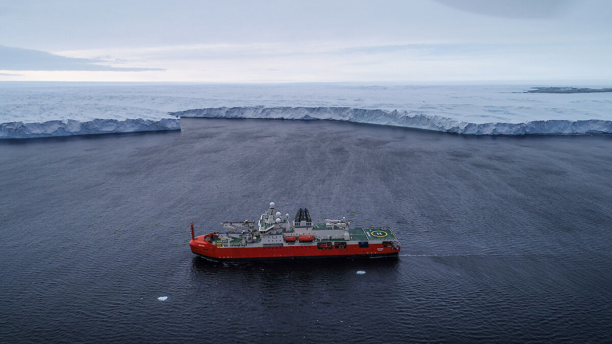
RSV Nuyina off the Vanderford Glacier in 2021.
(Photo: Pete Harmsen)
 
The canyon was discovered when wild weather forced resupply work at Casey research station to be temporarily suspended.

Rather than sit and wait for the weather to pass, voyage leadership decided to use the time to map the seafloor at the nearby Adams Glacier, about 70 km away.

localization with the GeoGarage platform (NGA nautical raster chart)
 
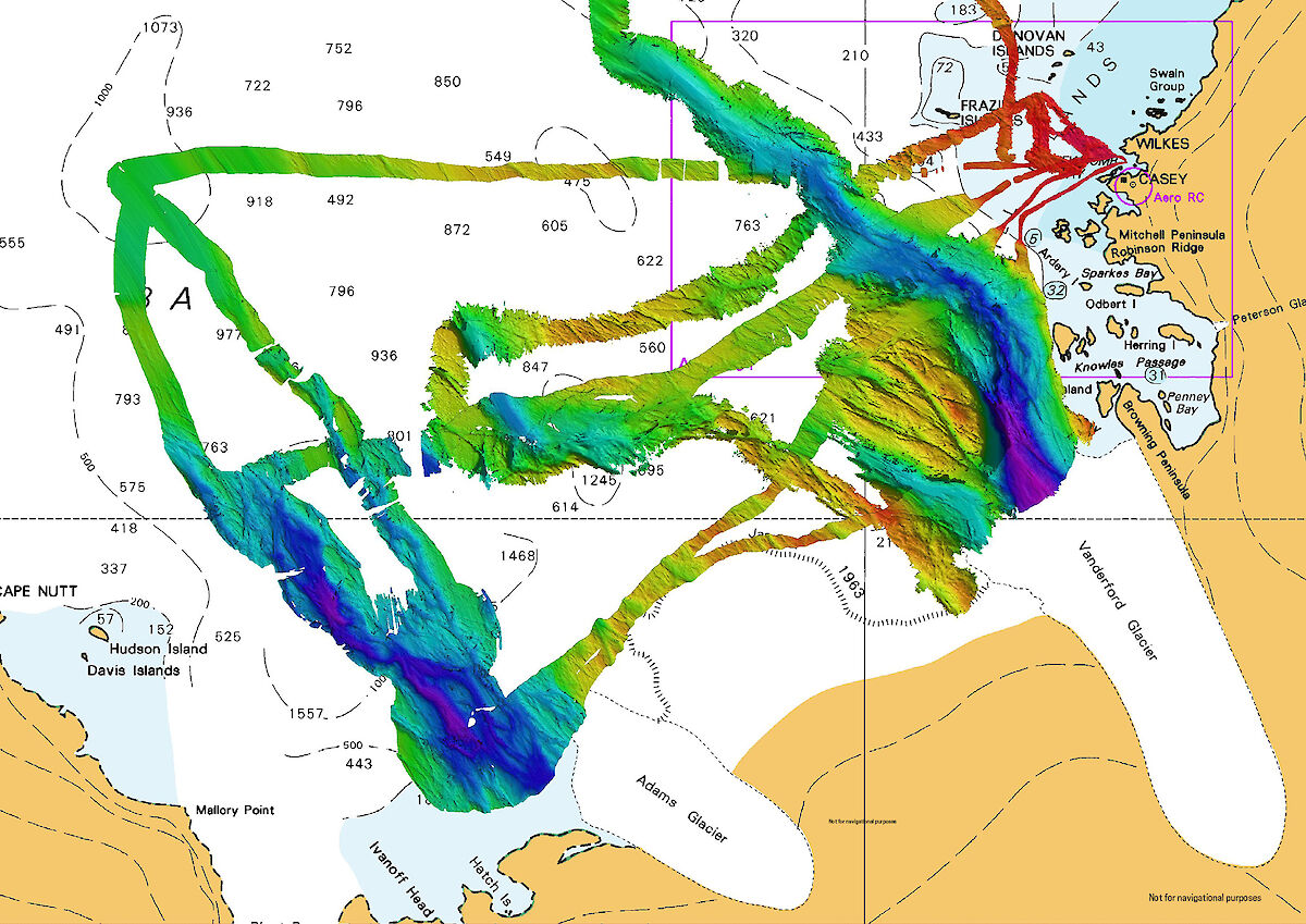
What they found was remarkable – a 2100 metre-deep, 9000 metre-wide canyon, extending more than 25 nautical miles (more than 46 kilometres) off the glacier front.

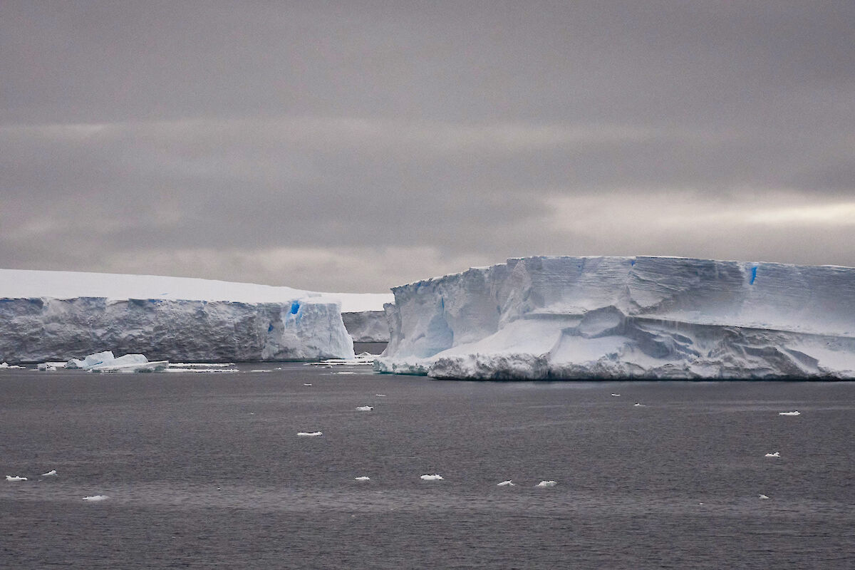
Icebergs at the front of Adams Glacier.
(Photo: Keith Deverell)

For senior acoustician Alison Herbert, and science systems engineer Tom Rushton Brumby, it’s the second time they’ve discovered an impressive Antarctic seafloor feature using the ship’s acoustic instruments.
 
Acousticians mapped a canyon in front of Adams Glacier earlier this year, while the Vanderford Canyon was mapped from RSV Nuyina on her maiden voyage in 2021-22.
Blue and purple colours indicate deep water.
(Photo: AAD/hydrographic material reproduced with permission of The Australian Hydrographic Office © Commonwealth of Australia 2024)


“This latest mapping adds to our initial discovery two years ago, on Nuyina’s maiden voyage to Casey, when we mapped the nearby Vanderford Canyon, which is 2200 metres deep, 2000 metres wide and at least 55 kilometres-long,” Ms Herbert said.
“Nuyina’s multibeam echosounder gives us much greater capability for detailed mapping of the seafloor than we’ve ever had before, and these two new discoveries suggest there will be many more to come.”

The acoustics team initially discovered just the southern tip of the canyon before the ship had to return to Casey for cargo operations.

 STRM bathymetry with the GeoGarage platform around Adams glacier

Voyage Leader Keith Ashby said that, fortunately, bad weather enabled the return of the vessel to the area a few days later, when further observations were taken in very difficult conditions.
“Four metre seas and 50 knot winds put a hold on our resupply operations at Casey, so we decided to ride out the weather in open water, allowing our acoustics team to conduct about 15 hours of mapping in front of Adams Glacier,” Mr Ashby said.
“Then on our way back to Australia we made another fleeting visit to fill in some remaining gaps, resulting in a comprehensive picture of this deep, glacial trough.
“As the voyage was primarily for station resupply, the fact that we had any opportunity to complete some seabed mapping was really pleasing. To discover a substantial feature like a large canyon was genuinely exciting.”

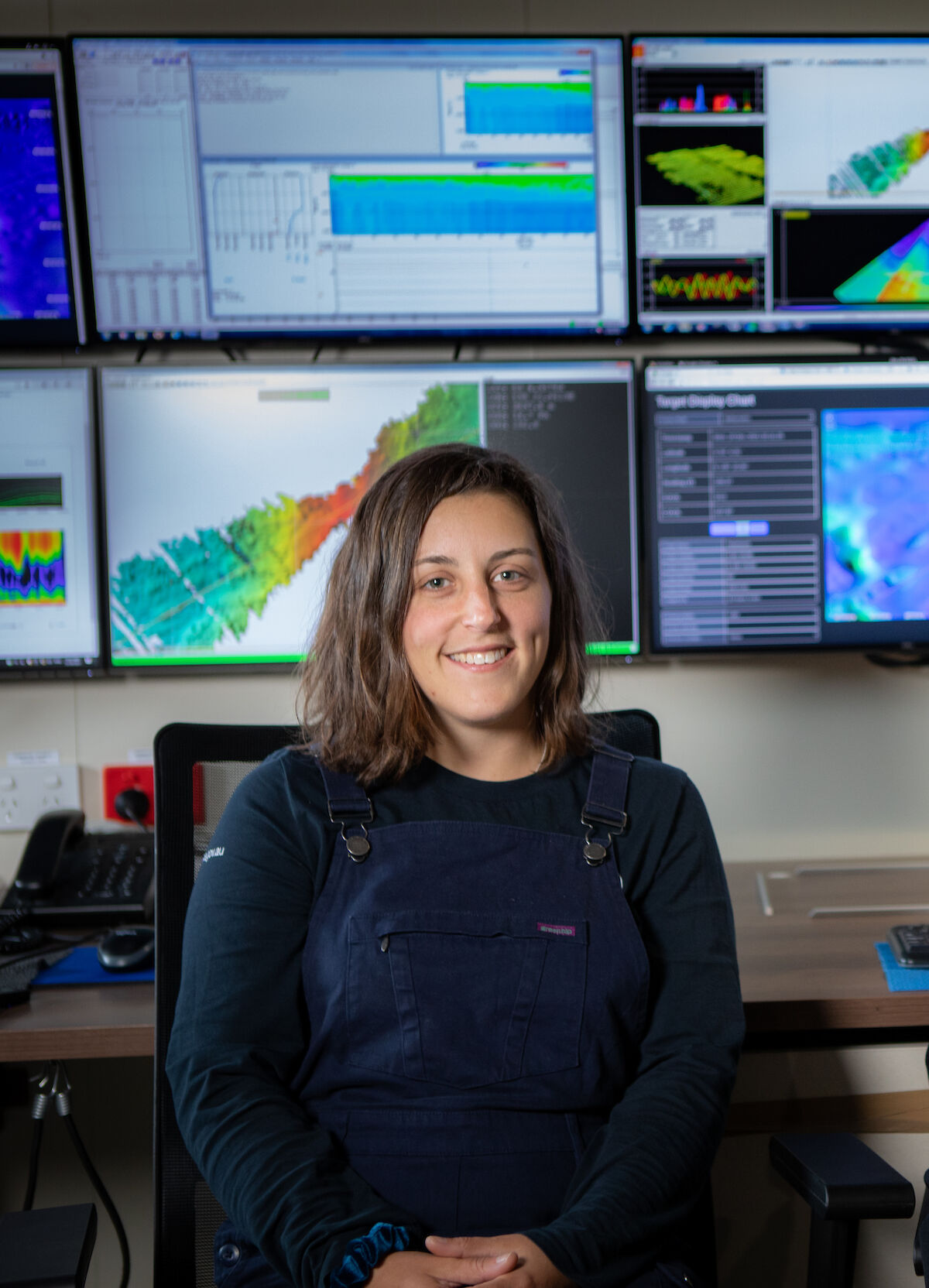
Acoustician Alison Herbert on board RSV Nuyina.
(Photo: Pete Harmsen)

The Nuyina’s multibeam echosounder works by sending out pings of sound in a fan-shape beneath the ship and ‘listens’ to the returning echoes to build a picture of the seafloor.
“I always find it fun, and almost mesmerising, to make a rainbow road of the seabed ping by ping,” Ms Herbert said.

Among other things, maps of the seabed generated using multibeam echosounder data provide insights into the geological and glacial history of the area and allow scientists to identify areas for further study.

RSV Nuyina technology manager, Lloyd Symons, said the ship had risen to the challenge it was designed for.
“One of the specific objectives in building RSV Nuyina was to provide Australia with the capability to map the Antarctic continental shelf,” Mr Symons said.
“Discovery and mapping of these deep glacial canyons is key to developing better models of the interaction between the Antarctic ice sheet and the ocean. This is just the beginning."
 
Links :

Thursday, January 25, 2024

Remote hydrography and regulation: mission impossible?


From Hydro by David Vincentelli, Nicolas Gracieux


Legal frontiers of USVs

The development of unmanned and autonomous surface vehicles in recent years has triggered a new era in civilian and military maritime operations.
One of the applications that is likely to benefit from this technological revolution is seabed mapping.
Exail (formerly iXblue) decided to make maritime autonomy and remote hydrography a key technology priority in 2017, when it released its first DriX unmanned[1] surface vessel (USV).
Since then, the DriX USV has become a large commercial success, with more than 20 units built and sold around the world (USA, UK, Korea, Brazil, Poland, UAE, Japan, etc.), and operations in many more countries, such as Canada, Taiwan, Saudi Arabia, Bahrein, New Zealand and Tonga.

In a world that is in constant need of field-proven data but is also highly concerned about the impact of human activities, the environmental impact of shipborne missions hangs in the balance.
The introduction of USVs helps the acceptance of such investments by considerably reducing the carbon footprint of the survey – an improvement of over 95% in energy consumption in the case of DriX.
During a survey conducted in February 2023 in the Bay of Biscay, DriX covered 2,400 nautical miles in 12 days of operations, using 600L of fuel for the DriX mission and up to 2,000L for the associated logistics, mobilization and escort vessels in the visited ports.
A comparison for the same client, who carries out this type of mission every year with crewed vessels, reveals that using DriX saved 200,000L of fuel.

USVs can be regarded as a force multiplier and complementary data collection subsystem to mother research or military vessels, or as a stand-alone tool working from port to port for dedicated mapping and environmental assessments.
This capability allows key players to integrate USVs into their long-running survey routines and provides long maritime persistence at sea for new players with fewer investment capabilities.

Despite these successes and the return on experience gathered, some operators remain cautious about the potential risks – whether legal or operational – associated with the exploitation of such autonomous vehicles and technologies.
Nevertheless, Exail has demonstrated over the years that the advantages of autonomous technology and unmanned vessels such as DriX considerably outweigh the potential risks.
For Exail, the experience at sea has demonstrated that the risks associated with the operation of an unmanned vehicle can be reasonably mastered.

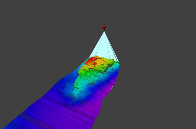
Visualization of multibeam echosounder data acquisition conducted by the DriX USV.
Legal qualification for USVs

As far as we know, there is no current unified international definition of a ship.
The United Nations Convention on the Law of the Sea (UNCLOS), signed in Montego Bay in 1982, refers in all its provisions to ships without providing a definition.
Nevertheless, being qualified as a ship triggers many legal consequences.
Ships are subject to many international and national conventions, such as laws and regulations concerning shipbuilding and design (with safety requirements), navigation (COLREG, SOLAS, STCW conventions) or maritime pollution (MARPOL convention and Hong Kong convention for vessel recycling).
It also bestows rights and obligations: rules of navigation defined in the UNCLOS when sailing in national waters, EEZs or international waters, or conditions and limitations for performing survey or scientific missions in territorial waters, contiguous zones or EEZs.

Several of these legal provisions may be disproportionate for USVs, as we cannot expect unmanned platforms that are not designed to carry human beings (such as DriX) to strictly comply with the same safety rules as traditional passenger vessels.
Similarly, the rules of safety at sea cannot be construed and applied in the same manner for traditional manned vessels and USVs.

For these reasons, we believe that USVs must be considered as a new legal category.
French law has selected this option, by adapting the existing maritime legal framework to the specificities of USVs.
This will avoid the application of irrelevant provisions from the existing legal maritime framework, and thus protect and encourage the innovation allowed by USV development.

We must also consider the case of warships.
In hydrography, many vessels belong to naval forces and therefore fall under the classification of a warship, as defined by Article 29 of UNCLOS[2].
As discussed above for civilian ships, USVs exploited by naval forces cannot be considered a traditional warship due to the absence of a crew.
Nevertheless, a military USV would act under the command of a naval force State organization (even remotely), could bear specific marks and could be included on a navy list.
For these reasons, we believe it will be relevant to extend, with necessary adaptation, the current definition of warship to military USVs so that they can benefit from specific rights recognized by international law, such as immunity.
For military USVs used for hydrography, this would be an interesting development that could help guarantee safer operations in sensitive areas.

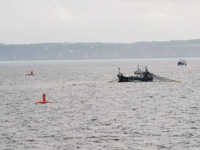
DriX conducting a survey among fishermen.
 
Legal tools to safely operate USVs

Although no international legal framework is in place to regulate USV operations, various legal tools do exist (or will exist) to allow safe remote operations.
Over recent years, and despite the lack of appropriate regulation, Exail has demonstrated its ability to successfully support its customers during their remote hydrographic missions with the DriX USV.
Remarkable scientific results have been achieved, along with unprecedent savings in time and fuel compared to traditional surveys.
The USVs have proved to be a mandatory yet complementary asset for hydrographic surveys, seabed mapping and oceanographic research.

On the contractual side, the use of knock-for-knock indemnity clauses makes it possible to allocate the risks of damage or loss to property or of death or injury to personnel between the parties.
This cancels the risk of claim between the parties as a result of an incident involving a USV.
Additional contractual provisions on liability limitation also help to reduce the risk.

With regard to non-contractual incidents or damage to third parties, insurance coverage is a second line of defence.
As for manned vessels, USVs need to be insured through hull & machine and P&I insurances, or equivalent insurance coverages.
Moreover, with the growing development of USV activities, many insurance companies are now able to provide interesting insurance coverage for USVs in terms of cost or implementation.

As a last point, good coordination with local authorities in the area of operations should also be considered.
In the case of Exail, we regularly keep the concerned local authorities informed of our USV operations and even establish temporary agreements with local search and rescue services where possible, as part of our risk assessment.

As such, the lack of a unified legal framework has not been a definitive obstacle for Exail.
Contractual and insurance tools have been very helpful, and the more recent emergence of new legislation on USVs is a key factor that will increase the possibility of USV operations.

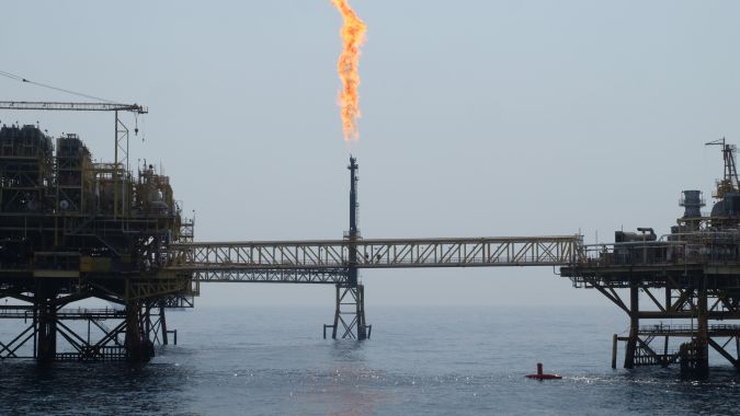
DriX operating near an offshore platform.
French regulations on USVs


France provides a very interesting example of new regulations for USVs.
This regulation, which has been built step by step since the Blue Economy Act of 2016 (Loi Leroy), enables successful collaboration between industry, operators and authorities.
Recognizing the important impact that this new regulation would have on its survey operations, Exail actively participated in working sessions to develop the new regulation.

France now authorizes USV operations in its waters[3], officially for experimental purposes only, although business operations also go through the same permit process.
The Prefectures Maritimes are responsible for providing these USV permits.
For USVs less than 10m with a speed below 10 knots and with no cargo or passengers, permits to operate a USV in a defined area are granted upon simple declaration.
For other USVs, prior authorization from the maritime authorities is required.
Exail’s DriX falls in this second category and Exail has therefore regularly applied for such permits since the issuance of this administrative regulation in May 2020.
This procedure is likely to change in 2024 with the obligations of flagging and registration of drones to operate in French waters.

The next step was the ordinance law of 13 October 2021[4], which reformed French maritime legislation with rules on USV certification and flag procedures, insurance obligation, identification marking and liability regimes for USV operators and owners.
The final step will be the entry into force, hopefully by the end of 2023 or in early 2024, of the practical administrative regulations on technical identification criteria for USVs, the certification procedure, the minimum safety equipment requirements for USVs and operator permits.

It is interesting to note that, based on our experience, this first attempt at USV regulation has not been an obstacle for survey missions.
In addition, it has the benefit of familiarizing maritime authorities with the USV concept of operations through risk assessment and survey supervision.
With growing USV activities, having authorities that are used to managing such USV operations might be highly beneficial for all present and future operators acting in French waters.

Note that French law distinguishes between ‘maritime drone’ and ‘autonomous vessel’[5].
We deem this distinction to be very relevant, as a drone without cargo or passengers should not be treated in the same way as a larger autonomous vessel with people onboard.
The safety criteria for construction or sea-going must therefore also be different, to avoid disproportionate or irrelevant requirements for drones.
Whereas the legal regime for drones is now complete and will enter into force soon, the legal status for autonomous vessels remains experimental (with a two-year limitation) and is far from being fully completed.

Thus, in the case of hydrography missions in France, it is currently easier to operate a unit classified as a drone rather than an autonomous vessel.

 
DriX operating near an offshore platform.

Status of operators

A last interesting point to be underlined is the status of USV operators.
Indeed, behind the drones, the IA and the screens, there will always be a human who is legally responsible.
French law considers the USV operator as the captain in charge of commanding the USV (even if the USV is remotely commanded or under autonomous mode).
To reduce their liability risk, French law has innovated with the application of liability limitation based on the LLMC convention of 1976 to the owner/charter/captain of the drone.
Such a provision may reassure operators and owners regarding their risk while supervising USV operations.

In addition, to the extent that the USV operator acts within the scope and limits of their position, the liability shifts in the case of an incident to the owner rather than the USV operator.
This legal mechanism also reinforces the individual legal protection of USV operators.
The exception is if the USV operator’s conduct involves gross negligence or willful intent to kill, injure or damage.

Considering the legal tools available in a context of emerging regulation, Exail and Exail’s clients have successfully operated DriX in the territorial and EEZ waters of over 20 countries with differing maritime regulations since 2017.
These include Azerbaijan, Tonga, Taiwan, Saudi Arabia, Brazil, France and the US. USV operators and Exail have adapted the documents that they use in the private sector (risk assessment, concept of operations) in the best way that they can to cope with this increase and heterogeneity in regulation.

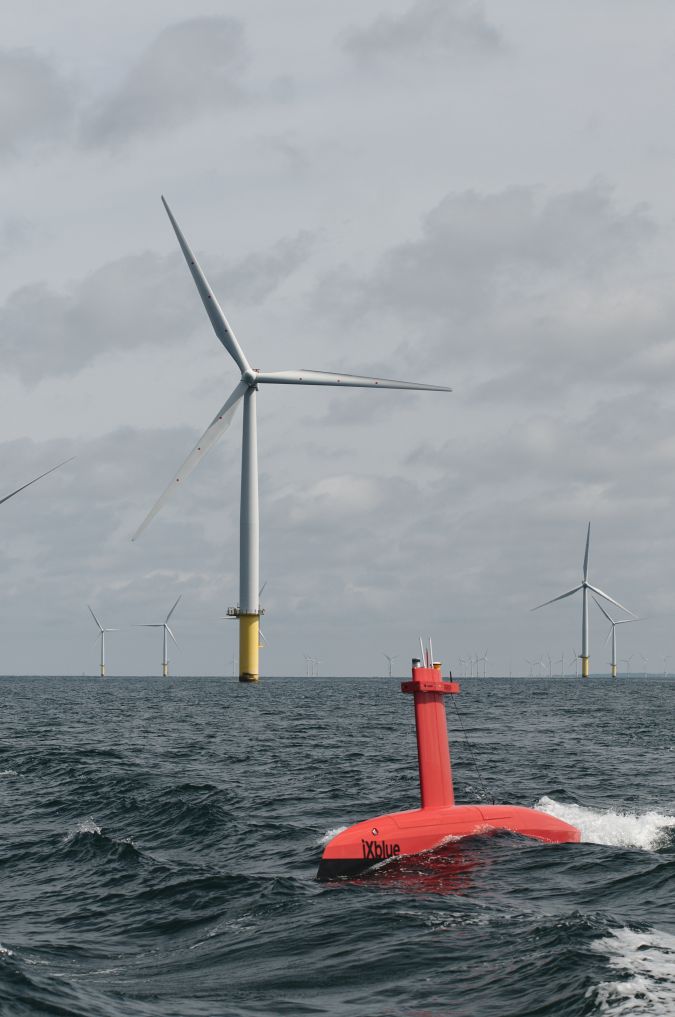
DriX acquiring hydrospatial data in a wind farm.
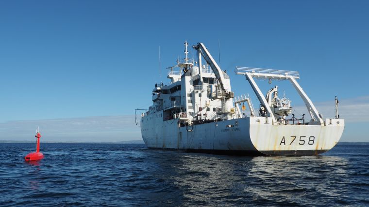
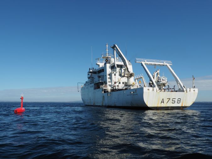
DriX tested off the coast of Brittany, France, alongside the hydro-oceanographic ship Beautemps-Beaupré.

Pending questions

Despite the progress made, many questions remain.
For example, what happens when a USV sailing under the French flag enters the waters of another country?
Will it be admitted as it is, or will it need to go through a local certification process first?
This is a critical legal and operational issue that is, to our knowledge, far from being solved.

Also, if a USV is being operated autonomously from a remote operational centre (ROC), which law applies?
Is it the flag jurisdiction of the USV, or the jurisdiction of the location of the ROC if these are not the same?
Considering that the key element from which an incident and subsequent liability may result is the USV, we believe that the flag jurisdiction of the USV would be more appropriate.

Conclusion


With the entry into force of the last legal and regulatory provisions by the end of 2023, France will probably have one of the most comprehensive legal frameworks for USV operations in the world.
At the same time, DriX clients and other autonomous platform operators have proven that the lack of an international legal framework need not be an obstacle to performing more agile, more efficient, and more environmentally friendly surveys that complement conventional survey vessel operations.

[1] We deliberately use the term ‘unmanned’ rather than ‘uncrewed’ as we consider that reference to the word ‘crew’ can create confusion about the nature of the concerned vessel.
An unmanned vessel does not carry anyone onboard (no crew or passengers), whereas an uncrewed vessel has no crew but could can carry a passenger.

[2] Article 29 of UNCLOS defines a warship as: “a ship belonging to the armed forces of a State bearing the external marks distinguishing such ships of its nationality, under the command of an officer duly commissioned by the government of the State and whose name appears in the appropriate service list or its equivalent, and manned by a crew which is under regular armed forces discipline”.

[3] Arrêté du 20 mai 2020 relatif aux modalités d’expérimentation de la navigation des engins flottants maritimes autonomes ou commandés à distance.

[4] Ordonnance n° 2021-1330 du 13 octobre 2021 relative aux conditions de navigation des navires autonomes et des drones maritimes.

[5] A drone is an unmanned surface or subsea vessel with a length between 1m and 16m, a speed of less than 20 knots, less than 100UMS gross tonnage, less than 300kJ of kinetic energy and without any cargo or passengers.
Any unmanned vessel not complying with the cumulative criteria is classified as an autonomous vessel.
 
Links :