Wednesday, August 26, 2020

'It's terrifying': can anyone stop China's vast armada of fishing boats?

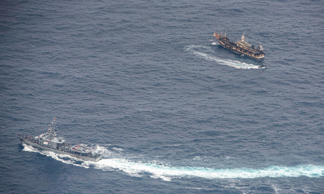
An Ecuadorian navy vessels challenges a fishing boat on 7 August after a fleet of mostly Chinese-flagged ships were detected in the Pacific Ocean.
Photograph: Santiago Arcos/Reuters

From The Guardian by Dan Collyns

Ecuador stood up for the Galápagos, but other countries don’t stand a chance against the 17,000-strong distant-water fleet

The recent discovery by the Ecuadorean navy of a vast fishing armada of 340 Chinese vessels just off the biodiverse Galápagos Islands stirred outrage both in Ecuador and overseas.

Under pressure after Ecuador’s strident response, China has given mixed signals that it could begin to reel in its vast international fishing fleet.
Its embassy in Ecuador declared a “zero tolerance” policy towards illegal fishing, and this week it announced it was tightening the rules for its enormous flotilla with a series of new regulations.

But with 325 of those 340 ships remaining off Ecuador, and local navy commander Darwin Jarrín saying last week that nearly half of those vessels had intermittently switched off their satellite communications – breaching the rules of the regional fisheries management organisation – the episode has shown how difficult it is for small nations to stand up to China’s distant fleet even when it descends on the archipelago that inspired Charles Darwin’s Theory of Evolution.

China’s vast fishing fleet, by far the world’s largest, has been overfishing seas much further from the world’s gaze than the islands known for their giant tortoises and iguanas.
From West Africa’s Gulf of Guinea to the Korean peninsula, the fleet has moved into the waters of other countries – switching off transponders to avoid detection, depleting fish stocks and threatening food security for often poor coastal communities.
In east Asia, fishing vessels may act as the vanguard of an aggressive geopolitical strategy aimed at asserting territorial claims.


China’s new regulations this week include harsher penalties for companies and captains involved in illegal, unreported and unregulated – or IUU – fishing.
But conservationists monitoring the Galápagos episode are sceptical.

“Beyond this one-sided announcement, the problem remains the same,” says Pablo Guerrero, marine conservation director for WWF Ecuador.
“These boats operate without observers on board, they do not return to port, they transship their catch to mother vessels, which land the catch at ports.
So, in a nutshell, they are fishing all the time, the fishing operation doesn’t stop.”

The fleet is a vast and complex network.
Among the hundreds of vessels are fuel providers, fishing boats, tender boats and reefers, some of which camouflage unregistered boats, Guerrero says.
Many ships spend long periods at sea where shocking human rights violations have been reported.

NGO Global Fishing Watch and the Overseas Development Institute (ODI) thinktank have used cutting-edge technology and data analysis to reveal that the size and scope of China’s distant-water fleet has been hugely underreported.
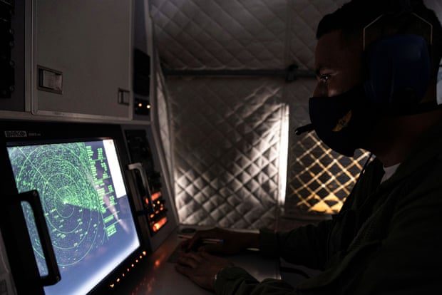

An Ecuadorian navy officer looks at a radar on 7 August after the mostly Chinese-flagged fleet was detected in an international corridor that borders the Galápagos Islands.
Photograph: Santiago Arcos/Reuters

The ODI found the fleet had 16,966 vessels, five times more than previous estimates.
By contrast, the US distant-water fleet comprises 300 boats.

In 2017, as part of its 13th fisheries five-year plan, China announced plans to cap the size of the fleet to 3,000 vessels by 2020.

“We were shocked by the results because we were expecting 4,000 or 5,000 vessels,” says Miren Gutiérrez, the lead author of the ODI report.

The research, which took more than a year, also found nearly 1,000 of the boats were using “flags of convenience” and at least 183 vessels were involved in suspected IUU fishing, for which China ranked the worst-performing nation in a 2019 global index.

“On the surface, it looks like a very fragmented fleet, but we suspect the core of it is probably in the hands of a few companies,” says Gutiérrez.
Recent research shows the Chinese government heavily subsidises fishing through tax exemptions, mostly on fuel, to the value of $16.6bn (£12.6bn) per year, or 47% of total global fishing subsidies.

“Most of this overfishing is not illegal, that’s the problem,” Gutiérrez says, as most of it goes on in international waters.
Most of the fleet’s vessels are trawlers – banned within China’s territorial waters and notorious for damaging ecosystems by dragging nets along the seafloor.
Other common boats are longliners, for larger fish such as tuna or shark, and squid-jiggers, which usually operate in deeper waters.

“To shift the dynamic there needs to be radical transparency,” says Philip Chou, an expert on distant-water fishing at Oceana, a marine conservation group.
“So far, the evidence has not shown that [the Chinese government] has taken it further than rhetoric.”

China would need to open up about its catch, the real-time location of its fleets, the ownership of fishing vessels, and the opaque bilateral or regional agreements it has made with low-income coastal nations, Chou says.
In west Africa, for example, a 2018 report by the Environmental Justice Foundation found 90% of Ghanaian-flagged vessels had Chinese involvement.
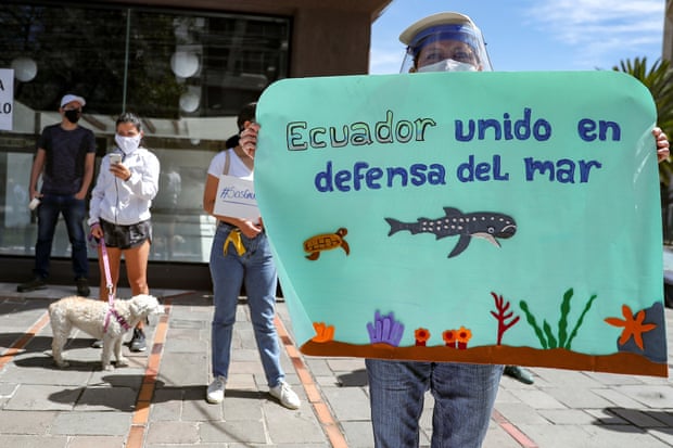
Protesters outside the Chinese embassy in Quito, Ecuador, earlier this month call for fisheries control.
Photograph: José Jácome/EPA

China’s self-declared shake-up proposes changes to high-seas transshipment rules – the movement of cargo from one vessel to another – along with reforms to distant-water fishing.
It also announced two three-month fishing moratoriums: one west of the Galápagos, between September and November, and another beginning in July in the south Atlantic near Argentina.

The world’s biggest seafood exporter is also mooted to be planning to ratify the Port State Measures Agreement, the first internationally binding accord in which ports around the world pledge not to allow illegal or unregulated fishing boats to land catches.

'They just pull up everything!' Chinese fleet raises fears for Galápagos sea life
“It’s a significant concession,” says Steve Trent, executive director of the Environmental Justice Foundation.
“But in the context of global fisheries it’s not enough, it’s not nearly enough.”

China hauled up about 15% of the world’s reported fishing catch in 2018, according to the UN fisheries agency, more than twice the second- and third-ranking countries.
But the lack of transparency means it is impossible to truly know how much seafood humans take from the ocean amid an alarming drop in marine life in the past half-century.

The UN’s Food and Agriculture Organization (FAO) estimates that illegal fishing has an annual cost of up to $23bn.
The FAO also calculatesd that nearly 60 million people worked in fishing or aquaculture in 2016, 85% of them in Asia.

Ecuador is one of a few small nation states that have pushed back against the Chinese flotillas.
In the hotly disputed South China Sea, Indonesia sent F-16 fighter jets along with navy, coastguard and fishing boats to repel 63 Chinese fishing boats and four coastguard vessels from its waters in January.
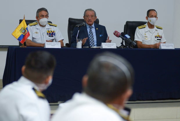
Ecuador’s defence minister, Oswaldo Jarrin, flanked by navy admirals, at a press conference, in the port city of Guayaquil, about the Chinese fleet operating near the Galápagos Islands.
Photograph: Reuters

But North Korean fishing boats may have come off worse from exchanges with China’s “dark fleets”, amid reports of “ghost boats” washing up on Japanese shores containing the bodies of North Korean fishermen.
In its backyard, the Chinese fleet has a fearsome reputation for systemic illegal fishing and aggressive tactics when faced with competitors or foreign patrol vessels.

China signed a key UN fish stocks agreement in 1996 but never ratified it.
It is a member of seven regional fishery management organisations, or RFMOs, but its distant water fleet operates outside of those frameworks, says Mercedes Rosello, director of House of Ocean, a not-for-profit legal consultancy that monitors IUU fishing.
“When you are looking at thousands of vessels, the rules and mechanisms which that flag state adopts are of huge transcendence,” Rosello says.

The US, Japan, and the EU, which make up about 70% of the global seafood market, need to take proactive measures to disrupt IUU fish from Chinese vessels from entering international supply chains, says Trent.

“[Without] wholescale structural change by China and the system of global governance of the ocean to make sure the Chinese do abide by the law,” he says, the world’s fish stocks would continue their precipitous decline.
“The people who suffer first and worst are almost always the coastal communities who rely on those fisheries for their survival, wellbeing and food,” he says.
“Exactly what happens in the Galápagos [Islands] happens in locations around the world and it’s terrifying.”

Links :

Tuesday, August 25, 2020

NASA researchers track slowly splitting 'Dent' in Earth’s magnetic field

 Earth’s magnetic field acts like a protective shield around the planet, repelling and trapping charged particles from the Sun.
But over South America and the southern Atlantic Ocean, an unusually weak spot in the field – called the South Atlantic Anomaly, or SAA – allows these particles to dip closer to the surface than normal.
Currently, the SAA creates no visible impacts on daily life on the surface.
However, recent observations and forecasts show that the region is expanding westward and continuing to weaken in intensity.
The South Atlantic Anomaly is also of interest to NASA’s Earth scientists who monitor the changes in magnetic strength there, both for how such changes affect Earth's atmosphere and as an indicator of what's happening to Earth's magnetic fields, deep inside the globe. 

From NASA by Mara Johnson-Groh and Jessica Merzdorf

A small but evolving dent in Earth’s magnetic field can cause big headaches for satellites.

Earth’s magnetic field acts like a protective shield around the planet, repelling and trapping charged particles from the Sun.
But over South America and the southern Atlantic Ocean, an unusually weak spot in the field – called the South Atlantic Anomaly, or SAA – allows these particles to dip closer to the surface than normal.
Particle radiation in this region can knock out onboard computers and interfere with the data collection of satellites that pass through it – a key reason why NASA scientists want to track and study the anomaly.

The South Atlantic Anomaly is also of interest to NASA’s Earth scientists who monitor the changes in magnetic field strength there, both for how such changes affect Earth's atmosphere and as an indicator of what's happening to Earth's magnetic fields, deep inside the globe.

Currently, the SAA creates no visible impacts on daily life on the surface.
However, recent observations and forecasts show that the region is expanding westward and continuing to weaken in intensity.
It is also splitting – recent data shows the anomaly’s valley, or region of minimum field strength, has split into two lobes, creating additional challenges for satellite missions.

A host of NASA scientists in geomagnetic, geophysics, and heliophysics research groups observe and model the SAA, to monitor and predict future changes – and help prepare for future challenges to satellites and humans in space.

It’s what’s inside that counts

The South Atlantic Anomaly arises from two features of Earth’s core: The tilt of its magnetic axis, and the flow of molten metals within its outer core.

Earth is a bit like a bar magnet, with north and south poles that represent opposing magnetic polarities and invisible magnetic field lines encircling the planet between them.
But unlike a bar magnet, the core magnetic field is not perfectly aligned through the globe, nor is it perfectly stable.
That’s because the field originates from Earth’s outer core: molten, iron-rich and in vigorous motion 1800 miles below the surface.
These churning metals act like a massive generator, called the geodynamo, creating electric currents that produce the magnetic field.

As the core motion changes over time, due to complex geodynamic conditions within the core and at the boundary with the solid mantle up above, the magnetic field fluctuates in space and time too.
These dynamical processes in the core ripple outward to the magnetic field surrounding the planet, generating the SAA and other features in the near-Earth environment – including the tilt and drift of the magnetic poles, which are moving over time.
These evolutions in the field, which happen on a similar time scale to the convection of metals in the outer core, provide scientists with new clues to help them unravel the core dynamics that drive the geodynamo.

“The magnetic field is actually a superposition of fields from many current sources,” said Terry Sabaka, a geophysicist at NASA’s Goddard Space Flight Center in Greenbelt, Maryland.
Regions outside of the solid Earth also contribute to the observed magnetic field.
However, he said, the bulk of the field comes from the core.

The forces in the core and the tilt of the magnetic axis together produce the anomaly, the area of weaker magnetism – allowing charged particles trapped in Earth’s magnetic field to dip closer to the surface.

When solar material streams strikes Earth’s magnetosphere, it can become trapped and held in two donut-shaped belts around the planet called the Van Allen Belts.
The belts restrain the particles to travel along Earth’s magnetic field lines, continually bouncing back and forth from pole to pole.
Credits: NASA Goddard / Tom Bridgman

The Sun expels a constant outflow of particles and magnetic fields known as the solar wind and vast clouds of hot plasma and radiation called coronal mass ejections.
When this solar material streams across space and strikes Earth’s magnetosphere, the space occupied by Earth’s magnetic field, it can become trapped and held in two donut-shaped belts around the planet called the Van Allen Belts.
The belts restrain the particles to travel along Earth’s magnetic field lines, continually bouncing back and forth from pole to pole.
The innermost belt begins about 400 miles from the surface of Earth, which keeps its particle radiation a healthy distance from Earth and its orbiting satellites.

However, when a particularly strong storm of particles from the Sun reaches Earth, the Van Allen belts can become highly energized and the magnetic field can be deformed, allowing the charged particles to penetrate the atmosphere.

“The observed SAA can be also interpreted as a consequence of weakening dominance of the dipole field in the region,” said Weijia Kuang, a geophysicist and mathematician in Goddard’s Geodesy and Geophysics Laboratory.
“More specifically, a localized field with reversed polarity grows strongly in the SAA region, thus making the field intensity very weak, weaker than that of the surrounding regions.”
A pothole in space

Although the South Atlantic Anomaly arises from processes inside Earth, it has effects that reach far beyond Earth’s surface.
The region can be hazardous for low-Earth orbit satellites that travel through it.
If a satellite is hit by a high-energy proton, it can short-circuit and cause an event called single event upset or SEU.
This can cause the satellite’s function to glitch temporarily or can cause permanent damage if a key component is hit.
In order to avoid losing instruments or an entire satellite, operators commonly shut down non-essential components as they pass through the SAA.
Indeed, NASA's Ionospheric Connection Explorer regularly travels through the region and so the mission keeps constant tabs on the SAA's position.

The International Space Station, which is in low-Earth orbit, also passes through the SAA.
It is well protected, and astronauts are safe from harm while inside.
However, the ISS has other passengers affected by the higher radiation levels: Instruments like the Global Ecosystem Dynamics Investigation mission, or GEDI, collect data from various positions on the outside of the ISS.
The SAA causes “blips” on GEDI’s detectors and resets the instrument’s power boards about once a month, said Bryan Blair, the mission’s deputy principal investigator and instrument scientist, and a lidar instrument scientist at Goddard.

“These events cause no harm to GEDI,” Blair said.
“The detector blips are rare compared to the number of laser shots – about one blip in a million shots – and the reset line event causes a couple of hours of lost data, but it only happens every month or so.”

The Sun expels a constant outflow of particles and magnetic fields known as the solar wind and vast clouds of hot plasma and radiation called coronal mass ejections.
This solar material streams across space and strikes Earth’s magnetosphere, the space occupied by Earth’s magnetic field, which acts like a protective shield around the planet.
Credits: NASA Goddard / Bailee DesRocher

In addition to measuring the SAA’s magnetic field strength, NASA scientists have also studied the particle radiation in the region with the Solar, Anomalous, and Magnetospheric Particle Explorer, or SAMPEX – the first of NASA’s Small Explorer missions, launched in 1992 and providing observations until 2012.
One study, led by NASA heliophysicist Ashley Greeley as part of her doctoral thesis, used two decades of data from SAMPEX to show that the SAA is slowly but steadily drifting in a northwesterly direction.
The results helped confirm models created from geomagnetic measurements and showed how the SAA’s location changes as the geomagnetic field evolves.

“These particles are intimately associated with the magnetic field, which guides their motions,” said Shri Kanekal, a researcher in the Heliospheric Physics Laboratory at NASA Goddard.
“Therefore, any knowledge of particles gives you information on the geomagnetic field as well.”

Greeley’s results, published in the journal Space Weather, were also able to provide a clear picture of the type and amount of particle radiation satellites receive when passing through the SAA, which emphasized the need for continuing monitoring in the region.

The information Greeley and her collaborators garnered from SAMPEX’s in-situ measurements has also been useful for satellite design.
Engineers for the Low-Earth Orbit, or LEO, satellite used the results to design systems that would prevent a latch-up event from causing failure or loss of the spacecraft.

Modeling a safer future for satellites

In order to understand how the SAA is changing and to prepare for future threats to satellites and instruments, Sabaka, Kuang and their colleagues use observations and physics to contribute to global models of Earth’s magnetic field.

The team assesses the current state of the magnetic field using data from the European Space Agency’s Swarm constellation, previous missions from agencies around the world, and ground measurements.
Sabaka’s team teases apart the observational data to separate out its source before passing it on to Kuang’s team.
They combine the sorted data from Sabaka’s team with their core dynamics model to forecast geomagnetic secular variation (rapid changes in the magnetic field) into the future.

The geodynamo models are unique in their ability to use core physics to create near-future forecasts, said Andrew Tangborn, a mathematician in Goddard’s Planetary Geodynamics Laboratory.

“This is similar to how weather forecasts are produced, but we are working with much longer time scales,” he said.
“This is the fundamental difference between what we do at Goddard and most other research groups modeling changes in Earth’s magnetic field.”

One such application that Sabaka and Kuang have contributed to is the International Geomagnetic Reference Field, or IGRF.
Used for a variety of research from the core to the boundaries of the atmosphere, the IGRF is a collection of candidate models made by worldwide research teams that describe Earth’s magnetic field and track how it changes in time.

“Even though the SAA is slow-moving, it is going through some change in morphology, so it’s also important that we keep observing it by having continued missions,” Sabaka said.
“Because that’s what helps us make models and predictions.”

The changing SAA provides researchers new opportunities to understand Earth’s core, and how its dynamics influence other aspects of the Earth system, said Kuang.
By tracking this slowly evolving “dent” in the magnetic field, researchers can better understand the way our planet is changing and help prepare for a safer future for satellites.

Links :

Monday, August 24, 2020

US Navy electronic charts transition : DNCs to be replaced by ENCs

DNC data available on CD-ROM

From US Navy
 
UNCLASSIFIED// 
ROUTINE 
R 071418Z AUG 20 MID510001583052U 
FM CNO WASHINGTON DC 
TO NAVADMIN 
INFO CNO WASHINGTON DC 
BT 
UNCLAS 
 
NAVADMIN 221/20 
 
MSGID/NAVADMIN/CNO WASHINGTON DC/N2N6/AUG// 
 SUBJ/TRANSITION TO ELECTRONIC NAVIGATIONAL CHART// 
 
REF/A/PUB/IHO/1NOV00// 
REF/B/DOC/NATO/27SEP15// 
REF/C/PUB/NSG/1MAY20// 
REF/D/INST/OPNAV/30SEP19// 
 
NARR/REF A IS AN INTERNATIONAL HYDROGRAPHIC ORGANIZATION (IHO) PUBLICATION 
WHICH DESCRIBES THE ELECTRONIC NAVIGATIONAL CHART (ENC) S-57 FORMAT.   
REF B IS NORTH ATLANTIC TREATY ORGANIZATION (NATO) STANDARD AGEOP-19 DOCUMENT 
WHICH DESCRIBES AML FOR S-57 FORMAT.  
REF C IS NATIONAL SYSTEM FOR GEOSPATIAL INTELLIGENCE (NSG) FOUNDATION GEOINT 
(FG) INTELLIGENCE MISSION DATA PLAN PUBLICATION WHICH LISTS THE TYPES OF 
PRODUCTS NATIONAL GEOSPATIAL-INTELLIGENCE AGENCY (NGA) PLANS TO PRODUCE OVER 
THE NEXT FIVE YEARS.   
REF D IS OPNAVINST 9420.1C-POSITIONING, NAVIGATION AND TIMING POLICY WHICH 
DIRECTS TRANSITION FROM STANDARD NAUTICAL CHARTS TO ENC// 
POC/BUSHNELL/CAPT/OPNAV N2N6E4/TEL:  (571) 256-8231/ 
EMAIL:  JILLENE.BUSHNELL(AT)NAVY.MIL// 
POC/HANAFIN/CIV/OPNAV N2N6E4/TEL:  (571) 256-8227/ 
EMAIL:  CAROLINE.HANAFIN1(AT)NAVY.MIL// 
 
RMKS/1.  This NAVADMIN addresses the Navys discontinued use of the Digital Nautical Chart (DNC), the submarine specific product MATT, and Tactical Ocean 
Data (TOD) by fiscal year (FY) 2025 and its transition to the Electronic 
Navigational Chart (ENC) (using the IHO S-57 data format standard), Submarine 
ENC, and Additional Military Layers (AML).  The adoption of ENC enables the 
ability to create and display AMLs which overlay additional information on 
the navigation chart that is not available on paper or DNC. 
 
2.  With this transition, AML will replace TOD 0, TOD 4, and anti-submarine 
warfare (ASW) bathymetry products.  NGA will release limited coverage of ENC, 
SMENC, and AML in FY20 and complete global coverage by FY24. 
 
3.  Ships equipped with ENC-approved Electronic Chart Display and Information 
System (ECDIS) software shall use ENC where and when available, and continue 
to use DNC where and when ENC is not available.  Navy programs relying on DNC 
for navigational or non-navigational purposes shall plan for DNC termination 
in FY25. 
 
4.  The AML data layer requirements are currently being generated and will 
include (not all-inclusive) contour line bathymetry; environment, seabed and 
beach; large bottom objects; maritime foundation and facilities; routes, 
areas, and limits; and small bottom objects.  Commands should submit 
additional requirements for any other desired information and unmet data 
display needs as AML requirements to their Type Commander. 
 
5.  Released by VADM Jeffrey E. Trussler, Deputy Chief of Naval Operations 
for Information Warfare, OPNAV N2N6.// 
 
BT 
#0001 
NNNN 
UNCLASSIFIED//
 
Links :

Evidence of Viking outpost found in Canada

 Daring Viking seafarers used ships like this modern replica to reach the New World in their search for furs, walrus ivory, and trading partners—which they may have found in the native Dorset people.
Photographs by David Coventry

From National Geographic by Heather Pringle

Following a subtle trail of artifacts, a Canadian archaeologist searches for a lost chapter of New World history.

Something about the strange strands didn’t fit.
Patricia Sutherland spotted it right away: the weird fuzziness of them, so soft to the touch.

The strands of cordage came from an abandoned settlement at the northern tip of Canada’s Baffin Island, far above the Arctic Circle and north of Hudson Bay.
There indigenous hunters had warmed themselves by seal-oil lamps some 700 years ago.
In the 1980s a Roman Catholic missionary had also puzzled over the soft strands after digging hundreds of delicate objects from the same ruins.
Made of short hairs plucked from the pelt of an arctic hare, the cordage bore little resemblance to the sinew that Arctic hunters twisted into string.
How did it come to be here? The answer eluded the old priest, so he boxed up the strands with the rest of his finds and delivered them to the Canadian Museum of Civilization in Gatineau, Quebec.

Years passed.
Then one day in 1999 Sutherland, an Arctic archaeologist at the museum, slipped the strands under a microscope and saw that someone had spun the short hairs into soft yarn.
The prehistoric people of Baffin Island, however, were neither spinners nor weavers; they stitched their clothing from skins and furs.
So where could this spun yarn have come from? Sutherland had an inkling.
Years earlier, while helping to excavate a Viking farmhouse in Greenland, she had seen colleagues dig bits of similar yarn from the floor of a weaving room.
She promptly got on the phone to an archaeologist in Denmark.
Weeks later an expert on Viking textiles informed her that the Canadian strands were dead ringers for yarn made by Norse women in Greenland.
“That stopped me in my tracks,” Sutherland recalls.

Arctic mask

Daring Viking seafarers used ships like this modern replica to reach the New World in their search for furs, walrus ivory, and trading partners—which they may have found in the native Dorset people.

The discovery raised tantalizing questions that came to haunt Sutherland and drive more than a decade of dogged scientific sleuthing.
Had a Norse party landed on the remote Baffin Island coast and made friendly contact with its native hunters?
Did the yarn represent a key to a long lost chapter of New World history?

 Finely spun Viking yarn

Viking seafarers were the explorers par excellence of medieval Europe.
Crafting sturdy wooden sailing ships that inspire awe even today, they set sail from their Scandinavian homeland hungering for land, gold, and treasure.
Some voyaged west to what is now Scotland, England, and Ireland in the eighth century, bringing death by the sword in raids immortalized in medieval manuscripts.
Many turned to foreign commerce.
As early as the ninth century Viking merchants nudged eastward along the shores of the White and Black Seas and navigated the shoals of eastern European rivers.
They founded cities on major Eurasian trade routes and bartered for the finest wares from the Old World—glassware from the Rhine Valley, silver from the Middle East, shells from the Red Sea, silk from China.

The most adventurous set their courses far west, into the treacherous fogbound waters of the North Atlantic.
In Iceland and Greenland, Viking colonists carved out farming settlements and filled storehouses with Arctic luxuries destined for European markets, from walrus ivory to spiraling narwhal tusks that were sold as unicorn horns.
Some chieftains, fearless in the face of the unknown, pressed farther west, navigating through iceberg-strewn waters to the Americas.

Donny Pitseolak patrols for polar bears on the shores of Baffin Island, where archaeologists have discovered cordage made the Viking way and other evidence of European contact.

Sometime between A.D. 989 and 1020, Viking seafarers—perhaps as many as 90 men and women in all—landed on a Newfoundland shore and raised three sturdy halls and an assortment of sod huts for weaving, ironworking, and ship repair.
In the 1960s a Norwegian adventurer, Helge Ingstad, and his archaeologist wife, Anne Stine Ingstad, discovered and excavated the overgrown ruins of this ancient base camp at a place called L’Anse aux Meadows.
Later, Canadian archaeologists found iron ship rivets and other artifacts from what appeared to be a Viking shipwreck off the coast of Ellesmere Island.
But in the years that followed, few other traces of the Vikings’ legendary exploration of the New World came to light—that is, until Patricia Sutherland came along.

In the soft morning light on Baffin Island, Sutherland and her field crew wind single file down a rocky footpath into a green hollow known as Tanfield Valley.
The high wind of the previous evening has died, and the heavy clouds have cleared, leaving blue sky along the rugged coast that Viking seafarers once called Helluland—“stone slab land.” Long before the Vikings arrived, the area’s ancient inhabitants built a settlement here, at a site known today as Nanook.

As Sutherland clambers down the hill, she scans the shoreline warily for polar bears.
The coast is clear this morning, and as she crosses between two freshwater ponds, she marvels aloud at the valley’s thick, spongy moss.
“It’s full of greenery, full of turf for making buildings,” she says.
“It’s the greenest valley in the area.”

Sutherland, now a research fellow at the University of Aberdeen, smiles at the perfection of it all.
Below us lies a protected cove, a natural harbor for an oceangoing Viking ship.
Along some boggy patches in the valley, an oily-looking microbial slick suggests the presence of bog iron, the ore that Viking smiths worked expertly.
But as Sutherland scrambles up a small rise to the excavation, her high spirits evaporate.
Eight inches of muddy water from the previous night’s storm flood the pits.
Draining them will require hours of bucket brigades and pumping.
“We’re running out of time here,” she snaps.

Unearthing what she believes to be a Viking outpost, archaeologist Patricia Sutherland (in orange jacket) and her colleagues work in Baffin Island’s Tanfield Valley, which offered turf for sod shelters and a harbor for ships.

With her silver-gray curls, girlish voice, and diminutive five-foot-nothing frame, Sutherland seems an unlikely expedition leader.
But the 63-year-old archaeologist is a rolling storm in camp.
She is the first up each morning and the last to crawl into a sleeping bag at night.
In between she seems to be everywhere—flipping pancakes, making lunches for Inuit elders, checking the camp’s electric bear fence.
She makes nearly every decision, whether large or small.
Just three months earlier she underwent major shoulder surgery; after four weeks of excavation her left arm is so swollen that she tucks it into a sling.

But Sutherland is nothing if not determined.
In 1999 the discovery of the yarn sent her back to the storage rooms at the Canadian Museum of Civilization.
She began scrutinizing artifacts that other archaeologists had dug from sites of Arctic hunters known today as the Dorset, who ranged the eastern Arctic coast for nearly 2,000 years until their mysterious disappearance in the late 14th century.
Poring over hundreds of presumably Dorset artifacts, often under a microscope, Sutherland discovered more pieces of spun yarn that had come from four major sites—Nunguvik, Tanfield Valley, Willows Island, and the Avayalik Islands—scattered along a thousand miles of coastline, from northern Baffin Island to northern Labrador.
Sutherland also noticed something decidedly odd about the collections from these sites.
Teams working there had turned up numerous pieces of wood, despite the fact that the landscape is treeless tundra.
To Sutherland’s astonishment, she discovered fragments of what seemed to be tally sticks, used by Vikings for recording trade transactions, and spindles, which might have been for spinning fibers.
She also noted scraps of wood with square nail holes and possibly iron stains.
One was radiocarbon-dated to the 14th century, toward the end of the Norse era in Greenland.

Did Vikings use these notched sticks to record trade transactions? Patricia Sutherland thinks so.

The more Sutherland sifted through the old Dorset collections, the more evidence she found that Vikings had come to these shores.
While examining the stone tools, she discovered nearly 30 traditional Norse whetstones, standard gear for Viking men and women.
She also found several Dorset carvings of what looked to be European faces, with long noses, prominent eyebrows, and possibly beards.

All these artifacts pointed strongly to friendly contact between Dorset hunters and Viking seafarers.
But to gather more clues, Sutherland needed to excavate, and Tanfield Valley seemed the most promising of the four sites.
In the 1960s American archaeologist Moreau Maxwell had dug part of a peculiar stone-and-turf structure there.
The ruins, he later wrote, were “very difficult to interpret,” but he finally concluded that wandering Dorset hunters had built some sort of house there.
Sitting in her office, surrounded by trays of Viking artifacts, Sutherland found that hard to believe.
The Dorset had built snug homes the size of an average modern bedroom.
The house in Tanfield Valley, one wall of which measured more than 40 feet long, would have been much, much larger.

On a cold Arctic afternoon Sutherland hunches over a square of earth inside the mysterious stone ruins.
With the tip of her trowel she loosens a small piece of whale bone.
Lifting the piece free, she brushes away the dirt, revealing two drill holes.
The Dorset had no drills—they made holes by gouging—but Viking carpenters stowed augers in their tool chests, and they often drilled holes for wooden dowels used to fasten pieces of wood together.

Sutherland slips the find into a plastic bag.
Earlier archaeologists, she explains, excavated extensively in the ruins, so she and her colleagues must work like forensic investigators, searching for minute, overlooked clues that could shed light on Tanfield Valley’s occupants.
In sediments taken from inside the walls, for example, Sutherland spied several tiny pelt fragments.
Expert analysis later revealed that they belonged to an Old World rat species, most probably the black rat, which must have reached the Arctic by ship.

Skillfully working walrus ivory, Dorset artists portrayed the mysteries and wonders of their remote Arctic world, from wandering polar bears (right) to what may be the face of a European visitor (left). Carvings on a piece of antler (above) present a study in contrasts: One face is broad and round, features typical of the indigenous Dorset.
The other is long and narrow with a prominent nose and heavy brows, evoking a European.

The ruins have yielded other clues that aren’t so subtle.
One team member excavated a whalebone shovel closely matching those found in Greenland’s Viking settlements.
It’s “the exact size and material as the spades used to cut sod for houses,” notes Sutherland.
And that makes a lot of sense.
Sutherland and her colleagues found remnants of turf blocks—a material the Vikings used to build insulated walls—and a foundation made of large rocks that appear to have been cut and shaped by someone familiar with Norse stone masonry.
The overall size of the structure, the type of walls, and a drainage channel lined with stones resemble features of Viking buildings in Greenland.
One area still has the telltale reek of a latrine.
Along the floor, a team member excavated hand-size clumps of moss, the Viking equivalent of toilet paper.
“The Dorset people were never in places long enough to build a toilet structure,” says Sutherland.

But why would restless Vikings stop long enough to build on this blustery corner of Helluland?
What treasures did they seek?

Toward the end of the ninth century a wealthy Viking trader arrived at the court of King Alfred the Great in England.
An effusive man dressed in rich, foreign attire, Ohthere told of a long voyage he had taken to the coast of the White Sea, where northerners known as the Sami had furnished him with rare Arctic luxuries, from otter and marten furs to bushels of soft bird down.
Then the Viking trader presented the king with walrus ivory that could be carved into gleaming chess pieces and other exquisite works of art.

Lacking bows and arrows and living in small bands, Dorset hunters, like the one shown in this carving, likely posed little threat to the Vikings.
Eventually (and mysteriously) the Dorset disappeared.

Ohthere was not the only Viking merchant who catered to the European appetite for fine goods from the frozen north.
Each spring, men from Greenland’s Western and Eastern Settlements went north to a rich coastal hunting ground known as Nordsetur.
Camping along the shore, these medieval Greenlanders pursued walrus and other Arctic game, filling their boats with skins, furs, ivory, and even live polar bear cubs for trade abroad.
Just two or three days west of Nordsetur, across the choppy waters of the Davis Strait, lay another, potentially richer Arctic treasure-house: Helluland.
Its glacier-topped mountains loomed forbiddingly, but its icy waters teemed with walruses and narwhals, and its lands abounded with caribou and small fur-bearing animals.

The Viking seafarers who explored the North American coast a thousand years ago likely searched, as Ohthere did, for trading partners.
In Newfoundland, a region they called Vinland, the newcomers met with a hostile reception.
The aboriginal people there were well armed and viewed the foreigners as intruders on their land.
But in Helluland small nomadic bands of Dorset hunters may have spotted an opportunity and rolled out the welcome mat.
They had few weapons for fighting, but they excelled at hunting walruses and at trapping fur-bearing animals, whose soft hair could be spun into luxurious yarn.
Moreover, some researchers think the Dorset relished trade.
For hundreds of years they had bartered avidly with their aboriginal neighbors for copper and other rare goods.
“They may have been the real entrepreneurs of the Arctic,” says Sutherland.

With little to fear from local inhabitants, Viking seafarers evidently constructed a seasonal camp in Tanfield Valley, perhaps for hunting as well as trading.
The area abounded in arctic fox, and the foreigners would have had two highly desirable goods to offer Dorset hunters for their furs: spare pieces of wood that could be carved and small chunks of metal that could be sharpened into blades.
Trade in furs and other luxuries seems to have flourished.
Archaeological evidence suggests that some Dorset families may have prepared animal pelts while camping a short stroll away from the Viking outpost.

Thirteen years ago, when she first spotted the curious strands of cordage, Sutherland could never have envisioned a small Viking trading post standing on the coast of her beloved Arctic.
But for Sutherland much work remains.
Only a small fraction of Tanfield Valley has been investigated, and Sutherland’s remarkable findings—new evidence of friendly contact between Viking seafarers and aboriginal North Americans, and the discovery of what is probably the earliest European fur trade in the Americas—have stirred intense controversy among many of her colleagues.
Archaeology is all about interpreting the evidence.
As with the discovery of L’Anse aux Meadows decades ago, the fight for acceptance will be hard and long.
But Sutherland is determined to prove the doubters wrong.

She pulls the mosquito netting over her face and resumes digging.
“I think there is more to dig here, absolutely,” she says with a smile.
“And we are going to find much more.”

Links :

Sunday, August 23, 2020

Best of J Class yacht racing

Some of the most amazing, fabulous, epic J Class yacht racing footage.