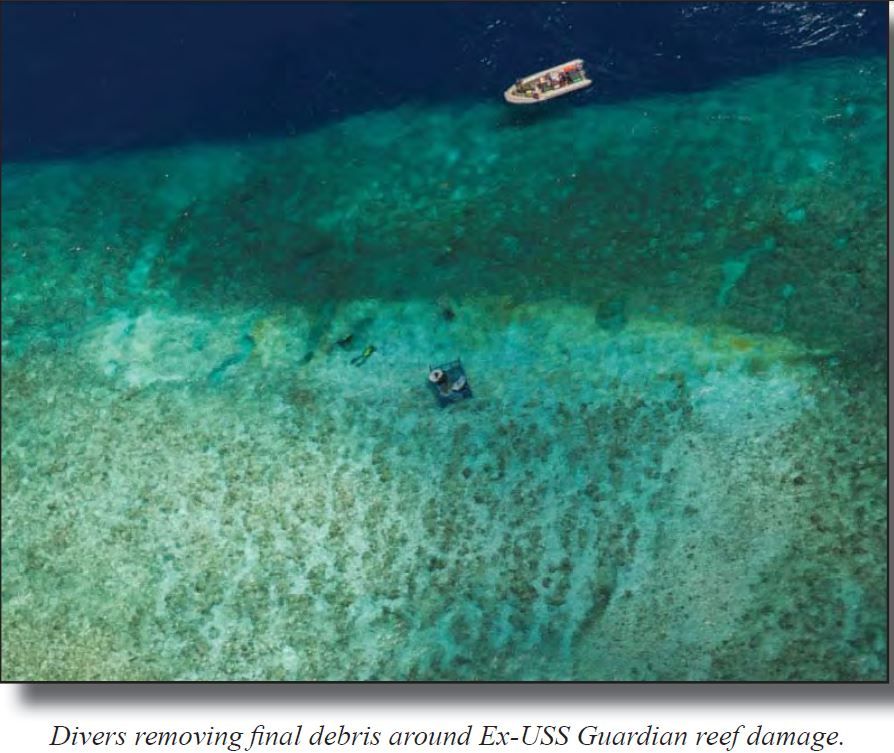
US Navy ship Guardian aground on Tubataha reefs
From Interaksyon (Rex Robles, the author is a retired Philippine Navy commodore and currently head of RCR Consultancy, a security risk management outfit)
Last week, the US Navy released the result of its investigation on the Jan. 17, 2013 grounding of USS Guardian in Tubbataha Reef in the Sulu Sea, pinning the blame on “lack of leadership” but praising the “heroic efforts of the crew to save their ship.”
One reason why the report seems superficial and incomplete is that it failed to attach true copies of essential navigational documents.

>>> geolocalization with the Marine GeoGarage <<<
As a rule, whenever a Navy ship leaves port for any destination, the path or course it is to take to reach its destination is set down beforehand on a maritime map, commonly referred to as a chart.
This is required for those navigating over water and all Navy vessels, except small boats on short trips along a coastline or a river, must perform this basic task.
The charted course is an official record of a ship’s movement and, together with the Quartermaster’s logbook that records the actual position, heading and speed of the ship at any time, will form an important part of any investigation involving that ship and its crew.
The course a voyage will take is reviewed and approved by the ship’s captain before it is implemented.
Any subsequent radical deviation from the charted course will, likewise, have to be approved by him.
The record of the ship’s planned movement together with the actual path to its destination is also recorded electronically, which is convenient and easy to retrieve.
US Navy USS Guardian crew ignored alarms
When our government failed to assert its sovereign right to conduct an independent investigation of the incident, we effectively barred ourselves from gaining access to certain necessary records surrounding the incident.
These records would have thrown light on many questions that the report seems to have glossed over.
According to the report, the admitted destination of the ship was Timor-Leste.
There was no mention of any stopover along the way, much less any intention to enter, with permission, the highly restricted and internationally protected waters of Tubbataha.
Indeed, from a navigator’s point of view, in order for the grounding to take place, the Guardian would have to stray way beyond the usual course followed by ocean-going vessels traversing the area

USS Guardian had two electronic vector charts (DNC) with different positions for the reef
GEN11A Southern Vietnam to Philippines (general scale chart)
COA11D South China Sea, Palawan Island, Philippines (coastal scale chart)

The CO onboard was aware of the discrepancy and chose the (wrong) more detailed chart (COA11D).
He neglected readily available information like the light list
which would have highlighted the chart problem.

extract from NGA NtM (Jan 23rd, 2013)
showing the update of faulty COA11D
Apparently, this will have to remain a mystery since the Philippine government has already inhibited itself from investigating the incident.
The unanswered questions go beyond what the report covers, which seems to confine itself only to questions of adequate leadership, navigational skill and accuracy of digital nautical charts (DNC).
Okay then, let’s just ask a couple of questions that are among several that obviously need to be asked: Was it part of the mission of the Guardian to transit through restricted waters?
If so, what clearance did it possess, and at what level was it granted?
The reference to “heroic efforts of the crew to save the ship” merely underlines the studious avoidance by the report from discussing the critical questions involved.

Finally, it would seem specious, at the very least, for the report to mention faulty digital maps at all. Navigational errors arising from the use of digital charts, which are based on multi-satellite projections, could not be in the order of “error” committed by the Guardian, which found itself scores of miles off course.
In language surely clear to every maritime navigator, one could expect an error of “seconds to a degree,” which translates to only several hundred feet, at the most.
But the all these hanging questions will remain in the air due to our own fault.
In our dealings with China, with Malaysia, and more recently with Taiwan, we have adopted a posture that many would consider timorous and tentative, but which our leaders apparently regard as subtle, sophisticated and effective.
Links :
- GeoGarage blog : Digital map error may have led to minesweeper grounding / Time running out for USS Guardian in Tubbataha as Amihan winds intensify
- NGA : Digital Nautical Chart (DNC) Discrepancies, Immediate Actions and Way Ahead Associated with USS GUARDIAN Grounding
- USNI news : Document: Guardian Grounding ‘Wholly Preventable’
- Navy : USS Guardian grounding investigation results released
Breaking Defense : Untold Tale Behind USS Guardian Reef Grounding: NGA’s Map Was Wrong By 8 Miles
ReplyDeleteNational Geospatial-Intelligence Agency re: January 2013 review of Coastal Digital Nautical Charts, 2013
ReplyDelete"
RE the USS Guardian, what did NGA's initial review entail?
What are we learning?
What is the fallout from the findings thus far?
If there is indeed erroneous data, how is that going to be fixed?
Our review quickly determined that the primary issue in the misplacement of the Tubbataha Reef on the Coastal Digital Nautical Chart was related to LANDSAT-based commercial imagery.
Therefore, from January 17 through the morning of January 22, we examined and validated the accuracy of every situation in the Digital Nautical Chart where that type of data was used.
In total, NGA reviewed DNC charts that cover more than 116 million square nautical miles of ocean.
In that review, we identified only one issue of magnitude similar to the misplacement of the Tubbataha Reef.
This error, which appeared on both the paper chart and the Digital Nautical Chart, rotated the placement of the southern coast of Chile toward the sea; at its widest, the discrepancy was 7,000 meters.
In accordance with our standard procedures, NGA warned mariners to "navigate with caution"
in this area when the error was discovered on January 20.
A total of 25 chart areas - less than one percent of the total DNC holdings -- included inaccuracies that required additional scrutiny.
Only two of those - the Tubbataha Reef and the Chilean coast - were cause for concern.
The Tubbataha Reef chart correction has been completed and the patch is available for download now.
The correction to the Chilean charts is being worked with the highest priority.
The remaining issues do not pose risks to navigation and will be corrected via normal update cycles.
Ultimately, we found that the error related to the Tubbataha Reef was caused by a combination of factors.
Prior to 2008, the charts in use included a number of "phantom islands" - the charts indicated islands that did not exist.
In response to customer requests to address that problem, NGA used LANDSATderived
imagery to update the charts.
One of these images included incorrect information about the location of the section of ocean that includes the Tubbataha Reef.
As a result, the reef was incorrectly placed in the DNC.
That was the first factor.
The second was simply human error.
In 2011, NGA obtained survey data that corrected this positioning.
Due to a failure to follow established procedure, this correction was made in one portion of the DNC,
but not in another.
A single source of data is never ideal, and we use multiple sources to validate information wherever possible. As mentioned earlier, we continuously receive new and better information, from a number of sources.
As more information is available from more parts of the world, we will have fewer regions where only one source of information exists.
That will decrease the risk of errors like this one.
In addition, we are going to further review our production processes - including everything from procedures to training -- to determine whether they could be improved.
We are assembling a team of experts from across the maritime community to assist.
First, it's important to note that NGA's safety of navigation products meet the International Hydrographic Organization {IHO) and the International Maritime Organization standards.
In addition,our production processes meet several external standards for process and quality control, including IS09001 Quality Management System.
Bottom line is that based on a careful review, we can now confirm that the error in the placement of the Tubbataha Reef in the Digital Nautical Chart was an exception, not a systemic problem.
And while no navigational aid is flawless, NGA is confident that the Digital Nautical Chart is safe for use in navigation.
"
Nextgov : How a misplaced reef on a digital chart destroyed a Navy minesweeper
ReplyDeleteInteraksyon : Tubbataha was off by 8 miles on USS Guardian's digital charts, says US mapping agency
ReplyDeleteGMA News : USS Guardian relied on 'inaccurate' digital maps of Tubbataha - intel agency
ReplyDelete