Thursday, March 8, 2018

Sea level rise in the sf bay area just got a lot more dire

Yellow areas are parts of the San Francisco Bay shoreline at risk of flooding by 2100 because of sea level rise (SLR) alone, while red indicates those areas at risk because of both sea level rise and local land subsidence (LLS), based on a new study by UC Berkeley and Arizona State geologists.
(Images by ASU/Manoochehr Shirzaei)

From Wired by Matt Simon

If you moveto the San Francisco Bay Area, prepare to pay some of the most exorbitant home prices on the planet.
Also, prepare for the fact that someday, your new home could be underwater—and not just financially.


Sea level rise threatens to wipe out swaths of the Bay's densely populated coastlines, and a new study out today in Science Advances paints an even more dire scenario: The coastal land is also sinking, making a rising sea that much more precarious.
Considering sea level rise alone, models show that, on the low end, 20 square miles could be inundated by 2100.
But factor in subsiding land and that estimate jumps to almost 50 square miles.
The high end? 165 square miles lost.
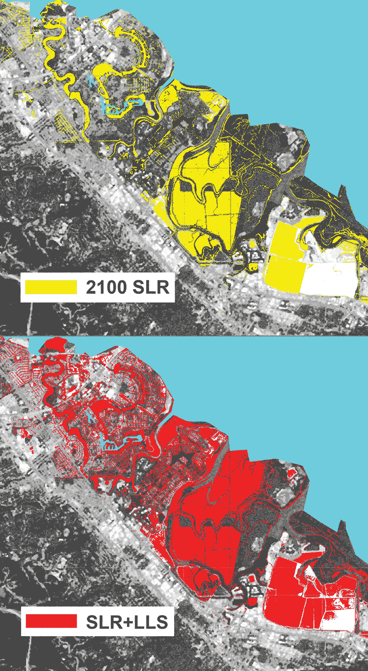
 Foster City, many areas of which could be flooded in 2100 because of rising sea levels (SLR, yellow), will be even more at risk because of local land subsidence (SLR+LLS, red).

The problem is a geological phenomenon called subsidence.
Different kinds of land sink at different rates.
Take, for instance, Treasure Island, which resides between San Francisco and Oakland.
It’s an artificial island made of landfill, and it’s sinking fast, at a rate of a third of an inch a year.
San Francisco Airport is also sinking fast and could see half its runways and taxiways underwater by 2100, according to the new analysis.

Now, subsidence is nothing new to climate scientists.
“People have been aware that this is an issue,” says UC Berkeley’s Roland Burgmann, coauthor of the paper.
“What was missing was really data that has high enough resolution and accuracy to fully integrate” subsidence in the Bay Area.
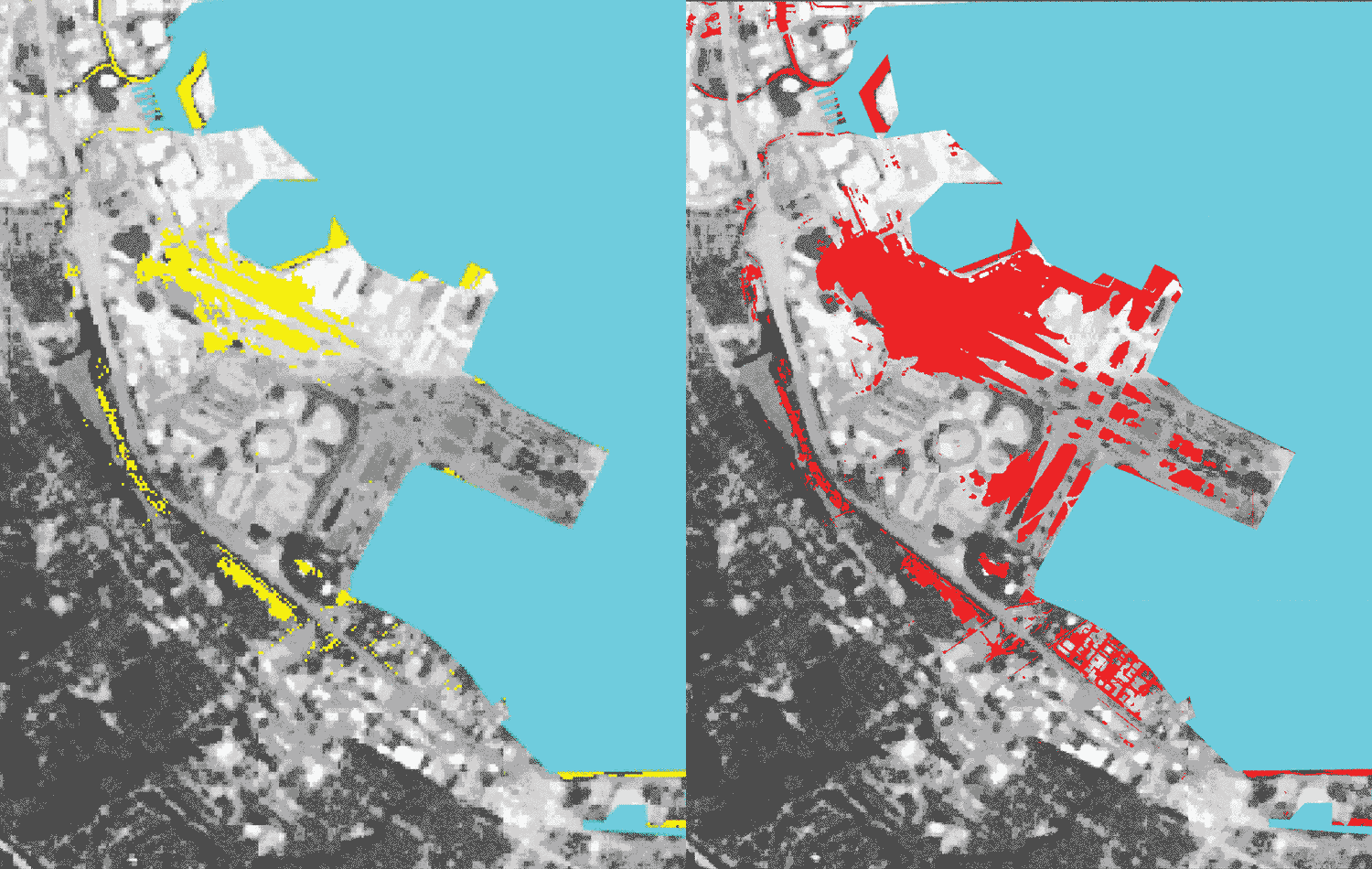
 San Francisco International Airport’s runways will be flooded by 2100 because of sea level rise (yellow) and subsidence of landfill used to construct the airport (red).

To get that data, the researchers took precise measurements of the landscape from lidar-equipped aircraft.
They combined this with data from satellites, which fire radar signals at the ground and analyze the return signals to estimate how fast land is moving either toward the spacecraft or away from them.

By comparing data from 2007 to 2011, the team showed that most of the Bay’s coastline is subsiding at a rate of less than 2 millimeters a year.
Which may not seem like much, but those millimeters add up, especially considering a study that came out last month suggested sea level rise is accelerating.

"You talk to someone about, Oh the land is going down a millimeter a year, and that can be kind of unimpressive," says the University of Nevada Reno's William Hammond, who studies subsidence but was not involved in the study.
"But we know as scientists that these motions, especially if they come from plate tectonics, that they are relentless and they will never stop, at least as long as we're alive on this planet."
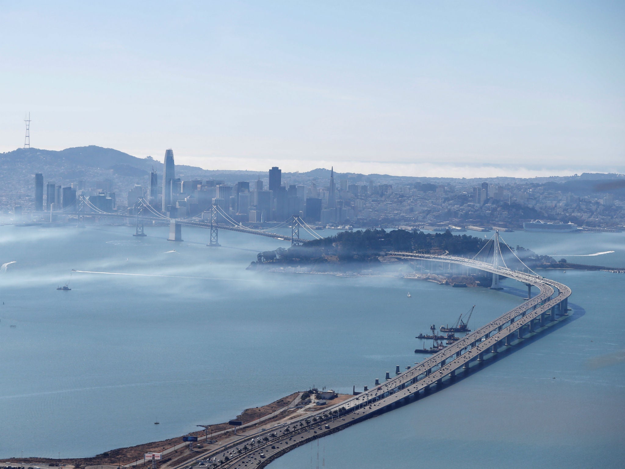
The San Francisco-Oakland Bay Bridge and San Francisco are seen from Oakland, California Ruters/Stephen Lam

Speaking of being alive on this planet: Humans have induced subsidence at an astonishing scale by rapidly depleting aquifers.
Take the South Bay, for instance.
“Parts of San Jose have been lowered up to 12 feet due to groundwater extraction,” says USGS coastal geologist Patrick Barnard.
Fortunately, the extraction policies that led to those losses are kaput.
But the same can’t be said for the rest of the planet, in particular for communities that are suffering drought exacerbated by climate change.

“It's not a major concern for the Bay anymore,” Barnard adds,
“but it is for in general aquifers worldwide, especially in developing countries where a lot of groundwater is extracted from these large river deltas where millions of people live. They're already extremely vulnerable to sea level rise.”

 Treasure Island is among the regions singled out by scientists behind the study.
NOAA nautical chart map with the GeoGarage platform

The developing world is nowhere near ready to deal with subsidence and rising seas, but neither is the developed world.
This is a problem that defies human ingenuity.
It’s not like the San Francisco Bay Area can build one giant sea wall to insulate itself.
And it’s not like low-lying Florida can hike itself up, or New York City can move itself inland a few hundred miles.

“There is no permanent solution to this problem,” says Arizona State University geophysicist Manoochehr Shirzaei, lead author of the paper.
“This will impact us one way or another. The forces are immense, it's a very powerful process, the cost of really dealing with it is huge, and it requires long-term planning. I'm not so sure there's a good way to avoid it.”
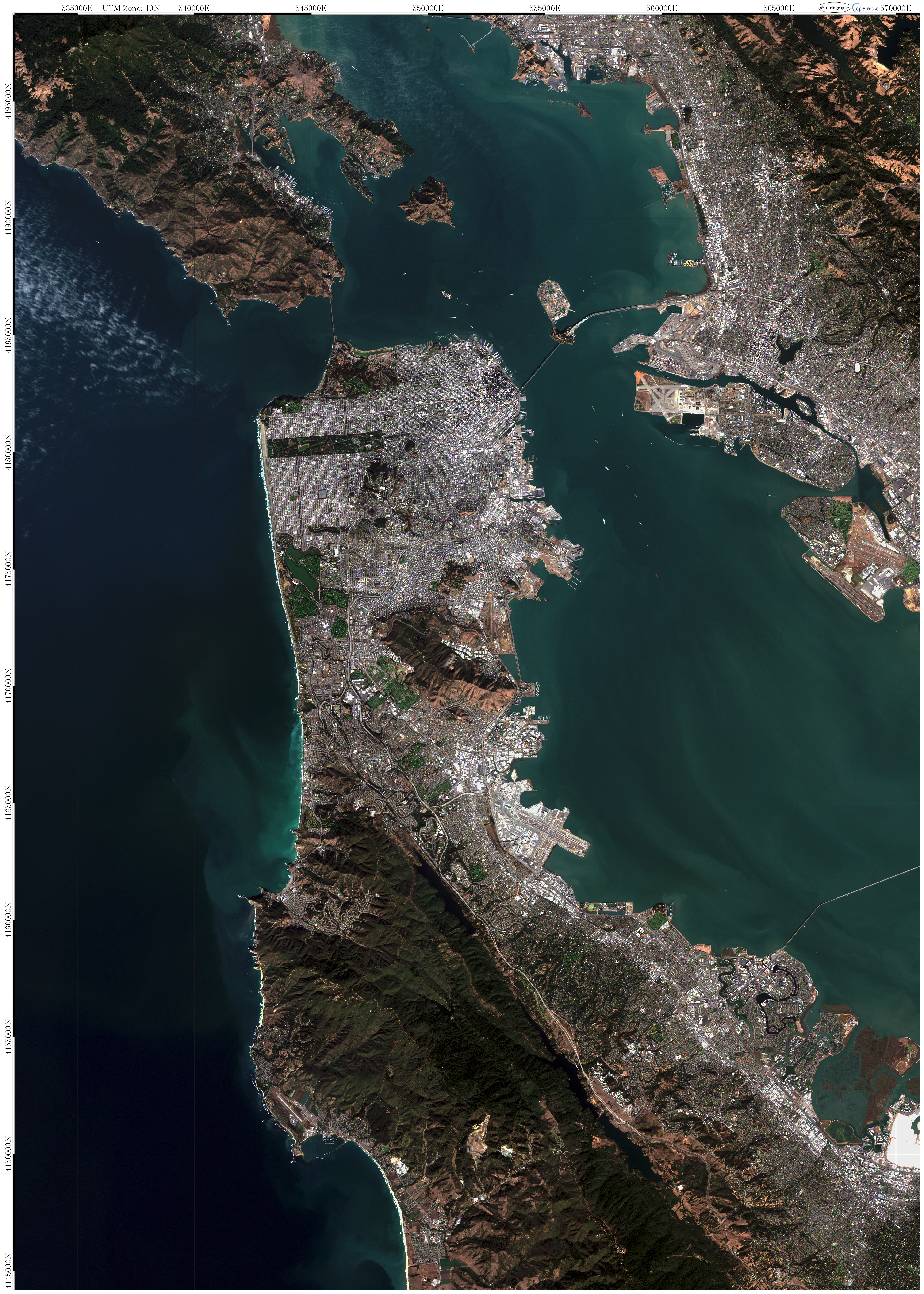
 San Francisco Bay from space by Copenicus EU Sentinel2

Save for keeping seas from rising in the first place.
That, of course, would require a tremendous global effort to cut back emissions.
But even conservative projections suggest future sea level rise could be dramatic.
Which means we as a species have to seriously reconsider the idea of a coastal town, or in case of the Bay Area, a sprawling coastal metropolis.
Because the sea is coming to swallow us, and there’s nothing we can do to stop it.

Links :

Wednesday, March 7, 2018

Oldest-known message in a bottle found on WA beach 132 years after being tossed overboard

On Sunday January 21st, 2018, Kym and Tonya Illman discovered a bottle on a beachside sand dune just north of Wedge Island in Western Australia.

From WashingtonPost by Theresa Vargas

Before there were computers and GPS beacons to track the ocean’s whims, there were slips of paper and bottles.
Or more specifically, slips of paper in bottles.


The world’s oldest message in a bottle was recently discovered on a beach in Western Australia, 132 years after it was tossed into the Indian Ocean as part of an experiment on ocean drift patterns, according to experts who call it “an exceedingly rare find.”
The previous record for the oldest message in a bottle was 108 years.

A report released by the Western Australia Museum details how the bottle was found and what its well-preserved message reveals about science and history.

The world's oldest-known message in a bottle — a form filled out as part of a German experiment to understand ocean currents.
Supplied: Kym Illman 

The dark green glass bottle, which measured less than 9 inches long and 3 inches wide, was found in January north of Perth by a woman named Tonya Illman, according to a museum news release Tuesday that quotes Illman on the surprising discovery.
She and a friend were walking along the dunes when she saw it near where her son’s car had become bogged down in soft sand.
“It just looked like a lovely old bottle, so I picked it up thinking it might look good in my bookcase,” Illman said.
“My son’s girlfriend was the one who discovered the note when she went to tip the sand out. The note was damp, rolled tightly and wrapped with string. We took it home and dried it out, and when we opened it we saw it was a printed form, in German, with very faint German handwriting on it.”

The form reveals the date the bottle was jettisoned along with the ship's name, home port, co-ordinates and travel route.
Supplied: Kym Illman

After some research and excitement, the family not knowing if what they found was “historically significant or a very inventive hoax,” brought their discovery to the museum.
Experts there took detailed measurements of everything from the narrow opening of the bottle to the twine wrapped around the yellowed paper inside of it.
There was no cork, and researchers believe it may have dried out, shrunk and dislodged at some point.
Because the paper was so well preserved, they also believe the bottle probably washed onto shore within a year of being thrown and lay buried for more than a century in damp sand.

With help from the WA Maritime Museum and the Australian National Maritime Museum, Kym and Tonya Illman were able to trace the origins of the world’s oldest message in a bottle all the way to Elsfleth, Germany.

On the paper were two significant details: the date June 12, 1886, and the name of a ship, “Paula.”

More digging, along with help from authorities in the Netherlands and Germany, revealed that the bottle was part of a long-term German Naval Observatory program studying global ocean currents.
An entry in the Paula’s meteorological journal written by the captain detailed the bottle being tossed overboard on the same date listed on the paper.

A painting of the German merchant sailing ship Paula in 1880 by artist Edouard Adam.
(Deutsches Schiffahrtsmuseum-Unterweser)

The route of the Paula with dates showing when bottles were tossed.
Source: Deutscher Wetterdienst / German Weather Service

The handwriting also matched his, down the extra curl in his C’s.
“It’s a once-in-a-lifetime, once-in-a-century, incredibly fortuitous find,” curator Ross Anderson, who led the research, said Tuesday by phone. The bottle represents an early stage of people trying to get a scientific understanding of the oceans, he said.
“There’s still so much to learn.”

 Driftchart for bottles thrown overboard in the Indian Ocean.
Source: Bundesamt für Seeschifffahrt und Hydrographie (BSH),
Federal Maritime and Hydrographic Agency.

The museum’s report lauds the discovery’s scientific significance.
“Ocean current and drift patterns are still not completely understood, and modern scientific work continues to investigate ocean currents, gyres, and drift patterns using drifters with GPS beacons and other drift targets,” the report reads.
“The need to understand long-term climate change patterns has also seen historic data, such as that recorded in Paula’s meteorological journal and other 19th century ships’ logbooks, added as datasets into global climate models.”

The report links the bottle to German scientist Georg von Neumayer, who implemented a drift bottle experiment from 1864 to 1933 that involved thousands of bottles being thrown overboard with preprinted message slips inside.
Ship captains were expected to write in details on one side of the paper, and those who found the bottles were asked to fill out the back and return the notes to either to the German Naval Observatory in Hamburg or the nearest German consulate.
Only 662 message slips were returned.
Before the latest discovery, the last one was found in January 1934.

Links :

Tuesday, March 6, 2018

Sunken World War II aircraft carrier found by deep-sea expedition


The final resting place of the USS Lexington, a World War II-era aircraft carrier, has been discovered 76 years after it was sunk in the Coral Sea, more than 500 miles off the coast of Australia.
One of the first aircraft carriers ever built by the U.S., the Lexington sank during the Battle of the Coral Sea in May of 1942.
The ship went down with 216 crew members and 35 aircraft.
But 2,770 crewmen and officers were rescued by awaiting U.S. ships.
The Lexington was the first aircraft carrier to be sunk in history.
The Battle of the Coral Sea stopped an important Japanese advance on Australia and New Guinea, and one month later the Battle of Midway permanently turned war in favor of the U.S.

 From National Geographic by Elaina Zachos

The U.S.S. Lexington has finally been found, decades later and thousands of feet underwater.

The crew of Research Vessel Petrel (R/V Petrel), the exploration ship of billionaire and Microsoft co-founder Paul Allen, discovered the wreckage of the World War II-era aircraft carrier Monday.
It was found about two miles below the surface of the Coral Sea and more than 500 miles off the eastern coast of Australia.

 Position of the shipwreck in the GeoGarage platform (AHS nautical chart)

The Lexington is one of the first aircraft carriers built by the U.S.
It went down in 1942 with 216 crewmembers and 35 aircraft on board, and it's finally been found.

Anti-aircraft artillery helped the U.S.S. Lexington in battle against Japanese ships.
The aircraft carrier, "Lady Lex" was found more than 3,000 meters below the surface, resting on the floor of the Coral Sea more than 500 miles off the eastern coast of Australia.

Wartime relics

Allen is the son of a WWII veteran, and the R/V Petrel team had been planning to locate the Lexington for about six months after they were given coordinates for where the sunken ship might be.
For this, they retrofitted their 250-foot vessel, originally deployed to the Philippine Sea in 2017, with subsea equipment that can reach depths up to three and a half miles.
(Read: "How Microsoft Billionaire Found Largest Sunken Battleship")

"We're dealing with an environment out here that is very harsh," Robert Kraft, Allen's director of subsea operations, told media.
"It's thousands of meters deep and it's very unpredictable. We're putting, you know, a lot of electronics and high voltage down in very deep waters and sea waters where it shouldn't belong, and so that always presents challenges."

End of the USS Lexington (1942)

First commissioned as a battlecruiser, the Lexington was launched as an aircraft carrier in 1925.
On May 4, 1942, the ship fought with the U.S.S. Yorktown against three Japanese carriers in the first carrier-on-carrier battle in history.
The Lexington sustained multiple hits from bombs and torpedoes until succumbing on May 8.
A secondary explosion had set uncontrollable fires raging through the vessel, triggering the call to abandon ship.
The U.S.S. Phelps delivered the final torpedoes that finally sank the ship.
(Read: "Wreckage of WWII-Era Warship U.S.S. Indianapolis Found After 72 Years")

With U.S. ships nearby, 2,770 crewmen and officers were rescued from the doomed vessel.
Among them was the captain and his dog Wags, the ship's ever-present mascot.
This episode was the first aircraft carrier casualty in history.

 Position of the shipwreck in the GeoGarage platform (AHS nautical chart)
15°20'S / 155°30'E

Several ships went under along with the Lexington.
The U.S.'s Sims, Neosho, and Yorktown succumbed to the waters.
The Japanese carrier Shōhō also went under, and the fleet carrier Shōkaku sustained significant damage.
The Battle of the Coral Sea halted a Japanese advance, and it also marked the first time two dueling ships never came within sight of each other.

Under the sea

Allen's other expeditions have yielded discoveries.
His team helped to find the U.S.S. Ward in November 2017, U.S.S. Indianapolis in August 2017, and the U.S.S. Astoria in February 2015.
He also helped to find the Japanese battleship Musashi and the Italian destroyer Artigliere in March 2015 and 2017, respectively.
(Read about how the billionaire's 300-foot yacht allegedly damaged protected coral reefs.)

Underwater footage shows the large guns and blast shields the carrier once brandished, as well as some airplanes strewn about the ocean floor.
Three-quarters of a century submerged underwater has taken a toll on the once-seaworthy vessel, but it is doubtlessly a notable historical and archaeological find
"It's kind of all this effort you've put in has paid off and for me, personally, I feel a bit of relief and I look forward to the next part of it, which is exploring the wreck," pilot and researcher Paul Mayer told media.
"And then very soon after that, I look forward to going and looking for the next one."

Links :

Monday, March 5, 2018

'Mega-colonies' of 1.5 million penguins discovered in Antarctica


Huge 'mega-colonies' of penguins have been discovered near the Antarctic peninsula, hosting more than 1.5m birds.
Researchers say it shows the area is a vital refuge from climate change and human activities and should be protected by a vast new marine wildlife reserve currently under consideration.
The Adélie penguins were discovered on the Danger Islands in the Weddell Sea, on the east side of the Antarctic peninsula

From The Guardian by Damian Carrington

The discovery shows the remote area is a vital refuge for wildlife from climate change and overfishing and should be protected by a new reserve, say scientists

Huge “mega-colonies” of penguins have been discovered near the Antarctic peninsula, hosting more than 1.5 million birds.
Researchers say it shows the area is a vital refuge from climate change and human activities and should be protected by a vast new marine wildlife reserve currently under consideration.

Danger islands near the Antarctic peninsula with the GeoGarage platform (UKHO map)

Danger islands detailed from NGA chart in the GeoGarage platform

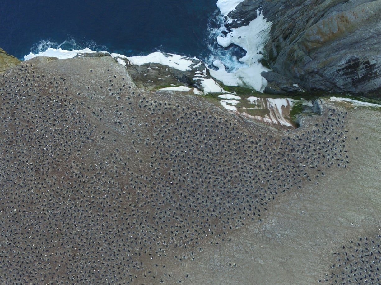
The huge numbers of Adélie penguins were found on the Danger Islands in the Weddell Sea, on the east side of the Antarctic Peninsula.
It is a difficult place to reach and has seldom been visited.
But scientists, prompted by satellite images, mounted an expedition and used on-the-ground counts and aerial photography from drones to reveal 751,527 pairs of penguins.

Aerial footage revealed an enormous breeding colony of Adélie penguins in the Danger Islands. Photograph: Thomas Sayre-McCord/WHOI/MIT

The researchers then examined satellite images going back to 1959 and believe the colony has been stable over that time.
In contrast, Adélie colonies to the west of the Antarctic Peninsula, where the impact of climate change and human activity are much greater, are in decline.

“This was an incredible experience, finding and counting so many penguins,” said Tom Hart, at the University of Oxford and part of the international research team.
Its report, Survey of Adélie Penguin Mega-colonies Reveals the Danger Islands as a Seabird Hotspot, is published in the journal Scientific Reports.

Michael Polito, at Louisiana State University and also part of the team, said: “I was amazed by the sheer number of Adélie penguins I saw.
The water around the island boiled with penguins.”

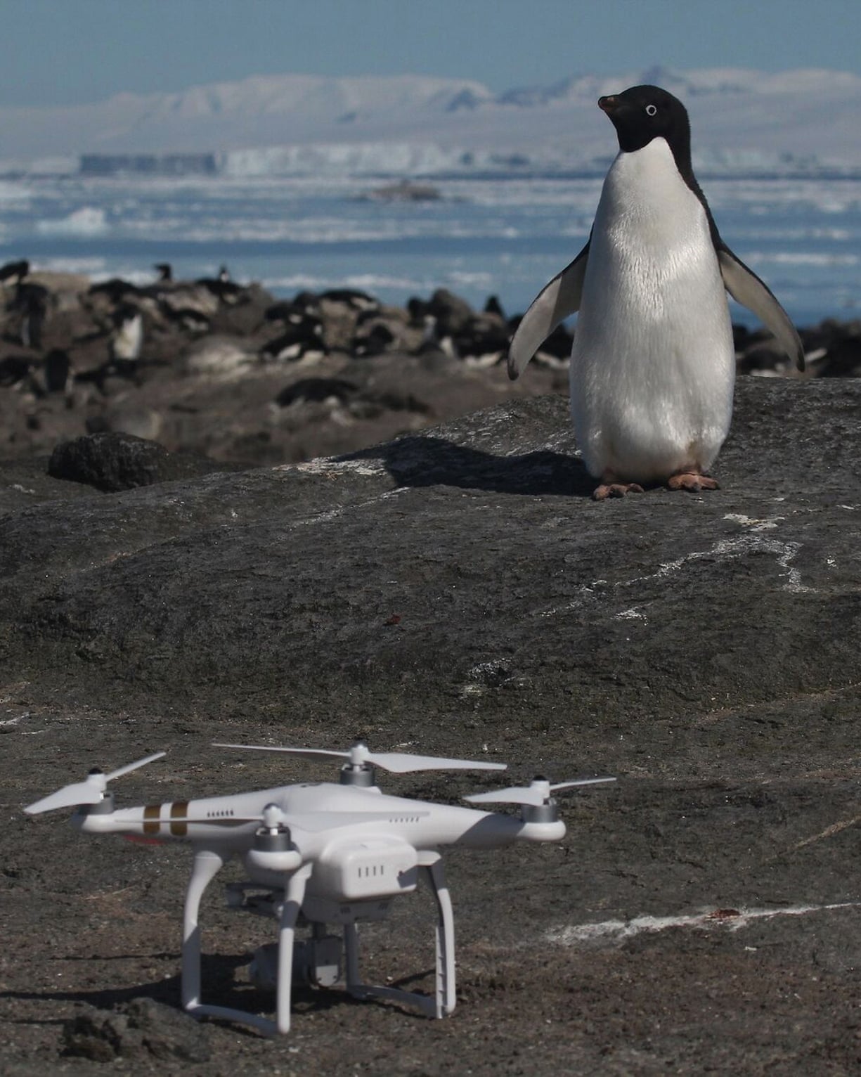
The researchers uses drone footage to calculate the number of penguins.
Photograph: Rachael Herman/Stony Brook University/Louisiana State University

Hart said: “The size of these colonies makes them regionally important and makes the case for expanding the proposed Weddell Sea Marine Protected Area (MPA) to include the Danger Islands. More than that, I think it highlights the need for better protection of the west Antarctic Peninsula, where we are seeing declines.”

Rod Downie, at WWF, said: “This exciting discovery shows us just how much more there still is to learn about this amazing and iconic species of the ice. But it also reinforces the urgency to protect Antarctic waters from the dual threats of overfishing and climate change.”

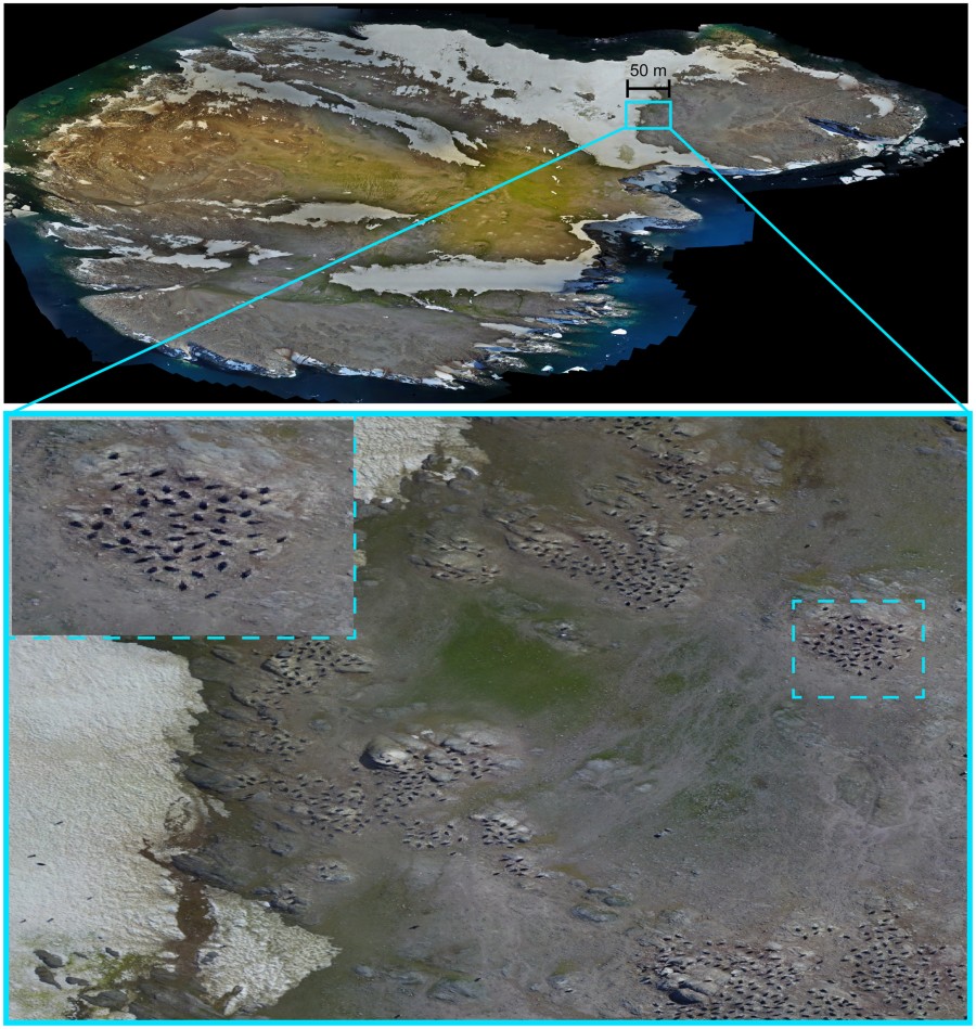
 UAV orthomosaic image of Brash Island (above),
with examples of zoomed-in penguin rookeries (below)

The proposed MPA is huge – 1.8m sq km or five times the size of Germany.
It would ban all fishing in a vast area of the Weddell Sea and around the Antarctic Peninsula, safeguarding killer whales, leopard seals and blue whales, as well as penguins that rely on the krill targeted by fishing ships.
The MPA already has the support of several countries, including the UK, and will go before a conference of the Antarctic nations in October.

Panoramic Quadcopter aerial imagery of an Adélie penguin breeding colony on Heroina Island, Danger Islands, Antarctica
Credit: Thomas Sayre McChord, Hanumant Singh, Northeastern University, © Woods Hole Oceanographic Institution

The discovery of the mega-colonies is a major development for polar scientists – and welcome good news.
In October, they reported that just two chicks had survived from a colony of 40,000 at Petrel Island, a few thousand kilometres west of the Antarctic peninsula.

Other penguins are also facing an uncertain future.
On Monday, researchers warned that king penguins could almost disappear from Antarctica by the end of the century unless climate change is curbed.

Links :

Sunday, March 4, 2018

It’s not too late to save coral reefs


From Nature by Mark Spalding

This year-2018-has been declared the "International Year of the Reef" by the International Coral Reef Initiative, but given recent headlines, you might be forgiven for asking if this was in fact the last year for coral reefs.
Coral reefs are "under siege" (USA Today), "ravaged by war" (New York Times) and "headed for [the] knockout punch" (BBC News). Even the normally conservative National Geographic has stated that the "window to save the world's coral reefs [is] closing rapidly".

A diversity of corals, echinoderms, sponges and other life compete for space and plankton on the reefs surrounding Bangka Island, North Sulawesi, Indonesia.
Photo © Ethan Daniels

This problem hasn't arisen overnight, of course.
In 1998 we released the first edition of Reefs at Risk, mapping the vast array of threats facing these extraordinary habitats from coastal development to pollution to overfishing.
It highlighted the global scale of the challenges facing reefs and was met with widespread shock.
That same year was also the first global coral bleaching event, brought on by the brutally hot combination of El Nino and climate change.
And while climate change and coral bleaching dominate today's headlines, it is the combination of these threats with the more local impacts of pollution and over-exploitation that also prevents reefs from recovering—death by a thousand cuts.

The consequences and implications of coral die-offs are numerous—for marine ecosystems, yes, but also for people around the world.
Some 200 million people live close to reefs.
More than a quarter of all marine species spend at least some part of their life cycle in coral reefs, including species that both commercial and subsistence fishermen depend on.
Reefs also protect coastal communities from erosion, flooding and storms—a healthy coral reef can reduce wave force by 97 percent—and generate billions of dollars in value for the tourism, pharmaceutical and other industries.

But it's too early to start writing an obituary for coral reefs.
As dire as their fate may seem now, science is changing what we know about coral reefs and how we might save them; about their roles within the broader ocean environment; and about their tremendous benefits to human communities and their economies.
In fact, the complexity and interdependence of these systems, and our reliance on them, may be the key to reefs' preservation.

This is key to our work at The Nature Conservancy—we are finding the support we need from our partners and allies in the communities, businesses and institutions whose fates are intertwined with those of coral reefs.
And it is in these places, at the intersections of conservation and business, finance and science, high politics and local communities, that we will find solutions.

Coral reefs worldwide are in trouble.
But a team of ocean scientists have found what they think could be a natural, ecological way to save the reefs -- and it already exists in nature.
It's a type of coral called a corallith.

Our strategy centers on empowering and collaborating with those on the frontlines of reef conservation.
Our Reef Resilience Network, for example, connects marine resource managers around the world and provides information and training opportunities to maximize conservation and restoration efforts.
Similarly, our work with fishermen in the Caribbean, the Solomon Islands and other regions is also demonstrating that a more sustainable approach to fishing sustains reef ecosystems and in turn leads to better fishing yields in the long term.
Well-managed, healthy reefs are proving more resilient to the wider effects of climate change.

But we're also finding more unlikely allies in the business community.
The tourism industry offers a good example. Globally, the tourism industry derives $36 billion in annual revenue from coral reefs; the Conservancy's Mapping Ocean Wealth initiative is helping to identify where and how reefs generate tourism's value and offering more incentives for conservation.
And one of the most significant new partners we've developed is the insurance industry, including Swiss Re, one of the largest reinsurers in the world.
Recognizing the importance of reefs for protecting coastal development, we are exploring innovative disaster risk financing mechanisms that will support long-term protection and restoration of reefs and other critical natural defenses.

This work is no panacea, of course.
Coral bleaching events, driven by warming oceans, are a serious and growing threat, and ocean acidification will complicate matters still further.
But science has already demonstrated that reefs have the ability to rebound from extreme damage.
Even reefs that were highly degraded by multiple disturbances have shown signs of recovery, so if we can reduce the damage from local sources, reefs will have a better shot at recovering from bleaching events.

What are coral reefs?
Coral can be found in tropical ocean waters around the world.
But how much do you know about reefs and the tiny animals—polyps—that build them?
Learn all about coral and why warming waters threaten the future of the reef ecosystem.

The newer and still developing piece of the puzzle, though, comes from our recognition that an awful lot of people have an awful lot to lose from coral reef extinction.
We are only just beginning to realize that we can engage these people and sectors—even if they might not always be the most obvious partners—as part of the solution.
The challenge is to provide them with the information and the tools they need to make better decisions about actions that will impact reefs.
Can we, in fact, empower them to become advocates for reefs?
And if we do, can we save coral reefs?

My answer to both questions is an unequivocal "yes."
I look forward to sharing more of the Conservancy's progress in the coming months as we move to make this International Year of the Reef a year of hope and resurgence.