Sandy ghost island with 2008 SHOM nautical map (7321/INT636)
 SHOM ENC
overlayed on Google Maps with transparency
overlayed on Google Maps with transparency
>>> geolocalization with the Marine GeoGarage <<<
From BBC
Sandy island undiscovered
A South Pacific island, shown on marine charts and world maps as well as on Google Earth, does not exist, Australian scientists say.

Google Earth view
but also found in satellite imagery view of Nokia Maps or map view of Bing Maps
using NASA Blue Marble imagery
using NASA Blue Marble imagery

Neither the French government - the invisible island would sit within French territorial waters if it existed - nor the ship's nautical charts, which are based on depth measurements, had the island marked on their maps.
>>> geolocalization with the Marine GeoGarage <<<
 extract of chart 5978 from SHOM (French Hydrographic Office)
no 'île Sable' in 1982
 Nouvelle Calédonie SHOM ENC official vector chart FR273210 (scale : 1:1,500,000)
(other view with depths in meters)
no 'île Sable' in 2012 update
>>> geolocalization with the Marine GeoGarage <<<

no 'île Sable' in 1982

(other view with depths in meters)
no 'île Sable' in 2012 update
But when scientists from the University of Sydney went to the area, they found only the blue ocean of the Coral Sea.
The phantom island has featured in publications for at least a decade.

Scientist Maria Seton, who was on the ship, said that the team was expecting land, not 1,400m (4,620ft) of deep ocean.
"We wanted to check it out because the navigation charts on board the ship showed a water depth of 1,400m in that area - very deep," Dr Seton, from the University of Sydney, told the AFP news agency after the 25-day voyage.
"It's on Google Earth and other maps so we went to check and there was no island. We're really puzzled. It's quite bizarre.
"How did it find its way onto the maps? We just don't know, but we plan to follow up and find out."


Atlas map : Australian, N.Z. ports (British map 1922)

Soviet Union atlas map (1967)
(David Rumsey collection)
with shoal indication instead of fictional 'Sandy island'
see other ancient maps from Rumsey collection on :
Maps of Sandy Island Through History
the non-existent "Sandy Island" has been drawn (or not) in some maps since the 1770's,
so long before the arrival of satellite imagery
 Karte von Australien oder Polynesien, nach den Zeichnungen Reisebeschreibungen und Tagebücher der vorzüglichsten Seefahrer bis 1789 entworffen im Jahr 1792 (Gallica BNF)
(note : the existence of another 'Sandy island' in the North of New Caledonia island)
with shoal indication instead of fictional 'Sandy island'
see other ancient maps from Rumsey collection on :
Maps of Sandy Island Through History
the non-existent "Sandy Island" has been drawn (or not) in some maps since the 1770's,
so long before the arrival of satellite imagery

(note : the existence of another 'Sandy island' in the North of New Caledonia island)

NGA chart 56 Great circle sailing chart of the North Pacific Ocean
(edition sept 1973)
with shoal indication instead of fictional 'Sandy island'


New Caledonia and Vanuatu bathymetric and topographic map
with 'Ile de Sable'
(also in GeoPortail overview)
 C-Map CM93/2 (2009) commercial vector map view on OpenCPN software
with 'Sandy island'
 Navionics (2012) commercial vector map online view
with 'Sandy Island'
 Great Barrier Reef and Coral Sea bathymetry
in Google Earth (kmz) / e-Atlas
with 'Sandy island'
with 'Ile de Sable'
(also in GeoPortail overview)

with 'Sandy island'

with 'Sandy Island'

in Google Earth (kmz) / e-Atlas
with 'Sandy island'
Australian newspapers have reported that the invisible island would sit within French territorial waters if it existed - but does not feature on French government maps.

Sandy island from the GSHHS worldwide high-resolution shoreline data set (QGIS view)
Mike Prince, the director of charting services for the Australian Hydrographic Service, a department within the Navy that produces the country’s official nautical charts,
said the world coastline database incorporated individual reports that were sometimes old or contained errors.
 Sandy island in the VMAP-0 vector map file,
available from NGA
next version of widely used Digital Chart of the World (DCW)
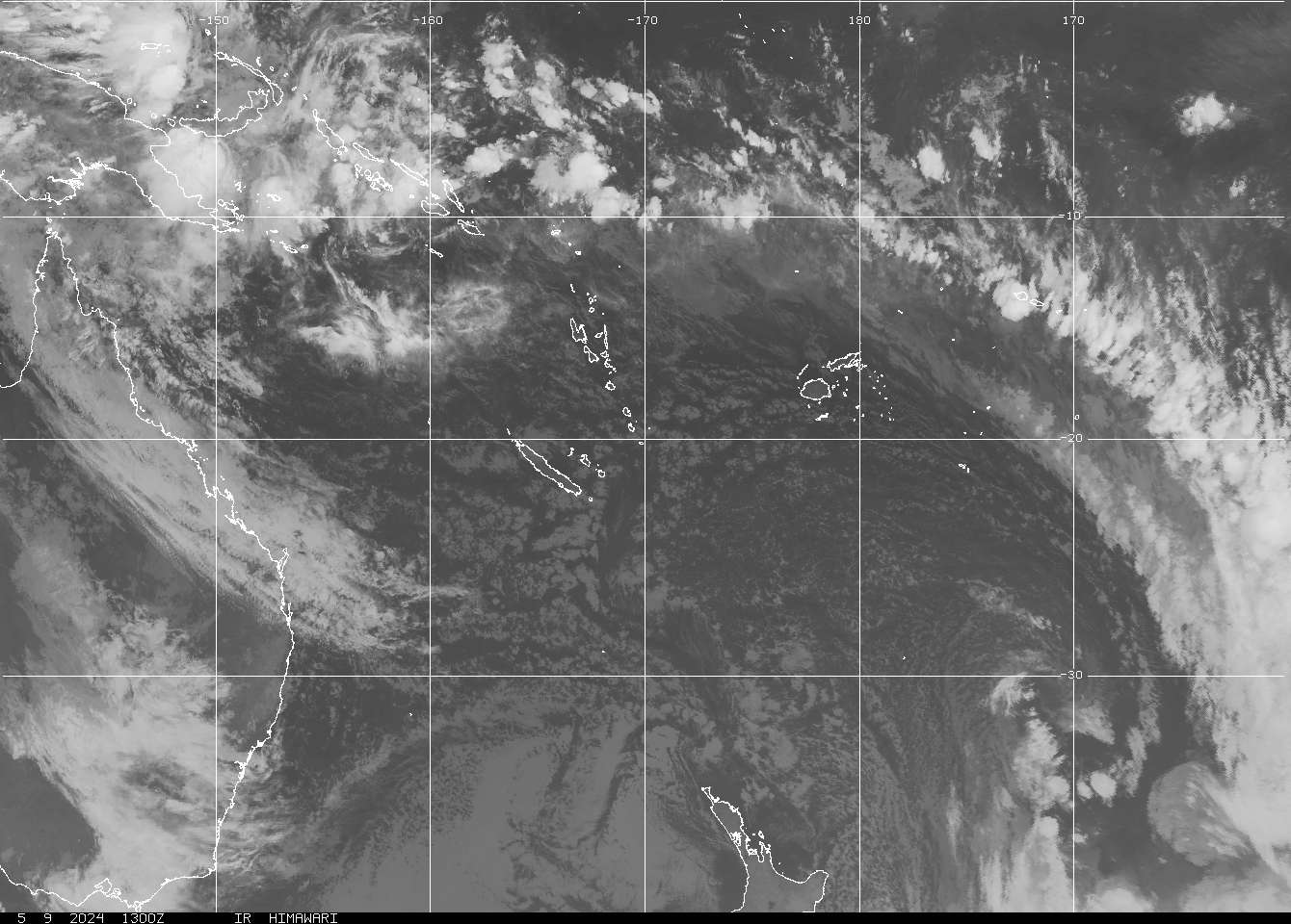
also found in weather satellite picture (GOES NOAA)
 Global gravity (kmz) on Google Earth in the area of the supposed 'Sandy island'
(ref : Sandwell, D. T., and W. H. F. Smith,
Global marine gravity from retracked Geosat and ERS-1 altimetry)
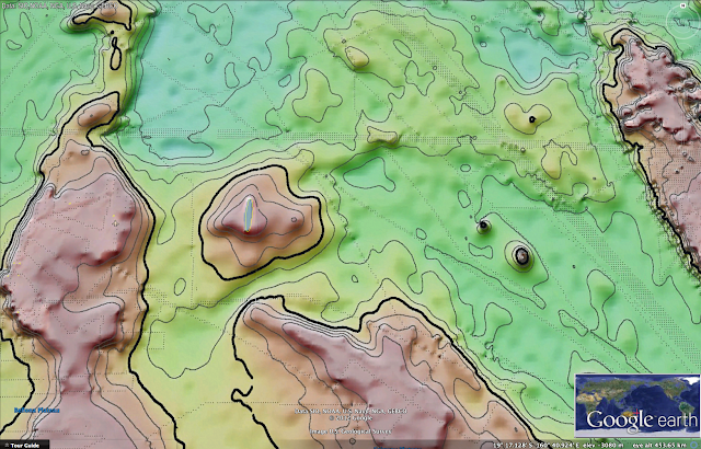 Measured and estimated seafloor topography (STRM30+) kmz by Google Earth
(ref : Smith, W. H. F., and D. T. Sandwell, Global seafloor topography
from satellite altimetry and ship depth soundings)
which has been directly used by Google or GEBCO (General Bathymetric Chart of the Oceans)
said the world coastline database incorporated individual reports that were sometimes old or contained errors.
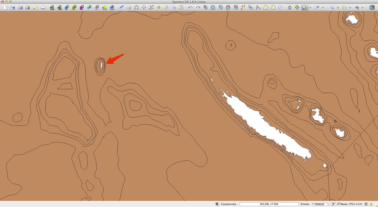
available from NGA
next version of widely used Digital Chart of the World (DCW)
also found in weather satellite picture (GOES NOAA)

(ref : Sandwell, D. T., and W. H. F. Smith,
Global marine gravity from retracked Geosat and ERS-1 altimetry)

(ref : Smith, W. H. F., and D. T. Sandwell, Global seafloor topography
from satellite altimetry and ship depth soundings)
which has been directly used by Google or GEBCO (General Bathymetric Chart of the Oceans)
Australia's Hydrographic Service, which produces the country's nautical charts, says its appearance on some scientific maps and Google Earth could just be the result of human error, repeated down the years.
A spokesman from the service told Australian newspapers that while some map makers intentionally include phantom streets to prevent copyright infringements, that was was not usually the case with nautical charts because it would reduce confidence in them.
Mike Prince, the director of charting services for the Australian Hydrographic Service, a department within the Navy, said that while some map-makers added non-existent streets in order to keep tabs on people stealing their data, that was not standard practice with nautical charts.
“[That would] reduce confidence in what is actually correct,” he said.
A spokesman for Google Earth said they consult a variety of authoritative sources when making their maps.
"The world is a constantly changing place, the spokesman told AFP, "and keeping on top of these changes is a never-ending endeavour'.'


indication of 'Sandy island' (discovered by 'Velocity' whaling ship 1876 -photos-) on :
Australia Coral Sea and Great Barrier Reefs
Australia Coral Sea and Great Barrier Reefs
shewing the Inner and Outer routes to Torres Strait,
compiled chiefly from the Surveys of Captains Flinders, King, Blackwood, Stanley, Yule & Denham
RN 1802-60 with additions from Admiralty surveys in progress to 1888
Published at the Admiralty Decr. 19th 1860 under the Superintendence of Capt. Washington, R.N., F.R.S. Hydrographer

indication of 'Sandy island' on
(BNF Gallica)

not any indication of 'Sandy island' on
Brue, A.H., Levasseur, E. Australie, Nouvelle-Zelande. 1875 World Atlas
Brue, A.H., Levasseur, E. Australie, Nouvelle-Zelande. 1875 World Atlas
David Rumsey collection

neither on :
Other ancient maps (BNF Gallica) :
- Carte de l'Océanie contenant l'Australie, la Polynésie et les Iles Asiatiques Par J.B. Poirson, Ing. Géog. Revue par A.Toussaint -Vve. Turgis (Paris)-1832
- General-Karte von Australien, Friedrich H. Handtke, 1889

neither on :
ORSTOM bathymetry map 1979 (other bathy maps 1981 / 1987)
 neither on Transas map
 neither on :
PlanetObserver Landsat satellite imagery (15m) (IGN GeoPortail view)


PlanetObserver Landsat satellite imagery (15m) (IGN GeoPortail view)

neither on :
http://explorateur-carto.georep.nc
or http://carto.gouv.nc (on Google Earth : kmz)
with bathymetric data from SHOM multibeam echo-sounder surveys in 2008
(IRD 'Alis' ship with Simrad EM1002 and IFREMER 'Atalante' ship with Simrad EM12,
isobaths ZEE NC file -pdf map-
surveys tracks SHOM + IFREMER + IRD)

The BBC's Duncan Kennedy in Sydney says that while most explorers dream of discovering uncharted territory, the Australian team appears to have done the opposite - and cartographers everywhere are now rushing to un-discover Sandy Island for ever.
Links :
- SydneyMorningHerald : Where did it go? Scientists 'undiscover' Pacific island
- Wikipedia / Talk
- blog GeoGarage : Lost Islands: the story of Islands that have vanished from nautical charts