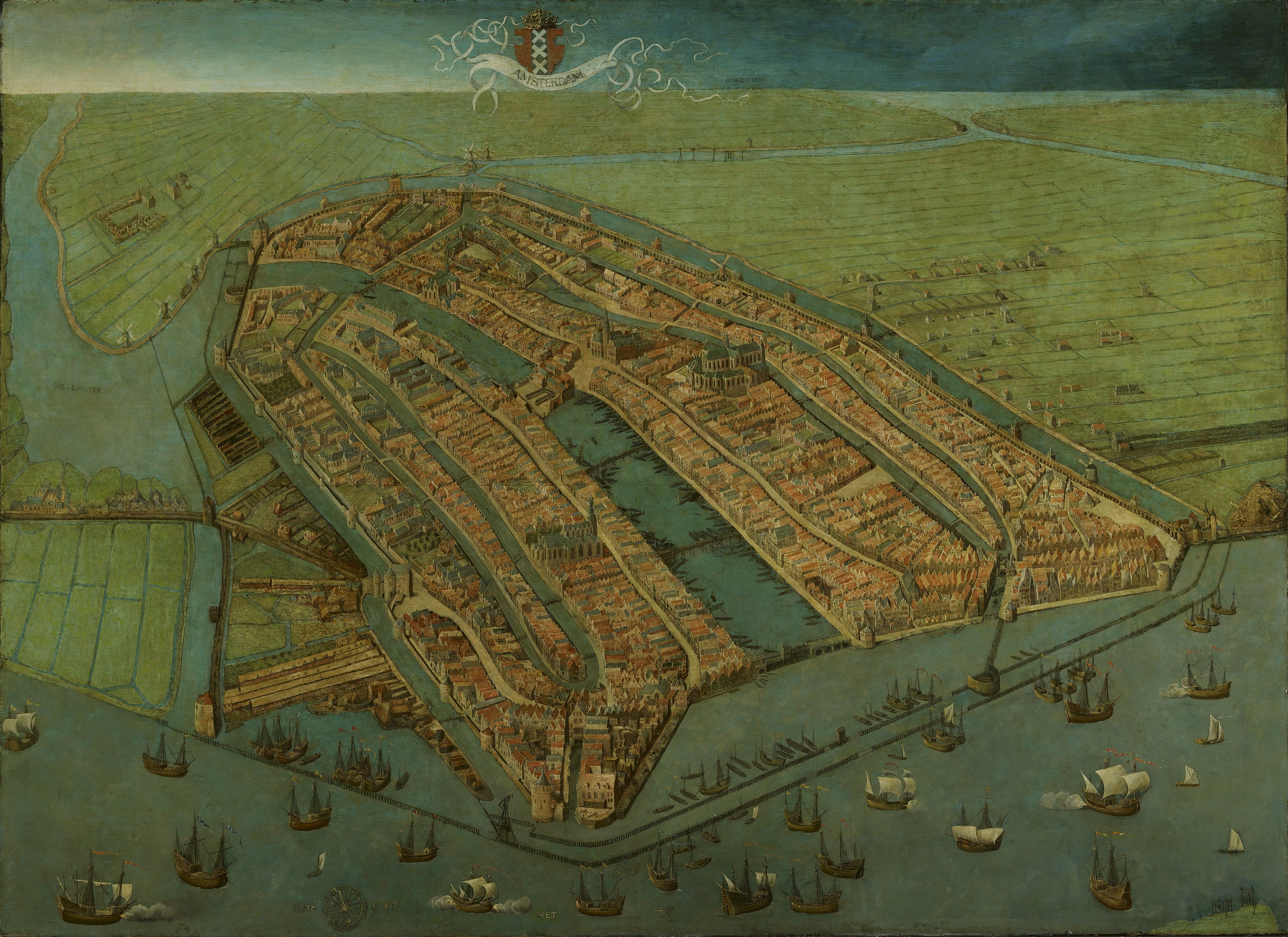
A 1538 painting by Cornelis Anthonisz showing a bird's-eye view of Amsterdam;
the famous Grachtengordel had not yet been established.
This actually is one of the oldest surviving maps of Amsterdam, showing the city's finished medieval walls, towers and gates.
Like
in most old maps of Amsterdam the city is shown from the river IJ, so
that the view is directed to the south rather than the north.
Collection Amsterdam Museum
.jpg)
Bird's eye view of Amsterdam, painted by Jan Micker around 1652.
Micker was inspired by Cornelis Anthonisz.' 1538 View of Amsterdam.
This painting thus portrays Amsterdam as it must have been around 1538, and not the enlarged Amsterdam of 1652.
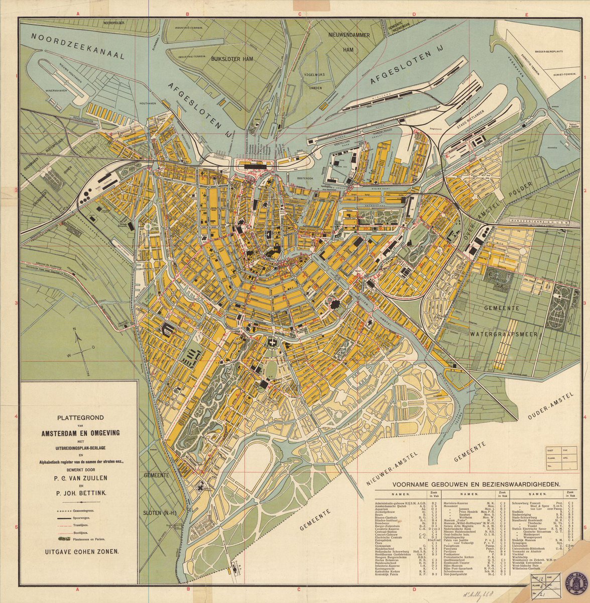 The urban design work of the Dutch architect Hendrik Petrus Berlage (1856-1934) focused on finding sustainable concepts to cope with the strong population growth of Dutch cities in the 1930s
 Amsterdam North up view in the GeoGarage platform (NLHO nautical chart)

Links :
- Wikimedia : other Old maps of Amsterdam
No comments:
Post a Comment