
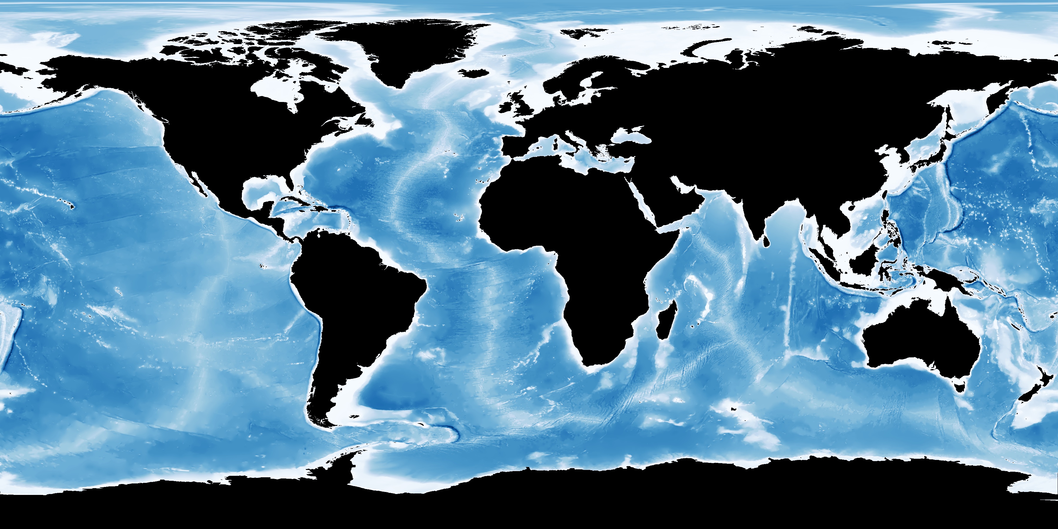
The ocean seabed is yet to be mapped in detail – but this might soon change (Image: GEBCO)
The Chairman of The Nippon Foundation, Yohei Sasakawa, has announced that The Nippon Foundation – GEBCO Seabed 2030 project to map the bathymetry of the world’s entire ocean floor by 2030 has started.
The Nippon Foundation has pledged $2 million per year as seed money – and is calling on the resources of the international maritime community for additional support.
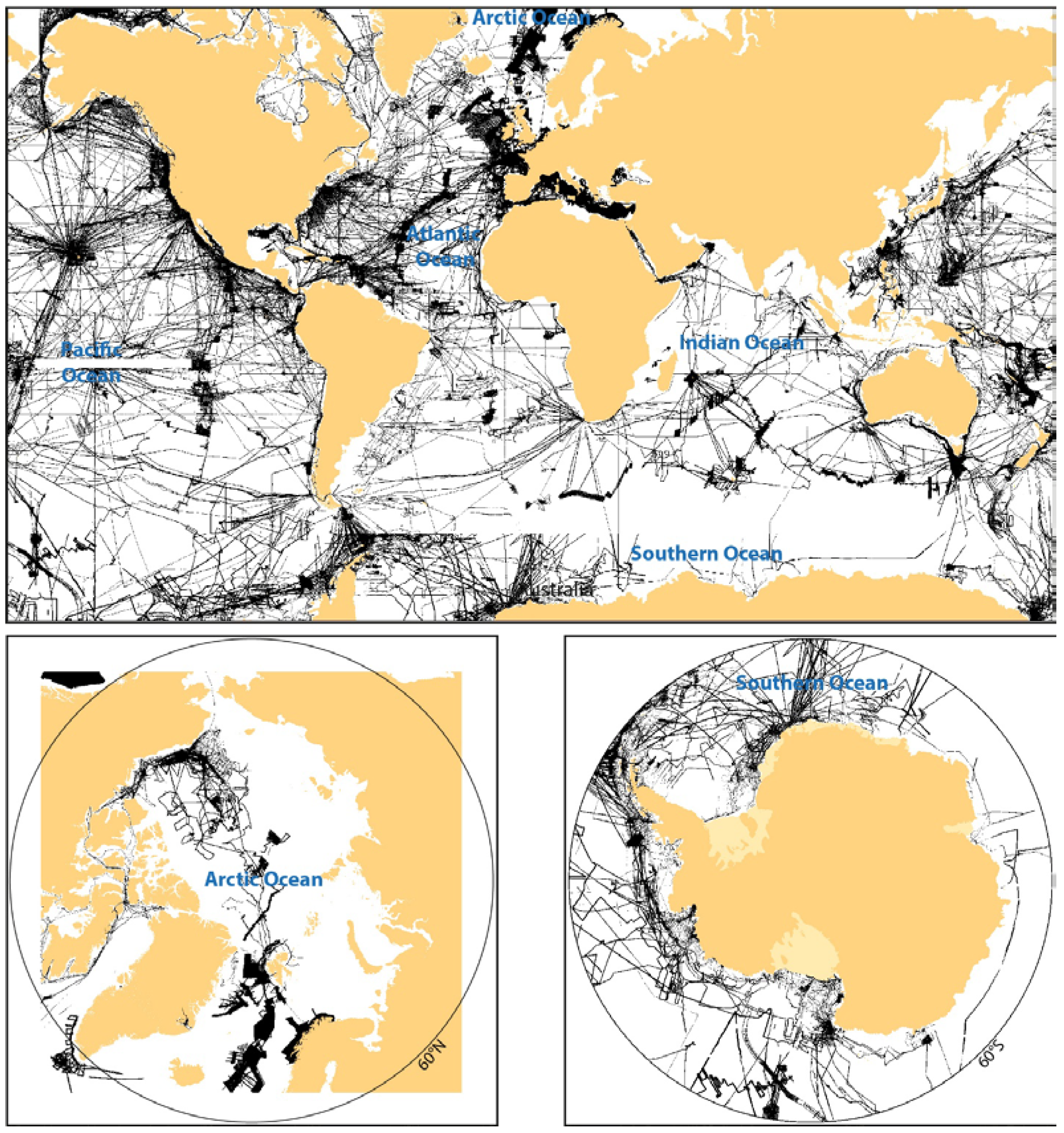
A concept paper for the project highlights that the vast majority of the world ocean has not been sampled by echo sounders even at a resolution of about 30 arc seconds.
Considering that many of the approximately one kilometer grid cells only have a single sounding in them, the percentage of the seafloor that has actually been measured by echo-sounders is considerably less than 18 percent.
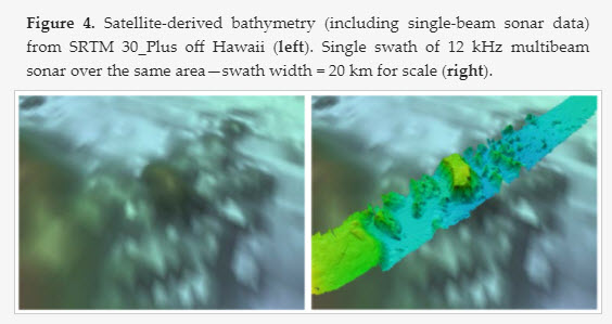
Satellite altimetry-derived bathymetry has represented an advancement, providing global coverage of general estimates of depths.
However, it is far less precise than echo sounder-derived data and has far less resolution than modern multi-beam sonars.
Understanding the bathymetry (seabed depth) of the global ocean is imperative, not only for improving maritime navigation, but also for enhancing our ability to predict climate change and monitor marine biodiversity and resources, says Sasakawa.
The project will make a significant contribution to the U.N.’s Sustainable Development Goal 14: to conserve and sustainably use the oceans, seas and marine resources for sustainable development.
A comprehensive map of the seafloor will assist global efforts to combat pollution, aid marine conservation, forecast tsunami wave propagation, and help inform the study of tides, wave action, and sediment transport.
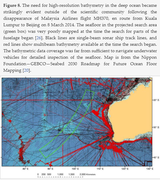
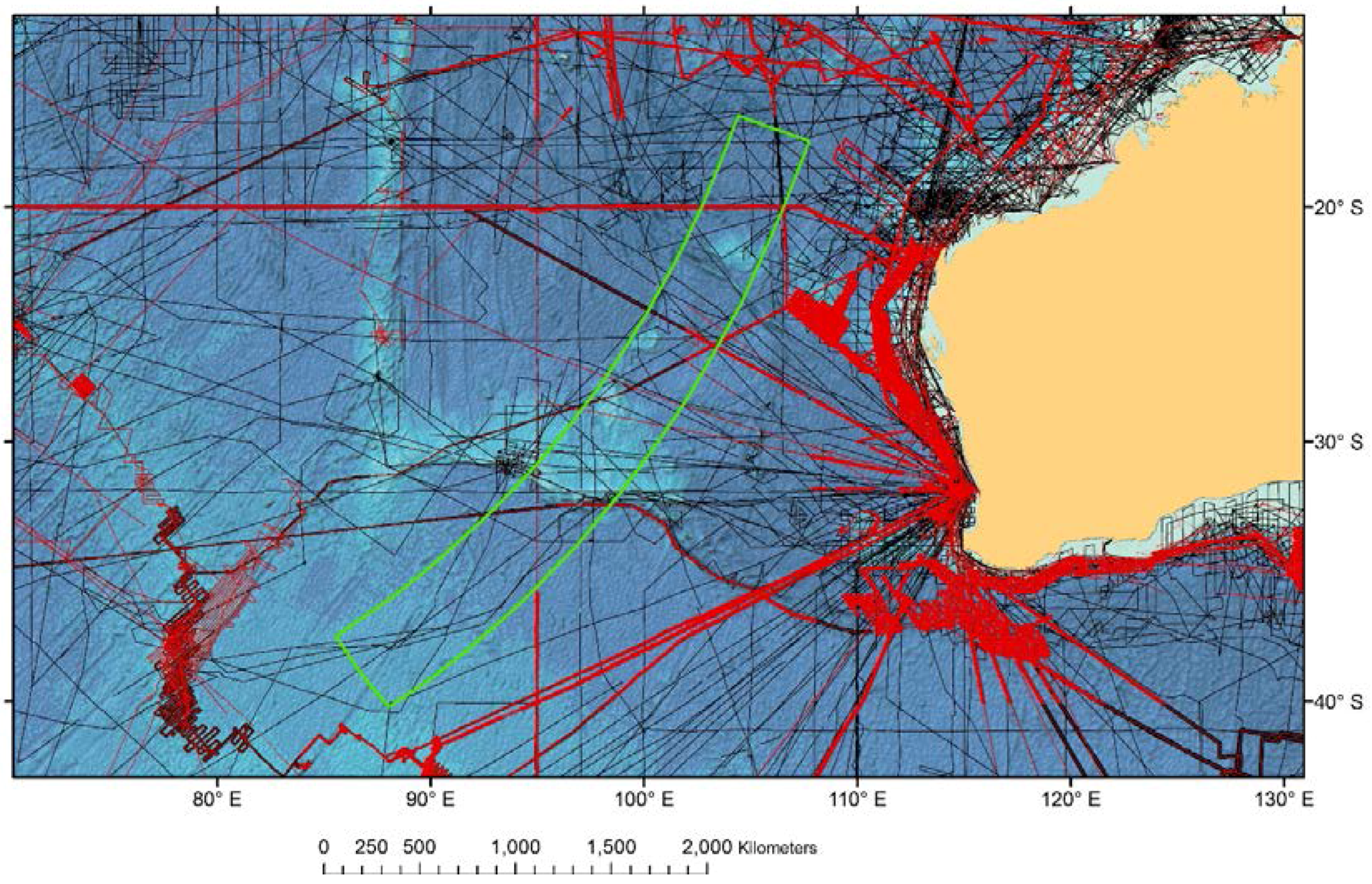
The need for bathymetric data was also highlighted by the disappearance in March 2014 of Malaysian Airlines flight, MH370.
The project’s structure is based on a roadmap produced by an establishment team of leading ocean mapping experts.
Sea floor mapping in search for missing flight MH370 released
“The Nippon Foundation alone cannot achieve the objectives of this ambitious project,” said Sasakawa.
“We will need the support of a large number of stakeholders, including world-leading technical experts.
It is crucially important that the maritime community comes together to achieve this important goal.”
As shallow seas lie mostly in the territorial waters of coastal states and much of the responsibility for mapping these waters will rest with local hydrographic agencies, most of the effort of the Nippon Foundation GEBCO Seabed 2030 Project will be focused on the 93 percent of the world’s oceans that is deeper than 200 meters and often beyond the jurisdiction of local hydrographic agencies.
For the other seven percent, the project will work closely with local hydrographic agencies to obtain shallow water data wherever possible.

Four Regional Centers have been set up, each with responsibility for a region of the world’s ocean, with a Global Center to produce the global map.
The Regional Centers are based at The Alfred Wegener Institute (AWI), Germany, covering the Southern Ocean; The National Institute of Water and Atmospheric Research (NIWA), Wellington, New Zealand, covering the South and West Pacific Ocean; The Lamont Doherty Earth Observatory, Columbia University, U.S., covering the Atlantic and Indian Oceans; and Stockholm University, Sweden, in partnership with the University of New Hampshire, U.S., for the North Pacific and Arctic Ocean.
The Global Center, which is responsible for centralized data management and products, is based at the U.K. National Oceanography Center, Southampton.

The Regional Centers will identify existing data from their assigned regions that are not currently in publicly available databases and seek to make these data available.
They will develop protocols for data collection and common software and other tools to assemble and attribute appropriate metadata as they assimilate regional grids using standardized techniques.
GEBCO bathymetry
(cortesy of OMG)
It will also act as the central focal point for the coordination of common data standards and processing tools.
The project will encourage and help coordinate and track new survey efforts and facilitate the development of new technologies that can increase the efficiency of seafloor mapping.

GEBCO-NF Alumni team completes XPRIZE testing phase
Satinder Bindra has been appointed leader of the international project team and brings a wealth of experience to the project, having previously worked for the Asian Development Bank, the United Nations Development Programme and UN Environment, where he promoted key environmental initiatives and sustainable development.
Bindra said: “This is a challenging opportunity to build a global common good and do something meaningful for our future generations.
The scale and scope of the project is such that we will have to work with international organizations, universities, civil society, the private sector, maritime industries -including fishing and shipping, youth organizations and citizens from every corner of the world.
As we strengthen our cooperation, we will deepen our understanding of the oceans and enhance our ability to map the remaining 85 percent of the ocean floor much faster than ever before.’’
Links :
- Hydro : Nippon Foundation-GEBCO Seabed 2030 Project / New Technology to Assist in Mapping the Ocean Floor
- NextBigFuture : Roadmap for Future Ocean Floor Mapping
- Futurism : Schools of Robots Are Mapping the Unknown Features of the Deep Sea
- NOAA : Seabed 2030 : Map the gaps
- EarthIsland : Deep impact : mapping the ocean floor could put undersea creatures at risk
- GeoGarage blog : Why the first complete map of the ocean floor is stirring controversial / Here are the teams competing to map the ocean for ... / Ocean floor to be mapped by 2030 ? / It's time to geek out over a new global bathymetric ... / The floor of the ocean comes into better focus / If the ocean was transparent : the see-through sea / How one brilliant woman mapped the ocean floor's ... / The great challenge of mapping the sea / Marie Tharp: the woman who mapped the ocean floor / X Prize to map 4,000m-deep ocean floor with robots / Scientists to survey uncharted seafloor area / MH370 spur to 'better ocean mapping' / MH370 search data unveils fishing hot spots ...
Hydro : Seabed 2030: A Call to Action
ReplyDeleteNewsDeeply : These Robots Could Help Map the Seafloor in Unprecedented Detail
ReplyDeleteGISlounge : Rapid Ocean Floor Mapping
ReplyDeleteNOAA : Mapping Our Planet, One Ocean at a Time
ReplyDeleteNewsDeeply : Deeply Talks: Behind the Quest to Map the Seabed by 2030
ReplyDelete