


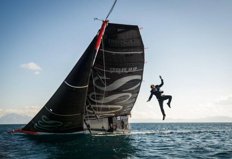
Alex Thomson does the best ever marketing stunt that involves sailing for Hugo Boss
Fure that with just that photo, Hugo Boss will get more media coverage
than an average America’s Cup campaign.
Fure that with just that photo, Hugo Boss will get more media coverage
than an average America’s Cup campaign.
Solo round the world yachtsman Alex Thomson performs a daring feat on board his high-speed yacht, Hugo Boss : He climbs up the 30-meter high mast of the moving vessel and dives into the ocean.
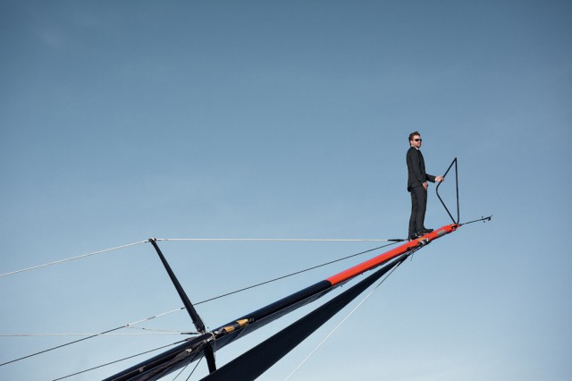
This is not the first stunt we've seen from Alex - two years ago he completed the "Keel Walk", a stunt that has become famous throughout the world

This is not the first stunt we've seen from Alex - two years ago he completed the "Keel Walk", a stunt that has become famous throughout the world

It seems like a kind of strange behaviour...
Does everybody walk on the mast?
A new game for this summer ?
Does everybody walk on the mast?
A new game for this summer ?
source : Compass Magazin
 or the Captain of the QM2 standing on the bulb of the ship
photo James Morgan
Links :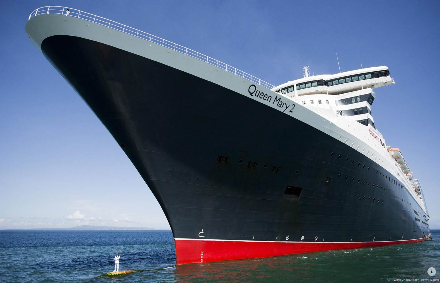
photo James Morgan
- ImocaOceanMasters : The 'Mast walk' by Alex Thomson
- GeoGarage blog : Walk on the wild side


