Monday, March 29, 2021

2 former Navy SEALs are using robot submarines to build ‘Google Earth’ for the ocean

Austin-based startup Terradepth aims to map the ocean floor and its environments with thousands of autonomous robotic submarines.
[Image: courtesy of Terradepth]

From FastCompany by Susan Karlin

In 2005, Joe Wolfel and Judson Kauffman were a year into their Navy SEAL careers when they received a briefing on the USS San Francisco, a nuclear-powered submarine that had crashed into an undersea mountain, in large part due to uncharted waters.

 
Joe Wolfel (left) and Judson Kauffman [Photo: courtesy of Terradepth]
 
“The Navy really doesn’t have charts or maps of very much of the seafloor at all,” Kauffman says.
Even now, 80% of the ocean remains unmapped, according to the National Oceanic and Atmospheric Administration.
“That was the first time that either one of us understood the level of ignorance that exists around this subsea world, so that kind of planted a seed.”

Still, their scheme for hurdling that challenge wouldn’t germinate for another dozen years, after the pair parlayed their military experience into a business consultancy and began noting the burgeoning array of space exploration robotics.

“One day we looked at each other and said, ‘Why isn’t anybody taking this technology—autonomy, AI, and machine learning—and finding a way to map the ocean?’ ” Kauffman says.
“There’s a whole lot of room for modern technology to come in and disrupt the world of ocean exploration and the industry of ocean surveys.”
 
[Image: courtesy of Terradepth]
 
That vision has since blossomed into Austin-based Terradepth, a data service company that has developed a new type of robotic submarine to autonomously map the ocean and its varied environments.
 
 
[Photo: courtesy of Terradepth]
 
The 30-foot-long submersible uses a camera and sensor suite to collect data, then employs machine learning to process it, discern what’s important, and reprogram itself to return to a location and test for additional information—all without human intervention.
The system relies on edge computing, which can analyze information and solve problems at the data source in near real time.
The team successfully ran the submarine through its first on-site paces in nearby Lake Travis earlier this month, paving the way for more robust testing in the Gulf of Mexico within three weeks and along the Florida coast after that.

 
Along with a camera, the submarine utilizes two types of sonar as well as depth, navigational, temperature, and geolocation instruments.
It can dive to nearly 20,000 feet, which allows it access to 98% of the ocean.
A mission autonomy computer calculates route planning, while a payload autonomy computer determines which system to turn on and what task to accomplish.
The system can also geotag the precise location of data samples.
Although the prototype runs on the same crude oil used to power ships, future iterations will use a more environmentally friendly hydrogen fuel cell generator currently awaiting a patent.
The system autonomously recharges at sea.
 
 
[Image: courtesy of Terradepth]
 
The endeavor has already piqued the interest of the maritime data collection industry and billionaire businessman Richard Branson, who is following its progress.
In just three years, the Terradepth team was able to build a successful prototype on a modest budget and staff for this type of research by reconfiguring existing technology.
That involved $8 million in seed money from data storage manufacturer Seagate Technology and a dozen engineers who’d previously worked on projects such as Tesla’s autonomous driving products and the Mars Pathfinder.
Terradepth is planning a second round of financing in about six weeks.

The leap forward was the team’s integration of off-the-shelf components.
“No one had ever put them together with the level of machine learning and autonomy that we required,” says Kauffman, who serves as co-CEO with Wolfel.
“The big question was, is this thing going to be able to do its job without human intervention, because no one’s ever really done that to the degree that we’re trying to do it.”
 
 
[Image: courtesy of Terradepth]
 
Before founding their startup in 2018, the entrepreneurs ran their idea by the Autonomous Underwater Vehicles Laboratory at the Massachusetts Institute of Technology.
“We said, ‘We’ve got this leapfrog concept,’ and sketched it out on a whiteboard.
And we said, ‘Are we crazy, or is this good? What do you think?’ ” Kauffman says.
“They went around the room and said, ‘Wow, it’s actually a really good idea. You should patent that immediately!’ ”

“It was a big surprise, that these two knuckleheads came up with something that some of the smartest engineers in the world didn’t see,” he adds with a laugh.
“One of their comments was, ‘We were probably staring at the problem too closely to see this kind of a solution.’ ”
[Image: courtesy of Terradepth]
 
Wolfel and Kauffman see Terradepth as a complement to existing ocean mapping and exploration initiatives, such as those conducted by NASA, Woods Hole Oceanographic Institution, the Nippon Foundation-GEBCO Seabed 2030 Project, and the Monterey Bay Aquarium Research Institute’s Seafloor Mapping Lab, which assisted in the probe’s sensor development.
Data from various mapping missions would be shared with research partners, sold to commercial clients, and stored in a cloud-based ocean data management system for the public.
“So it’s like a Google Earth of the oceans,” Kauffman says.

He and Wolfel plan to eventually add sensors to collect chemical, biological, and environmental DNA information to assimilate into the mapping data, which could unveil undiscovered patterns over time.
The goal is to have a networked fleet of 5,000 to 10,000 robots continuously collecting and adding to existing data sets for increasingly detailed maps that show how environmental factors are changing subsurface terrain.
 
 
[Image: courtesy of Terradepth]
 
Eventually, such ongoing monitoring could better illustrate the interactions between marine ecosystems as well as their relationships with the terrestrial world, like weather and bird migrations.
“Once you gather all the data for your first map, it’s not game over,” Kauffman says.
“There’s so much data in the ocean and so much that changes, it’s difficult to make sense of it when you just have little tiny pieces. And right now, with climate change, this is pretty valuable data.”
environments with thousands of autonomous robotic submarines.
 
Links :

Sunday, March 28, 2021

Three nuclear submarines of the Navy for the first time in history together surfaced from under the ice

For the first time in the history of modern Russia, three nuclear-powered submarines of the Navy surfaced together in the ice.
The Commander-in-Chief of the Navy, Admiral Nikolai Evmenov, reported this to the Supreme Commander-in-Chief of the Armed Forces Vladimir Putin.
According to Evmenov, the ice was one and a half meters thick.
The submarines surfaced "according to a single concept and plan at the appointed time in an area with a radius of 300 meters."
One of the nuclear missile carriers conducted practical torpedo firing.
After the launch, the torpedo was raised to the surface in a specially equipped hole.
 
The three Russian submarines which surfaced near North Pole were 1 x spy submarine and 2 x Ballistic Missile subs (one DELTA-IV and a Borei-II). 
 

The Umka-21 Arctic expedition has been conducted since March 20 under the leadership of the main command of the Navy.
As the president noted, it has no analogues in Soviet and modern Russian history.
He added that during the expedition they confirmed "the high combat capabilities of domestic weapons, their reliability in operation in extreme conditions."
In total, Umka-21 involved more than 600 military and civilian personnel, about 200 types of weapons, military and special equipment.
In the area of ​​the expedition, the average temperature is minus 25-30 degrees Celsius, wind gusts reach 32 meters per second. 
translated from Ria article (26/03/2021)

This is about submerged transit to the North Pole on 3 August 1958 breaking through the ice from the bottom.
Because her special propulsion allowed her to remain under far longer than diesel-electrics, she broke many records in her first years of operation, and traveled to locations previously beyond the limits of vessels.
 

On August 3, 1958, the U.S. nuclear submarine Nautilus accomplishes the first undersea voyage to the geographic North Pole.
The world’s first nuclear submarine, the Nautilus dived at Point Barrow, Alaska, and traveled nearly 1,000 miles under the Arctic ice cap to reach the top of the world.
It then steamed on to Iceland, pioneering a new and shorter route from the Pacific to the Atlantic and Europe.

The USS Nautilus was constructed under the direction of U.S. Navy Captain Hyman G.
Rickover, a brilliant Russian-born engineer who joined the U.S. atomic program in 1946.
In 1947, he was put in charge of the navy’s nuclear-propulsion program and began work on an atomic submarine.
Regarded as a fanatic by his detractors, Rickover succeeded in developing and delivering the world’s first nuclear submarine years ahead of schedule.
In 1952, the Nautilus’keel was laid by US President Harry S. Truman, and on January 21, 1954, first lady Mamie Eisenhower broke a bottle of champagne across its bow as it was launched into the Thames River at Groton, Connecticut.
Commissioned on September 30, 1954, it first ran under nuclear power on the morning of January 17, 1955.

Much larger than the diesel-electric submarines that preceded it, the Nautilus stretched 319 feet and displaced 3,180 tons.
It could remain submerged for almost unlimited periods because its atomic engine needed no air and only a very small quantity of nuclear fuel.
The uranium-powered nuclear reactor produced steam that drove propulsion turbines, allowing the Nautilus to travel underwater at speeds in excess of 20 knots.
In its early years of service, the USS Nautilus broke numerous submarine travel records and on July 23, 1958, departed Pearl Harbor, Hawaii, on “Operation Northwest Passage”—the first crossing of the North Pole by submarine.
There were 116 men aboard for this historic voyage, including Commander William R. Anderson, 111 officers and crew, and four civilian scientists.
The Nautilus steamed north through the Bering Strait and did not surface until it reached Point Barrow, Alaska, in the Beaufort Sea, though it did send its periscope up once off the Diomedes Islands, between Alaska and Siberia, to check for radar bearings.
On August 1, the submarine left the north coast of Alaska and dove under the Arctic ice cap.

The submarine traveled at a depth of about 500 feet, and the ice cap above varied in thickness from 10 to 50 feet, with the midnight sun of the Arctic shining in varying degrees through the blue ice.
At 11:15 p.m. EDT on August 3, 1958, Commander Anderson announced to his crew: “For the world, our country, and the Navy—the North Pole.” The Nautilus passed under the geographic North Pole without pausing.
The submarine next surfaced in the Greenland Sea between Spitzbergen and Greenland on August 5.
Two days later, it ended its historic journey to Iceland.
For the command during the historic journey, US President Dwight D. Eisenhower decorated Anderson with the Legion of Merit.

After a career spanning 25 years and almost 500,000 miles steamed, the Nautilus was decommissioned on March 3, 1980.
Designated a National Historic Landmark in 1982, the world’s first nuclear submarine went on exhibit in 1986 as the Historic Ship Nautilus at the Submarine Force Museum in Groton, Connecticut. 

Links :

Saturday, March 27, 2021

Living off the grid on a homemade island

Have you ever wanted to simply walk away and find a way to live life off the grid?
Canadian artists Catherine King and Wayne Adams of Vancouver Island did just that.
They've lived in Freedom Cove on a floating island of their own making, some 45 minutes by boat from the nearest town. for 24 years, making subsistence living look like a true adventure. 

Friday, March 26, 2021

Magnets, vacuums and plant-based nets: the new fight to clean plastic from our seas

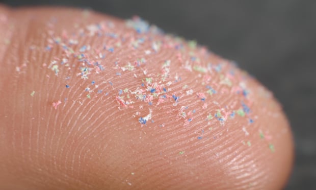
Microplastics have been found in drinking water, the food we eat and the air we breathe.
Photograph: a-ts/Alamy Stock Photo

From The Guardian by Adrienne Matei 

Tiny plastics are turning up in the air, our drinking water and our placentas. Here’s how innovators are handling the crisis

When it comes to microplastics, there’s rarely good news.
Researchers continue to find the tiny plastic fragments everywhere they look.

Microplastics have been found in rain, Arctic ice cores, inside the fish we eat, as well as in fruit and vegetables.
New research suggests 136,000 tons of microplastics are ejected from the ocean each year, ending up in the air we breathe.
They are in human placentas, our wastewater, and our drinking water.

All plastic waste, regardless of size, is detrimental to the environment, but microplastics pose a special challenge given their minuscule size (some are 150 times smaller than a human hair) and ability to enter the food chain.
The result is that chemical additives and all end up in the flesh and organs of fishand humans.
While the World Health Organization’s stance is that ingesting microplastics poses no known threat to human health, not everyone agrees.

“I think we know enough today to worry about it,” says Dr Douglas Rader, chief oceans scientist at the Environmental Defense Fund, pointing out that many microplastics contain chemicals linked to reproductive and hormonal disruption and cancer.

But it’s not all bad news.
Some are now innovating in microplastic extraction, providing the basis for a touch of cautious optimism.
Here is a look at several examples.

A microplastics magnet

Fionn Ferreira, a 20-year-old Irish inventor, found a way to successfully remove 88% of microplastics from water samples. Photograph: Fionn Ferreria
One way to remove microplastics from water is to encourage them to clump together into compounds that can be filtered – or, in the context of the 20-year-old Irish inventor Fionn Ferreira’s work, magnetized – out.

Ferreira created a homemade ferrofluid – a magnetic mixture of oil and powdered rust – and successfully used it to remove 88% of microplastics from water samples.
Ferreira’s efforts won him the top prize at the 2019 Google Science Fair.
He hopes to incorporate his findings into a device compatible with existing filtration systems, such as those in wastewater treatment plants (most of which are unable to sufficiently filter out microplastics).

In the future, he plans to test out whether he could use the device to make a self-cleaning filter for ocean engines.
“It could be built into the already existing water intake and outlets of the ships used to cool the engines, so as they’re taking in the water and as they’re driving around the oceans, they could be cleaning the water that passes through those engines,” he says.
(In autumn 2020, Suzuki Motor Corporation announced plans to introduce a microplastic filter into its watercraft outboard motors using similar logic.)
Using bottom feeders as ‘living vacuum cleaners’

 
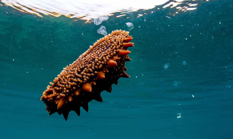
A Japanese spiky sea cucumber in the Sea of Japan. Photograph: Yuri Smityuk/TASS

Dr Juan José Alava, an expert in marine eco-toxicology and conservation, believes the answer to the microplastics problem could already be in the environment.
Alava studies organisms he calls “living vacuum cleaners”, including bottom feeders such as sea cucumbers, as well as the much smaller organisms that make up “epiplastic microbial communities”: strains of bacteria able to break down synthetic material, some of which originally evolved to metabolize naturally occurring polymers such as lignin and wax, and others which evolved to eat plastic garbage specifically.

“The idea is to identify communities of bacteria and try to enhance them – not by incorporating a new mix of genes created by humans, but by stimulating them to break down plastic,” he says.
When an organism can eliminate more plastic than it accumulates in its body or waste, it becomes “our best ally” in the fight against microplastics, says Alava.

A screen that can catch ‘plastic dust’

Marc Ward’s static-charged screen can capture plastic particles as small as 50 microns.

Photograph: Marc Ward

Marc Ward first became concerned about microplastics over 15 years ago while studying threats to wild marine turtle populations in Costa Rica.
Not only were turtles swallowing toxic microplastics, but the secluded beaches on which they nested were choked with plastic particulates.

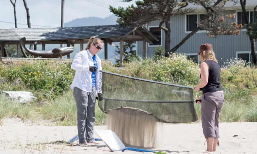
Ward began surveying beaches in both South America and near his home of coastal Oregon, sifting through sand with a static-charged screen able to capture plastic particles as small as 50 microns – essentially plastic dust.
In some areas, he found 10 pounds of microplastic in each square meter of beach.
The last straw for Ward came when, shortly after co-authoring a paper on marine plastic toxicity, he brought his two-year-old to their favorite beach in Oregon only to watch the child immediately try to put a piece of plastic garbage in his mouth.

Now, Ward works with a team to filter thousands of pounds of plastic out of Oregon’s beaches every year as part of his non-profit, Sea Turtles Forever’s Blue Wave initiative.

It may be that filter-cleaning sand at the beach is akin to chipping away at a mountain, and that ocean currents can undo such work in one fell swoop, yet Ward retains a positive outlook. 
“I know we are not the solution to ocean plastics,” he admits.
But he is extracting vast amounts of plastic from beaches nonetheless.
Plant-based nets than can collect even the tiniest particles

Scientists have created a new kind of water filter made from plant-derived nanocellulose mesh. Photograph: VTT Technical Research Centre of Finland
A new kind of water filter made from plant-derived nanocellulose mesh has been created by scientists at the VTT Technical Research Centre of Finland.

Nanoplastics – as tiny as 0.1 micrometers in diameter – have long proven particularly difficult to remove from drinking and wastewater given their minute size, and they have been found to accumulate in the tissues of humans and other organisms.

Hopefully, they have finally met their match.
The porous, colloidal structure of cellulose allows the material to bind to nanoplastics without using any chemical or mechanical interaction, says Tekla Tammelin, a research professor.

The gist (which this short video on the technology captures) is that cellulose filters can help researchers study nanoplastics, as well as keep them out of our water when integrated into wastewater filtration systems, or even laundry machines, where they could catch the tiny microfibers from synthetic clothing that comprise a subset of microplastics.
And while these findings are in their early days yet, the nanocellulose product has already garnered industry interest.
 
Links :

Thursday, March 25, 2021

Suez canal blocked by huge container ship after 'gust of wind'


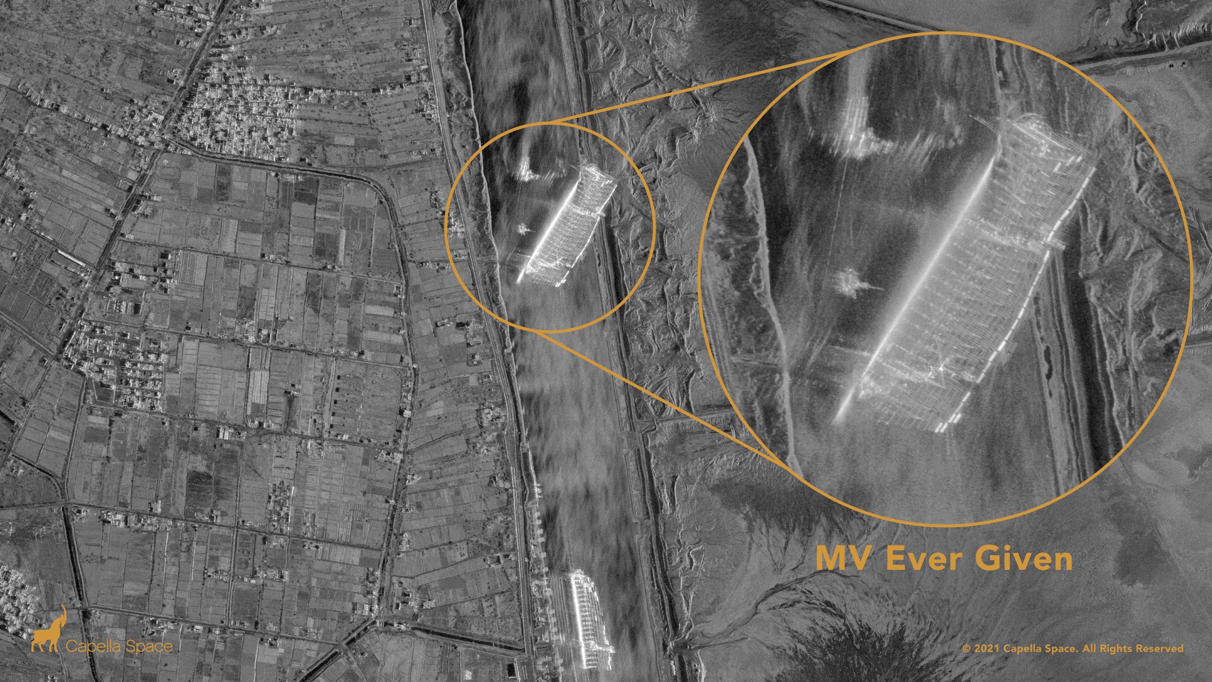
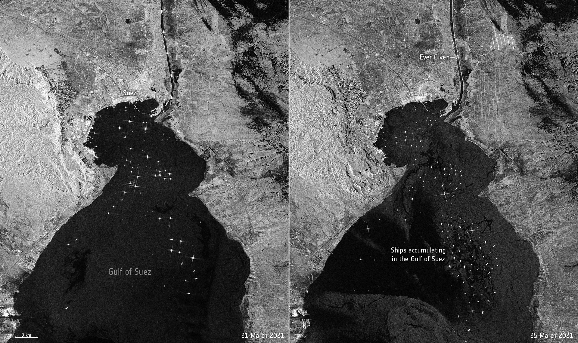
Satellite imagery shows mega container ship blocking Egypt’s Suez Canal 
(CNBC)

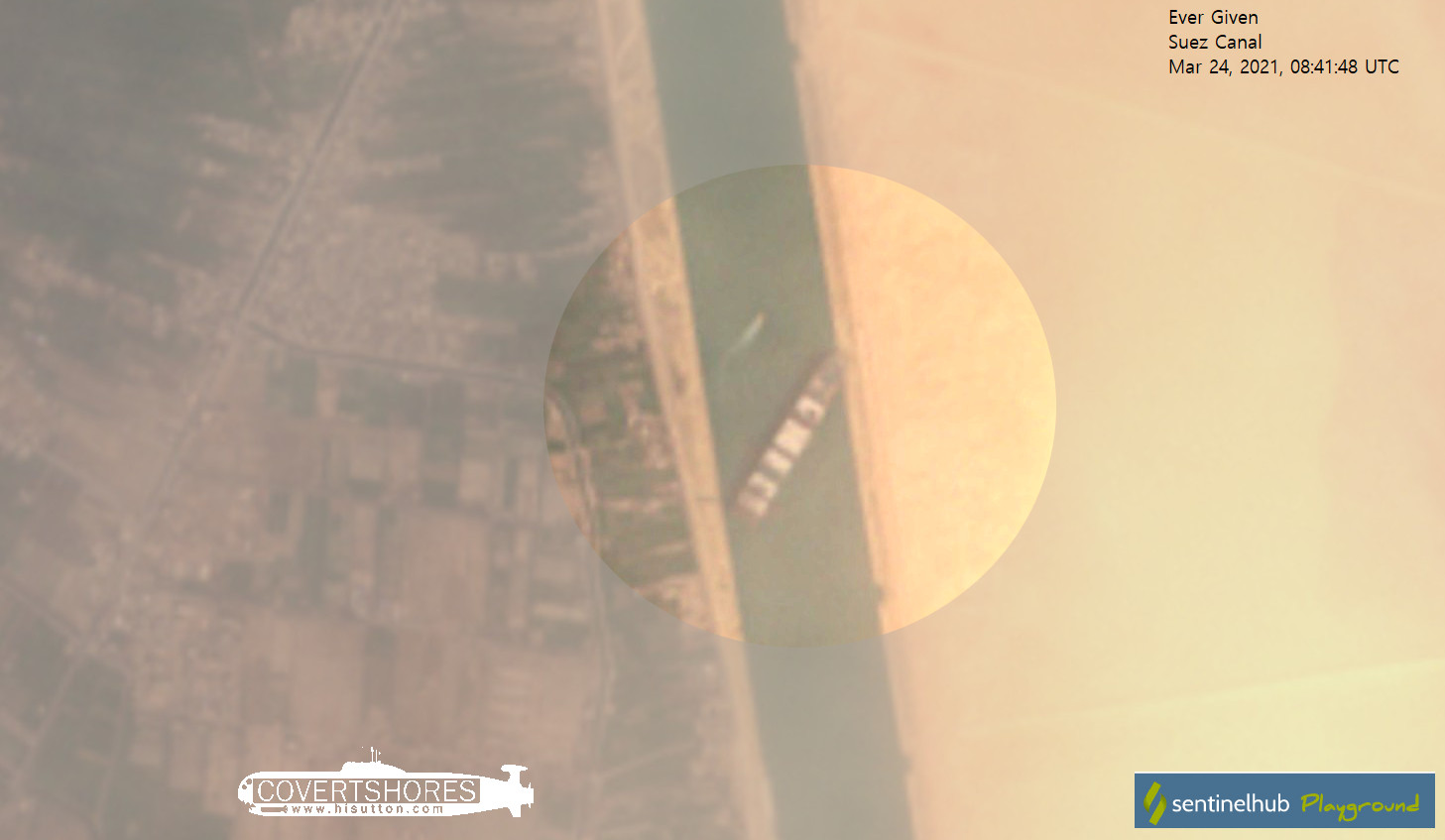
Capella’s #SAR constellation captures the Ever Given container ship blocking the Suez Canal with very high resolution 50 cm imagery as of 9:36am local Egyptian time.

From The Guardian by Martin Farrer and Michaél Safi

One of the largest container ships in the world has run aground in the Suez canal after being blown off course by a “gust of wind”, causing a huge jam of vessels at either end of the vital international trade artery.


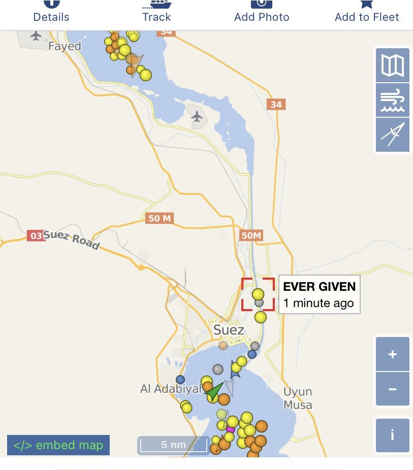
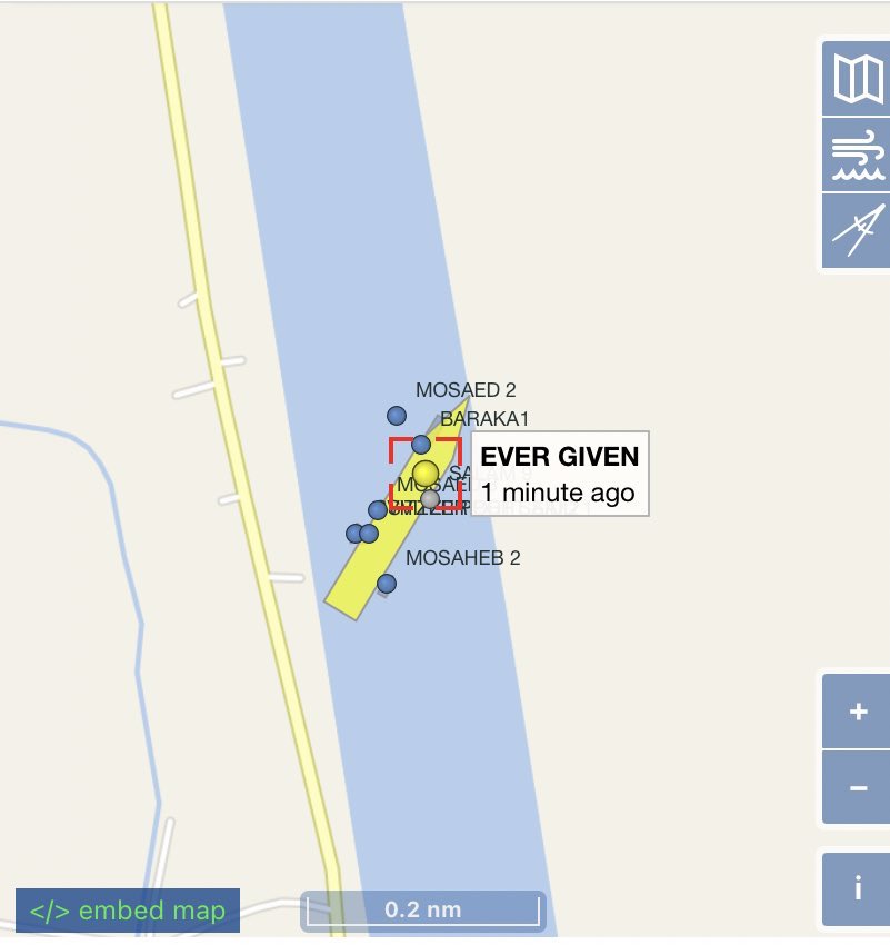
The 220,000-ton, 400-metre-long Ever Given – a so-called “megaship” – became stuck near the southern end of the canal on Tuesday.

Eight tugboats were working to free the vessel, blocking a lane through which about 50 ships a day passed in 2019, according to Egyptian government statistics.
 
Bernhard Schulte Shipmanagement (BSM), the ship’s technical manager, said it ran aground in the canal at about 05.40 GMT on Tuesday.
It said an investigation was under way.

Early reports speculated the vessel suffered a loss of power, but the ship’s operator, Evergreen Marine Corp, told Agence France-Presse it ran aground after being hit by a gust of wind.
 
A part of the Taiwan-owned MV Ever Given (Evergreen), lodged sideways and impeding all traffic across the waterway of Egypt’s Suez canal.
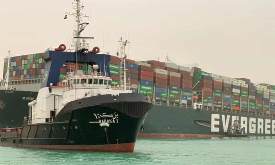
Impaled the canal shore with its bulbous bow.
Photograph: Suez canal/AFP/Getty Images

Egyptian forecasters said high winds and a sandstorm hit the area on Tuesday, with winds gusting as much as 31 mph.

BSM said all crew were safe and accounted for, and there had been no reports of injuries or pollution.

A growing number of tankers were gathering near the entrance to the canal on Wednesday morning waiting to pass through. An extended blockage would have severe consequences for trade.
 
Asia-Europe container flows were picking up again after China’s lunar new year and the alternative route via the Cape was a week slower, Tan Hua Joo, a consultant with Liner Research, told Reuters.

Lars Jensen, the chief executive at SeaIntelligence Consulting, said delays increased the risk of congestion at European ports.
“When the canal reopens, this will mean that the delayed cargo will now arrive at the same time as cargo behind it which is still on track,” he said.

As of Wednesday, five laden liquefied natural gas (LNG) tankers were unable to pass through the canal due to the grounded container ship, according to the data intelligence firm Kpler.
Of the five, three were bound for Asia and two for Europe, said Kpler analyst Rebecca Chia.
She said that if the congestion persisted until the end of this week, it would affect the transit of 15 LNG tankers.

This video shows that the obvious is not always true. 
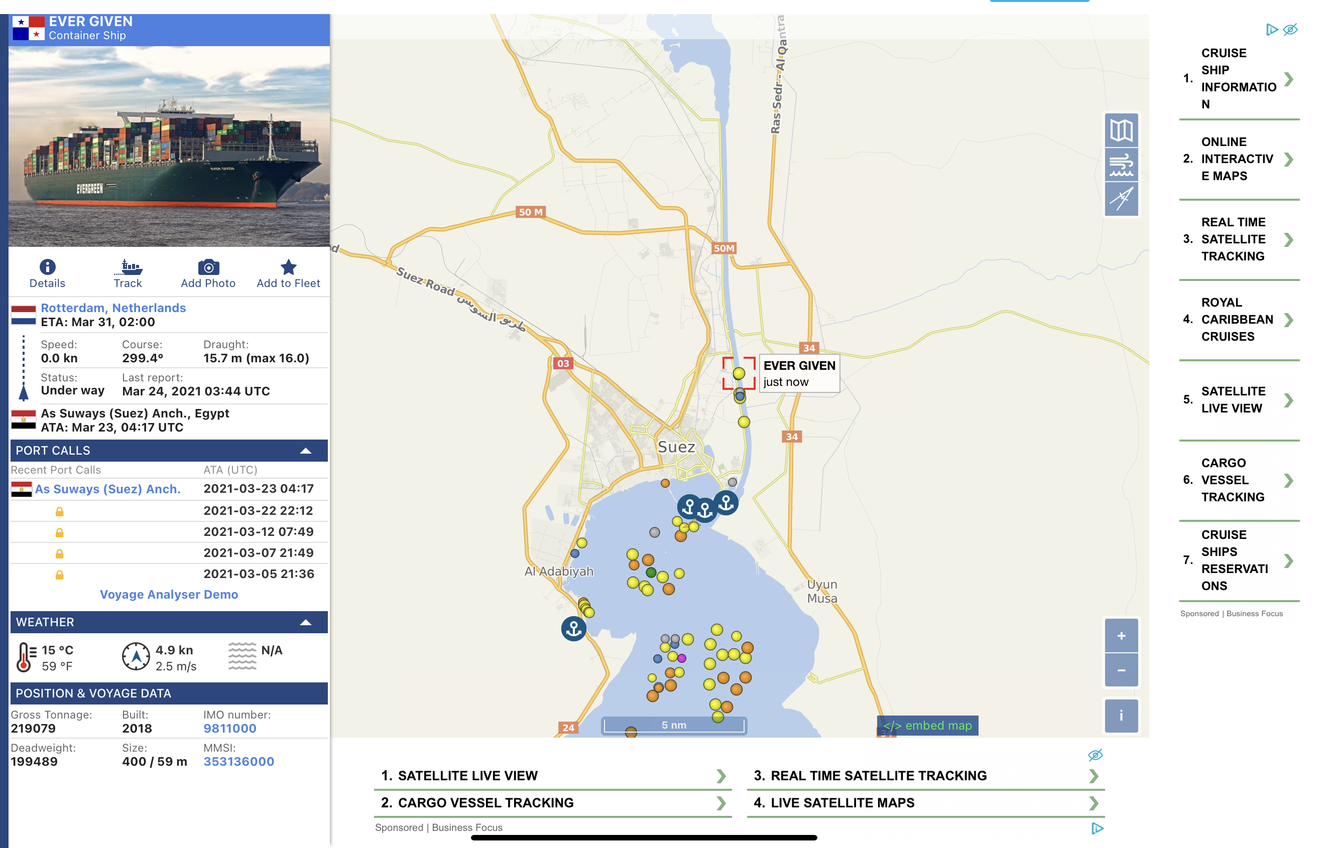
On the occasion of the disputed incident of the ultra-large container ship Ever Given blocking the Suez Canal, the VesselFinder team made a video simulation of the movements of the ship in more detail, for some time before it got stuck in the canal and blocked the main artery of cargo flow between Asia and Europe.
 
"Suspected gust of wind’ sends 400m-long vessel into bank, sparking several failed attempts to refloat it."
A cargo container ship that’s among the largest in the world has turned sideways and blocked all traffic in Egypt’s Suez Canal, officials said Wednesday, threatening to disrupt a global shipping system already strained by the coronavirus pandemic.
 
The Ever Given is one of a new category of ships called ultra-large container ships (ULCS), some of which are even too big for the Panama canal, which links the Atlantic and Pacific.
It is carrying hundreds of containers bound for Rotterdam from China.

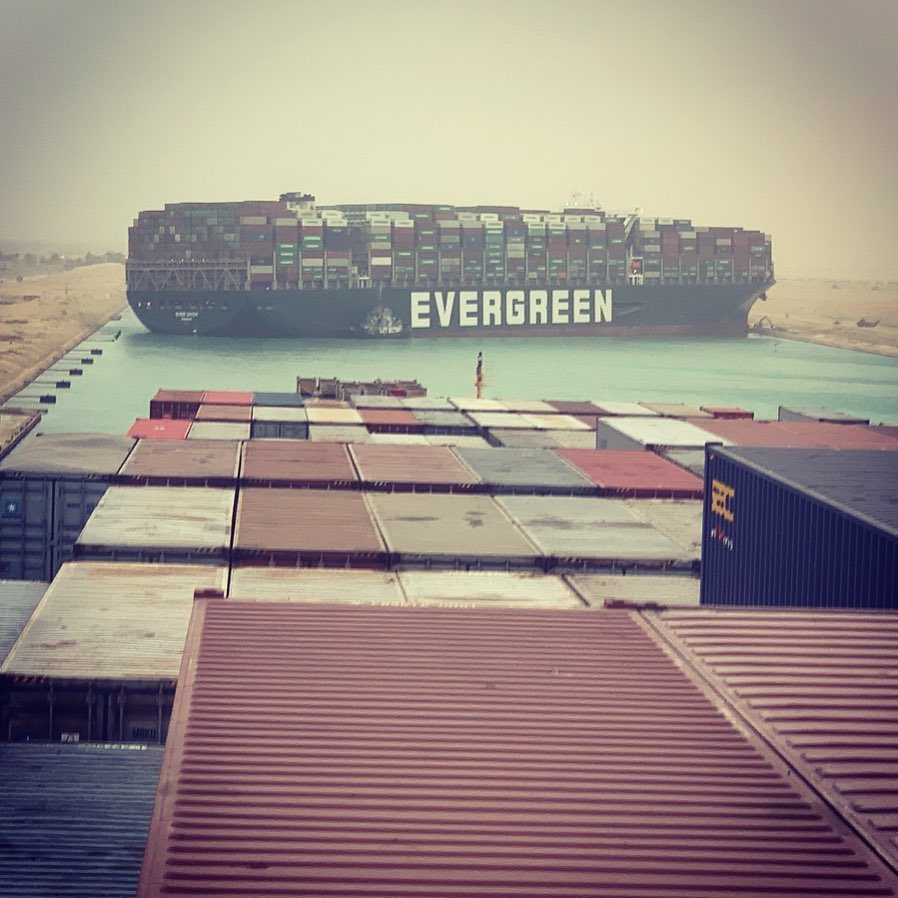
Pictures taken from another ship in the canal, the Maersk Denver, show the Ever Given lodged at an angle across the waterway.
It dwarfs the tugs sent in by the Egyptian authorities to try to free it, and also a mechanised digger that appeared to be trying to excavate ground in order to free the bow.

Julianne Cona, who posted the picture from the Maersk Denver on Instagram, watched the drama unfold as her ship waited at anchor.
“Hopefully it won’t be too long but from the looks of it that ship is super stuck,” she wrote. 
“They had a bunch of tugs trying to pull and push it earlier but it was going nowhere … there is a little excavator trying to dig out the bow.”
 
Photograph: Suez CANAL/AFP/Getty Images
The shipping monitoring site Vesselfinder.com showed the stricken ship surrounded by smaller tugs trying to free it from the banks.
 
The site also shows the traffic jam of other vessels at either end of the canal.
The trade monitor TankerTrackers.com tweeted that there were “a lot of fully laden” tankers stuck at either end of the canal carrying Saudi, Russian, Omani and US oil.

Normally ships form convoys to traverse the Suez north and south up and down the canal.
The Ever Given was part of a northbound convoy when the incident occurred, according to the shipping agent GAC.

The Suez canal is one of the most important waterways in the world and links the Mediterranean with the Red Sea and shipping lanes to Asia. It is 120 miles (190km) long, 24 metres (79ft) deep and 205 metres wide and can handle dozens of giant container ships a day.
It was expanded in 2015 to enable ships to transit in both directions simultaneously, but only in part of the waterway.
 
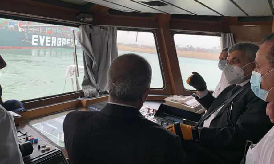
Gen Ossama Rabei, head of the Suez Canal Authority, second right, speaks to other staff onboard a boat near the stuck cargo ship.
Photograph: AP
 
Ships have been grounded in the canal before. In 2017, a Japanese ship became stuck but was refloated within hours.
Away from the canal, a more serious incident occurred near the German port of Hamburg in 2016 when the massive CSCL Indian Ocean ran aground and needed 12 tugs to set it free after five days.

But Flavio Macau, a senior lecturer in supply chain management at Edith Cowan University in Western Australia, said one problem was that container ships had become much bigger in recent years.
He added: “Moving about 50 ships a day, the impacts of a stranded ship are negligible unless it takes weeks to float it. But that is very unlikely and it should be over in a couple of days, tops.”
 
 Copernicus -Sentinel1

The canal’s role as a cornerstone of international trade, particularly in oil, led the Egyptian president, Abdel Fatah al-Sisi, to announce an expansion of the vital waterway in 2014, a project promised as “a gift to the world”.

It cost $8bn (£5.2bn at that time), after the Egyptian dictator demanded the project be completed within a year, promising Egyptian citizens that it would prove to be an “artery of prosperity”.
Egypt welcomed world leaders to a grand ceremony marking the reopening of the new canal channel in 2015, amid a wave of nationalist fervour about the project.

Egypt’s Suez Canal Authority pledged that the expansion would double revenues from increased traffic, declaring that the canal would afford Egypt $13.23bn annually by 2023.
Last year, revenues fell to $5.61bn, according to the canal authority’s own figures.
 
Links :