 Nautical charts for Germany today which leads to the availability of a new dedicated layer for Germany with BSH rasterized ENCs
 Until today, the GeoGarage platform used the raster chart material (RNC) provided by BSH to display nautical charts for the German areas.
For internal management reasons specific to BSH, the Hydrographic Institute of Germany has made some technical changes to deliver updates to their commercial licensees (whose GeoGarage) causing us problems to deliver updates for our customers in our chain of processes.
The GeoGarage platform was already in the capacity to deliver a rasterized visualization of Electronic Navigation Chart (vector ENC) through their web services (WMTS) for their B2B customers involved in webmapping and other onshore GIS activities.
Today, the GeoGarage platform is ready to propose the visualization of official ENC to their customers using mobile navigation apps (non SOLAS) so Weather 4D Routing and Navigation on iOS and SailGrib on Android.
In consequence, the GeoGarage platform no longer offers a subscription to BSH Raster maps for Germany on its e-commerce platform for mobile apps.
However, the Germany RNC subscription will continue for their current mobile customers until its expiry date (visible on your W4D R&N/Sailgrib application) but will not be automatically renewed on this date.
The RNC plan is replaced by a new layer based on ENC type maps edited bythe German Hydrographic Service (BSH), and rasterized for W4D/Sailgrib : Germany (derived from BSH ENC)
The price of the annual subscription (24.99 EUR) remains the same.
So Weather4D R&N and Sailgrib users (with last updated versions) can right now display the whole catalogue of BSH ENC (298 ENC at this time), with a half-yearly updating process : see GeoGarage news
Today, in this first version, the vector ENC are displayed using a graphical rendering similar to the one used in official ECDIS (s-52 IHO specifications) : they are not to be used for shipping navigation (IMO SOLAS), but only for recreative use, not as a primary tool for navigation.
Effectively, in contrast to the use in ECDIS, there is no possibility -today with the W4D/SailGrib current version- to ask for text info and details regarding any navigational objects (beacon, buoy, marks...).
Effectively, in contrast to the use in ECDIS, there is no possibility -today with the W4D/SailGrib current version- to ask for text info and details regarding any navigational objects (beacon, buoy, marks...).

View of Hamburg harbor with RNC chart
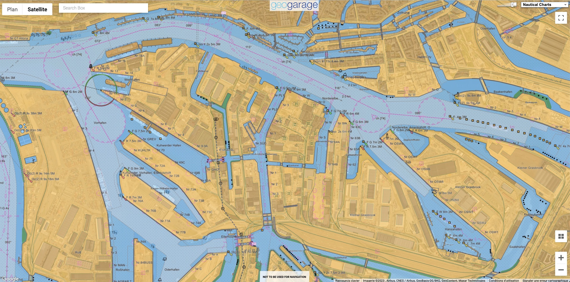
Same view of Hamburg harbor with ENC chart
No comments:
Post a Comment