A substantial proportion of the world’s sandy coastlines are already eroding owing to increased storm surges, flooding and sea-level rise.
For decades, coastal areas have been subject to intense urbanization and population growth. The European Union coastline is approximately 68,000km long, more than three times longer than that of the United States.
According to the European Environment Agency, almost half of the EU population lives less than 50km from the sea, with the seaside being Europe’s most popular holiday destination.
Understanding the Evolution of Coastal Environments
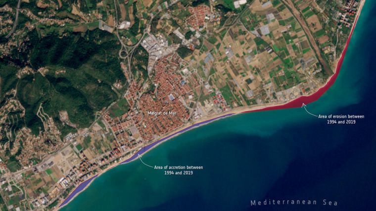
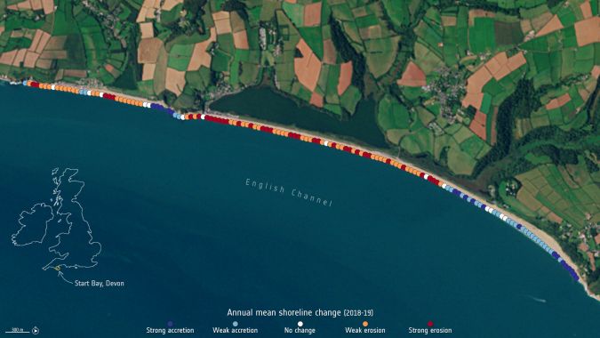
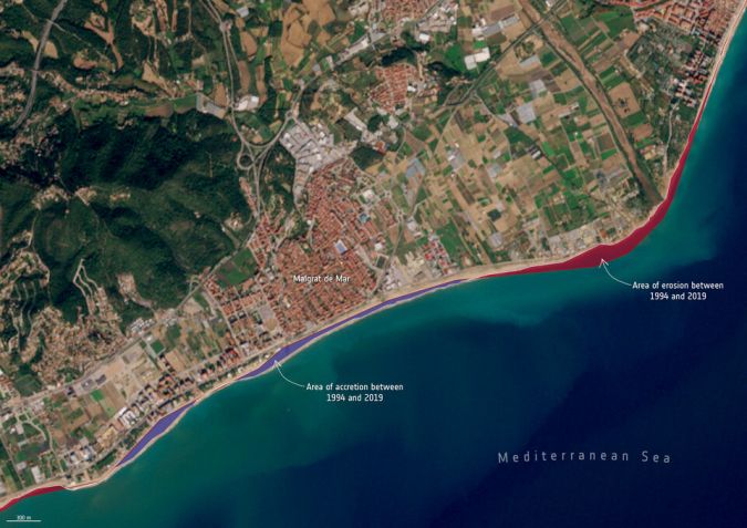
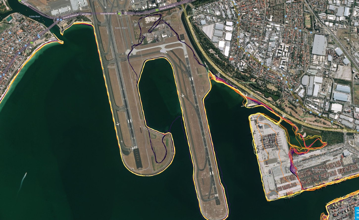
Coastal erosion is currently observed on many shorelines in Europe and will most likely worsen with rising sea levels. Monitoring coastal movement is key in understanding the evolution of coastal environments and these data can provide fundamental information to regional decision makers.
Roberto Díaz Sánchez, from the Directorate-General for the Coast and the Sea at the Spanish Ministry for the Ecological Transition and the Demographic Challenge, commented: “Taking part in this project has enlightened us in coastal surveillance from space. We are now firmly on the road to a new and promising coastal management paradigm, increasing our chances in successfully adapting our coasts to the effects of climate change.”
Mónica López, Spanish delegate at ESA and Centre for the Development of Industrial Technology, said: “I would like to congratulate all of the team for the successful project which focuses on a very important topic for some countries, including Spain. I would like to highlight a very positive aspect of the project which has been the high involvement of final users in all phases of the project, but mainly during validation and testing.”
Koen Verbruggen, director of Geological Survey Ireland at the Department of the Environment, Climate and Communications, added: “The datasets being produced under the ESA-funded Coastal Change from Space project have great potential application in Ireland and come at a very opportune time as we are establishing a National Coastal Change Management Strategy. The coastal change data can help us recognize areas of greatest change, and thus prioritize the allocation of resources at national and local levels.”

The next stage in the journey will be to use these insightful datasets to improve the performance of models and join with other infrastructure and coastal zone morphological knowledge to improve forecasts and enable sensible mitigation strategies to be employed.
On 22 January, the results of the Coastal Change from Space project were presented in an online webinar.
No comments:
Post a Comment