Ocean-surface currents
From ESA
With around 90% of world trade carried by ships, making sure a vessel follows the fastest route has clear economic benefits.
By merging measurements from different satellites, ESA is providing key information on ocean currents, which is not only making shipping more efficient but is also helping to reduce carbon dioxide emissions.
Globcurrent data set - Ocean dynamics 2.0
Shipping companies forecast ocean currents down to a depth of about 15 m to route their vessels through favourable currents and avoid those that might hinder a voyage.
Reliable forecasts are essential for making sure that goods arrive on time and that ships use as little fuel as possible.
The problem is that forecasts might not always be accurate.
Globcurrent V1 (2015):
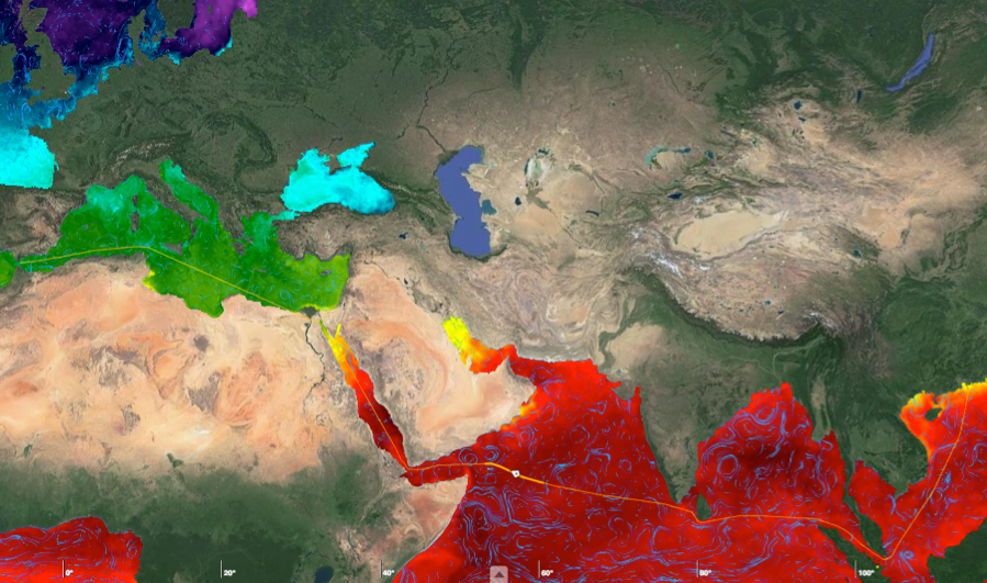
Geostrophic + Ekman @ 15m depth overlaid over ODYSSEA Sea Surface Temperature
Combining satellite measurements such as sea-surface height and temperature, surface winds and gravity, along with measurements taken in situ, can yield a unique view of ocean-surface circulation.

Shipping companies can use this information to understand general circulation characteristics of particular regions.
Building on Globcurrent, a near-realtime product would then allow them to choose the most reliable forecast for a given time and location.
Based in Marseille, France, CGM-CMA is a leading worldwide shipping company.
Through more than 200 shipping lines, the company operates on every one of the world’s seas.
The company is using satellite data from ESA’s Globcurrent project to optimise shipping routes.
Ocean scientists therefore teamed up with CGM-CMA, a worldwide shipping group, to optimise routing using Globcurrent data.
Fabrice Collard from Ocean Data Laboratory said, “The lack of confidence in ocean-circulation models has hindered ship routing.
“Today, Globcurrent can help assess which forecast products are the most reliable for a given local area. This, in turn, helps shipping companies choose a particular route that would make use of favourable currents.”

Ship track overlaid on a sea-surface temperature map from ESA’s Medspiration project and surface current streamlines from ESA Globcurrent project.
Patrice Bara from CGM-CMA remarked, “Reducing container vessel fuel consumption is an important challenge, especially when trying to cut down on emissions that contribute to global warming.
“Based on our experience with the Europe–Asia route, using existing ocean forecast products gives us a 0.4% cost saving. However, Globcurrent could help us achieve savings of up to 1.2% on fuel consumption.
“It is extremely important for us to assess the reliability of model forecasts against Globcurrent products in near-real time and to achieve our first target of reducing emissions of carbon dioxide by 180 000 tonnes a year.”

The western Mediterranean Sea has a variety of features that can be used to optimise ship routing.
Part of the challenge is to extract high-level features of interest such as water-type boundary fronts and significant currents of interest for a particular ship voyage.
This image shows sea-surface temperature overlaid with Globcurrent streamlines.
The white broken line shows the planned passage of a ship that takes advantage of ocean-surface currents.
Craig Donlon, ESA ocean scientist, added, “The importance of ocean surface currents cannot be overstated for those working on the ocean.
“Helping European industry to fine-tune their ship routing operations with Globcurrent brings not only financial savings but also the potential to reduce greenhouse gas emissions.
“Now Globcurrent has been demonstrated, the operational generation of products will be transferred to the Copernicus Marine Environmental Monitoring Service in the coming months.
“ESA will continue the fundamental task of scientific research and development to maintain and evolve the new system to take full benefit of the Copernicus Sentinel-1, Sentinel-2 and Sentinel-3 satellites, and in the future Sentinel-6.”
Links :
- GeoGarage blog : The Messina Rise cortex
- YouTube : Overview of the ESA-funded GlobCurrent project
No comments:
Post a Comment