The United States successfully claimed an additional one million square kilometers beneath the ocean, expanding its Extended Continental Shelf (ECS) boundaries.
Yes, it’s like America just bought a new basement, one that is almost 60% the size of Alaska.
Mead Treadwell, former lieutenant governor of Alaska and chair of the U.S. Arctic Research Commission, helps us understand the situation.
It’s not quite the purchase of Alaska, but the new area of land and subsurface resources under the land controlled by the United States is two Californias larger,” Treadwell explained.
The Extended Continental Shelf (ECS)
Picture the ocean like a multi-story building that starts at a country’s shoreline. International law gives coastal states clear rights out to 200 nautical miles.
That is the “main floor” of this hypothetical building.
The Extended Continental Shelf (ECS) is what comes next.
It covers the seabed and the rocks beneath it beyond that 200-nautical mile line.
This part of our hypothetical is more like the building’s underground levels than extra living space.
A country doesn’t gain new rights to the water column in that area, but it can claim rights to the resources in the seabed and subsoil if it can show the seafloor is a natural continuation of its land territory.
Under the rules, a coastal state can set the outer edge of its continental shelf as far as 350 nautical miles from its baseline.
In some cases, it can go 100 nautical miles beyond the 2,500-meter isobath, which is a line that traces where the ocean is 2,500 meters deep, but only if the science supports it.
Legality of ECS claims
UNCLOS Article 76 provides the playbook for drawing the continental shelf beyond 200 nautical miles. It explains what evidence counts, how to use geology and seafloor shape to justify an outer limit, and which constraints cap how far the line can go.
The Commission on the Limits of the Continental Shelf (CLCS) acts as the technical referee.
It reviews a coastal state’s submission and checks whether the methods and data meet the standards.
The commission includes specialists in fields like geology, hydrography, and oceanography, because these claims rise or fall on the science.
Claiming an Extended Continental Shelf
A state can’t just point at a map and declare victory.
It has to build a case, document it, and defend it with evidence that holds up under expert scrutiny.
Coastal states start by collecting data through seafloor surveys.
They use tools like seismic profiling, sediment sampling, and detailed bathymetric mapping to show what the seabed looks like and how it connects to the country’s landmass.
After that, they assemble a formal submission.
This package typically includes charts, maps, coordinates, and technical reports that explain the data, the methodology, and the proposed outer limits.
Then the CLCS reviews the submission in depth.
The commission tests the scientific reasoning and may ask questions or request clarifications.
It ultimately issues recommendations.
Those recommendations don’t automatically settle political disputes, but they carry real authority because they reflect a thorough, expert-driven evaluation of the evidence.
Twenty years of hard work
The U.S. began its quest for an ECS back in 2003.
This effort, which required teamwork between the U.S. State Department, the National Oceanic and Atmospheric Administration (NOAA), and the U.S. Geological Survey (USGS), was no easy task.
It took them twenty years and involved a massive data collection initiative, but it paid off, big time.
On December 19, 2023, the State Department announced new geographical coordinates of the U.S. ECS, adding massive chunks of territory in the Atlantic, Arctic, Pacific, and more.
The United States and UNCLOS
How might the U.S. attempt to use these rules to further expand the reach of U.S. territory under the Trump administration?
The relationship between the United States and the United Nations Convention on the Law of the Sea (UNCLOS) is complicated, to say the least.
While UNCLOS is often referred to as the “Constitution for the Oceans,” governing everything from maritime boundaries to resource rights and environmental standards, the U.S. has never actually ratified the treaty, even though it played a significant role in drafting it back in the 1970s and 1980s.
There are worries about issues like sovereignty, naval operations, and financial commitments that have created some major roadblocks.
Some senators fear that joining the treaty would mean giving up U.S. rights to the International Seabed Authority and could restrict access for U.S. companies to underwater resources.
On the flip side, military leaders, especially from the U.S. Navy, are all for ratification, arguing that it would help the U.S. tackle excessive maritime claims by other countries and secure navigational freedoms.
Supporters of ratifying UNCLOS believe that joining would boost U.S. influence in shaping global maritime rules and give legal certainty for U.S. claims, especially regarding the Extended Continental Shelf (ECS).
Even though the U.S. isn’t a formal party, it already follows many of the convention’s rules, using its provisions to back up territorial claims and assert navigation rights in international waters, like the South China Sea.
Science of exploration
This ambitious venture required a scientific odyssey of epic proportions.
The areas encompassed in this claim include the Arctic, the east coast Atlantic, the Bering Sea, the west coast Pacific, the Mariana Islands, and two regions in the Gulf of Mexico.
Brian Van Pay, Project Director for the State Department, explained further, saying, “Forty missions at sea, going to areas that we’ve never explored before, finding entire seamounts we didn’t even know existed.”
Scientists spent the equivalent of over three years charting new territory; using sonar mapping, geological sampling, and sediment layer analysis.
The outcome, as Van Pay notes, was a submission that aligns with the 1982 United Nations Convention on the Law of the Sea (UNCLOS) — the legal framework for this claim.
Importance of UNCLOS and ECS
The implications of this move are multifold.
For starters, the U.S. now has the right to control and potentially exploit resources like oil, gas, and minerals in the expanded territory.
However, it doesn’t mean they can suddenly start fishing further off the coast or start patrolling the new water regions.
It’s more like the U.S. government won the mineral rights to some underwater property.
The claim has been shaped carefully to avoid stepping on the toes of other nations, particularly Russia. But there might be a bit of an overlap with Canada, which may call for future diplomacy.
The biggest one of these, as mentioned above, is the lack of a formal ratification of UNCLOS by the U.S. Senate.
This gap could potentially limit the international legal weight of the claim.
Moreover, the claim’s validity is dependent on the robustness of the science backing it.
According to Treadwell, “If somebody came back and said, ‘Your science is bad,’ I think the United States would listen. But I don’t think science is bad. I think we’ve had very good science.”
Managing the Extended Continental Shelf
There’s more at stake than just economic gain.
The move also widens the U.S.’s jurisdiction to enforce environmental regulations effectively and protect fragile marine ecosystems from unchecked exploitation.
However, balancing these ecological responsibilities with economic interests will prove to be a tricky task.
But, hey, isn’t that part of the thrill?
As over 75 countries have already defined their ECS boundaries, it’s clear that the world is entering a new era of ocean governance.
So, will this new territory lead to a scramble for resources, or will it enhance cooperation in managing and protecting the world’s oceans? Let’s not get ahead of ourselves.
For now, America has made a bold move, and the rest of the world is watching.
One thing is for sure, though: how we navigate these waters will affect not only our economy but also the health of our oceans, the climate, and our future.
A fishing boat navigates around icebergs that broke off from the Jakobshavn Glacier and are floating in Disko Bay on March 10, 2025, in Ilulissat, Greenland. Joe Raedle | Getty Images News | Getty Images
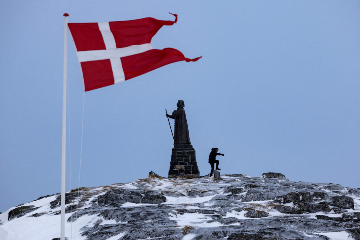
President Trump has said repeatedly that he wants the United States to control Greenland, refusing to take military action off the table and declaring that he will make the semi-autonomous Danish territory part of the U.S. "one way or the other."
Mr. Trump says the U.S. needs to control the vast, largely frozen island that sits mostly inside the Arctic Circle for security reasons, accusing China and Russia of trying to take it over instead.
Greenland's own democratically elected leaders have rejected any U.S. takeover, with the island's government calling it something they "cannot accept under any circumstance."
But the physical location of the island on the map — and the sea ice melting around its borders — is also of vital importance.
New routes around the globe
Melting Arctic sea ice has created more opportunity to use northern shipping routes — allowing logistics companies to save millions of dollars in fuel by taking much shorter paths between Asia and Western Europe and the United States.
Northern routes were long only passable in warmer months.
CBS News
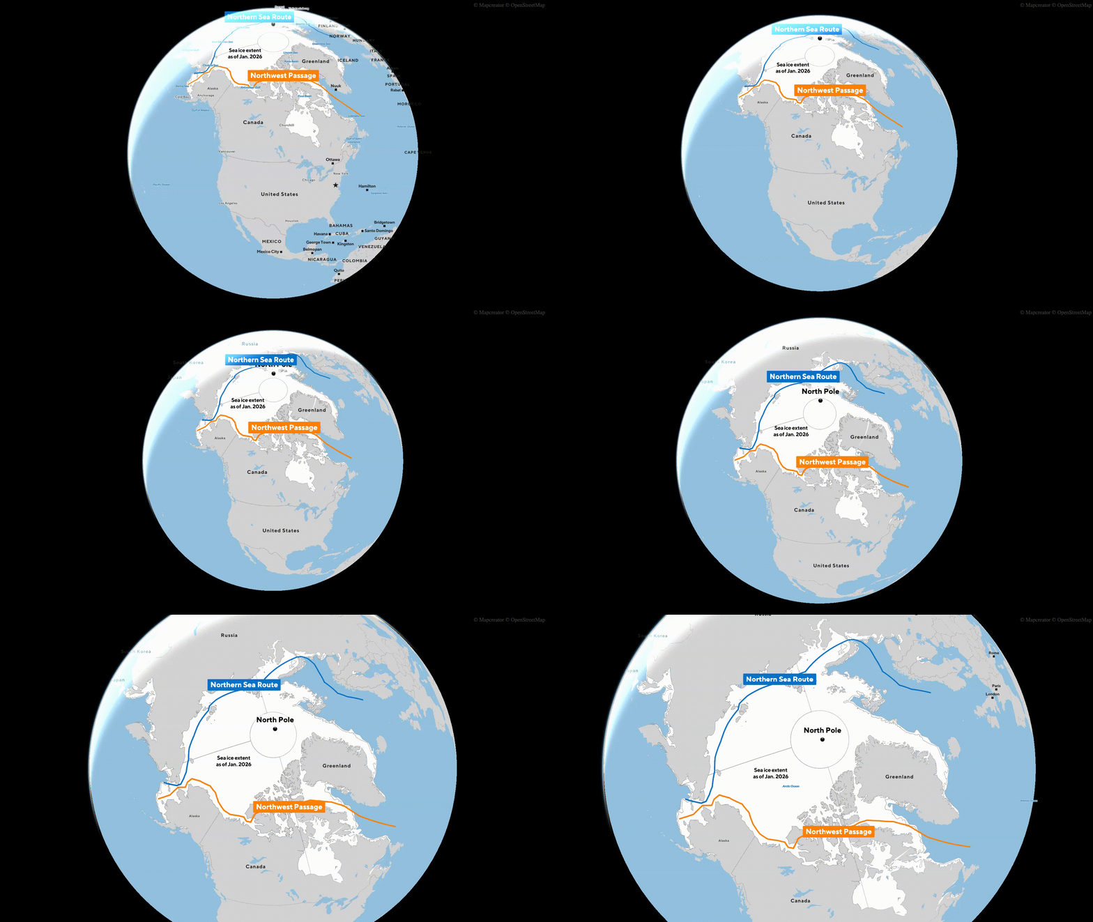
There are a couple primary routes through the Arctic becoming more viable, the Northern Sea Route (NSR), which follows Russia's roughly 15,000-mile northern border.
That path doesn't bring ships too close to Greenland, and Russia and China have agreed to develop the route together, and have been making greater use of it in recent years.
A Russian commercial vessel, aided by an icebreaker, first traversed the NSR in the winter in February 2021, proving it was possible.
The other route, called the Northwest Passage, comes much closer to Greenland's coastal waters and is more likely the path the Trump administration is concerned with.
The other, longstanding way to get goods from ports in Russia or the manufacturing powerhouses of East Asia is to go south. But that course, through Egypt's Suez Canal, is about 3,000 miles longer.
According to the Arctic Institute, compared to the Suez Canal route, the Northern Sea Route can save shippers as much as 50% in costs, considering fuel and other expenses, by reducing the distance from Japan to Europe, for instance, to only about 10 days compared to the roughly 22 it would take to sail around the southern tip of Africa and then through the Suez Canal.
A 2024 analysis by the Middlebury Institute of International Studiesalso said the northern route would shave about 10 days of a similar journey from Shanghai, China, to Rotterdam in the Netherlands.
As sea temperatures continue warming and winter ice cover shrinks, shipping traffic via the north is likely to increase, so control over that passage — and the long Greenlandic coastline that it skirts — will be of greater importance.
The U.S. National Oceanic and Atmospheric Administration shared graphs in 2022 predicting the new routes that would become available to regular tankers around Greenland over the coming decades.
Graphics shared by the U.S. National Oceanic and Atmospheric Administration in 2022 show the sea routes through the Arctic that are expected to become viable to regular vessels (in blue) and polar-class vessels (in red) around Greenland over the coming decades.
NOAA
NOAA's modeling shows a dramatic increase in viable journeys for both polar-class vessels fortified to forge through sea ice, and normal open water-faring ships.
The agency even predicts that by 2059, it will likely be possible for a polar-class vessel to sail the most direct route, right across the North Pole, as the formation of sea ice reduces further.
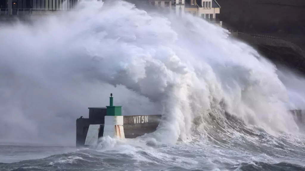
The UK’s Maritime & Coastguard Agency is reporting a busy night and efforts on Friday, January 9, to track containers after a severe winter storm crossed the region around the English Channel overnight. Warnings were posted for shipping as containers went overboard near the Isle of Wight.
Looking Back on Storm Goretti 🌀: Record Winds, Snow, and Disruption
Storm Goretti, the first named storm of the 2026 European storm season, swept across the UK and parts of Western Europe on 8–9 January. What made Goretti remarkable wasn’t a single extreme factor, but a… pic.twitter.com/SrRGcy7NLH
In meteorological terms, the storm became what is known as a bomb cyclone, where the storm rapidly intensifies.
It, however, left local areas surprised by the ferocity.
There were reports of wind gusts of 73 mph at Needles on the western side of the Isle of Wight.
At Portland, the winds were measured at approximately 65 mph, while in parts of Devon and Cornwall the winds reached 99 mph.
There were widespread reports of flooding, with the Portland Beach Road closed for hours due to high waves, while parts of the region reported sleet and even snow.
Elsewhere, 22 mm of rain was recorded in the Channel Islands.
The storm grew in intensity in the evening, peaking around 2300 local time.
The winds and waves, however, continued much of the night.
It was around the peak of the storm that the MCA reported it received a call about containers going overboard.
Around 2310, it was informed that an unnamed ship had lost 17 containers near Nab Tower and the Isle of Wight.
While the first report was being processed, a second vessel reported it had lost seven containers about 16 nautical miles south of St. Catherine’s Point.
The MCA said it had fixed-wing aircraft searching on Friday for a total of 24 containers believed to be in the water.
Ships were being warned of the danger.
The MCA was working with the shipping companies to determine the contents of the boxes.
Some reports said the first lot was believed to be reefers.
The second lot was thought to be empties, and the MCA said there was a good chance that some of the boxes sank in the high seas.
It emphasized that it is the responsibility of the shipping companies to locate and retrieve the overboard containers.
These losses come just a month after another reefer vessel lost 16 containers in the same general area. Boxes washed ashore and on the beaches, and inland, people were finding bananas.
At last account, 13 of the 16 containers were located, and the others were thought to have sunk in the waterway.
The MCA launched an investigation, noting that one concern was improperly secured containers, or it said that crews sometimes started to remove restraints in anticipation of reaching port to speed the handling.
While the search was continuing for the overboard containers, the weather was also impacting other shipping operations.
Hovertravel to the Isle of Wight was entirely canceled. DFDS was warning of disruptions and delays due to winds and waves for its cross-channel service between Dover and France.





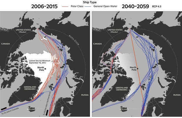 Graphics shared by the U.S. National Oceanic and Atmospheric Administration in 2022 show the sea routes through the Arctic that are expected to become viable to regular vessels (in blue) and polar-class vessels (in red) around Greenland over the coming decades.
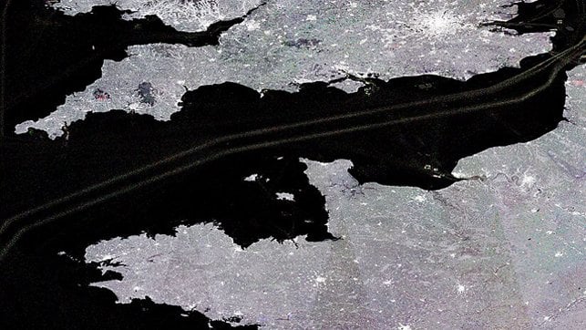 Shipping near the Isle of Wight and elsewhere in the English Channel was impacted by a severe winter storm (European Space Agency file photo)