Saturday, May 17, 2025

Our Planet | Coastal Seas

Experience our planet's natural beauty and examine how climate change impacts all living creatures in this ambitious documentary of spectacular scope.
In this episode: From fearsome sharks to lowly urchins, 90 percent of marine creatures live in coastal waters.
Protecting these habitats is a battle humanity must win.

Friday, May 16, 2025

Norway (NHS) layer update in the GeoGarage platform

 92 nautical raster charts updated

Antarctic glacier caught stealing ice from neighbour

Dotson Ice Shelf from Sentinel-1 pillars

From ESA

Thanks largely to Copernicus Sentinel-1, scientists have discovered that a glacier in Antarctica is rapidly siphoning ice from neighbouring flows – at a pace never before seen.
Until now, researchers believed that this process of ‘ice piracy’ in Antarctica took hundreds or even thousands of years, but these latest findings clearly demonstrate that this isn’t always the case.

Published today in The Cryosphere, the research, partly funded by the Science for Society element of ESA’s FutureEO programme, reveals that the fast-flowing Kohler East Glacier in West Antarctica has been stealing ice from a slower-moving neighbour.

Kohler Glacier, as well as the Pope and Smith Glaciers, are among the fastest-changing in West Antarctica, with some moving and thinning faster than others.
These glaciers are situated upstream of the Dotson and Crosson Ice Shelves.

Ice from the Pope, Smith and Kohler Glaciers flows into the Dotson and Crosson Ice Shelves, which float on the Amundsen Sea.
The rate at which the ice flows and eventual melts into the sea has implications for sea-level rise.

 
Localization with the GeoGarage platform (NGA nautical raster chart)

A group of scientists, led by the University of Leeds in the UK, examined high-resolution images from satellites such as Sentinel-1 along with other satellite data spanning 2005 to 2022 to understand the rates of flow from eight ice streams in the Pope-Smith-Kohler region.

They calculated ice velocity using a tracking technique that measures the displacement of visible features, such as crevasses or rifts, on or near the ice surface.
Data on ice-thinning rates from ESA’s CryoSat mission were also used in the study.

In doing so, they found that seven of the streams had sped up, one almost doubling its speed, but, in stark contrast, one had actually slowed down.

It turns out that the fastest-flowing glacier, Kohler East, is right next to a slower-flowing glacier, Kohler West.


However, the difference in speed of ice flow isn’t the only intriguing aspect of this vulnerable region.
The research team also discovered a significant shift in flow direction, which is resulting in the faster Kohler East stream rapidly drawing ice from its slower neighbour, Kohler West.

The researchers found that, on average, the glaciers in the Pope-Smith-Kohler region have sped up by 51% since 2005.
However, hidden within this average are some big differences.
Four glaciers sped up by between 60% and 87% over the 17 years, and, remarkably, six of the streams reached average speeds of over 700 m per year in 2022 alone.

The fastest were Kohler East and Smith West Glacier, where ice speeds increased by an average of 32 m a year over 17-year the study period.

Given the impacts climate change is having, this doesn’t really come as a surprise.
However, what is surprising is the fact that the speed of the Kohler West glacier actually slowed by 10% over the study period.


Lead author Dr Heather Selley, from the University of Leeds, explained “We think that this slowdown is because Kohler West also seems to have changed direction and flowed towards its neighbour, Kohler East.
“This change in direction is likely caused by the vastly different thinning rates on the neighbouring glaciers.
“Because Kohler East’s ice stream is flowing and thinning faster as it travels, it absorbs, or ‘steals’ ice from the slower-moving Kohler West.
“This is effectively an act of ‘ice piracy’, where ice flow is redirected from one glacier into another, and the accelerating glacier is essentially thieving ice from its slowing neighbour.
“Astonishingly, thanks to satellite data, we can see that this is happening in less than 18 years, whereas we’ve always thought it was this extremely long, slow process.”


These results show that there is substantial speed-up in this region of Antarctica, which has the highest recorded rates of thinning and grounding-line retreat.

The grounding line is the point at which glaciers on land transition to ice shelves and start to float.
If the grounding line retreats, this can cause instability and even faster flow of the ice sheet towards the ocean.

Prof. Anna Hogg, also from the University of Leeds, added, “Our results suggest that ice flow redirection is an important new process in contemporary ice-sheet dynamics, which is required to understand present-day structural change in glaciers and the future evolution of these systems.


“The data reveal previously unobserved interactions between floating ice shelves and grounded ice sheets, which will affect future sea-level rise, and may influence changes in the mass of ice sheets and ice shelves during the 21st century.”

Dr Martin Wearing, ESA Polar Science Cluster Coordinator, said, “This new study highlights the unique ability of satellites to provide both the temporal and spatial coverage required to assess change in the polar regions.
“Using data from Copernicus Sentinel-1, as well as data on ice thinning from ESA’s CryoSat mission, the team has revealed the complex evolution of ice flow in part of West Antarctica over the past few decades.
“Understanding these changing dynamics and what drives them is crucial for improved projections of future ice-sheet change and contributions to sea-level rise.”
 
Links :

Thursday, May 15, 2025

The woman unlocking the mysteries of the deep sea in Fiji

Nicknamed ‘Moana’, Charlene Erasito is the only female Pacific Islander on the expedition to document unexplored parts of the ocean

From The Guardian by Sera Sefeti


On the island of Rotuma in Fiji, Christmas is a time of joy, a celebration bursting with song, dance and laughter.
Charlene Erasito remembers watching the festivities there when she was a child, captivated as people paraded through the village for “fara,” a local Christmas celebration.

Erasito never imagined that decades later, she would return to the same shores, no longer as a spectator but as a scientist.
Erasito, now 30 years old, is the only female Pacific Islander aboard an ambitious expedition seeking to document unexplored ocean ecosystems in Fijian waters.

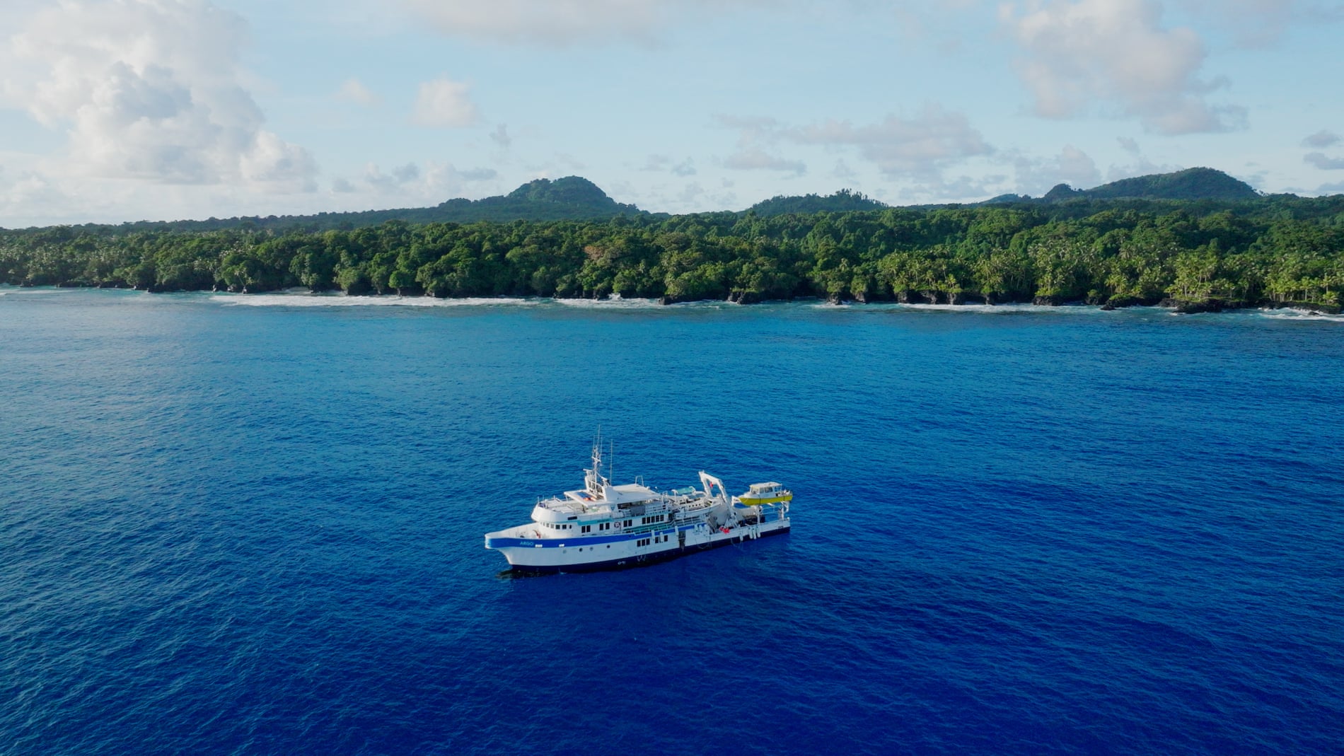
The months-long project, led by National Geographic Pristine Seas, began in April with a crew of local and international experts.
It starts with deep sea exploration and will later examine shallower parts of the ocean.
The expedition began in Fiji and will also travel to Tuvalu and Tonga.

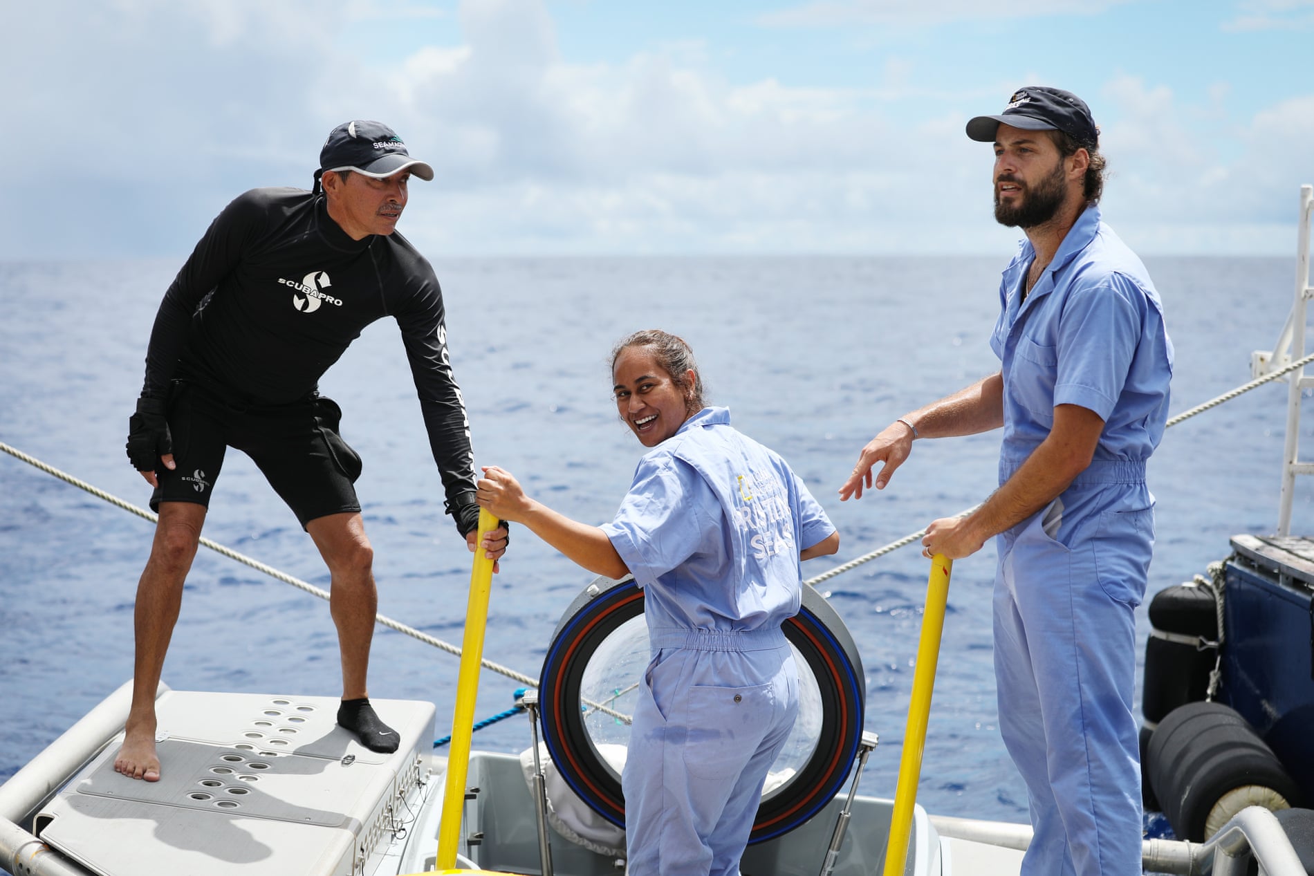
Stepping on the deck of the research vessel last month, Erasito was affectionately nicknamed “Moana” by her crew mates – a title she accepts with a laugh.
“It was funny because, as a child, I actually had a pet pig and chicken,” Erasito says, referencing the popular animated Disney film. 
“Except I named them ‘Pig’ and ‘Chicken’. Zero creativity there.”

Erasito is studying for her PhD at the French national institute for ocean science and technology.
The invitation to join the expedition came after her research on seamounts – underwater mountains that rise from the sea floor- and biodiversity in New Caledonia impressed the Pristine Seas team.
In that project, she used remote-operated vehicles, imagery and acoustic data to explore deep-sea life.
 
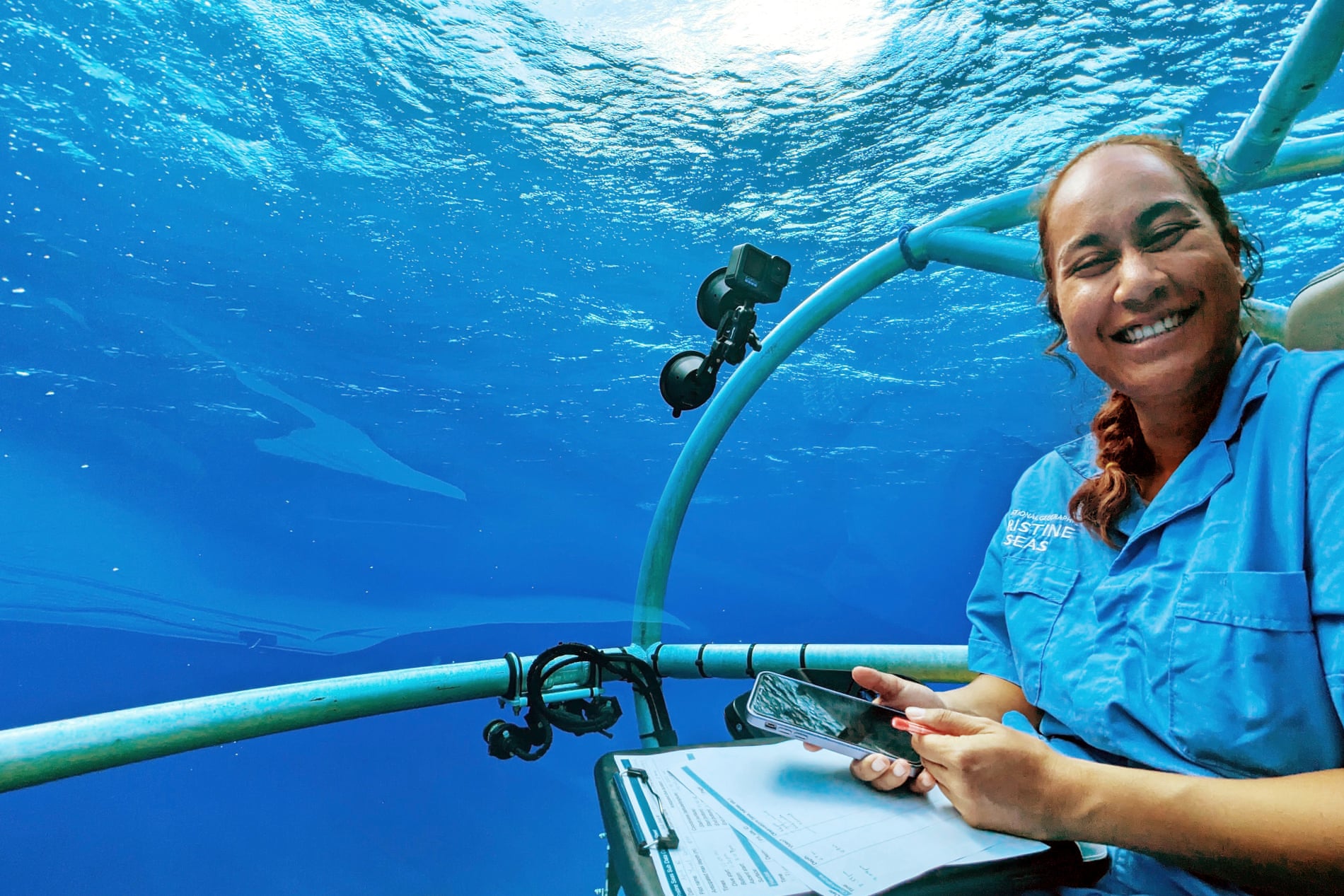
 Charlene Erasito onboard the submersible during the Fiji expedition.
Photograph: Beth Pezzoni/National Geographic Pristine Seas

She has family links to Rotuma and was “speechless” when asked to join the Fijian project.
“I was at work in France when the invitation came. It took me days to process and respond. It was surreal,” she says.
“I was thrilled to be going back to sea, but this expedition would be different. We would be exploring deep-sea ecosystems around my home island of Rotuma – something I never imagined I’d have the chance to do” she says.

Erasito says it “felt like a duty” to return to the Rotuma, where she remembers travelling as a child for her late father’s work.
She had fond memories of swimming, fishing and the beach.
 
The Pacific expedition will travel to Fiji, Tuvalu and Tonga.
Photograph: Brett Kuxhausen/National Geographic Pristine Seas

“I used to listen to stories of night fishing that my dad would share or different aspects of Rotuma … but mostly the significance of the ocean to Rotuma and her people.”
“Every person we met on the island felt like family – whether or not we were actually related. That’s the magic of home.”

The expedition has given Erasito experience with new technologies including types of underwater cameras and video tools.
“Seeing the deep-sea footage – the fish, the corals, and the life hidden beneath the surface – was incredible. And to know we’re exploring with minimal disruption to these fragile habitats was important to me.”

The deep-sea part of the Rotuma exploration has wrapped up, and the vessel is on its way to Tuvalu.
So far, scientists have documented diverse and healthy ecosystems, and have begun sharing their knowledge with village chiefs.
At the end of the journey, they will report the full findings to government and other partners.

Dr Keiron Fraser, expedition leader for Pristine Seas, said Fiji and Rotuma are home to “an awe-inspiring array of marine life”
“Guided by our local partners, this team will help unlock the mysteries of the ocean so we can learn how to best protect it,” he said.

The Pacific Ocean is home to many, but due to its sheer size, there are areas that are yet to be fully explored.
“For many of our islands, the ocean isn’t just our back yard. It’s our lifeline. Protecting it starts with knowledge – and that starts with expeditions like this,” Erasito says.

Fraser says Erasito’s involvement has been “inspiring for the young people in Rotuma”.
“We’ve been unbelievably lucky to have Charlene with us. The children loved her… a real example of what’s possible.”

Erasito hopes other young Pacific women will follow her path.
“The ocean is in our blood, our stories, and our responsibilities. You belong – in science, on ships, in submarines, and in rooms where ocean decisions are made. Follow your heart.”

Links :

Wednesday, May 14, 2025

Russia needs more resources to handle emergencies on the Northern Sea Route


From ArcticToday by Ekaterina Blokova

Last winter was marked by several maritime accidents in Russian waters.
These events raised doubts about the ability of the country’s emergency services to respond promptly and effectively.

The latest incident occurred on February 9, when the Chinese bulk carrier An Yang 2 ran aground off the coast of Sakhalin due to a hull breach.
Two weeks earlier, the Russian nuclear icebreaker 50 Let Pobedy collided with the cargo ship Yamal Krechet while breaking ice in the Kara Sea.
Both vessels managed to continue operations and reached their ports independently.The most serious environmental damage among these was caused by a series of oil tanker accidents with the Volgoneftfleet in the Kerch Strait.
On December 15, in bad weather, two tankers carrying fuel oil crashed, spilling approximately 4,000 tons of oil products into the sea.
On December 17, another tanker issued a distress signal due to a crack in its hull and was towed to safety, preventing a spill.

According to official assessments by the Russian Academy of Sciences, it may take 10 to 15 years for the ecosystems affected by Kerch to recover.
If an accident like this was to occur in the Arctic, with its harsh climate, fragile environment and vast distances, the consequence could be much more severe.

The 1989 Exxon Valdez oil spill off the coast of Alaska demonstrated that oil persisted in the Arctic environment even after 20 years, and a full ecological recovery could take more than 50 years.
In financial terms, Rosatom estimates that within the first 24 hours, damage to water bodies from an oil spill on the Northern Sea Route (NSR) would exceed100 billion rubles.

During the fall of 2024 alone, there were three incidents along the NSR:

Alternative:On September 5, the research vessel Akademik Nikolay Strakhov suffered a main engine failure and lost propulsion in the Kara Sea.
Assistance arrived only two weeks later and towing to Murmansk was completed on September 27.
On October 6, the dredging vessel Nordic Giant ran aground near Teriberka in the Murmansk region.
The rescue operation to refloat the boat only started 41 days later, on November 16.
On October 30, the tanker Ammolite lost control in Ugolnaya Bay (Chukotka) when fishing nets became entangled in its propeller, forcing the engine to shut down.
The tanker awaited assistance for 12 days, causing media concern due to stormy weather and temperatures as low as 32°C, with 4,000 tons of oil products onboard.
The expected icebreaker rescue vessel Spravedlivy was unavailable because it was assisting other ships.

Earlier, on June 4, another accident occurred.
In the Yenisei Gulf of the Kara Sea, the ice pressure capsized and sank the tugboat Baikal.
With the assistance of the icebreaker Vladivostok it was trying to approach the drifting barge Dikson, which had broken free from its moorings due to ice drift.
One of the nine crew members of Baikal went missing, while the others were rescued.
An investigation by Russian transport authority Rostransnadzor revealed that the accident was caused by the absence of a towing operation plan for ice conditions, a failure to maintain a safe distance between the icebreaker and the tug, and a failure to provide information in a timely manner.

Just a month after this accident, on August 1, 2024, Rosatom – which manages the NSR – reported that no emergencies had occurred on the route in the two years since Northern Sea Route administration came under its control on August 1, 2022.

These accidents have not caused significant environmental damage, but they raise concerns that if a more serious accident happens, rescue ships might take too long to arrive, and the available resources may not be enough to handle the situation.
 
Emergency Response Infrastructure on the NSR

Currently, emergency response infrastructure along the NSR is underdeveloped, a fact acknowledged even by Russian officials.

Several agencies are involved in handling emergencies in the Arctic, but the key players are the Ministry of Transport, the Ministry of Emergency Situations (EMERCOM), and Rosatomflot.

The Marine Rescue Service, under the Ministry of Transport, is responsible for search-and-rescue operations and oil spill cleanup when tanker owners or extraction companies cannot handle their spills themselves (despite the fact that by law says they must do so).
In the Arctic, its units operate in the ports of Murmansk and Dikson, with rescue sub-centers in Arkhangelsk, Pevek, and Tiksi.
However, the Pevek and Tiksi sub-centers operate only during the summer navigation season, leaving the entire area from Novaya Zemlya to Chukotka under the responsibility of the center in Dikson during the rest of the year.

In emergencies, both natural and man-made, EMERCOM assists with rescue operations.
If an operation takes place at sea, EMERCOM is responsible for aviation support.
However, search-and-rescue helicopter coverage only extends to a small portion of the NSR’s navigable waters.

There are also EMERCOM emergency rescue centers in Arkhangelsk, Murmansk, Vorkuta, Naryan-Mar, and Pevek, with search-and-rescue teams in Dudinka, Nizhneyansk (Yakutia), and Chersky (Yakutia).
Additionally, plans are underway to establish three new centers along the NSR in Sabetta, Dikson, and Tiksi.
On November 19, 2024, news emerged that another center would be built in Khatanga on the Taymyr Peninsula.

However, the creation of these centers has been delayed.
Initially, 10 emergency response centers were planned along the NSR by 2015, but only three were completed on time.
Deadlines were repeatedly put back, and most of the centers remain unfinished.

In addition to land-based response centers, a search-and-rescue fleet, including vessels with the appropriate ice class, is essential for ensuring the safety of both ships and their crews -as well as the environment.
However, along the more than 5,000 km stretch from Murmansk to the Bering Strait, there is only one Marine Rescue Service vessel of Icebreaker 6th class and two Arc5-class vessels assigned to Arctic ports.
The remaining ships have an ice class of Arc4 or lower.
Even Icebreaker 6 and Arc5-class vessels cannot navigate the Northern Sea Route during winter without icebreaker support.

The NSR Development Plan until 2035 envisions the construction of 46 emergency rescue vessels by 2030.
Initially, 16 of them were scheduled for delivery in 2024, but only two were completed, while the construction of the remaining vessels has been delayed due to shortages of imported components caused by international sanctions.
As a result, it is unlikely that all 46 vessels will be ready by 2030.
 
The Venta Maersk on the Northern Sea Route during September 2018.
(Source: Courtesy of Maersk)
 
Key Risk Factors

Between 2009 and 2020, a total of 520 maritime accidents and incidents were recorded in Arctic waters, mostly due to equipment failure, ice compression, storm damage, grounding, or collisions.

The likelihood of future accidents and associated environmental risks continues to rise with increasing shipping activity.
An EMERCOM report highlights key risk factors in the Russian Arctic, including growing cargo traffic on the NSR, new investment projects, aging icebreaker fleets, and climate change.

These risks are further exacerbated by the emergence of so-called “shadow fleets,” consisting of older vessels (15 to 20-plus years old) lacking proper insurance.
Such ships often disable identification systems and conduct risky oil transfers at sea, increasing the likelihood of spills.

However, spills can occur from any vessels that use petroleum products as fuel.
Most ships operating along the Northern Sea Route still use the dirtiest fuel—marine fuel oil (heavy fuel oil, HFO).
Tellingly, Russia is the only Arctic nation that has not joined the International Maritime Organization’s ban on the use and transportation of HFO in the Arctic.

At the same time, there are currently no effective methods of collecting petroleum products in Arctic seas, and their natural decomposition in cold water occurs very slowly.

Mechanical collection is extremely difficult in the presence of ice and loses its effectiveness with each passing hour after a spill.
If petroleum products become embedded in the ice, their removal becomesalmost impossible due to the vast volumes of contaminated ice and the challenges of transportation.
Because of the great distances, rescue vessels may take several days or even weeks to reach the site of an accident.
Additionally, the lack of infrastructure and the limited number of emergency response centers hinder rapid assistance and complicate logistics in Arctic regions.

With environmental protection taking a backseat to industrial development in Russia’s Arctic policy, the risk of severe environmental disasters continues to grow.

Links :