Wednesday, October 1, 2025

Unique digital connection results in digital nautical chart with accurate terminal and berth information

 port of Rotterdam NLHO ENC in the GeoGarage platform
 
 
The Port of Rotterdam Authority is constantly working on Port Call Optimisation: ensuring that ship visits run as safely and efficiently as possible.
 
From departure from the previous port until leaving the port of Rotterdam.
An important step in this process is the accurate positioning of terminals and berths.
Thanks to a collaboration between the Port of Rotterdam Authority and the Royal Netherlands Navy Hydrographic Service (Hydrographic Service), the location data for this infrastructure has become much more accurate and accessible to all parties in the maritime chain.
Various port users benefit from this in both the contractual and operational phases.
Previously, location data was based on the names of terminals and berths.
When ownership changed, the name often changed as well, which could lead to confusion.
That is why unique Global Location Numbers (GLNs) have now been assigned to port infrastructure worldwide.
These GLNs are already in use in the logistics sector and have now been integrated into the Harbour Master Management System (HaMIS) and the Port Community System (PCS) Portbase—the core systems of the Port of Rotterdam.
Because the Harbour Master uses this data daily in notifications, the data is highly reliable.
Updates are performed twice daily, during which changes to the datasets are shared.
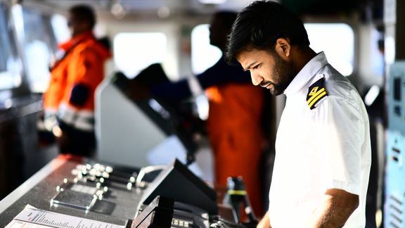
 
Photo: Danny Cornelissen
 
Hydrographic Service 
 
Captains of seagoing vessels require detailed information in order to plan their voyages and navigate safely in accordance with IMO Resolution A.893(21).
This data is available in their advanced navigation system ECDIS (Electronic Chart Display and Information System).
An ECDIS uses official Electronic Navigational Charts (ENC).
The Hydrographic Service publishes these ENCs and other nautical products.
Each country has its own Hydrographic Service, which is the only entity authorized to publish ENCs.
Port authorities are not permitted to do this.
To ensure safe shipping traffic, terminals and berths must be accurately indicated in ENCs.
Hydrographic Services collect data from ports in their country.
If the accuracy of this data cannot be guaranteed, it is usually not included in ENCs.
It is therefore crucial that port authorities and Hydrographic Services share location data correctly and in a standardized manner.
The Port of Rotterdam Authority is the first port authority in the world to achieve this.
 
 port of Rotterdam NLHO ENC in the GeoGarage platform
 
Single Point of Truth 
 
Shippers need precise location data to comply with clauses relating to safe ports and berths.
The ships they deploy must match the berth, and collecting location data from different databases is time-consuming.
Now there is a single point of truth: one platform with validated location data.
Through an Application Programming Interface (API), shippers can link their systems to Portbase and immediately access the correct data.
Thanks to near real-time updates, ships and berths can be matched automatically. 

In addition to captains and shippers, nautical service providers such as pilots and linesmen also benefit from standardization.
Pilots use the same data on the nautical chart as captains.
The standardization of location data eliminates any room for differences in interpretation.
Linesmen can determine the mooring configuration in advance based on accurate location data.

Next steps 

In addition to location data, the Port Authority also wants to map the depths and restrictions of terminals and berths in a standardized manner.
These three datasets can be used to assess whether a ship is suitable for the Port of Rotterdam in 99% of cases.
The Port of Rotterdam Authority calls on other port authorities to share their location data with their national hydrographic services in the same standardized manner.
The solution is highly scalable and globally applicable.

Tuesday, September 30, 2025

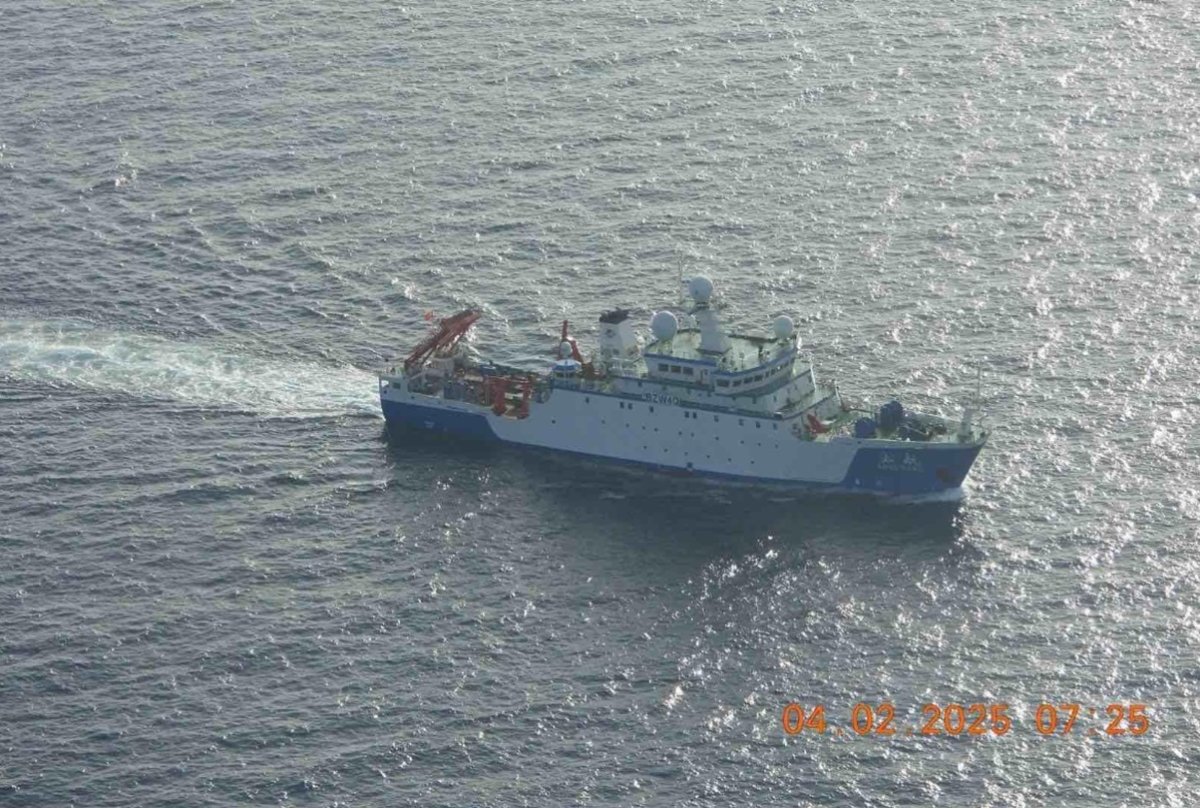
China research ship 'Loitering' near undersea cables

Chinese fisheries research ship the Song Hang operating in the Sulu Sea on April 2.
Philippine Coast Guard

From Newsweek by By Micah McCartney

The irregular movements of a Chinese fishery survey ship in April have raised suspicions that it was collecting data on undersea cables critical to global communications.

The Song Hang "exhibited deliberate loitering patterns directly over critical infrastructure, the kind of movement associated with mapping or surveillance activity, not fishing," maritime analytics firm Windward wrote in a new report.

Why It Matters

The Chinese Communist Party is known to leverage both military and civilian sectors to advance political and economic objectives.
This strategy extends to the maritime domain, where Chinese vessels have been accused of collecting intelligence and of conducting oceanographic research in other countries' maritime zones without permission—an act that violates international law.

The Song Hang's apparent focus on submarine cables is particularly sensitive as these cables carry about 99 percent of intercontinental data traffic.
Over the past two years, there have been multiple incidents of Chinese vessels damaging or severing these cables—including one case in February where Taiwanese authorities detained the crew on suspicion of sabotage.

What To Know

Windward, which tracks global vessel behavior using artificial intelligence, on Monday published an analysis of ship-tracking data highlighting an "unmistakable" difference between the Song Hang's movements and the "natural, erratic" ones of known fishing vessels.

The Song Hang's grid-like paths last month, consistent with survey activity, were concentrated directly over and adjacent to Pacific undersea cables east of Japan and east of the Philippines.

Windward also cited other "red flags" linked to the vessel, including "discrepancies between its transmitted and registered IMO, an unclear ownership trail, and a moderate illegal, unreported, and unregulated fishing risk score."

The Song Hang's activities detailed by Windward aren't the only ones to have come under scrutiny in recent weeks.

In early April, the ship attracted the attention of the Philippine Coast Guard as it entered the Sulu Sea, within the country's archipelagic waters.


Responding to radio hails, the crew said it was headed to the Indian Ocean to "catch fish," Philippine Coast Guard spokesperson Jay Tarriela told reporters.

However, observers said the Song Hang was taking a highly indirect route. A National Security Council official said Manila would continue to monitor the vessel "to ensure that it keeps to its track and it does not conduct maritime survey inside our waters."

While innocent passage is permitted through a country's archipelagic waters, conducting survey activity is not, according to the United Nations Convention on the Law of the Sea.

The Song Hang was launched in 2017 as China's first oceangoing fishery survey ship. Operated by Shanghai Ocean University, it is equipped with laboratories and capable of biological, meteorological and hydrological research.

"It has great significance in tapping into China's ocean fishery resources, protecting ocean ecology and transforming China into a maritime power," said Chen Xinjun, the president of the university's College of Marine Sciences, as quoted by China Daily.

What People Have Said


Ray Powell, the director of the Stanford University-affiliated maritime analysis group SeaLight, wrote on X, formerly Twitter: "Remember China's Song Hang research ship? ...
The ship told the Philippine Coast Guard it was on its way to go 'fishing' in the Indian Ocean. Seriously. Now Windward has analyzed its patterns to show how its favorite 'catch' is intelligence on undersea cables."

What Happens Next

Despite complaints from its neighbors, China is likely to continue deploying research ships, including the Song Hang, on intelligence-gathering missions in the region.
 
Links :

Monday, September 29, 2025

France & misc. (SHOM) layer update in the GeoGarage platform

 
2 new charts, 192 charts updated 

Mining the Arctic's precious resources is a fool's errand


LWM/NASA/LANDSAT/Alamy
 
The Arctic is a land of riches – not just in its beauty, wildlife and cultural heritage, but in the kinds of commodities we value most: oil, gas, lithium, cobalt, gold and more.

Yet those treasures are no good to us.
As our special report on polar science reveals (see “Why vanishing sea ice at the poles is a crisis for the entire planet”), extracting the abundant resources of the Arctic for commercial gain is tricky.

Trying to haul oil and gas from the region is an expensive business, even with the dubious tailwind of melting sea ice helping to clear new patches of ocean for drilling.
As industry and transport gradually shift to electric and hydrogen power, oil demand will fall, making the expense ever harder to justify.

It is a similar story for minerals, too. Greenland is a hotspot for in-demand materials, perhaps one reason why US President Donald Trump is aggressively pursuing its takeover.
But even leaving aside Greenland’s lack of infrastructure – roads are hard to come by on this icy island – this is a risky place to invest. The landscape is changing fast as glaciers melt, revealing new, precarious coastlines that threaten landslides and tsunamis.

For a hard-nosed business executive, there are easier, less hazardous places to mine

Across the terrestrial Arctic, melting permafrost is destabilising existing roads, buildings and industrial sites.
For a hard-nosed business executive, there are easier, less hazardous places to mine.

Viewing the Arctic as a ticket to bountiful economic growth is a fool’s errand.
Instead of seeing it as a region ripe for exploitation, we should treat it as a scientific wonder, while also respecting the people who live there.
After all, as the fastest-changing region on Earth, it is at the vanguard of our climate future.
And there is so much still to learn: how quickly might the ice disappear?
How fast will sea levels rise?
And what happens if and when the ice is gone?

On a more positive note, researchers are pioneering ever more inventive ways to unlock these mysteries, from a new “drifting” laboratory to ultra-deep ice drills and state-of-the-art submarines.
The Arctic is overflowing with opportunities for exploration and discovery.
We just need to let go of the idea of monetising them.

Sunday, September 28, 2025

The hidden world of seamounts


Seamounts are important deep sea ecosystems.
Breaking the flat monotony of the abyssal plains, these underwater mountains emerge from the mud. Those that rise less than 1,000 m (3,000 feet) above the plains are called abyssal hills, while anything taller is a seamount.
And there are at least 100,000 of them, with over half found in the Pacific Ocean near the tectonic plate boundaries. An unsurprising statistic, for Seamounts are formed from volcanism.
The same process responsible for the formation of many island chains.
At mid-ocean ridges, the converging tectonic plates collide at boundaries called subduction zones.
One plate is subducted, or forced down towards the Earth’s molten interior.
As it is subducted, the crust melts and becomes magma, which rises through the rock and erupts to form volcanoes and seamounts.


Watch Part 2 - Islands: 

• The Hidden World of Islands 00:00 - An Introduction to Seamounts
02:00 - Chapter 1: Mountains in the Deep - How Seamounts Form
03:30 - Chapter 1: Mountains in the Deep - The Pacific Ring of Fire
04:33 - Chapter 2: An Underwater Paradise - The Perfect Ecosystem
06:41 - Chapter 2: An Underwater Paradise - The Life of Seamounts
07:30 - Chapter 2: An Underwater Paradise - The Davidson Seamount
08:23 - Chapter 2: An Underwater Paradise - The Coral Gardens
10:05 - Chapter 2: An Underwater Paradise - The Octopus Garden
11:18 - Chapter 3: The Land of Volcanoes - Hawaii's Island Chains
12:09 - Chapter 3: The Land of Volcanoes - Island Preview
 
Scientists believe seamounts to be biodiversity hotspots due to upwelling currents bringing nutrients to surface waters and creating an area where we can see corals, sponges, and all the associated animals that live around them.