From UKHO
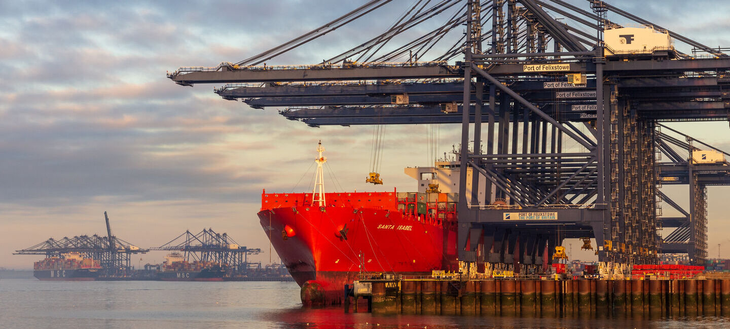
Ports face growing pressure from larger ships, busier channels, and changing navigation demands.
Higher-resolution S-100-ready data can improve safety, efficiency, and coordination — and help ports keep pace with peers already exploring these capabilities.
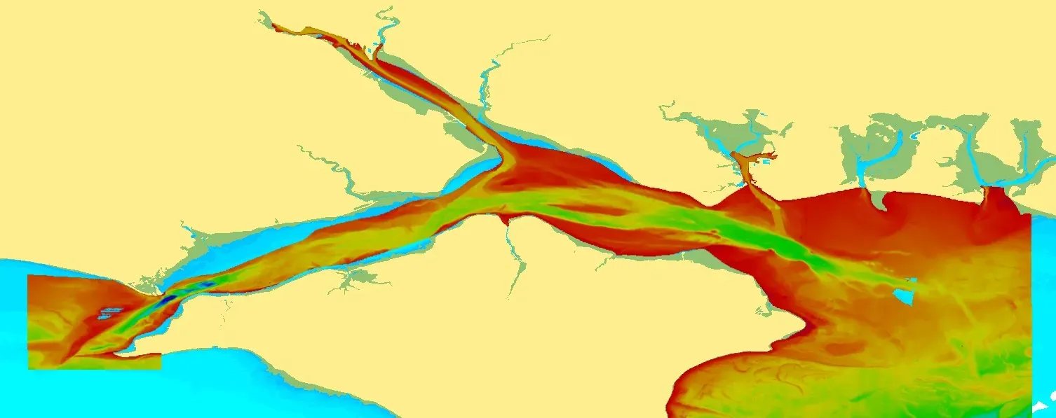
Multibeam bathymetry in the Solent.
Gaps in coverage are clearly visible on the left- and right-hand sides.
Gaps in coverage are clearly visible on the left- and right-hand sides.
Preparing for changing data expectations
Ports are operating within increasing constraints.
Vessels are getting larger.
Traffic density is increasing.
Many approaches and navigation channels are dredged, tidally constrained, or both.
At the same time, ports are under pressure to improve efficiency, reduce delays and maintain safety margins, often within the same physical footprint.
Against this backdrop, digital navigation is evolving.
The industry is beginning to move away from static, generalised representations of the seabed towards higher-resolution, layered S-100 standards.
These can support better situational awareness and more informed decision-making.
As digital navigation evolves, an important question emerges: is port data detailed enough to support what modern systems are beginning to ask of it?
This matters, not just because of emerging standards or S-100 timelines, but also because data quality increasingly underpins how constrained water space is used, managed, and shared.
The move towards S-100 is often discussed in terms of standards, systems, and timelines.
But beneath that sits a more fundamental change: rising expectations of source data.
Sea trials and early implementations have highlighted that legacy survey data — while entirely fit for traditional charting — may not always support emerging high-resolution digital layers when these are displayed or combined in new ways.
In particular, limitations become apparent where coarse bathymetric data is asked to coexist with finer-scale environmental or operational information.
This is not about data being ‘wrong’ or ‘outdated.’
It is about new use cases placing different demands on data density and consistency.
For certain S-100 data layers, particularly those concerned with bathymetry, this means higher-resolution seabed data is a prerequisite.
For certain S-100 data layers, particularly those concerned with bathymetry, this means higher-resolution seabed data is a prerequisite.
High-fidelity bathymetric survey from multibeam echosounding (showing prominent coverage gap) of the Solent, UK.
What does S-100-ready bathymetric data mean in practice?
For ports, the conversation often comes down to resolution.
While requirements will vary by location and use case, discussions increasingly reference bathymetric data capable of supporting visualisation at around 2 metres per pixel.
Achieving this level of detail is typically only possible using multibeam echosounding, particularly in areas where precise under-keel clearance or navigable limits are critical.
This represents a significant change from some historic survey approaches, and it is important to acknowledge that:
- The scale of the task can be significant
- Survey planning, prioritisation, and cost all matter
- Not every area needs the same level of detail
However, for some ports, particularly those on primary shipping routes or handling large vessels, this level of survey capability is often already within reach; or aligns closely with existing or planned survey activity.
Crucially, higher-resolution bathymetric data is not an ‘extra’ for S-100.
For some layers, it is a foundational requirement.
Why S-100 makes sense for ports
From a port perspective, investing in collecting higher-quality, S-100-ready source data is not primarily about compliance.
It is about control, resilience, and alignment with how port operations are evolving.
Greater confidence over constrained water space
More precise bathymetric data can give ports greater confidence in how limited navigable water is used, particularly in dredged, tidal, or heavily trafficked waterways.
In some contexts, this could support more informed decisions about navigable tidal and cargo windows, vessel movements, and safety margins, helping to reduce the risk of groundings or costly channel blockages.
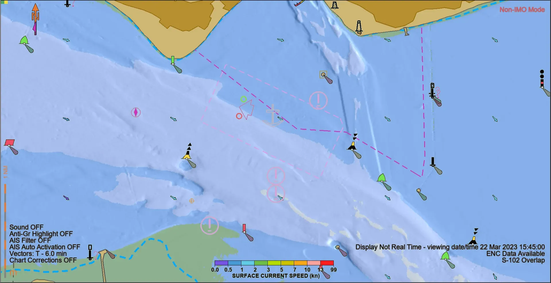
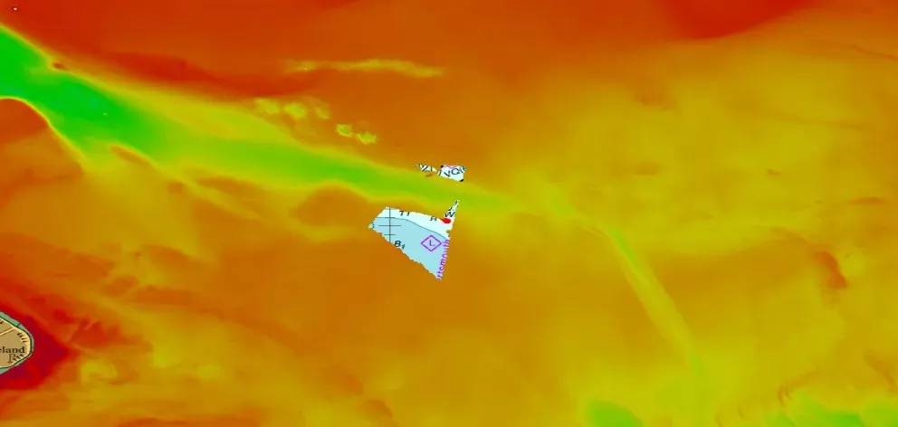
S-101 ENC of Isle of Wight area with S-102 and S-111data layers applied.
Improved operational resilience
Busy ports increasingly depend on a wide range of information — from infrastructure and traffic to environmental conditions and local navigation features — to manage daily operations.
At present, this information is typically spread across multiple systems or held by individuals and is not always visualised together.
A common S-100 framework offers a way to integrate these data layers more consistently, which could support enhanced situational awareness in both routine operations and periods of disruption.
Alignment with emerging operational practices
Ports, vessel operators and charterers are already working together on practices such as just-in-time arrival, speed optimisation, and collaborative port call planning.
Higher-quality, standardised data strengthens this collaboration, supporting more confident and coordinated decision-making across the port call ecosystem.
Reduced friction across the port call ecosystem
Using a common data framework can help improve shared understanding between ports, ship operators, terminal operators, and charter parties.
While outcomes will vary, greater clarity, coordination, and predictability can help ports avoid unnecessary delays, operational disruptions, and costly disputes, particularly when conditions change.
Why act now?
Implementing higher-resolution, S-100-ready surveys is not a quick or simple task, but it is a strategic investment in risk management, operational resilience, and long-term readiness.
Targeted efforts — for example, focusing on primary navigation channels or high-traffic areas — make the work manageable while reducing exposure to delays, operational disruptions, and costly disputes.
Acting now also positions ports to align with emerging practices such as just-in-time arrivals and improved coordination across the port call ecosystem.
Ports that take early steps can maintain control over constrained waterways and stay on par with peers already exploring these capabilities, such as the Port of London.
“For ports, the real potential of S-100 lies in how it connects high-quality survey data to everyday operational decisions: it will enable us to maximise efficiency by demonstrating where under-keel clearance margins really sit.
At the Port of London, that starts with high accuracy and high fidelity multibeam echosounder surveys.
The level of detail they provide isn’t about producing ‘better charts’ for their own sake; it’s about having the confidence to support safer, more flexible use of constrained water space to maximise cargo and tidal windows.
Without that survey resolution, the promise of S-100 simply can’t be realised.”
David Parker, Hydrographer of the Port of London
What higher-quality data could enable over time
Before looking ahead, it’s worth noting that improvements in data quality have already delivered tangible benefits through the evolution of Electronic Navigational Charts.
The move towards higher-density ENCs has shown how more detailed, consistent source data can improve clarity, usability, and confidence for mariners operating in complex port environments.
Next-generation S-101 ENCs, for example, build on this foundation by supporting improved symbology, richer attribution, and greater consistency across data layers.
This will help mariners interpret port environments more clearly and reliably.
These developments illustrate an important point: richer outcomes begin with richer data.
Where the necessary data foundations are in place, S-100-based products have the potential to support a range of positive operational outcomes for ports and their users.
These may include:
- Dynamic under-keel clearance
- Larger vessel tolerances
- Optimised cargo loading
For illustration, initial calculations suggest that for a typical 400-metre container vessel, every additional 10 cm of under-keel clearance could equate to approximately 97 additional TEU — subject to local conditions and operational constraints.
- Port call optimisation
- Reduced idle time and delays
- Fewer disputes linked to laytime and demurrage
- Enhanced Master–Pilot exchange
- Autonomous vessels
None of these outcomes are automatic.
They depend on local context, governance and how data is used.
But they all rely on having the right data in place first.
In future, specifications such as S-131 Marine Harbour Infrastructure are expected to describe detailed port facility layouts and services — supporting richer harbour information alongside bathymetry and dynamic environmental layers to enhance berth-to-berth planning and operational awareness.
Continuing the conversation on data readiness
S-100 is not an overnight change; it is a long-term transition but preparing for it begins with understanding data readiness today.
What bathymetric data is already held?
Where is it sufficiently detailed — and where might it not be?
How well would it support emerging S-100 layers and use cases?
For ports, maintaining control over increasingly constrained waters ultimately comes back to a conversation about higher-quality data.
Where is it sufficiently detailed — and where might it not be?
How well would it support emerging S-100 layers and use cases?
For ports, maintaining control over increasingly constrained waters ultimately comes back to a conversation about higher-quality data.
Doing so positions them to seize emerging opportunities in digital navigation and keep pace with leading ports that are already preparing.
Links :
No comments:
Post a Comment