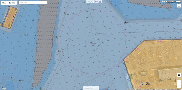
The first HD ENC maps covers the Rostock harbor waterways area.
DE6HOSR1 / DE6HOSR2 / DE6HOSR3
Depth contours are now not only shown in 2m, 5m or 10m, but every full meter.
see ENC catalogue updated kmz for Google Earth
comparison with the previous appearance of the same place
-----------------------------------------------------------------------------------------------------------------------------
-----------------------------------------------------------------------------------------------------------------------------
The Federal Maritime and Hydrographic Agency (BSH) is already presenting the High Density Electronical Navigational Chart - HD ENC for short - in order to make the electronic nautical chart more precise and standardised than ever before on the way to the introduction of the new international S100 standard in 2026
BSH has started producing new electronic nautical charts with a higher resolution for depth display
The main feature of the new HD-ENC charts is the much more detailed
depth information in higher resolution and with depth contours at 1
metre intervals instead of the previous 5 metre intervals, which enables
a higher degree of safety, particularly when navigating near the coast.
With these HDENCs, navigation can be improved because the available navigation space can be utilized much better.
This makes navigating German waters increasingly safe and we are making an active contribution.
BSH is now gradually rolling out production to ports and heavily frequented sea waters.
Links :


No comments:
Post a Comment