The Antarctic Circumpolar Current surrounds Antarctica like a force field, keeping out warmer waters, but scientists are worried about breaches.
They are concerned eddies spinning off from the current act as gateways to let warmer water reach the icy continent, speeding up melting.
What's next?
They are concerned eddies spinning off from the current act as gateways to let warmer water reach the icy continent, speeding up melting.
What's next?
The researchers will embark on the RV Investigator on Wednesday and deploy high-tech monitoring devices in the Southern Ocean to better understand the problem.
It is the planet's strongest flow of water and behaves like a climatic force field in the Southern Ocean.
"The Antarctic Circumpolar Current flows around the icy continent from west to east and acts as our safety belt so that the warm water doesn't reach the Antarctic and melt the ice," the CSIRO's Benoit Legresy explained.
But scientists are concerned that eddies spinning off from the current are acting as a "gateway" for warmer waters to enter the frigid zones.
"If you get this warm water towards Antarctica, it starts to melt glaciers and then we have [a] runaway [situation] of ice melting into the ocean and rising sea levels," he said.
Scientists are concerned the warmer water will speed up the melting of Antarctic ice, leading to rising sea levels.
(Supplied: AAD/Jan Lieser)
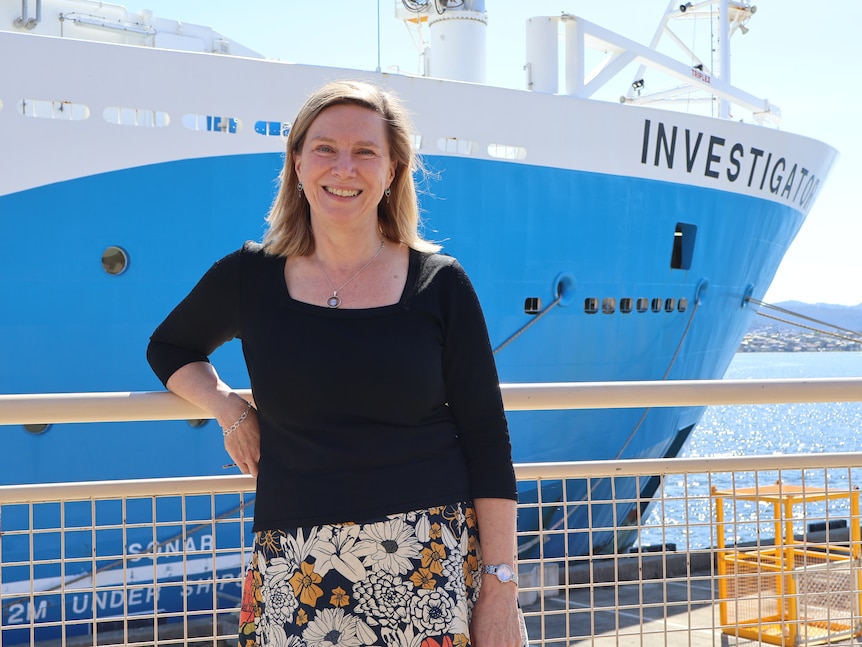
To better understand the process, Dr Legresy and a team of Australian and international scientists are about to embark on a month-long voyage on board the CSIRO's research vessel, RV Investigator.
"There are five 'eddy heat flux gates', or hot spots, identified around the Antarctic Circle and they're acting as a gateway for the heat to go south," he said.
"We're going to track down those small features that we think explain the heat seeping into polar waters."
Dr Benoit Legresy on board CSIRO's RV Investigator
(Supplied: CSIRO)
Deep-sea 'gliders' to reach a depth of 1,000m
The researchers will deploy a range of high-tech observational equipment once the ship reaches one of the heat transfer zones, about halfway between Tasmania and Antarctica.
The equipment includes three autonomous deep-sea ocean "gliders", which can sample the water column down to a depth of about 1,000 metres.
The deep-sea ocean gliders will be deployed for six months in the Southern Ocean to study the "heat flux gates".
(Supplied: CSIRO)
The gliders will traverse a vast section of the Southern Ocean over a six-month period, automatically surfacing to transit data.
A floating monitoring system known as a tall mooring will also be deployed.
The device, which includes 35 instruments that measure currents, temperature salinity and oxygen, will be anchored in the middle of the research area and collect data for 18 months.
Anchors for the tall mooring, weighing 1.5 tonne each.(Supplied: CSIRO)
Other equipment will be towed behind the RV Investigator to gather information about the velocity, temperature, salinity and turbulence of the water.
The researchers hope all the data they collect will complement high-definition imagery captured by a "revolutionary" satellite jointly developed by NASA and the French space agency, CNES.
The Surface Water and Ocean Topography (SWOT) satellite, which is far more accurate than previous satellites, can map currents by detecting small height variations on the ocean's surface.
"Our first images already show the incredible two-dimensional structure of ocean eddies and fronts, and how they are stretched and strained by the turbulent ocean," CNES SWOT ocean lead, Dr Rosemary Morrow, said.
"Our first images already show the incredible two-dimensional structure of ocean eddies and fronts, and how they are stretched and strained by the turbulent ocean," CNES SWOT ocean lead, Dr Rosemary Morrow, said.
"The new SWOT observations, combined with measurements taken on the RV Investigator, will usher in a new era by extending our knowledge from on-dimensional sections to the full 3D ocean variations."
Unprecedented changes highlight importance of voyage
Australian research ship, RV Investigator, at sea.
The Investigator's sonar sensors, used to map the seabed, have also helped rediscover shipwrecks, including MV Blythe Star and the SS Iron Crown.(Supplied: CSIRO)
The RV Investigator has been uncovering secrets of the deep since 2014 and notched up its 100th voyage earlier this year.
When it departs Hobart on Wednesday, it will be carrying 54 people on board, including 20 crew, 20 scientists and 14 support staff.
While the Southern Ocean's heavy seas might cause some interruptions, the scientists plan to conduct research 24 hours a day, split evenly between two teams.
One 12-hour shift will be led by Dr Legresy, with the other stint overseen by Associate Professor Helen Phillips from the Australian Antarctic Program Partnership at UTAS. 
Associate Professor Helen Phillips says scientists want a better understanding of how heat passes cross the current.
(Supplied: CSIR0)
Associate Professor Phillips said the voyage will provide important information at a time of unprecedented changes, including significant reductions in Antarctic sea ice.
"What's surprising to scientists is the speed at which these changes are happening," she said.
"This incredible reduction in the sea ice was way outside the bounds of what we might have expected and so there are surprises in the climate system.
"Understanding better how the heat moves across this current, that's a barrier to that heat, will really help us understand how much heat is moving southward to Antarctica to affect that sea ice."
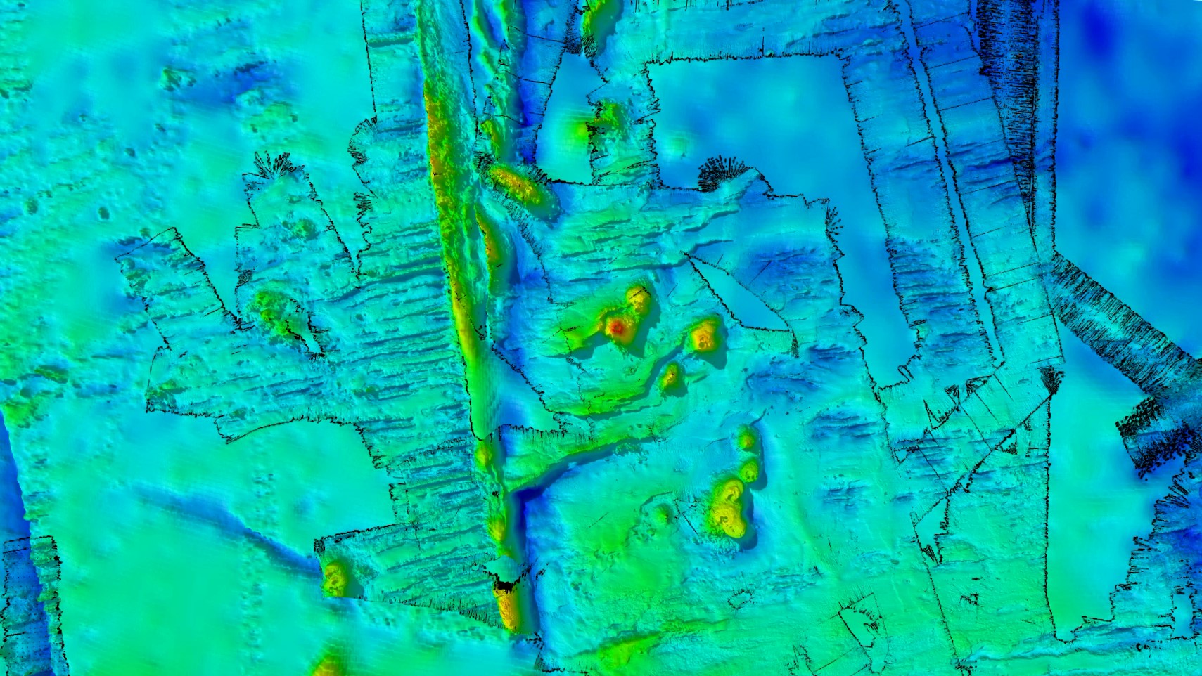
20 millions year old mountain range found near Antarctica with 4 underwayer volcanoes
during the FOCUS voyage
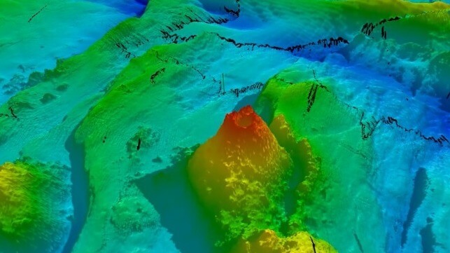
An especially prominent volcanic seamount that the researchers dubbed "Mt. Doom" (CSIRO)
The data collected during the trip will support research programs at the CSIRO, the University of Tasmania as well as institutions in the United States and Europe.
The RV investigator is scheduled to return to Hobart on December 20.
The RV investigator is scheduled to return to Hobart on December 20.
Links :
- ABC : 'Five-sigma' event unfolding in Antarctica
- CSIRO : Oceanography, seafloor mapping and satellite combine to map world’s strongest current
- AAPP : Oceanography, seafloor mapping and satellite combine to explore world’s strongest current
- LiveScience : Zoom through a 'spectacular' chain of ancient underwater volcanoes on Antarctic ocean floor
- Maritime Executive : Australian Research Vessel Discovers New Underwater Mountain Range


No comments:
Post a Comment