
Image credit: Malys et al., Journal of Geodesy 2015 / Google Maps/Infoterra Ltd/Bluesky
From El Pais by Rafael Clemente
In the past, the zero meridian used to be established coinciding with the last known land, beyond which there was only unexplored ocean
For centuries, the problem of determining the position of a ship on the high seas was a difficult one, although latitude and longitude pose two very different difficulties.
Latitude is measured with respect to a very clear reference point: the Equator.
On the other hand, for longitude there is no specific starting point, since all meridians are the same.
Latitude could easily be established simply by measuring the height of the North Star above the horizon (in the Southern Hemisphere, the Southern Cross offered an acceptable if not nearly as accurate substitute).
During the day, the reference was the Sun, although the calculation required some corrections according to the time of day and the time of the year, and was therefore only within the reach of trained professionals.
Longitude was another matter.
The concept of a “meridian” did not appear until the 16th century.
Medieval navigators calculated their course by dead reckoning or by applying “recipes” drawn up by cartographers.
These routes established nautical days between origin and destination, guided by the wind or following a given parallel.
Needless to say, these specialists guarded their knowledge (and their business) so jealously that once the routes had been established on their navigation charts, they used to give the client a simple indication of the directions to follow in each section of the voyage and erased all the annotations made on their maps so they could reuse it.
In the past, the zero meridian was established using the last known land, beyond which there was only unexplored ocean.
It seems that Ptolemy used the Canary Islands or, more likely, Cape Verde.
All longitudes were measured from there to the East, since the meaning of negative numbers was not yet widespread.
Columbus was the first to notice that the compass needle did not point due north, but as he moved across the Atlantic, the deviation decreased until magnetic and geographic north coincided.
There was nothing special about that meridian; it just seemed like a “natural” way to establish a reference.
Although the method of determining longitude at sea by magnetic declination would not be practical due to irregularities in the magnetic field.
The Treaty of Tordesillas, which established the zones of Portuguese and Spanish influence in the New World, only prescribed that the demarcation line would be found 370 leagues to the west of the Cape Verde Islands.
Much more than the 100 leagues established the previous year by papal bull, but no specific reference to degrees of longitude.
Geographers engaged in endless discussions about how many leagues were covered by one degree.
And later, if the line (defined as “from pole to pole”) extended to the other hemisphere, since the areas of the Pacific that could be colonized depended on it.
For many years, Cape Verde would serve as a more or less official reference point for the zero meridian.
In the middle of the 16th century, Mercator transferred it to the island of Fuerteventura, but that was not a universal agreement either, since each cartographer used to assign the meridian where it best suited him for practical, nationalist, or religious criteria.
Thus, the origin of longitudes was located briefly in Jerusalem, Rome, Pisa, Saint Petersburg, the Great Pyramid of Cheops, and Copenhagen (perhaps in homage to Tycho Brahe).
In the 17th century, Cardinal Richelieu decreed that France would adopt the meridian that used the island of El Hierro, at 19º 55′ West, which would then be rounded to 20º only so that 0º would pass through Paris.
For a long time, longitude could only be calculated by astronomical methods.
Lunar eclipses offered a good system: they occurred simultaneously throughout the planet, but each observer saw them at a different time, depending on their geographical position.
Columbus himself tried twice during his second and fourth voyages; although the few events available at the time did not offer many guarantees.
Other astronomers, including Galileo, suggested using a very accurate cosmic clock: the eclipses of Jupiter’s satellites.
Calculation tables were compiled to help with the task.
In theory, it might have worked on dry land, but locating them from the heaving deck of a ship at sea was impossible.
By the eighteenth century, the calculation of longitude was still an unresolved problem.
The methods were estimated by determining the position based on the course and path taken, which resulted in errors of tens of kilometers.
It was the cause of numerous tragedies: there were captains who were unable to find their reference islands and were so lost that they did not know if they were to the east or west, while, in the meantime, half the crew died of scurvy; or shipwrecks like the one in the Scilly Islands in which the British navy lost four ships of the line and more than two thousand lives in a single night.
Following these incidents, the British Admiralty promoted the search for a more reliable system for calculating longitude.
At least with an acceptable margin of error.
For a long time it was known that the solution was to compare the local time with the time at the reference meridian, but since there were no reliable clocks, it had to be calculated by other methods.
The most commonly used was lunar distances.
In essence, it was based on measuring the angle between the center of the moon and a bright star.
The stars were fixed, but the position of the Moon changed throughout the night.
Astronomers could calculate how it varied minute by minute and record the results in tables referring to a reference meridian.
In general, of course, the same one from where the calculations had been made.
It was certainly a formidable job, requiring the collective effort of several generations of mathematicians.
Because it was not only about predicting distances, but also helping with the multiple corrections that would be required.
For example, the effect of refraction caused by the atmosphere or the different apparent size of the Moon depending on whether it was at its apogee or perigee, which, in turn, affected the determination of its center.
It was the fifth Astronomer Royal, Nevil Maskeline, who, with the publication of the Nautical Almanac (1767), would give a great boost to the method of calculating lunar distances.
It was not a fast or convenient system: it required complex calculations that could take more than four hours to reach an acceptable result.
Maskeline himself, during a trip to the island of Saint Helena, took eight hours.
Around this time, an amateur watchmaker and carpenter named John Harrison built the first marine chronometer that was accurate enough to keep time to within a few seconds of error, despite the rough conditions of a sea voyage.
With its help, the calculation of the length was not only quick and easy, but much more accurate.
The downside to Harrison’s watch was its price, since it was a genuine piece of precision manufacturing.
So, until it became more affordable over time, sailors continued to use the method of lunar distances.
And since the Almanac tables had been calculated from the royal observatory in Greenwich, its meridian (and its local time) became a “de facto” reference.
In the second half of the 19th century, the need to adopt a common reference became more and more evident, not only because of navigation imperatives, but also to unify railway timetables.
In the United States, each population center was governed by a schedule that referred to its own meridian, taking Washington as its origin (which had also served to establish the limits of numerous states in the Midwest).
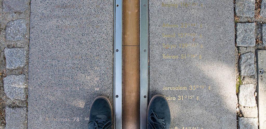
After several attempts, in October 1884 an international conference was convened in Washington with, among other things, the purpose of officially defining the Greenwich meridian as the origin of longitude measurements.
The agreement was adopted by 23 votes to one.
Only the Dominican Republic voted against; France and Brazil abstained.
In fact, France would still resist accepting the pre-eminence of Greenwich for thirty years, to the point of resorting to the euphemism “Paris mean time minus 9 minutes and 21 seconds.”
- IFLScience : Why Is The Greenwich Meridian Not Where It Should Be?
- RMG : The Prime Meridian
- GeoGarage blog : Opinion: How the Prime Meridian changed the world / Farewell Greenwich Mean Time / Lines of Longitude explained, with maps / 22nd October 1884: International Meridian Conference in ...
No comments:
Post a Comment