While the first confirmed mainland sighting of Antarctica wasn’t until 1820, there are suggestions that a Turkish cartographer by the name of Hagii Ahmed Muhiddin Piri, also known as Piri Reis, actually included Antarctica on a map in the early 1500s.
But how accurate is this assumption?
And how could Piri have included the undiscovered continent over three centuries before it was actually seen?
While his exact birthdate is unknown, Piri Reis was born between 1465 and 1450 in Gallipoli, a peninsula in eastern Turkey.
At the time, it was part of the Ottoman empire.
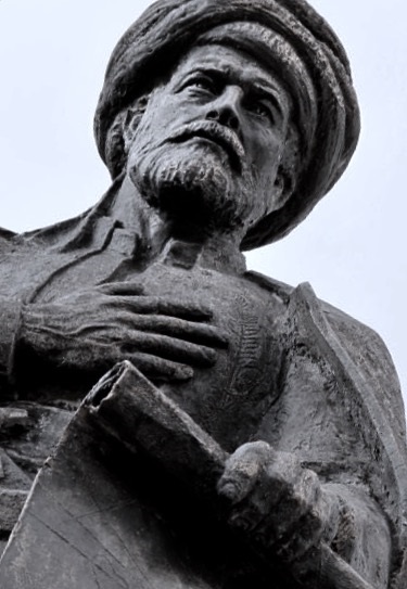
At an early age, Reis began navigating and sailing the seas with his uncle Kemal Reis.Statue of Piri Reis
In 1494, Piri Reis officially joined the Ottoman Navy as a commander, leading the charge between the Ottoman Empire and Venice.
When his uncle died in 1511, Piri returned to Gallipoli and began drawing his maps and books as he began to develop an esteemed reputation for map-making.
Piri (Reis is a title meaning "admiral") did not draw Antarctica, he drew the Terra Australis which was depicted on pretty much every map during the 1400s to early 1700s.
A Whole New World
His most famous map, the 1513 World Map, and the Book of Navigation remain among the most studied pieces of early maritime navigational techniques.
His 1513 World Map wasn’t discovered until 1929 and is known as one of the oldest maps of America that exists.
The map, centered on the Sahra, was drawn on a small piece of preserved gazelle skin.
Only one-third of the map survived, but was discovered at the Topkapı Palace in Istanbul, where it is today — though not on public display.
Controversy
While the map was discovered in the 1920s, it wasn’t until later, in 1965, when Charles Hapgood published a paper about the history of Antarctica.
Hapgood, a University of New Hampshire professor, studied Piri’s map in his research and included many theories about it in his book, Maps of the Ancient Sea Kings.
His research found some interesting results that are hard to find modern explanations for.
For one, it appears that Piri Reis’ map in 1513 was drawn using a Mercator Projection — a cartography technique developed by the Flemish geographer in 1563 that is used today as the standard map projection.
This method illustrates how Earth’s cylindrical shape impacts the illustration of maps.
Since this methodology was undiscovered until the late 16th century, researchers are baffled by Piri’s apparent use of the Mercator Projection.
One possible explanation points to Piri’s different source documents that he used to create his own maps.
It was known that Piri studied 20 different maps and charts, including Greek, Portuguese, and Arabic, and Christopher Columbus even draws one.
With Piri’s in-depth study of these maps, his use of the Mercator Projection is possibly explained by the Greeks, who also used astrological and geological calculations, including latitude and longitude, to draw maps.
However, it continues to be impressive, as this type of spheroid trigonometry wasn’t widely used until the middle of the 18th century.
This proved that early map makers not only knew that Earth was round, but they were accurate within 50 miles of its actual circumference.
Piri Reis’ maps have baffled scientists and researchers as they look for answers to explain how accurate a cartographer in the 1500s was.
And even with a possible explanation for his mapping style, one aspect of Piri’s 1513 World Map remains unsolved — How did he know to incorporate Antarctica centuries before it was even discovered?
Antarctica Uncovered
As Professor Hapgood and others studied Piri’s maps, they noticed that Antarctica was included in the drawings — but was drawn without its ice caps.
This astonished scientists, as 97.6% continent today is covered in ice — and has been for over a million years, according to most estimates.
How could he have included a map without Antarctica’s ice caps?
Piri’s map is so accurate that even the in-lands and topographical representation are identical to today’s modern-day maps of Antarctica.
Some have speculated this could have resulted from alien civilization or other strange, unknown supernatural occurrences without a clear explanation.
How else could Piri Reis’s source maps accurately illustrate a continent without aerial surveying from 600,000 years ago?
One theory is that Piri Reis used a source document with information older than 4,000 BCE.
But, this would mean that an ancient civilization would have had the sophistication to navigate the world and chart the lands before any well-known language or technology.
Others who have studied Piri Reis’ map believe that aliens aren’t to thank for the early discovery of Antarctica.
But instead, theorize that a shift in the Earth’s axis caused part of South America to break off, forming what is known today as Antarctica.
The representation of Antarctica on Piri’s map is also a close representation of South America’s coastline, where Uruguay and Argentina are joined.
In his research, Hapgood offers that the shift in the Earth’s axis could have caused the piece of land now known as Antarctica to break off from South America and move thousands of miles south, where it is now covered with ice.
Scientists have dispelled this theory, though, and say it is impossible to occur.
—
From what we know about Piri Reis cartography, he included that he didn’t conduct the original surveying shown in his maps.
But instead, compiled a large number of source maps that date back to the 4th century BC or earlier.
While the historical depiction of the map is impressive, some would argue that humankind’s ability to pass down information from century to century with great accuracy is even more impressive.
While maps earlier than Piri Reis have either been destroyed or undiscovered, some argue that Piri’s map points to a lost civilization with technology greater than what mankind knows today.
Scholars generally dismiss these claims, but others argue that we should view history more openly.
The inclusion of Antarctica is yet to be explained.
But one thing is for sure — Piri Reis’ 1513 World Map is a stunning example of unsolved mysteries of our world and how much more there is to uncover.
Links :
No comments:
Post a Comment