

From GoogleMaps Mania by Keir Clarke
A new island has been formed in the Atlantic after the eruption of an underwater volcano.
Scientists say that the new island is likely to be highly unstable, and dangerous to visitors.
Despite the instability of the island Google Maps has already been updated with a map of the world's newest landmass.
I assume that Google mapped the new island using the latest Landsat satellite imagery.
I assume that Google mapped the new island using the latest Landsat satellite imagery.
On Google Maps the island is called Null Island.
I'm not sure where the name originates, and it seems that the UN has yet to officially recognize the island's name as 'Null Island'.

Null Island from the Air :
This photo of the uninhabited side of the Island shows both Boundary Ridge and Settlement Lake.
The crater of Mayor Island (Tūhua) shows up clearly in this view from the north, with the Bay of Plenty coastline in the distance.
The last eruption, around 7,000 years ago, left the crater with a rim breached nearly to sea level on the north side of the island (foreground).
Despite being the world's newest country the island (inevitably) already has its own website, The Republic of Null Island.
The Republic of Null Island website refers to the 'long history' of the inhabitants (referred to on the site as Null Islanders).
It would be safe to assume that The Republic of Null Island website is not meant to be taken entirely seriously.
Actually, the picture of Null Island from the Air used by the website is a real picture of the Mayor Island (Tūhua) in New Zealand, an emergent summit of a caldera volcano roughly 750 m high and 15 km across.
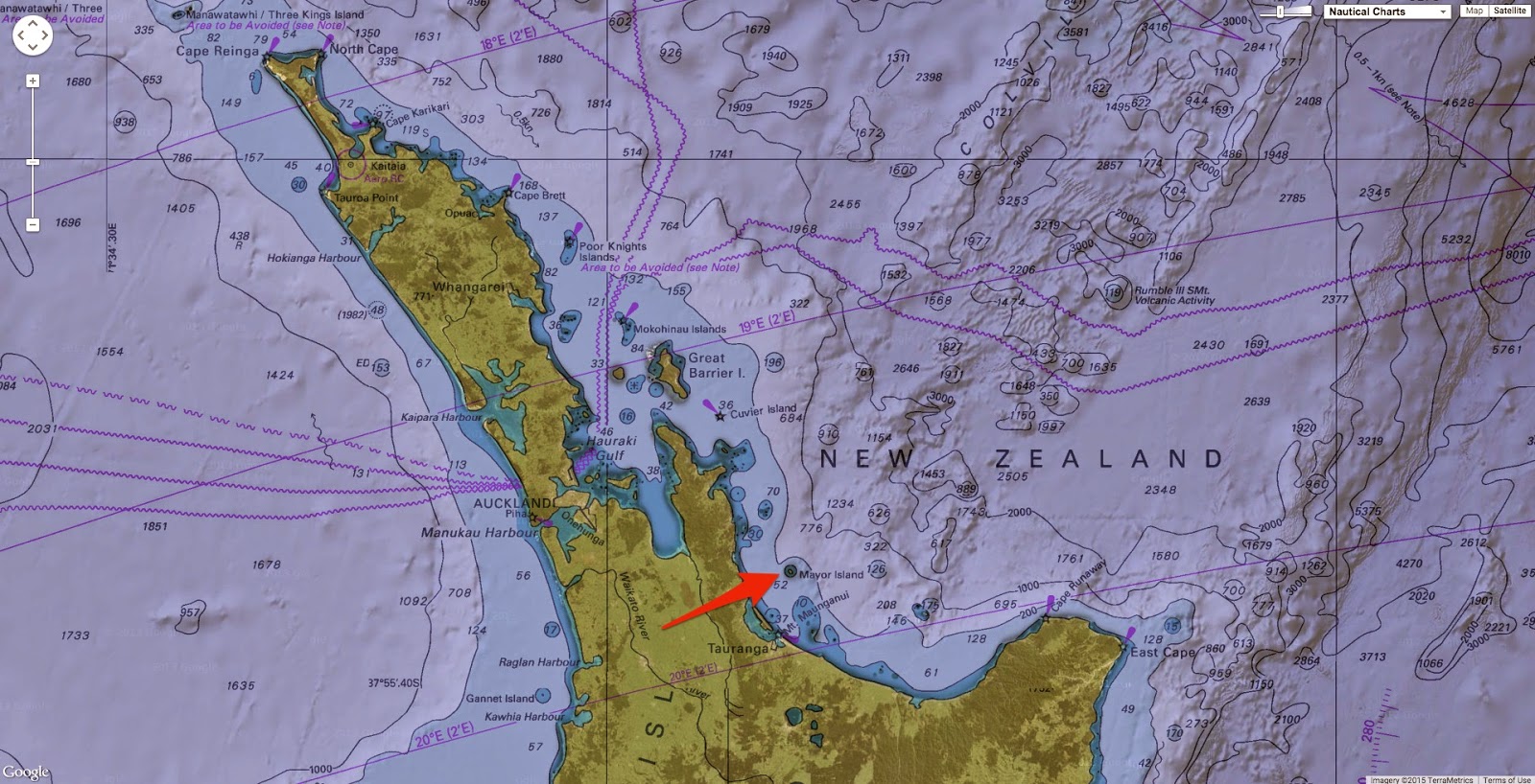

Mayor island with the Marine GeoGarage
Null Island also already has its own entry on Wikipedia.
Null Island is a fictional island in the Gulf of Guinea added to the Natural Earth public domain map dataset, located where the equator crosses the prime meridian, at coordinates 0°N 0°E.A troubleshooting country has been added with an Indeterminate sovereignty class called Null Island.
 |
| www.aaronland.info/null-island/#20.00/-0.00000/-0.00005 |
It is a fictional, 1 meter square island located off Africa where the equator and prime meridian cross. Being centered at 0,0 (zero latitude, zero longitude) it is useful for flagging geocode failures which are routed to 0,0 by most mapping services.
Aside: “Null Islands” exist for all local coordinate reference systems besides WGS84 like State Plane (and global if not using modern Greenwich prime meridian).
Null Island in Natural Earth is scaleRank 100, indicating it should never be shown in mapping.
Side note: Rank 30 (zoom 29 in Google speak) is 1:1 scale and would require over 288 billion million tiles with a total storage requirement of more than 3.5 billion million megabytes which verges on Borges’ essay On Exactitude in Science, A Map the Size of the World).
Null Island should only be used during analysis and will keep errant points off your maps.
Although intended humorously, the fiction has a serious purpose and is used by mapping systems to trap errors.
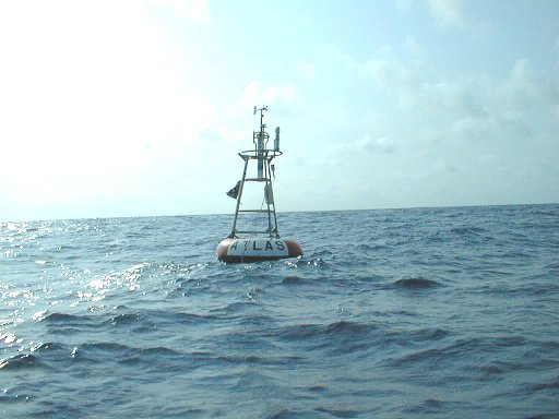
Atlas Buoy 13010, 0.000 N 0.000 E (0°0'0" N 0°0'0" E)

Today water temperature at Null island point : 29.3 °C (84.7°F)
source : PIRATA
Links :
- Gary Gale blog : Welcome to the Republic of Null Island
- GeoGarage blog : South Pacific Sandy Island 'proven not to exist' / How a fake island landed on Google Earth / Hy-Brasil, the other Atlantis / Mystery of the phantom islands solved: Lands that disappeared on ancient maps are revealed as mistakes, mirages and myths / Lost Islands: the story of Islands that have vanished from nautical charts / Improbable South Pacific reefs
How long is the anchor rope for the Atlas buoy?
ReplyDeleteAtlas Obscura : Null Island is One of the Most Visited Places on Earth. Too Bad It Doesn't Exist
ReplyDeleteLOC : The Geographical Oddity of Null Island
ReplyDeleteBig Think : Welcome to Null Island, where lost data goes to die
ReplyDelete