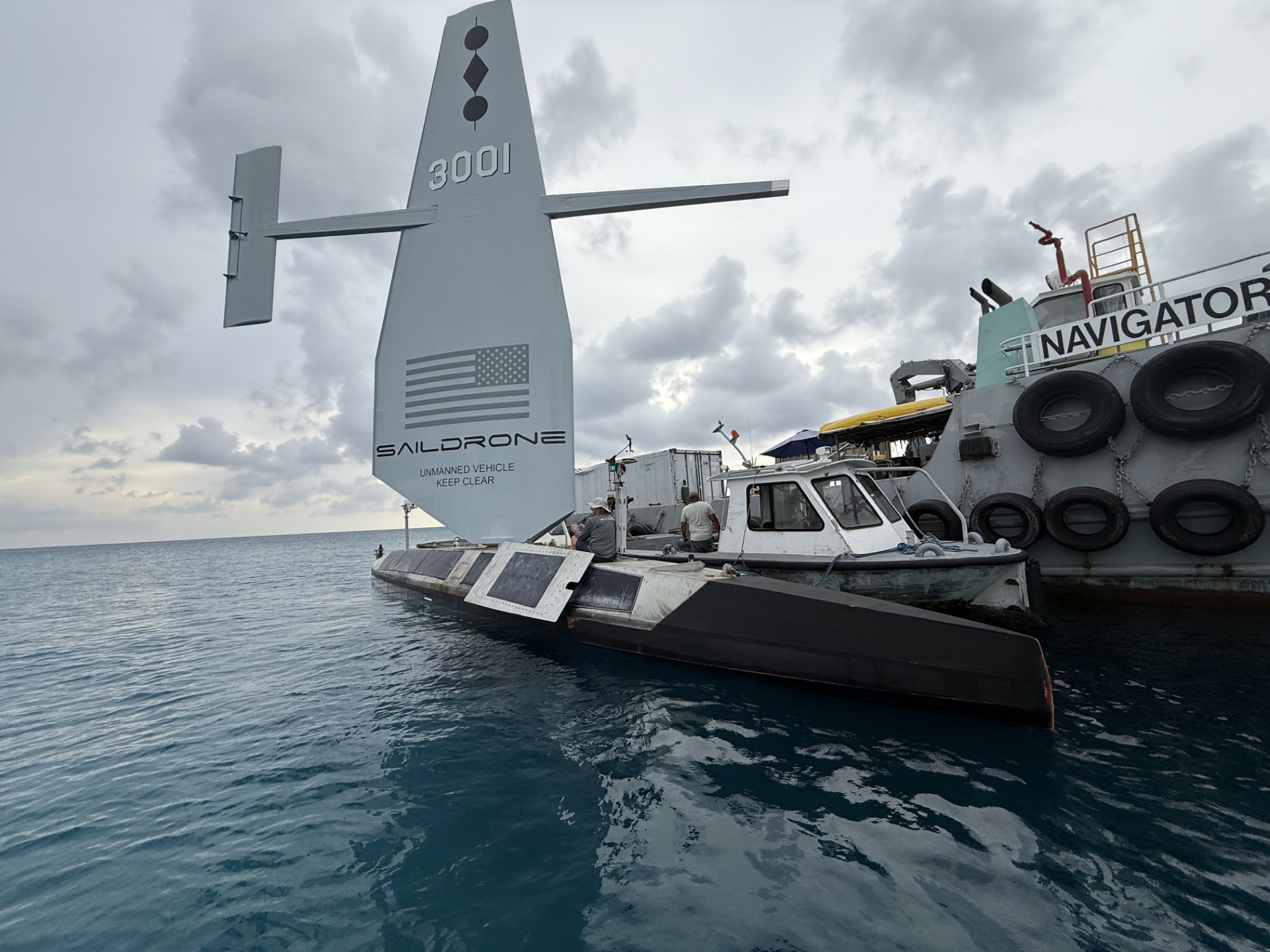
 Saildrone in George Town Harbour on 23 June. - Photo: Simon Boxall
From CaymanCompass by Simon Boxall
The remotely operated vessel is currently north of Little Cayman
Sargassum seaweed is hindering the autonomous vessel Saildrone, but the survey it is conducting of the waters around the Cayman Islands is still progressing.
The vessel is currently conducting operations off the north coast of Little Cayman.
Over the past few months, the vessel has been seen coming in and out of the port of George Town and while in the port, support staff have been observed scrubbing the noticeable amount of salt that has accumulated on the solar panels running along the side of the hull of the vessel.
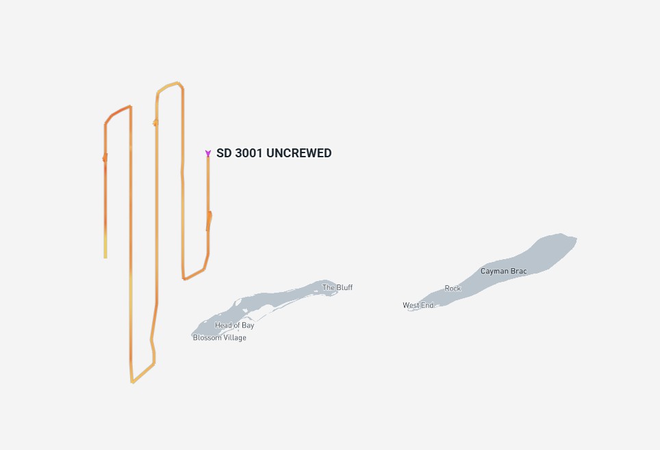
On 21 July, the Saildrone was surveying the waters north of Little Cayman.
– Screen capture image, Marinetraffic.com
Jenn Virskus, head of marketing and communication for the company said, “The Saildrone Surveyor’s movements in and out of George Town port are part of standard maintenance and servicing events that occur during long-duration missions in complex marine environments” and that the “Saildrone platforms and integrated hardware are designed to withstand normal environmental buildup, such as salt on solar panels.”
Viskus did however acknowledge that, “exceptionally high levels of sargassum in the waters around the Cayman Islands — some of the highest on record — have influenced certain aspects of vessel operation, including routine maintenance and mission planning.”
Despite the issue with the sargassum she said, “The survey is progressing steadily, with a significant portion of the planned area already covered.”
As previously reported by the Compass, the survey covers 29,300 square nautical miles or about 80% of Cayman’s exclusive economic zone, and the data will be used to produce a high-resolution map of Cayman’s seafloor.
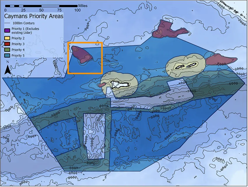
This Saildrone map shows where the company expects its Saildrone Surveyor SD-3001 to operate.
When asked if there had been any notable findings so far, such as old Spanish galleons or German U-boats, Jenn Virskus remained guarded, “While we’re not ready to announce any dramatic discoveries just yet, the data is revealing some exciting geological and ecological insights that we look forward to exploring further with local partners in the months ahead.”
Compass Media also asked if the surveying vessel was being remotely operated from outside of the Cayman Islands jurisdiction and whether the data from the maritime survey was also being held and processed outside of the Cayman Islands?
The company spokesperson said: “As with many international research and mapping projects, elements of data management and remote operations may be supported by teams or systems outside the immediate jurisdiction, which is standard practice in marine science.”
She added, “All data collected during the survey will be submitted to the United Kingdom Hydrographic Office (UKHO). As the Primary Charting Authority for the Cayman Islands, the UKHO will use the data to update nautical charts and make it accessible to other Cayman Islands government agencies and research institutions.”
The short spreading centre area southwest of Grand Cayman around Mount Dent and the Von Damm vent field and the mid-Cayman rise were already surveyed by the UKHO and are not part of the Saildrone survey.
 Visualization of Cayman island in the GeoGarage platform (UKHO nautical raster charts)
This area is said to hold potentially valuable resources, including gold-rich seafloor sulphide deposits.
In an earlier company release on the Saildrone mission, the company said the mapping data it produces will be a prerequisite for exploring, exploiting or conserving Cayman’s natural resources found offshore.
In an earlier company release on the Saildrone mission, the company said the mapping data it produces will be a prerequisite for exploring, exploiting or conserving Cayman’s natural resources found offshore.
“The mission will provide detailed and precise bathymetric data for the Cayman Islands, contributing to a comprehensive understanding of the seafloor topography in the region,” Saildrone wrote in a press release.
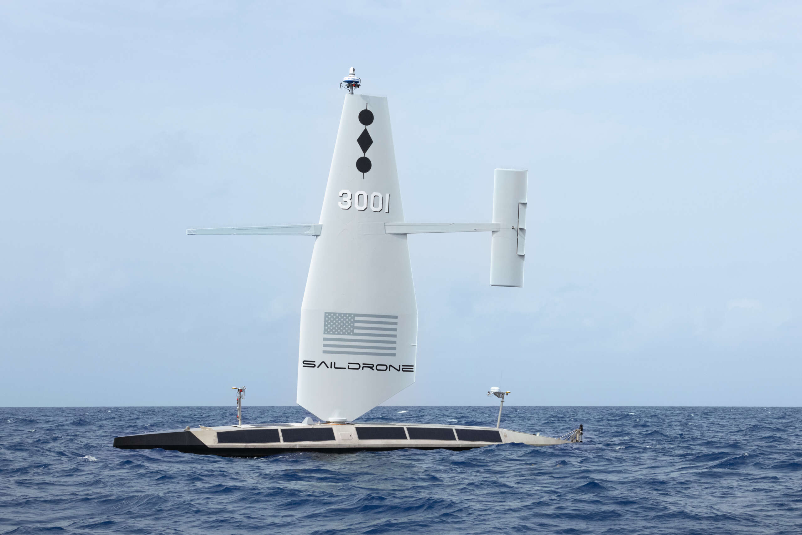
The Saildrone Surveyor SD-3001 will explore Cayman waters for about six months.
– Photo: Saildrone
“The data collected will not only enhance maritime navigation and charting but also support scientific research, environmental conservation efforts, and marine resource management in the Cayman Islands.”
The Saildrone Surveyor SD-3001, uses “multibeam echo sounders and metocean sensors for ocean mapping and ecosystem monitoring, as well as radar, cameras, and advanced machine learning”, the company said.
The pilots also have a 360-degree view around the vessel using the Star Link network, which is how they collect data in real time.
The hydrographic survey of the waters around the Cayman Islands is being done through a philanthropic project, funded by the Cayman Islands based London & Amsterdam Trust Company Limited.
Links :
- InsideUnmannedSystems : USVs Guarding the Global Backbone
- GeoGarage blog : Revealing underwater landscapes: trends in bathymetric surveying
No comments:
Post a Comment