(ATSB / ReefVTS)
From Maritime Executive
The Australian Transportation Safety Bureau (ATSB) has released its investigative report on the near-grounding of the Rosco Poplar in the Great Barrier Reef, which started with a faulty GPS unit and was narrowly averted at the last minute by a marine pilot.
The final report into the near-miss grounding of bulk carrier Rosco Poplar highlights the various concepts, techniques and attitudes that together comprise bridge resource management are essential defences against human error.
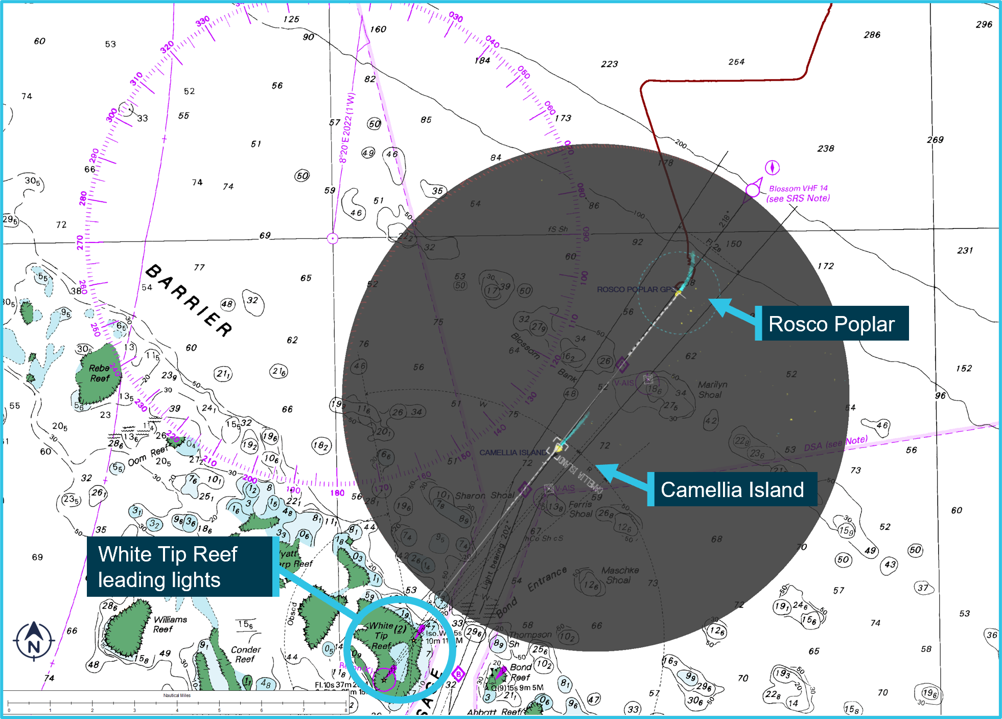
In the early hours of May 4, 2022, the bulker Rosco Poplar prepared to enter Hydrographers Passage, a narrow channel through the Great Barrier Reef.
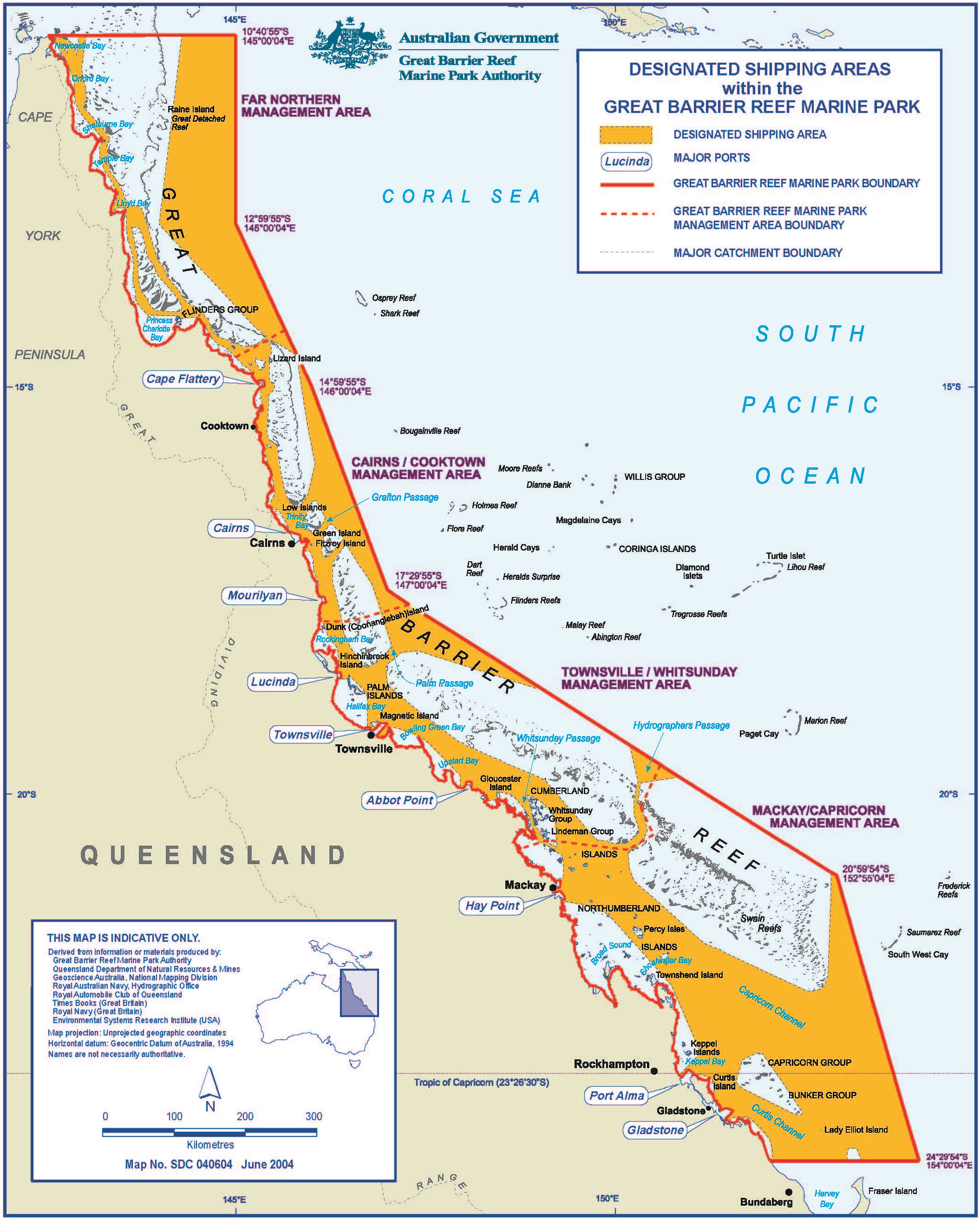
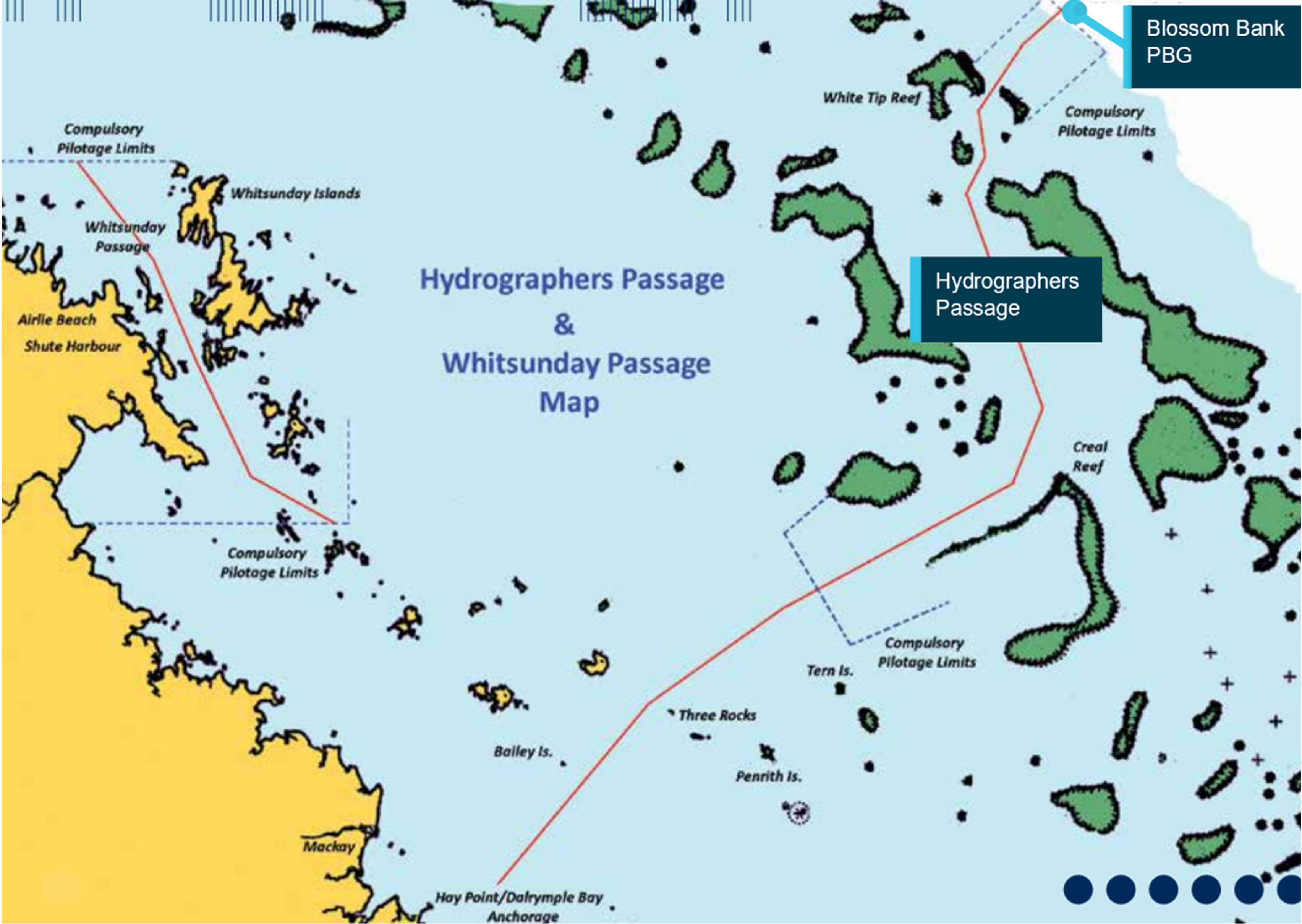
The ship was inbound for the Hay Point coal terminal, with the master and a coastal pilot on the bridge and the second mate on watch.
It was the 1,685th time that the pilot was transiting the passage.
Visibility was clear, and there was little traffic, just one ship ahead.
The tide was running, and an exceptionally strong tidal stream of more than five knots of opposing current would be setting the ship near the passage entrance.
The passage plan called for maximum speed in order to offset the effects of the current.
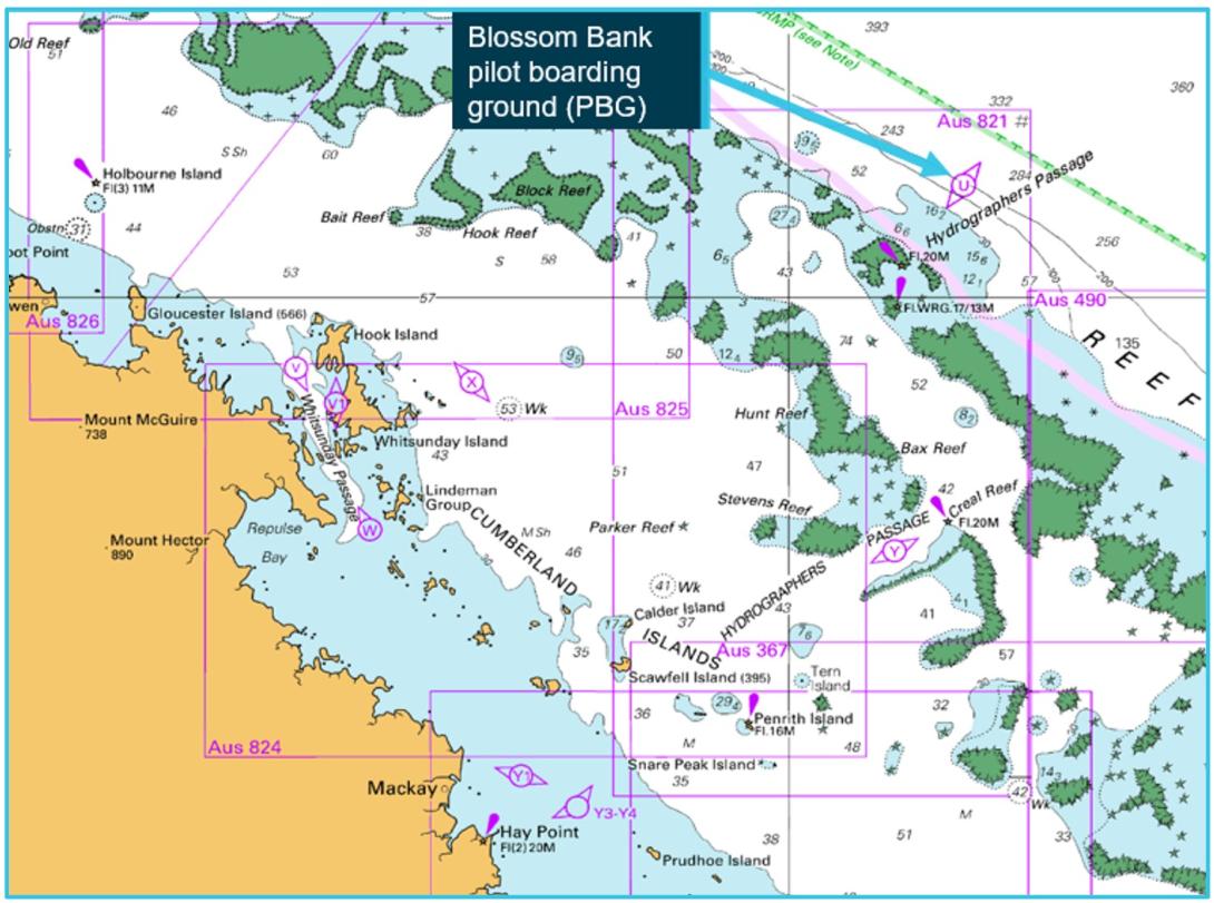
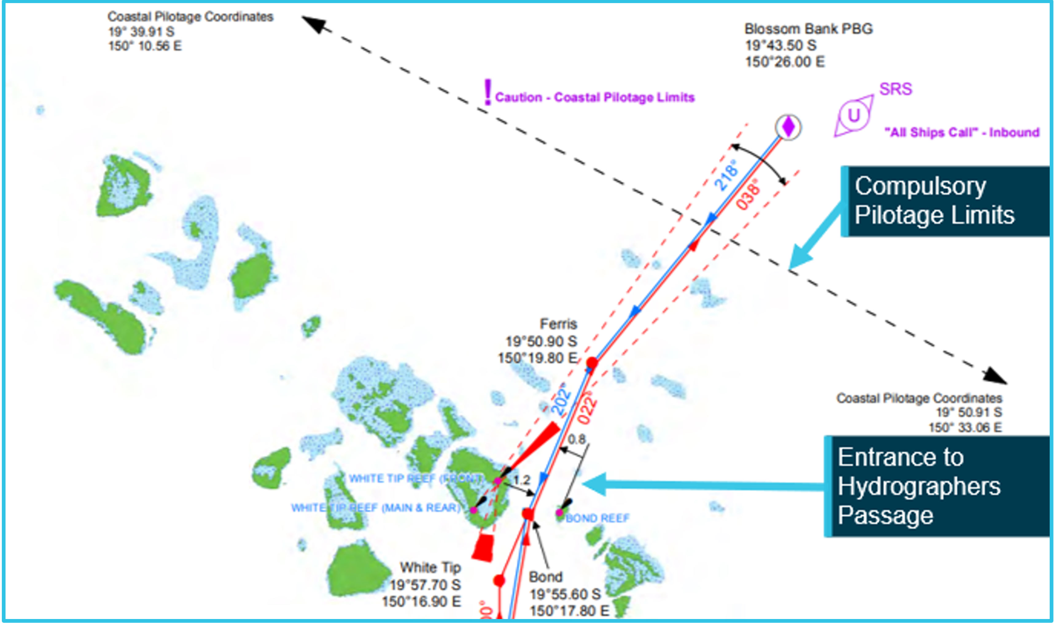
Navigational chart showing Blossom Bank pilot boarding ground
Navigational chart with Rosco Poplar’s radar display overlaid (grey) at 0217
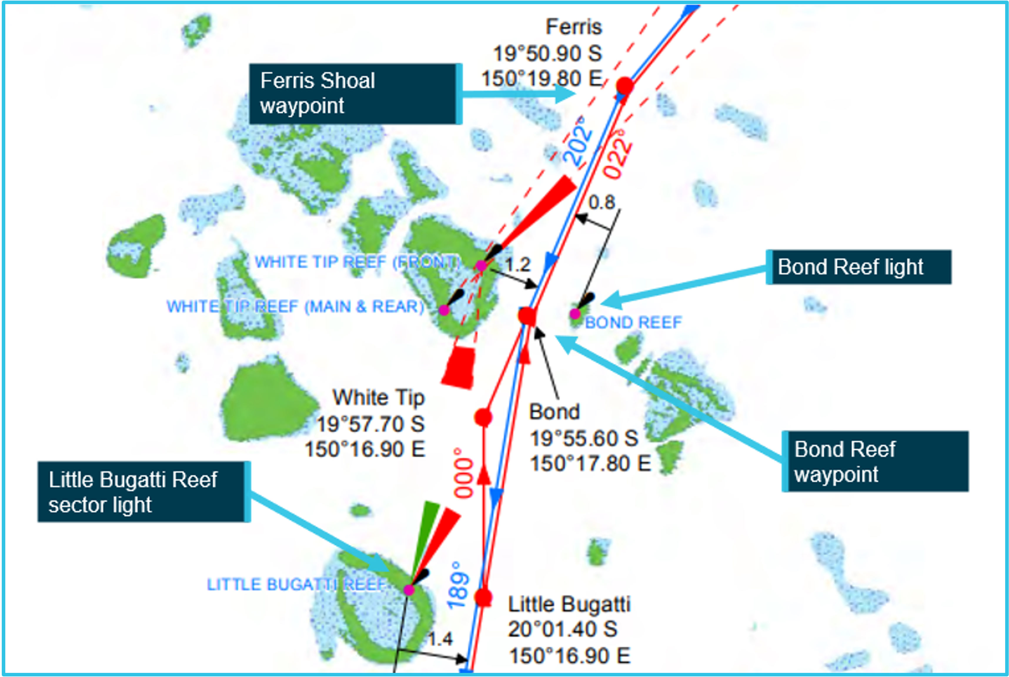
Standard planned routes near Bond Entrance (inbound tracks are blue)
Rosco Poplar’s track, as displayed on the ship’s ECDIS
At 0239, as they entered the passage, the master noticed that there was a difference between the heading displayed on the radar and the heading on the ECDIS units.
He discussed the discrepancy with the second mate in Chinese for the next 20 minutes, and he recalled that something similar had happened on a previous voyage, but he did not tell the pilot.
Though no one on the bridge knew it, the ship's GPS unit was generating a false position reading, and it was feeding it to the ECDIS, the AIS, the radars and the pilot's PPU tablet.
The PPU was set up to use the ship's GPS data feed for positioning instead of its own independent GPS receiver, contrary to company policy.
Radar image at 0235
He looked out the window and saw that the sector light ahead was white, indicating that the vessel was lined up on a safe course.
Shortly after, the vessel's master noticed that a flashing white light on the port bow was getting closer, and was now nearly dead ahead.
This was Bond Reef Light, a warning marker on the edge of the reef, but the master was not aware of its identity.
He did not notify the pilot, who was relying solely on the ECDIS and PPU for tracking the ship's position.
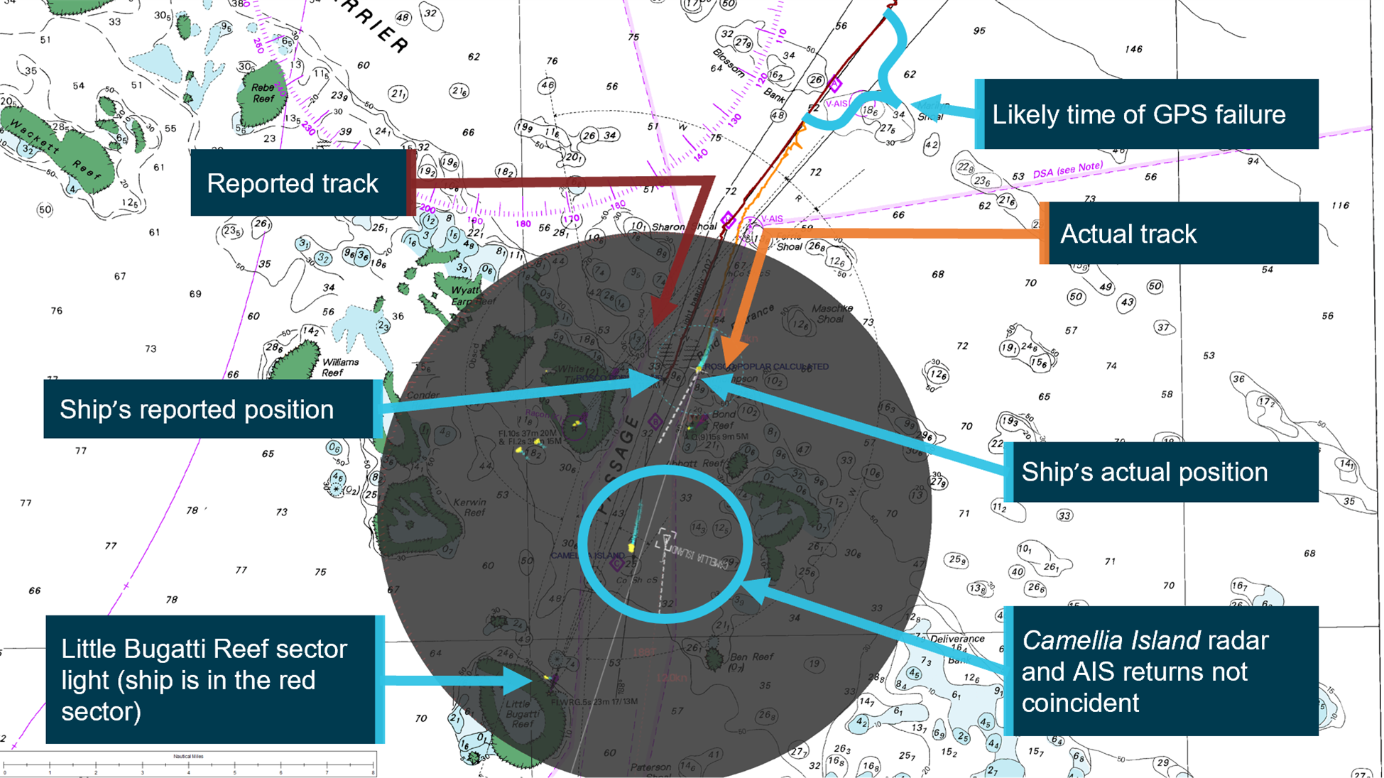
Position indicated by GPS at 0305 vs actual position (radar overlaid in grey)
At 0311, the pilot looked out to check the sector light, and he saw that it was red.
He ordered a heading change to starboard to take the ship back to the center of the channel.
One minute later, multiple alarms sounded on the bridge indicating that the GPS had failed.
The bridge team watched Bond Reef light slide by in the night, close aboard on the port side.
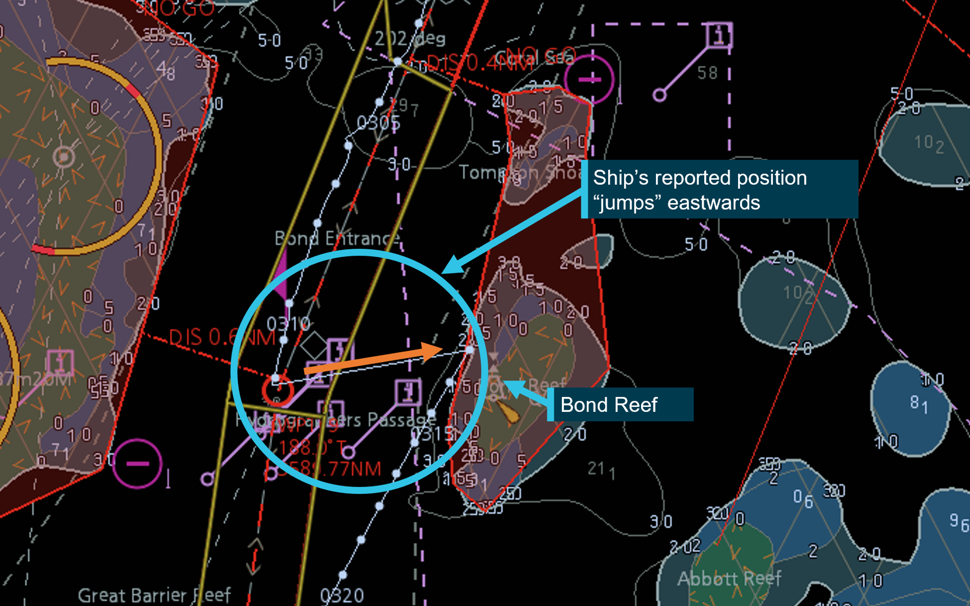
When the GPS came back online, they saw that the ship's apparent position on the ECDIS - which had appeared to be normal and on course up until 0312 - had shifted to the east edge of the channel, towards the reef.
The GPS unit's position had been off by 0.92 nautical miles to the west (below).
At 0313, the VTS center for the Great Barrier Reef (ReefVTS) received a series of automated grounding warnings based on the AIS signal from Rosco Poplar.
The vessel's AIS unit was transmitting the vessel's now-accurate position next to Bond Reef.
The VTS operator assumed that this sudden position change was a system error, and he spent the next 17 minutes attempting to troubleshoot it with colleagues.
At 0336, he managed to raise the Rosco Poplar on VHF, and he confirmed with the pilot that the ship had in fact passed dangerously close to Bond Reef.
The ship completed the rest of the pilotage uneventfully and continued to the anchorage area, where an investigation began.
He ordered a heading change to starboard to take the ship back to the center of the channel.
One minute later, multiple alarms sounded on the bridge indicating that the GPS had failed.
The bridge team watched Bond Reef light slide by in the night, close aboard on the port side.
When the GPS came back online, they saw that the ship's apparent position on the ECDIS - which had appeared to be normal and on course up until 0312 - had shifted to the east edge of the channel, towards the reef.
The GPS unit's position had been off by 0.92 nautical miles to the west (below).
At 0313, the VTS center for the Great Barrier Reef (ReefVTS) received a series of automated grounding warnings based on the AIS signal from Rosco Poplar.
The vessel's AIS unit was transmitting the vessel's now-accurate position next to Bond Reef.
The VTS operator assumed that this sudden position change was a system error, and he spent the next 17 minutes attempting to troubleshoot it with colleagues.
At 0336, he managed to raise the Rosco Poplar on VHF, and he confirmed with the pilot that the ship had in fact passed dangerously close to Bond Reef.
The ship completed the rest of the pilotage uneventfully and continued to the anchorage area, where an investigation began.
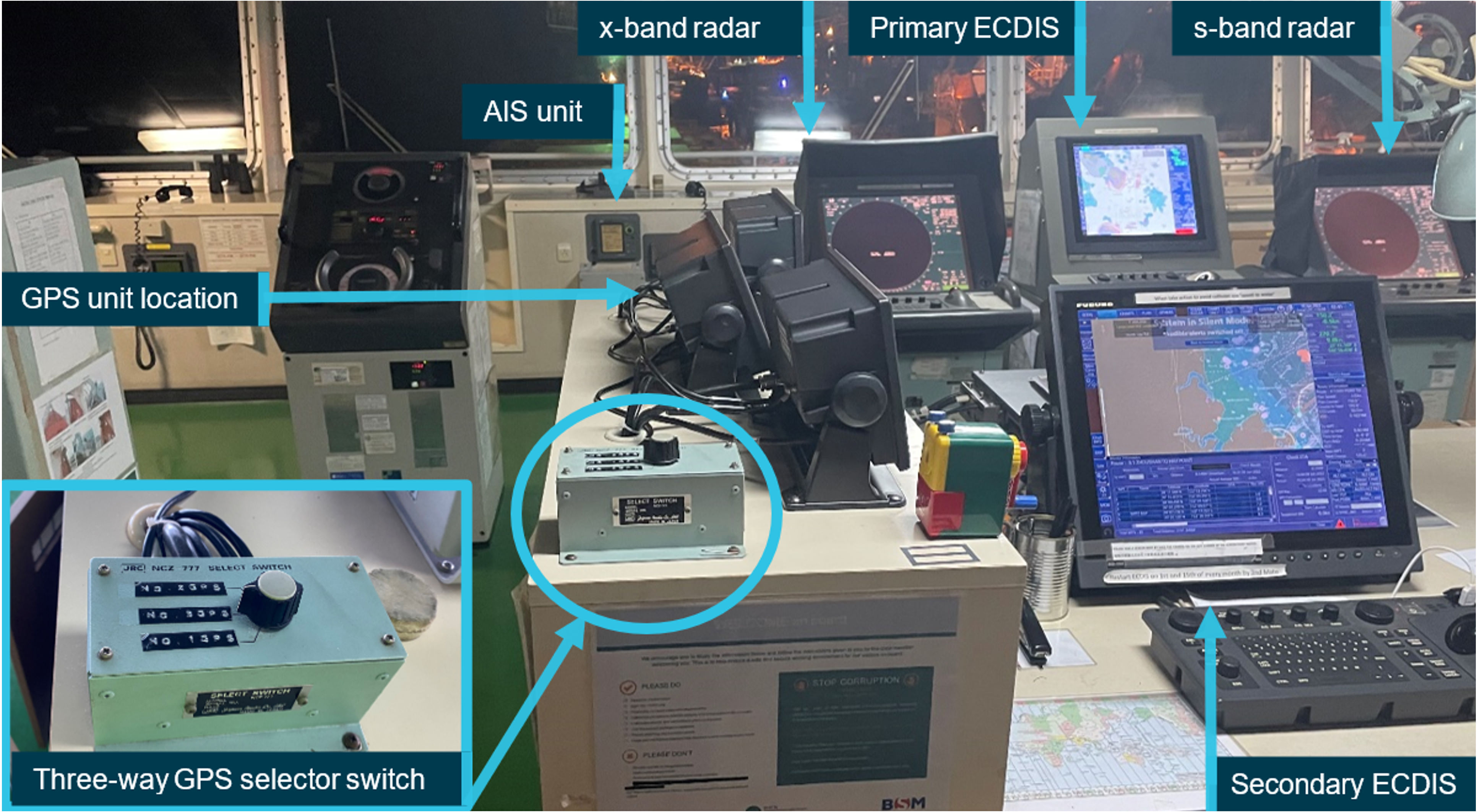
Rosco Poplar's navigational equipment bridge
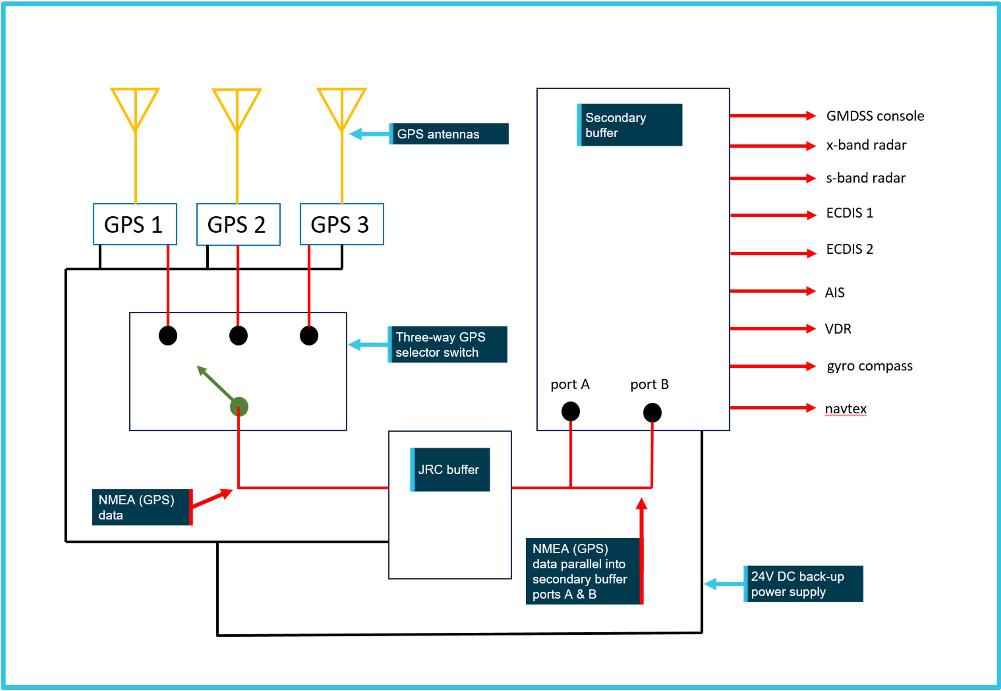
Diagram of bridge equipment configuration
Over the next few days, two obsolete GPS units and their antennas were replaced aboard Rosco Poplar - a job that had been anticipated and scheduled weeks before the near-miss.
The Australian Maritime Safety Authority's inspectors then came aboard, and they detained the ship until June 9 so that the bridge officers could receive remedial training.
AMSA determined that they "demonstrated inadequate operational proficiency with respect to navigation."
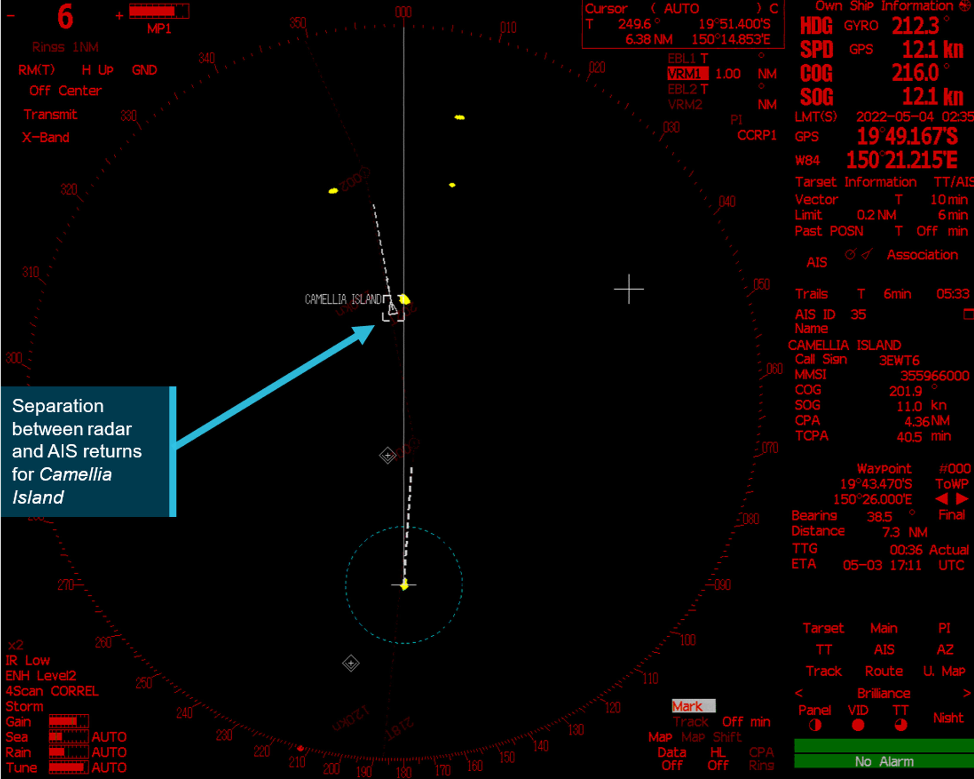
Meanwhile, ATSB investigators pulled the ship's voyage data recorder and downloaded images from the bridge radar displays.
The radar return of the other ship on the display showed that the target's GPS position began to clearly deviate from the radar position at about 0235 - a sign that the GPS position was faulty.
It also showed that the ship entered the red zone of the sector light at about 0256, roughly 15 minutes before the pilot noticed that something was wrong.
The Australian Maritime Safety Authority's inspectors then came aboard, and they detained the ship until June 9 so that the bridge officers could receive remedial training.
AMSA determined that they "demonstrated inadequate operational proficiency with respect to navigation."
Meanwhile, ATSB investigators pulled the ship's voyage data recorder and downloaded images from the bridge radar displays.
The radar return of the other ship on the display showed that the target's GPS position began to clearly deviate from the radar position at about 0235 - a sign that the GPS position was faulty.
It also showed that the ship entered the red zone of the sector light at about 0256, roughly 15 minutes before the pilot noticed that something was wrong.
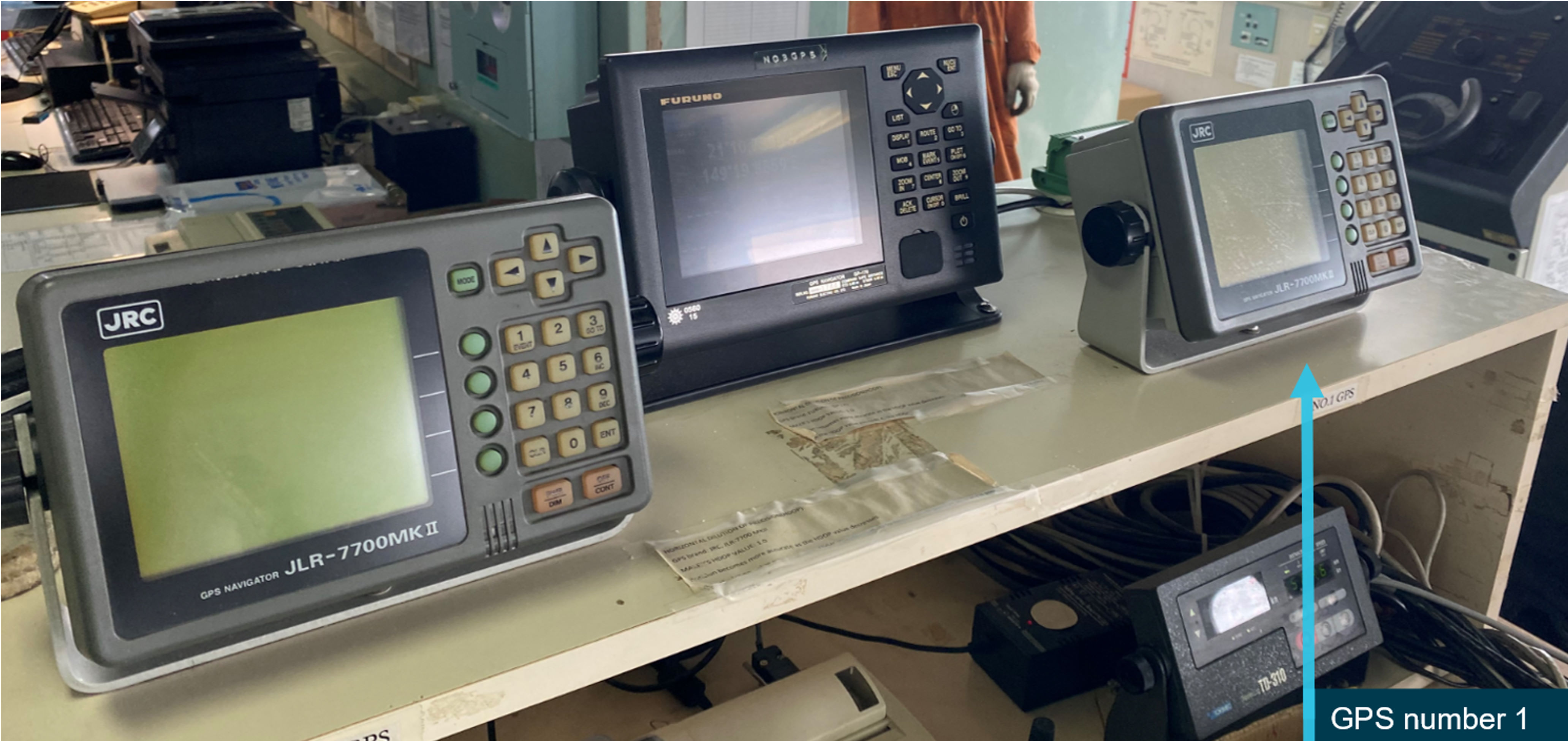
Arrangement of the GPS units
The exact cause of the GPS failure could not be determined because the owner removed and replaced the GPS unit days after the casualty, but the OEM suggested that it could have been an antenna failure.
(External spoofing was ruled out, as no other disturbances were reported nearby.)
(External spoofing was ruled out, as no other disturbances were reported nearby.)
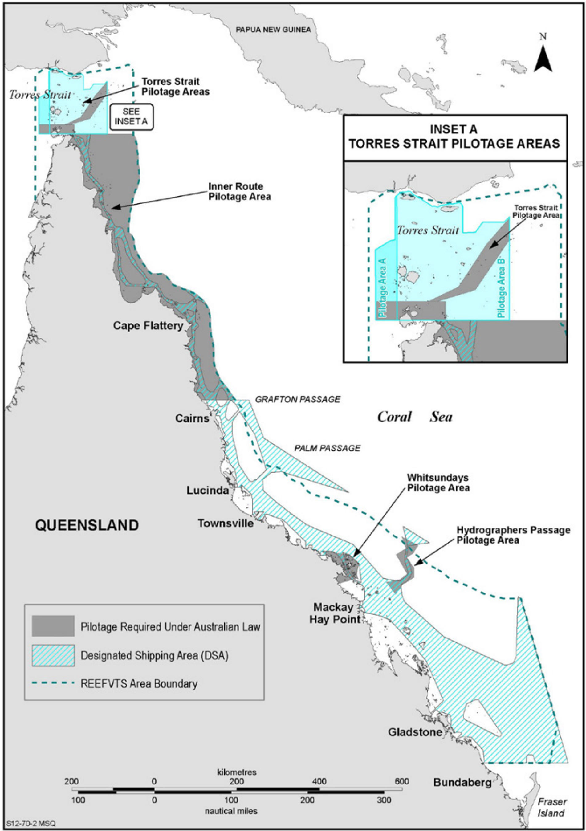
Great Barrier Reef and Torres Strait compulsory pilotage areas
The ATSB investigators faulted the bridge team and the pilot for failing to notice that they were standing into danger.
The agency found that if they had used the radar to check their progress, they would have picked up early signs that the GPS position was off.
Likewise, visual checks on the Bond Reef light and the sector light should have provided clear indicators that the ship was drifting off track.
As the bridge team did not adequately use these means of navigation, ATSB found, it took them about 37 minutes between the time when the GPS unit failed and the time when the pilot detected danger.
ATSB also noted basic failures of bridge resource management, beginning with a less-than-detailed master-pilot exchange.
"While a key aim of the MPX was to establish individual roles and responsibilities for watchkeeping and expectations for communication during the pilotage, these requirements were neither discussed nor implemented," the agency concluded.
A fuller MPX might have encouraged the ship's master to speak up when he began to have doubts about the accuracy of the ship's position.
ATSB also faulted Australia's pilot competency assessment program, which requires every marine pilot to undergo a "check voyage" with a "check pilot" - one of their colleagues.
The agency looked at all 490 check voyages conducted since 2017, and found that the pilots had given each other a pass rate of nearly 100 percent with zero "unsatisfactory" results.
While intended to improve pilotage, the check system "had not resulted in any significant benefit to coastal pilot competency by way of formalized corrective action," ATSB concluded.
The agency recommended reviewing and improving the assessment system.
Links :
No comments:
Post a Comment