source ATSB
From Maritime Excecutive
The Australian Transport Safety Bureau issued a report on a 2021 grounding that it is another example of crews being too dependent on their electronic navigation tools and failing to properly review the information.
While the local cargo ship only suffered hull dents and scrapped paint in the incident, the ATSB faults the crew for failing to verify the route plan, and even when they observed that they were closer to waypoints did not correct the route before the grounding incident.
The grounding also highlighted problems with Australia’s monitoring system designed to protect the environment at the Great Barrier Reef.
The Trinity Bay is a 3,150 dwt general cargo ship built in 1996 operated by a crew of nine and managed by Sea Swift of Australia.
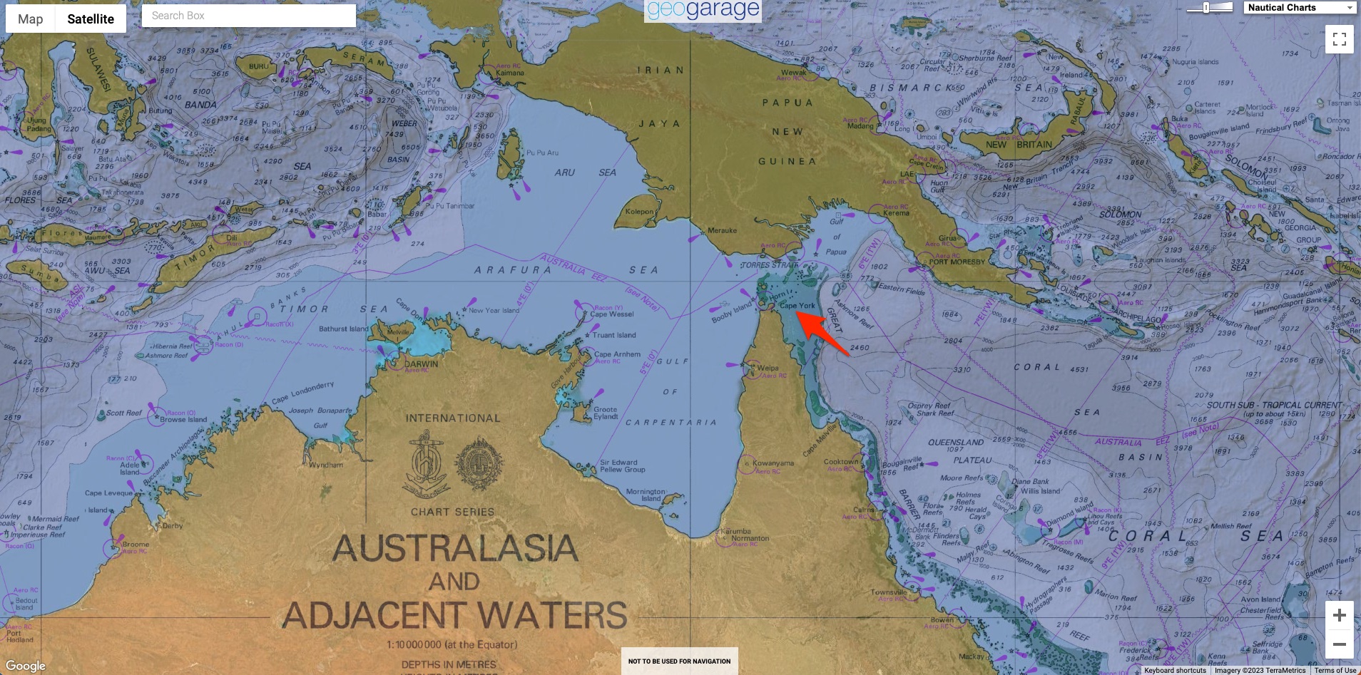
The vessel was running a regular route of 520 nautical miles between Cairns in the Far North of Australia and Thursday Island in the Torres Strait.
Localization with the GeoGarage platform (AHS nautical raster charts)
ATSB’s investigation report details that in an effort to address a deficiency identified during a recent internal audit, which required the use of approved routes and waypoints, the ship’s master used a draft passage planning tool that was being trialed by the operator to plan new routes at the beginning of January 2021.
The ship had been following a standard route over the previous 10 years on its weekly trips between the two ports.
Starting in late 2018 the vessel had received an exemption from the requirement to carry a licensed coastal pilot.
During a voyage prior to the grounding, the master directed the ship’s watchkeeping officers to evaluate the newly created route plan and they did not identify any significant concerns.
The new routes from the planning tool were then entered into the Trinity Bay’s electronic chart system (ECS), a navigation information system that displayed the vessel’s position and relevant nautical chart data.
However, according to the ATSB the ECS was not approved for use as the ship’s primary means of navigation and did not possess automatic route safety checking functions.
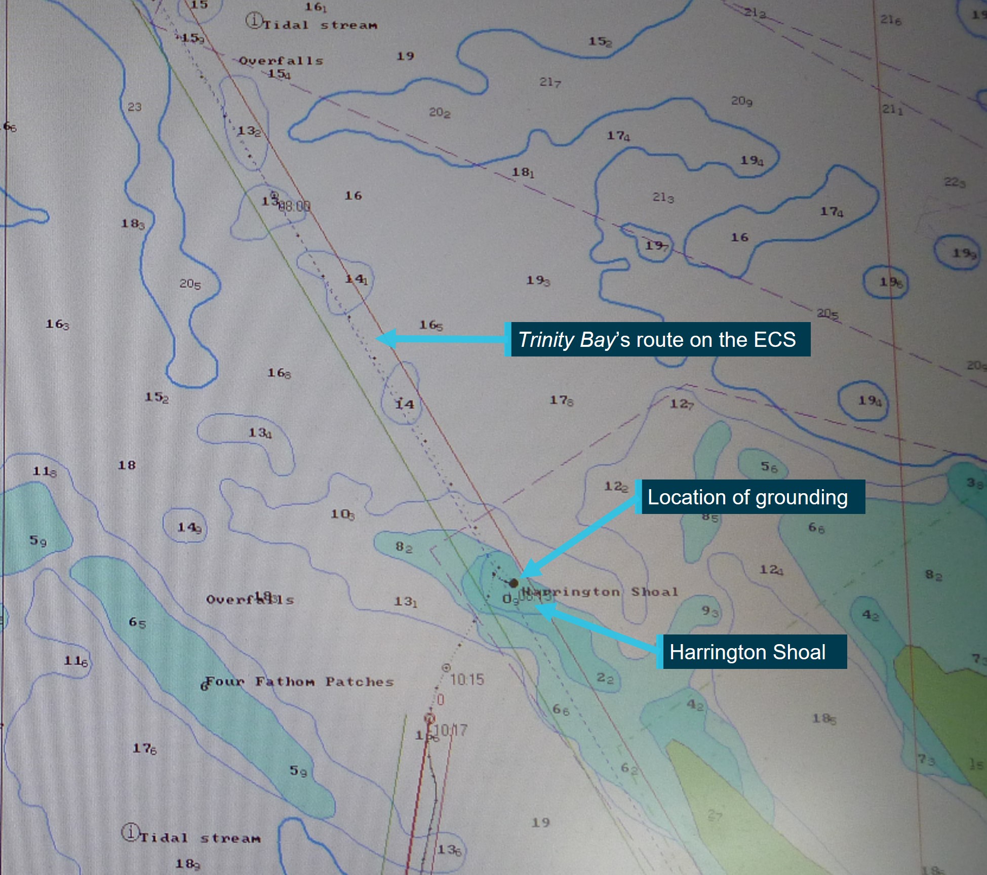
Image of TRANSAS ECS screen taken after grounding showing Trinity Bay’s planned route and track in vicinity of Harrington Shoal.
Source: Sea Swift, annotated by the ATSB.
Source: Sea Swift, annotated by the ATSB.
The northern voyage was uneventful.
They followed the new route on the ECS but noted that the master had not plotted the route on the paper charts which still showed the older route plan.
For the southbound trip departing January 19, 2021, the master again entered the new route to the ECS but did not plot the new waypoints and routes onto the ship’s paper charts.
The following morning the chief mate was the officer of the watch with the vessel on autopilot and traveling at about 12 knots.
Shortly after 0730 and following a course alteration, they noted that the parallel index for the radar listed in the voyage plan was incorrect and did not correspond to the planned route.
They however continued to follow the route on the ECS.
About 15 minutes later they also observed that they were closer to the waypoint for Harrington Reef than they were accustomed to but proceeded.
At 0800 a check determined that there was “no cause for concern” on the route but 10 minutes later the bow began to swing sharply to port and the speed plunged.
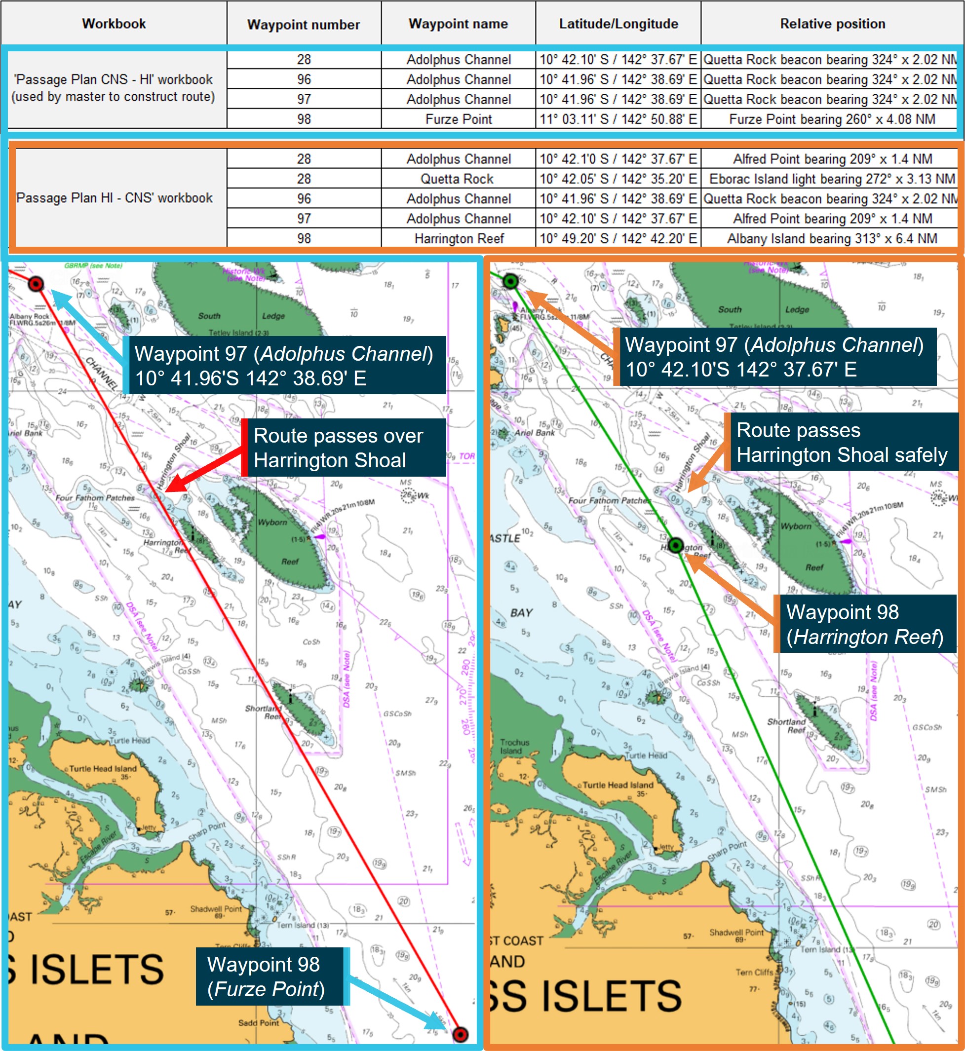
The chart figure on the left shows the route passing over Harrington Shoal using waypoints from the ‘Passage Plan CNS – HI’ workbook.
The chart figure on the right shows a route, constructed with the same numbered waypoints but from the ‘Passage Plan HI – CNS’ workbook, passing Harrington Shoal safely.
The Trinity Bay was aground on the mostly sandy Harrington Shoal.
They began to deballast and less than two hours later on the rising tide, they were able to free the ship and back off the shoal.
A survey showed dents and paint loss but there was no breach or pollution.
The following day after the master was relieved and the ECS was taken out of service, they were able to proceed to Cairns where they arrived on January 22.
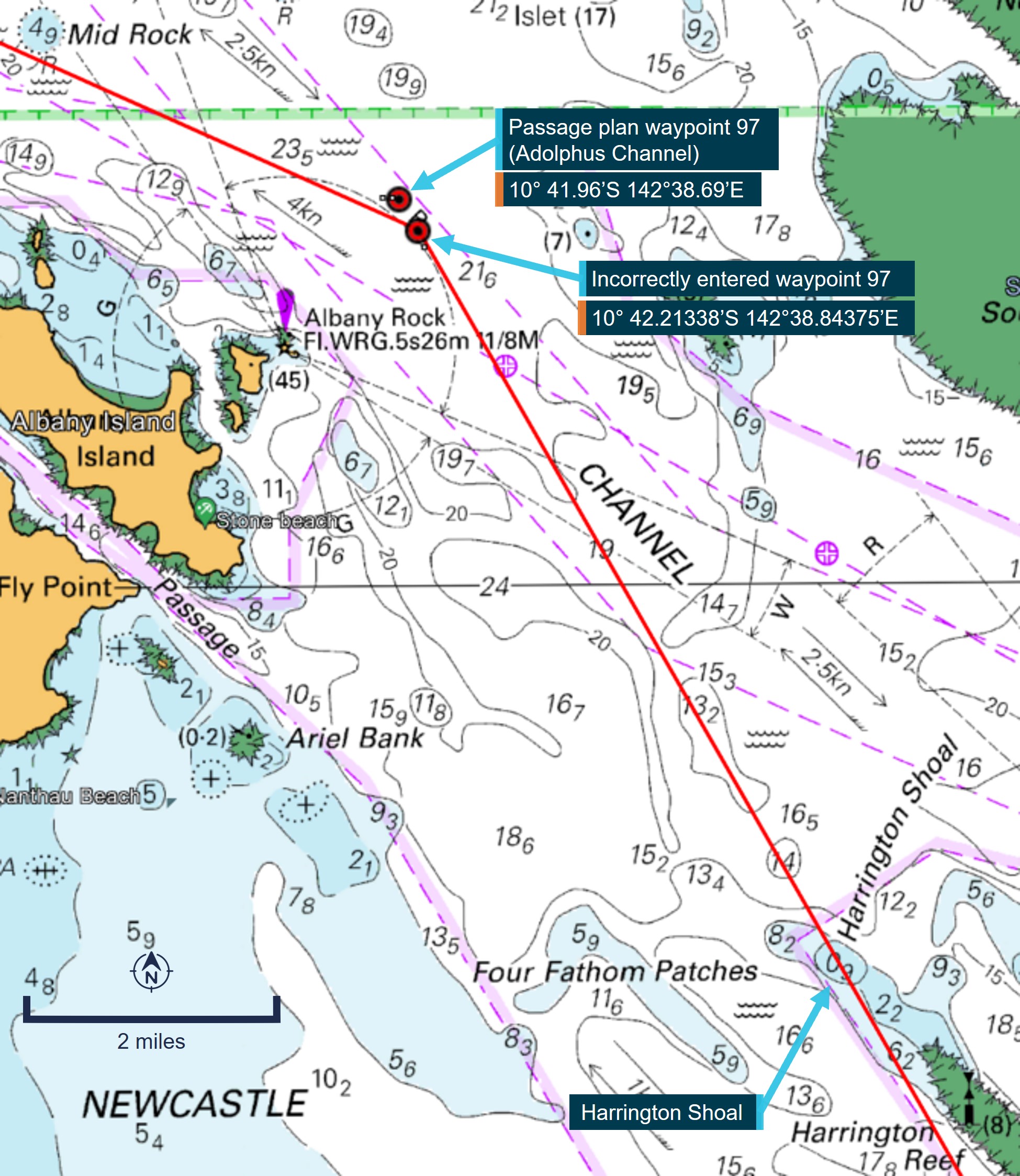
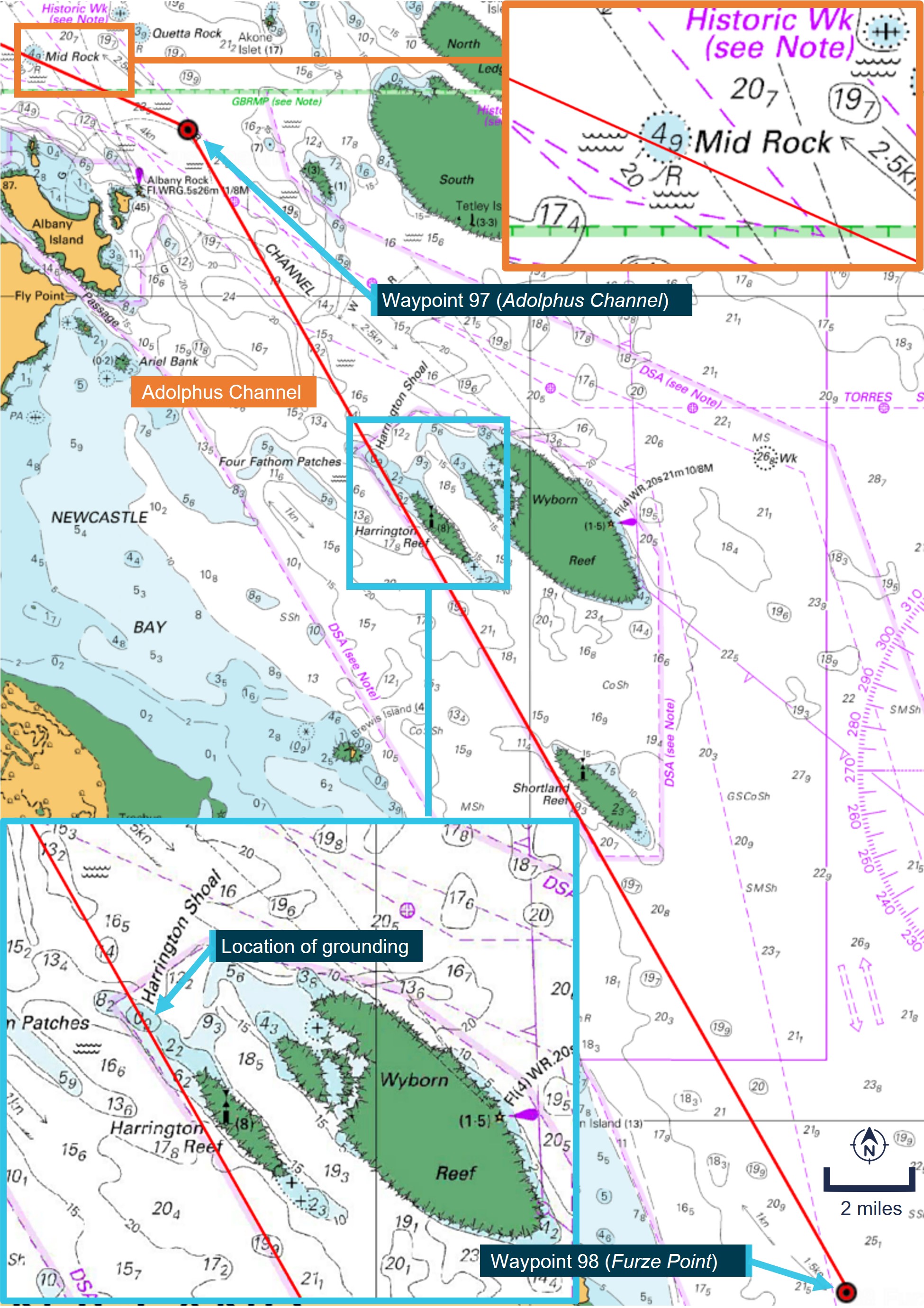
The ATSB in its investigation found that the planning tool contained waypoint data errors.
The incorrect data in the planning tool had set a course close to the danger of Mid Rock and then directly over the charted danger of Harrington Shoal.
On the day of the grounding, the officer of the watch was primarily monitoring the ship’s passage using the ECS.
While they were marking radar plots on the paper chart, that chart still had the original route marked and they were not using the most appropriate scale for the area.
“This investigation highlights how the development and use of a detailed passage plan in accordance with the accepted principles of passage planning remains essential to safe navigation,” commented Stuart Macleod, ATSB Director Transport Safety.
“Passage planning should be thoroughly appraised, with the route laid out and independently checked on the ship’s primary means of navigation, and then effectively monitored.”
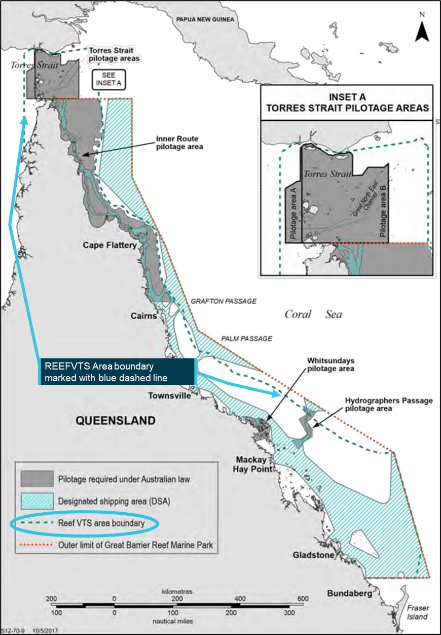
REEFVTS area boundary at the time of the grounding
The ATSB’s investigation also found that at the time of the grounding, there was an ongoing technical fault in the REEFVTS (Great Barrier Reef and Torres Strait vessel traffic service) monitoring and surveillance system.
Alarms were received indicating that the Trinity Bay was sailing close to Mid Rock, and again as it approached Harrington Shoal.
The duty operator for the system designed to warn of potential dangers was being presented with an abnormally high number of erroneous alerts and alarms due to the fault and as such acknowledged the alerts but did not follow up on them.
ATSB reports the ship’s operator, Sea Swift, removed the system from service and implemented a mentoring and audit program to ensure crews were following requirements on passage planning and navigation.
Updates were also implemented for the software on the monitoring system and the Great Barrier Reef monitoring was split into two zones after this incident.
In the final report, ATSB highlights the need to confirm and not solely depend on electronic systems.
ATSB says flag administrators and safety investigators have investigated several other groundings identifying common recurring themes related to passage planning and monitoring.
The report cites three additional examples from the UK’s MAIB.
This month the U.S.’s National Transportation Safety Board reported a similar instance where the officers of a cruise ship were depending on an electronic system which turned out not to have up-to-date information resulting in a docking accident causing $2 million in damages.
Links :
- MarineLink : Voyage Planning Tool Errors Contributed to Grounding
No comments:
Post a Comment