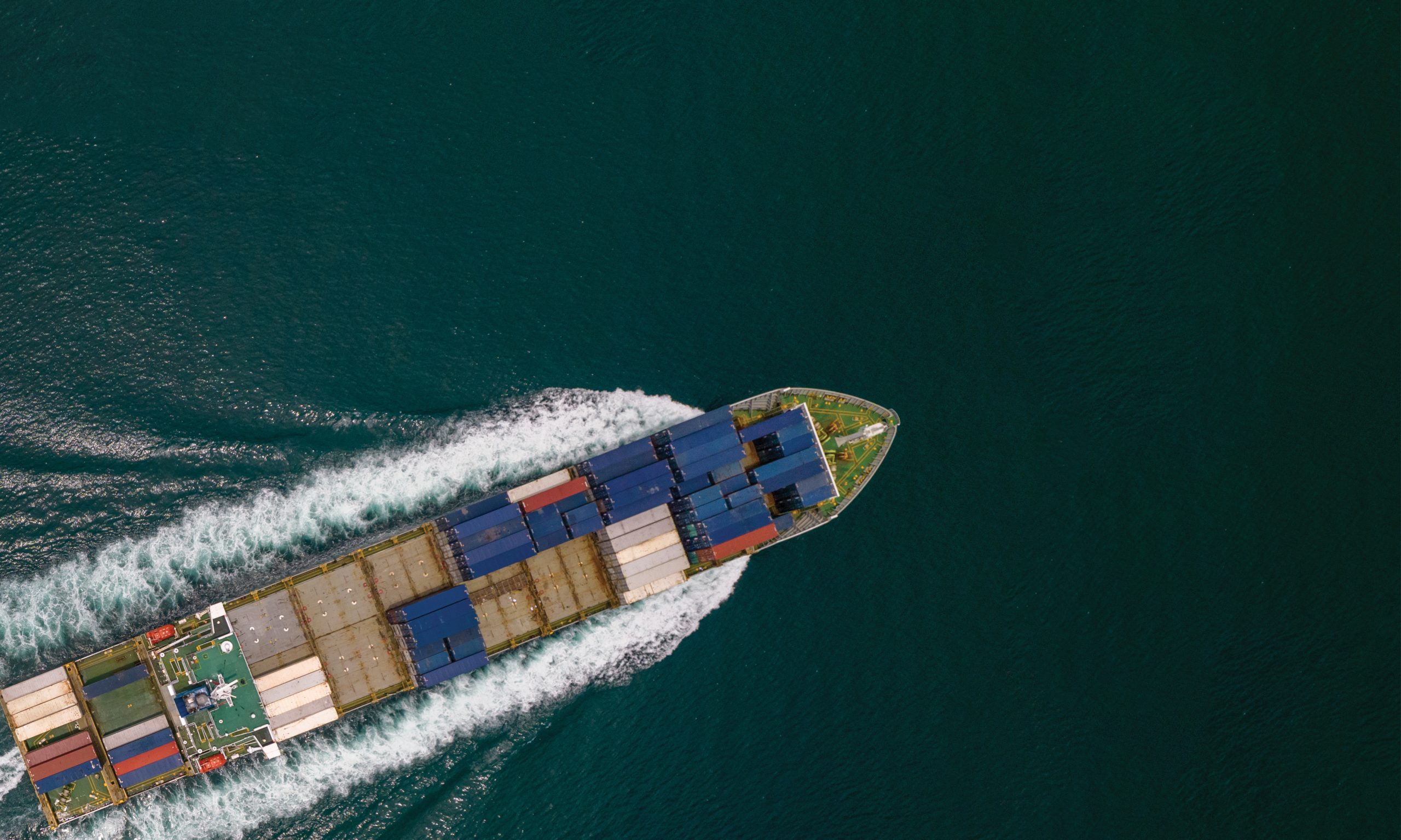
From Geospatial World by Sachin Awana
The criticality of oceans and nautical boundaries is being echoed globally.
As several disputes arise, technology’s role in monitoring mishaps and safeguarding countries becomes paramount.
Naval power, oceanic adventure, and a dive into the unknown has been the story of venturing into the seas since early 14th century.
From the European colonies to modern American fleets, oceans have become increasingly important for civilisations across the globe.
With recent burgeoning from China, the emphasis on oceanic integrity, movements, and militarisation was never this immediate.
Taking technology into the picture, the possibilities in oceans become boundless.
With Automatic Identification System (AIS), Satellite Imagery, Earth Observation, and Navigation among others, the pool of opportunities become ever so larger.
But with technology comes drawbacks too.
Illegal, Unreported, and Unregulated (IUU) fishing has become an increasing issue, taking toll on ship identification authorities and systems.
Various satellite companies such as Maxar, Spire, Hawkeye 360, and Global Fishing Watch have meticulously charted the illegal ventures of ships from countries around the world.
However, spoofing tracking systems have plagued the domain, making it easier for illegal vessels to leave false footprints behind.
A common suspicion has emerged in the form of China, which has been surpassing the lengths of their nautical boundaries to capture exotic fish from Exclusive Economic Zones (EEZs) – an area where disturbing the natural habitat of fishes have been prohibited to safeguard the species.
This comes with little surprise since the global ocean economy is estimated to be worth some $2.3 trillion per year in goods and services, about the size of the German economy, the world’s 5th largest.
The upgraded defence, Maritime Domain Awareness and geospatial technologies have been the cornerstone to monitor and maintain border integrity of countries worldwide in this vast and entropic industry.
As Vice Admiral Lochan Singh Pathania, Former Chief Hydrographer of India says,“For centuries, maritime domain awareness and geospatial have been instrumental for safeguarding critical assets.
As a Hydrographer, I have first-hand witnessed the transformative potential of geospatial technology in the domain. Geospatial intelligence revolutionises our understanding of sea and land. Sophisticated data and analysis help us produce maps with unprecedented accuracy.”
Sino Sea Surge
A civilian protest in Philippines triggered a showof- strength from Chinese navy, enabling a chain of reaction from the smaller East Asian countries – which are gathering their own naval capabilities to curb Chinese influence.
Two days after the protest and Chinese intervention in the Philippines, Japan stepped up to sign the largest maritime security pact with Manila.
The project will enable Japan to fund the construction of 5 large patrol ships that will encircle Philippines and will be operated by their coast guards.
The amount equates to $507 million in the form of Official Development Aid loan from the Japanese International Cooperation Agency.
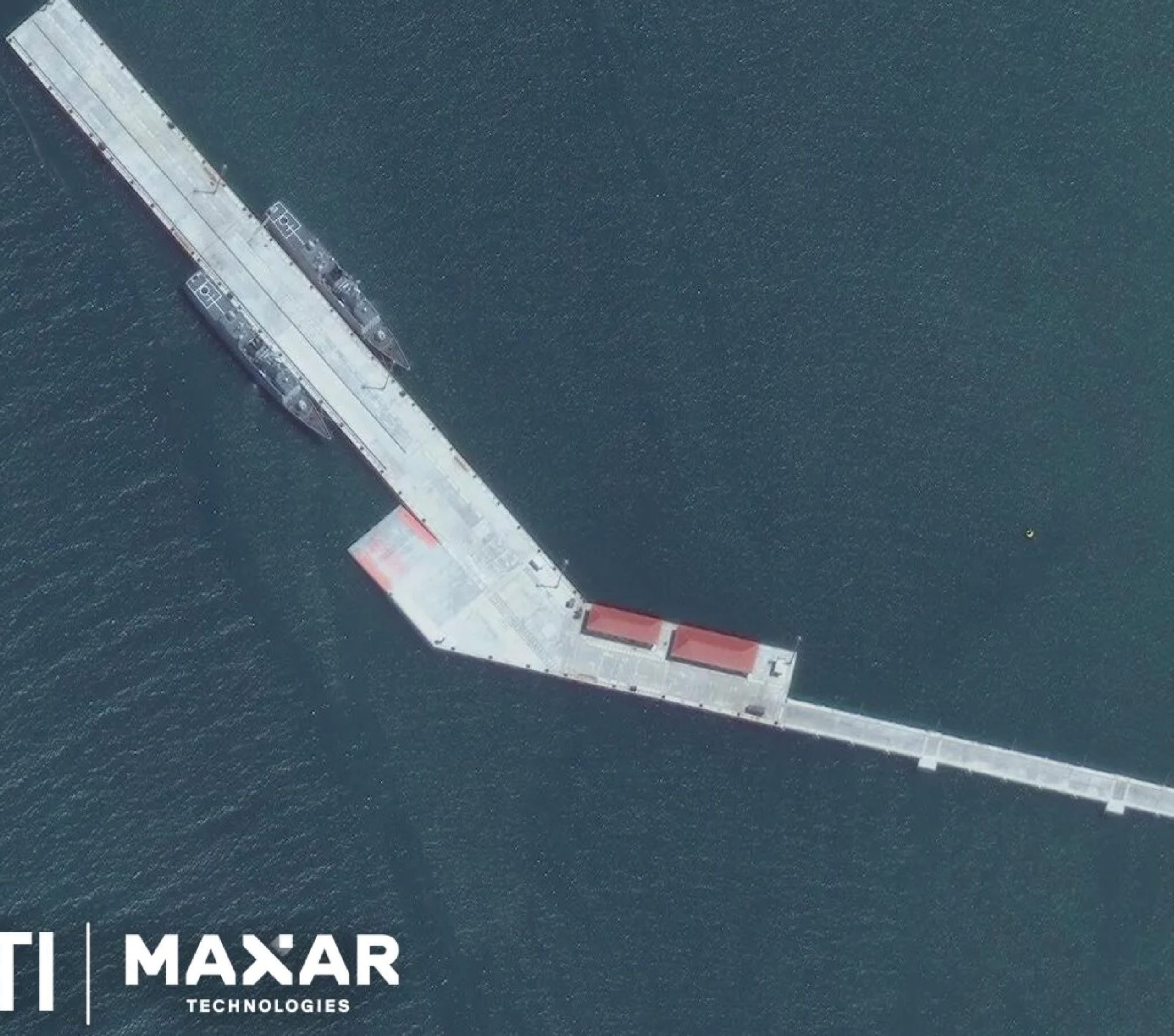 Satellite Imagery showcasing Chinese warships in Combodia
These retaliation efforts from the east and south-east Asian countries is nothing new.
China has been building its naval fleet from ground up, and is now extending its arm to the fullest capacity, targeting nations in the South China Sea, as well as, the Indian Ocean.
In April of 2024, two Chinese warships were found to be settled at Cambodia’s Ream Naval Base, which was expectedly funded by Beijing.
These strategic moves by the Chinese Navy have been seen for almost a decade now, reassuring the strategy of China to build influence and assets in different countries through offering exciting loans and construction aid as a value added service.
Small nations with little to no influence, money, or tactical capability have taken up the amount masqueraded as development.
Unable to payback the loan, or demanding more development after re-payment, has put China in a win-win situation and a larger scope for more influence.
Pakistan, Djibouti, Sri Lanka, Bangladesh, and now Cambodia have found a cash-cow partner, whereas, Philippines, India, and Japan are trying to keep the Chinese Yuan out of their country.
The geopolitics at play here suggests in all likelihood, the importance of seas, naval capabilities, and strategic approach in waterways.
With 80% of the world trade exchanges going through seas, it is of great imperative that the routes are monitored to keep away from any threat.
Spacebased systems such as Satellites and Automated Information System (AIS) come into play here, tracking the voyage of ships periodically.
As written by Isaac B Kardon, Senior Fellow for China Studies at the Carnegie Endowment for International Peace, the maritime area is the most susceptible to changes in international law given China’s ventures and challenges to almost every aspect of the maritime law as put in place by UNCLOS.
Interestingly, Kardon writes “Far from disregarding international law in its maritime disputes, Beijing regards law as essential.” This provides a tunnelthought into the ways of how China is using the International Maritime Law to its complimentary use by bending the laws.
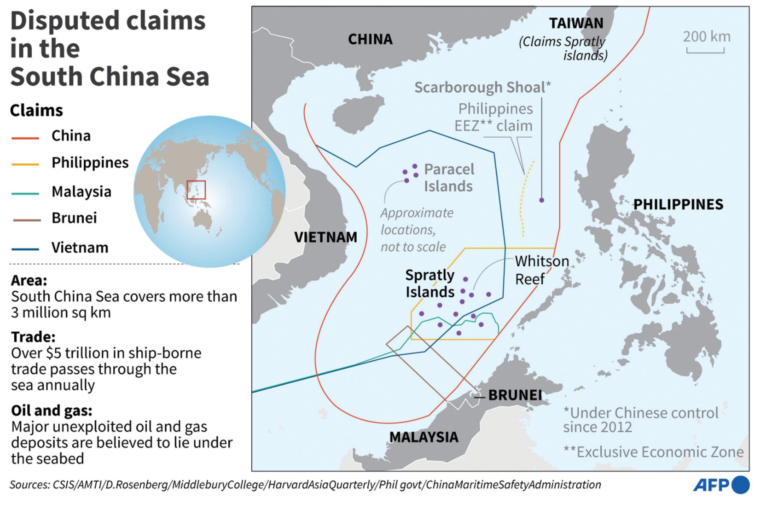
“More than half of the 3 million square kilometers of maritime jurisdiction claimed by China faces overlapping maritime claims and jurisdictional disputes with neighboring countries.
Our work to safeguard maritime rights and interests is facing a very complicated and severe situation,” Xi Jinping, General Secretary of the Chinese Communist Party, said in a speech to the CCP Central Committee Political Bureau.
With 80% of the world trade exchanges going through seas, it is of great imperative that the routes are monitored to keep away from any threat.
Space-based systems such as Satellites and Automated Information System (AIS) come into play here, tracking the voyage of ships periodically.
Data to Rescue
An up-surging demand in near real-time satellite data has been hailed as a major key for fighting illegal ventures of countries.
Various companies are launching satellites to build the capability as satellite data becomes more and more important.
This has even led to some innovations in data processing and analysis part, with several companies announcing satellite on-board processing technology.
This deducts the time it takes for satellite data to translate into meaningful insights by processing the data and images captured in space itself and then sending down to the ground stations for sorting out the little left anomalies in the dataset.
One such company, PierSight is also aiding the satellite imagery cause in the maritime domain.
Addressing the problems of oil spill, illegal fishing and other similar activities in the sea, the company plans to launch a constellation of satellites by 2025.
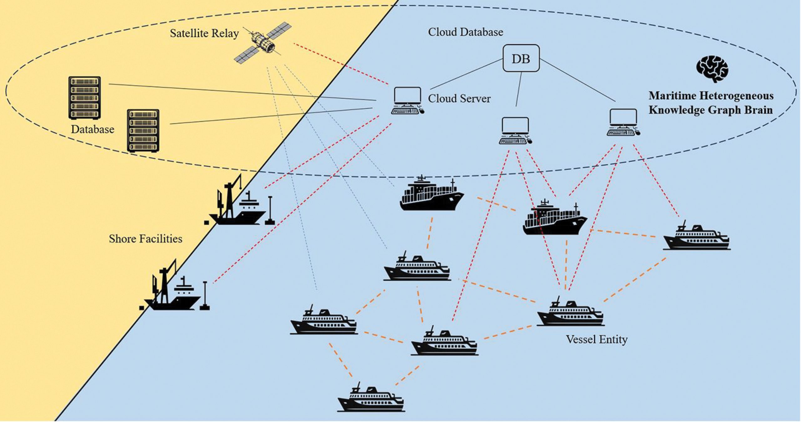
With their current satellites in space, PierSight utilises synthetic aperture radars (SAR) are active sensors, cornering the maritime domain.
They can image day and night and even in poor weather conditions.
“Our satellites are purpose-built specifically for maritime applications.
We have deterministic targets in ships and other presence of human activity in the sea.
This laser-sharp focus helps us optimize our satellites for wide area coverage and increased persistence.
We can capture a lot more imagery than a typical SAR satellite in a single orbit.
Every 10 minutes, each satellite can image up to 2,30,000 square kilometres of ocean area,” says Vinit Bansal and Gaurav Seth, Co-founders of PierSight.
Collaborative Effort
Although traditionally used on land and airborne, geospatial technology’s versatility makes it vital for our seas.
From mapping the ocean bed to navigating in the treacherous and unbound seas, geospatial has offered a direly needed helping hand.
The International Maritime Organisation (IMO) has also charted out the need for navigation under its Safety of Life at Sea (SOLAS) regulations.
In 1983, the organisation adopted a resolution that identified the importance of up-to-date hydrographic information for safe navigation.
Under these regulations, a challenge of outdated surveys of certain ocean regions were found.
The global ocean economy is estimated to be worth $2.3 trillion per year in goods and services, about the size of the German economy, the world’s 5th largest.
According to the IHO, “The resolution invited Governments to conduct hydrographic surveys and co-operate with other Governments where necessary.
This was followed in 1985 by a resolution urging IMO Member Governments to establish regional hydrographic commissions or charting groups and to support groups already set up by the IHO to prepare accurate charts.”
Sustainable Seas
Our oceans are extremely important when it comes to curbing global warming effects and synthesising our ecosystem.
Marine geospatial data provide crucial insights that help to reduce the carbon impact of shipping and other ocean industries, as well as map, monitor and manage precious marine habitats – including blue carbon sinks – while also mitigating the impact of climate change on coastal communities.
“The United Kingdom Hydrography Office (UKHO) provides geospatial information to support initiatives to combat climate change and its impacts.
One prime example it is the ADMIRALTY Marine Innovation Programme, where innovators and start-ups are supported to develop new solutions that keep our oceans safe, secure, and thriving,” explains Thomas Mellor, Head of OEM Technical Support and Digital Standards at UK Hydrographic Office.
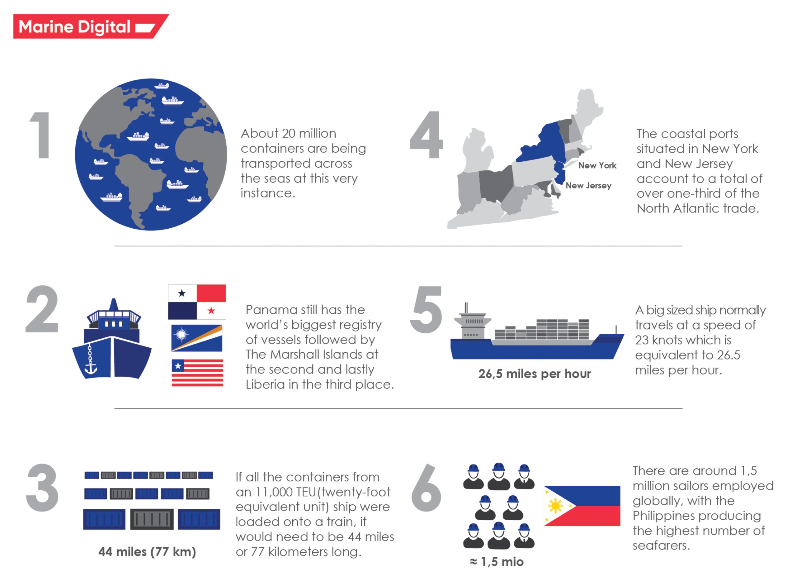 Some figures about the global maritime industry.
It has become clear that marine geospatial information can help protect our marine environment by securing habitats, supporting humanitarian and disaster relief efforts, and ensuring resilience against the forces of nature.
UKHO has a leading role in the Overseas Territories Seabed Mapping Programme, which helps British Overseas Territories improve maritime safety, and the Commonwealth Marine Economies Programme which helps some of the most vulnerable Small Island Developing States (SIDS) make the most of their natural maritime assets.
In an example given by Thomas, UKHO partnered with the Caribbean island of Anguilla to develop the Anguilla Data Hub.
The Hub is a web-based portal that provides a user interface to an Anguilla MSDI (Marine Spatial Data Infrastructure).
This cloud-based portal combines bathymetric data with complementary data sets such as that from the Automatic Identification System (AIS) fitted on most ships.
However, sustainability efforts are pushed to backburners with China’s advent of waterway adventures, harrowing the vast South China Sea and claiming numerous independent islands as their own.
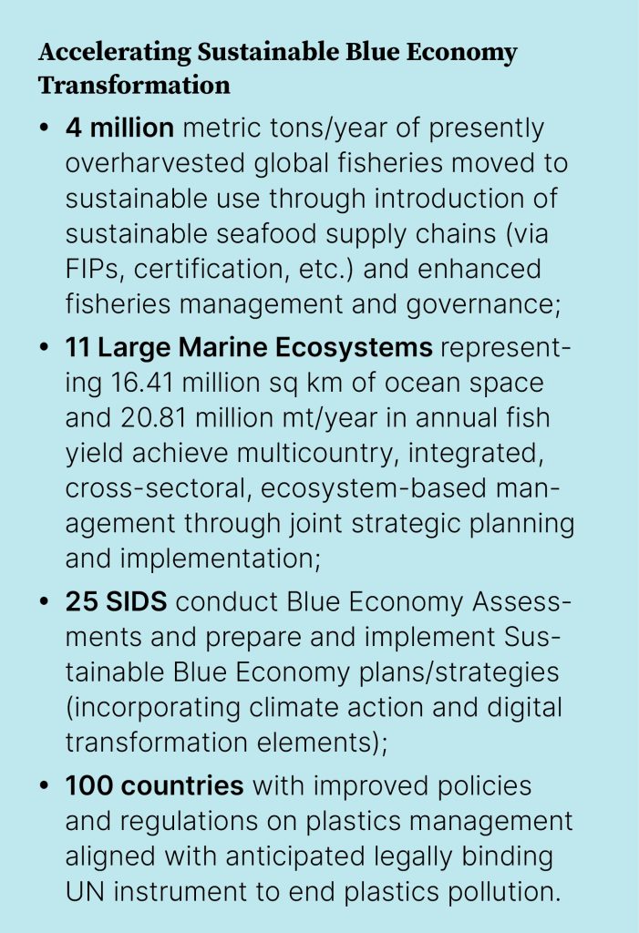
According to UNDP estimates, the annual socioeconomic costs due to ocean mismanagement amount to nearly US $1 trillion.
The global organisation has also laid out several transformational goals and objectives that would be catalysed in order to protect our oceans.
Over the last twenty-five years, UNDP has mobilized upwards of $1 billion for ocean protection and restoration actions in over 100 countries.
Precision Mapping
A challenge from ages, mapping the ocean bed has seemed unattainable for the large part of human time on earth.
However, given the immediateness of climate change, a deeper understanding of what lies under our oceans has become paramount.
Seabed 2030 – a collaborative project between The Nippon Foundation and the General Bathymetric Chart of the Oceans (GEBCO) – aims to map the entire seabed by the end of the decade.
Currently, the consortium has managed to map about 25% of our ocean beds, which has resulted into 5.4 million square kilometre of new data.
The challenges in mapping seafloor comes in multiple ways.
Our land area is mapped thanks to Geospatial Information System (GIS) which also plays an active role when it comes to mapping undersea.
However, contemporary mapping is carried out via multibeam sonar systems.
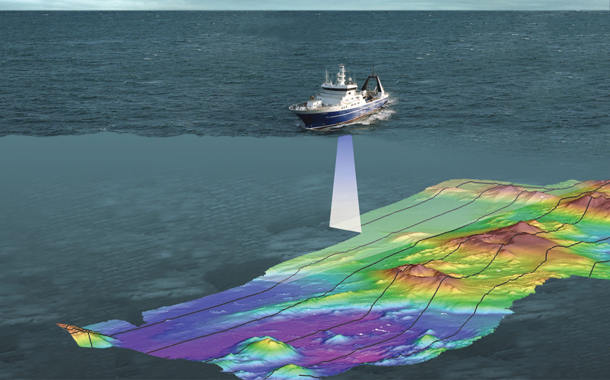 Seabed Mapping visualised
“Multibeam systems produce high-resolution data, meaning that there are many data points per area.
More data points means you can see more details.
Multibeam bathymetric maps are suitable for many applications including safe navigation and studying benthic habitats,” according to NOAA.
The reason why only a quarter of the seafloor has been mapped until now is because of the increased cost of high-resolution data.
However, modern bathymetric maps use a combination of high and low resolution data.
Much of this low-resolution data comes from satellite altimeters.
Large underwater features, like seamounts larger than 1.5 kilometers (0.9 miles), have enough mass to affect the gravitational force in a given area.
This change in gravity creates tiny bumps and dips on the sea surface.
Satellite altimeters are sensitive enough to detect and measure these changes.
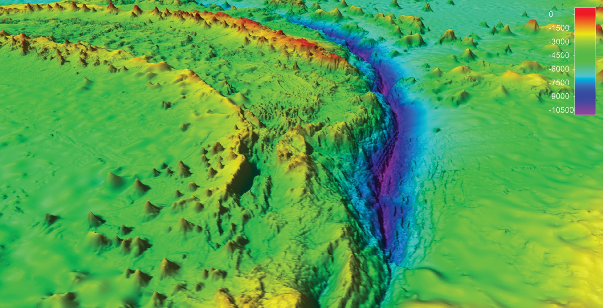 Bathymetric map of the deepest part of the ocean, the Mariana Trench in the Pacific Ocean.
Murky Waters?
The numerous disputes arise on a regular basis, especially after Beijing’s unequitable and unbound growth.
The Asia-Pacific region has become a hotbed for maritime contests, shining light on disparities amongst marine dependent communities as well.
Technology through its limitless potential comes as saviour, with satellite imagery and AIS combining to provide a worthwhile image of in-sea movements.
But the respite seems meagre, and as nations flock to own up marine equity in the form of small islands, oceanic boundaries, and exclusive economic zones, the question of sustainability remain unanswered.
No comments:
Post a Comment