The El Niño of 2015-2016
WMO has produced an animation to explain this year’s El Niño event.
From WMO (U.N. system’s authoritative voice on weather, climate and water)
A mature and strong El Niño event, which is contributing to extreme weather patterns, is expected to strengthen further by the end of the year, according to the latest Update from the World Meteorological Organization.
Peak three-month average surface water temperatures in the east-central tropical Pacific Ocean will exceed 2 degrees Celsius above normal, placing this El Niño event among the three strongest since 1950. (Strong previous El Niños were in 1972-73, 1982-83 and 1997-98).
1997 vs. 2015: Animation Compares El Niños Side-by-Side
see Climate Central
The El Niño-Southern Oscillation is a naturally occurring phenomenon which is the result of the interaction between the ocean and atmosphere in the east-central Equatorial Pacific.
Typically, El Niño events peak late in the calendar year, with maximum strength between October and January of the following year.
They often persist through much of the first quarter of that year before decaying.
“Severe droughts and devastating flooding being experienced throughout the tropics and sub-tropical zones bear the hallmarks of this El Niño, which is the strongest for more than 15 years,” said WMO Secretary-General Michel Jarraud.
“We are better prepared for this event than we have ever been in the past.
On the basis of advice from National Meteorological and Hydrological Services, the worst affected countries are planning for El Niño and its impacts on sectors like agriculture, fisheries, water and health, and implementing disaster management campaigns to save lives and minimize economic damage and disruption,” he said.
“The level of international, national and local mobilization is truly unprecedented, exemplifying the value of actionable climate information to the society”, said Mr Jarraud. “The preparedness for this El Niño will benefit from the systems WMO has been working to strengthen since the last major event in 1997-1998”, he added.


WMO released its Update on the eve of an international El Niño Conference in New York, of which WMO is a major co-sponsor, to increase scientific understanding of this event as well as its impacts, and help boost resilience to anticipated global socio-economic shocks.
“Our scientific understanding of El Niño has increased greatly in recent years.
“The level of international, national and local mobilization is truly unprecedented, exemplifying the value of actionable climate information to the society”, said Mr Jarraud. “The preparedness for this El Niño will benefit from the systems WMO has been working to strengthen since the last major event in 1997-1998”, he added.
What a difference a year makes. Strong El Niño settling in, comparing a
year ago with today, as shown by this visualization of sea surface temp
anomalies.
WMO released its Update on the eve of an international El Niño Conference in New York, of which WMO is a major co-sponsor, to increase scientific understanding of this event as well as its impacts, and help boost resilience to anticipated global socio-economic shocks.
“Our scientific understanding of El Niño has increased greatly in recent years.
However, this event is playing out in uncharted territory. Our planet has altered dramatically because of climate change, the general trend towards a warmer global ocean, the loss of Arctic sea ice and of over a million square km of summer snow cover in the northern hemisphere,” said Mr Jarraud.
“So this naturally occurring El Niño event and human induced climate change may interact and modify each other in ways which we have never before experienced,” he said.
“Even before the onset of El Niño, global average surface temperatures had reached new records. El Niño is turning up the heat even further,” said Mr Jarraud.

It is important to note that El Niño and La Niña are not the only factors that drive global climate patterns.
“So this naturally occurring El Niño event and human induced climate change may interact and modify each other in ways which we have never before experienced,” he said.
“Even before the onset of El Niño, global average surface temperatures had reached new records. El Niño is turning up the heat even further,” said Mr Jarraud.
Comparison
of the existing El Niño to past strong events.
In short, we're in the
middle of one of the strongest El Niño's in recorded history.
It is important to note that El Niño and La Niña are not the only factors that drive global climate patterns.
For example, the state of the Indian Ocean (the so-called Indian Ocean Dipole), or the Tropical Atlantic Sea Surface Temperature, are also capable of affecting the climate in the adjacent land areas.

Regionally and locally applicable information is available via regional/national seasonal climate outlooks, such as those produced by WMO Regional Climate Centres (RCCs), Regional Climate Outlook Forums (RCOFs) and National Meteorological and Hydrological Services (NMHSs).
WMO released its Update on the eve of an international El Niño Conference to increase scientific understanding of this event and help boost resilience to anticipated global socio-economic shocks. The conference takes place on 17-18 November at Colombia University in New York and is co-sponsored and jointly organized by the World Meteorological Organization, the International Research Institute for Climate and Society (IRI), the U.S. Agency for International Development and the U.S. National Oceanic and Atmospheric Administration.
The conference will:
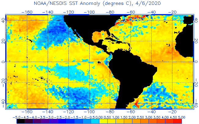
Most Recent 2 Months Sea Surface Temperature Anomaly Animation (Western Hemisphere)
NOAA SST anomalies
NOAA SST anomalies
Regionally and locally applicable information is available via regional/national seasonal climate outlooks, such as those produced by WMO Regional Climate Centres (RCCs), Regional Climate Outlook Forums (RCOFs) and National Meteorological and Hydrological Services (NMHSs).
WMO released its Update on the eve of an international El Niño Conference to increase scientific understanding of this event and help boost resilience to anticipated global socio-economic shocks. The conference takes place on 17-18 November at Colombia University in New York and is co-sponsored and jointly organized by the World Meteorological Organization, the International Research Institute for Climate and Society (IRI), the U.S. Agency for International Development and the U.S. National Oceanic and Atmospheric Administration.
The conference will:
- Provide an overview of the 2015 El Niño and its potential impacts
- Explore the connection between the current El Niño and global change
- Foster dialogue between climate scientists and development practitioners to strengthen action for climate resilience and sustainable development
- Examine the progress, and lessons learned, over last 20 years in international, national and regional climate services, with a focus on El Niño
The conference will be livestreamed.
Background Information
The ongoing El Niño has already been associated with a number of major impacts.
Background Information
The ongoing El Niño has already been associated with a number of major impacts.
These include:
Coral bleaching: Record ocean temperatures, caused in part by El Niño, have contributed to a major coral bleaching event.
Coral bleaching: Record ocean temperatures, caused in part by El Niño, have contributed to a major coral bleaching event.
It began in the north Pacific in summer 2014 and expanded to the south Pacific and Indian oceans in 2015. It is hitting U.S. coral reefs disproportionately hard.
NOAA estimates that by the end of 2015, almost 95 percent of U.S. coral reefs will have been exposed to ocean conditions that can cause corals to bleach.
Tropical cyclones: El Niño has contributed to a very active tropical cyclone season in the Western North Pacific and Eastern North Pacific basins.
Tropical cyclones: El Niño has contributed to a very active tropical cyclone season in the Western North Pacific and Eastern North Pacific basins.
Hurricane Patricia, which made landfall in Mexico on 24 October, was reportedly the most intense tropical cyclone in the western hemisphere.
El Niño tends to reduce hurricane activity in the Atlantic and around Australia.
Regional Impacts:
South East Asia: El Niño is typically associated with drought in South East Asia.
Regional Impacts:
South East Asia: El Niño is typically associated with drought in South East Asia.
This has helped fuel wildfires in Indonesia, among the worst on record, which has caused dense haze to cover many parts of Indonesia and other neighbouring countries, with significant repercussions for health.
Pacific Islands: Historically, El Niño has caused reduced rainfall in the southwest Pacific (from southern Papua New Guinea southeast to the southern Cook Islands) and enhanced rainfall in the central and eastern Pacific (e.g. Tuvalu, Kiribati, Tokelau and Nauru).
Pacific Islands: Historically, El Niño has caused reduced rainfall in the southwest Pacific (from southern Papua New Guinea southeast to the southern Cook Islands) and enhanced rainfall in the central and eastern Pacific (e.g. Tuvalu, Kiribati, Tokelau and Nauru).
But it also affects the number of tropical cyclones and their preferred tracks, so that there is a risk of extreme rainfall events even where drier than normal conditions are forecast.
The India Meteorological Department reported that the June-September rainfall over India as a whole was 86% of its long period average.
El Niño situation is believed to have played a key role in the rainfall deficit, which was successfully forecast by the India Meteorological Department as early as in June 2015.
Eastern Africa: The October to December rainfall season is expected to be highly influenced by the El-Nino phenomenon which is usually associated with enhanced rainfall within the equatorial sector of the Greater Horn of Africa during the October – December period.
Eastern Africa: The October to December rainfall season is expected to be highly influenced by the El-Nino phenomenon which is usually associated with enhanced rainfall within the equatorial sector of the Greater Horn of Africa during the October – December period.
However, local systems and the sea surface temperature patterns of the Indian Ocean impart highly on the influence of El-Nino to the region’s seasonal rainfall performance.
More information here.
Southern Africa; A number of countries in southern Africa are reporting below average rainfall leading to drought conditions and fears of food insecurity.
Southern Africa; A number of countries in southern Africa are reporting below average rainfall leading to drought conditions and fears of food insecurity.
El Niño is a contributory, but not the only, factor. Further reading here.
South America: El Niño has a major impact on a number of countries in South America.
South America: El Niño has a major impact on a number of countries in South America.
For instance, in the 1997-98 El Niño, central Ecuador and Peru suffered rainfall more than 10 times normal, which caused flooding, extensive erosion and mudslides with loss of lives, destruction of homes and infrastructure, damage to food supplies.
In Peru about 10% of the health facilities were damaged.
National meteorological services throughout the region have been very active in advising governments on preparedness measures to try to limit damages from this year’s El Niño.
The International Center for the Investigation of the El Niño Phenomenon, is WMO’s Regional Climate Centre for Western South America and is based in Ecuador.
The International Center for the Investigation of the El Niño Phenomenon, is WMO’s Regional Climate Centre for Western South America and is based in Ecuador.
It has organized briefings for policy makers and representatives from disaster risk management, agriculture and food production, health, tourism and other industries in South America.
In Central America, the Caribbean Climate Outlook Forum is issuing outlooks for El Niño-related conditions.
North America: the U.S. National Atmospheric and Oceanic Administration is regularly issuing El Niño Updates and advisories, along with regular blogs.
In Central America, the Caribbean Climate Outlook Forum is issuing outlooks for El Niño-related conditions.
North America: the U.S. National Atmospheric and Oceanic Administration is regularly issuing El Niño Updates and advisories, along with regular blogs.
Links :
- ECMWF : El Niño approaches peak warming
- MetOffice : Is an El Niño on the way and what might its impacts be?
- Hawaii Univ : Extreme Pacific sea level events to double in future
- NOAA : El Niño: One of Nature’s Biggest Weather Makers
- LA Times : Massive El Niño is now 'too big to fail,' scientist says
- NASA : El Niño Strengthening
- Climate Central : El Niño Keeps Antarctic Sea Ice From Another Record Max
- NYTimes : The Pacific Ocean Becomes a Caldron
- EarthSky : El Niño strengthening / El Niño already disrupting ocean food web
- Nature : Hunting the Godzilla El Niño
BBC : El Nino weather 'could be as bad as 1998', says Nasa
ReplyDeleteClimateCentral : How a Monster El Niño Transforms the World’s Weather
ReplyDelete