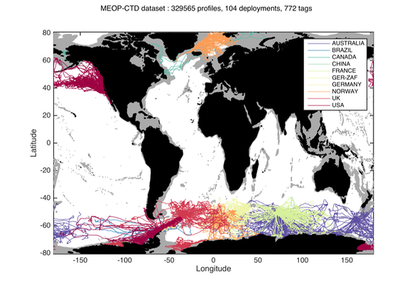
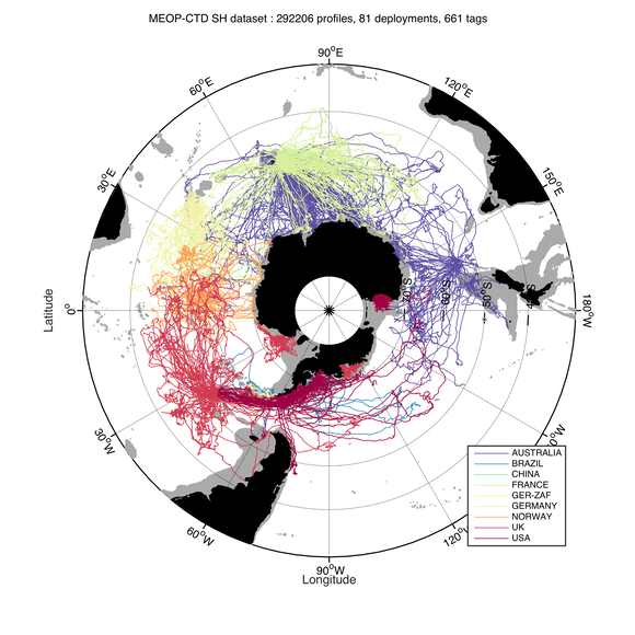
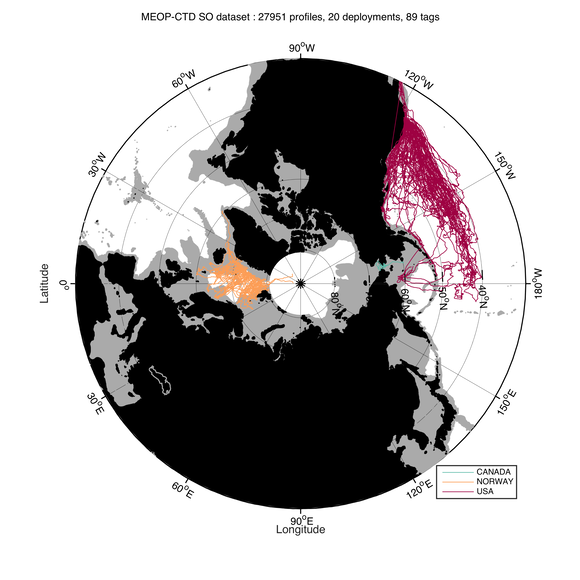
World map showing the distribution of CTD profiles (i.e. vertical profiles of temperature and salinity) currently available in the MEOP-CTD database.
From The Washington Post by Elahe Izadi
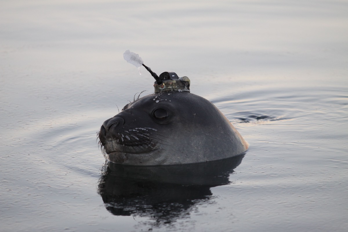
Southern seal tagged with a CTD-SRDL on South Georgia. (University of St. Andrew)
photo : Iain Field
Since 2004, more than 1,000 southern elephant seals sporting non-invasive sensors have traversed the world and sent data back to researchers via satellite.
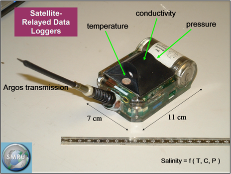
A CTD-SRDL tag, featuring a miniaturized CTD on top of the core unit, with the microcontroller below, the wet/dry sensor on the frontside, the battery on the rear, and the Argos antenna pointing

Schematic overview of the methodology used to produce oceanographic data using instrumented marine mammals. Adapated from Roquet et al. (2014)
"The information sent back to us gives us details about the seal’s immediate physical environment," Lars Boehme, a lecturer at the University of Andrews, said in a statement.
"It’s like tweeting."
The online portal storing the data, Marine Mammals Exploring the Oceans Pole to Pole, launched Monday.
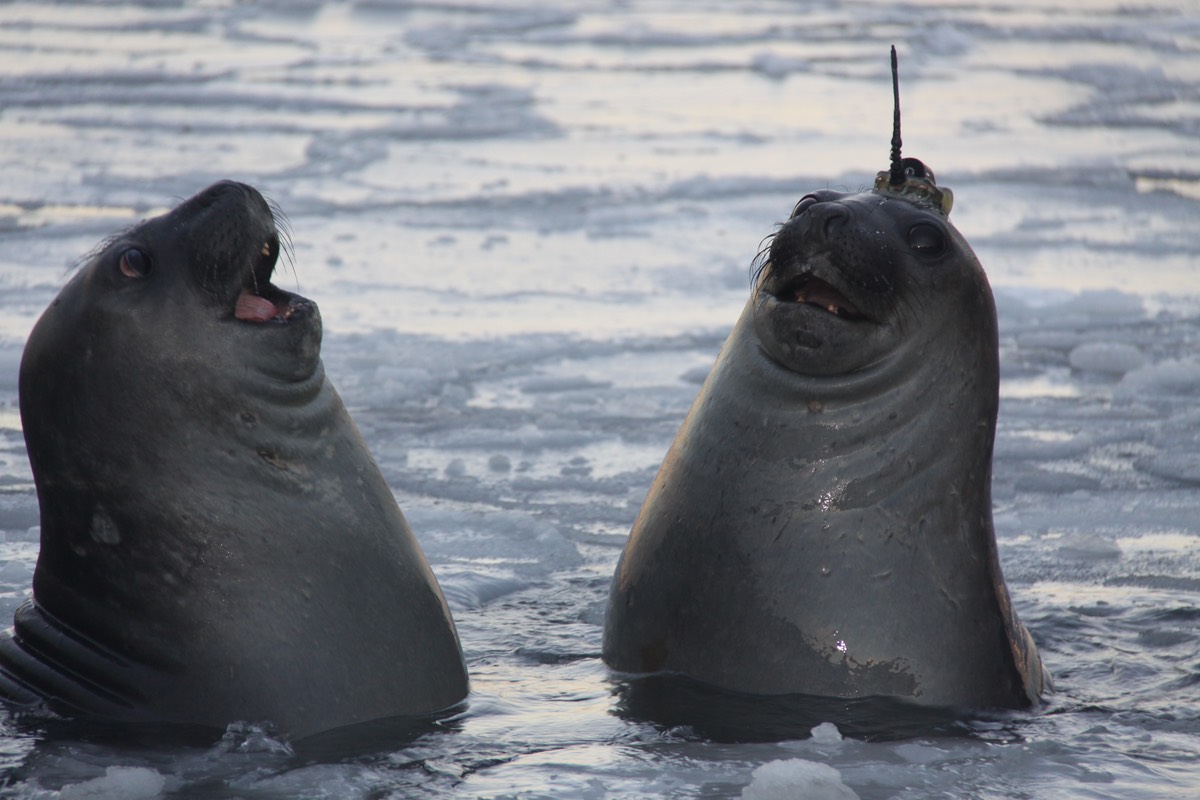
photo : Clive McMahon
Southern elephant seals, massive creatures measuring more than 20 feet long and weighing up to 8,800 pounds, live in sub-Antarctic and Antarctic waters.
For this project, researchers caught and measured seals, then attached the sensors to their heads.
The devices fall off when the animals molt.
The battery-powered monitors, called CTD-SRDL, last up to a year and measure salinity and temperature.
Seal dives, which can go as deep as 6,000 feet, feed information to the environmental profiles, AFP reported.
Aside from the novelty of getting a bunch of giant seals to collect data from the ocean, "of more general importance is that data from these remote and inaccessible places now gives us a much clearer picture of the state of the world’s oceans," Mike Fedak, a University of St Andrews biology professor, said in a statement.
"We have since shown that data from these far-flung locations is critical to understanding the broader state of the Global Ocean."
Fedak told AFP that the data can be used for things such as tracking the movement of glaciers.
"They are taking data from places where there has been virtually no data before," he said.
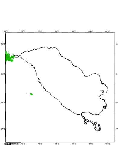
Corresponding seal track.
Kuerguelen Islands can be seen on the upper left corner,
as well as the Heard Islands just below.
Researchers involved in the project said that "sustained observations" are required to closely monitoring polar oceans.
"Changes in the polar oceans have global ramifications and a significant influence on weather and climate," Boehme said in a statement.
MEOP is a consortium of 11 countries and some scientists have already had access to the data for research on the temperature and salinity of oceans.
Some of the information collected by the seals has been used in weather forecasting and by scientists studying how animals respond to changes in ocean conditions.
Links :
No comments:
Post a Comment