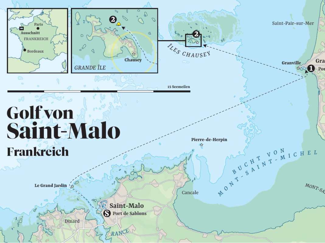
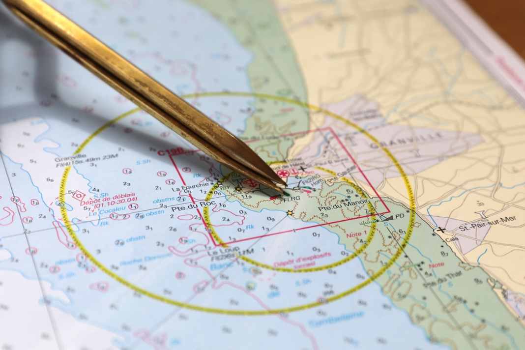
Overview map of the cruise stages
ImagesPhoto: Christian Tiedt
From Yacht by Christian Tiedt
From the Gulf of Saint-Malo, we cross the English Channel to England.
Our actual destination is the Channel Islands.
We start with the only French archipelago - the Îles Chausey.
Our actual destination is the Channel Islands.
We start with the only French archipelago - the Îles Chausey.
The old town centre of Saint-Malo has an unusual Latin name: Intra Muros - within the walls.
And indeed, from the outside it looks like a single fortress when you stand at its feet: grey stone that stretches up over the linear house facades behind it to the massive chimneys, which themselves look like crenellated towers.
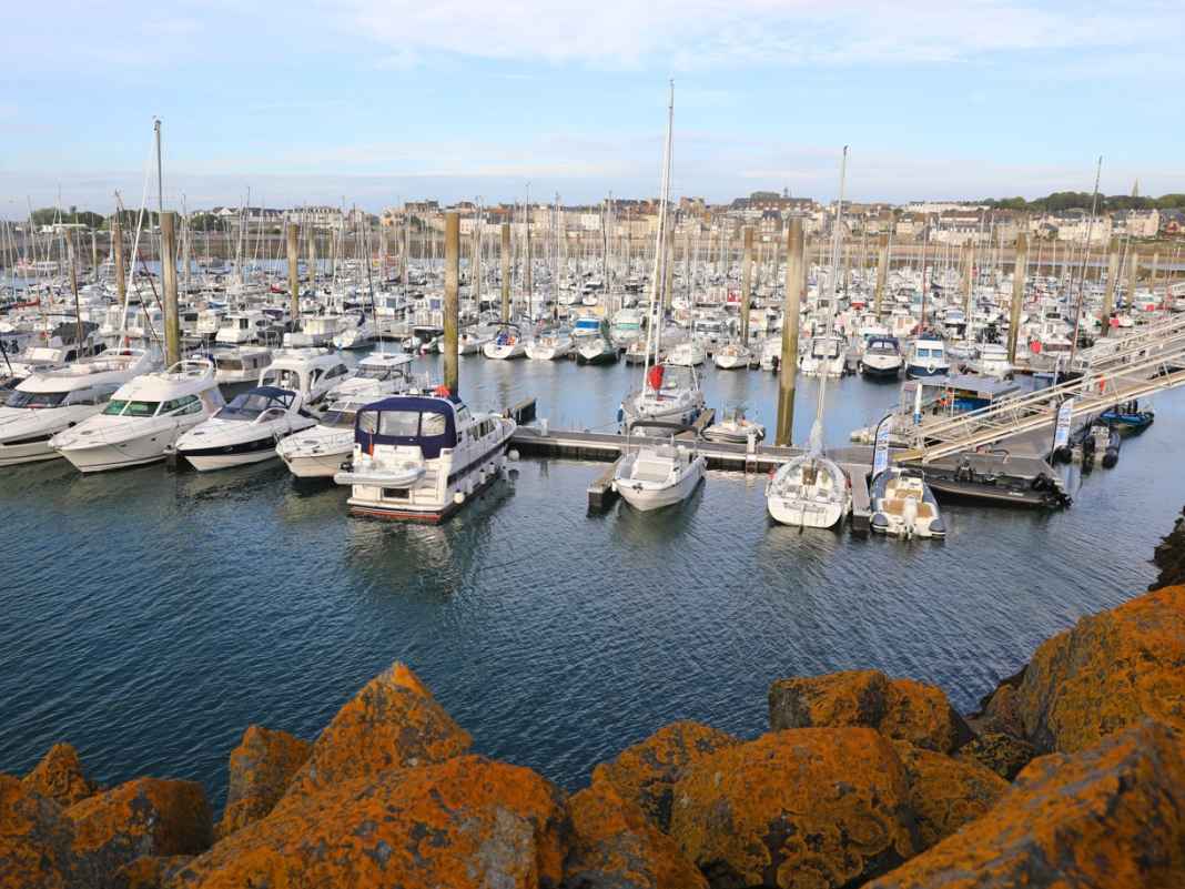
Marina of Saint-Malo in the Port de Sablons
This is where Vauban, the legendary fortress builder of the Sun King Louis XIV, ran riot to protect the harbour of the Breton buccaneer town from the revenge of the robbers.
But that's not all: forts were also built on the surrounding tidal islands, whose cannons could fire on all sea routes to the harbour.
Saint-Malo is not only surrounded by its walls, but also by the sea on three sides.
But that's not all: forts were also built on the surrounding tidal islands, whose cannons could fire on all sea routes to the harbour.
Saint-Malo is not only surrounded by its walls, but also by the sea on three sides.
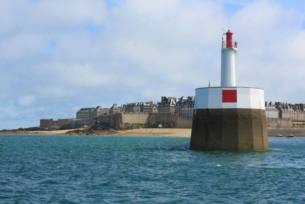
Pier head with sea mark, Saint-Malo in the background
You enter through the Porte de Dinan with its massive twin towers.
Directly behind it is the home of the legendary corsair Robert Surcouf, who repeatedly inflicted spectacular damage on the English during the Napoleonic Wars.
Even though the Royal Navy won the battle of the fleets, it was unable to get hold of the cunning captain with the letter of marque: Surcouf was able to raise or sink almost 50 ships, more than just painful pinpricks for the pride of the British Admiralty - and the wallets of the British shipowners entrusted with their protection.
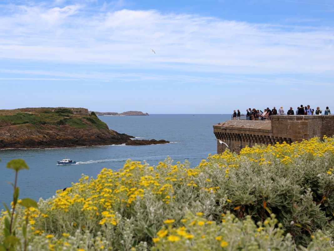
The walk over the battlements of the city wall is truly impressive, even if it is peaceful all around.
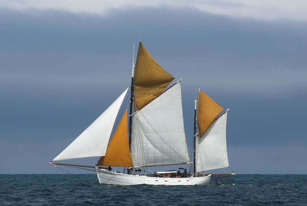
White sails between the islands, fast ferries and pleasure craft, a gaff-rigged sloop with a long bowsprit that could have come straight from Surcouf's time.
Below, in front of the wall, the beaches, dotted with parasols, and again and again rocks, sharp-edged, interspersed with small pools left behind by the draining water.
The walls of the natural swimming pool now also emerge; just a few minutes ago, only the diving tower protruded from the sea.
Together with tourists from Quebec and Brazil as well as a biker gang from Gelsenkirchen, we continue along the walkway, at a narrow point only in single file, Surcouf in bronze on the left, his raised arm pointing resolutely towards the lake.
View from the walls of Saint-Malo, with the Tour Bidouane on the right
Then the descent from the wall and into this militarised city, to Saint Vincent Cathedral, where a wedding is taking place to the delight of the tourists.
The father leads the bride in her white dress and train into the interior, where she is greeted by the choir singing.
But the spiritual is not far removed from the spiritual: Just two corners away, Breton music beckons through a round arch for a tasting of calvados and cider.
Finally, all the specialities are available on Rue Saint-Vincent: from lobster and oysters to butter caramel and Kouign-Amann, the region's round cake.
Half an hour later, our crew is sitting near the Port de Sablons.
The sun is shining in the sky and ambrée sparkles in the glass.
The cruise can begin!
The next morning, a high wall of black quarry stone rises up in front of the hull window: The boulders form the harbour wall, now visible at low tide.
At spring tide, the tidal range here can be more than ten metres.
Once again we climb the now very steep bridge up to the service building, then we make ready for sea and cast off.
Start of the cruise, two weeks lie ahead of us, at the end of the journey lies Portsmouth.
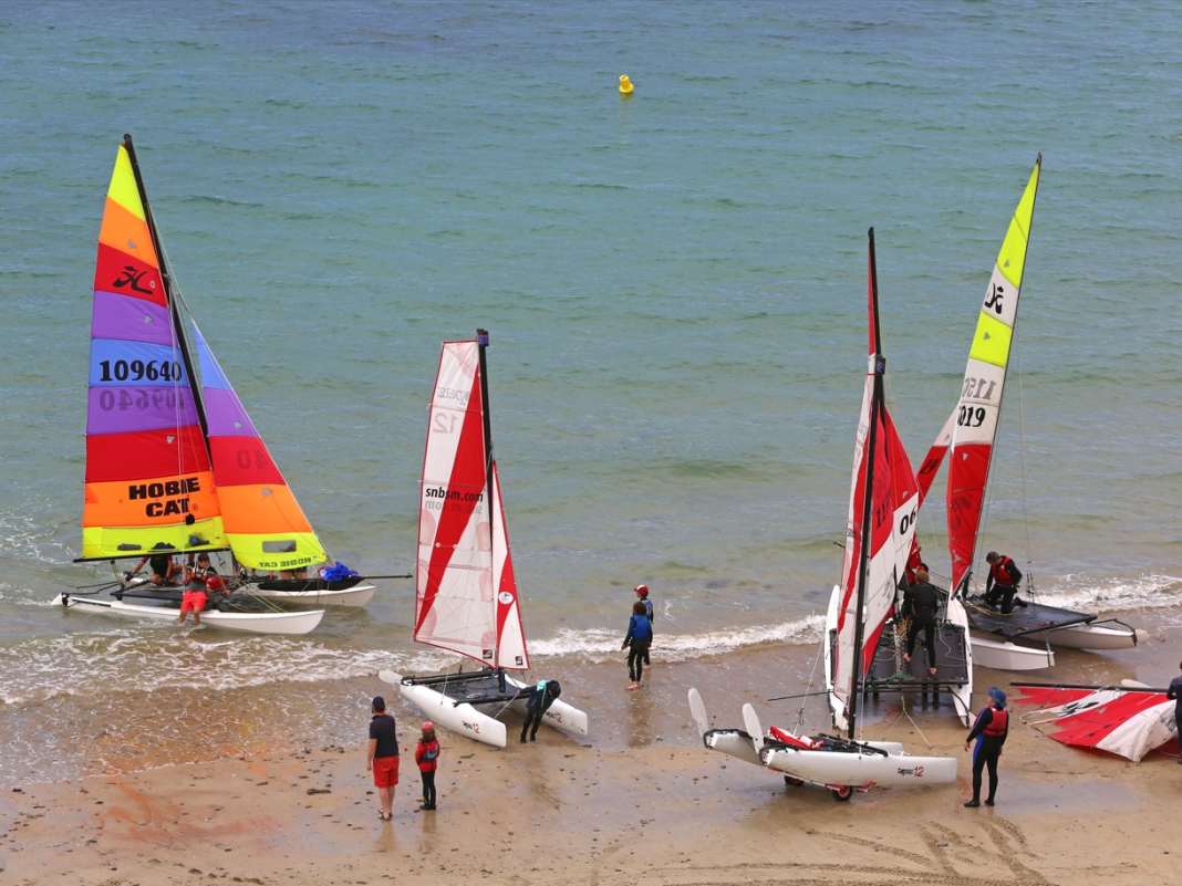
Catamarans on the beach at Saint-Malo
Across the bay of Mont-Saint-Michel
The actual destination, however, is the Channel Islands: Jersey, Guernsey and Co.
These are comparatively short distances, the only long leg will be across the Channel itself.
What will the weather be like? Atlantic changeable, a bit of everything, with clouds, rain, but also sunshine.
And with a wind that is likely to be three to four Beaufort around west-north-west most of the time.
The car ferry to Portsmouth departs in front of us, it's a pretty old boat.
This doesn't seem to be the most lucrative route across the English Channel.
The water is rising and there are already more than four metres of water above the seuil at the harbour entrance, the coaming, which always guarantees two metres of water on the inside.
The sky clears and the sun comes out to see us off.
We pass the sky-high gate of the pier walls, with Saint-Malo to the right against the light.
The dead-straight fairway leads north-west across the roadstead of Saint-Malo, with the rocks and islands sinking deeper to the right and left as the tide rises.
Yachts cross against the north-west towards the approach.
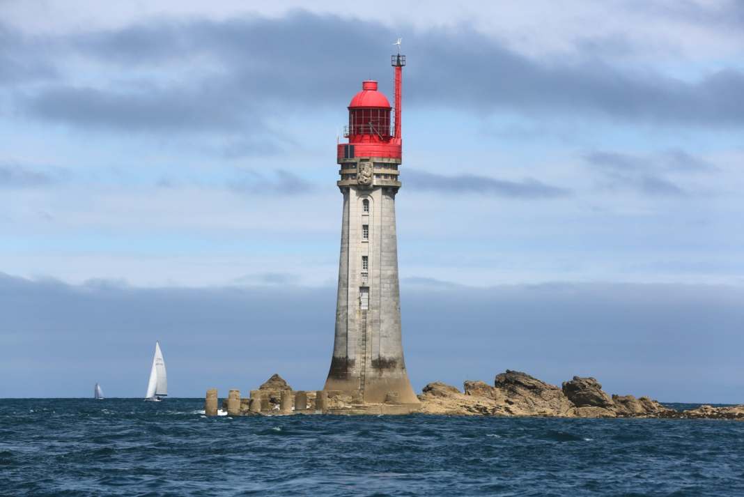
The Le Grand Jardin lighthouse at the start of the approach to Saint-Malo
Only when we have the Le Grand Jardin lighthouse ahead on starboard do we feel a stronger swell.
We turn right onto an ENE course that will take us across the bay of Mont-Saint-Michel.
Past the Île de Cézembre and then onwards, with two waypoints towards our first destination for the day, the harbour of Granville.
It's getting hazy; the famous rock with its cathedral, which gave the wide, shallow bay its name, can just be glimpsed on the horizon in the south-east.
Granville: On-board visit from the border guard
We are now travelling almost alone until we reach the coast of the Cotentin peninsula, which is already part of Normandy.
Granville is heralded by the Pointe du Roc, a cape with cliffs and a lighthouse.
The harbours, again surrounded by fortress-like protective walls and overlooked by two churches, lie to the east.
The fishing harbour is protected by a lock gate and at Port de Hérel, a seuil prevents the marina from falling dry, which can be accessed from three hours before to three hours after high tide.
There we find a spot right next to the "Visiteurs" sign - but also diagonally opposite a grey douanes patrol boat.
Of course, the five border officials start their shift by visiting us on board ...
We've never been checked so thoroughly before, although it's clear that we've just come from Saint-Malo and have to appear completely unsuspicious.
This goes on for a good half hour until we are finally wished a safe journey and, as we want to continue on to the Channel Islands, have fun with "les Anglais".
Christian Dior's church and colourfully painted bunkers
Granville, initially grey and somewhat unapproachable, becomes more accessible in the sunlight of the second day.
With just over an hour left, we set off for the haute ville, the historic upper town, buy souvenirs at Place Cambernon and resist the temptations of La Rafale, where we had stopped last night.
Mali Blues drifts outside and the landlord with the curved gag beard wipes his tables on the street.
We follow Rue Notre Dame towards Le Roc, the headland.
Flowers bloom on the stone façades and what is made of wood has been brightly painted.
We reach the large church, which was begun under English rule in the 15th century but not completed until the 18th century.
As the French Wikipedia entry reveals, it is in the Flamboyant Gothic style: a term I have never heard before, but it is fitting that none other than Christian Dior was baptised here in 1908.
Another extravagant detail: although the entire mainland coast is made of nothing but stone, the granite for the construction of the church was brought from the Îles Chausey, our destination today, in small cargo ships, the so-called gabares.
Apparently, no effort was too great for the glory of the Lord ...
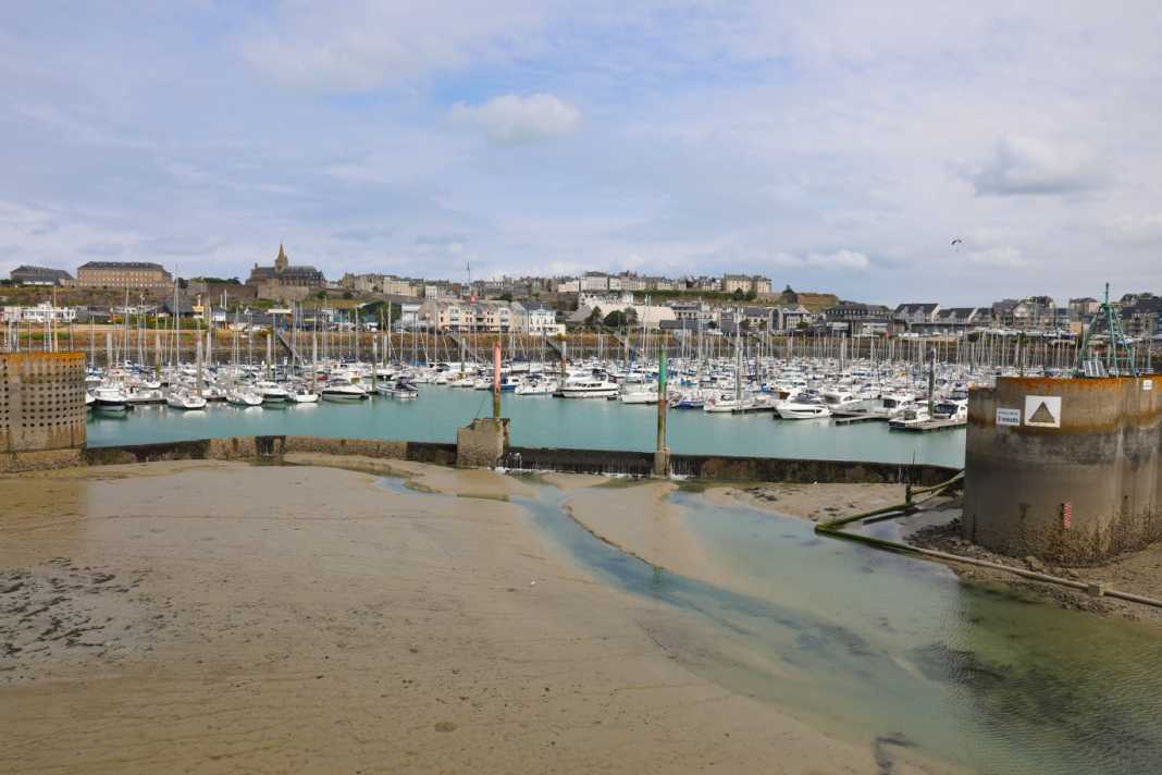
The marina of Granville in the Port de Hérel
Standard blocks from the concrete construction kit, Hitler's Atlantic Wall.
One of these so-called standard buildings is painted as a house, with a brick pattern and windows.
Naive painting in the truest sense of the word, but historically documented as a crude camouflage measure.
With the Granville lighthouse behind it, the former coastal artillery position forms an unusual ensemble.
Otherwise, it is a beautiful place, with a sweeping view to the north over the curved coastline of the Cotentin.
An unobtrusive monument, a steel plate with a cut-out Lorraine cross, commemorates the Resistance and the fighting after the Allied landings.
The horizon can be seen through the long cross arm of the cross.
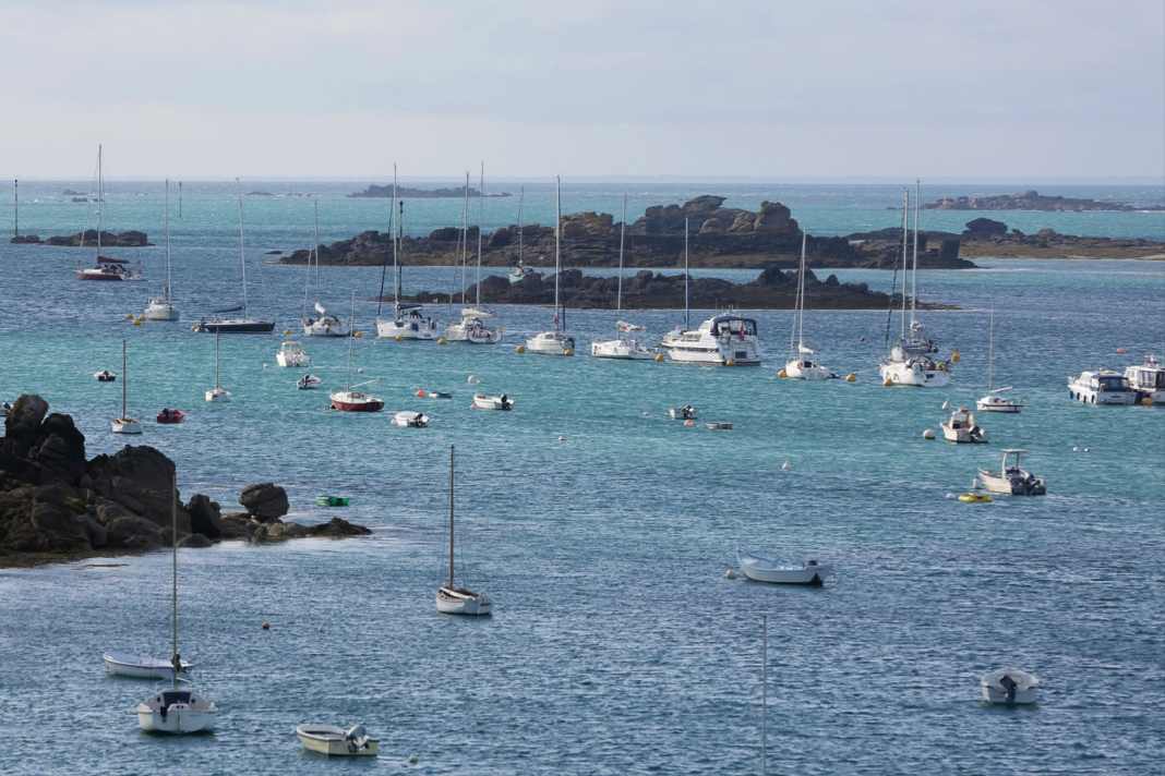
Control of the Sound de Chausey
Farewell to the French mainland
When we finally set sail, with 3.30 metres of water above the seuil, the sky had long since closed up again.
It is barely nine nautical miles to the southern approach to Îles Chausey.
It doesn't matter that the westerly wind on this leg is once again blowing directly from the front at three Beaufort.
Finally, the first sharply contoured rocks emerge from the sea on the starboard side.
Our destination is the Grande Île.
It is the only French Channel Island and, despite its grandiose name, also the smallest at barely two kilometres in length.
But if you look at the nautical chart of the Îles Chausey, a whole double page at a scale of 1 : 25,000, you see a completely different picture: The archipelago measures nine nautical miles from west to east, three from north to south.
It is crossed by a fairway, the Chenal Beauchamp.
The rest is coloured green and is therefore dry.
Now, shortly before high tide, there is hardly any sign of it, but that is about to change.
Another navigable entrance, the Sound de Chausey, follows the eastern shore of the main island, which not only has a lighthouse at its highest point, but also a number of other buildings.
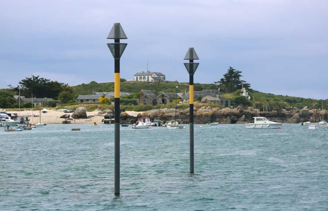
Passing the flooded landing stage for the day ferry, the high cardinal poles, the "Eiffel Tower", a lattice mast with a sea mark, we make our way to the buoy field.
Of course, we leave the douanes' mooring ring free.
The current is already running out and it takes a while before we are finally moored in front of the bow and stern on two lines.
When we finally set sail, with 3.30 metres of water above the seuil, the sky had long since closed up again.
It is barely nine nautical miles to the southern approach to Îles Chausey.
It doesn't matter that the westerly wind on this leg is once again blowing directly from the front at three Beaufort.
Finally, the first sharply contoured rocks emerge from the sea on the starboard side.
Our destination is the Grande Île.
It is the only French Channel Island and, despite its grandiose name, also the smallest at barely two kilometres in length.
But if you look at the nautical chart of the Îles Chausey, a whole double page at a scale of 1 : 25,000, you see a completely different picture: The archipelago measures nine nautical miles from west to east, three from north to south.
It is crossed by a fairway, the Chenal Beauchamp.
The rest is coloured green and is therefore dry.
Now, shortly before high tide, there is hardly any sign of it, but that is about to change.
Another navigable entrance, the Sound de Chausey, follows the eastern shore of the main island, which not only has a lighthouse at its highest point, but also a number of other buildings.
Passing the flooded landing stage for the day ferry, the high cardinal poles, the "Eiffel Tower", a lattice mast with a sea mark, we make our way to the buoy field.
Of course, we leave the douanes' mooring ring free.
The current is already running out and it takes a while before we are finally moored in front of the bow and stern on two lines.
A former thonier, a tuna fisherman, on the bay of Mont-Saint-Michel
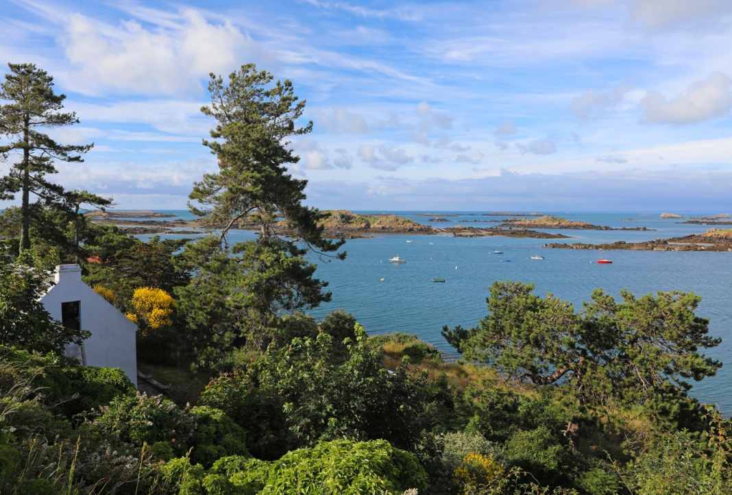
Insider tip in the Gulf of Saint-Malo: the Îles Chausey
We are just sitting at the jetty when the harbour captain comes by with his RIB and makes himself comfortable on board with us; the night costs twelve euros, you can't complain about that.
The rocks slowly rise out of the water around us, black and brown, and join together to form ridges.
You don't want to walk on any of them.
In Scandinavia, the granite has been polished smooth by the glaciers, here everything is sharp-edged, despite the wind and waves that have been passing over it for thousands of years.
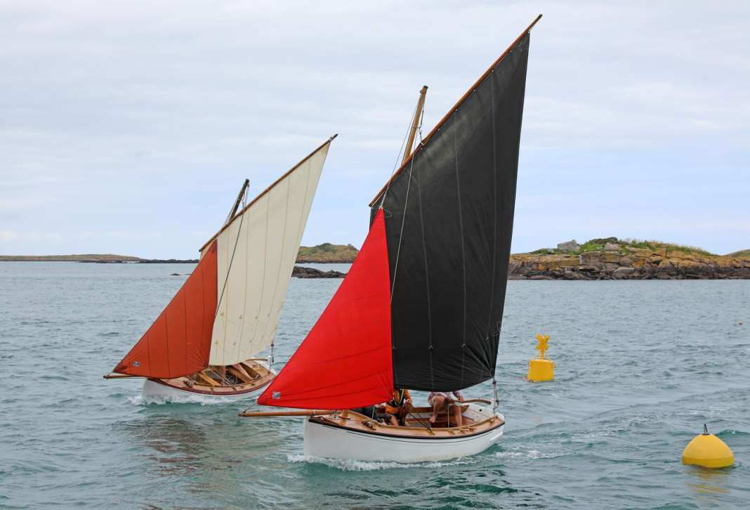
Classic fishing boats as daysailers on the Sound de Chausey
Into the dinghy.
We pull our dinghy ashore by the wide brick slipway, on the outside of which the last passenger ferry of the day is just coming alongside.
We don't need to tie it up, it will be higher later.
However, we have no idea how high ...
We pull our dinghy ashore by the wide brick slipway, on the outside of which the last passenger ferry of the day is just coming alongside.
We don't need to tie it up, it will be higher later.
However, we have no idea how high ...
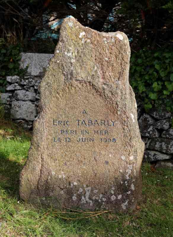
Memorial stone for Éric Tabarly on Grande Île
Lobster baskets flank the path, and at the top of the crossing a memorial stone commemorates the sailing legend Éric Tabarly, who died at sea.
Of the two restaurants, we like the simpler one, Contre Vents et Marées, much better.
There's a lot going on inside and the large panoramic windows look out onto the sound.
We book a table and explore until then.
Beautiful panorama with the Sound de Chausey
Narrow paths wind their way between hedges, here and there a whitewashed chalet is hidden between crooked pine trees.
On to the overgrown fort, then to the lighthouse and the church.
There are even four beaches.
The Grande Île is truly beautiful, a sparkling gem.
In addition, the restaurant offers a magnificent view of a fantastic landscape where the sea used to be.
There, a plateau enclosed by high cliffs! Not that far away.
I wonder if anyone has ever set foot on it?
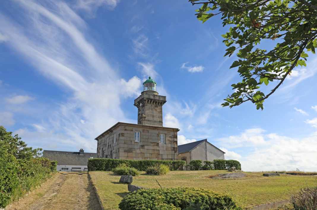
Chausey lighthouse on Grande Île
The mood is good and remains so until we realise in the twilight after dinner that the ramp with our not quite light RIB no longer leads directly to the water - but into the stony, sandy silt at the bottom of the small bay.
We have to tow almost 50 metres.
Isn't someone laughing somewhere in the darkness? We finally get back on board with cold feet.
But you never stop learning.
Tomorrow we will continue on to Jersey - to the "Anglais".
We have to tow almost 50 metres.
Isn't someone laughing somewhere in the darkness? We finally get back on board with cold feet.
But you never stop learning.
Tomorrow we will continue on to Jersey - to the "Anglais".
Murings on the Sound de Chausey at half water
Links :
- GeoGarage blog : Chausey islands / Old nautical map of Chausey island / Grandes marées in Chausey / Two canots in the Chausey islands / Saint Malo Live webcam / Ciara storm in Saint Malo / Bon-Secours beach in Saint-Malo : tides time-lapse / High tide in Saint Malo / 'Tides of the century' in France
No comments:
Post a Comment