
Navygatio – web home page
From NavigationMac by Francis Fustier
The latest update of Weather4D Routing & Navigation brings a major novelty : Navygatio (¹), a web interface which will allow to record the navigations on a server as time goes by, to add photos, to share own page with relatives, to compare the tracks, to analyze performance, and many more things to come.
A real " cloud at the unique service of Weather4D Routing & Navigation users with iOS and SailGrib WR with Android.
Developed for over a year jointly by Henri Laurent (SailGrib) and Olivier Bouyssou (Weather4D) this new interface already allows the recording of all navigation data, either in cellular connection (real and / or deferred time), either in satellite connection with Iridium GO! (deferred) (²).
Tracks, data from connected instruments, and, icing on the cake : automatic data recording in alogbook !
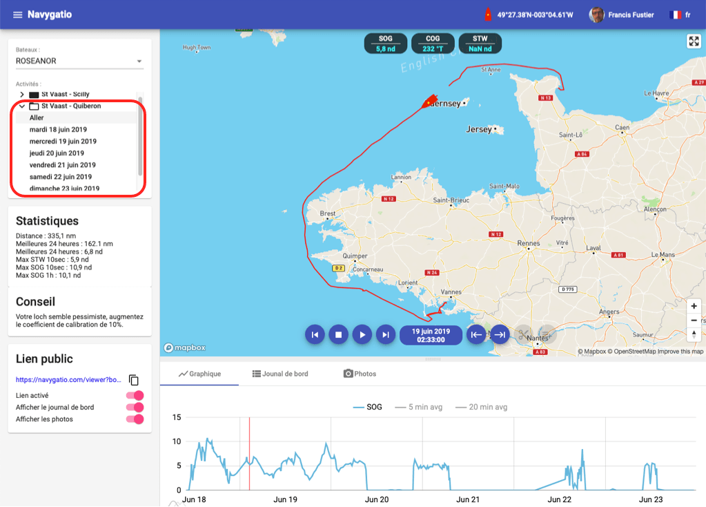
Several trips grouped together in the outbound journey
Implementation
In Navygatio website we create an account, exclusively with a Google email address (Gmail) or Apple (Apple Store account address).
We enter the information about the boat, then we create an activity.
It can be a cruising voyage, a training, a regatta, etc.
We can create as many activities as we have navigations, cruises or regattas, to perform.
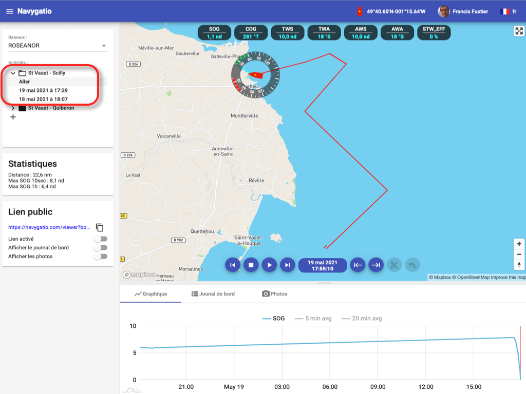
In the same activity, several trips can be recorded if necessary.
We can then group the trips together in a single journey to replay it on the screen.
Once the account has been created on the website Navygatio, we connect to it in Weather4D Routing & Navigation via a new entry in the "Navigation" menu.
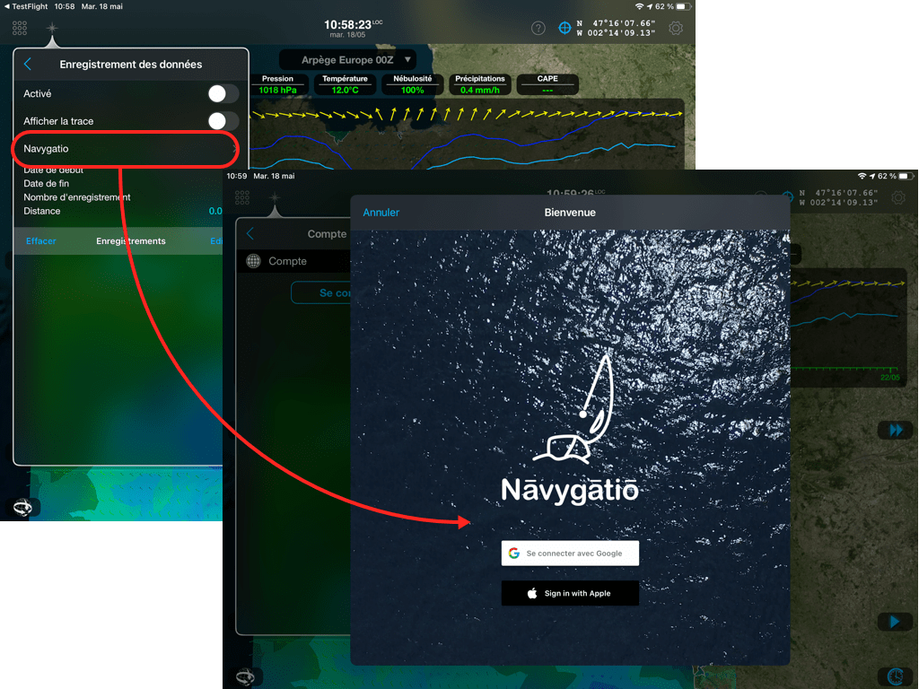
Connection with Weather4D Routing & Navigation
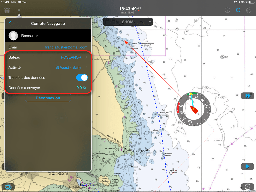
Select the email address used in Navygatio, the name of the boat, and the current activity to choose from a list of activities.
When leaving, after activating the navigation mode in Weather4D, just activate "Data transfer".
They will be synchronized, either in real time with an internet connection (cellular connection near the coast), either deferred as soon as a connection is available (cellular or satellite) (²).
We see the track and the transferred data displayed on the screen, all available data attached to the route is recorded.
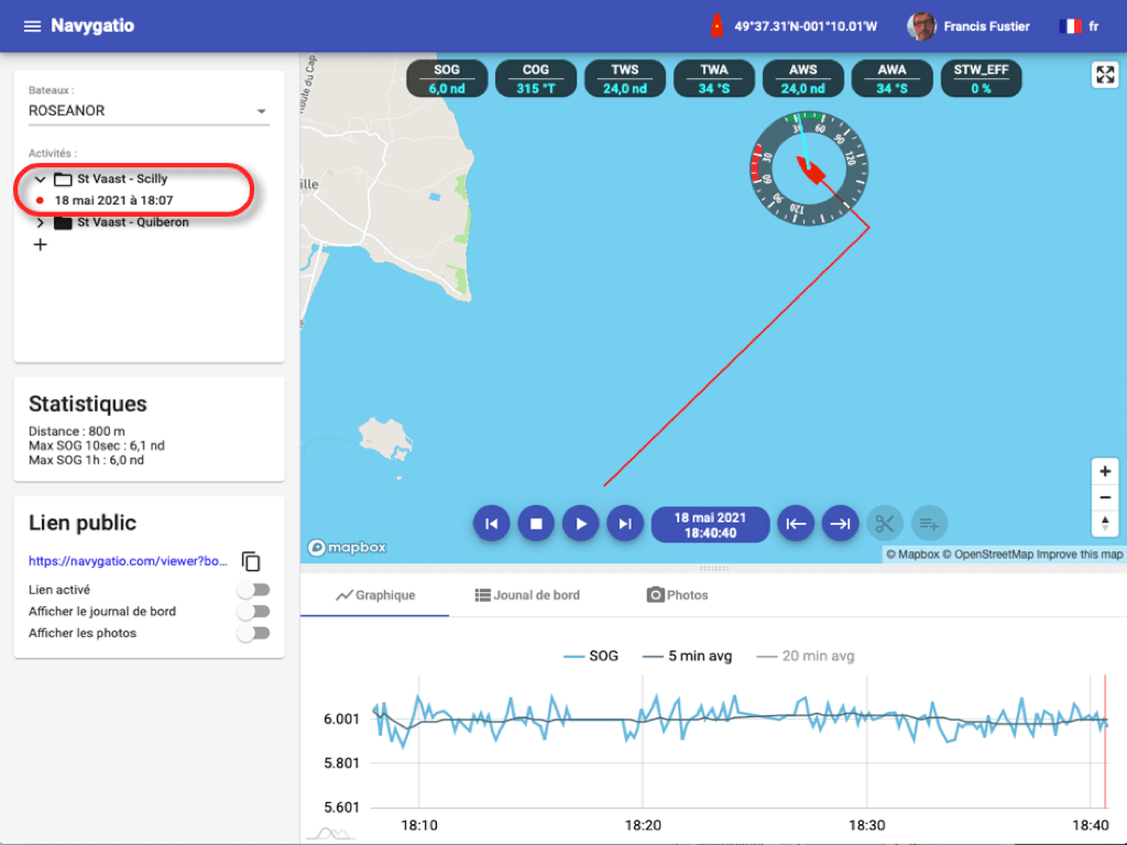
By clicking on a data label in Navygatio, a graph traces its evolution over time.
We can move forward or back in time, you can also click anywhere on the track line to bring the boat back to it and read the data at that point in time, for example when tacking.
You can also display average values over time.
At the end of a course, just turn off data transfer to stop recording.
Like this, several successive tracks can be recorded for the same cruise, or several stages of the same regatta, by reactivating the transfer at each new start.
A new trip begins…

… registered in Navygatio
You can share a public link with your loved ones to your Navygatio page for a single course, and better, you can invite " followers ", or other users registered in Navygatio, who will be able to access all your journeys.
Your competitor-friends will be able to analyze your performance data, compare with theirs, and many other things.
Other important feature, functionlogbook will evolve in the near future.
In addition to data transfer in the "Logbook" tab of the web interface, input fields will allow you to add textual notes.
Thereafter, a real Logbook interface will be available, in the same way as the Instruments page, in half screen.
Also, the possibility will be offered to subscribers to GeoGarage maps to display the nautical charts on the screen Navygatio, to see more precisely the journeys made.
Finally, the identifiers of the Navygatio account should soon be unified for the weather subscription account and the GeoGarage account., in order to simplify its use.
It goes without saying that access to Navygatio is free for all Weather4D Routage users.
& Navigation with iOS and SailGrib WR with Android.
It also provides them with a real free tracking solution thanks to the "Public link" function for the attention of relatives.
Other more advanced functions will be added later, mainly for the attention of racers, race and rally organizers.
Note :
The function data transfer to Navygatio is completely independent of the function AIS data sharing that can be activated in the General Settings > Navigation > AIS settings.
This last, when activated, only feeds information from AIS targets, voluntarily shared by Weather4D users, displayed on the application (light blue ship icons) (³).
Simultaneous broadcasting of the two streams is not incompatible.
Pending the update of User Guide, the Navygatio user manual is available at this link in PDF format : NAVYGATIO.
To download without moderation.
–––
(¹) Domain name, anglicized (Navy instead of Navi), from Navigatio which means "Navigation" in… Latin ! Comes from the wordnāvigō (navigate), formed withnāvis (ship) andagō (make).
(²) Function awaiting validation.
(³) See User Guide Weather4D Routing & Navigation pages 131-132.
Links :
This is promising, but the link to the Navygatio User Manual in PDF is broken. Impossible to find how to remove an element in an activity, which is problematic because uploading sometimes hang, so it has to be done again, and the next day, several uploads of the same data are displayed.
ReplyDelete