The new map showing the continent of Zealandia in more detail than ever before.
From Stuff
GNS Science has published the most detailed maps yet of the 95 per cent undersea continent of Te Riu-a-Māui/Zealandia.
New Zealand is the main part of the 5 million square kilometre continent above sea level, with New Caledonia being the other.
GNS has also launched a website called E Tūhura - Explore Zealandia, where the maps can be bought and which provides information about Zealandia.
The most detailed maps of Zealandia to date – incorporating all five million square kilometres (two million sq miles) of this underwater region and its geology
The website includes a brief history of Zealandia, explaining it was once part of the southern supercontinent of Gondwana, along with Australia, Antarctica, South America, Africa and India.
About 150 million years ago Gondwana started to break up, and about 100m years ago the Zealandia part started to "stretch like pizza dough".
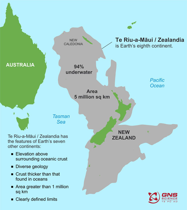
Explaining why Zealandia should be considered a continent, the E Tūhura website said: "like all continents, Zealandia has high elevation compared with surrounding oceanic crust, rocks such as granite, schist and greywacke, relatively thick and low-velocity crust, and large size."
Bathymetric maps of Zealandia (GNS)
The map above shows the bathymetry of Zealandia – in other words, the shape of the ocean floor.
The highest parts of Zealandia are the orange-coloured areas of New Zealand and New Caledonia. They are surrounded by continental shelves (yellows). The blue areas are deeper basins of oceanic crust.
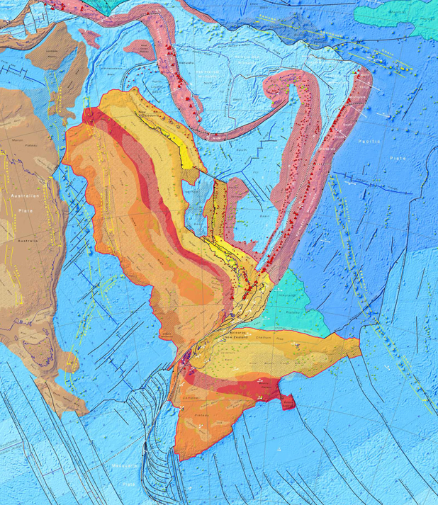
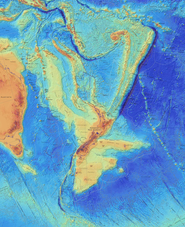
Tectonic map of Zealandia (GNS)
The second map shows the types of crust that make up Zealandia and its main tectonic feature.
An explanation of the map said that asdid the other continents, Zealandia had a foundation of old, hard, crystalline rocks and a cargo of younger sedimentary basins and volcanoes.
“We’ve made these maps to provide an accurate, complete and up-to-date picture of the geology of the New Zealand and southwest Pacific area – better than we have had before," GNS geologist Dr Nick Mortimer, the lead author of the maps, said.
They provided a fresh context in which to explain and understand the setting of New Zealand's volcanoes, plate boundary and sedimentary basins.
Links :
- Stuff : White Island/Whakaari: Health and Safety laws waived for eruption rescue to take place / Sunken continent Zealandia used to be closer to the surface, with a very different climate / Scientists explore the hidden continent of Zealandia / Scientists to drill into Zealandia, the lost continent beneath New Zealand / New Zealand actually sits on a continent called Zealandia, it's just that most of it is under water
- CNN : Maps reveal new details about New Zealand's lost underwater ...
- GeoGarage blog : We thought New Zealand was an island nation. Scientists ... / The missing continent it took 375 years to find
No comments:
Post a Comment