From MartimeExecutive
The National Transportation Safety Board has released its report on the grounding of an ATB cargo barge on a rock just off Kodiak Island last year.
The National Transportation Safety Board has released its report on the grounding of an ATB cargo barge on a rock just off Kodiak Island last year.
The casualty was caused by improper use of an electronic chart system (ECS), according to NTSB: the master overlooked the symbol for a submerged rock, and the chart system's auto-checking function was not used to verify the safety of the voyage.

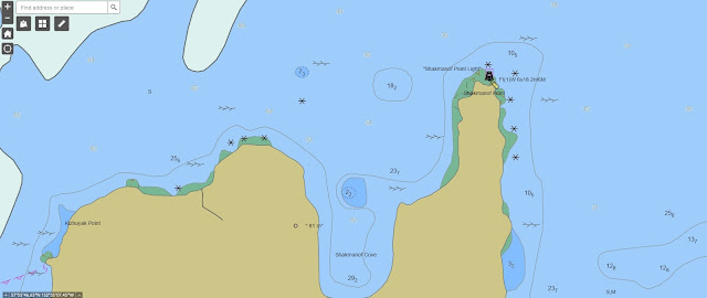
Area where the Cingluku/Jungjuk grounded, as indicated by a circled X.
(Background source: Google Maps)
(Background source: Google Maps)
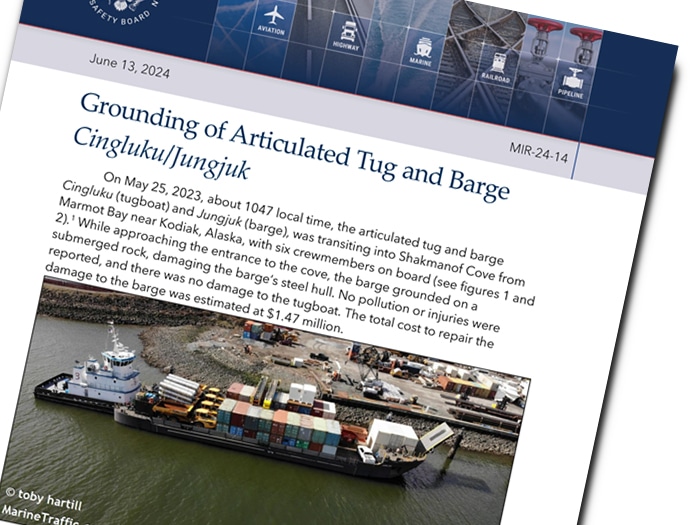
On the morning of May 22, 2023, the ATB tug/barge combination Cingluku / Jungjuk left the small port of Togiak, Alaska, headed for Seward.
The Cingluku had supplies on board for another vessel, and planned to rendezvous in Shakmanof Cove on Kodiak Island.
The barge was unladen and partially ballasted, and was drawing about six feet of water at the stern.
 Approximate voyage trackline of the Cingluku/Jungjuk.
(Background source: Google Earth)
On May 23 at midday, as Cingluku transited False Pass, the captain - a 20-year veteran of the towing industry - laid out a course to Shakmanof Cove using the tug's electronic chart system.
It was his first time on a voyage into the remote bay on Kodiak's northern coast.
The tug continued on through the rest of the day and all of May 24, arriving off Kodiak on the morning of the 25th.

Track of the Cingluku/Jungjuk as it approached Shakmanof Cove, overlaid on
NOAA ENC US4AK5PM.
NOAA ENC US4AK5PM.
(Background source: NOAA ENC as viewed on Made Smart automatic identification system)
The United States Coast Pilot 9 (Alaska) noted a rock in the area where the ATB
grounded stating, “Kizhuyak Point: A rock, which uncovers about 4 feet, is 400 yards
north from this point. Shoal water extends 300 yards north of the rock.”
grounded stating, “Kizhuyak Point: A rock, which uncovers about 4 feet, is 400 yards
north from this point. Shoal water extends 300 yards north of the rock.”
The tug approached Shakmanof Cove at about 1030 hours in the morning, and the mate joined the master on watch.
Two deckhands and the engineer were stationed on the bow in preparation for landing, but had little forward visibility because of the barge's large bow ramp.
At about 1047, as the ATB rounded Kizhuyak Point, the barge ran aground on a submerged rock about 400 yards off the shoreline.
At about 1047, as the ATB rounded Kizhuyak Point, the barge ran aground on a submerged rock about 400 yards off the shoreline.
The tug was not affected, and its ATB coupling to the barge remained in place. Alaska's strong tides came to the rescue and lifted the barge off about six hours later.
The crew remained in the cove to await good weather and arrange for a dive inspection.
Divers found no signs of penetration of the hull, and there was no flooding in the barge's void spaces.
After the ATB reached Seward, it was drydocked for a class inspection.
After the ATB reached Seward, it was drydocked for a class inspection.
The damage included a 16-20 foot long dents in the bottom plating and frame damage in the same area, in way of the centerline forward ballast tank.
The total estimated cost of repairs came to about $1.5 million.
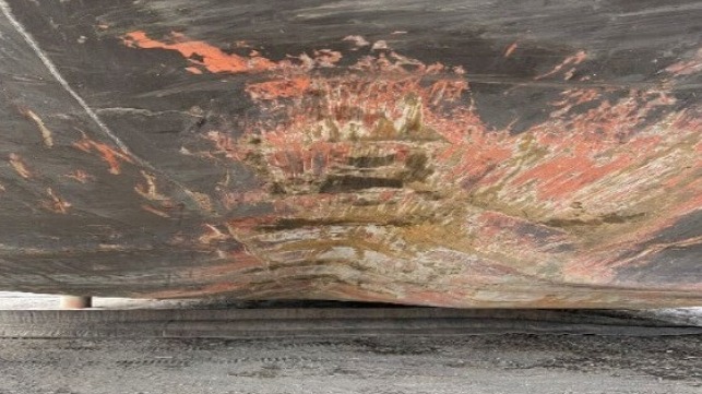 Hull damage along the bottom of the barge (NTSB)
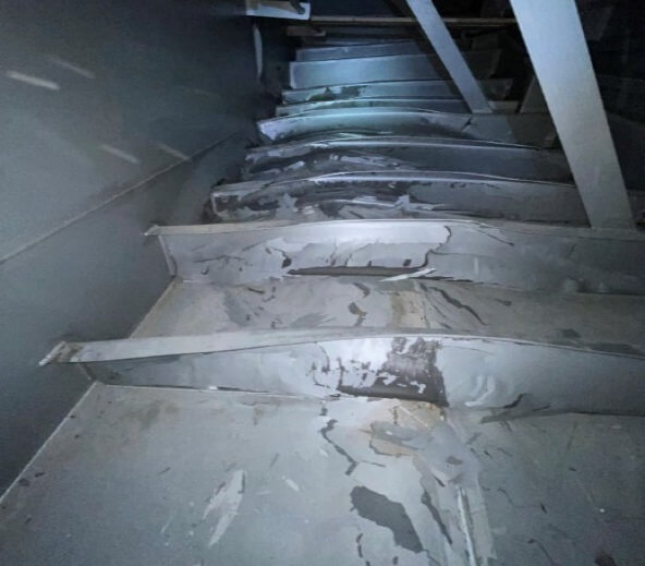
Frame damage inside the ballast tank (NTSB)
While the rock was not visible from the surface, it was a charted hazard, and it appeared on the NOAA chart that the master had used to prepare the voyage plan.

ENC US4AK5PM, as viewed by investigators using an equivalent ECS.
The chart shows an isolated danger symbol over the rock that the ATB struck.
(Backgroundsource: NOAA ENC as viewed on Rose Point ECS)

RNC for the area near Shakmanof Cove.
The symbol for the rock in the area of the grounding is indicated by a red circle.
(Background Source: NOAA Chart 16594, 14th Edition, January 2015)
visualization with the GeoGarage platform

ENC US4AK5PM, for the area near Shakmanof Cove, as viewed by investigators using an equivalent ECS.
The asterisk symbol for the rock in the area of the grounding is indicated by a red circle.
The asterisk symbol for the rock in the area of the grounding is indicated by a red circle.
(Background source: NOAA ENC as viewed on Rose Point ECS)
The tug's master and mate used the common ECS platform Rose Point, often found on working vessels in Alaska.
The system has a depth contour safety feature that highlights shoals and hazards based on the vessel's draft, but the crew told NTSB they didn't use it.
The reason, they said, was that "the soundings don't really mean anything" in Western Alaska, where much of the survey data dates back many decades.
The software can also highlight isolated dangers, like this submerged rock, but that option was turned off.
The company's policy in its SMS did not require the use of these features, and the firm did not give its crews formal training on the use of the software.
 US4AK5PM NOAA visualizations


"When investigators viewed the area on an equivalent ECS, the asterisk marking the rock was displayed alongside soundings of similar size and color, so it is possible that the captain mistook the asterisk for a depth sounding or other chart information when plotting and reviewing the route," concluded NTSB. "Using other available resources, such as the Coast Pilot, would have helped the captain in identifying the rock when planning and reviewing the route."
Links :
No comments:
Post a Comment