From Navigate Response by Dustin Eno
In the hands of people without an adequate understanding of our industry AIS data causes problems
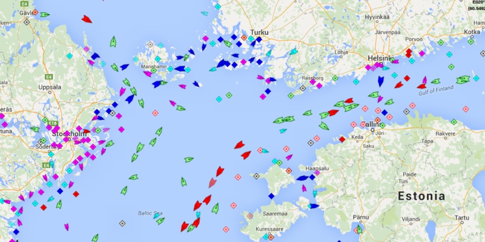
Automated Identification System (AIS) data is a valuable tool for tracking ships and maritime activities.
It is used by various parties, including journalists, researchers, and the public, to monitor vessel movements and gather information about shipping trends.
However, despite the fantastic user interfaces created by platforms like MarineTraffic, AIS data is too often misinterpreted, leading to incorrect conclusions and false narratives.
In the hands of people without an adequate understanding of our industry AIS data causes problems which fall roughly into three categories:
Errors in AIS data that are obvious with context, but that are nevertheless not questioned and are instead taken as fact.
In 2019, as oil was washing up on Brazilian beaches, investigators were trying to identify the source of the spill.
The Brazilian Laboratory of Satellite Image Analysis and Processing looked at satellite imagery to track the oil at sea and then used AIS data to identify which vessels had been in the area.
One ship was identified and an “expert” presented the vessel’s name to a senate committee and the public as the culprit.
There was just one problem, the vessel was 12,000km away in India at the time.
An error in the AIS data showed her in the Atlantic for about 24 hours around the time the spill was believed to have happen.
Obviously, it would be impossible for a large tanker to relocate from India to Brazil and back in the span of a couple days.
Some involved indicated that the “unusual” movement of the vessel was part of the reason she was suspected.
Unusual? Try impossible! But the data was not doubted as it should have been.
We were able help our client to clear their name, but it took weeks to get all the allegations removed.
With a little critical analysis of the data, the vessel never should have been under suspicion in the first place.
Switching AIS to low power mode is misinterpreted as going “dark” for nefarious purposes.
As a safety precaution, the power setting on the AIS units on tankers is routinely reduced from 12.5W to 1W while the vessel is berthed or engaged in cargo operations.
If an AIS receiver is nearby this will have no impact and the data will still be received without interruption, but if the receiver is further away it may no longer be able to pick up the weaker signal and this could be mistaken for the tanker turning off its AIS – perhaps to hide while doing something wrong…
We see this issue arise during ship to ship (STS) transfer operations which generally happen in more remote areas farther from receivers.
It is true that some operators do turn off their AIS to hide STS operations (for example if in breach of sanctions).
Unfortunately, some observers also assume this is what has happened in completely innocent cases when in fact the AIS has just been switched to low power mode as per standard operating procedures.
We’ve dealt with numerous enquiries from well-intentioned journalists along the lines of:“your client’s vessel arrived at _______ turned off her AIS and, when she turned it back on, had a larger draft suggesting she’d loaded cargo in an STS operation.
Why was the AIS turned off?
What is she hiding?”
Convincing a journalist, or worse an activist, that in fact the AIS was on the whole time is difficult, especially if they believe they’ve caught the vessel / company in the act of doing something dodgy.
Convincing a journalist, or worse an activist, that in fact the AIS was on the whole time is difficult, especially if they believe they’ve caught the vessel / company in the act of doing something dodgy.
Attacking Open Source Intelligence: The Fake AIS data epidemic explained
Everyone (and their mother) has discovered AIS signals.
When there is a major confrontation at sea, or a ship gets stuck in the Suez Canal, it's a race to the data used to track ships.
But like any form of Open Source Intelligence (OSINT) the signals you get may be misleading.
They may even be fake.
In fact tat is happening more and more frequently.
Here's how. Article on Yantar spy ship http://www.hisutton.com/Yantar.html
The AIS track on a map is visually easy to interpret, but only tells one part of the story and without context can be badly misleading.
One AIS platform famously caught the Ever Given “drawing” male genitals in the southern Suez anchorage before going on to blook the canal some hours later.
Of course, the pattern was purely coincidental and was visible only on this platform due to the exact moments that they captured the data.
On all other platforms the track of the vessel looked purely random.
A vessel drifting in the Baltic Sea last year was absurdly accused by some on Twitter of being involved in damaging to the Nord Stream pipeline simply because she was floating in the rough proximity of the damage at roughly the same time while awaiting orders.
In another story, tanker 1 called in Russia and then a couple weeks later met tanker 2 which had come from Iraq via Turkey; after meeting tanker 2 proceeded to Greece.
A journalist with a major outlet reported that an STS operation moved Russian oil from tanker 1 to tanker 2 so that it could be imported into Greece.
In reality, tanker 2 needed an unscheduled drydock and so transferred the remainder of its Iraqi cargo to tanker 1 and arrived in Greece empty ready for drydocking.
All understandable conclusions if one approaches the data with suspicion and doesn’t check the fuller context, but all wrong.
And obviously wrong with a little investigation.
What’s the conclusion?
It is easy to be angry with the social media users and journalists who make accusations based only on an incomplete understanding of AIS data.
Being angry is justified, but not useful.
Instead, these misunderstandings and assumptions, most of which stem from a distrust of our industry, are a reminder that as an industry we must continue to do more to explain our operations.
Explain AIS data.
And build trust with our ultimate stakeholders – the general public.
Links :
- GeoGarage blog : Spoofed AIS signals form symbol of Russian invasion / After 20 years of service, AIS is about to get a big upgrade / Russian tanker falsifies AIS data, hides likely activity ... / AIS Mystery: 12 ships appear to cross continents and drive in ... / New AIS B+ transponders explained : Everything you need ... / AIS gets an upgrade / Global analysis shows where fishing vessels turn off their ... / Chinese GPS spoofing circles could hide Iran oil shipments / Google's global fishing watch is using 'manipulated data' / Ghost ships, crop circles, and soft gold: A GPS mystery in ... / Shadow tanker fleet: A ticking time bomb waiting to cause ...
No comments:
Post a Comment