
16190 Bering Strait North (zoom on Diomede Islands)
>>> geolocalization with the Marine GeoGarage <<<
From NOAA
Chart improves navigational safety for maritime gateway to the Arctic.
NOAA Office of Coast Survey has released a new nautical chart for the Arctic, which will help mariners navigate the Bering Strait.
Chart 16190 (Bering Strait North) incorporates precise depth measurements acquired recently by NOAA Ship Fairweather hydrographic surveys.
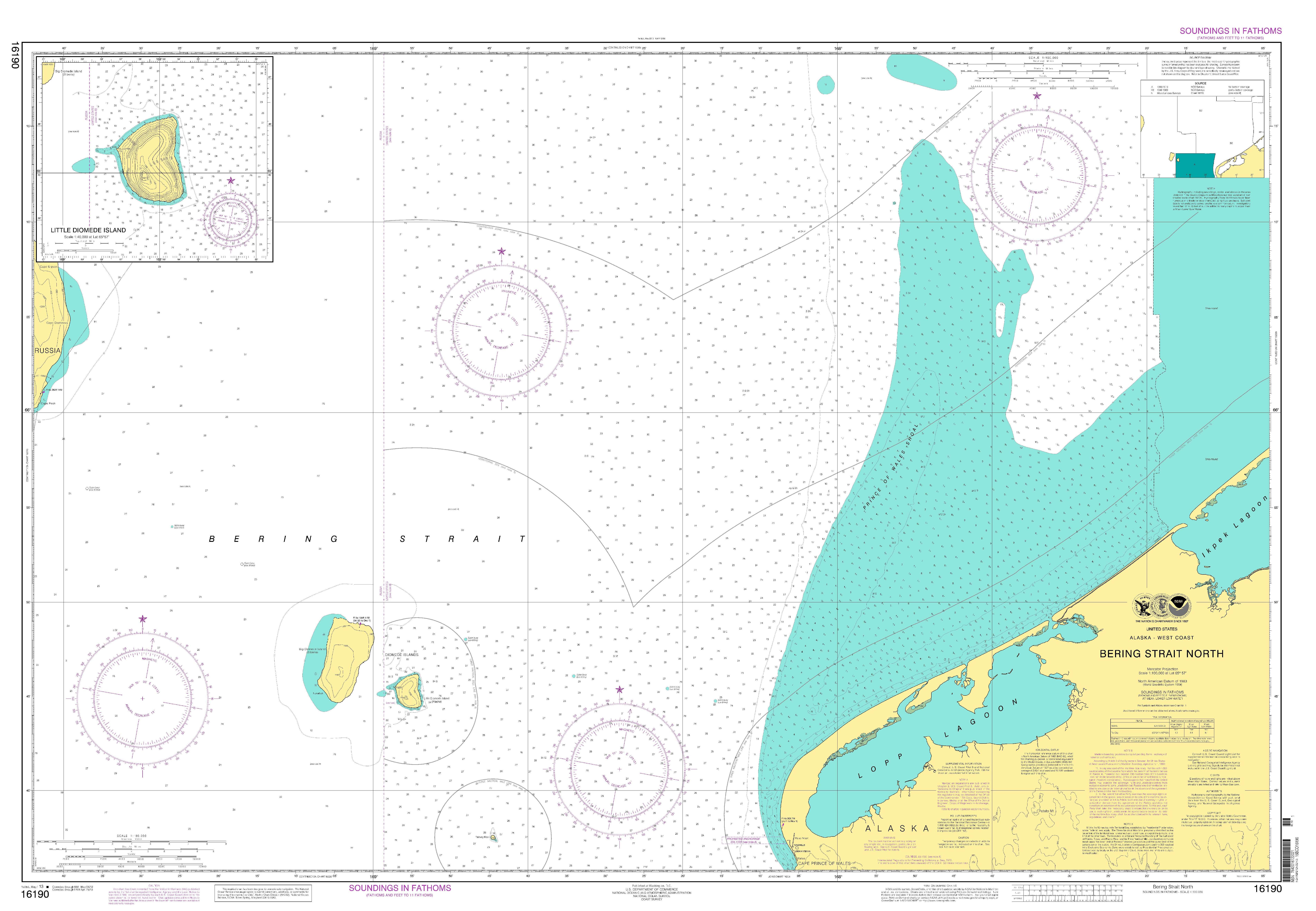
Chart 16190 (Bering Strait North)
Coast Survey is also releasing a new edition of Chart 16220 (St Lawrence Island to Bering Strait).
"Our Arctic Nautical Charting Plan identified the need for 14 new charts in the Arctic," explains Commander Shep Smith, chief of Coast Survey's Marine Chart Division.
"Chart 16190 was high on our list of priorities, since the Bering Strait is the maritime gateway from the Bering Sea in the Pacific Ocean to Chukchi Sea in the Arctic Ocean."
"Charting the gateway is absolutely vital for safe navigation, but it is more than that," Smith says.
"In addition to the very practical aspects, this chart also symbolizes an opening to the growing opportunities for maritime transportation in the Arctic."
Charts 16190 and 16220 include recent hydrographic information in U.S. waters between Cape Prince of Wales and the immediate waters surrounding Little Diomede Island.
They also include recent NOAA shoreline surveys of the Diomede Islands and Cape Prince of Wales.
- Chart 16190 provides 1:100,000 scale coverage, including a 1:40,000 scale inset of Little Diomede Island.
- Chart 16220 provides 1:315,350 scale coverage.
At that scale, every charted depth was separated by about two nautical miles and the chart depicted only a handful of depths.
Most of the old charted depths were from 1950 and provided incomplete information about the depths or possible hazards on the sea floor.
Chart 16190 is the second new chart resulting from the Arctic Nautical Charting Plan.
Coast Survey created the first of the new Arctic charts, Chart 16161 (Kotzebue and Approaches), in April 2012. (See New Alaska navigational chart makes increased Arctic shipping safer.)
Chart 16220 had previously been maintained by the National Geospatial-Intelligence Agency, but Coast Survey assumed responsibility for it in 2010.
The equivalent NOAA electronic navigational charts (NOAA ENC®) for 16190 will be available this summer.
Watch for US4AK8D (Bering Strait North), and US5AK8D (Little Diomede Island).
The 16220 ENC equivalent -- US3AK89M -- was created in 2012 and included the new Fairweather hydro.
No comments:
Post a Comment