
Cartografia di Tolomeo, Francisco Berlinghieri (1440-1501)
In accordance with Columbus’s theories, the explored regions of North America are shown attached to the Asian continent.
 The first printed map to show the world as a sphere from 1515
was a collaboration between Albrecht Dürer and Johann Stabius
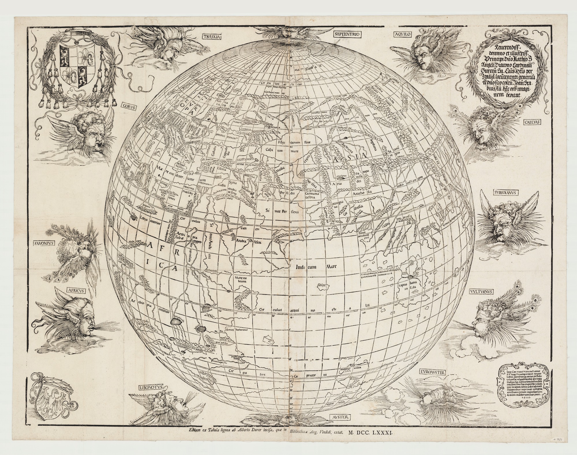
Here's a 1781 reprint.
was a collaboration between Albrecht Dürer and Johann Stabius
Here's a 1781 reprint.

"Carta universal en que se contiene todo lo que del mundo se ha descubierto fasta agora, hizola Diego Ribero cosmographo de su magestad, año de 1529"
Atlas type Lafréri (1543-1577) BNF

(Geographicus)
 Fernando Bertelli’s version of Paolo Forlani’s World Map, after Giacomo Gastaldi: Universale Descrittione Tutta La Terra Conosciuta Fin Qui (Venice, 1565).
Osher Map Library And Smith Center For Cartographic Education, University Of Southern Maine (Osher Collection)
Osher Map Library And Smith Center For Cartographic Education, University Of Southern Maine (Osher Collection)

1596 map of the world
by Lambert Andreas
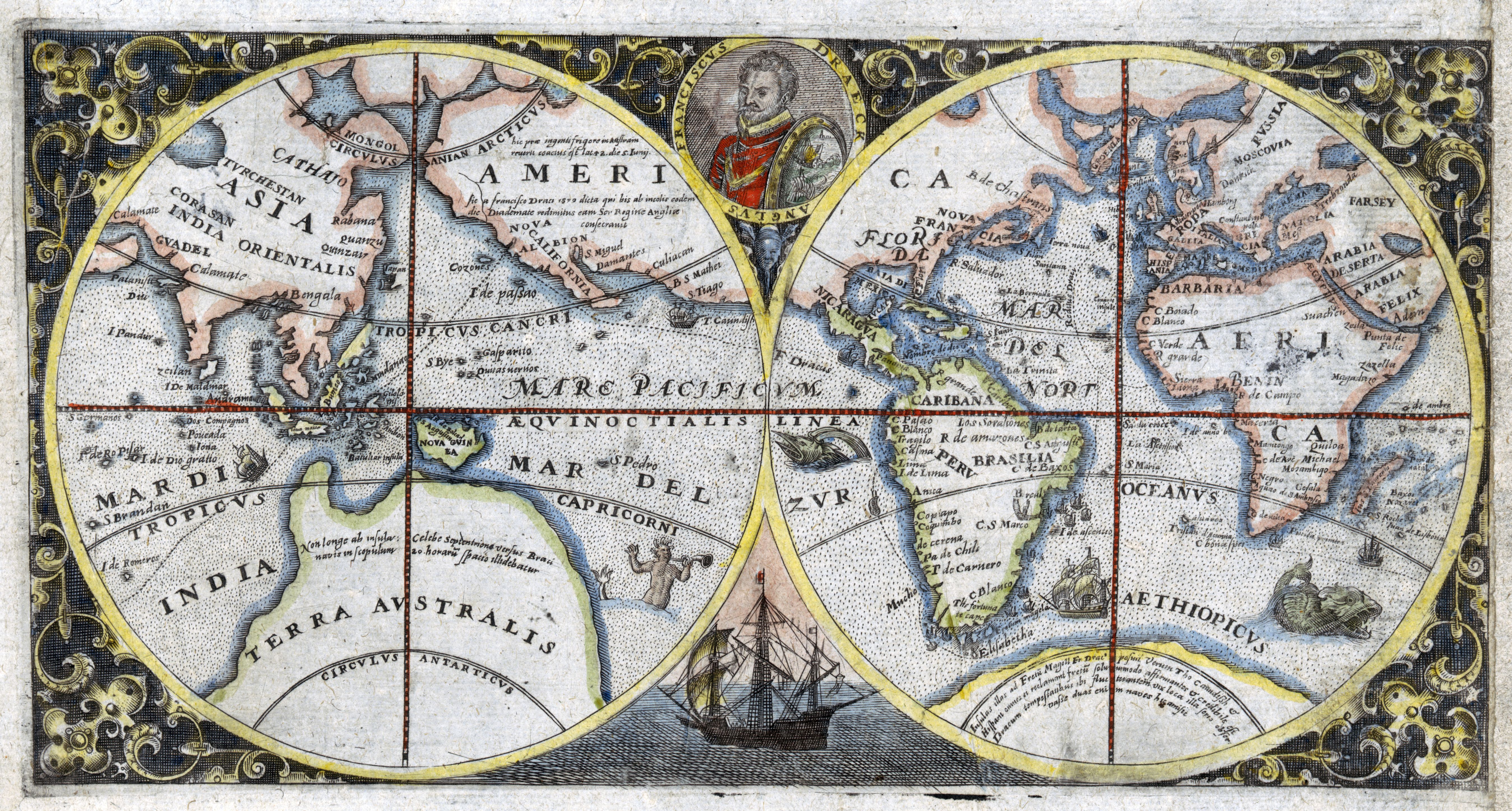
1600 double hemispherical map of the world showing Sir Francis Drake's voyage

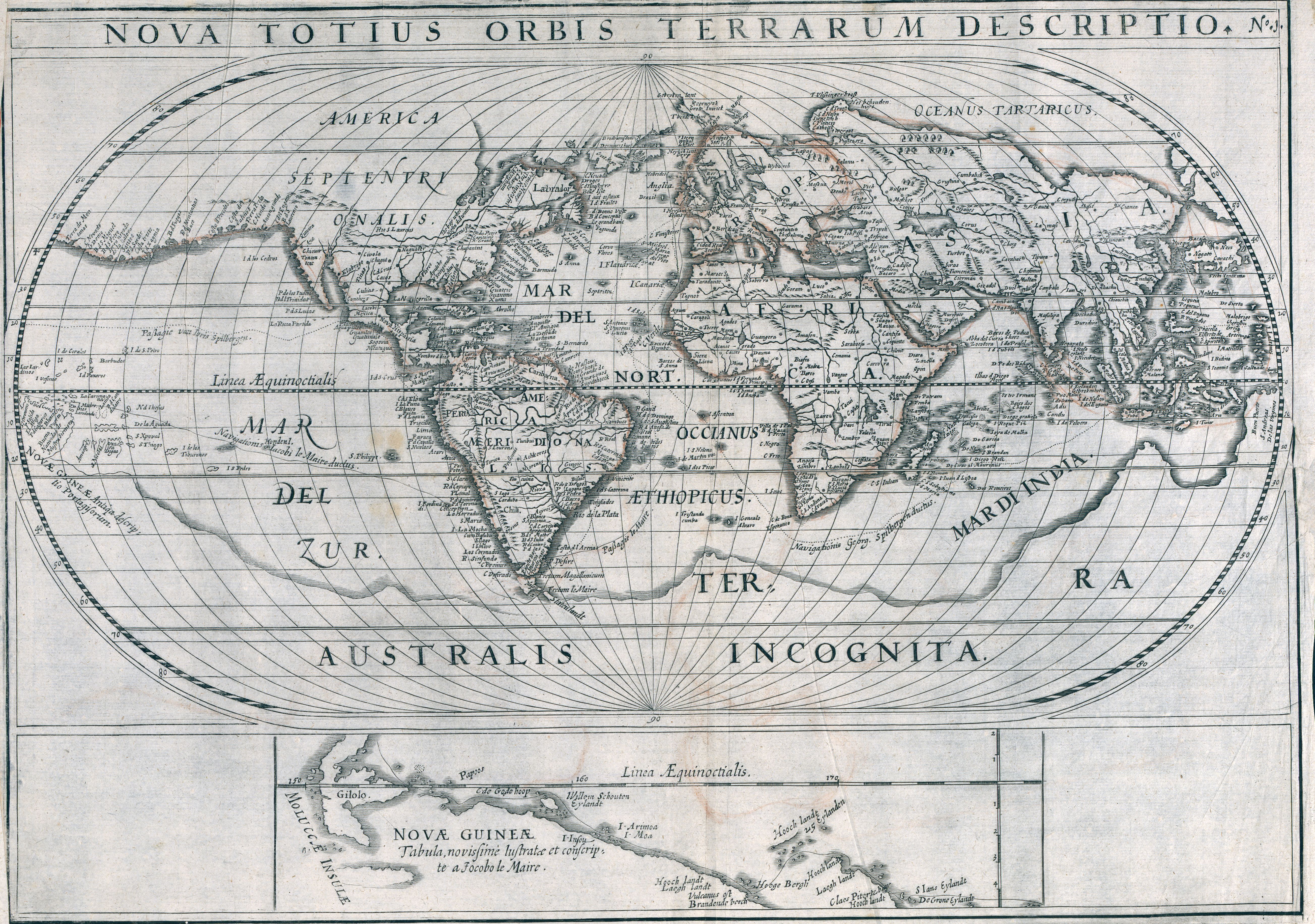
1619 World map showing voyages of Joris van Spilbergen and Jacob le Maire
by Nicolaes van Geelkercken
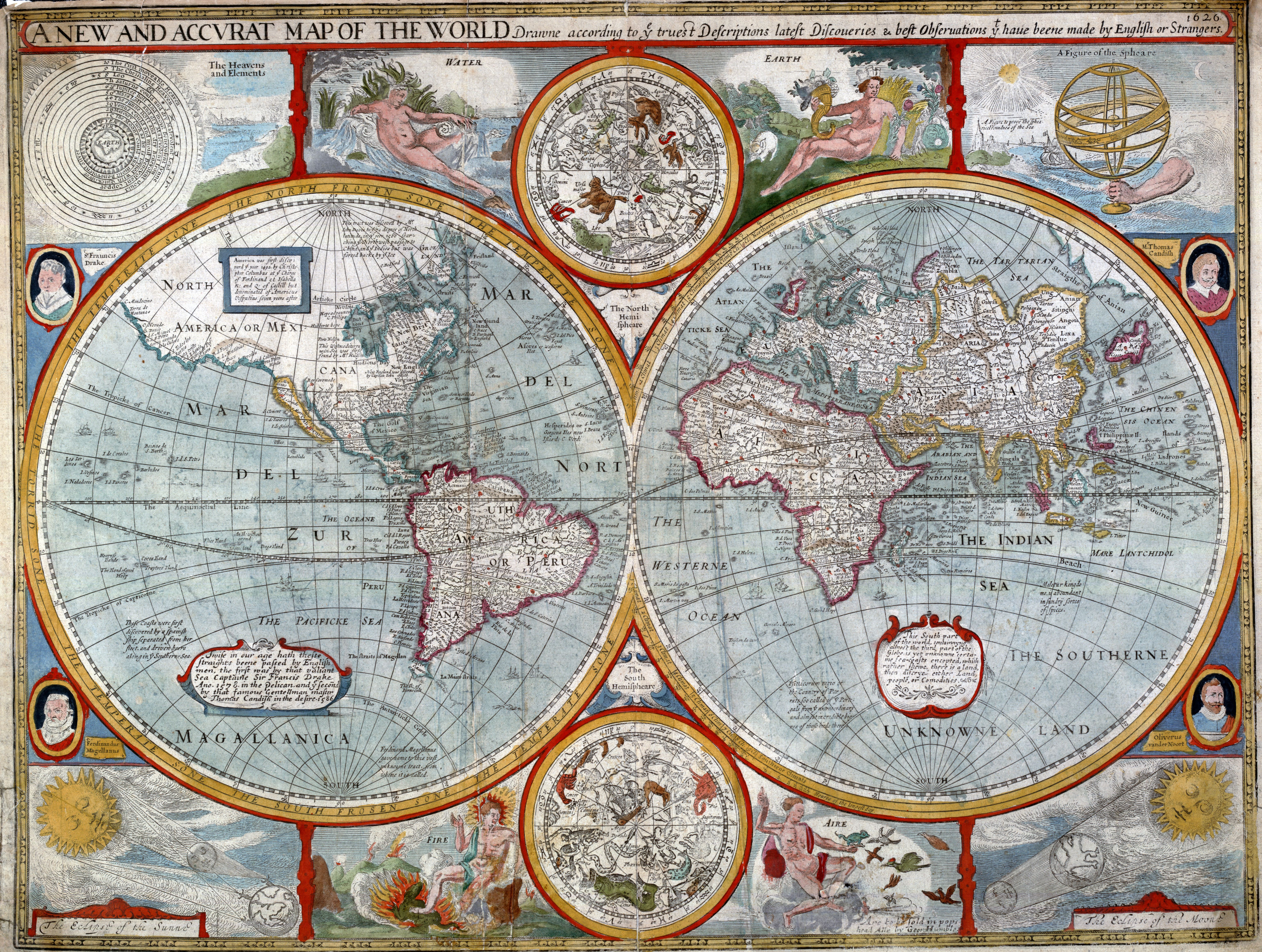
1626 map of the world
by John Speed
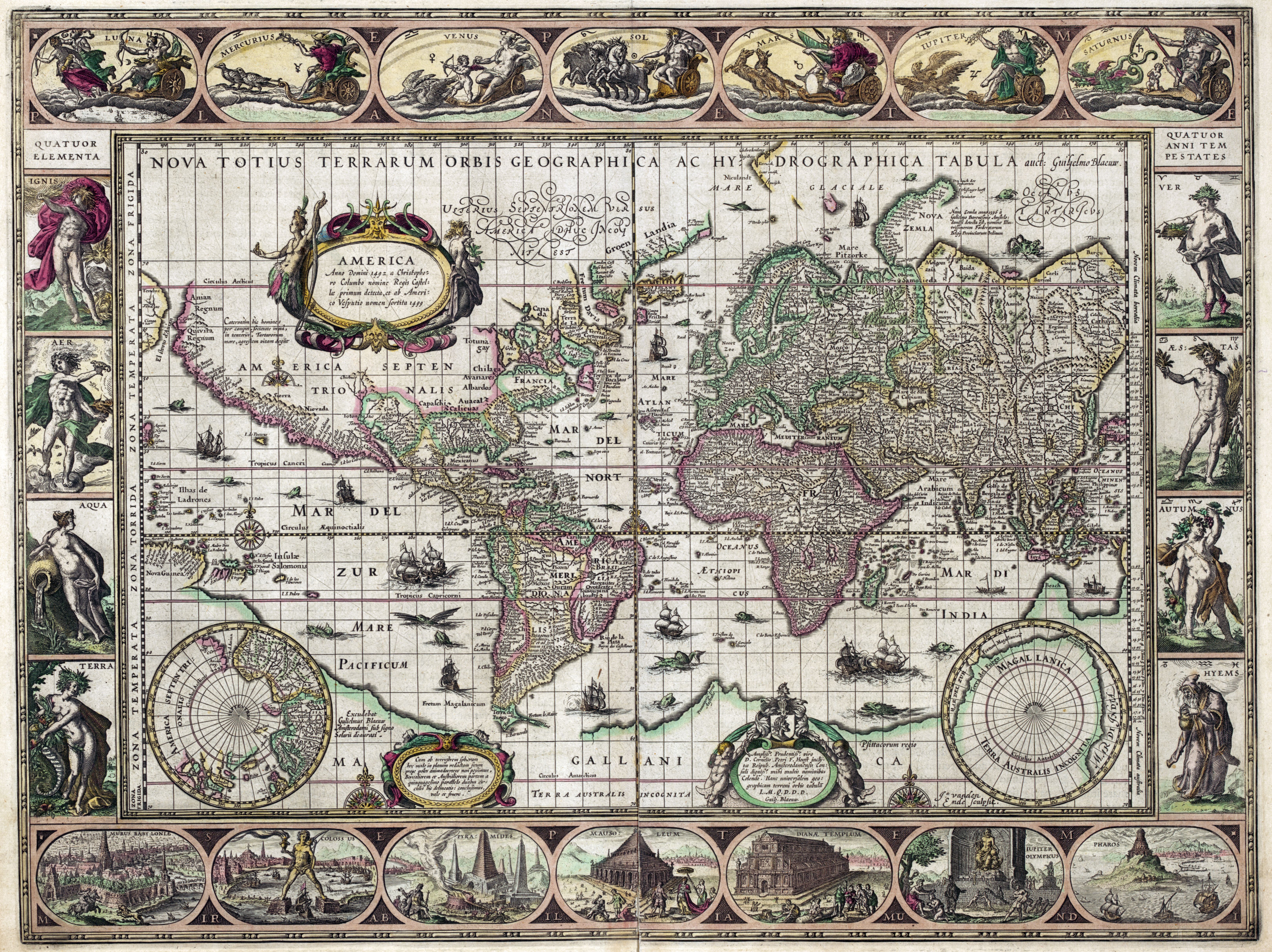
1631 map of the world
by Willem Janszoon Blaeu
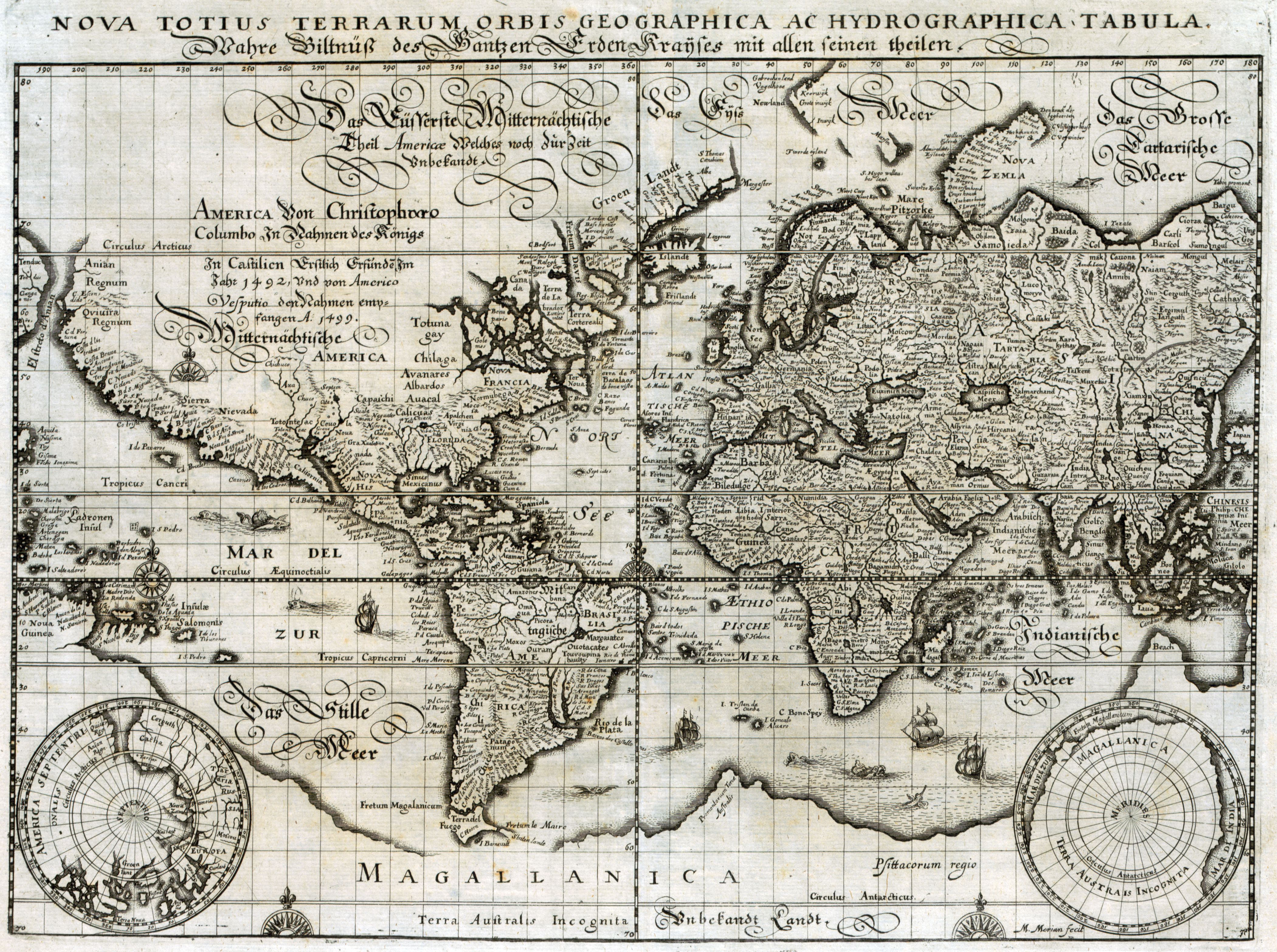
1638 map of the world
by Matthaeus Merian

1643 double hemispherical world map
by Melchior Tavernier

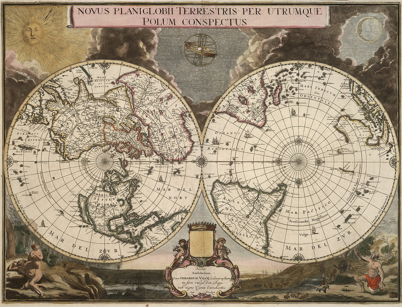
Gerard Valck , 1695
 A view of the world as known in 1681
by Joseph Moxon
by Joseph Moxon
1693 world map
by Pierre Mortier
with also the idea of the Island of California and embryonic Australia
with also the idea of the Island of California and embryonic Australia
(see geographicus)
 Andreas van Lugtenburg (1708)
1716 world map
showing principal shipping routes and landmass to the south called 'Laender des Sud Pols'
1716 world map
showing principal shipping routes and landmass to the south called 'Laender des Sud Pols'
from the 1720/30s, by Johann B. Homann, whose style is noted as an influence on Seutter.
1728 map of the world - by Gerard van Keulen


Constructed By Hermann Berghaus and Fr. v. Stulpnagel.

Links :
- GeoGarage blog : Ancient world maps / First you make the maps
No comments:
Post a Comment