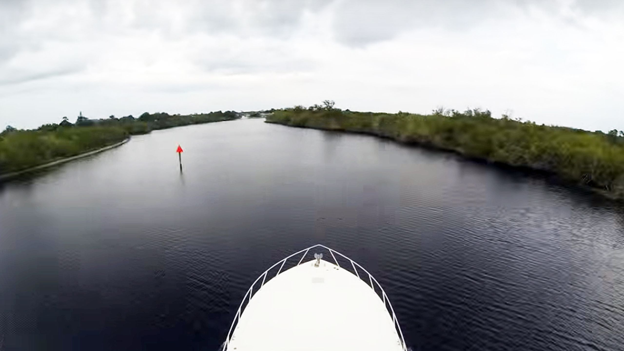
Accident scene : This is Marker 38 as shown from a YouTube video shot from a different boat,
going the other way at another time.
going the other way at another time.
From PassageMaker by Peter Swanson
In December 2013, I wrote stories about the “magenta line” on our nautical charts depicting the Intracoastal Waterway, and now lawyers want me to answer questions for a court case on the subject.
Here’s what I wrote in one of the articles:
For years experienced boaters have known that the magenta line should be viewed with skepticism as an indicator of depth. But at the same time they appreciated the fact that it provided an easy way to follow the ICW’s route as it winds through the labyrinthine systems of creeks, rivers, and canals that comprise the waterways of the coastal South.The Feds removed much of the magenta line from government charts, citing safety concerns, but the electronic cartography industry—Navionics, C-Map and Garmin—did not follow suit.
The problem is that some novice boaters have no compunction about speeding down that dotted line like it was the center lane of I-95, and, as NOAA officials recently wrote in their request for comments on the Federal Register, “Numerous examples can be found where the charted Intracoastal Waterway Route (“magenta line”) passes on the wrong side of aids to navigation; crosses shoals, obstructions, shoreline; and falls outside of dredged channels, etc.”
It’s a fact that anyone who follows the magenta line closely enough and far enough will go aground, as I recently demonstrated at a known trouble spot on the ICW at Crooked River in Georgia. The fact that I intended to follow the line until I touched bottom softened the blow, but some hard-charger would have experienced the nautical equivalent of a car wreck.
Customers like the magenta line, they say.

Red Marker 38 with magenta line on Navionics webmapping
see Waterwayguide
Then came that “hard-charger” I was predicting. On Dec. 27, 2014, a year after that article, Pedro Torres of Tampa was westbound on the St. Lucie canal at 21 knots.
Seaduction, his Wellcraft 36, was equipped with a Garmin chartplotter, and Torres was riding the magenta line as many of us do.
Unfortunately the line veered to the wrong side of Red Marker 38, so instead of taking the mark properly to starboard, Torres took it to port.
The boat exited the channel and slammed into a shoal.
And the result was the equivalent of a car wreck without the benefit of air bags.
Torres’ wife Christine was thrown below on impact, suffering injuries to her spine, neck and skull, including a badly bleeding head wound and broken bones.
She was airlifted to a nearby hospital in critical condition.
Florida Fish & Wildlife investigators concluded that Torres’ inexperience and inattentiveness contributed to the accident but that he had broken no laws.
Last year, Christine Torres filed suit against Garmin, alleging that the company “knew that its decision to retain and display the magenta line as the ‘recommended route’ without any ‘ground-truthing,’ changes, corrections or warnings would place its users and their innocent passengers in grave danger.”
Garmin fixed the error by moving the magenta line to respect Red Marker 38, and prepared to defend itself in court.
Pedro Torres, Garmin’s lawyers argue, had behaved like a knucklehead when he mindlessly followed a colored line on his plotter.
They insisted that the court assign part, if not all the blame for his wife’s injuries to him in its final decision.
Okay, many of us waterway veterans are nodding our heads in agreement right now, aren’t we?
But let’s look at it through the eyes of a South Florida jury, particularly after it’s heard from some of the experts rounded up by Torres attorney Michael Eriksen.
One is Anthony Andre, a Ph.D who researches human factors, ergonomics and usability in product design. His expertise includes the concept of “automation trust.”
From a court document:
Dr. Andre is expected to testify that (1) Garmin’s public relations and marketing information invites trust in Garmin and its products; (2) It was feasible for Garmin to perform a human factors evaluation of the subject interface, taking into account the principle of automation trust; (3) Garmin’s failure to employ human factors specialists to do so did not comply with generally accepted principles and guidelines applicable to interface design; (4) Garmin’s continuing use and display of known chart “errors and defects,” such as a “recommended route” drawn on the incorrect side of channel markers, was similarly contrary to the referenced human factors principles…Andre’s attack goes on and on.
Lee Alexander is another witness with a Ph.D and a heavy hitter in electronic charting, theory and practice.
His testimony would center on “ground truthing” and the fact that Garmin had the means to determine the accuracy of the magenta line but failed to do so.
So what does a jury—perhaps lacking in judgmental old salts—make of all this? Garmin could well have a problem.
The government got rid of the magenta line because it was dangerous.
Garmin did not.
Pedro Torres spent, say, $20,000 on a Garmin electronics suite.
Why would he not trust his marine chartplotter the way the jurors hearing his case trust the GPS in their cars?
After all. if you hover the Garmin plotter’s cursor over the magenta line, the words that pop up on the screen are: “Recommended Route.”
By the way, C-Map has a correct line at Marker 38, while Navionics appears to have three to choose from, one of which cuts the mark.
I have brought this to Navionics’ attention so it can be fixed.

This is the magenta line at the accident scene prior to NOAA's decision to remove the line.
Note that the scale of the chart is such that there's no way to conclude that the line might pass to the wrong side of Red Marker 38.
Zoom in on an electronic chart, however, and there is literally room for error.
 View in the GeoGarage platform (NOAA RNC 11428) today

View in the GeoGarage platform (NOAA ENC) today


View in the GeoGarage platform (NOAA ENC) today
Back in 2013 I made a query to Garmin about the magenta line, which sparked an internal debate. The resulting chain of emails has become evidence in the case.
The lawyer for Christine Torres says he wants to question me about the articles I wrote at the time and my Garmin query in a deposition.
Here’s what I asked a Garmin spokesman back in 2013:
Wes,We know what the answer was.
The federal government is eliminating its “magenta line” from East Coast ICW charts. NOAA says this “best route” indicator is no longer valid, so it is eliminating the line while it considers what to do next. The question for Garmin is this:
There are three choices Garmin has. It can eliminate the magenta line from its cartography; it maintain the line as it is now, even though the government no longer stands behind, or it can develop a third option.
What is Garmin going to do and why?
The line stayed put, but not everyone inside the company was entirely comfortable with that.
One Garmin employee, Ryan Casanova, was of two minds.
“If NOAA doesn’t stand behind the line, then I am not sure how we could go on publishing it, if we don’t know how reliable it is.”
But then Casanova agreed with colleagues who argued that as Garmin incorporated NOAA updates in the future, the line would eventually disappear from their cartography as well—not soon enough to save Christine Torres, however.
Meanwhile NOAA is working to restore verified magenta lines to its charting section-by-section.
“Since the magenta line was pulled from our charts we have had the policy to reapply it to small craft charts after undergoing a review process to ensure that the line does not direct boaters into hazards areas. There are still some charts that have not been updated. The labels and mile marks are still retained to indicate to boaters the general location of the ICW,” says Kyle R. Ward, southeast navigation manager, NOAA Office of Coast Survey
“Some harbor charts do not display the ICW because the intent of those charts is for deep-draft vessels. In these cases the ICW is usually still marked with labels and a channel framework.”
I’ll continue to keep you updated about the case of Torres v. Garmin as I await my waterboarding at the hands of the attorneys.
Here's that video we promised:
Covering 130 miles and 16 hours of continuous shooting starting at mile
100 of the Okeechobee waterway, a go pro time lapse of the
Caloosahatchee River, Lake Okeechobee, St. Lucie River, Hobe Sound and
the lights of Palm Beach.
Shot aboard Nyati, a 52' Viking convertible
on its way to the Viking Yachts Shipyard
- PassageMaker : Navionics Initiative: An ICW Magenta Line Re-Do / Magenta Line To Come Back; Active Captain in the Mix - PassageMaker / Feds Seek Cruiser Comments on 'Magenta Line' Future - PassageMaker / Fate of 'Magenta Line' Will Be In Our Hands, NOAA Says ...
- Panbo blog : NOAA erases the Magenta Line, will crowdsourcing step up?
- GeoGarage blog : Intracoastal Waterway Route “Magenta Line” on NOAA ...
- Waterway Guide : The ICW magenta line is coming back!
No comments:
Post a Comment