A research boat in the waters of Papahānaumokuākea Marine National Monument near Hawaii. NOAA
From e360Yale by Fred Pearce
In the last decade, governments have been pushing to create vast Marine Protected Areas large enough to protect species from overfishing and other threats.
But critics are questioning whether the creation of these large protected areas is driven more by geopolitics than conservation.
How can we save the oceans?
They cover two-thirds of the planet, but none are safe from fishing fleets, minerals prospectors, or the insidious influences of global warming and ocean acidification.
In the past decade, there has been a push to create giant new Marine Protected Areas (MPAs).
They now cover nearly 9.7 million square miles, equivalent to more than the land area of North America.
Cristiana Pașca Palmer, executive secretary of the UN Convention on Biological Diversity, says the world is on course reach the convention’s target of having a tenth of the oceans protected by next year.
But questions are being raised.
The growth has been driven by the formation of giant MPAs bigger than many countries, often in remote regions where the threat to biodiversity is lower.
So, critics are asking, are countries creating big distant MPAs to distract attention from the harder task of protecting trashed coastal ecosystems closer to home?
And is there a geopolitical game afoot, a stealth rush to control the oceans for political ends?
And does that explain why half of the ocean waters covered by MPAs are in the hands of the United States and two former European colonial powers, Britain and France?
Most ocean scientists see the rush to create vast MPAs as a boon to marine conservation.
They are cost-effective, connect different marine ecosystems, and encompass larger parts of the ranges of migrating species such as whales and tuna, protecting “corridors of connectivity among habitats in ways not afforded by smaller MPAs,” says Bethan O’Leary, a marine scientist at the University of York in England.
But the geography of the new large MPAs seems to reflect politics as well as ecology.
The biggest American MPAs are in the 200-mile internationally recognized exclusive economic zones (EEZs) off Alaska and around the Hawaiian archipelago.
And France and Britain are busy asserting their control over wide stretches of oceans in EEZs around tiny islands that they hung onto at the close of the European colonial era.
Britain has fully protected less than only 2.9 square miles of its domestic waters, but has promised 1.5 million square miles of “enhanced marine protection” around its territories in remote oceans by 2020.
That is more than 16 times the size of the UK itself.
The waters earmarked include three of the 12 largest MPAs declared to date: around the Chagos Archipelago in the Indian Ocean, Pitcairn Island in the Pacific, and South Georgia in the Southern Ocean, to be followed by Ascension Island, St. Helena, and Tristan da Cunha, all in the South Atlantic.
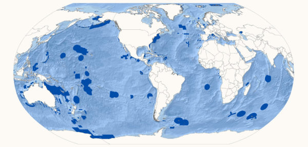
Marine Protected Areas (dark blue) cover nearly 7 percent of the world's oceans.
France is not far behind, promising 850,000 square miles by 2020, including waters around New Caledonia and French Polynesia, as well as Reunion and Mayotte in the Indian Ocean.
These giant MPAs are a relatively new phenomenon.
Most have been created since 2010, when the Convention on Biological Diversity adopted its 10 percent target.
Until then, most were small, and about half of the world’s 15,000 MPAs still measure only a few square miles.
But the case to go big has been growing.
While small safe spaces for nature may protect particular habitats like coral reefs and sea grasses, their impact on wider marine ecosystems and migrating fish stocks is bound to be small, marine ecologists argue.
Partly because of this, and partly through bad design and poor enforcement, a recent meta-analysis of the impacts of existing MPAs by Graham Edgar, a senior research scientist at the University of Tasmania, found that “most of the MPAs studied… were not ecologically distinguishable from fished sites.”
Some scientists also say that with coastal MPAs, local fishers often lose out.
Their livelihoods are disrupted as their fishing activities are declared illegal, while big commercial fishers just move on and damage somewhere else.
There have been calls for codes of conduct to protect such communities.
Nathan Bennett, an ocean geographer at the University of British Columbia, said in a Yale Environment 360 interview two years ago that protecting the interests of coastal communities could “make the difference between the success and failure of marine conservation.”
So will large MPAs do better?
Most are in remote near-pristine areas with lots of marine life to save.
The U.S.’s Papahānaumokuākea Marine National Monument in the Hawaiian archipelago, for instance, is more than twice the size of Texas and supports 7,000 species, a quarter of them endemic.
The 250,000-square-mile MPA declared by the British around the Chagos archipelago in the Indian Ocean is “the world’s largest contiguous undamaged [coral] reef area,” according to the former chief scientific advisor for the area, Charles Sheppard of Warwick University.
It includes the largest atoll in the world, the Great Chagos Bank, and has 310 species of coral, 821 of fish (including 50 shark species), and 355 of molluscs.
The MPA there has created the world’s largest “no-take” zone, where all commercial fishing is banned.
But some say the progress on protecting the oceans this way has been hyped.
Enric Sala, a marine ecologist at the National Geographic Society, recently called the claim to be close to achieving protection for 10 percent of the world’s oceans “false and counterproductive.” While 7 percent of the oceans have so far been earmarked for some protection, only 5 percent have actually had plans implemented, and only 2 percent ban commercial fishing.
Among MPAs where commitments remain unimplemented, Sala notes, two of the biggest are New Zealand’s Kermadec Ocean Sanctuary and French New Caledonia’s Coral Sea Nature Park.
And when the departing Bush administration in 2009 created the Marianas Trench National Marine Monument near the U.S. territory of Guam in the western Pacific, it ceded to pressure from the Northern Mariana Islands to allow fishers to continue their activities there.
But O’Leary says most designated large MPAs have management plans either in place or in preparation, and the development of drone, radar and satellite technology will make them easier to police than in the past.
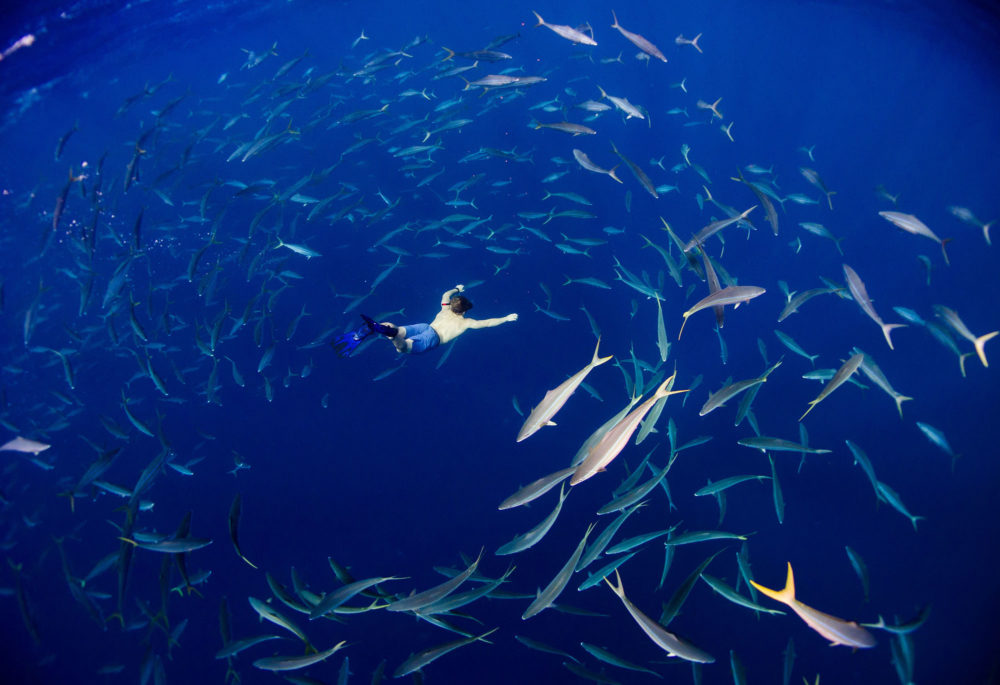
A diver swims in French New Caledonia’s Coral Sea Nature Park, a Marine Protected Area in the South Pacific.
A second concern of critics is that the massive coverage of MPAs may not be addressing the urgent task of protecting marine species and ecosystems from real and current threats.
Most large MPAs are in remote areas.
The U.S., for instance, has fully protected less than 1 percent of seas in its waters around the continental U.S., compared with 43 percent in remote waters.
Luiz Rocha of Hope for Reefs, a campaigning initiative of the California Academy of Sciences, says large remote MPAs “invariably exclude the only areas that would benefit from spatial protection, those close to the shore. They protect areas that nobody uses, and that changes nothing.”
In fact, it is worse than nothing, he argues, because by allowing countries to hit UN targets, these remote MPA’s reduce the pressure to provide real protection where it is needed.
Even bigness provides few benefits, Rocha contends.
“The media and the public love announcement of reserves ‘the size of Belgium,’ but for species like tuna, the size of Belgium is like the size of your backyard.”
But O’Leary and other advocates for large MPAs counter that big protected areas provide more protection for migrating species than small areas.
And even if they don’t counter urgent current threats, O’Leary says, they do provide “proactive protection of ocean wilderness areas against future exploitation,” in the same way as protected terrestrial wildernesses.
Some critics charge that many big MPAs are as much about geopolitics as conservation.
This particularly applies to the post-colonial MPAs of Britain and France, in which tiny, sometimes unpopulated, mid-ocean islands once occupied as refueling stops for naval vessels, become the 21st-century basis for what some are calling “ocean grab.”
Britain has declared an MPA around South Georgia, which is claimed by Argentina, and, just as controversially, has also done so around the Chagos archipelago in the mid-Indian Ocean.
In colonial times, the archipelago was administered by Britain from adjacent Mauritius.
However, in 1965, three years before granting independence to Mauritius, the British separated it off and signed a deal with the U.S. for a major American military base on the largest of its 60 islands, Diego Garcia.
As part of the deal, the British subsequently forcibly removed some 1,500 Chagossians.
Living in exile in Mauritius and the UK, they have been campaigning to be allowed to return and resume economic activities such as fishing.
That was made more difficult when in 2010, Britain created a giant “no-take” MPA around the archipelago, excluding only Diego Garcia.
A message from the U.S. Embassy unearthed and published by Wikileaks, said British officials had said that “establishing a marine park would, in effect, put paid to resettlement claims.”
The British government has repeatedly denied any such motive.
Things came to a head last month when, after decades of legal dispute, the International Court of Justice in The Hague, the UN’s highest court, declared British control of the Chagos to be a “wrongful act.”
The islands, including the MPA, should be handed back to Mauritius “as rapidly as possible,” the court ruled.
It is far from clear if the British government will accede to this demand.
Mauritius’s London embassy did not respond to requests to clarify its plans for the MPA.
But in the past it has said that while it had no problem maintaining an MPA, a no-take zone would “not be compatible” with its plans for returning Chagossians and exploiting marine resources.
Whatever the future for such contested waters, the bigger prize of saving oceans remains.
Scientists have argued that the world should aim to protect not 10 percent, but 30 percent of the oceans.
That would require concerted international efforts to protect the two-thirds of the oceans that lie outside national EEZs.
Just 0.5 per cent of these “high seas” are currently covered by MPAs.
These are in areas covered by regional or international treaties.
The largest is the Ross Sea MPA off the coast of Antarctica, which covers an area almost the size of Alaska and is one of the world’s most productive marine ecosystems, though concerns have mounted because of a krill fishery allowed there under the terms of the Antarctica Treaty.
Others include the Charlie-Gibbs MPA, a biodiversity hotspot in the mid-North Atlantic where polar and tropical waters meet.
It is managed by the Ospar Convention on the Northeast Atlantic marine environment, which is named after a famous 19th-century American pirate.
But many more may be established if the UN finalises a new High Sea Treaty on schedule in 2020.
Talks on the treaty were scheduled to resume in New York this week.
Its provisions will almost certainly include creating MPAs in international waters.
Candidates include the Sargasso Sea, a zone of sluggish waters in the North Atlantic off the British territory of Bermuda that is full of floating seaweed among which both American and European eels breed.
The question then becomes who will fund and manage MPAs on the high seas.
The moving forces behind them will likely be the same as those that helped trigger the recent spurt of large national MPAs: American and other conservation groups, backed by private philanthropists.
Conservation International helped mastermind the French MPA around New Caledonia.
The Switzerland-based Bertarelli Foundation helped establish those around French Polynesia and Chile’s Easter Island.
In the Seychelles, The Nature Conservancy raised money from U.S. philanthropists, including actor Leonardo DiCaprio, to buy up national debt in return for the creation of two large marine reserves.
The Louis Bacon Foundation, established by a U.S. hedge fund manager, is to pay for policing a British MPA around Ascension Island.
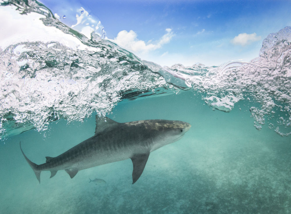
A tiger shark seen in the Papahānaumokuākea Marine National Monument near Hawaii.
Biggest of all is the Pew Charitable Trusts, which says it has already “helped safeguard 5.2 million square kilometers – an area 10 times the size of Central America.”
Pew first proposed and helped fund British MPAs at Chagos and Pitcairn, as well as pushing for U.S. initiatives such as the Marianas Trench Marine National Monument.
In a joint initiative with the Bertarelli Foundation, Pew recently appointed former U.S. Secretary of State John Kerry and former British Prime Minister David Cameron as “ocean ambassadors.”
Elizabeth Karan, a senior manager at Pew, said in an email interview that rather than trying to take over the oceans, her organization is helping “identify important areas for biodiversity on the high seas, and work with governments [to] develop proposals.” Policing of these non-national MPAs would be done by treaty signatories regulating their industries.
Some see such philanthropists as planetary saviors; others as agents of a creeping privatization of one of the last great global commons.
Either way, it is a big task.
Links :
- Pew : Research Key to Boosting Benefits of Large Marine Protected Areas
- Mongabay : Marine protected areas are getting SMART (commentary)
- National Geographic : Largest Marine Protected Area in North America Created off Mexico / Protecting Baja Mexico / Marine Protected Areas Are Important. But Are They Working?
- GeoGarage blog : Bigger is not better for ocean conservation / Study discovers just 13 percent of world's oceans are / Why the UK wants to protect 30% of the World's ... / Huge reserves protect underwater mountains ... / How to save the high seas


No comments:
Post a Comment