From Inquirer by Ambeth R. Ocampo
Geography used to be required, or part of social science subjects, in
elementary and high school until it was pulled out long ago.
Nobody
noticed nor howled to ask for its return.
Geography, where one memorizes the names of countries and their
capital city, is probably considered a useless subject but it does make a
young Filipino more cosmopolitan, more marketable in a global world.
I guess geography has been merged with other subjects and is tucked
away in the new K-to-12 and college general education curricula.
“Intermediate Geography” by Miller and Polley was the last textbook
used in Philippine schools in the 1950s that probably became extinct
when people realized that except for Mayon volcano on the cover, the
content was exactly the same as the 1918 edition!
My appreciation of how the physical shape of the Philippines came to be took root outside of a classroom while browsing the Lopez Museum map collection, fascinated first by its antiquity, and later by the way it told the story of how the nation came to be.
It included the earliest nautical charts made in the 15th and 16th centuries, jealously guarded by the Portuguese and Spanish that both claimed rights to the islands following the 1493 Papal Bull “Inter Caetera” issued by Pope Alexander VI that cut the world in half like an orange and granted rights to discover the unknown world to the competing crowns of Portugal and Spain.
It is not well-known that the Philippines fell on the Portuguese side.
Dutch mapmakers entered the game in the 17th century charting the
known world and carving out what we know as Indonesia that, in some
maps, included the Philippines.
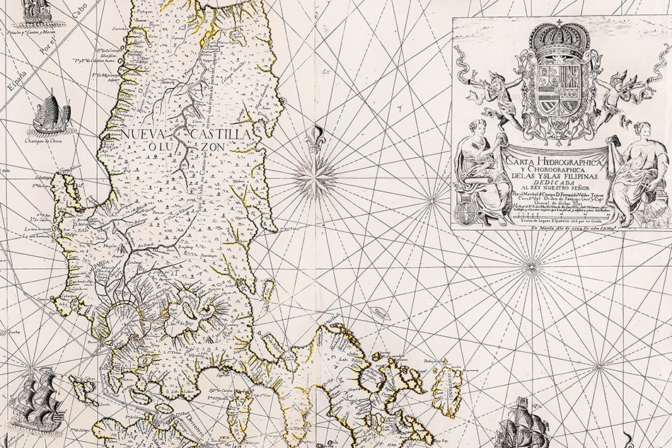
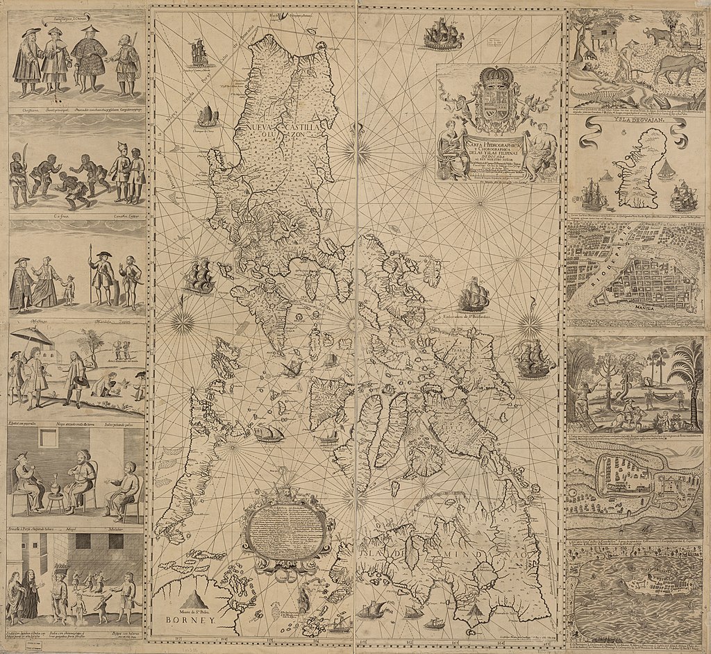
Then came Jesuit Father Pedro Murillo
Velarde and his 18th-century map that spawned many copies by French and
German mapmakers.
Maps show us that Filipinas was under Spain from 1565 to 1898, with a
short British interlude of 20 months between 1762 and 1764, followed by
the United States from 1898 to 1946, with a Japanese interlude between
1942 and 1945.
Maps, like history, include and exclude depending on the person who
made them, and the person reading them.
Carta Hydrographica y Chorographica de las Yslas Filipinas Dedicada al Rey Nuestro Señor por el Mariscal d. Campo D. Fernando Valdes Tamon Cavallº del Orden de Santiago de Govor.
E. Aguilar Cruz introduced me to the Velarde map, guiding me through its cartouche, in French, that stated it was a hydrographic and chorographic map depicting both bodies of water in relation to land arranged by regions.
It was dedicated by governor-general Fernando Valdes Tamon, drawn by
Velarde, and printed by Nicolas de la Cruz Bagay in 1734.
Cruz’s map was
a reduced version made in 1750 in Nuremberg by George Maurice Lowitz
and republished in 1760.
He asked me to translate the long text at the bottom of the map, this
being a short history from Magellan to Legazpi followed by a detailed
listing of the agricultural and mineral products of the islands by
region.
Reading it meant going beyond the placenames to looking at the
mountains and hills and tracing the path of waterways where people built
early settlements that developed into today’s barangays, towns, cities,
and provinces that altogether formed el pais (the country).
In the late 19th century, Jose Rizal and his generation saw
themselves as hijos del pais (sons of the country), one step into taking
Filipinas not as an overseas territory of Spain, but as a nation.
Antique maps of the Philippines are valuable as singles but, when
seen in a series, depict in their detailed differences the emergence of a
nation.
Velarde’s map may be three centuries old but it gained contemporary
relevance when China drew a “nine-dash line” on the map, literally
changing the face of the earth.
From their point of view, parts of the
Philippines are theirs by traditional and “historic” rights, but the
South China Sea to them is the West Philippine Sea to us.
Historical rights are irrelevant following agreements in the United
Nations Convention on the Law of the Sea but the Philippines has proven
that China cannot produce a map older than the 1734 Velarde map showing
Panacot (Scarborough Shoal) and Los Bajos de Paragua (Spratlys) in their
territory.
It is significant that the three shoals indicated in the map bear the
names: Galit (Anger), Panacot (Threat) and Lumbay (Sorrow), ancient
names that can be emoticons that express how Filipinos feel about our
territorial dispute with China.
Maps teach us more than geography, they teach us nationhood and identity.
Links :
- Inquirer : Catch ancient maps exhibit ‘Mapping the Philippine Seas / The 1734 Murillo Velarde Map / Mother of Philippine maps’ settles sea dispute with China
- Rappler : Ever heard of the 1734 Murillo Velarde map and why it should be renamed? / Ancient maps support PH claim over Scarborough
- GeoGarage blog : Philippines uses 18th-century English aristocrat's map to claim disputed islands / China revises mapping law to bolster claims over South China Sea land, Taiwan


No comments:
Post a Comment